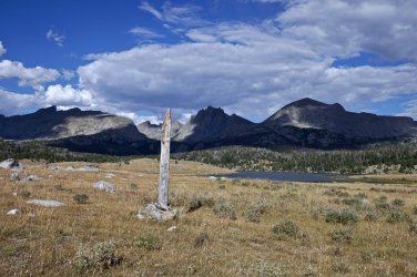
I've hiked the Fremont Trail from Big Sandy a couple times and from the Sweetwater TH on the CDT at Mile 1767. Back in 2011 a friend and I lost the Highline Trail because it was so little used and not maintained. You'll be smart to stick with the Fremont Trail. It's prettier too. It's just about 70 miles from Big Sandy TH and Green Lakes TH.
You mention knee and back issues, as well as age. 10 miles a day can be relaxing if you're in good shape, start really early, and take lots of well deserved breaks to rest or fish. If you're coming from a lower elevation, life behind a desk or some other sedentary way of spending your time, 10 miles a day will be a constant push. The topo maps don't show the constant up and down of the second two thirds of the trip. Little 500' climbs to a ridge top, down, and then up again. I was 59 the last time I walked the trail (2011) and didn't remember those "bumps" from previous hikes.
The hike over Knapsack Col by Peak Lake and up to Cube Rock Pass is ethereal, but my 25 year old memory of that part of the hike is that I was just beat to hell by the time we got to Cube Rock Pass, and still wanted to get below Summit Lake to timberline out of the nasty weather. Luckily you can make an ontrail decision about which route to take. In 1993 my girlfriend and I lost the trail for the whole crossing above Elbow Lake. Nothing but snow and water and bits of tundra. In 2011 I went through that part in a rain/sleet storm and 20 mph winds - couldn't see anything as we were in the clouds.
The only time (2003) I went over Cube Rock Pass and down to the trail intersection with the CDT, there had been a major rock slide over a quarter mile of trail and we had to climb over and around volkswagen sized boulders. That slowed us way down. Others may chime in to say if that section has been improved or not. Also, by going that way you miss Elbow Lake and the incredible scenery. The walk down from Cube Rock to the CDT is in a steep valley that's awesome, buy not open like the Elbow Lake trail.
Colin Fletcher, in his book, "The River" said that the headwaters of the Colorado River came from the lilttle lake to the north of Green River Pass - my memory could be incorrect here. He hiked until he could canoe, and then rafted down the Colorado to the Gulf of California, or tried to - I think it dried up before the Gulf.
On one trip on the Fremont Trail my brother-in-law fly fished and was somewhat successful. He had a peak experience where Clear Creek crosses the CDT between the two Green Lakes. He fished upstream of the crossing and was gone for 30 minutes or so. This was probably 1PM or so. He walked down through the brush just shaking his head. With total wonder he said, "I'm never going to fish again. Nothing could be better than this." He said that every cast brought in a trout, usually 12" or larger. Every cast. He said he stopped counting at 20. As it was the last day he released them all. He still gets a faraway look in his eye when he remembers that half hour.
Postholer interactive trail maps for your favorite trail.
www.postholer.com

