lostlandscapes
rope mule
- Joined
- Jan 17, 2012
- Messages
- 328
On July 24th my girlfriend and I set off to spend 6 days exploring (from what we could gather) some of the finer (if not most popular) terrain in the Wind River Range. It was the maiden voyage for both of us to this spectacular, glacially scoured alpine paradise. Moving to Utah two years ago meant leaving the majestic beauty of the Sierra Nevada behind me. As a consequence, I've been in withdrawal from that wondrous golden refuge ever since. Thankfully, the Winds satiated my need for sheer, tormented granite. Now I can't wait to get back.
[parsehtml]<iframe width="640" height="480" frameborder="0" scrolling="no" marginheight="0" marginwidth="0" src="https://maps.google.com/maps/ms?msa=0&msid=204335470138595281142.0004c4d0d7157e4d70211&hl=en&ie=UTF8&t=p&ll=42.746508,-109.236717&spn=0.121019,0.219727&z=12&output=embed"></iframe><br /><small>View <a href="https://maps.google.com/maps/ms?msa=0&msid=204335470138595281142.0004c4d0d7157e4d70211&hl=en&ie=UTF8&t=p&ll=42.746508,-109.236717&spn=0.121019,0.219727&z=12&source=embed" style="color:;text-align:left">Winds Loop July 24-29</a> in a larger map</small><br><br>[/parsehtml]Our first (car) camp, about two miles south of the Big Sandy Trailhead after the afternoon drive up from SLC:
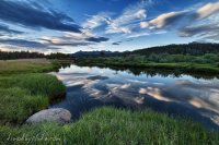
After setting up our camp down at Clear Lake in the early afternoon just as a brutal thunderstorm caught up with us (by far the worst weather of the trip), we eagerly wound our way up to Deep Lake:
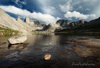
One of the many serene cascades emanating from the Deep Lake drainage, with Warbonnet lingering patiently:
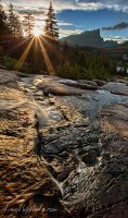
Back at our Clear Lake camp just in time to catch the last light on Haystack:
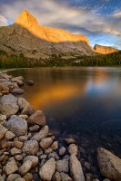
The clouds (bluffingly) gathered quickly and early on the day #2, which encouraged hasty exploration of the Temple Lake environs. We were tempted to hike up to the pass, but the threatening skies held us at water's edge.
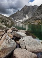
Day 3 witnessed us both regrettably and excitably packing up for the Cirque. The Deep lake region is utterly surreal. But we knew we had something with even more grandeur beckoning us. The climb from Big Sandy Lake was more moderate than expected, and the first clouds of the day greeted us as we leisurely made Jackass pass at noon. Our absurdly scenic camp for the next two nights waited for us quietly in the lush meadows seen in the left-center portion of this image:
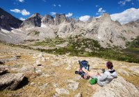
Fading light on the northern segment of the Cirque. Texas Pass is the notch to the right of the unnamed prominent peak. It was crazy staring at that route of ours for two straight days, knowing nothing of it. It ended up being extremely benign (with exception to the north side, which is a different scree-from-hell story all-together)
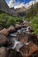
Late light during night 3. We met some haggard climbers at this spot who were just coming off of Pingora (most prominent peak on the right)--most of whom only carried and consumed one liter (one!) of water in over 13 hours of climbing. Minimalists, indeed.
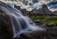
Warbonnet and Warrior Peaks:
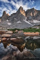
Mitchell Peak, with Jackass Pass the prominent saddle on the right:
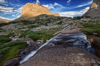
Breakfast:
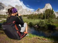
On day 4 (our second day in the Cirque), we chiseled our way up towards Cirque Lake at the base of Wolf's Head, about as high as a Class II jaunt will take you in the Cirque. The beauty is unspeakable up there.
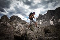
Later that day we clambered up to an unnamed tarn below Warrior and Pylon Peaks to discover this mysteriously over-sized mammalian pelvic/vertebra remnant. Bear?

First light on Pylon Peak and the Watch Tower from near camp:
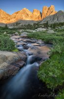
Day 5, and finally picking our way up towards Texas Pass. From L-R, Warbonnet, Warrior Peaks, Pingora (up front), and Watch Tower (recessed):
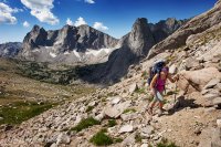
The final snowfield below Texas Pass:
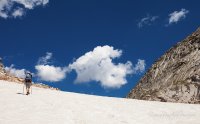
The view north from Texas Pass down into the Washakie Creek drainage. Although it doesn't look like much from this vantage point, that scree field heading down to Texas Lake is fairly violent. Definite roll-over territory. I surmise it'd be much easier coming up it.
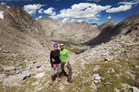
From this point we moved at a pretty good clip towards the Hailey Pass Trail and the western (and final) segment of our circuit.
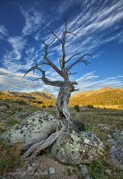
Dead sentinel of Fish Creek Park:
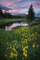
We entertained grand thoughts of making it all the way back to the Big Sandy trailhead and the beer cooler, but decided to lay up at Mirror Lake. Ended up being a wise choice, as we were granted the finest light of our entire trip:
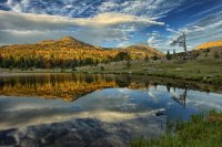
Mirror Lake and Laturio Mountain:
The Winds are an insanely beautiful mountain range. Hoping to get up there one more time in 2012, and hopefully many, many more times in 2013. Have a lot of lost time to make up. Truly a Land of Alpine Sublime.
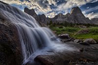
Featured image for home page:
[parsehtml]<iframe width="640" height="480" frameborder="0" scrolling="no" marginheight="0" marginwidth="0" src="https://maps.google.com/maps/ms?msa=0&msid=204335470138595281142.0004c4d0d7157e4d70211&hl=en&ie=UTF8&t=p&ll=42.746508,-109.236717&spn=0.121019,0.219727&z=12&output=embed"></iframe><br /><small>View <a href="https://maps.google.com/maps/ms?msa=0&msid=204335470138595281142.0004c4d0d7157e4d70211&hl=en&ie=UTF8&t=p&ll=42.746508,-109.236717&spn=0.121019,0.219727&z=12&source=embed" style="color:;text-align:left">Winds Loop July 24-29</a> in a larger map</small><br><br>[/parsehtml]Our first (car) camp, about two miles south of the Big Sandy Trailhead after the afternoon drive up from SLC:

After setting up our camp down at Clear Lake in the early afternoon just as a brutal thunderstorm caught up with us (by far the worst weather of the trip), we eagerly wound our way up to Deep Lake:

One of the many serene cascades emanating from the Deep Lake drainage, with Warbonnet lingering patiently:

Back at our Clear Lake camp just in time to catch the last light on Haystack:

The clouds (bluffingly) gathered quickly and early on the day #2, which encouraged hasty exploration of the Temple Lake environs. We were tempted to hike up to the pass, but the threatening skies held us at water's edge.

Day 3 witnessed us both regrettably and excitably packing up for the Cirque. The Deep lake region is utterly surreal. But we knew we had something with even more grandeur beckoning us. The climb from Big Sandy Lake was more moderate than expected, and the first clouds of the day greeted us as we leisurely made Jackass pass at noon. Our absurdly scenic camp for the next two nights waited for us quietly in the lush meadows seen in the left-center portion of this image:

Fading light on the northern segment of the Cirque. Texas Pass is the notch to the right of the unnamed prominent peak. It was crazy staring at that route of ours for two straight days, knowing nothing of it. It ended up being extremely benign (with exception to the north side, which is a different scree-from-hell story all-together)

Late light during night 3. We met some haggard climbers at this spot who were just coming off of Pingora (most prominent peak on the right)--most of whom only carried and consumed one liter (one!) of water in over 13 hours of climbing. Minimalists, indeed.

Warbonnet and Warrior Peaks:

Mitchell Peak, with Jackass Pass the prominent saddle on the right:

Breakfast:

On day 4 (our second day in the Cirque), we chiseled our way up towards Cirque Lake at the base of Wolf's Head, about as high as a Class II jaunt will take you in the Cirque. The beauty is unspeakable up there.

Later that day we clambered up to an unnamed tarn below Warrior and Pylon Peaks to discover this mysteriously over-sized mammalian pelvic/vertebra remnant. Bear?

First light on Pylon Peak and the Watch Tower from near camp:

Day 5, and finally picking our way up towards Texas Pass. From L-R, Warbonnet, Warrior Peaks, Pingora (up front), and Watch Tower (recessed):

The final snowfield below Texas Pass:

The view north from Texas Pass down into the Washakie Creek drainage. Although it doesn't look like much from this vantage point, that scree field heading down to Texas Lake is fairly violent. Definite roll-over territory. I surmise it'd be much easier coming up it.

From this point we moved at a pretty good clip towards the Hailey Pass Trail and the western (and final) segment of our circuit.
Dead sentinel of Fish Creek Park:

We entertained grand thoughts of making it all the way back to the Big Sandy trailhead and the beer cooler, but decided to lay up at Mirror Lake. Ended up being a wise choice, as we were granted the finest light of our entire trip:

Mirror Lake and Laturio Mountain:

The Winds are an insanely beautiful mountain range. Hoping to get up there one more time in 2012, and hopefully many, many more times in 2013. Have a lot of lost time to make up. Truly a Land of Alpine Sublime.
Featured image for home page:

