Wind River Mountain Conditions 2019

I just finished my drive west. Am now in Steamboat and headed up to Pinedale in a few days. I shall see. Did a little comparison between this year, last year, and two high snow years from the recent past.


View attachment 78936


View attachment 78937


View attachment 78938


View attachment 78939


Island Lake July 7, 2017
View attachment 78940


Titcomb Basin July 11. 2014
View attachment 78941


Indian Basin July 13, 2014
View attachment 78942
Great analysis. Any details on the snowed in Titcomb basin shot with the raging river in it you can share?
 
Hey, this is important. Finally a current local conditions report. Thanks @RyanP for point this out and thanks GreatOutdoorsShop for the report:

https://www.greatoutdoorshop.com/blog/2019/06/21/trailhead-conditions-report-06-21-19/

Trailhead Conditions Report 06/21/19

Snow and rain continue to fall on the Rockies above 10,000 feet, bringing the snowpack to about 110-130% of average. Overall, all trails below 9000 feet are snow free and hikeable, but be aware of muddy trails and high stream crossings as our temperatures inch up. Always check NOAA forecasts for the Pinedale area to get an idea of the weather we’re experiencing. Throughout May and June the weather has almost given us whiplash, and last night was very cold and windy. But! It’s now the first day of summer, so we’re optimistic that maybe, just maybe, the weather will even out a bit moving forward.

Head’s up: The mosquitos are starting, ( cue dramatic music: dun, dun, dunnnnnnnnn!) and as the snow continues to melt off, there’s a lot of standing water around, so be prepared with bug spray and headnets. Long sleeves and pants are recommended. The animals are also out and about, so remember to please give them plenty of space and respect their right to be wild out there. Be responsible with your food and campsites and carry bear spray always. Water crossings are rising and the currents are high and swift. Snow travel can be treacherous if you are not properly prepared, so think things through before you go out. We love our local Search and Rescue crew, but we also love people not putting these wonderful volunteers in harrowing, dangerous conditions that could have easily been avoided with a little research. Be safe-when in doubt, pick a new route.

Green River Lakes
– The road to the lakes is open and clear of snow. The Highline Trail is clear to Three Forks Park, and the Porcupine Trail is accessible for about 7 miles. High country lakes such as Lozier Lakes are still frozen and the terrain is completely snow-covered with about 2 feet of snow. You absolutely cannot do the Lozier Lakes loop snow-free yet.

New Fork Lakes – The road to the trailhead is open and in good shape. The trail up the valley is hikeable, but muddy. Bugs will be bad down in the valley and in the willows-watch for moose! Both campgrounds are open.

Spring Creek Park – The road is open and in about as good of shape as it always is. Expect some boggy stuff in the trees and watch for mosquitos.

Elkhart Park Trailhead – The Pine Creek Canyon Trail is accessible to Long Lake, but the Pole Creek Trail is still holding quite a bit of snow. Sacred Rim is not accessible. There’s a full 2 feet of snow at Miller Park.

Boulder Lake Trailhead – The trail to Blueberry Lake is open, and the trail up Boulder Canyon is open to the confluence.

Scab Creek Trailhead – The road is passable and dry up to the campground, which is open, but no services are available. The trail is hikeable up to about 9000 feet. Scab Creek Buttress is dry and in good condition to climb.

Big Sandy Trailhead – Big Sandy is open and accessible. The trail toward Dad’s Lake is open with patchy snow, but snow covered beyond that point. On the river side of the trail, the trees are holding more snow than the Dad’s Lake side, but you still encounter full snow conditions pretty quickly. Watch for some muddy sections along the road. The bugs are thick at the trailhead/campground.

Be safe and enjoy! If we can help with any trip planning, please feel free to give us a shout anytime!
 
That comparison map is impressive. Any sense of how this will affect things come early/mid-Sept? Just too early to tell? Most lakes I'm targeting this year are near 10K so I guessing ice out will be late July/early August. By late August hopefully streams will be mostly easy crossings. Most snow fields over passes like Fall Creek were minor 2 years ago, but maybe microspikes might be in order for places like Indian Pass this year?
 
That comparison map is impressive. Any sense of how this will affect things come early/mid-Sept? Just too early to tell? Most lakes I'm targeting this year are near 10K so I guessing ice out will be late July/early August. By late August hopefully streams will be mostly easy crossings. Most snow fields over passes like Fall Creek were minor 2 years ago, but maybe microspikes might be in order for places like Indian Pass this year?
Yes, it is too early to tell. For this season... Microspikes are always a good idea.
 
Thanks Art. Looks like I'll be out there the last 2 weeks in Sept. this year. If this snow doesn't melt by then, it'll probably be dumping new snow. Next year will be interesting as I'm leading a few folks from our hiking group right after Labor Day.
 
Thanks Art. Looks like I'll be out there the last 2 weeks in Sept. this year. If this snow doesn't melt by then, it'll probably be dumping new snow. Next year will be interesting as I'm leading a few folks from our hiking group right after Labor Day.
September is often the best time to travel the Wind Rivers. Often significant periods of high pressure and cold nights killing the bugs so you have no snow on the ground and no bugs. The big mammals are starting to get active and rowdy due to cooler temps and hormone surge just starting.
 
Last edited:
DSC09458.jpg
Photographers Pt - June 27, 2019

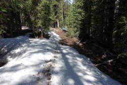
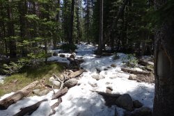
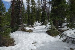
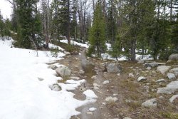
Took a day hike. Went a bit past Photo Pt. Patchy snow within 1/2mi of Elkhart Park. Steady cover after Photo Pt. Wet, soft, post holey. Warm and melting fast. One car in parking lot over night. I'm going elsewhere for a bit, don't want to work that hard.
DSC09436.jpg


DSC09437.jpg


DSC09473.jpg


DSC09480.jpg
 
Be prepared for heavy bug pressure!!!
Yeah, ideally, I'd have gone in the beginning of August or later. Plane tickets with people coming from afar, weddings, and other commitments of people in the group forced it to be an earlier season trip. Hoping that at least means less people in the area!
 

These reports have been great to keep up with and the people at the shop are friendly. If you want to get info on the east or south side of range you can contact the Wild Iris in Lander - really friendly people. I'm hoping Jackson comes back with some promising news. I'm looking to get into the Winds within the next week.
 
Yeah, ideally, I'd have gone in the beginning of August or later. Plane tickets with people coming from afar, weddings, and other commitments of people in the group forced it to be an earlier season trip. Hoping that at least means less people in the area!
Well?..... New TR coming?
 
Here's a brief summary. I'll put up some pictures later tonight.

Our whole route worked out. Big Sandy to Hailey Pass, Washakie Pass, and all creek crossings in between were a go. East side of Washakie was a little sketchy with snow, and some people may not have been comfortable with it. Lots of the trails were wet, but not to the point of it being unpleasant.

SO MANY MOSQUITOES. I was there at the same time last year, and I thought they were bad then, but they were even worse this time. We survived by using lots of deet, walking all day, and wearing our rain jackets in camp. In spite of the horrible bug conditions, we had an awesome time.

Let me know if you have questions.
Welcome home, mister! If you aren't breathing mozzies and digging them out of your ears in July in the Windies than you aren't living :) Good on ya for completing your lollipop route!
 
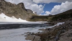
Hailey Pass, ascending from the south. The trail gets lost in the snow here and there, but still easy to follow. It is also a creek in places.
IMG_20190714_130341.jpg


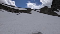
Hailey Pass, descending the north side. Steep and snowy. We bypassed the upper bit of snow because it was so steep. Glissaded the lower bit. Probably doable to ascend this side, but I would not choose to do so.
IMG_20190714_134150.jpg

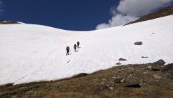
Washakie Pass east side. We ascended maybe 200 feet on steep snow to get to the top, kicking steps and using shortened trekking poles for extra stability. We took a breather at the small strip of rock just below the top in the first photo below.
IMG_20190715_110905.jpg
IMG_20190715_113322.jpg

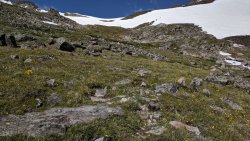
Washakie west side had no issues, other than the trail being a creek in many places (as with quite a few places on our route).

Let me know if you have any questions.
 
Back
Top