Dreamer
off route
- Joined
- Jun 14, 2016
- Messages
- 327
The summer of 2014 saw quite a bit of early season snow in the Winds. I delayed my launch a little and chose an easy start on the Pole Creek Trail. Patchy snow in the trail began not far above the trailhead. Generally I avoid the popular spots even though they are very scenic, but early and under difficult conditions they can be pleasant.
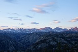
evening at Photographers Point
After a mid afternoon start I walked as far as Photographers Pt. It was head net conditions as it always is that time of year. If you want to be almost certain to avoid all bugs in the Winds wait until the third week in August. I spent my time erasing knucklehead fire pits. The use sites here have suffered from ignorance and disregard. What kind of idiot thinks it’s appropriate to place another fire in the middle of the nice flat tent spot? Photo Pt gets so much traffic that it is a lost cause. I still clean there sometimes. I remember when there were no discernible sites, not so long ago. It is the remote camps that really benefit from the effort. When I come back to a way out spot where I did a restoration and can find no sign my spirit soars.
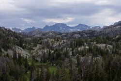
on the way in
After a nice early start I slogged through plenty of wet snow on the Seneca Lake Trail. The creek that flows from Seneca can be tough early, but not so fast this time. As my feet were already soaked (and would remain so for a couple weeks) I waded deep along the submerged trail at the edge of Little Seneca instead of scrambling up around.
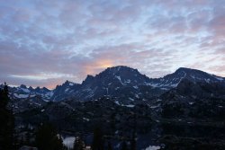
dawn over Fremont Peak
For my second night I camped above the ever popular Island Lake. I’m glad the managers have placed someone there now to enforce common sense, consideration and the rules. The next morning I packed and headed to the trail intersection to Titcomb/Indian Basins were I stashed the load and day hiked up into Titcomb. I went to the end and the weather rolled in. Rained steady for the walk down to the pack and then let go. I set up in a nearby hidden spot for the night.
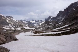
into Titcomb Basin
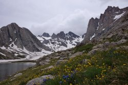
flowers waste no time here
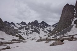
upper Titcomb Basin and Bonney Pass
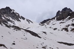
Knapsack Col
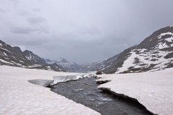
upper Titcomb Basin
I woke the next morning feeling quite poorly in the gut. After multiple squats in the bushes I lay back down for a while. When I got vertical again I decided to walk around nearby a little.
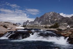
Fremont Peak
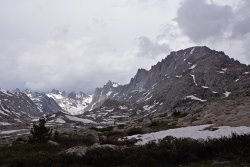
Titcomb Basin
Day five came and I still felt out of sorts. I packed and pushed a short ways into upper Indian Basin. The sun was back and it was so nice. I picked a flat spot and spent the afternoon defending my gear from rampaging marmots. They got my camera bag, my cook pot cozy, and while I was watching a couple of them another crept unobserved up behind me and chewed on the lid of my water bottle. It was just short of nonfunctional. I got so mad I threw rocks at them in the distance until I hit one, and then felt badly.
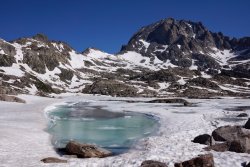
Fremont Peak
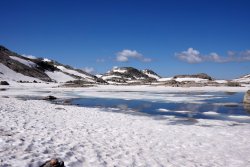
Indian Basin
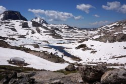
Indian Basin
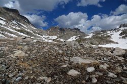
Indian Basin
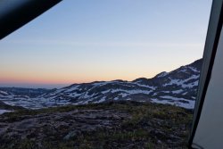
Indian Basin camp sunset
My tummy felt way better in the morning. It froze hard overnight and I was sure glad I had my light crampons and axe as I continued up over Indian Pass and into the rest of my odyssey.
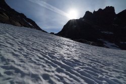
Indian Pass
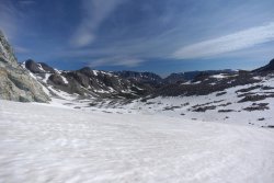
the other side

evening at Photographers Point
After a mid afternoon start I walked as far as Photographers Pt. It was head net conditions as it always is that time of year. If you want to be almost certain to avoid all bugs in the Winds wait until the third week in August. I spent my time erasing knucklehead fire pits. The use sites here have suffered from ignorance and disregard. What kind of idiot thinks it’s appropriate to place another fire in the middle of the nice flat tent spot? Photo Pt gets so much traffic that it is a lost cause. I still clean there sometimes. I remember when there were no discernible sites, not so long ago. It is the remote camps that really benefit from the effort. When I come back to a way out spot where I did a restoration and can find no sign my spirit soars.

on the way in
After a nice early start I slogged through plenty of wet snow on the Seneca Lake Trail. The creek that flows from Seneca can be tough early, but not so fast this time. As my feet were already soaked (and would remain so for a couple weeks) I waded deep along the submerged trail at the edge of Little Seneca instead of scrambling up around.

dawn over Fremont Peak
For my second night I camped above the ever popular Island Lake. I’m glad the managers have placed someone there now to enforce common sense, consideration and the rules. The next morning I packed and headed to the trail intersection to Titcomb/Indian Basins were I stashed the load and day hiked up into Titcomb. I went to the end and the weather rolled in. Rained steady for the walk down to the pack and then let go. I set up in a nearby hidden spot for the night.

into Titcomb Basin

flowers waste no time here

upper Titcomb Basin and Bonney Pass

Knapsack Col

upper Titcomb Basin
I woke the next morning feeling quite poorly in the gut. After multiple squats in the bushes I lay back down for a while. When I got vertical again I decided to walk around nearby a little.

Fremont Peak

Titcomb Basin
Day five came and I still felt out of sorts. I packed and pushed a short ways into upper Indian Basin. The sun was back and it was so nice. I picked a flat spot and spent the afternoon defending my gear from rampaging marmots. They got my camera bag, my cook pot cozy, and while I was watching a couple of them another crept unobserved up behind me and chewed on the lid of my water bottle. It was just short of nonfunctional. I got so mad I threw rocks at them in the distance until I hit one, and then felt badly.

Fremont Peak

Indian Basin

Indian Basin

Indian Basin

Indian Basin camp sunset
My tummy felt way better in the morning. It froze hard overnight and I was sure glad I had my light crampons and axe as I continued up over Indian Pass and into the rest of my odyssey.

Indian Pass

the other side
Last edited:
