NateGeesaman
Donkey
- Joined
- Jan 20, 2012
- Messages
- 272
I recently went on my first solo backpacking trip to the Northwestern chunk of Grand Staircase Escalante National Monument. A month before this trip, while hiking in the same area with slc_dan, I had the harrowing experience of missing a turn in a loop trail we were attempting and winding up hiking 20+ miles and not getting back to our car until after 2 A.M. The area where we accidentally wandered was so beautiful I decided that I needed to come back with a pack and a better map and spend a few days wandering around.
This trip report will have photos from my previous trip mixed in where appropriate.
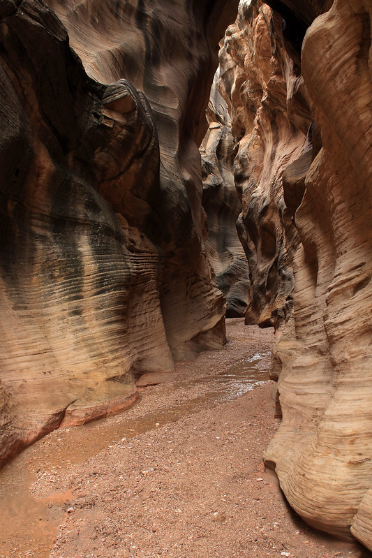
I left SLC early and arrived at Bull Valley Gorge around 10:30 A.M. I planned to take the canyon down to Sheep Creek and on to the Paria River where I would set up my camp. I walked along the canyon rim to the West of Skatumpah Road where it is easy to climb down to the canyon floor and proceeded down this uniquely beautiful slot.
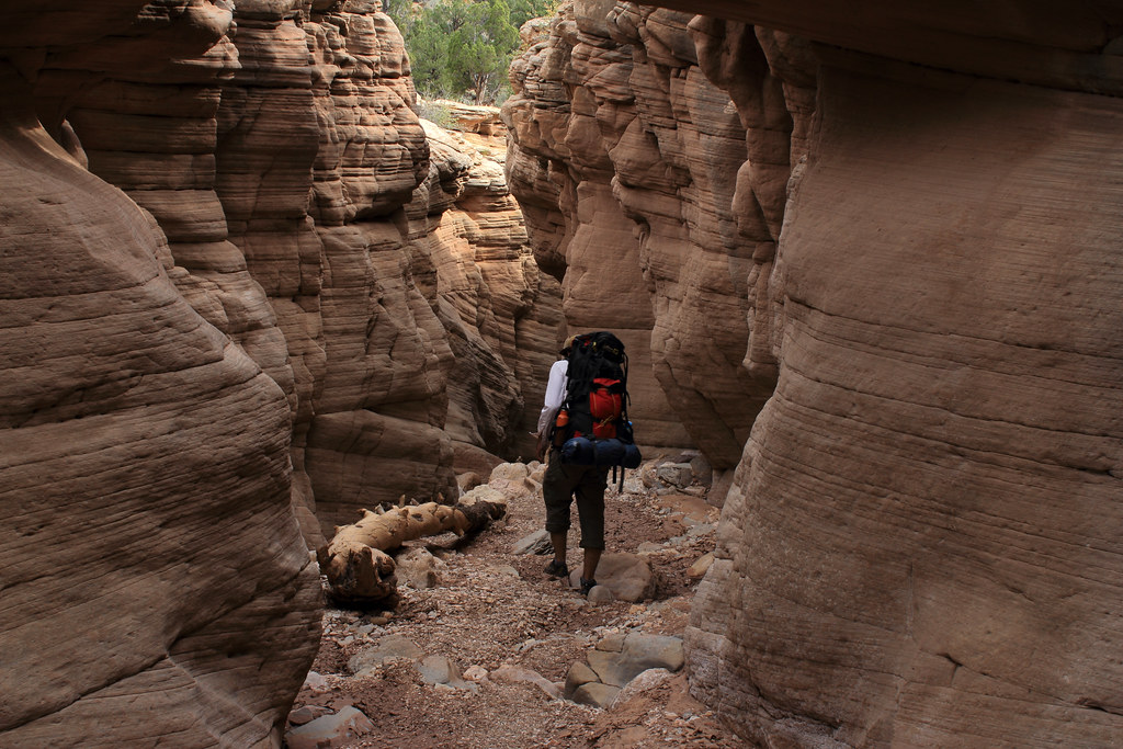
Upper BVG by NateGeesaman, on Flickr
There were many interesting log jams in the upper part of the canyon.
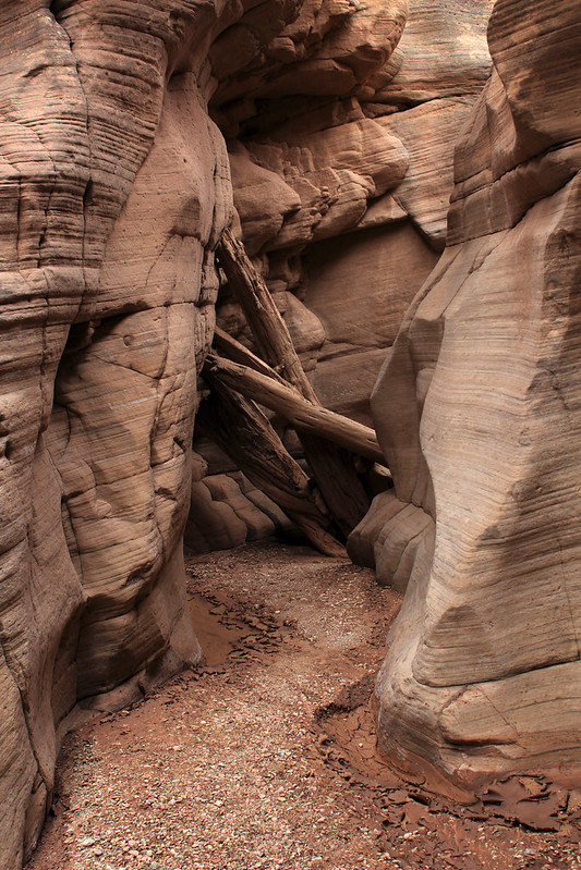
Bull Valley Gorge Jam by NateGeesaman, on Flickr
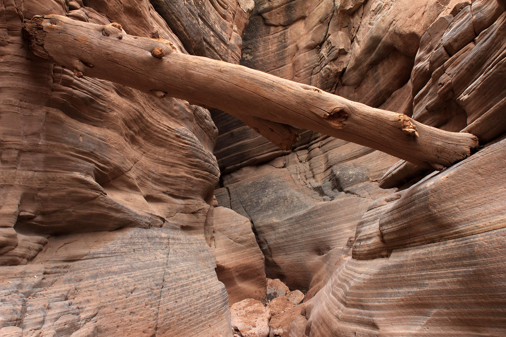
BVG Log Jam by NateGeesaman, on Flickr
I was not in the canyon long before I saw the worrying signs of muddy hand prints on the canyon walls and stepping stones dripping from muddy foot steps. I had to remove my pack and stem over a small pool. Not long after this I ran into a more intimidating obstacle. There was a drop off of about 10 feet from a chock stone down into a muddy pool with a shoe floating in it. There was a dog leash with two handles firmly wedged between the chock stone and the canyon wall to aid the climb, but with the option of lowering the pack down ruled out by a shoe eating muddy pool, I chose to turn back and take Willis Creek instead. If I had someone to help pass the packs down I may have attempted to carry on, but being by myself I erred on the side of caution and took to plan B.
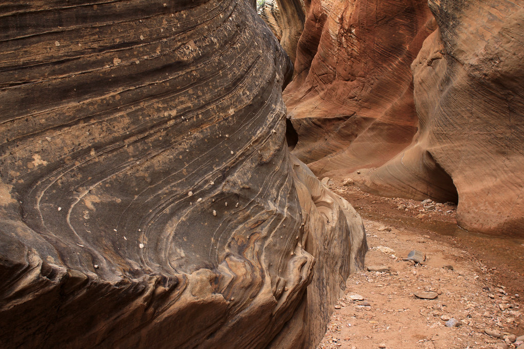
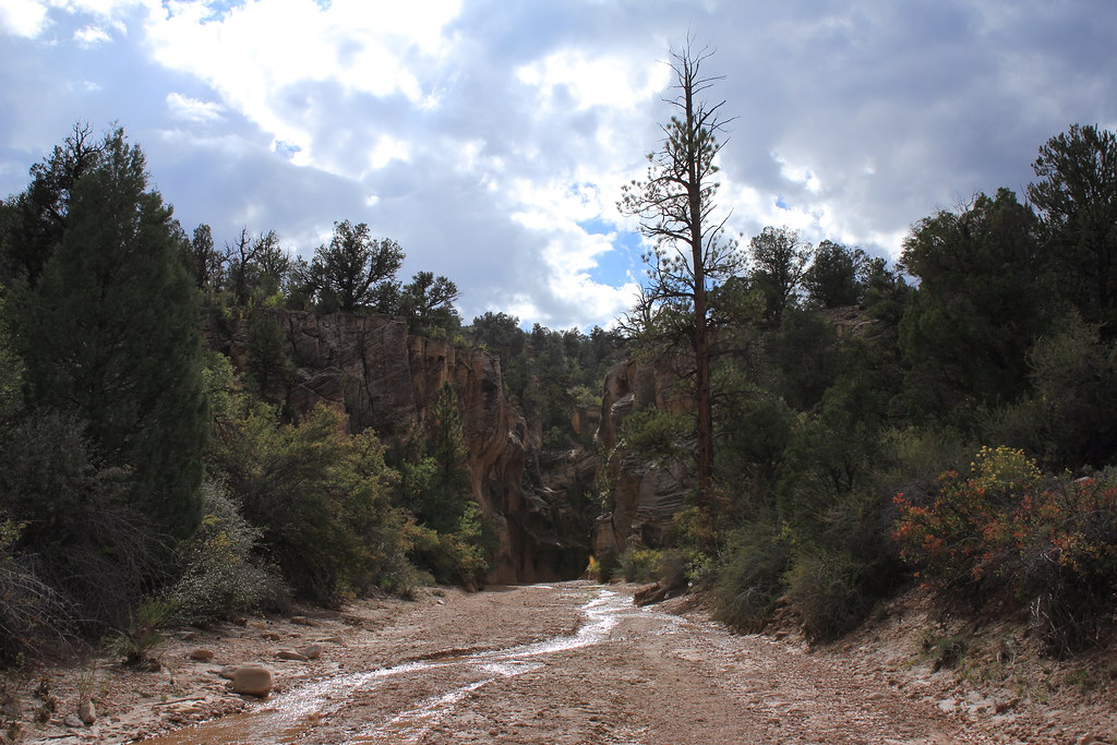
Willis Creek by NateGeesaman, on Flickr
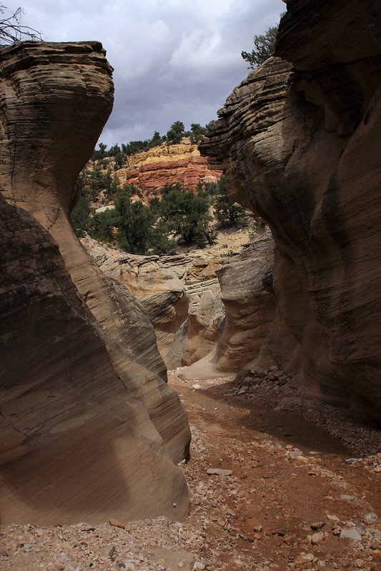
Willis Layers by NateGeesaman, on Flickr
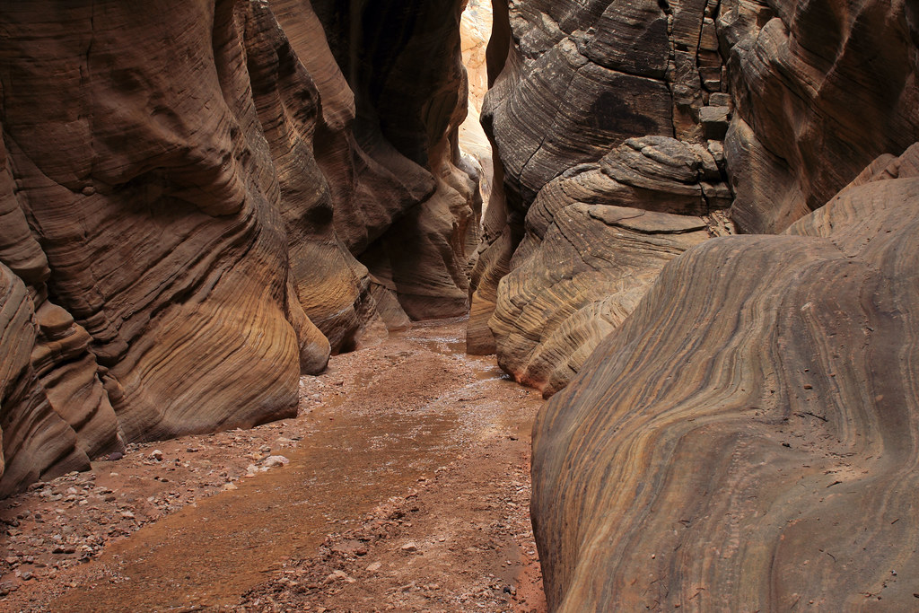
Willis Creek by NateGeesaman, on Flickr
At the base of Willis Creek where it meets Sheep Creek there are some cool petroglyph panels.
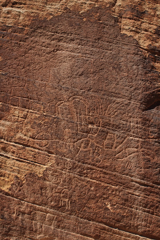
Grand Staircase Petroglyphs by NateGeesaman, on Flickr
intuitive cat tells me this looks like a route and drainage map on this BIG panel
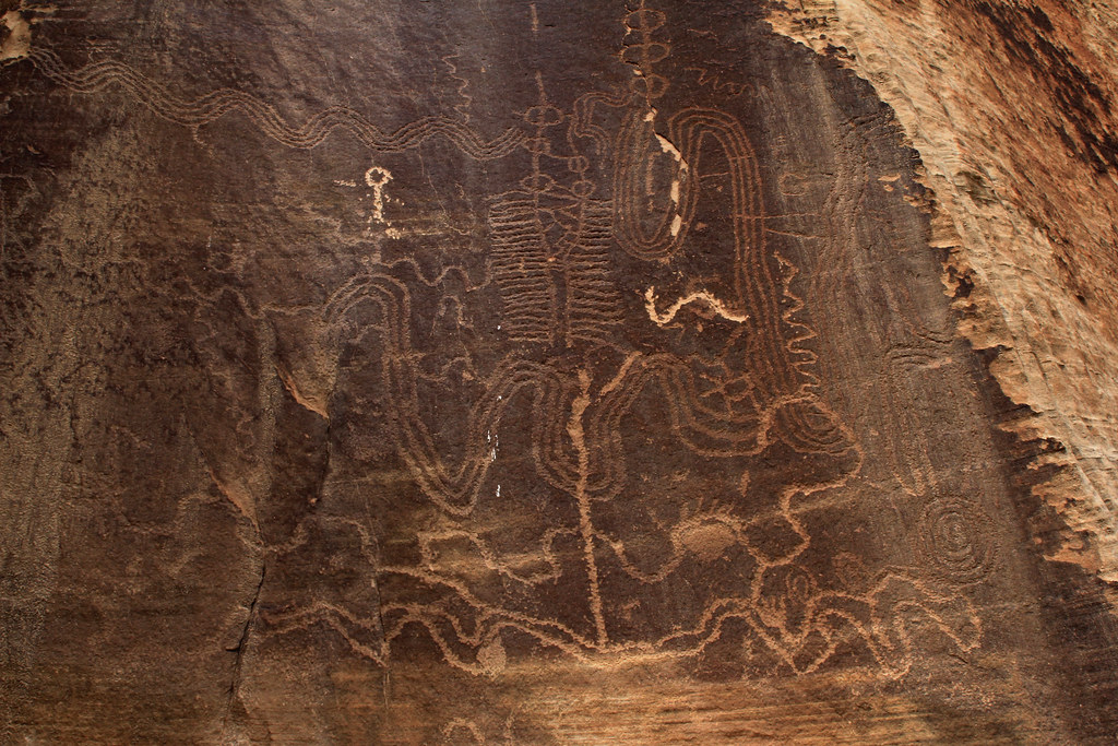
SHEEP CREEK MAP by NateGeesaman, on Flickr
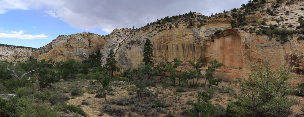
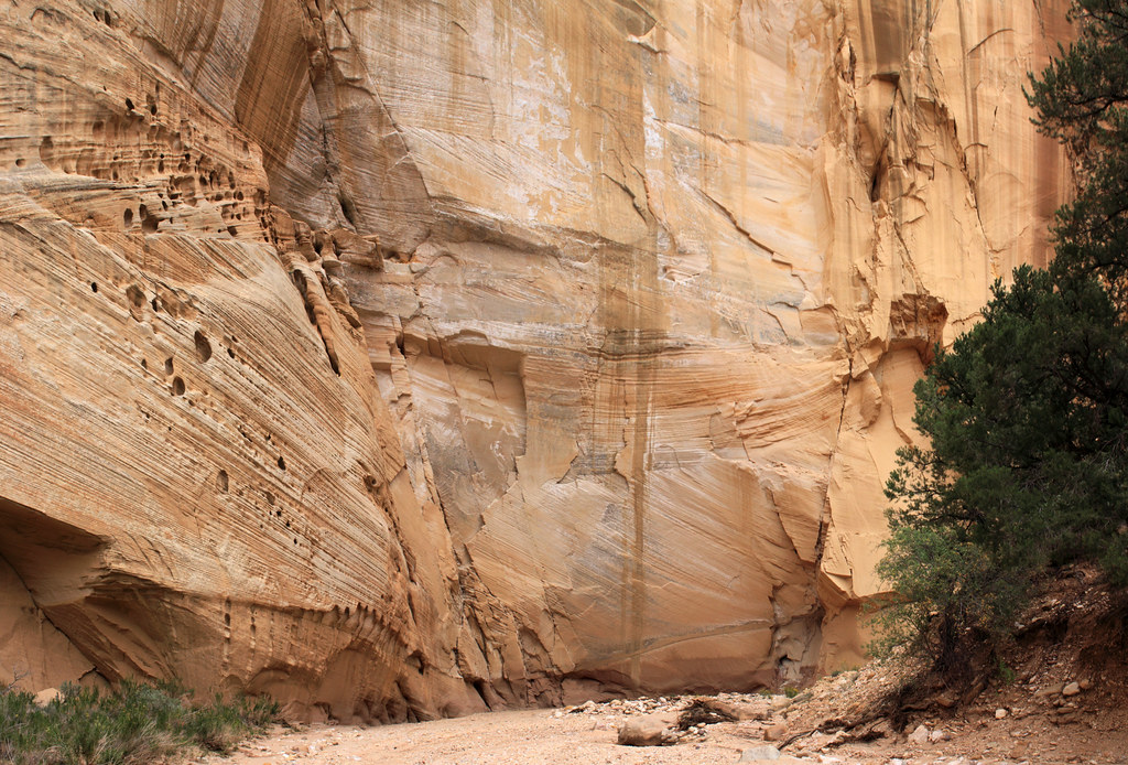
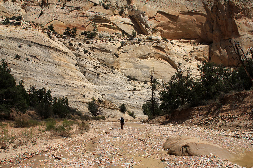
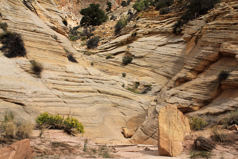
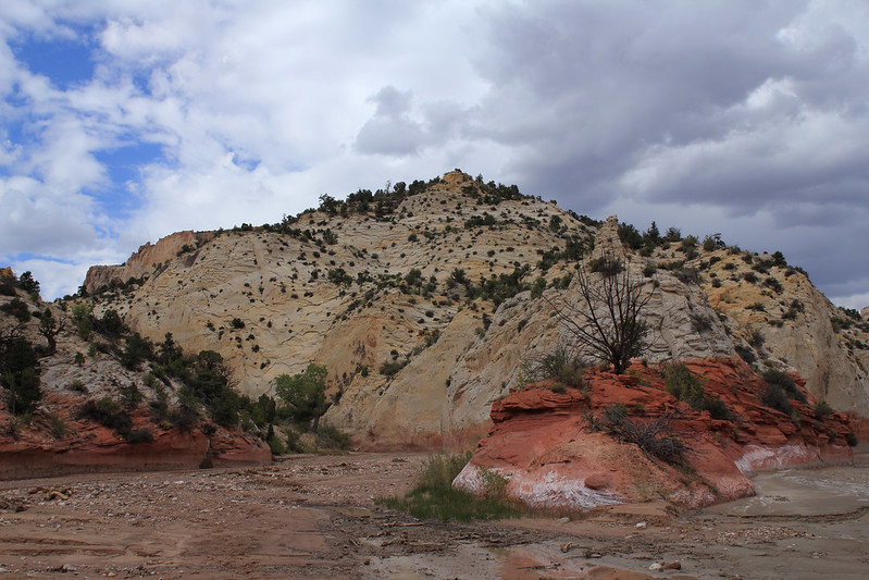
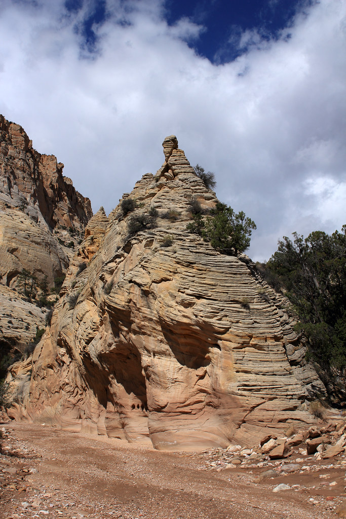
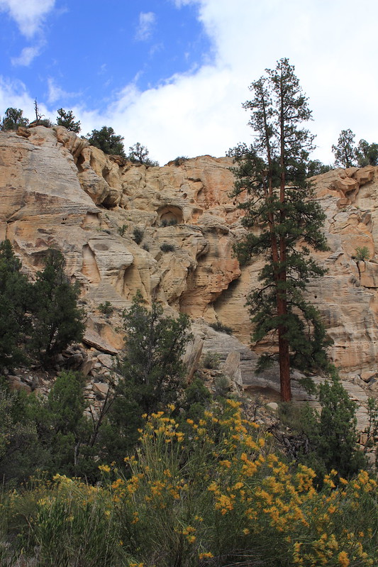
Sheep Creek Canyon is very beautiful and a great place to walk around with colorful towering canyon walls and beautiful old Junipers, Pinyon Pines, and Cottonwoods peppered everywhere.
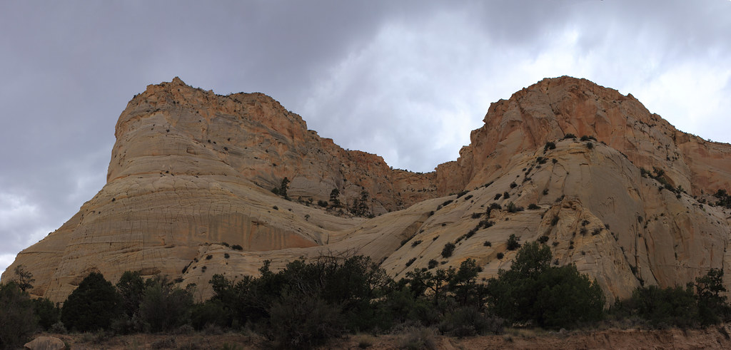
Sheep Creek Cliffs Pano by NateGeesaman, on Flickr
Grand Staircase Scene by NateGeesaman, on Flickr
Sheep creek alcove pano by NateGeesaman, on Flickr
Here is Dan on our first trip to this area in a super yellow section of Sheep Creek Canyon:
Sheep Creek Canyon Yellows by NateGeesaman, on Flickr
Little Dan by NateGeesaman, on Flickr
Break Time
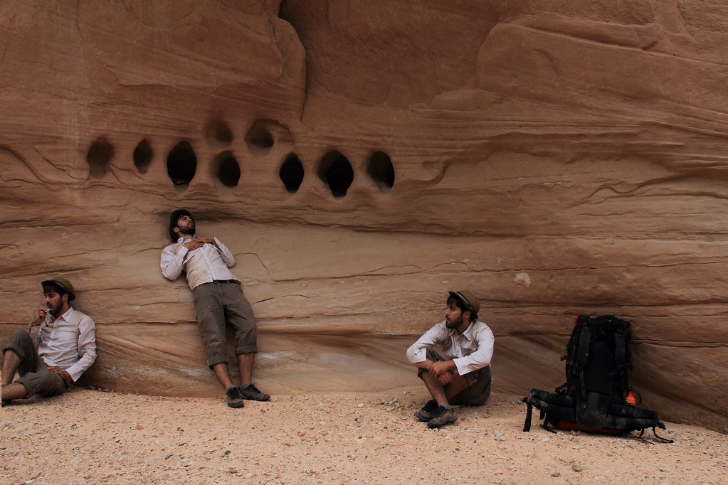
Sheep Creek Multiplicity 2 by NateGeesaman, on Flickr`
Now, I believe that this is where we ran into problems on our initial visit.
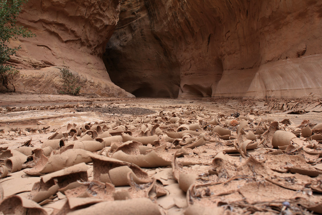
Quicksand dried by NateGeesaman, on Flickr
This side canyon was a muddy mess with an unusual mud wall to wall in the narrow opening. The whole area flooded the day before and the canyon floor still held a lot of moisture in contrast to the above photo. Your foot would sink down about a foot into the mud and feel super heavy when you tried to lift it out. Interestingly, when you lifted your foot out of the mud it was still relatively dry. Weird scary mud! It felt too sketchy to try and enter the canyon so we continued searching in vain for the turn in the loop for many miles before we decided to turn around and backtrack.
On this most current visit to this canyon I saw a clue of sheep tracks entering, but not exiting the canyon. This route got that sheep somewhere so It must go somewhere worth exploring. I planned return and explore further the next day and see if it led to the bottom of Bull Valley Gorge as I suspected.
So on down Sheep Creek Canyon I went towards the Paria where I planned to set up camp for a few nights.
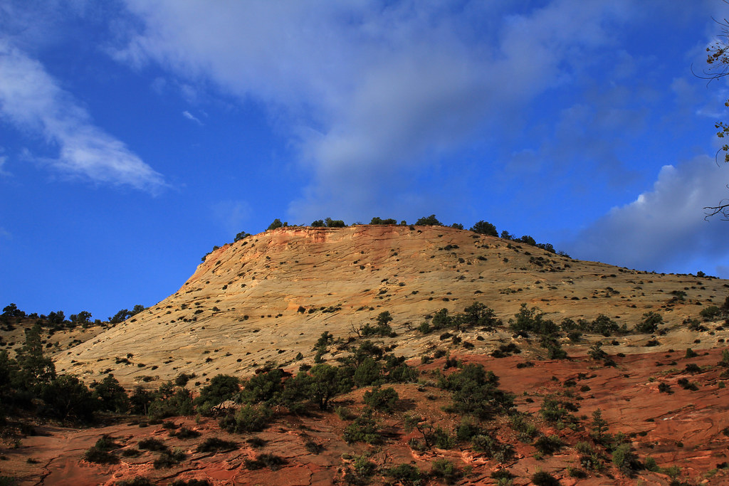
Sheep Creek Butte by NateGeesaman, on Flickr
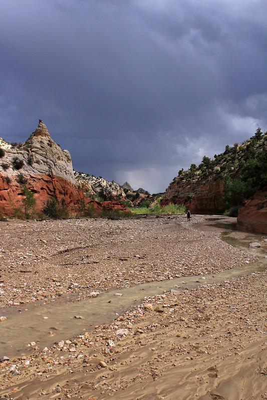
Same butte last visit:
Paria River Weather Show by NateGeesaman, on Flickr
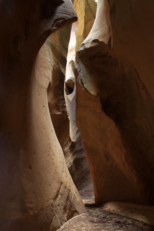
There is another awesome side slot worth exploring just before Sheep Creek meets The Paria River.
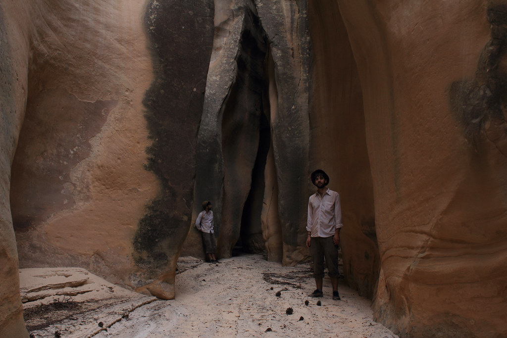
Sheep Creek Side Slot Selfie by NateGeesaman, on Flickr
Here's looking at you by NateGeesaman, on Flickr
last visit
Sheep Creek Canyon Side Slot by NateGeesaman, on Flickr
Sheep Creek didn't flow very well til the bottom where I was able to filter some good water.
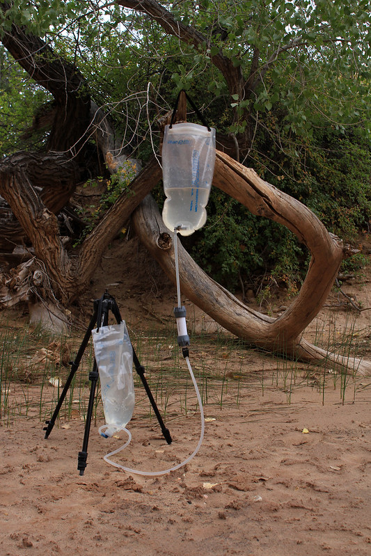
Sheep Creek Filter by NateGeesaman, on Flickr
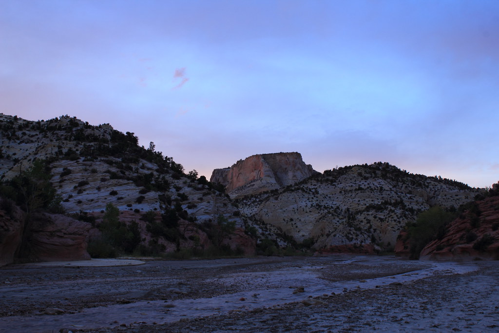
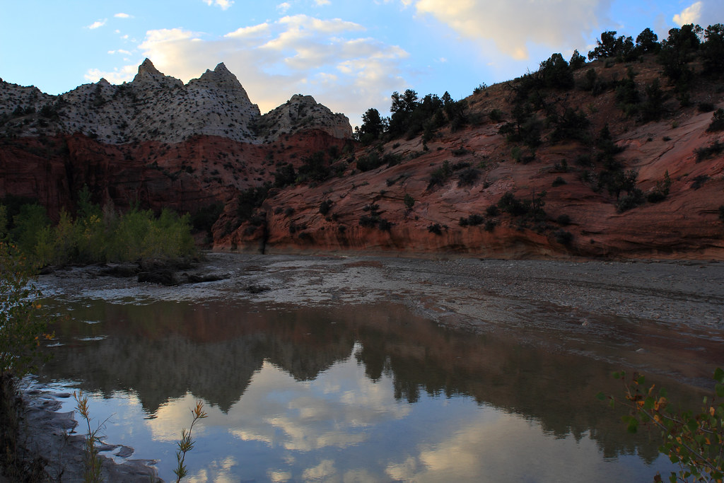
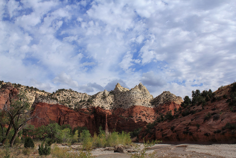
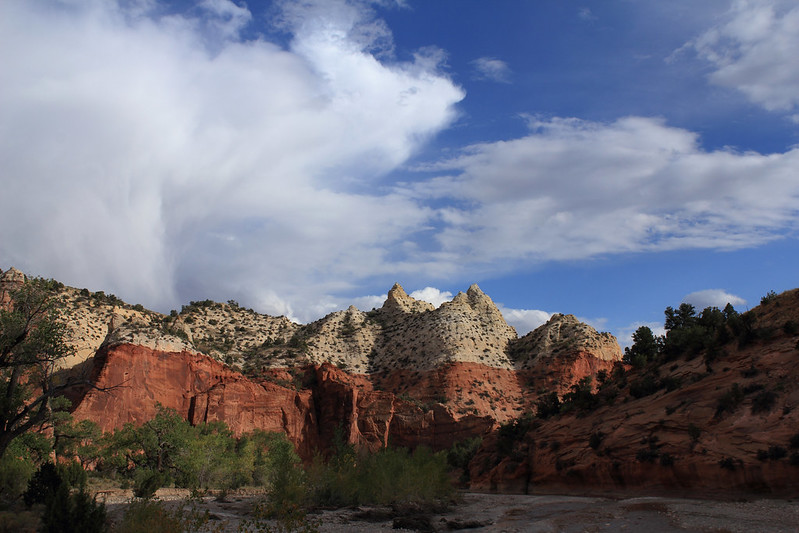
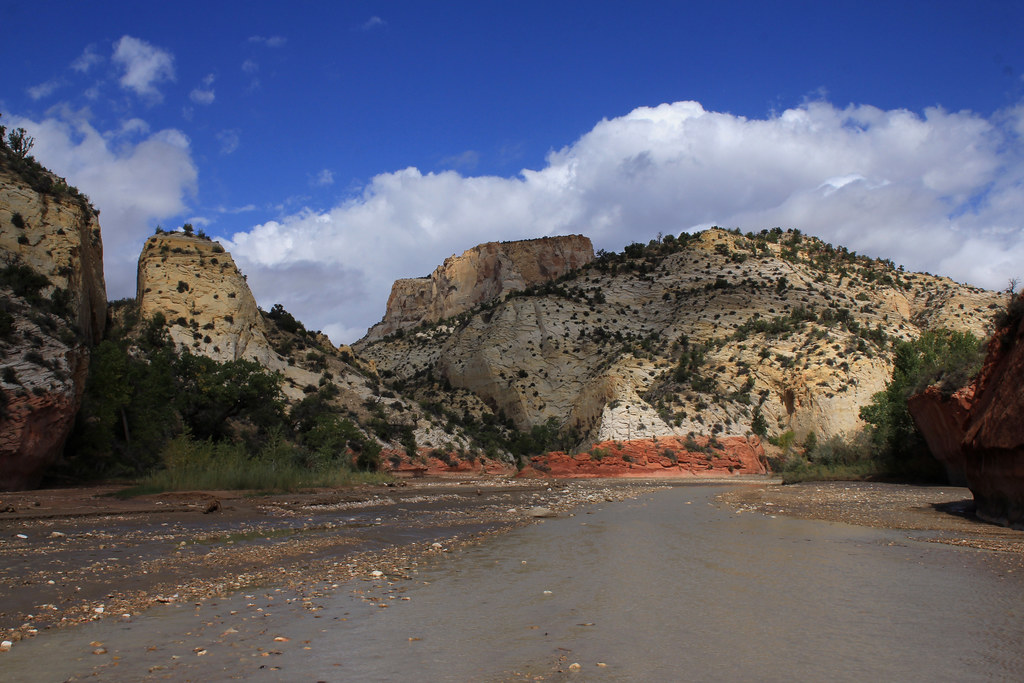
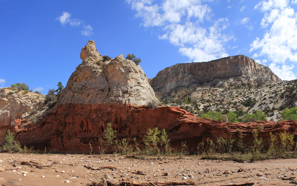
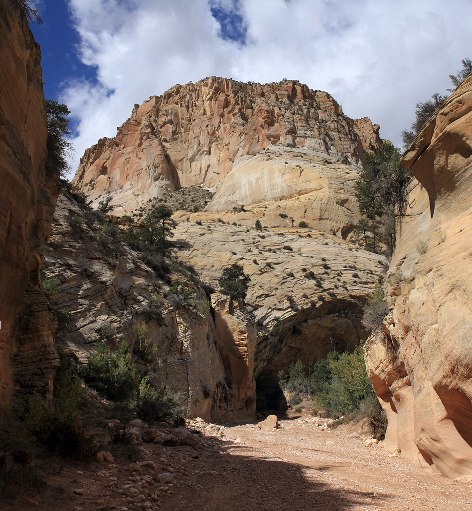
Not far from this canyon Sheep Creek Canyon joins up with Paria Canyon in beautiful fashion with layered deep red and white sandstone forming beautiful little peaks.
I had excellent light here on my first visit:
Dan on the Upper Paria River by NateGeesaman, on Flickr
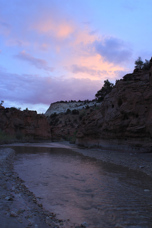
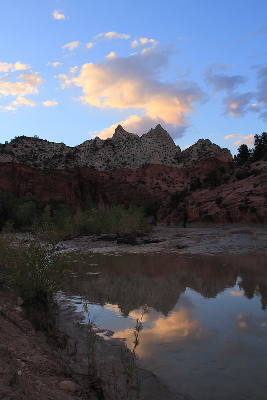
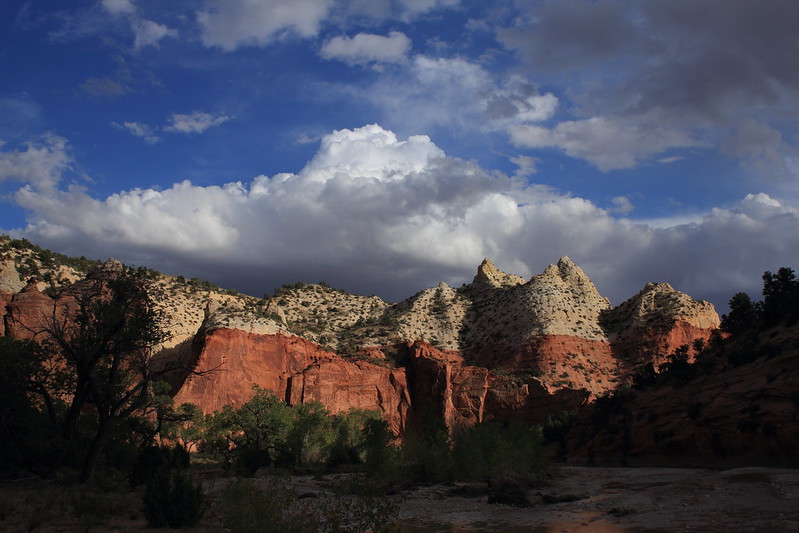
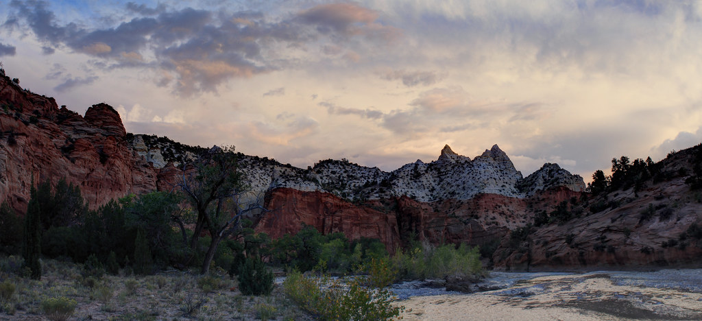
On this most current visit it was already getting dark by the time I reached this point, but I had a bit of drama in the sky to help out photos:
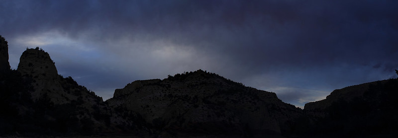
Stormy Dusk Pano by NateGeesaman, on Flickr
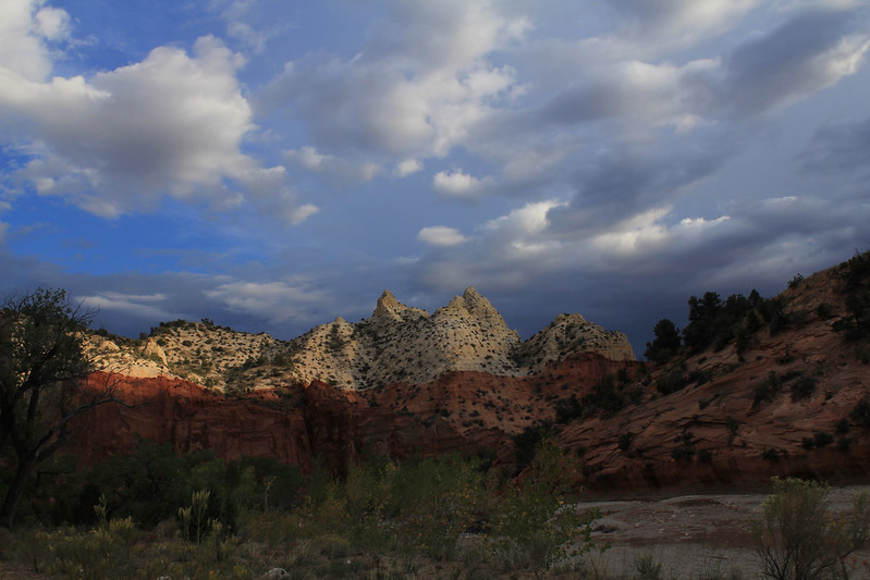
The last rays in Paria Canyon:
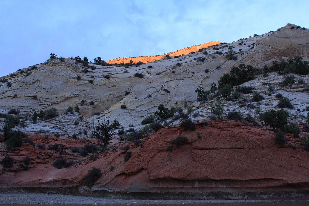
Last Rays in Paria Canyon by NateGeesaman, on Flickr
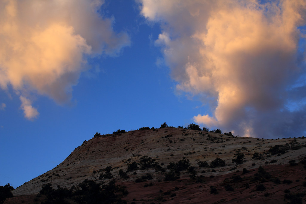
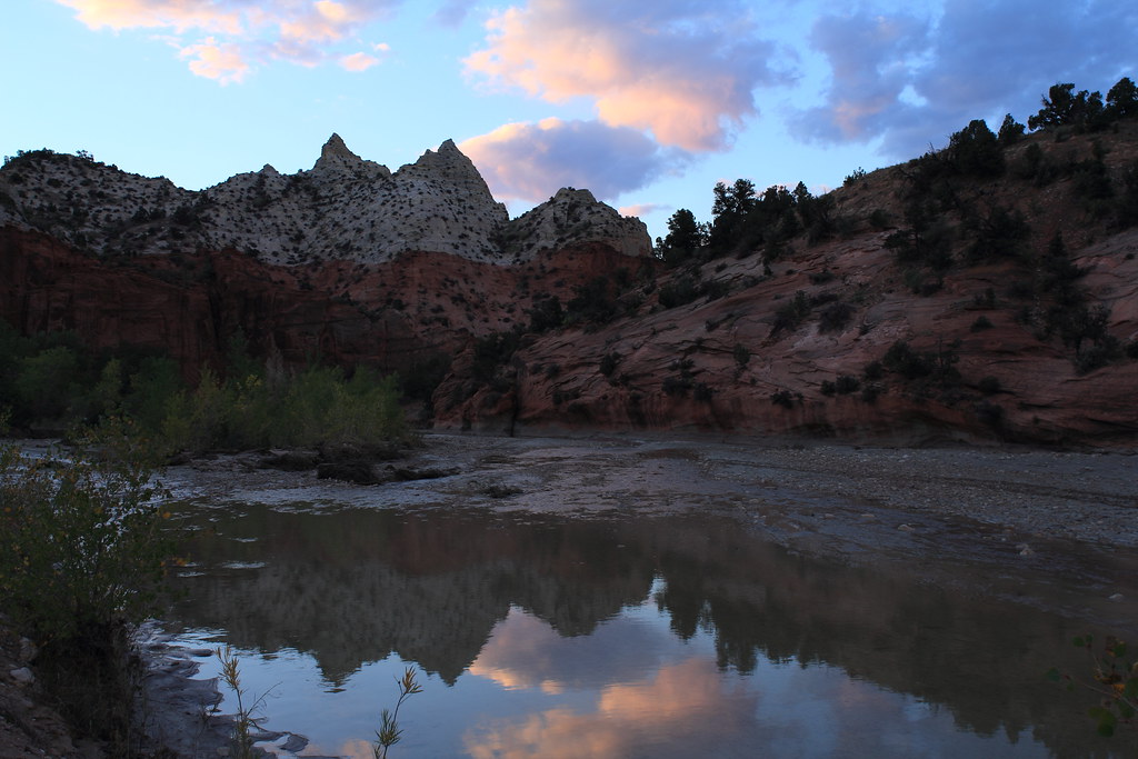
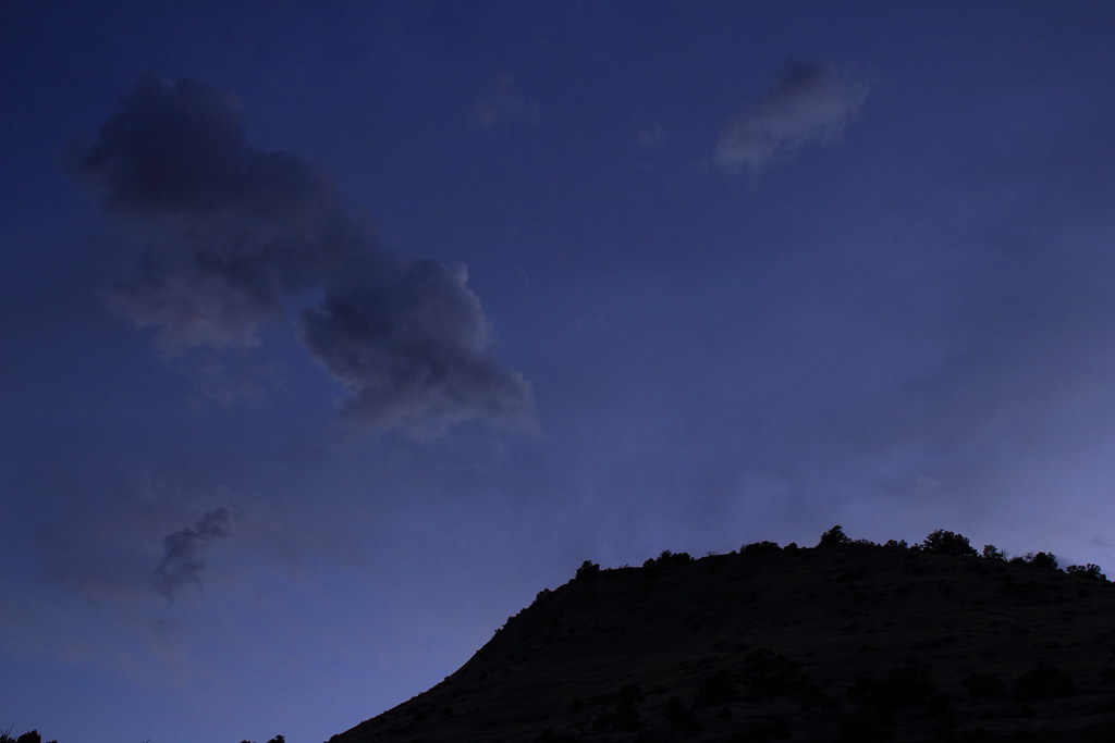
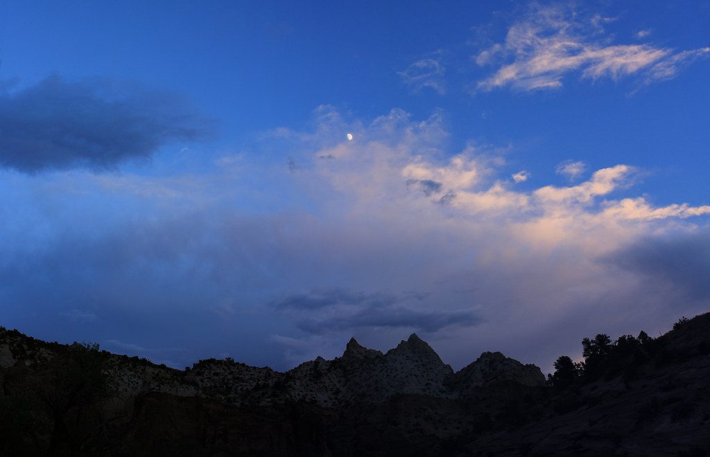
Some nice color in the sky to usher in the night:
Paria Canyon Sunset by NateGeesaman, on Flickr
Sheep Creek Paria River Junction Sunset by NateGeesaman, on Flickr
The night was cloudy with a bright moon behind the clouds peeking through from time to time. I drank some whiskey and crashed early since night shots were not coming out very good. I had one of the best nights of sleep in recent memory.
The sunrise was a good one and shot me out of my sleeping bag to my camera.
Sunset light Paria by NateGeesaman, on Flickr
Teepee Sunrise 1 by NateGeesaman, on Flickr
Teepee Sunrise 2 by NateGeesaman, on Flickr
Teepee Sunrise 3 by NateGeesaman, on Flickr
The first rays of sunlight hitting the walls of Paria Canyon and some great clouds:
First light Paria by NateGeesaman, on Flickr
I made some tea and ate almond bread for breakfast between taking photos.
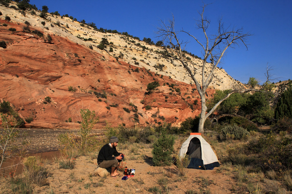
Morning Tea by NateGeesaman, on Flickr
The forecast called for a chance of thunderstorms in the afternoon, so I wanted to get on the trail early back up to Bull Valley as early as possible. So back up to Sheep Creek Canyon I went in search of Bull Valley Gorge.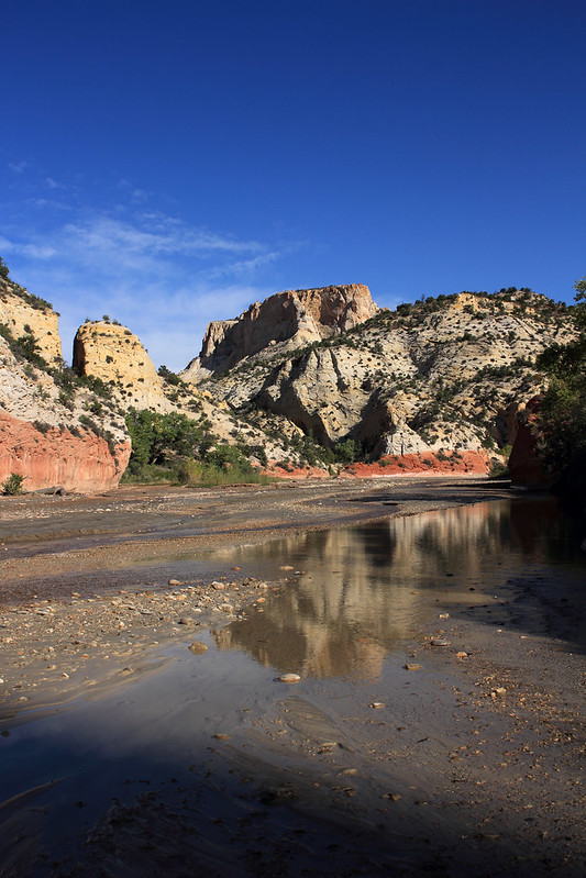
Sheep Paria Junction AM by NateGeesaman, on Flickr
The clouds were thickening quickly. It is hard to see the weather coming and it seems to change so fast when you are down on the canyon floor.
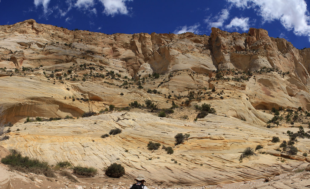
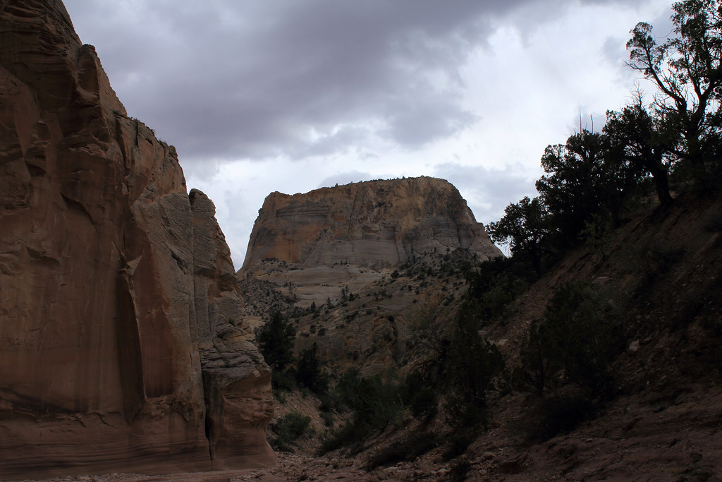
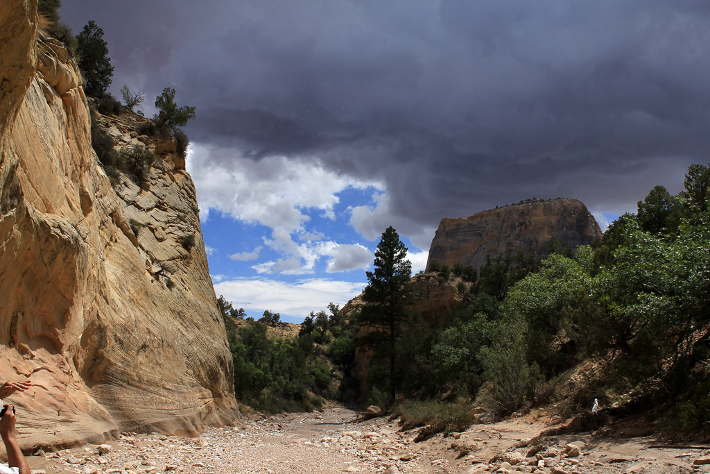
I headed down the side canyon towards Bull Valley Gorge and it opened up magnificently.
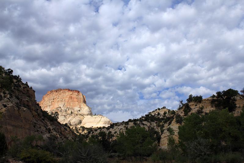
Spotlit Butte 2 by NateGeesaman, on Flickr
Yellow Chunk by NateGeesaman, on Flickr
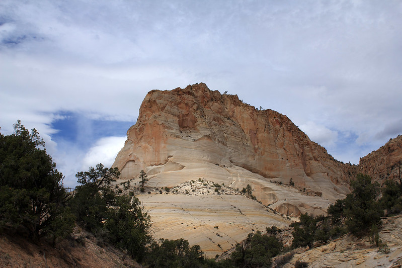
Spotlit Butte by NateGeesaman, on Flickr
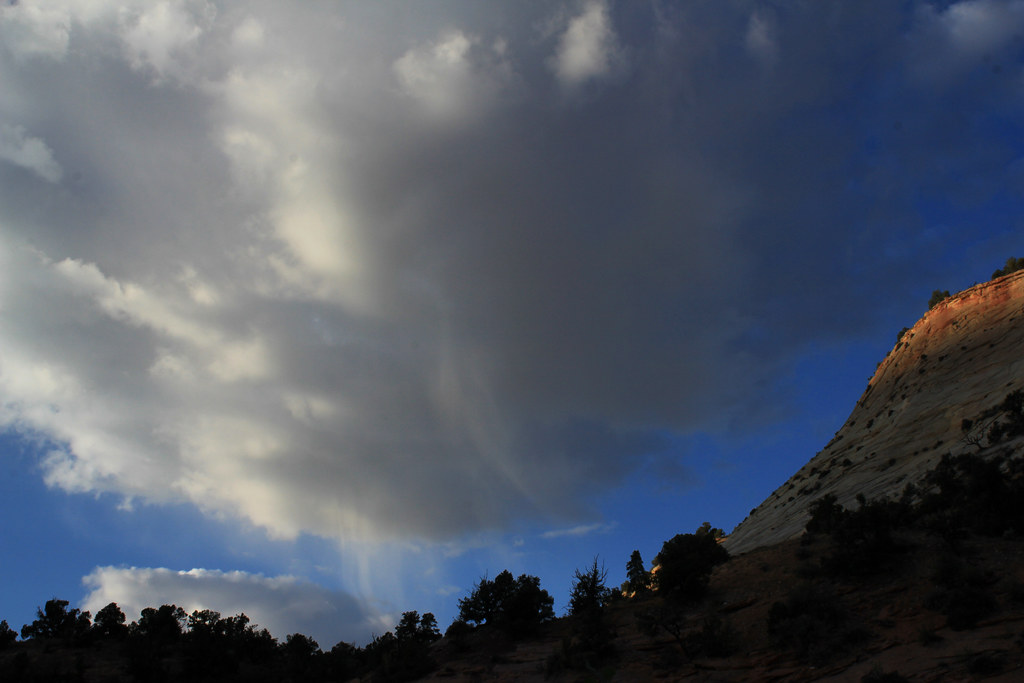
I hiked for quite a ways and I believe I was very close to the start of the narrows of Bull Valley Gorge when I saw this sky and heard thunder.
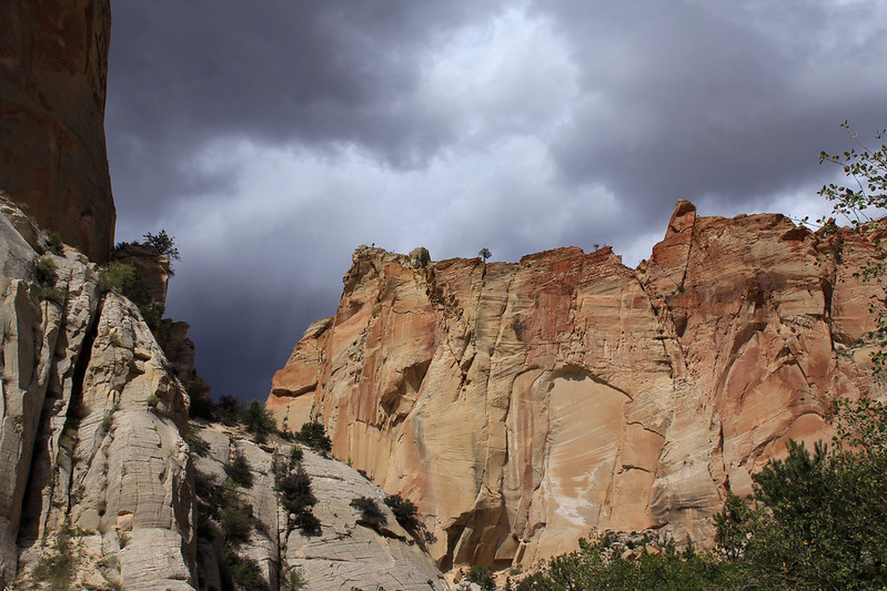
Ominous Sky by NateGeesaman, on Flickr
Seeing all the gnarly log jams in the top of the canyon the day before was still fresh on my mind and a good reminder that I should take no chances of being in the canyon if it flooded, so I turned back and once again Bull Valley Gorge eluded me
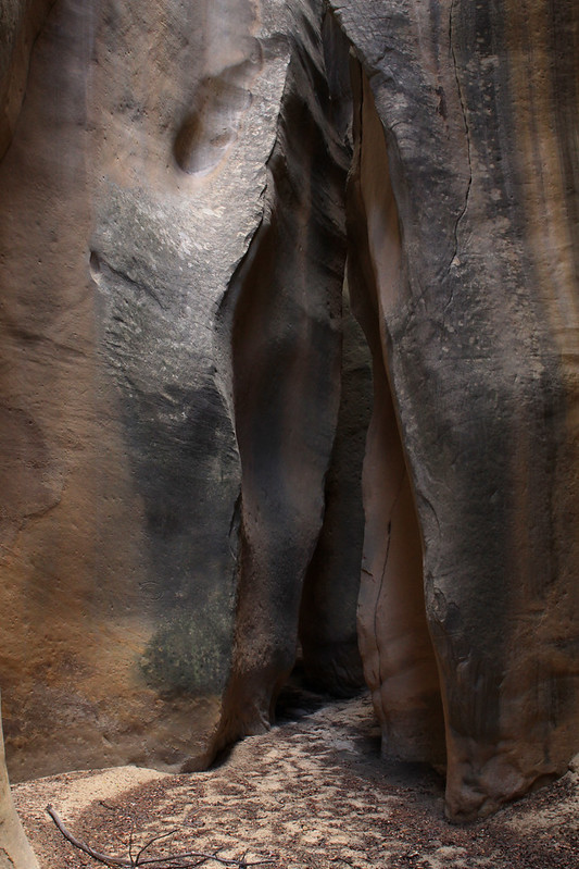
Here is a shot of the narrows that lead back to Sheep Creek Canyon:
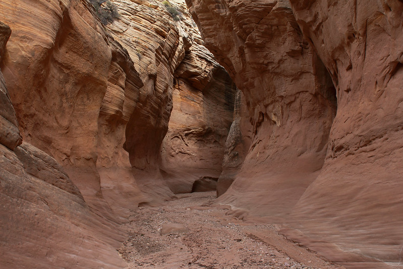
Sheep Creek Side Canyon Narrows by NateGeesaman, on Flickr
Even though I was unable to see Bull Valley Gorge, I had a great days hiking experiencing a new area and got in over 8 miles.
This is looking back up Sheep Creek from the Paria River on my way back to camp.
Sheep Paria Junction Afternoon by NateGeesaman, on Flickr
When I got back to camp the clouds were going off and it was sprinkling intermittently. I was tired from hiking about 18 miles so far this trip and ready to chill and weather watch.
Teepee Afternoon Clouds by NateGeesaman, on Flickr
one hour later:
Teepees w tall clouds by NateGeesaman, on Flickr
a half hour later:
Teepees tall clouds 2 by NateGeesaman, on Flickr
another hour later:
Teepee's Last Rays by NateGeesaman, on Flickr
The sky was putting on a nice show for me and the Sunset was decent.
Paria Camp Sunset Pano by NateGeesaman, on Flickr
Teepee Sunset Pano by NateGeesaman, on Flickr
The sky threatened a lot, but was just beautiful with a little bit of rain.
Dusk Cloud Paria by NateGeesaman, on Flickr
Teepee Moon by NateGeesaman, on Flickr
Right about now it started raining hard. It stormed all night with many many strong little thunderstorms rolling over the canyon. It wasn't until dawn when the storm finally broke. It rained almost an inch overnight.
What a rough night of sleep that was with crashing thunder throughout the night.
I awoke to beautiful clouds rolling over the canyon as the tail end of the storms passed.
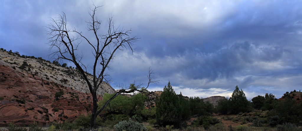
Paria Morning Pano by NateGeesaman, on Flickr
This was shot as the first rays of sunshine hit the walls of Paria Canyon from my camp.
First light Paria by NateGeesaman, on Flickr
It was great to feel the sunshine after waking up in a slightly wet sleeping bag. I let my stuff dry out in the sun for a while and ate a ton of food and drank a ton of tea while warming up.
Once I got all packed up and warm I headed back up Paria Canyon towards Sheep Creek. There were more beautiful clouds and spotty sunshine to accompany my journey back to my car.
Sheep Creek meets Paria River by NateGeesaman, on Flickr
Sheep Creek Meets Paria Canyon by NateGeesaman, on Flickr
Break time back in Sheep Creek Canyon:
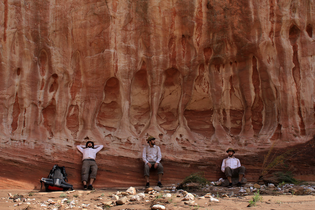
Sheep Creek Multiplicity by NateGeesaman, on Flickr
Sheep Creek is awesome! Even after walking through it the past 2 days I could not say I was tired of the views at all.
Sheep Creek Canyon 1 by NateGeesaman, on Flickr
Sheep Creek Teepee by NateGeesaman, on Flickr
Sheep Creek Growth by NateGeesaman, on Flickr
and once again, back up Willis Creek towards my car.
Willis Return 2 by NateGeesaman, on Flickr
Even between the narrows Willis Creek is beautiful. You have to love really lush desert like this.
Lush Willis by NateGeesaman, on Flickr
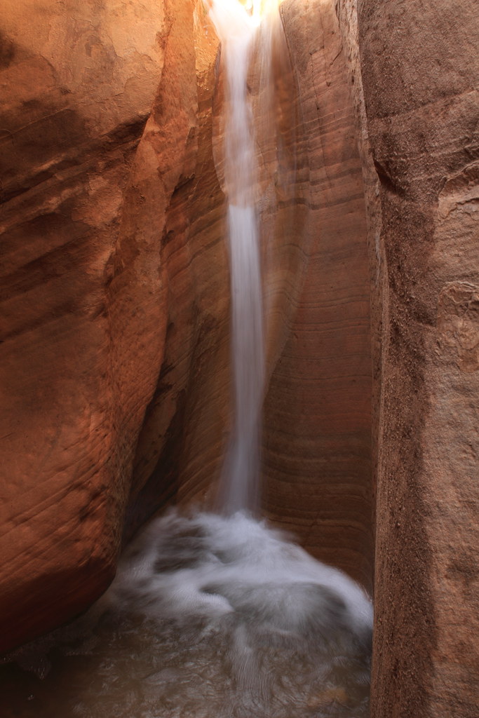
Willis Creek Falling by NateGeesaman, on Flickr
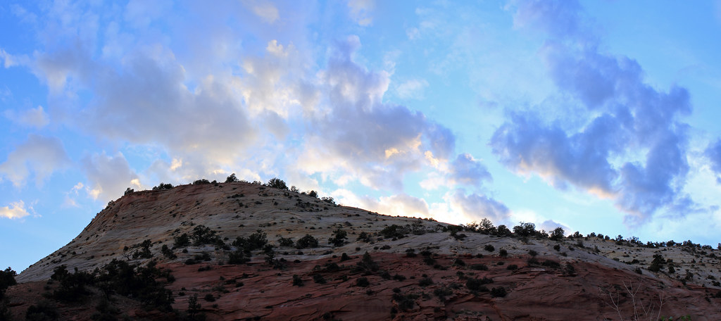
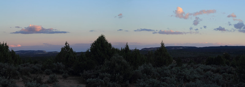
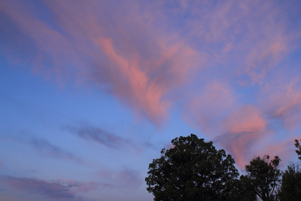
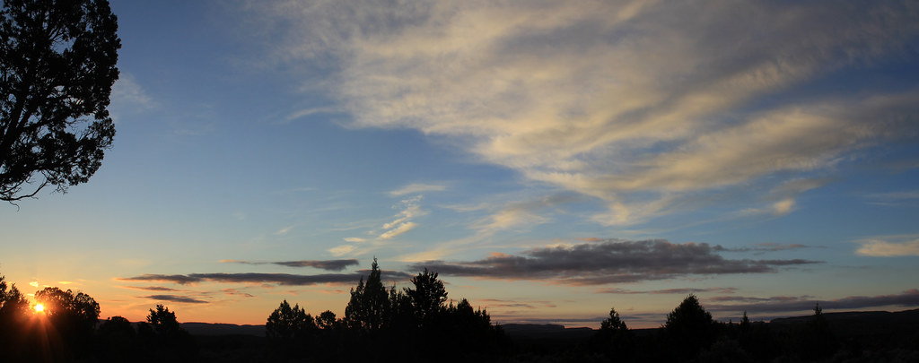
I arrived back at the car around 5. I planned to spend one more night car camping and drive home for work after taking in the sunrise. I found a great spot with 360 degree expansive views and enjoyed the comforts of car camping for the night. There was a nice long sunset that night.
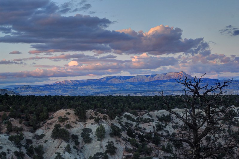
Sunset from camp by NateGeesaman, on Flickr
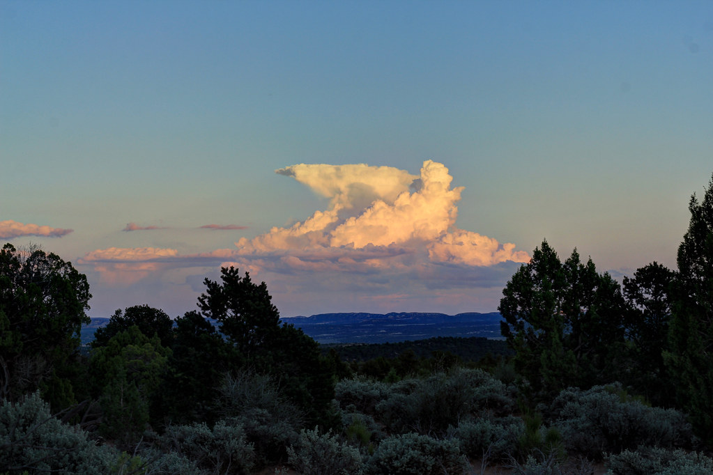
Anvil Cloud by NateGeesaman, on Flickr
Grand Staircase sunset by NateGeesaman, on Flickr
I got a fire going once it got dark intermittently relaxed and took night shots.
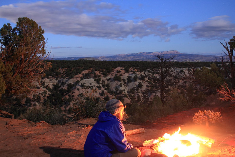
Hell Yes! by NateGeesaman, on Flickr
It was great to get to see stars! The first two nights were super cloudy and all my night shots were meh. If you look close in this shot you can see Lenticular clouds forming over the distant butte.
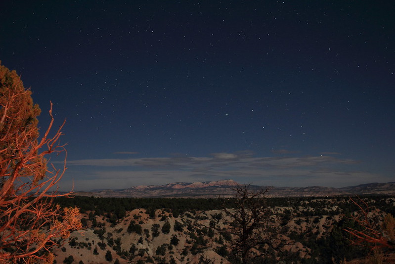
Night Lenticulars by NateGeesaman, on Flickr
I awoke before dawn and took some photos of the disappearing stars and made tea.
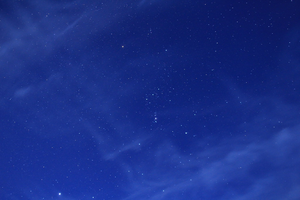
Pre-Dawn Orion by NateGeesaman, on Flickr
The sunrise was a great one and a fine way to cap off my time in the area.
Heart Cloud Sunrise by NateGeesaman, on Flickr
Sunrise from camp 9-26-12 by NateGeesaman, on Flickr
I drove home with just enough time to download my photos before it was back to the grind for me.
~thanks for looking~
Featured image for home page:

This trip report will have photos from my previous trip mixed in where appropriate.
I left SLC early and arrived at Bull Valley Gorge around 10:30 A.M. I planned to take the canyon down to Sheep Creek and on to the Paria River where I would set up my camp. I walked along the canyon rim to the West of Skatumpah Road where it is easy to climb down to the canyon floor and proceeded down this uniquely beautiful slot.
Upper BVG by NateGeesaman, on Flickr
There were many interesting log jams in the upper part of the canyon.
Bull Valley Gorge Jam by NateGeesaman, on Flickr
BVG Log Jam by NateGeesaman, on Flickr
I was not in the canyon long before I saw the worrying signs of muddy hand prints on the canyon walls and stepping stones dripping from muddy foot steps. I had to remove my pack and stem over a small pool. Not long after this I ran into a more intimidating obstacle. There was a drop off of about 10 feet from a chock stone down into a muddy pool with a shoe floating in it. There was a dog leash with two handles firmly wedged between the chock stone and the canyon wall to aid the climb, but with the option of lowering the pack down ruled out by a shoe eating muddy pool, I chose to turn back and take Willis Creek instead. If I had someone to help pass the packs down I may have attempted to carry on, but being by myself I erred on the side of caution and took to plan B.
Willis Creek by NateGeesaman, on Flickr
Willis Layers by NateGeesaman, on Flickr
Willis Creek by NateGeesaman, on Flickr
At the base of Willis Creek where it meets Sheep Creek there are some cool petroglyph panels.
Grand Staircase Petroglyphs by NateGeesaman, on Flickr
intuitive cat tells me this looks like a route and drainage map on this BIG panel
SHEEP CREEK MAP by NateGeesaman, on Flickr
Sheep Creek Canyon is very beautiful and a great place to walk around with colorful towering canyon walls and beautiful old Junipers, Pinyon Pines, and Cottonwoods peppered everywhere.
Sheep Creek Cliffs Pano by NateGeesaman, on Flickr
Grand Staircase Scene by NateGeesaman, on Flickr
Sheep creek alcove pano by NateGeesaman, on Flickr
Here is Dan on our first trip to this area in a super yellow section of Sheep Creek Canyon:
Sheep Creek Canyon Yellows by NateGeesaman, on Flickr
Little Dan by NateGeesaman, on Flickr
Break Time
Sheep Creek Multiplicity 2 by NateGeesaman, on Flickr`
Now, I believe that this is where we ran into problems on our initial visit.
Quicksand dried by NateGeesaman, on Flickr
This side canyon was a muddy mess with an unusual mud wall to wall in the narrow opening. The whole area flooded the day before and the canyon floor still held a lot of moisture in contrast to the above photo. Your foot would sink down about a foot into the mud and feel super heavy when you tried to lift it out. Interestingly, when you lifted your foot out of the mud it was still relatively dry. Weird scary mud! It felt too sketchy to try and enter the canyon so we continued searching in vain for the turn in the loop for many miles before we decided to turn around and backtrack.
On this most current visit to this canyon I saw a clue of sheep tracks entering, but not exiting the canyon. This route got that sheep somewhere so It must go somewhere worth exploring. I planned return and explore further the next day and see if it led to the bottom of Bull Valley Gorge as I suspected.
So on down Sheep Creek Canyon I went towards the Paria where I planned to set up camp for a few nights.
Sheep Creek Butte by NateGeesaman, on Flickr
Same butte last visit:
Paria River Weather Show by NateGeesaman, on Flickr
There is another awesome side slot worth exploring just before Sheep Creek meets The Paria River.
Sheep Creek Side Slot Selfie by NateGeesaman, on Flickr
Here's looking at you by NateGeesaman, on Flickr
last visit
Sheep Creek Canyon Side Slot by NateGeesaman, on Flickr
Sheep Creek didn't flow very well til the bottom where I was able to filter some good water.
Sheep Creek Filter by NateGeesaman, on Flickr
Not far from this canyon Sheep Creek Canyon joins up with Paria Canyon in beautiful fashion with layered deep red and white sandstone forming beautiful little peaks.
I had excellent light here on my first visit:
Dan on the Upper Paria River by NateGeesaman, on Flickr
On this most current visit it was already getting dark by the time I reached this point, but I had a bit of drama in the sky to help out photos:
Stormy Dusk Pano by NateGeesaman, on Flickr
The last rays in Paria Canyon:
Last Rays in Paria Canyon by NateGeesaman, on Flickr
Some nice color in the sky to usher in the night:
Paria Canyon Sunset by NateGeesaman, on Flickr
Sheep Creek Paria River Junction Sunset by NateGeesaman, on Flickr
The night was cloudy with a bright moon behind the clouds peeking through from time to time. I drank some whiskey and crashed early since night shots were not coming out very good. I had one of the best nights of sleep in recent memory.
The sunrise was a good one and shot me out of my sleeping bag to my camera.
Sunset light Paria by NateGeesaman, on Flickr
Teepee Sunrise 1 by NateGeesaman, on Flickr
Teepee Sunrise 2 by NateGeesaman, on Flickr
Teepee Sunrise 3 by NateGeesaman, on Flickr
The first rays of sunlight hitting the walls of Paria Canyon and some great clouds:
First light Paria by NateGeesaman, on Flickr
I made some tea and ate almond bread for breakfast between taking photos.
Morning Tea by NateGeesaman, on Flickr
The forecast called for a chance of thunderstorms in the afternoon, so I wanted to get on the trail early back up to Bull Valley as early as possible. So back up to Sheep Creek Canyon I went in search of Bull Valley Gorge.
Sheep Paria Junction AM by NateGeesaman, on Flickr
The clouds were thickening quickly. It is hard to see the weather coming and it seems to change so fast when you are down on the canyon floor.
I headed down the side canyon towards Bull Valley Gorge and it opened up magnificently.
Spotlit Butte 2 by NateGeesaman, on Flickr
Yellow Chunk by NateGeesaman, on Flickr
Spotlit Butte by NateGeesaman, on Flickr
I hiked for quite a ways and I believe I was very close to the start of the narrows of Bull Valley Gorge when I saw this sky and heard thunder.
Ominous Sky by NateGeesaman, on Flickr
Seeing all the gnarly log jams in the top of the canyon the day before was still fresh on my mind and a good reminder that I should take no chances of being in the canyon if it flooded, so I turned back and once again Bull Valley Gorge eluded me
Here is a shot of the narrows that lead back to Sheep Creek Canyon:
Sheep Creek Side Canyon Narrows by NateGeesaman, on Flickr
Even though I was unable to see Bull Valley Gorge, I had a great days hiking experiencing a new area and got in over 8 miles.
This is looking back up Sheep Creek from the Paria River on my way back to camp.
Sheep Paria Junction Afternoon by NateGeesaman, on Flickr
When I got back to camp the clouds were going off and it was sprinkling intermittently. I was tired from hiking about 18 miles so far this trip and ready to chill and weather watch.
Teepee Afternoon Clouds by NateGeesaman, on Flickr
one hour later:
Teepees w tall clouds by NateGeesaman, on Flickr
a half hour later:
Teepees tall clouds 2 by NateGeesaman, on Flickr
another hour later:
Teepee's Last Rays by NateGeesaman, on Flickr
The sky was putting on a nice show for me and the Sunset was decent.
Paria Camp Sunset Pano by NateGeesaman, on Flickr
Teepee Sunset Pano by NateGeesaman, on Flickr
The sky threatened a lot, but was just beautiful with a little bit of rain.
Dusk Cloud Paria by NateGeesaman, on Flickr
Teepee Moon by NateGeesaman, on Flickr
Right about now it started raining hard. It stormed all night with many many strong little thunderstorms rolling over the canyon. It wasn't until dawn when the storm finally broke. It rained almost an inch overnight.
What a rough night of sleep that was with crashing thunder throughout the night.
I awoke to beautiful clouds rolling over the canyon as the tail end of the storms passed.
Paria Morning Pano by NateGeesaman, on Flickr
This was shot as the first rays of sunshine hit the walls of Paria Canyon from my camp.
First light Paria by NateGeesaman, on Flickr
It was great to feel the sunshine after waking up in a slightly wet sleeping bag. I let my stuff dry out in the sun for a while and ate a ton of food and drank a ton of tea while warming up.
Once I got all packed up and warm I headed back up Paria Canyon towards Sheep Creek. There were more beautiful clouds and spotty sunshine to accompany my journey back to my car.
Sheep Creek meets Paria River by NateGeesaman, on Flickr
Sheep Creek Meets Paria Canyon by NateGeesaman, on Flickr
Break time back in Sheep Creek Canyon:
Sheep Creek Multiplicity by NateGeesaman, on Flickr
Sheep Creek is awesome! Even after walking through it the past 2 days I could not say I was tired of the views at all.
Sheep Creek Canyon 1 by NateGeesaman, on Flickr
Sheep Creek Teepee by NateGeesaman, on Flickr
Sheep Creek Growth by NateGeesaman, on Flickr
and once again, back up Willis Creek towards my car.
Willis Return 2 by NateGeesaman, on Flickr
Even between the narrows Willis Creek is beautiful. You have to love really lush desert like this.
Lush Willis by NateGeesaman, on Flickr
Willis Creek Falling by NateGeesaman, on Flickr
I arrived back at the car around 5. I planned to spend one more night car camping and drive home for work after taking in the sunrise. I found a great spot with 360 degree expansive views and enjoyed the comforts of car camping for the night. There was a nice long sunset that night.
Sunset from camp by NateGeesaman, on Flickr
Anvil Cloud by NateGeesaman, on Flickr
Grand Staircase sunset by NateGeesaman, on Flickr
I got a fire going once it got dark intermittently relaxed and took night shots.
Hell Yes! by NateGeesaman, on Flickr
It was great to get to see stars! The first two nights were super cloudy and all my night shots were meh. If you look close in this shot you can see Lenticular clouds forming over the distant butte.
Night Lenticulars by NateGeesaman, on Flickr
I awoke before dawn and took some photos of the disappearing stars and made tea.
Pre-Dawn Orion by NateGeesaman, on Flickr
The sunrise was a great one and a fine way to cap off my time in the area.
Heart Cloud Sunrise by NateGeesaman, on Flickr
Sunrise from camp 9-26-12 by NateGeesaman, on Flickr
I drove home with just enough time to download my photos before it was back to the grind for me.
~thanks for looking~
Featured image for home page:


")