Which Lakes on the Boulder have no vehicle access

Duke

Mountain Carver
Joined
Feb 19, 2012
Messages
382
I am considering a trip to the Aquarius plateau area in Utah but want to backpack in. I can't find a good source that tells me which lakes one can 4 wheeler in to and which ones require a hike. Anybody know of such a resource? It seems that most have road access. ?

Duke
 
I've always just used the USGS Topo and satellite imagery when scouting trips there. Last time I looked there were quite a few that you had to hike to but pretty much none that weren't more than 2-3 miles from the nearest road or ATV trail. I would assume those maps are accurate, but I could be wrong. Sorry, not much help. If you don't already use the BCP topo map, I highly recommend it.
 
The other thing that's confusing is that a lot of the roads on Boulder Top have been closed but are still on maps and easily seen on satellite pictures. Are you looking for a lake on the top or on the flanks?
 
The loop I like to do is Honeymoon, Pear, Blind, Solitaire lakes. All full of nice Tigers. If you have an ATV you can get within a few miles of the lakes then walk around the base of the plateau.
 
Bob

I wasn't looking anywhere in particular but would guess the scenery is better on the flanks.

Gary,

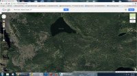
thanks. However, your recommendation helps illustrate why my map skills are so poor that I am unable to follow Nick's suggestion (even though it likely works for everyone else). I was looking at Pear Lake recently and could swear that I see a road leaving to the south. One problem I have with Sat photos is that roads are now just ATV trails and I can't tell the difference between them and hiking trails.

Pear.jpg
 
Thanks Gary. And....just to confuse things....what I call Pear lake this map in the link calls Cutler lake. What can I say, Navy guys like me don't get the Land-Nav map skills that Army @Aldaron has.

p.s. I see you are from Vegas. We moved here from Vegas 8 yrs ago. Love Idaho but miss the Vegas desert too.
 
Back
Top