I woke to the smell of smoke. Uh oh. I was hoping to make it through the trip without wildfire smoke intruding on the scenery, but it was bound to find me eventually. The smoke had moved in overnight and sunk into the valley. I wasn’t sure where it was coming from – there could be a fire nearby, or it could have drifted in from hundreds of miles away.
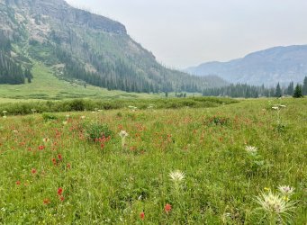
I emerged from the tent later than normal, as the cliff on the east side of the valley blocked the early sun. The persistent shade and the nearby river made for an unusually cold morning. I was moving slowly, hoping that the sun would crest the cliffs above before I had to wade the icy river. It eventually appeared, but it didn’t make wading the river any more pleasant.
I waded the river three times in the first couple of miles. Immediately after the 3rd crossing I arrived at an obscure, unmarked junction. The main trail continues downstream along the North Fork Buffalo. To the right is a surprisingly prominent trail heading up a tributary valley. This trail isn’t shown on any map that I’ve seen. I’m guessing that it is either an old, abandoned trail or one of the many unofficial trails created by horsepackers.
Back in 2022 I had wandered up this trail in error, not realizing that the main trail fords the river to continue upstream along the North Fork Buffalo. Fortunately I had realized my error quickly. After my trip I did a little research and found that the trail goes to Tri County Lake. That was of interest, as Tri County Lake was pretty high on my list of places that I wanted to visit. The valley that it passes through was of interest, too, as the topo map suggests a number of waterfalls in the drainage. The creek actually has two forks. One begins near the Continental Divide and starts out running roughly parallel to the North Fork Buffalo. The other fork drains Tri County Lake. It looked like both forks and the combined stream would have waterfalls.
My goal was to see as many waterfalls as possible while finding my way to Tri County Lake. I wasn’t sure of the exact route to the lake, but there was only one possible route that looked plausible for horse traffic.
The trail started off great, but that ended when the trail entered burned forest. It was a mess of deadfall from that point on. The trail braided frequently where different groups had taken varying routes to get around the obstacles. Guessing at the best possible route was difficult. I employed the strategy of following the freshest horse poop. I figured that if anyone knew where they were going, it was the horses. And if a horse could get through, I should be able to.
I found a rare piece of trash along this stretch. It was a fishing license that had either been discarded or dropped by mistake. It had been purchased on July 19th in Moose, Wyoming, so I knew that someone had been up this valley in the last few days.
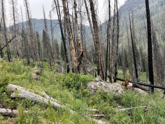
I passed a couple of tributary waterfalls along here, but they weren’t very scenic due to the burned forest.
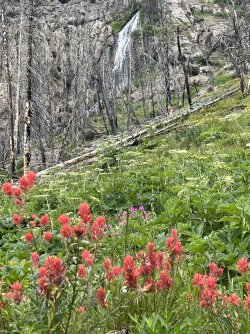
This would be quite picturesque without the burned forest.
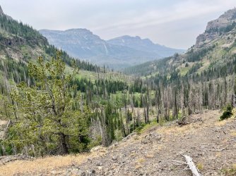
I reached a cliff a few minutes later with a decent view down the valley. It would have been a great view without the burned forest. I had lunch there before resuming the hike.
DO GO CHASING WATERFALLS
The next stretch of trail was hard to follow. Eventually it completely disappeared. I did find huge patches of wildflowers though.
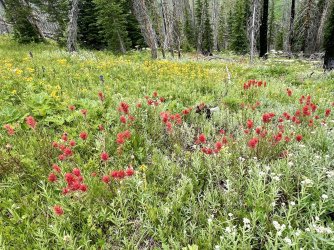
The next stretch of trail was hard to follow. Eventually it completely disappeared. I did find huge patches of wildflowers though.

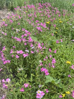
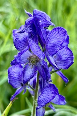
Does the blossom at the top look angry, or is it just me?
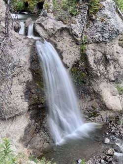
Before long I gave up on regaining the trail and headed down towards the creek. The first likely waterfall is just downstream from the confluence of the two forks, and I didn’t want to miss it. As expected, there is a really nice waterfall there. I got a view of it from a cliff above the creek. A closer view from the base would have been nice, but I didn’t see a safe route down from my vantage point. I probably could have reached the creek farther downstream, but I knew that I had a full afternoon ahead of me.
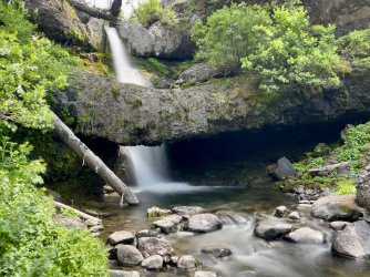
I climbed back up the slope to get around the waterfall before heading back down towards the confluence of the two forks. Just above the confluence I found a small but pretty waterfall on the fork coming from Tri County Lake.
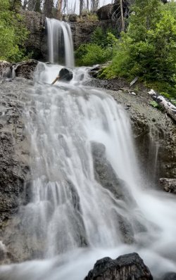
Last waterfall on the fork that starts at Tri County Lake
There are some big cascades on the other fork, but they aren’t particularly scenic. I thought about going up the Tri County Lake fork, but it looked like there should be a waterfall a short distance upstream on the other stream.
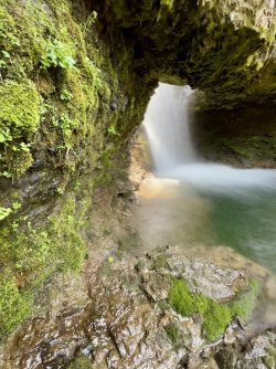
I headed that way and pushed through some bushes to reach the creek. I looked upstream, and I couldn’t believe my eyes. There was a waterfall as expected. The surprising part was the natural bridge in front of it! I wasn’t expecting that! I went a little crazy, taking photos and videos and exploring up to the base of the bridge.
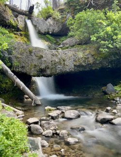
Waterfall and natural bridge on the fork originating at the Continental Divide
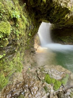
Under the bridge
I wonder how many people have seen this waterfall? The unofficial trail is over a hundred vertical feet above, and it is mostly traveled by horseback riders. How many of them have bushwhacked down here to fish or look for waterfalls?
From there I backtracked to the Tri County Lake fork and headed upstream. I quickly found another waterfall a short distance above the one I’d passed earlier.
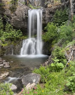
Above that was a run of 3 larger waterfalls. I climbed above the first, and stumbled on the trail, which crosses the stream at the base of another one. From there I continued up, quickly reaching a third waterfall. I kept climbing, and arrived at a narrow canyon with more waterfalls. It looked like there might be even more farther up the canyon, but I didn’t see a reasonable way to scramble up there.
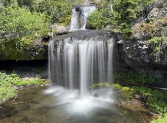
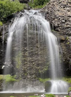
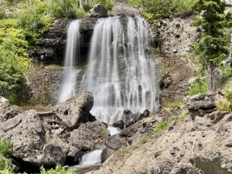
I backtracked to the trail and followed it up the valley to the east, away from the fork draining Tri County Lake. A few minutes later a triple waterfall came into view. These waterfalls aren’t far upstream from the waterfall with the natural bridge. These waterfalls are really nice, but the sun was out and the light was terrible for photography.
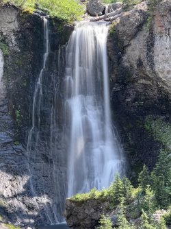
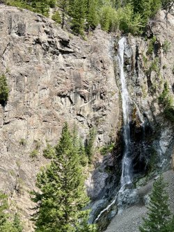
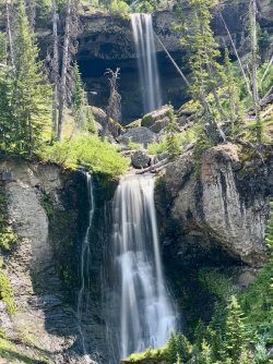
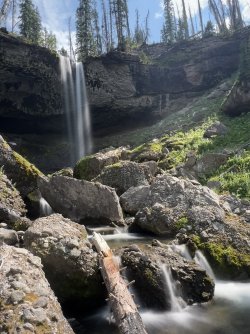
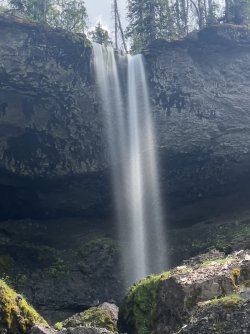
I explored each of them before returning to the trail. The path took me by one more waterfall before reaching treeline, where the trail disappeared in a meadow.
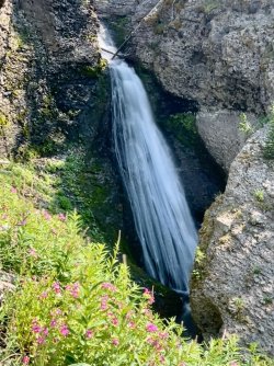
At that point I had a decision to make. It looked like there might be a couple more small waterfalls farther up the drainage. However, the most plausible route to Tri County Lake would require climbing northeast, away from the creek, to get above some cliffs. Once past the cliffs, the optimal route would head north.
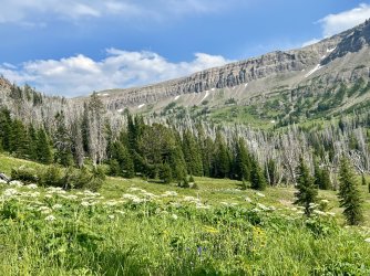
I headed that way, but dark clouds were building behind me. It looked like a storm was imminent. Camping at Tri County Lake would probably be safe since it is down in a basin, but it is still above treeline and very exposed. The rest of the hike there would be exposed, too.
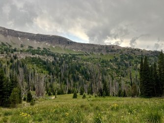 As luck would have it, I spotted a possible place to camp in a small clump of fir trees just ahead of me. It wasn’t a great spot, but there was room for one small tent in a place that was almost flat.
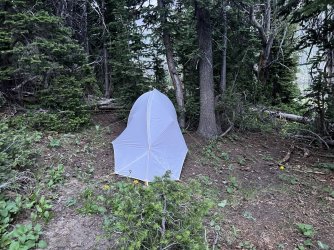
I was tired from a long day of exploring, so I decided to stop there. I got the tent up quickly, but the storms passed. Later, another wave of storms threatened, but they passed, too.
After setting up camp I went hunting for water, as I didn’t want to go all the way back down to the main creek. I found a good water source in a minor gully right after I stumbled upon the trail. It was heading towards Tri County Lake, exactly where I expected it. I made a note of its location before heading back to camp.
I had lentil curry for dinner that night, for the second time on the trip. This time it didn’t agree with me. In fact, you could say that it went straight through. That was surprising – I’d never had that problem with any of our dehydrated meals before. Fortunately that was the only night that I had a problem.
Unfortunately, that wasn’t my only issue. Early in the trip my shoulder straps started rubbing me raw. It was odd, since I’ve had this pack for years and I never had a problem with its fit. The issue got worse as the trip went on. I think it was because I was losing weight and my hip belt was maxed out. That kept me from tightening it more and taking more of the weight off of my shoulders. For some reason I had just been ignoring it, but the chaffing just got worse. I finally decided to try to do something about it. I tried moleskin and bandaids. Both helped some, but none of those options would stay on for very long because of the sweat.
I went to sleep that night looking forward to reaching Tri County Lake the next morning.

