pstm13
Auribus Teneo Lupum
- Joined
- Dec 27, 2012
- Messages
- 572
Day 1:
We left the hotel at about 9:00 am with clear skies and drove to the Needles visitor’s center to obtain our permit.

Newspaper Rock was on the way so we stopped and took a few pictures. At the visitor’s center, the ranger reviewed basic backcountry regulations and water availability. The permit is to be attached to your pack or tent in the event you have contact with a park ranger. Once we obtained our permit, we doubled back to Beef Basin Road and drove to the trailhead. On the way, we passed several mines that looked interesting but I do not know anything about them. The road is passable with a 2WD vehicle in good weather but was rough in several spots. The trailhead is not visible from the road. There is simply a place to park with no markings. I had to use my GPS to confirm that we were in the correct area. We arrived at the trailhead at about 11:30 am. Once in the parking area there is a trailhead sign with a logbook. When we arrived, it was snowing and cold. There were patches of snow on the butte and along the trail. As we hiked, the snow turned to hail and then rain as we made it deeper into the canyon.

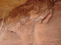
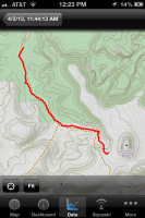
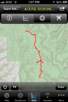
The initial trail is very steep with large rocks and it appears to have been washed out several times. My wife was initially reluctant to use a trek pole but eventually relented because of the terrain. We both used them religiously throughout the trip. Once at the bottom of the canyon and in Canyonlands National Park the trail quickly turns into a marsh with several stream crossings. With the added runoff from the rain and snow, we could not cross the stream without getting our feet wet and muddy. On the return trip, the weather was sunny and the water level dropped so there was no mud and much less water. Keeping our feet dry was not a problem. The trail can be difficult to follow at times. As a rule, just keep to the right side of the canyon and you will be fine. The trail deviates from the one marked on the topo map in spots so do not plan to follow the trail marked on the map blindly. As you get closer to Kirk’s cabin there is some possible rock art. To me it appeared that some is authentic and then it was defaced.
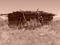
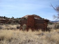
Finally, Kirk’s cabin comes into view and the trail forks after the cabin. To divert to the campgrounds SC1 and SC2 the trail turns right into a small canyon away from the stream. Because of the weather, there are no pictures of our campsite at SC1. The distance from the trailhead to SC1 campground is approx. 4.64 miles and the hike took us about 2 ½ hours to complete.
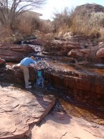
Upon arrival at SC1 we were cold and wet. We set up camp, cooked dinner, and tried to dry out or cloths. In order to fix dinner I needed water and had to hike back to the stream. Because of the additional runoff from the rain, animal scat observed on the trail, and the fact that the marsh is upstream from the water collection point I was concerned about water quality. To deal with this I added bleach to the water in addition to filtering it. The water had a distinct swimming pool taste to it but it was comforting after seeing all the animal scat in the marsh as we hiked.
View attachment 9453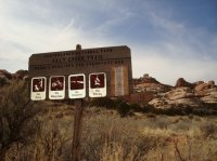
Day 2
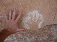
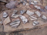
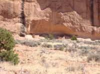
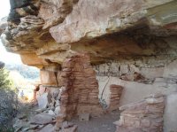
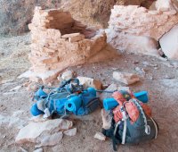
We took some additional time drying out our cloths, sleeping bags, and tent the morning of the second day. We did not leave camp until about 12:30 pm. The hike to SC3 was full of ruins, rock art, and arches. If you proceed past SC3 to the next canyon, you will see even more ruins and art.
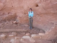
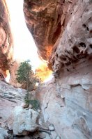
The trail was very flat or down hill except for one spot and went through a lot of high sagebrush along the bank of the creek. It moved back and forth between the right and left sides of the canyon. At some points, the trail was hard to follow.

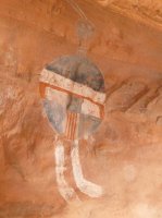
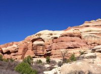
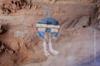
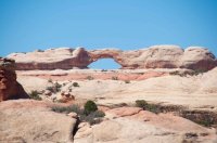
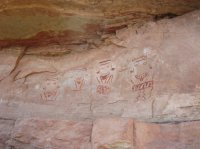
We relied on our GPS two or three times to find our way back to the trail. The sand and game trials made things a little confusing at times. As we hiked, it was very helpful to use as small pair of binoculars. The canyon walls are lined with ruins and rock art. At times, the trail takes you to the opposite side of the canyon. It was great to be able to spot ruins and art from a distance. In a nutshell, you will see a rock art panel across from Kirk’s cabin, a small set ruins just past the cabin, Big Ruins (15 min. diversion from main trail), several arches, Wedding Ring Arch, several other small ruins, the All American Man, the Four Faces and ruins, some cave ruins, the “squash” ruins, and other small ruins, cliff dwellings, and some rock art just past SC3 campground. We hiked about 8 ½ miles. It seemed that about every ½ mile we walked past an arch, ruin, or rock art. I am currently working on a list of sites with GPS coordinates. If you do not see them at the end of this post feel free to send me a message and I’ll get the list to you.




Day 3
The morning of day three was very cold. The clear sky at night dropped the temperature to about 31. Eventually as the sun rose and warmed the canyon, we were able to filter water and get moving. Because of a schedule issue, we would be forced to hike out to Cathedral Butte from SC3 rather than just hike back to SC2 and out the next day. As we made it through the 11 ½ miles back to the trailhead, we saw several ruins and a few arches that we did not spot on the hike in to the area. Many of the ruins seem hidden while traveling from south to north and blend in with the canyon walls very well.

Once again, it was helpful to refer back to the GPS when we lost the trail in the sand and ended up following deer tracks.
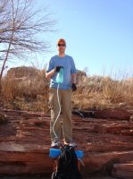
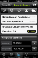
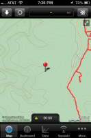
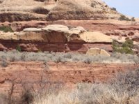
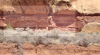
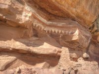
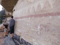
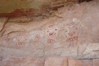
We stopped at Kirk’s cabin for lunch and to filter water. It was then that we spotted the rock art panel with triangle shapes across the wash.
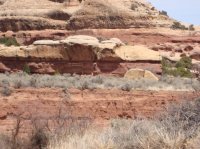
The temperature rose to about 82 as we walked through the sandy riverbeds. The marsh was not an issue at all because the water level dropped after the rain and snow. The last mile of the hike out of the canyon to the trial was slow going. We finally made it back to the car at around 6:00pm that evening.
Received conformation in mail with reservation number
Backcountry permit from Needles visitor’s center upon arrival
http://www.nps.gov/cany/planyourvisit/backcountrypermits.htm
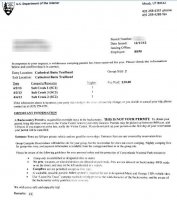
Trail Head: Entrance-Cathedral Butte
Exit-Cathedral Butte (not recommended)
Access: Beef Basin Rd
Timeframe: 3 days and 2 nights during the 1st Week of April 2013
Location: Day 1-Salt Creek 1
Day 2-Salt Creek 3
Day 3-Salt Creek 2 (planned but not used)
Weather: High temp. 82
Low temp. 31
Temp change: 51
Snow, hail, rain, on day 1
Sunny on day 2 and 3
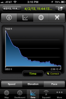
Elevation: High-7103 ft
Low-5650 ft
Change-1453 ft
Cell Service: Very low signals at Big Ruins and Squash Ruins (I sent and received text messages and made one phone call with AT&T)
Distance: Day 1- 4.64 miles
Day 2-8.56 miles
Day 3-11.53 miles
Total-24.73 miles
Meals: Breakfast-oatmeal and brown sugar in seal a meal pouches
Lunch-beef jerky, granola bars, and trail mix in seal a meal pouches
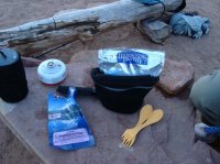
Dinner-Backpacker’s Pantry freeze-dried meals (Kung Po Chicken and Cashew Chicken Curry)
Drinks-hot chocolate and apple cider
Snacks-Clif bars, Shot gel and bloks, trail mix, candy bars, Hi-Chews
Gear: McNett Frontier Pro filter with an extra bladder
Gerber 30-000469 Dime Mirco Tool
Maglite SP2P01H Mini PRO
Optimus Crux Lite with Terra Solo Cook Set and extra steel mug from Wal-Mart
Coghlan's 1005 Flint Striker ½ sticks
Outdoor Products 5x7 tarp
Outdoor Products trek poles
IPhone with home-made battery pack and GPS Kit App.
Coleman Rest Easy Camp Pad (cut in half)
Energizer headlamp
HI-TEC V-Lite 2-Person Tent
Suisse Sport Adventurer Mummy Bag
High Sierra and Kelty packs
Toasty Toes (my wife gives these an A+)
Small pair of binoculars
Nikon D90
Para cord
Other misc. supplies
Featured image for home page:
We left the hotel at about 9:00 am with clear skies and drove to the Needles visitor’s center to obtain our permit.

Newspaper Rock was on the way so we stopped and took a few pictures. At the visitor’s center, the ranger reviewed basic backcountry regulations and water availability. The permit is to be attached to your pack or tent in the event you have contact with a park ranger. Once we obtained our permit, we doubled back to Beef Basin Road and drove to the trailhead. On the way, we passed several mines that looked interesting but I do not know anything about them. The road is passable with a 2WD vehicle in good weather but was rough in several spots. The trailhead is not visible from the road. There is simply a place to park with no markings. I had to use my GPS to confirm that we were in the correct area. We arrived at the trailhead at about 11:30 am. Once in the parking area there is a trailhead sign with a logbook. When we arrived, it was snowing and cold. There were patches of snow on the butte and along the trail. As we hiked, the snow turned to hail and then rain as we made it deeper into the canyon.

The initial trail is very steep with large rocks and it appears to have been washed out several times. My wife was initially reluctant to use a trek pole but eventually relented because of the terrain. We both used them religiously throughout the trip. Once at the bottom of the canyon and in Canyonlands National Park the trail quickly turns into a marsh with several stream crossings. With the added runoff from the rain and snow, we could not cross the stream without getting our feet wet and muddy. On the return trip, the weather was sunny and the water level dropped so there was no mud and much less water. Keeping our feet dry was not a problem. The trail can be difficult to follow at times. As a rule, just keep to the right side of the canyon and you will be fine. The trail deviates from the one marked on the topo map in spots so do not plan to follow the trail marked on the map blindly. As you get closer to Kirk’s cabin there is some possible rock art. To me it appeared that some is authentic and then it was defaced.

Finally, Kirk’s cabin comes into view and the trail forks after the cabin. To divert to the campgrounds SC1 and SC2 the trail turns right into a small canyon away from the stream. Because of the weather, there are no pictures of our campsite at SC1. The distance from the trailhead to SC1 campground is approx. 4.64 miles and the hike took us about 2 ½ hours to complete.
Upon arrival at SC1 we were cold and wet. We set up camp, cooked dinner, and tried to dry out or cloths. In order to fix dinner I needed water and had to hike back to the stream. Because of the additional runoff from the rain, animal scat observed on the trail, and the fact that the marsh is upstream from the water collection point I was concerned about water quality. To deal with this I added bleach to the water in addition to filtering it. The water had a distinct swimming pool taste to it but it was comforting after seeing all the animal scat in the marsh as we hiked.
View attachment 9453


Day 2
We took some additional time drying out our cloths, sleeping bags, and tent the morning of the second day. We did not leave camp until about 12:30 pm. The hike to SC3 was full of ruins, rock art, and arches. If you proceed past SC3 to the next canyon, you will see even more ruins and art.

The trail was very flat or down hill except for one spot and went through a lot of high sagebrush along the bank of the creek. It moved back and forth between the right and left sides of the canyon. At some points, the trail was hard to follow.

We relied on our GPS two or three times to find our way back to the trail. The sand and game trials made things a little confusing at times. As we hiked, it was very helpful to use as small pair of binoculars. The canyon walls are lined with ruins and rock art. At times, the trail takes you to the opposite side of the canyon. It was great to be able to spot ruins and art from a distance. In a nutshell, you will see a rock art panel across from Kirk’s cabin, a small set ruins just past the cabin, Big Ruins (15 min. diversion from main trail), several arches, Wedding Ring Arch, several other small ruins, the All American Man, the Four Faces and ruins, some cave ruins, the “squash” ruins, and other small ruins, cliff dwellings, and some rock art just past SC3 campground. We hiked about 8 ½ miles. It seemed that about every ½ mile we walked past an arch, ruin, or rock art. I am currently working on a list of sites with GPS coordinates. If you do not see them at the end of this post feel free to send me a message and I’ll get the list to you.


Day 3
The morning of day three was very cold. The clear sky at night dropped the temperature to about 31. Eventually as the sun rose and warmed the canyon, we were able to filter water and get moving. Because of a schedule issue, we would be forced to hike out to Cathedral Butte from SC3 rather than just hike back to SC2 and out the next day. As we made it through the 11 ½ miles back to the trailhead, we saw several ruins and a few arches that we did not spot on the hike in to the area. Many of the ruins seem hidden while traveling from south to north and blend in with the canyon walls very well.

Once again, it was helpful to refer back to the GPS when we lost the trail in the sand and ended up following deer tracks.

We stopped at Kirk’s cabin for lunch and to filter water. It was then that we spotted the rock art panel with triangle shapes across the wash.

The temperature rose to about 82 as we walked through the sandy riverbeds. The marsh was not an issue at all because the water level dropped after the rain and snow. The last mile of the hike out of the canyon to the trial was slow going. We finally made it back to the car at around 6:00pm that evening.
Trip Summary
Trip: Upper Salt Creek-Canyonlands National Park
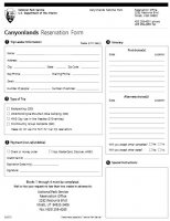
Permits: Reservations made in advance by fax (suggested) Cost-$30Received conformation in mail with reservation number
Backcountry permit from Needles visitor’s center upon arrival
http://www.nps.gov/cany/planyourvisit/backcountrypermits.htm


Trail Head: Entrance-Cathedral Butte
Exit-Cathedral Butte (not recommended)
Access: Beef Basin Rd
Timeframe: 3 days and 2 nights during the 1st Week of April 2013
Location: Day 1-Salt Creek 1
Day 2-Salt Creek 3
Day 3-Salt Creek 2 (planned but not used)
Weather: High temp. 82
Low temp. 31
Temp change: 51
Snow, hail, rain, on day 1
Sunny on day 2 and 3
Elevation: High-7103 ft
Low-5650 ft
Change-1453 ft
Cell Service: Very low signals at Big Ruins and Squash Ruins (I sent and received text messages and made one phone call with AT&T)
Distance: Day 1- 4.64 miles
Day 2-8.56 miles
Day 3-11.53 miles
Total-24.73 miles
Meals: Breakfast-oatmeal and brown sugar in seal a meal pouches
Lunch-beef jerky, granola bars, and trail mix in seal a meal pouches
Dinner-Backpacker’s Pantry freeze-dried meals (Kung Po Chicken and Cashew Chicken Curry)
Drinks-hot chocolate and apple cider
Snacks-Clif bars, Shot gel and bloks, trail mix, candy bars, Hi-Chews
Gear: McNett Frontier Pro filter with an extra bladder
Gerber 30-000469 Dime Mirco Tool
Maglite SP2P01H Mini PRO
Optimus Crux Lite with Terra Solo Cook Set and extra steel mug from Wal-Mart
Coghlan's 1005 Flint Striker ½ sticks
Outdoor Products 5x7 tarp
Outdoor Products trek poles
IPhone with home-made battery pack and GPS Kit App.
Coleman Rest Easy Camp Pad (cut in half)
Energizer headlamp
HI-TEC V-Lite 2-Person Tent
Suisse Sport Adventurer Mummy Bag
High Sierra and Kelty packs
Toasty Toes (my wife gives these an A+)
Small pair of binoculars
Nikon D90
Para cord
Other misc. supplies
Featured image for home page:

Last edited:

