- Joined
- Aug 8, 2016
- Messages
- 2,077
In the early part of 2016 my brother, Brent, and I decided to plan and execute a backpacking trip along the Uinta Highline Trail. It’s something I have always wanted to do and with both of us in our mid-to-late fifties it seemed like if we’re going to do this we needed to do it now, before we got too old.
To say this was an ambitious goal is probably the understatement of the century. The two of us had been on numerous backpacking trips with my dad in our youth. Had many great adventures in the High Sierras while growing up in Southern California. We had even taken a trip with two of our Utah cousins to Cuberant Lake in the Uintas when I was about fifteen years old. This is probably what got it all started for me.
Since then we had only had one other backpacking trip into Ryder lake many years ago. I personally hadn’t done any real hiking since that time even though I always dreamed of doing it again. I have been living in Utah since 1985, initially in the Salt Lake area. I managed to do quite a few short hikes in Big Cottonwood canyon on week days after work. After the trip to Ryder Lake I pretty much gave up hiking as I didn’t have anyone to go with and my wife really didn’t like me to go alone. Never the less, it always has remained my passion.
Back to April 2016. Brent and I committed to doing the entire Highline Trail from east to west. Mapping out the trip it came out to about 102 miles. (deep breath) Did I already mention the word ambitious?
We both had to buy all new gear as either what we had was too old/out of date or had been given way to family. We were thinking we could get geared up for about $800.00 each. Boy, were we way off base on that!
We also need to start training for this. I for one was not in any kind of shape to be doing this, and I knew it, so I had to get serious about it. For me this started out with 3-4 mile walks around town, working my way up to ten miles or so. I slowly began taking my pack and increasing the load over time. As August got closer I began to do almost daily hikes up the “M” here in Morgan, UT. It’s about a two-mile loop with about 825 ft. of elevation gain. It’s quite a steep little trail. As the trip got closer I began to do my hikes to the “M” early every morning before work, often doing most of the loop in the dark. In the beginning I had to stop several times on the way up. As I continued I got to where I could go full speed all the way up without stopping. I was encouraged. I managed to lose almost twenty pounds.
I recruited my grandson for a shakedown overnighter in mid July. We headed in to Naturalist Basin where we camped at Blue Lake and took a side trip up to the saddle east of Mt. Agassiz. I was so glad I did this shakedown trip as it revealed a bunch of things. First, the good. The hiking was very enjoyable and I was pleasantly surprised that I had the strength and stamina to do it. The training was paying off. Now for the bad. I was using my dad’s old Camp 7 North Col sleeping bag. It’s a great bag but It turned out it was just too small for me. Had I not found this out I would have been miserable on our big trip. The second thing I found was I suffered from periodic breathing during the night. We were at 11,000 ft, much like it was going to be along the Highline, so this was very discouraging, to say the least. I had always had some altitude sickness; headache, mild nausea, on previous trips, but never had a problem sleeping. I did some research and discovered Diamox. All I can say is it worked wonderfully for me on the Highline trip. I’ll never go high without it again.
Food! This proved to be one of the biggest challenges for the trip. We were planning on ten days with an option for eleven. We planned the meals using a lot of advice of some seasoned through hikers. The week running up to the trip I started buying all the food. When Brent flew in from Dallas a couple of days in advance of the trip we started kitting up the food. We put it all on the kitchen counter and put it together in individual meal bags, then those went into daily bags. We saw this pile of bulging zip-lock bags sitting in front of us. No way was that all going to fit in our packs! We had to get really creative but we did manage to get it all in.
I had bought a Gregory Baltoro 75 pack, and Brent a Baltoro 85. We got the packs all packed up. We both ended up in the 55-58-pound range. Oh, my heck! And that was without water! I had trained with about 40 pounds on my daily hikes so I was a bit worried but I was so motivated I was not going to let it stop me now!
We managed to work out our travel logistics. My next-door neighbor agreed to drive us out to the eastern trail head along UT 191. My wife would pick us up at the Hayden Pass trail head along the Mirror Lake Highway.
The Event.
We expected our first day to be only a half day, just to play things safe. We headed out from Morgan at 6:00 am. Stopped in Evanston for a hearty breakfast then on to Flaming Gorge. We arrived at the trail head at McKee Draw and were on our way at 10:25 am.
Here is a video of our trip. It was my first attempt to video something like this using only my smart phone. (hearing that word ambitious again) My goal was to produce something for friends and family to get a flavor for what the experience was like. It was especially for my dad whose age and health would not allow him to come along on this trip. It's pretty difficult getting nine days into a video. It’s about 50 minutes long so make yourself comfortable and enjoy. Otherwise, read on...
Day One - Friday 8/26/2016
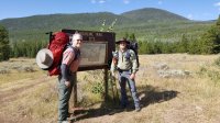
The trail starts as a 1,000 ft. climb by going up through quaking aspen and pines to a saddle on the way to East Park Reservoir. The first couple of miles of the trail is also part of the Outlaw ATV trail. This particular section is rated “most difficult” and we could see why. It was very steep in a few places with almost bolder-size rocks making up the trail. It was difficult walking these parts. I cannot imagine how it would be on an ATV!
The weather was warm, mid-sixties or so, and beautiful. However, it started turning bad as we neared East Park Reservoir. We ended up getting soaked in a wet-hail downpour. Luckily it was relatively warm and we didn't get chilled. We had traveled 4.3 miles so far.
East Park Reservoir
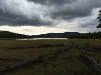
We ended up setting up camp on an old logging road 2.4 miles north of East Park where the Highline turns to the west. It was a very poor site but with the rain we were just in a hurry to get out of it and settled for the night. Of course as soon as we got set up and had some dinner the rain stopped. Typical Uintas!
Day Two - Saturday 8/27/2016
Day two was a nerve-racking day. We quickly realized that neither of us had an appetite. Many of the high calorie "goodies" we had packed were just not appealing in any way, shape or form. We started to worry a bit at that point. We hoped this was just a temporary thing but would prove to be a concern the entire trip. The other problem was water.
When planning our route I had discovered that from East Park Reservoir there was no water available along the trail until Summit Park. On our schedule this would have been two days out. We ended up having to take a detour south from the trail along FR 37 for 1.4 miles to find water flowing in Center Creek. We ran out of drinking water about two hours before we found it. Not good. This would be the location of our second camp.
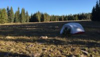
For those who have never done the extreme eastern end of the Highline the country is a bit different than the western half. Aside from being quite a bit drier in general it is heavily forested. The first two days we rarely got a vista of the area. It is still very beautiful and I really enjoyed our time in the forest.
Day Three - Sunday 8/28/2016
We woke this morning to 27 degrees with frost covering the tent. This would be the coldest temps of the trip. We ate a little something, packed up and headed out.
We arrived at Summit park at 3:21 pm where we had our next opportunity to fill up our water. Sadly the water in the creek flowing through the center of the meadow was pretty murky. Cattle grazing there had made many muddy wallows which I sure contributed to the poor quality of the water. We were not filtering water but rather using AquaMira drops. We filled our bottles by pouring through my shemagh in an attempt to clean it up a bit. Brent said it had a pretty "earthy" flavor. Not my favorite for sure
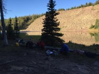
We decided to make for Hacking Lake #1 as a camp site for the night. This required a short detour south from the Highline. We rolled in to the lake at around 7:30pm making this a really long day.
Very pretty lake although the shoreline was pretty beat up from overuse.
Hacking Lake #1
Day Four - Monday 8/29/2016
Since we weren't eating all the food packed for each day we decided to burn what we hadn't eaten in an attempt to lighten our packs somewhat. This helped some but sure didn't feel good doing it. Especially when you find out what happened on day nine.
Day four would take us to where we could finally see the peaks of the High Uintas. Things were getting really exciting! From Hacking Lake #1 the trail goes along a forest service road until just east of Leidy Peak. I had originally planned our route to go around the north side of Leidy but when we got to the junction of the north and south trails the south trail was definitely more prominent and obviously more well maintained. With this we decided to take the south route. That turned out to be a poor choice as it was quite a bit longer going that way.
Just east of Lake Wilde we saw six or seven mountain goats heading up a hill. It appeared to be ewes with their babies. I'm sure they saw us before we did as they were already high-tailing it out and over the hill. I was kind of surprised to see them out in the open and not up on a mountain somewhere.
When we arrived at Lake Wilde, just below Gabbro Pass, we decided to call it a day. We hadn’t traveled very far but it was a long hard haul around Leidy Peak. It was all above tree line. The terrain consists of rocky tundra with no foot path and made for pretty slow going negotiation through all the rocks. We were also finally seeing some elevation which also contributed to our fatigue.
Since it was early evening we had time for baths and washing clothes. I must say it felt wonderful.
We made camp for the night. Weather was very mild and it was a beautiful place to stay.
Day Five – Tue 8/30/2016
This morning we were greeted by this when we got out of the tent...
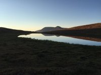
The day's trip began attacking Gabbro Pass. There are two trails up the pass one other north side, the other on the south. We made the decision to take the north trail as it was much more gradual than the other. The irony is when we got near the top of the pass there is a snow field that we didn't want to cross. We ended up dropping back down below the snow field and going across to the south trail anyway. In retrospect we should have taken the south trail.
At the base of the pass we saw a broken track from a snow mobile. I cannot imagine taking a snow machine all the way up into there and having it break down like that. Crazy! Kind of wish they would have taken the track out with them though... it’s a defininte eyesore in the back country.
Next up was Deadman Lake at about 11,000 ft. It’s a beautiful place with lots of camp site opportunities...
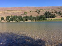
We had some snacks and did some foot maintenance, including a refreshing soak in the cool lake. We both managed to get some blisters started at this point.
Heading on we went over the pass to the west dropping down into the Whiterocks River drainage. After having been above tree line for almost two days going down into the forest was a welcome change providing cool shade for rest stops and a chance to get out of the wind.
We ended up pulling in to Chepeta Lake at about 6:30 pm and made camp in some trees next to the parking area.
Up until now we had not seen another person the whole trip. That evening we ran into a BLM fire guy that had just hiked up to the mountain north of Chepeta Lake to do some maintenance on a remote weather station. What a cool job!
Day Six – Wednesday 8/31/2016
We both continued to have poor appetites and continued to burn the food we were not eating. We ate what we could and started the day’s trip to the Fox Lake area.
We got a huge treat when coming to the eastern-most of the Reader Lakes. We saw our first moose standing in the water eating. She raised her head seeing us and quickly went back to her meal. That was cool enough seeing her but when we went around the western edge of the lake we got to see one of her two calves, up close. She was all of maybe 15-20 yards from us partially hidden in the trees. We got to spend a minute or two "talking" to her while she sniffed us on the breeze before mom left the water and started down our way. That was our cue to move on. I captured this event in the video.
Today’s travels would be one of the toughest of the trip so far. North Pole Pass is a bear. It's mostly above tree line and very rocky. It's really deceptive as you come up to the top of the pass only to find there is another, even higher, un-named pass yet to come. Long rocky switch backs take you down into the Fox Lake area.
We saw about fourteen deer in a meadow when approaching Brook Lake where we made camp for the night.
Day Seven – Thursday 9/1/2016
Morning of day seven we packed up and started toward Fox Lake. We were hoping to make it to Painters Basin today. We ran into our second person of the trip. It was a guy from southern Utah who had come in over Fox-Queant Pass. We found out he was 70 years old which encouraged me to think I could have many more years of hiking
Our challenge for the day would be weather. We started getting rain and hail along with some lightning and thunder. We donned our rain gear and covered our packs and pressed on. It got bad enough we decided to sit it out for a while. We were about ¼ mile east of the Kidney Lakes Trail junction when we ended up taking shelter for about two hours before moving on.
With the rain delay we spent our night along the Uinta River. It was a really nice camp site where we made a big fire, had some dinner and headed to bed. It rained on and off all night.
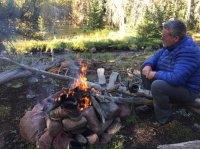
Day Eight – Friday 9/2/2016
Today is Painters Basin or Bust! If we get lucky enough we might even manage to get over Anderson Pass today. We are about a day behind schedule but I wasn't too worried about it... yet.
As we entered the basin I was totally in awe of the surrounding mountains. I got a new appreciation for the thirteeners in the area. When Gilbert and Kings peaks came into view I started getting really excited. I couldn’t believe I finally had gotten here. Summiting Kings Peak was another thing that has always been on my life’s bucket list. Now it was within sight!
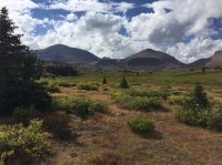
As we got further into the basin the weather continued to deteriorate. Rumbling thunder started to be a bit more frequent as did the rain showers. It did not feel like it was likely to let up. We decide to make camp in the basin about a mile from the junction between the trails to Anderson Pass and Gunsite Pass. We found a really great camp site, set up and decided to rest up with the anticipation of attacking Anderson Pass and, weather permitting, summiting Kings Peak the next day.
That evening after a good meal we sat down with the map to see how our schedule was going. It looked like we had at least three really hard days to Hayden Pass, more realistically four. We decided to take inventory of our food and came to the conclusion we only had enough for three days. I checked for the most recent weather report on my InReach and it didn’t look good.
Playing several scenarios it didn’t look like we had any good escape routes if things did not go according to plan by the time we were into it a day or two further. I had to keep in mind that my wife was going be picking us up and I didn’t want to send her all over back country roads trying to find some obscure trail head. Henrys Fork was looking like the only viable early exit route.
We had to make the really hard decision. Do we we press onward hoping we could get out in three days or call it a day and go out via Henrys Fork tomorrow. Of course all the time we were discussing this all I could think about is all the food we discarded along the way. Grrrrr!
We made the decision to play it safe and take the early exit. I can’t tell you how disappointed I was that I was going to fail completing my goals on this trip. I had to remind myself that we were doing the right thing and make the best of it.
Day Nine – Saturday 9/3/2016
We were going home today. We packed up and headed towards the Anderson Pass and Gunsite Pass trails junction. I was being pulled to go on to Anderson but had to make the right turn and head for Gunsite.
Looking back into Painters Basin
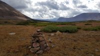
The weather this morning had become extremely windy. We could hardly stand up when we went over Gunsite pass. On the way down Henry’s Fork we ran in to a couple of guys who had summitted Kings Peak earlier that morning. They said it was pretty scary on top with up-draft winds blowing across the summit at such velocity that one had to lean into it to stay standing only to have them stop all of a sudden and they would fall forward.
Looking back south to Gunsite Pass
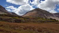
The head of Henrys Fork
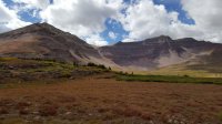
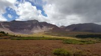
Beautiful rainbow as we approached the Henrys Fork trail head
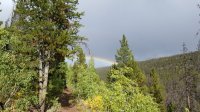
By the time we reached the Henry’s Fork trail head at about 5:00 pm it had begun to pour rain just as we were loading up in the truck. It was an epic downpour and we were instantly drenched. Glad to be in the truck at that point.
All in all the trip was one I’ll never forget. I got to see lots of some of the most beautiful country around and I got to do it with my brother. I also got to prove to myself that I could do the hard things (82 miles). This was very important to me.
Will I be back to do it again? Maybe finish off the trip? Maybe attempt the whole trail again with better planning now that I have some real-world experience doing something like this? Was this too ambitious? Maybe. But I would jump at the chance to do it again!
To say this was an ambitious goal is probably the understatement of the century. The two of us had been on numerous backpacking trips with my dad in our youth. Had many great adventures in the High Sierras while growing up in Southern California. We had even taken a trip with two of our Utah cousins to Cuberant Lake in the Uintas when I was about fifteen years old. This is probably what got it all started for me.
Since then we had only had one other backpacking trip into Ryder lake many years ago. I personally hadn’t done any real hiking since that time even though I always dreamed of doing it again. I have been living in Utah since 1985, initially in the Salt Lake area. I managed to do quite a few short hikes in Big Cottonwood canyon on week days after work. After the trip to Ryder Lake I pretty much gave up hiking as I didn’t have anyone to go with and my wife really didn’t like me to go alone. Never the less, it always has remained my passion.
Back to April 2016. Brent and I committed to doing the entire Highline Trail from east to west. Mapping out the trip it came out to about 102 miles. (deep breath) Did I already mention the word ambitious?
We both had to buy all new gear as either what we had was too old/out of date or had been given way to family. We were thinking we could get geared up for about $800.00 each. Boy, were we way off base on that!
We also need to start training for this. I for one was not in any kind of shape to be doing this, and I knew it, so I had to get serious about it. For me this started out with 3-4 mile walks around town, working my way up to ten miles or so. I slowly began taking my pack and increasing the load over time. As August got closer I began to do almost daily hikes up the “M” here in Morgan, UT. It’s about a two-mile loop with about 825 ft. of elevation gain. It’s quite a steep little trail. As the trip got closer I began to do my hikes to the “M” early every morning before work, often doing most of the loop in the dark. In the beginning I had to stop several times on the way up. As I continued I got to where I could go full speed all the way up without stopping. I was encouraged. I managed to lose almost twenty pounds.
I recruited my grandson for a shakedown overnighter in mid July. We headed in to Naturalist Basin where we camped at Blue Lake and took a side trip up to the saddle east of Mt. Agassiz. I was so glad I did this shakedown trip as it revealed a bunch of things. First, the good. The hiking was very enjoyable and I was pleasantly surprised that I had the strength and stamina to do it. The training was paying off. Now for the bad. I was using my dad’s old Camp 7 North Col sleeping bag. It’s a great bag but It turned out it was just too small for me. Had I not found this out I would have been miserable on our big trip. The second thing I found was I suffered from periodic breathing during the night. We were at 11,000 ft, much like it was going to be along the Highline, so this was very discouraging, to say the least. I had always had some altitude sickness; headache, mild nausea, on previous trips, but never had a problem sleeping. I did some research and discovered Diamox. All I can say is it worked wonderfully for me on the Highline trip. I’ll never go high without it again.
Food! This proved to be one of the biggest challenges for the trip. We were planning on ten days with an option for eleven. We planned the meals using a lot of advice of some seasoned through hikers. The week running up to the trip I started buying all the food. When Brent flew in from Dallas a couple of days in advance of the trip we started kitting up the food. We put it all on the kitchen counter and put it together in individual meal bags, then those went into daily bags. We saw this pile of bulging zip-lock bags sitting in front of us. No way was that all going to fit in our packs! We had to get really creative but we did manage to get it all in.
I had bought a Gregory Baltoro 75 pack, and Brent a Baltoro 85. We got the packs all packed up. We both ended up in the 55-58-pound range. Oh, my heck! And that was without water! I had trained with about 40 pounds on my daily hikes so I was a bit worried but I was so motivated I was not going to let it stop me now!
We managed to work out our travel logistics. My next-door neighbor agreed to drive us out to the eastern trail head along UT 191. My wife would pick us up at the Hayden Pass trail head along the Mirror Lake Highway.
The Event.
We expected our first day to be only a half day, just to play things safe. We headed out from Morgan at 6:00 am. Stopped in Evanston for a hearty breakfast then on to Flaming Gorge. We arrived at the trail head at McKee Draw and were on our way at 10:25 am.
Here is a video of our trip. It was my first attempt to video something like this using only my smart phone. (hearing that word ambitious again) My goal was to produce something for friends and family to get a flavor for what the experience was like. It was especially for my dad whose age and health would not allow him to come along on this trip. It's pretty difficult getting nine days into a video. It’s about 50 minutes long so make yourself comfortable and enjoy. Otherwise, read on...
Day One - Friday 8/26/2016

The trail starts as a 1,000 ft. climb by going up through quaking aspen and pines to a saddle on the way to East Park Reservoir. The first couple of miles of the trail is also part of the Outlaw ATV trail. This particular section is rated “most difficult” and we could see why. It was very steep in a few places with almost bolder-size rocks making up the trail. It was difficult walking these parts. I cannot imagine how it would be on an ATV!
The weather was warm, mid-sixties or so, and beautiful. However, it started turning bad as we neared East Park Reservoir. We ended up getting soaked in a wet-hail downpour. Luckily it was relatively warm and we didn't get chilled. We had traveled 4.3 miles so far.
East Park Reservoir

We ended up setting up camp on an old logging road 2.4 miles north of East Park where the Highline turns to the west. It was a very poor site but with the rain we were just in a hurry to get out of it and settled for the night. Of course as soon as we got set up and had some dinner the rain stopped. Typical Uintas!
Day Two - Saturday 8/27/2016
Day two was a nerve-racking day. We quickly realized that neither of us had an appetite. Many of the high calorie "goodies" we had packed were just not appealing in any way, shape or form. We started to worry a bit at that point. We hoped this was just a temporary thing but would prove to be a concern the entire trip. The other problem was water.
When planning our route I had discovered that from East Park Reservoir there was no water available along the trail until Summit Park. On our schedule this would have been two days out. We ended up having to take a detour south from the trail along FR 37 for 1.4 miles to find water flowing in Center Creek. We ran out of drinking water about two hours before we found it. Not good. This would be the location of our second camp.

For those who have never done the extreme eastern end of the Highline the country is a bit different than the western half. Aside from being quite a bit drier in general it is heavily forested. The first two days we rarely got a vista of the area. It is still very beautiful and I really enjoyed our time in the forest.
Day Three - Sunday 8/28/2016
We woke this morning to 27 degrees with frost covering the tent. This would be the coldest temps of the trip. We ate a little something, packed up and headed out.
We arrived at Summit park at 3:21 pm where we had our next opportunity to fill up our water. Sadly the water in the creek flowing through the center of the meadow was pretty murky. Cattle grazing there had made many muddy wallows which I sure contributed to the poor quality of the water. We were not filtering water but rather using AquaMira drops. We filled our bottles by pouring through my shemagh in an attempt to clean it up a bit. Brent said it had a pretty "earthy" flavor. Not my favorite for sure
We decided to make for Hacking Lake #1 as a camp site for the night. This required a short detour south from the Highline. We rolled in to the lake at around 7:30pm making this a really long day.
Very pretty lake although the shoreline was pretty beat up from overuse.
Hacking Lake #1

Day Four - Monday 8/29/2016
Since we weren't eating all the food packed for each day we decided to burn what we hadn't eaten in an attempt to lighten our packs somewhat. This helped some but sure didn't feel good doing it. Especially when you find out what happened on day nine.
Day four would take us to where we could finally see the peaks of the High Uintas. Things were getting really exciting! From Hacking Lake #1 the trail goes along a forest service road until just east of Leidy Peak. I had originally planned our route to go around the north side of Leidy but when we got to the junction of the north and south trails the south trail was definitely more prominent and obviously more well maintained. With this we decided to take the south route. That turned out to be a poor choice as it was quite a bit longer going that way.
Just east of Lake Wilde we saw six or seven mountain goats heading up a hill. It appeared to be ewes with their babies. I'm sure they saw us before we did as they were already high-tailing it out and over the hill. I was kind of surprised to see them out in the open and not up on a mountain somewhere.
When we arrived at Lake Wilde, just below Gabbro Pass, we decided to call it a day. We hadn’t traveled very far but it was a long hard haul around Leidy Peak. It was all above tree line. The terrain consists of rocky tundra with no foot path and made for pretty slow going negotiation through all the rocks. We were also finally seeing some elevation which also contributed to our fatigue.
Since it was early evening we had time for baths and washing clothes. I must say it felt wonderful.
We made camp for the night. Weather was very mild and it was a beautiful place to stay.
Day Five – Tue 8/30/2016
This morning we were greeted by this when we got out of the tent...

The day's trip began attacking Gabbro Pass. There are two trails up the pass one other north side, the other on the south. We made the decision to take the north trail as it was much more gradual than the other. The irony is when we got near the top of the pass there is a snow field that we didn't want to cross. We ended up dropping back down below the snow field and going across to the south trail anyway. In retrospect we should have taken the south trail.
At the base of the pass we saw a broken track from a snow mobile. I cannot imagine taking a snow machine all the way up into there and having it break down like that. Crazy! Kind of wish they would have taken the track out with them though... it’s a defininte eyesore in the back country.
Next up was Deadman Lake at about 11,000 ft. It’s a beautiful place with lots of camp site opportunities...

We had some snacks and did some foot maintenance, including a refreshing soak in the cool lake. We both managed to get some blisters started at this point.
Heading on we went over the pass to the west dropping down into the Whiterocks River drainage. After having been above tree line for almost two days going down into the forest was a welcome change providing cool shade for rest stops and a chance to get out of the wind.
We ended up pulling in to Chepeta Lake at about 6:30 pm and made camp in some trees next to the parking area.
Up until now we had not seen another person the whole trip. That evening we ran into a BLM fire guy that had just hiked up to the mountain north of Chepeta Lake to do some maintenance on a remote weather station. What a cool job!
Day Six – Wednesday 8/31/2016
We both continued to have poor appetites and continued to burn the food we were not eating. We ate what we could and started the day’s trip to the Fox Lake area.
We got a huge treat when coming to the eastern-most of the Reader Lakes. We saw our first moose standing in the water eating. She raised her head seeing us and quickly went back to her meal. That was cool enough seeing her but when we went around the western edge of the lake we got to see one of her two calves, up close. She was all of maybe 15-20 yards from us partially hidden in the trees. We got to spend a minute or two "talking" to her while she sniffed us on the breeze before mom left the water and started down our way. That was our cue to move on. I captured this event in the video.
Today’s travels would be one of the toughest of the trip so far. North Pole Pass is a bear. It's mostly above tree line and very rocky. It's really deceptive as you come up to the top of the pass only to find there is another, even higher, un-named pass yet to come. Long rocky switch backs take you down into the Fox Lake area.
We saw about fourteen deer in a meadow when approaching Brook Lake where we made camp for the night.
Day Seven – Thursday 9/1/2016
Morning of day seven we packed up and started toward Fox Lake. We were hoping to make it to Painters Basin today. We ran into our second person of the trip. It was a guy from southern Utah who had come in over Fox-Queant Pass. We found out he was 70 years old which encouraged me to think I could have many more years of hiking
Our challenge for the day would be weather. We started getting rain and hail along with some lightning and thunder. We donned our rain gear and covered our packs and pressed on. It got bad enough we decided to sit it out for a while. We were about ¼ mile east of the Kidney Lakes Trail junction when we ended up taking shelter for about two hours before moving on.
With the rain delay we spent our night along the Uinta River. It was a really nice camp site where we made a big fire, had some dinner and headed to bed. It rained on and off all night.

Day Eight – Friday 9/2/2016
Today is Painters Basin or Bust! If we get lucky enough we might even manage to get over Anderson Pass today. We are about a day behind schedule but I wasn't too worried about it... yet.
As we entered the basin I was totally in awe of the surrounding mountains. I got a new appreciation for the thirteeners in the area. When Gilbert and Kings peaks came into view I started getting really excited. I couldn’t believe I finally had gotten here. Summiting Kings Peak was another thing that has always been on my life’s bucket list. Now it was within sight!

As we got further into the basin the weather continued to deteriorate. Rumbling thunder started to be a bit more frequent as did the rain showers. It did not feel like it was likely to let up. We decide to make camp in the basin about a mile from the junction between the trails to Anderson Pass and Gunsite Pass. We found a really great camp site, set up and decided to rest up with the anticipation of attacking Anderson Pass and, weather permitting, summiting Kings Peak the next day.
That evening after a good meal we sat down with the map to see how our schedule was going. It looked like we had at least three really hard days to Hayden Pass, more realistically four. We decided to take inventory of our food and came to the conclusion we only had enough for three days. I checked for the most recent weather report on my InReach and it didn’t look good.
Playing several scenarios it didn’t look like we had any good escape routes if things did not go according to plan by the time we were into it a day or two further. I had to keep in mind that my wife was going be picking us up and I didn’t want to send her all over back country roads trying to find some obscure trail head. Henrys Fork was looking like the only viable early exit route.
We had to make the really hard decision. Do we we press onward hoping we could get out in three days or call it a day and go out via Henrys Fork tomorrow. Of course all the time we were discussing this all I could think about is all the food we discarded along the way. Grrrrr!
We made the decision to play it safe and take the early exit. I can’t tell you how disappointed I was that I was going to fail completing my goals on this trip. I had to remind myself that we were doing the right thing and make the best of it.
Day Nine – Saturday 9/3/2016
We were going home today. We packed up and headed towards the Anderson Pass and Gunsite Pass trails junction. I was being pulled to go on to Anderson but had to make the right turn and head for Gunsite.
Looking back into Painters Basin

The weather this morning had become extremely windy. We could hardly stand up when we went over Gunsite pass. On the way down Henry’s Fork we ran in to a couple of guys who had summitted Kings Peak earlier that morning. They said it was pretty scary on top with up-draft winds blowing across the summit at such velocity that one had to lean into it to stay standing only to have them stop all of a sudden and they would fall forward.
Looking back south to Gunsite Pass

The head of Henrys Fork


Beautiful rainbow as we approached the Henrys Fork trail head

By the time we reached the Henry’s Fork trail head at about 5:00 pm it had begun to pour rain just as we were loading up in the truck. It was an epic downpour and we were instantly drenched. Glad to be in the truck at that point.
All in all the trip was one I’ll never forget. I got to see lots of some of the most beautiful country around and I got to do it with my brother. I also got to prove to myself that I could do the hard things (82 miles). This was very important to me.
Will I be back to do it again? Maybe finish off the trip? Maybe attempt the whole trail again with better planning now that I have some real-world experience doing something like this? Was this too ambitious? Maybe. But I would jump at the chance to do it again!
Last edited:
