Adventures With BeeGee
Regular Guy
- Joined
- Aug 3, 2014
- Messages
- 28
Trip Report: Palmetto State Park
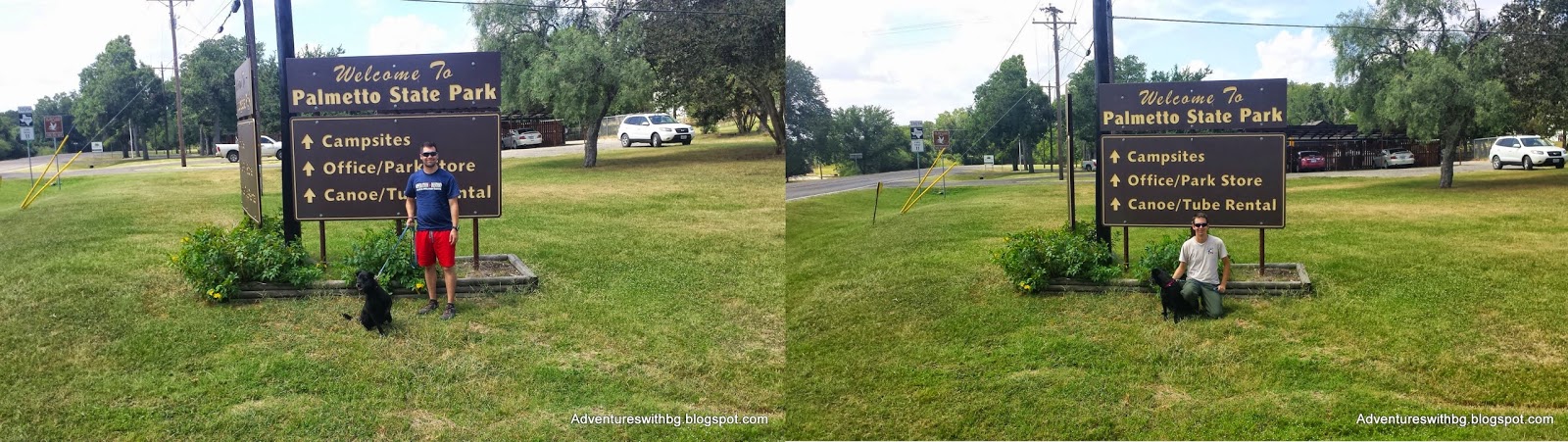
On Wednesday, August 6th My Brother, BeeGee, and myself went on our second official trip since starting this blog. I hope to keep visiting interesting places throughout Texas and reporting back so the information is freely available.

BeeGee & Jarrett and BeeGee & Jack Looking Cool at the Entrance Sign
The Background
Location: 78 Park Road 11 South, Gonzales, TX 78629
Admission: $3 per adult; Children under 12 are free
Elevation: 480 to 600 ft.
Weather: Sunny, hot, 82 to 90F
Difficulty: Easy
Website: http://www.tpwd.state.tx.us/state-parks/palmetto
PalmettoState Park is located in Gonzales County and is close to Gonzales and Lulling,Texas. The San Marcos River runs throughthe park and there is a 4-acre lake as well. The park offers hiking, camping, RV hook ups, fishing, canoeing, tubing,paddle boating, a cabin to rent, and a pavilion to rent. Canoes, tubes, and paddleboats can be rented andused in Oxford Lake. The park has 6trails and 2 spurs for hiking. Thetrails total 4.3 miles and a total walkable distance of 4.91 miles.
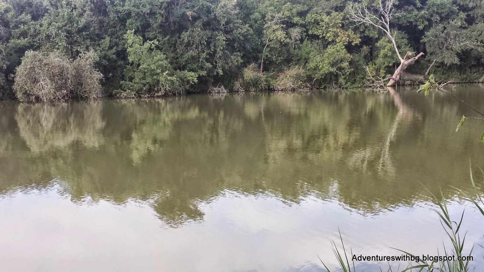
Oxbow Lake, One of the Biggest Attractions in Palmetto State Park
Theland for Palmetto State Park was purchased from private landowners and the Cityof Gonzales from 1934 to 1936. PalmettoState Park is another park built by the Civilian Conservation Corp that wascompleted and opened in 1936. Inaddition, the park is covered in dwarf palmetto plants, which have a verytropical look.
Dwarf Palmetto Plant Growing Around a Wooden Bridge
ParkHQ Trail
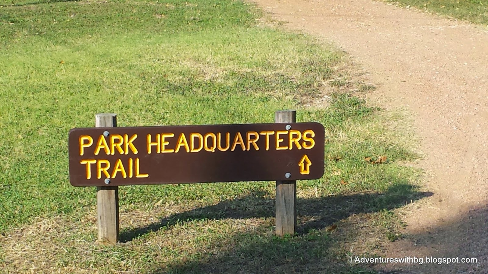
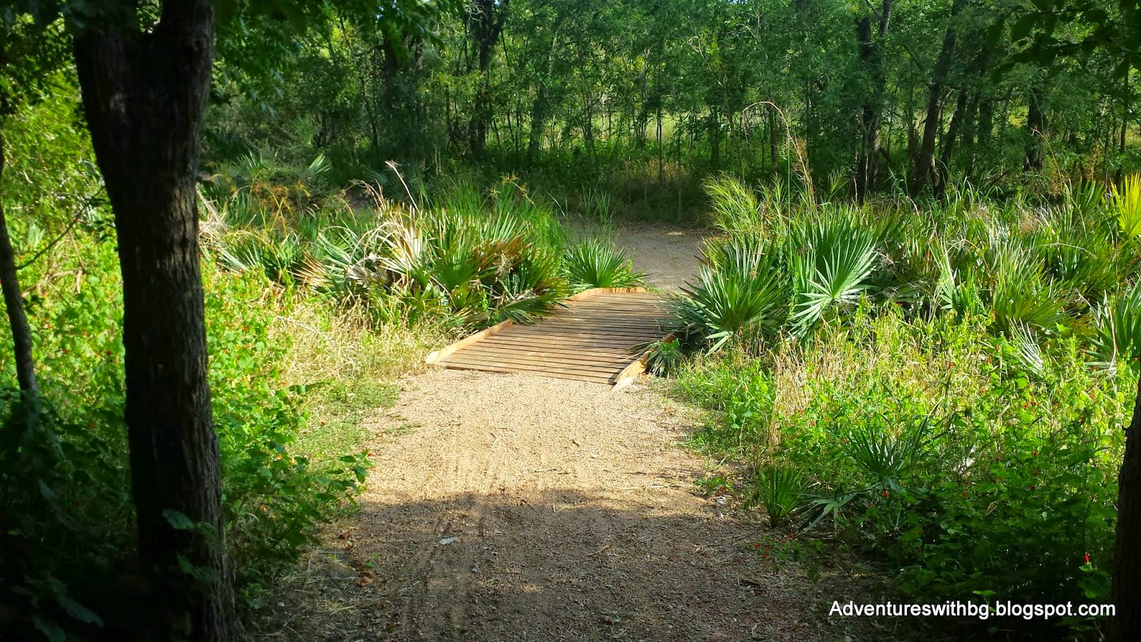
The Park Headquarters TrailheadThePark Headquarters Trail is only .22 miles, which is the shortest in the park. In addition, the trail is a short, flat,graveled path that travels from the park headquarters to Oxbow Trail, Oxbow Lake, and the day use area. Furthermore, the path is shaded and fairlycool on our walk considering its summer. If youintend to only use the lake or rent equipment from the park, this trail willallow you to walk there quickly. While leaving your vehicle safely at the park headquarters. Finally, the HQ trail parallels the park’smain road and is limited in scenery and nature.

The Graveled Park HQ Trail Leading to Oxbow Lake
OxbowLake
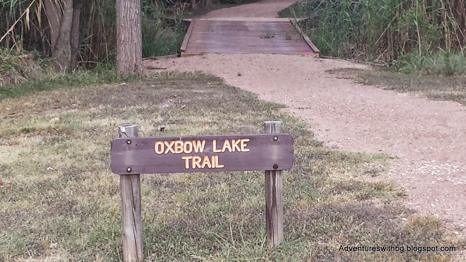
The Oxbow Lake TrailheadTheOxbow trail is a .68 mile graveled trail that travels the edge of OxbowLake. The trail is nice and shaded path. Moreover, it is an easy walk and providesaccess to multiple spots along the lake. The access points to the lake provide excellent fishing or swimmingspots, but be careful there are no lifeguards on duty. In addition, there are multiple woodenbridges along the path, but there was no water underneath during our trip. Furthermore, this trail provides access tobird watching. Finally, this is thelocation of the paddleboats and canoes available for renting.
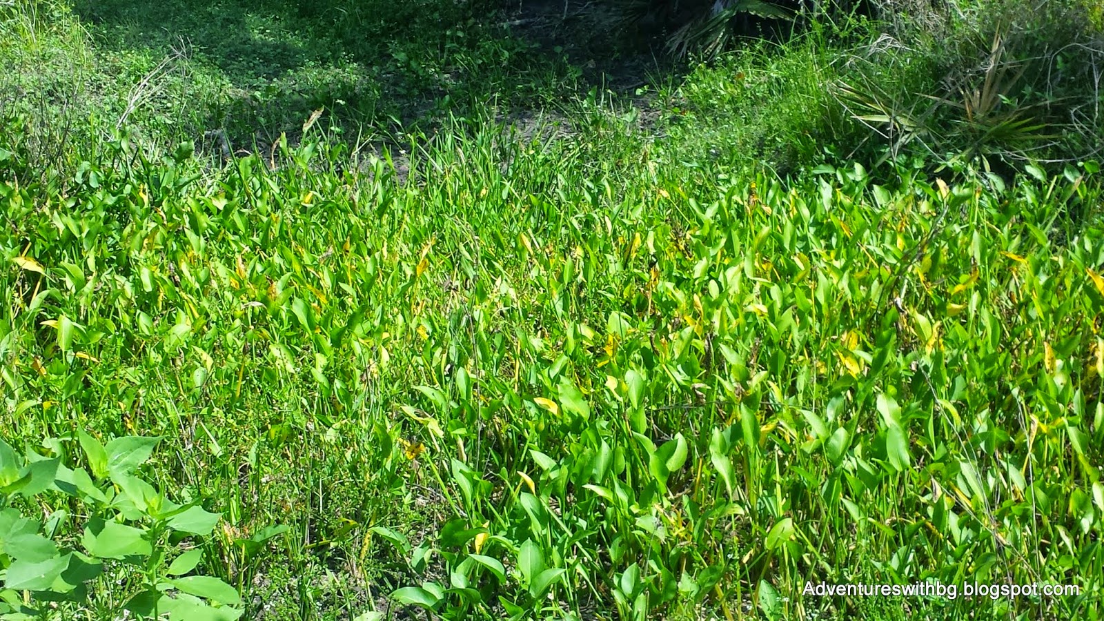
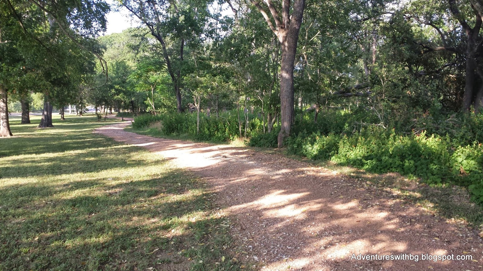
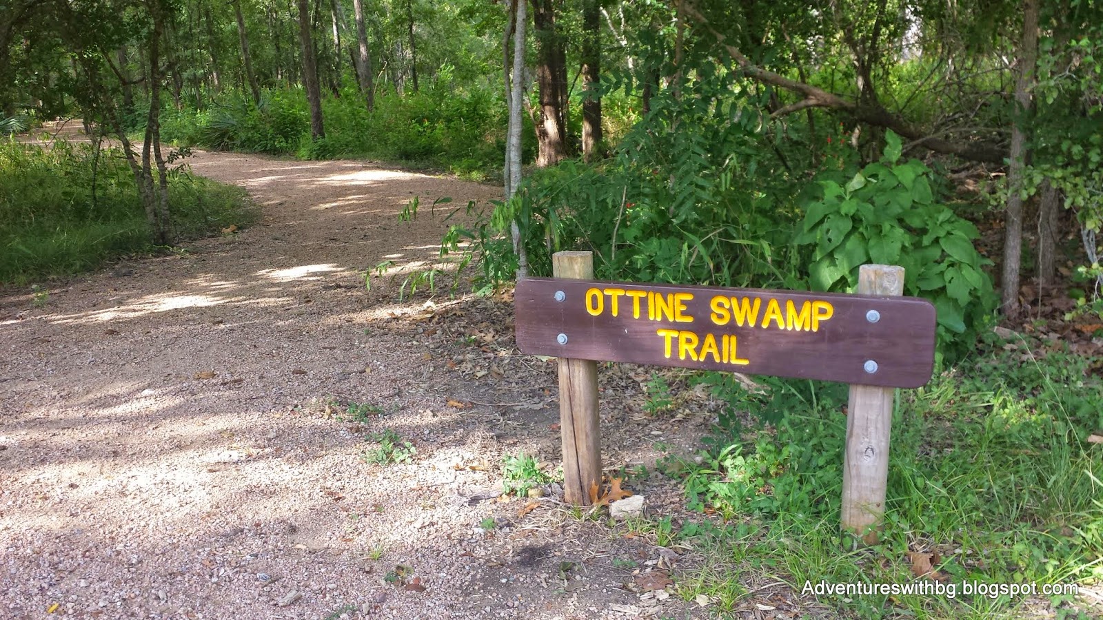
OttineSwamp Trail

The Ottine Swamp TrailheadTheOttine Swamp Trail is a 1.08 mile graveled trail that travels through the parksfamous swamps, which are named after the neighboring small town. In addition, the trail is mostly shaded andhas many boardwalks that span its swamps. However, on our trip most of theswamps were dry. There was almost nowater left this summer so the boardwalks only acted to keep us out of theswamps vegetation. Furthermore, dwarf Palmetto plants grow along this trail in swamps along with various other undergrowth vegetation. Finally, there are rest areas with benches on the boardwalk so you can sit down and catch your breath or do some bird watching.
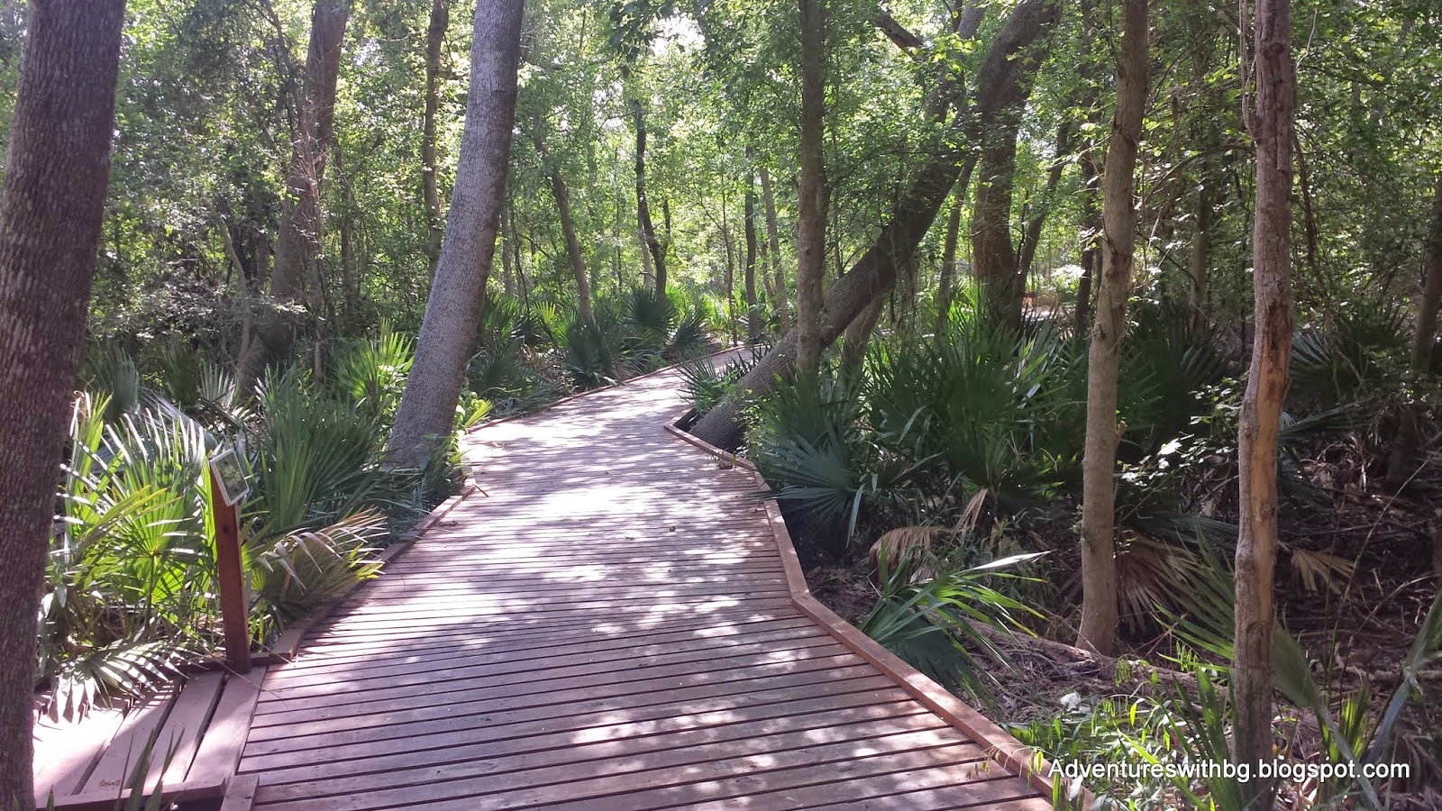
Boardwalk on The Ottine Swamp Trail
All along this trail little lizards darted along the edge of the trail. This drives BeeGee crazy and she will pounce like a cat any chance she gets to try and check those fast little lizards. As far as I know she has never succeeded in catching one, but she hasn't let that stop her.
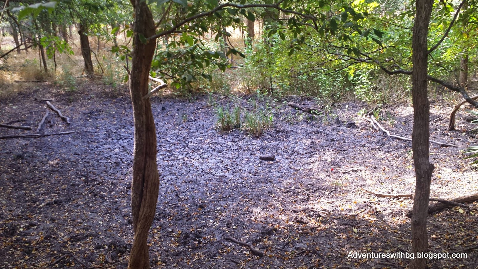
Dried Swamp on the Ottine Trail
Excitingly, there was an abundant amount of wildlife on this trail. We saw deer, swamp rabbits, lizards, birds, and butterflies. It was a struggle sometimes to keep BeeGee calm with all the other living creatures out there to chase.
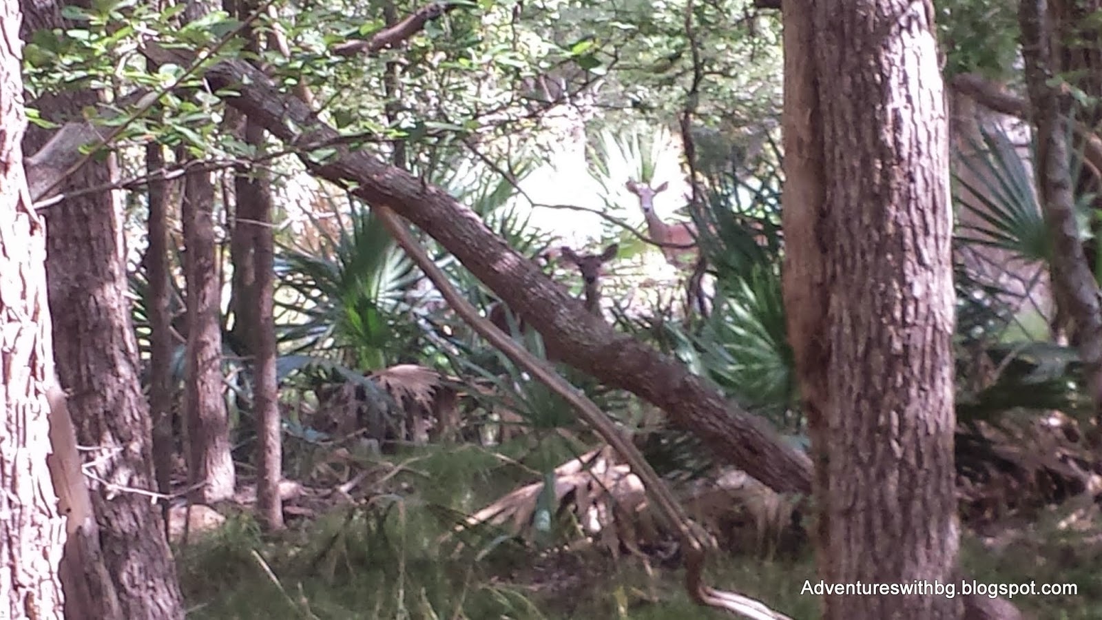
Two Deer Hiding Along the Ottine Swamp Trail
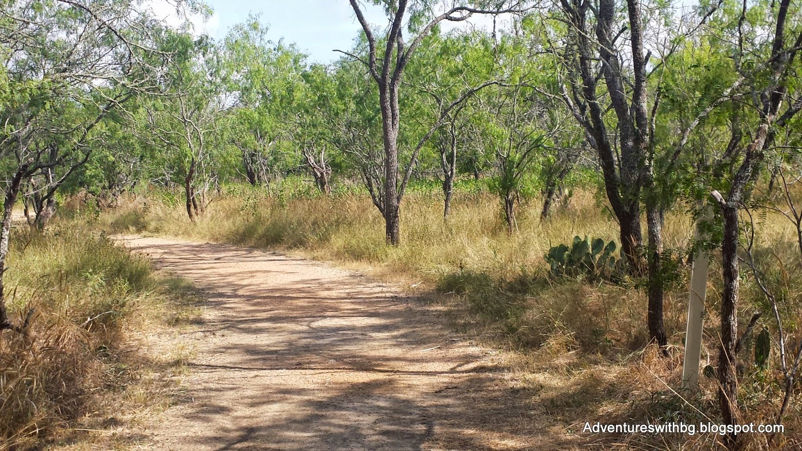
MesquiteFlats Trail
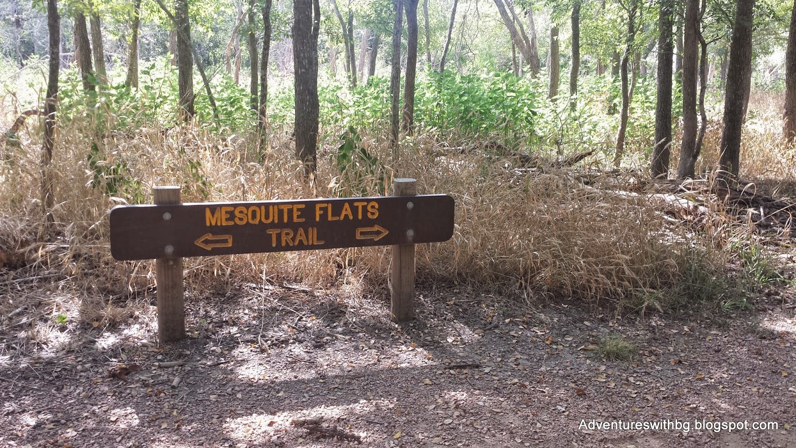
One of The Mesquite Flats TrailheadsTheMesquite Flats Trail is a 1.01 mile graveled trail that winds through an areafull of mesquite trees. In addition,this trail is only partly shaded and has sections of open skies, so it was thewarmest trail of our hike. Finally, we didn’t see much wildlife, but we did see plenty of animal markings: tracks, fur, and scat.
The mesquitetree is neat or a nuisance depending on your view. The tree its self is short with thorns and isused to make furniture or wood fires for barbeque. However, mesquite tree roots grow very deep,which results in other vegetation being killed around the trees. In addition, the seed pods have a sweet honey taste and the seeds can be cooked, ground, and used in bread. Just don't eat the seeds raw as it can make you sick.
Mesquite Trees and Cactus on the Mesquite Trail
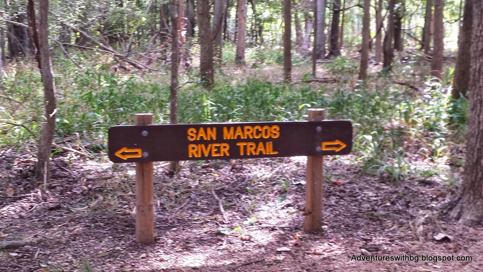
SanMarcos River Trail

One of the San Marcos River TrailheadsTheSan Marcos River trail is another graveled path and is 1.25 miles long. In addition, the trail is shaded and runsalong the San Marcos River. However, theSan Marcos River is not visible from the trail. This is because of the overgrown vegetation. Furthermore, it is difficult to get to theSan Marcos River because the river’s edge is steep.
TheSan Marcos River Trail is famous for its mud boil, which is one the PalmettoState Park’s main attractions. A mudboil is deep water that is heated and bubbles up to the surface. Unfortunately, Palmetto State Park’s mud boilhas been dry since 1970 due to a lower water table. All that is left on the San Marcos Trail’smud boil is a dried depression with green vegetation growing in thelocation.
Palmetto State Park's Mud Boil
Wedid eventually find an easy path down to the San Marcos River so BeeGee could lay down in the water and cool off. However, if you don't mind a steep descent or fighting through plants, there are multiple paths that take you to the San Marcos River from this trail.
PalmettoInterpretive Trail
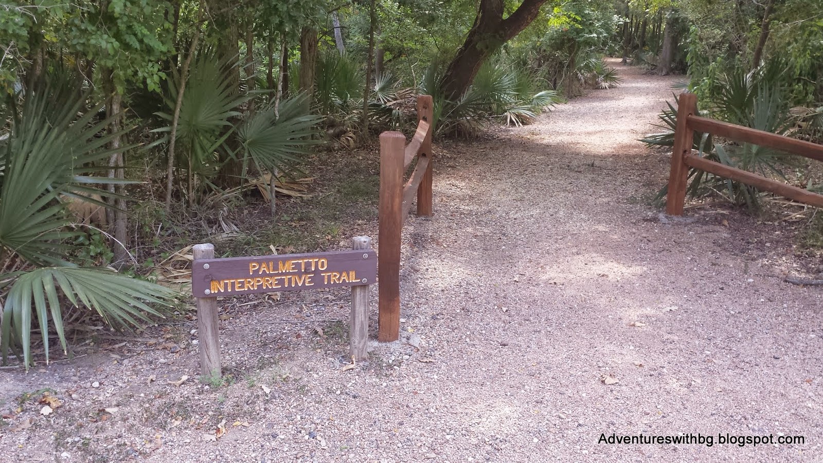
Palmetto Interpretive TrailheadThePalmetto Interpretive Trail is, in my opinion, the most fun trail in the parkand is located in the middle of the other trails. The trail is only .33 miles, graveled, and isshaded the entire path. The trail has amild temperature because the water level is maintained for the swamps in thisarea. Plus, the area is covered in Palmetto dwarf plans
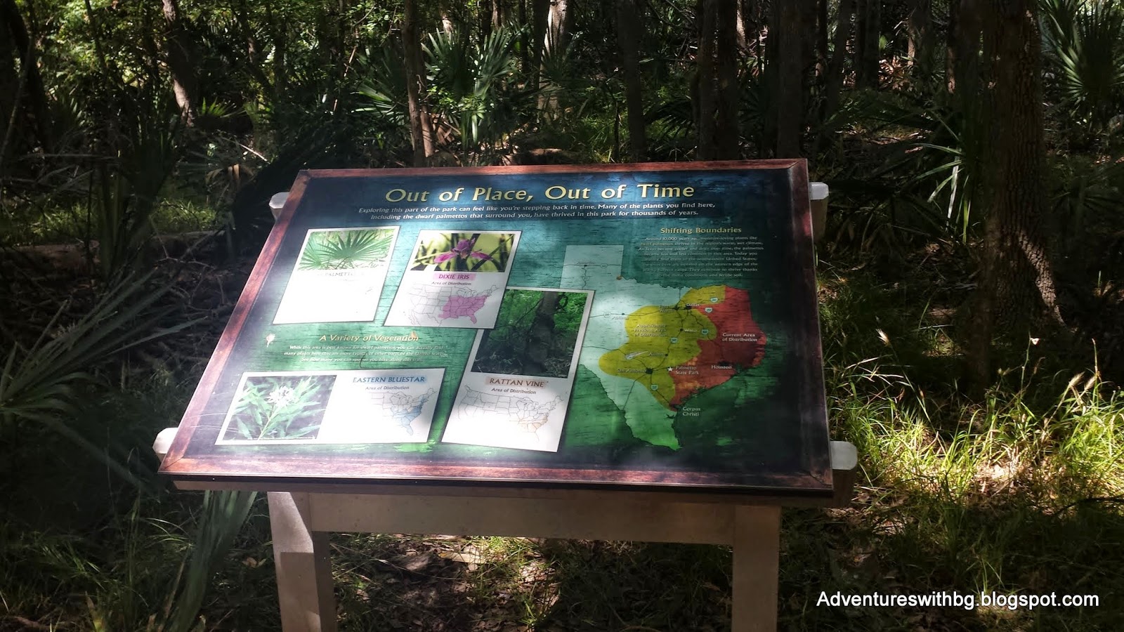
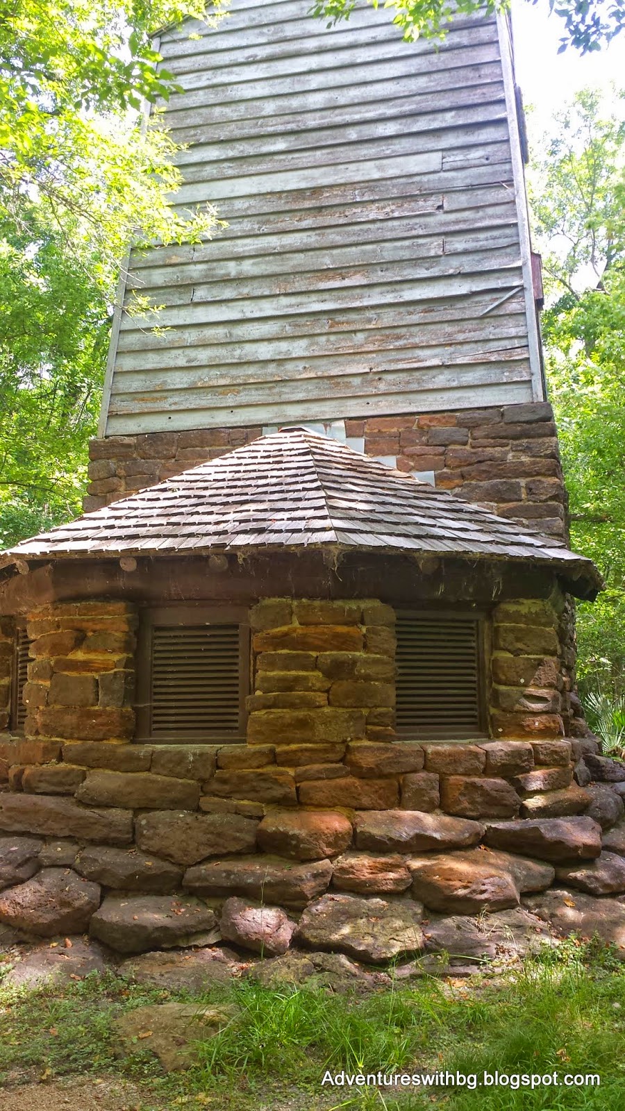
Allalong the trail are signs that describe the unique wildlife and plants of thepark, local heritage, and other interesting information. In addition, the Civilian Construction Corp’sartesian well is located on this trail. The well provides the water to maintain the natural look of the Park’sswamps. Finally, be prepared for asulfur smell in this area and increased humidity.

Interpretive Sign on the Palmetto Trail
FinalThoughts
PalmettoState Park has multiple things to do with the whole family, from camping tofishing to swimming. In addition, thepark is close to Lulling where there is also excellent barbeque. Just be mindful that the park is home torattle snakes and be safe when swimming in Oxbow Lake or the San Marcos River. Therefore, if you are new to hiking orcamping and looking for something close to home, I strongly recommend thispark. If you are an experienced trailblazer, I would look elsewhere unless you need to get out to hike and are shorton time.

The Water Tower and Artesian Well on the Palmetto Trail
If you have ever beento Palmetto State Park, let me know your thoughts and feel free to mention anythingI missed.
Monday, August 11, 2014
Trip Report: Palmetto State Park
Trip Report: Palmetto State Park
On Wednesday, August 6th My Brother, BeeGee, and myself went on our second official trip since starting this blog. I hope to keep visiting interesting places throughout Texas and reporting back so the information is freely available.
BeeGee & Jarrett and BeeGee & Jack Looking Cool at the Entrance Sign
The Background
Location: 78 Park Road 11 South, Gonzales, TX 78629
Admission: $3 per adult; Children under 12 are free
Elevation: 480 to 600 ft.
Weather: Sunny, hot, 82 to 90F
Difficulty: Easy
Website: http://www.tpwd.state.tx.us/state-parks/palmetto
PalmettoState Park is located in Gonzales County and is close to Gonzales and Lulling,Texas. The San Marcos River runs throughthe park and there is a 4-acre lake as well. The park offers hiking, camping, RV hook ups, fishing, canoeing, tubing,paddle boating, a cabin to rent, and a pavilion to rent. Canoes, tubes, and paddleboats can be rented andused in Oxford Lake. The park has 6trails and 2 spurs for hiking. Thetrails total 4.3 miles and a total walkable distance of 4.91 miles.
Oxbow Lake, One of the Biggest Attractions in Palmetto State Park
Theland for Palmetto State Park was purchased from private landowners and the Cityof Gonzales from 1934 to 1936. PalmettoState Park is another park built by the Civilian Conservation Corp that wascompleted and opened in 1936. Inaddition, the park is covered in dwarf palmetto plants, which have a verytropical look.
Dwarf Palmetto Plant Growing Around a Wooden Bridge
ParkHQ Trail
The Park Headquarters TrailheadThePark Headquarters Trail is only .22 miles, which is the shortest in the park. In addition, the trail is a short, flat,graveled path that travels from the park headquarters to Oxbow Trail, Oxbow Lake, and the day use area. Furthermore, the path is shaded and fairlycool on our walk considering its summer. If youintend to only use the lake or rent equipment from the park, this trail willallow you to walk there quickly. While leaving your vehicle safely at the park headquarters. Finally, the HQ trail parallels the park’smain road and is limited in scenery and nature.
The Graveled Park HQ Trail Leading to Oxbow Lake
OxbowLake
The Oxbow Lake TrailheadTheOxbow trail is a .68 mile graveled trail that travels the edge of OxbowLake. The trail is nice and shaded path. Moreover, it is an easy walk and providesaccess to multiple spots along the lake. The access points to the lake provide excellent fishing or swimmingspots, but be careful there are no lifeguards on duty. In addition, there are multiple woodenbridges along the path, but there was no water underneath during our trip. Furthermore, this trail provides access tobird watching. Finally, this is thelocation of the paddleboats and canoes available for renting.
OttineSwamp Trail
The Ottine Swamp TrailheadTheOttine Swamp Trail is a 1.08 mile graveled trail that travels through the parksfamous swamps, which are named after the neighboring small town. In addition, the trail is mostly shaded andhas many boardwalks that span its swamps. However, on our trip most of theswamps were dry. There was almost nowater left this summer so the boardwalks only acted to keep us out of theswamps vegetation. Furthermore, dwarf Palmetto plants grow along this trail in swamps along with various other undergrowth vegetation. Finally, there are rest areas with benches on the boardwalk so you can sit down and catch your breath or do some bird watching.
Boardwalk on The Ottine Swamp Trail
All along this trail little lizards darted along the edge of the trail. This drives BeeGee crazy and she will pounce like a cat any chance she gets to try and check those fast little lizards. As far as I know she has never succeeded in catching one, but she hasn't let that stop her.
Dried Swamp on the Ottine Trail
Excitingly, there was an abundant amount of wildlife on this trail. We saw deer, swamp rabbits, lizards, birds, and butterflies. It was a struggle sometimes to keep BeeGee calm with all the other living creatures out there to chase.
Two Deer Hiding Along the Ottine Swamp Trail
MesquiteFlats Trail
One of The Mesquite Flats TrailheadsTheMesquite Flats Trail is a 1.01 mile graveled trail that winds through an areafull of mesquite trees. In addition,this trail is only partly shaded and has sections of open skies, so it was thewarmest trail of our hike. Finally, we didn’t see much wildlife, but we did see plenty of animal markings: tracks, fur, and scat.
The mesquitetree is neat or a nuisance depending on your view. The tree its self is short with thorns and isused to make furniture or wood fires for barbeque. However, mesquite tree roots grow very deep,which results in other vegetation being killed around the trees. In addition, the seed pods have a sweet honey taste and the seeds can be cooked, ground, and used in bread. Just don't eat the seeds raw as it can make you sick.
Mesquite Trees and Cactus on the Mesquite Trail
SanMarcos River Trail
One of the San Marcos River TrailheadsTheSan Marcos River trail is another graveled path and is 1.25 miles long. In addition, the trail is shaded and runsalong the San Marcos River. However, theSan Marcos River is not visible from the trail. This is because of the overgrown vegetation. Furthermore, it is difficult to get to theSan Marcos River because the river’s edge is steep.
TheSan Marcos River Trail is famous for its mud boil, which is one the PalmettoState Park’s main attractions. A mudboil is deep water that is heated and bubbles up to the surface. Unfortunately, Palmetto State Park’s mud boilhas been dry since 1970 due to a lower water table. All that is left on the San Marcos Trail’smud boil is a dried depression with green vegetation growing in thelocation.
Palmetto State Park's Mud Boil
Wedid eventually find an easy path down to the San Marcos River so BeeGee could lay down in the water and cool off. However, if you don't mind a steep descent or fighting through plants, there are multiple paths that take you to the San Marcos River from this trail.
PalmettoInterpretive Trail
Palmetto Interpretive TrailheadThePalmetto Interpretive Trail is, in my opinion, the most fun trail in the parkand is located in the middle of the other trails. The trail is only .33 miles, graveled, and isshaded the entire path. The trail has amild temperature because the water level is maintained for the swamps in thisarea. Plus, the area is covered in Palmetto dwarf plans
Allalong the trail are signs that describe the unique wildlife and plants of thepark, local heritage, and other interesting information. In addition, the Civilian Construction Corp’sartesian well is located on this trail. The well provides the water to maintain the natural look of the Park’sswamps. Finally, be prepared for asulfur smell in this area and increased humidity.
Interpretive Sign on the Palmetto Trail
FinalThoughts
PalmettoState Park has multiple things to do with the whole family, from camping tofishing to swimming. In addition, thepark is close to Lulling where there is also excellent barbeque. Just be mindful that the park is home torattle snakes and be safe when swimming in Oxbow Lake or the San Marcos River. Therefore, if you are new to hiking orcamping and looking for something close to home, I strongly recommend thispark. If you are an experienced trailblazer, I would look elsewhere unless you need to get out to hike and are shorton time.
The Water Tower and Artesian Well on the Palmetto Trail
If you have ever beento Palmetto State Park, let me know your thoughts and feel free to mention anythingI missed.
On Wednesday, August 6th My Brother, BeeGee, and myself went on our second official trip since starting this blog. I hope to keep visiting interesting places throughout Texas and reporting back so the information is freely available.
BeeGee & Jarrett and BeeGee & Jack Looking Cool at the Entrance Sign
The Background
Location: 78 Park Road 11 South, Gonzales, TX 78629
Admission: $3 per adult; Children under 12 are free
Elevation: 480 to 600 ft.
Weather: Sunny, hot, 82 to 90F
Difficulty: Easy
Website: http://www.tpwd.state.tx.us/state-parks/palmetto
PalmettoState Park is located in Gonzales County and is close to Gonzales and Lulling,Texas. The San Marcos River runs throughthe park and there is a 4-acre lake as well. The park offers hiking, camping, RV hook ups, fishing, canoeing, tubing,paddle boating, a cabin to rent, and a pavilion to rent. Canoes, tubes, and paddleboats can be rented andused in Oxford Lake. The park has 6trails and 2 spurs for hiking. Thetrails total 4.3 miles and a total walkable distance of 4.91 miles.

Oxbow Lake, One of the Biggest Attractions in Palmetto State Park
Theland for Palmetto State Park was purchased from private landowners and the Cityof Gonzales from 1934 to 1936. PalmettoState Park is another park built by the Civilian Conservation Corp that wascompleted and opened in 1936. Inaddition, the park is covered in dwarf palmetto plants, which have a verytropical look.

Dwarf Palmetto Plant Growing Around a Wooden Bridge
ParkHQ Trail

The Park Headquarters TrailheadThePark Headquarters Trail is only .22 miles, which is the shortest in the park. In addition, the trail is a short, flat,graveled path that travels from the park headquarters to Oxbow Trail, Oxbow Lake, and the day use area. Furthermore, the path is shaded and fairlycool on our walk considering its summer. If youintend to only use the lake or rent equipment from the park, this trail willallow you to walk there quickly. While leaving your vehicle safely at the park headquarters. Finally, the HQ trail parallels the park’smain road and is limited in scenery and nature.
The Graveled Park HQ Trail Leading to Oxbow Lake
OxbowLake

The Oxbow Lake TrailheadTheOxbow trail is a .68 mile graveled trail that travels the edge of OxbowLake. The trail is nice and shaded path. Moreover, it is an easy walk and providesaccess to multiple spots along the lake. The access points to the lake provide excellent fishing or swimmingspots, but be careful there are no lifeguards on duty. In addition, there are multiple woodenbridges along the path, but there was no water underneath during our trip. Furthermore, this trail provides access tobird watching. Finally, this is thelocation of the paddleboats and canoes available for renting.
OttineSwamp Trail
The Ottine Swamp TrailheadTheOttine Swamp Trail is a 1.08 mile graveled trail that travels through the parksfamous swamps, which are named after the neighboring small town. In addition, the trail is mostly shaded andhas many boardwalks that span its swamps. However, on our trip most of theswamps were dry. There was almost nowater left this summer so the boardwalks only acted to keep us out of theswamps vegetation. Furthermore, dwarf Palmetto plants grow along this trail in swamps along with various other undergrowth vegetation. Finally, there are rest areas with benches on the boardwalk so you can sit down and catch your breath or do some bird watching.

Boardwalk on The Ottine Swamp Trail
All along this trail little lizards darted along the edge of the trail. This drives BeeGee crazy and she will pounce like a cat any chance she gets to try and check those fast little lizards. As far as I know she has never succeeded in catching one, but she hasn't let that stop her.

Dried Swamp on the Ottine Trail
Excitingly, there was an abundant amount of wildlife on this trail. We saw deer, swamp rabbits, lizards, birds, and butterflies. It was a struggle sometimes to keep BeeGee calm with all the other living creatures out there to chase.

Two Deer Hiding Along the Ottine Swamp Trail
MesquiteFlats Trail

One of The Mesquite Flats TrailheadsTheMesquite Flats Trail is a 1.01 mile graveled trail that winds through an areafull of mesquite trees. In addition,this trail is only partly shaded and has sections of open skies, so it was thewarmest trail of our hike. Finally, we didn’t see much wildlife, but we did see plenty of animal markings: tracks, fur, and scat.
The mesquitetree is neat or a nuisance depending on your view. The tree its self is short with thorns and isused to make furniture or wood fires for barbeque. However, mesquite tree roots grow very deep,which results in other vegetation being killed around the trees. In addition, the seed pods have a sweet honey taste and the seeds can be cooked, ground, and used in bread. Just don't eat the seeds raw as it can make you sick.

Mesquite Trees and Cactus on the Mesquite Trail
SanMarcos River Trail
One of the San Marcos River TrailheadsTheSan Marcos River trail is another graveled path and is 1.25 miles long. In addition, the trail is shaded and runsalong the San Marcos River. However, theSan Marcos River is not visible from the trail. This is because of the overgrown vegetation. Furthermore, it is difficult to get to theSan Marcos River because the river’s edge is steep.
TheSan Marcos River Trail is famous for its mud boil, which is one the PalmettoState Park’s main attractions. A mudboil is deep water that is heated and bubbles up to the surface. Unfortunately, Palmetto State Park’s mud boilhas been dry since 1970 due to a lower water table. All that is left on the San Marcos Trail’smud boil is a dried depression with green vegetation growing in thelocation.

Palmetto State Park's Mud Boil
Wedid eventually find an easy path down to the San Marcos River so BeeGee could lay down in the water and cool off. However, if you don't mind a steep descent or fighting through plants, there are multiple paths that take you to the San Marcos River from this trail.
PalmettoInterpretive Trail

Palmetto Interpretive TrailheadThePalmetto Interpretive Trail is, in my opinion, the most fun trail in the parkand is located in the middle of the other trails. The trail is only .33 miles, graveled, and isshaded the entire path. The trail has amild temperature because the water level is maintained for the swamps in thisarea. Plus, the area is covered in Palmetto dwarf plans
Allalong the trail are signs that describe the unique wildlife and plants of thepark, local heritage, and other interesting information. In addition, the Civilian Construction Corp’sartesian well is located on this trail. The well provides the water to maintain the natural look of the Park’sswamps. Finally, be prepared for asulfur smell in this area and increased humidity.
Interpretive Sign on the Palmetto Trail
FinalThoughts
PalmettoState Park has multiple things to do with the whole family, from camping tofishing to swimming. In addition, thepark is close to Lulling where there is also excellent barbeque. Just be mindful that the park is home torattle snakes and be safe when swimming in Oxbow Lake or the San Marcos River. Therefore, if you are new to hiking orcamping and looking for something close to home, I strongly recommend thispark. If you are an experienced trailblazer, I would look elsewhere unless you need to get out to hike and are shorton time.
The Water Tower and Artesian Well on the Palmetto Trail
If you have ever beento Palmetto State Park, let me know your thoughts and feel free to mention anythingI missed.
Monday, August 11, 2014
Trip Report: Palmetto State Park
Trip Report: Palmetto State Park
On Wednesday, August 6th My Brother, BeeGee, and myself went on our second official trip since starting this blog. I hope to keep visiting interesting places throughout Texas and reporting back so the information is freely available.
BeeGee & Jarrett and BeeGee & Jack Looking Cool at the Entrance Sign
The Background
Location: 78 Park Road 11 South, Gonzales, TX 78629
Admission: $3 per adult; Children under 12 are free
Elevation: 480 to 600 ft.
Weather: Sunny, hot, 82 to 90F
Difficulty: Easy
Website: http://www.tpwd.state.tx.us/state-parks/palmetto
PalmettoState Park is located in Gonzales County and is close to Gonzales and Lulling,Texas. The San Marcos River runs throughthe park and there is a 4-acre lake as well. The park offers hiking, camping, RV hook ups, fishing, canoeing, tubing,paddle boating, a cabin to rent, and a pavilion to rent. Canoes, tubes, and paddleboats can be rented andused in Oxford Lake. The park has 6trails and 2 spurs for hiking. Thetrails total 4.3 miles and a total walkable distance of 4.91 miles.
Oxbow Lake, One of the Biggest Attractions in Palmetto State Park
Theland for Palmetto State Park was purchased from private landowners and the Cityof Gonzales from 1934 to 1936. PalmettoState Park is another park built by the Civilian Conservation Corp that wascompleted and opened in 1936. Inaddition, the park is covered in dwarf palmetto plants, which have a verytropical look.
Dwarf Palmetto Plant Growing Around a Wooden Bridge
ParkHQ Trail
The Park Headquarters TrailheadThePark Headquarters Trail is only .22 miles, which is the shortest in the park. In addition, the trail is a short, flat,graveled path that travels from the park headquarters to Oxbow Trail, Oxbow Lake, and the day use area. Furthermore, the path is shaded and fairlycool on our walk considering its summer. If youintend to only use the lake or rent equipment from the park, this trail willallow you to walk there quickly. While leaving your vehicle safely at the park headquarters. Finally, the HQ trail parallels the park’smain road and is limited in scenery and nature.
The Graveled Park HQ Trail Leading to Oxbow Lake
OxbowLake
The Oxbow Lake TrailheadTheOxbow trail is a .68 mile graveled trail that travels the edge of OxbowLake. The trail is nice and shaded path. Moreover, it is an easy walk and providesaccess to multiple spots along the lake. The access points to the lake provide excellent fishing or swimmingspots, but be careful there are no lifeguards on duty. In addition, there are multiple woodenbridges along the path, but there was no water underneath during our trip. Furthermore, this trail provides access tobird watching. Finally, this is thelocation of the paddleboats and canoes available for renting.
OttineSwamp Trail
The Ottine Swamp TrailheadTheOttine Swamp Trail is a 1.08 mile graveled trail that travels through the parksfamous swamps, which are named after the neighboring small town. In addition, the trail is mostly shaded andhas many boardwalks that span its swamps. However, on our trip most of theswamps were dry. There was almost nowater left this summer so the boardwalks only acted to keep us out of theswamps vegetation. Furthermore, dwarf Palmetto plants grow along this trail in swamps along with various other undergrowth vegetation. Finally, there are rest areas with benches on the boardwalk so you can sit down and catch your breath or do some bird watching.
Boardwalk on The Ottine Swamp Trail
All along this trail little lizards darted along the edge of the trail. This drives BeeGee crazy and she will pounce like a cat any chance she gets to try and check those fast little lizards. As far as I know she has never succeeded in catching one, but she hasn't let that stop her.
Dried Swamp on the Ottine Trail
Excitingly, there was an abundant amount of wildlife on this trail. We saw deer, swamp rabbits, lizards, birds, and butterflies. It was a struggle sometimes to keep BeeGee calm with all the other living creatures out there to chase.
Two Deer Hiding Along the Ottine Swamp Trail
MesquiteFlats Trail
One of The Mesquite Flats TrailheadsTheMesquite Flats Trail is a 1.01 mile graveled trail that winds through an areafull of mesquite trees. In addition,this trail is only partly shaded and has sections of open skies, so it was thewarmest trail of our hike. Finally, we didn’t see much wildlife, but we did see plenty of animal markings: tracks, fur, and scat.
The mesquitetree is neat or a nuisance depending on your view. The tree its self is short with thorns and isused to make furniture or wood fires for barbeque. However, mesquite tree roots grow very deep,which results in other vegetation being killed around the trees. In addition, the seed pods have a sweet honey taste and the seeds can be cooked, ground, and used in bread. Just don't eat the seeds raw as it can make you sick.
Mesquite Trees and Cactus on the Mesquite Trail
SanMarcos River Trail
One of the San Marcos River TrailheadsTheSan Marcos River trail is another graveled path and is 1.25 miles long. In addition, the trail is shaded and runsalong the San Marcos River. However, theSan Marcos River is not visible from the trail. This is because of the overgrown vegetation. Furthermore, it is difficult to get to theSan Marcos River because the river’s edge is steep.
TheSan Marcos River Trail is famous for its mud boil, which is one the PalmettoState Park’s main attractions. A mudboil is deep water that is heated and bubbles up to the surface. Unfortunately, Palmetto State Park’s mud boilhas been dry since 1970 due to a lower water table. All that is left on the San Marcos Trail’smud boil is a dried depression with green vegetation growing in thelocation.
Palmetto State Park's Mud Boil
Wedid eventually find an easy path down to the San Marcos River so BeeGee could lay down in the water and cool off. However, if you don't mind a steep descent or fighting through plants, there are multiple paths that take you to the San Marcos River from this trail.
PalmettoInterpretive Trail
Palmetto Interpretive TrailheadThePalmetto Interpretive Trail is, in my opinion, the most fun trail in the parkand is located in the middle of the other trails. The trail is only .33 miles, graveled, and isshaded the entire path. The trail has amild temperature because the water level is maintained for the swamps in thisarea. Plus, the area is covered in Palmetto dwarf plans
Allalong the trail are signs that describe the unique wildlife and plants of thepark, local heritage, and other interesting information. In addition, the Civilian Construction Corp’sartesian well is located on this trail. The well provides the water to maintain the natural look of the Park’sswamps. Finally, be prepared for asulfur smell in this area and increased humidity.
Interpretive Sign on the Palmetto Trail
FinalThoughts
PalmettoState Park has multiple things to do with the whole family, from camping tofishing to swimming. In addition, thepark is close to Lulling where there is also excellent barbeque. Just be mindful that the park is home torattle snakes and be safe when swimming in Oxbow Lake or the San Marcos River. Therefore, if you are new to hiking orcamping and looking for something close to home, I strongly recommend thispark. If you are an experienced trailblazer, I would look elsewhere unless you need to get out to hike and are shorton time.
The Water Tower and Artesian Well on the Palmetto Trail
If you have ever beento Palmetto State Park, let me know your thoughts and feel free to mention anythingI missed.