Thanks to a "Look What You've Been Missing..." email from this website I read Scatman's post on Jay Creek. Having also visited Jay Creek for the first time this year-- but in different conditions-- I got inspired to do this, my first trip report. I hope you enjoy.
To set the scene: It was southwest Montana's "winter that never came." On the solstice my wife and I hiked Emigrant Peak: not something we would normally try, let alone get away with. Over the Christmas holiday I tore off much of our roof, added insulation, and lifted it 8 inches, learning as I went. No worries, though, the weather was high pressure with no end in sight. As my project dragged on into January the mosquitoes started biting. By mid-February the Snotel site at Silvergate was less than half of its previous record low. By all appearances, there was no way we'd get to do the ski trip we'd been planning for a year, more or less.
Then came the first week in March. Jackson got its biggest-ever single-day March dump, and I could not believe my eyes when I checked the Younts Snotel and it was up to 100%. We were on! --Even if I practically hadn't skied at all that season-- Here goes!
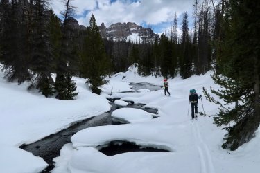
It was bluebird skies and fresh snow the whole drive down. Too nice, as it turned out, since a few inches on the surface got full of melt. When we started out the next morning, at the plowed pullout for the Brooks Lake road, it was icy snowmobile tracks all the way. (It seems worth mentioning that, right now, a 23,000-acre fire has burned up to this spot from the other side of the highway.) (And it might also be worth mentioning that, while we didn't actually start at Togwotee Pass but somewhat below it, we didn't actually end at Tower, either; rather at the Petrified Trees interpretive pullout. Notwithstanding the catchy title of this post.) We got off of them the best we could:
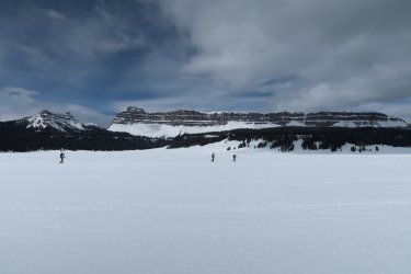
Crossing Brooks Lake
*
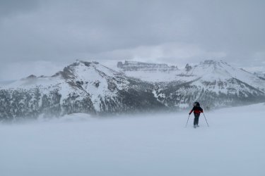
As soon as we were ready to cash in on all that nice stable weather and gain the high country it turned on us. There was some snow falling from the sky but it was insignificant in the greater onslaught of bitter wind and occasional ground blizzard.
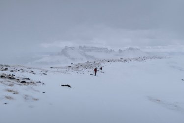
Above Bonneville Pass, with Pinnacle Buttes in the background.
*
It wasn't possible to find the cozy, sheltered nook we wanted for our high camp that night. But as we packed camp the next morning the congealed grey sky lightened, dissolved, then broke. Suddenly the day was full of promise.
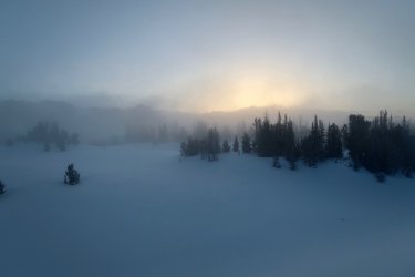
*
Working our way east along the Dunoir/ Cub Creek divide, spirits were high.
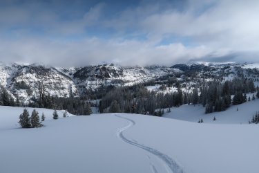
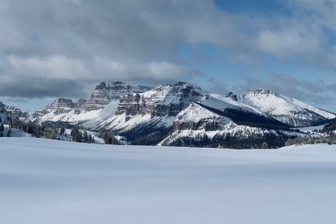
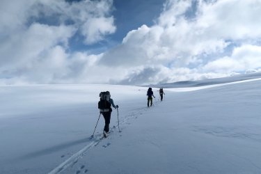
Despite having planned to go up and over Crescent Mountain, we dropped into North Fork Buffalo as the winds picked up.
Wolverine tracks worked this drainage up and down. Finally I crossed some that were fresh that morning. Unfortunately they weren't going our direction; instead, they angled back up toward the side canyon we'd just passed.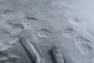
*
We took the next right-hand side canyon to gain the Buffalo Plateau. It's the perfect ski ingress, as far as I'm concerned, with rugged flanks and a smooth flat bottom.
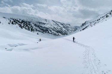
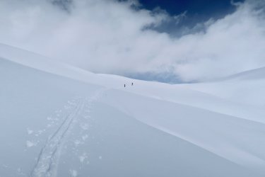
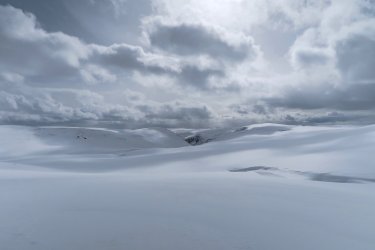
Seeing the Buffalo Plateau in winter conditions had been a dream of mine for a fifteen years. It lived up to my expectations.
When the clouds briefly parted to show us Younts-- and then the sun came out and buttered the top of it-- we all involuntarily stopped and stared. We hoped to ski from its summit the following day.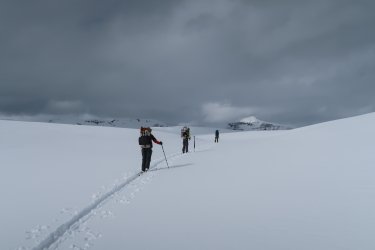 .
.
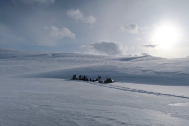 We found a nice camp in the lee of a drift. It would serve us for two nights. I've seen grizzlies walk through there in other seasons, but this made me no less surprised to make out the faint outlines of bear tracks in the wind crust.
*
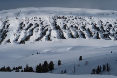
The next day dawned in that wintery mix of grey that thins and thickens in rapid time. I only needed to see shadows every once in a while to sustain my optimism.
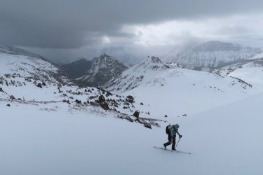
So we climbed the divide above Marston Pass with enthusiasm. But this quickly ran out. By the time we got to the top the wind was thrashing us and the snow was slashing hard. Younts, only a couple miles away, was lost in a great wall of whiteout. We returned to camp, read, and did some mellow laps on a hill above camp. We needed a mellow hill because the light was completely flat.
*
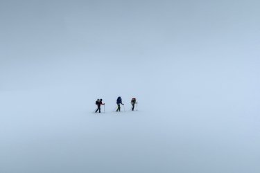
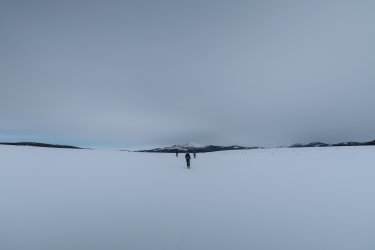
In the past I've loved taking pictures of little ant figures lost in oceans of white but I got my fill of it very quickly this day: there was no other picture to take. We crossed Ferry Lake without knowing when, exactly, and ditto for Jay Benchmark. I think this might be Ferry Lake, actually:
*
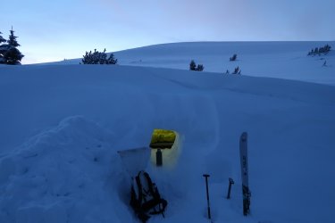
After surveying our windy, exposed campsite that night-- near a small pond southeast of Tricounty Lake-- I decided to dig a snowcave. There was a drift plenty big for it. As I did-- classic-- the sky completely cleared off. That way you get your days grey and sunless, then the blanket gets pulled off just in time to expose you to the full chill of vacuum of space. After dinner, wandering off to pee, I was shocked to see the Grand lit by sunset. For a good five seconds of ogling I thought I was looking at some flaming fairy-palace of clouds.
*
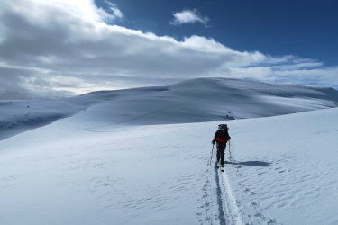
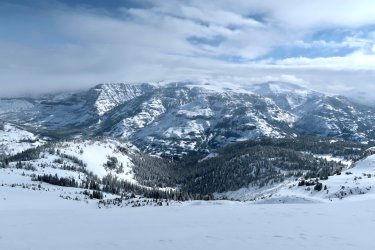
The up-shot to not being able to take good weather for granted is that you stop taking it for granted. We kept getting swept but snow squalls, but for a half mile the next day, my god could we see.
Thunder Mountain
*
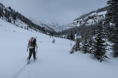
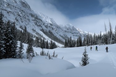
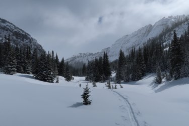
Then, as promised, Jay Creek. A bonafide delight.
*
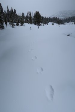
At Two Ocean Pass, more wolverine tracks. We saw these intermittently all the way to Bridger Lake.
*
Hawk's Rest
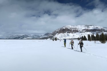
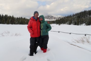
Right up there with Paris in spring, Hawk's in March is widely known as a romantic retreat.
Too bad we couldn't stay in the cabin.
*
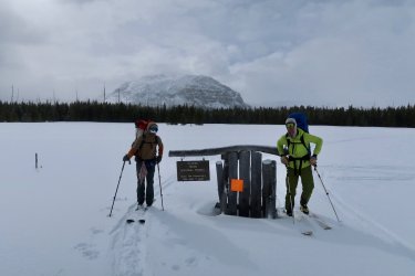
We had two former members of the Blackrock trail crew along. So this picture had to be taken.
*
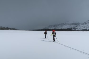
Lynx flat, as I call it, was a highlight of the last time Jen and I skied through here, 7 years earlier. We could actually see the mountains that time.
*
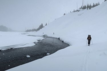
It took a while to hunt down a crossing of the Yellowstone around Mountain Creek. Somehow, stupidly, I managed to fill one of my ski boots with water in the process. Getting it dry-ish again was a multi-day process.
*
Unsettled weather all the way. Sort of like our failed bid on Younts-- but in reverse-- our only look at Colter Peak came hours after we despaired of getting a window to ski it.
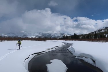
And even that window closed fast. At the mouth of the upper Yellowstone we already had a pretty complete picture of what our lake crossing would consist of.
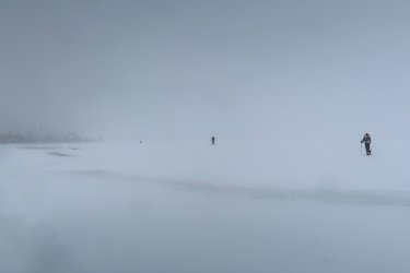
We ate lunch on Molly's Islands just for the novelty of it. Closed to all visitation within a quarter mile radius during every other season, these islands for us were frozen snow mounds that had sprigs of willow poking out. I'll never forget them.
*
The weather pretty much continued like this. We visited the highpoint of the Promontory, and tried to finish out the ridge north from there...
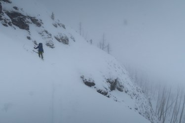
...which actually got a little hairy. We left the final quarter mile-- and all the glory therein-- for skiers of the future.
Crossing the Southeast Arm was blind but not nearly as scary as the time I did it in a canoe with a two-year-old. This is the moment when we could see where we were going again: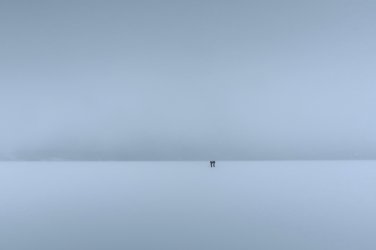
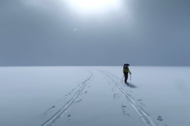
Eventually we crossed from the east shore
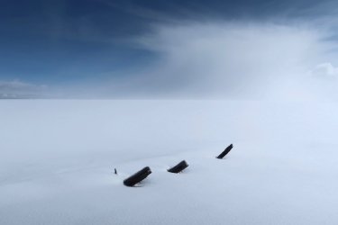
to Stevenson Island. I hoped we'd be able to find Yellowstone's most famous shipwreck-- figured there was no real chance, though, not with all the snow drifted on that side of the island-- and then, there it was. Kind of fitting, somehow, to see it poking out of the snow like that. Jen nailed it when she recited,
...It was locked in the ice
But I saw in a trice
It was called the E.C. Waters...
(with apologies to Robert Service)
*
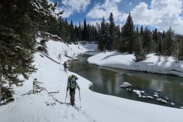
We elected to follow Pelican Creek up from its outlet, just to see something new, but for an hour or two it felt like a terrible mistake. The cutbanks were steep, gloppy, and cluttered with downfall; there was no crossing the creek; the flat timber above was jackstraw through and through. Here we're getting through it with our skis on, at least:
*
The warmest afternoon segued into the coldest night. Pelican Valley was about -10F in this scene and there were foxes running all over the place. We have our sights locked on Pelican Cone.
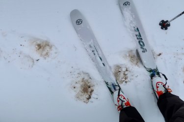
After seeing these monster tracks we got a fleeting glimpse of the bear that made them. My only grizzly sighting in the month of March.
*
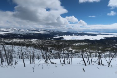
Some karma payout: beautiful weather on top of Pelican Cone.
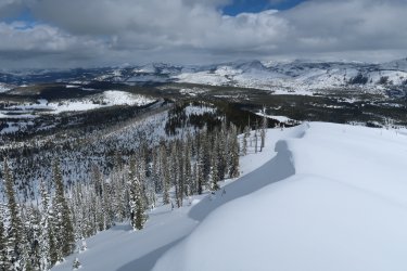
And the snow was excellent skiing off the backside, too. There was a massive cornice that would've spoiled the steep part, but the wind shadow of the lookout created a perfect little doorway through it.
*
Crossing the Mirror Plateau was wonderful. It was cloudy, snowing, all of that, but I knew by then to expect nothing less. I loved the ambience, I loved just getting lost in the winter scene up there...
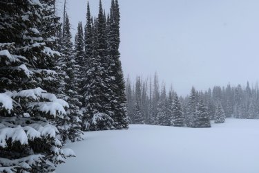
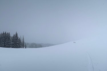
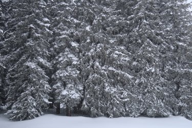
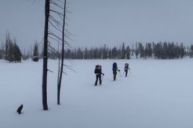
Crossing Mirror Lake.
*
The only day of the trip that it didn't snow was the last one.
Amethyst Mountain has never struck me as a destination, exactly. But, that day, it was the most spectacular mountain in the world to me. As naturally as we revelled in the sun and the views it was nevertheless surprising to find that we weren't the only ones. Rosy finches and horned larks were flitting and hopping around with so much energy you'd almost think they were finding something to eat up there.
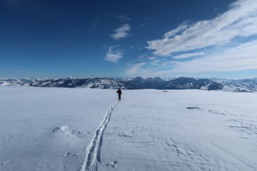
*
I was prepared for our descent to be equally transcendent. But the snow had no base going into the north range-- the only thing we had to ski on was what fell during the course of our trip. How many times was I seduced into making another turn, only to smash my skis onto a few more rocks? This spectacular skier's vista toward Washburn was a cruel trick: I would've been better off taking my skis off and bootpacking down at that point.
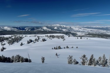
*
As we got lower and less exposed we found some drifted bands to work, and even a pitch that was worth a downhill lap.
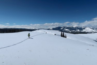
Then it was the highway. Our winter idyll was over, and nothing was left of it, it seemed, but the dream.
To set the scene: It was southwest Montana's "winter that never came." On the solstice my wife and I hiked Emigrant Peak: not something we would normally try, let alone get away with. Over the Christmas holiday I tore off much of our roof, added insulation, and lifted it 8 inches, learning as I went. No worries, though, the weather was high pressure with no end in sight. As my project dragged on into January the mosquitoes started biting. By mid-February the Snotel site at Silvergate was less than half of its previous record low. By all appearances, there was no way we'd get to do the ski trip we'd been planning for a year, more or less.
Then came the first week in March. Jackson got its biggest-ever single-day March dump, and I could not believe my eyes when I checked the Younts Snotel and it was up to 100%. We were on! --Even if I practically hadn't skied at all that season-- Here goes!

It was bluebird skies and fresh snow the whole drive down. Too nice, as it turned out, since a few inches on the surface got full of melt. When we started out the next morning, at the plowed pullout for the Brooks Lake road, it was icy snowmobile tracks all the way. (It seems worth mentioning that, right now, a 23,000-acre fire has burned up to this spot from the other side of the highway.) (And it might also be worth mentioning that, while we didn't actually start at Togwotee Pass but somewhat below it, we didn't actually end at Tower, either; rather at the Petrified Trees interpretive pullout. Notwithstanding the catchy title of this post.) We got off of them the best we could:

Crossing Brooks Lake
*

As soon as we were ready to cash in on all that nice stable weather and gain the high country it turned on us. There was some snow falling from the sky but it was insignificant in the greater onslaught of bitter wind and occasional ground blizzard.

Above Bonneville Pass, with Pinnacle Buttes in the background.
*
It wasn't possible to find the cozy, sheltered nook we wanted for our high camp that night. But as we packed camp the next morning the congealed grey sky lightened, dissolved, then broke. Suddenly the day was full of promise.

*
Working our way east along the Dunoir/ Cub Creek divide, spirits were high.


Despite having planned to go up and over Crescent Mountain, we dropped into North Fork Buffalo as the winds picked up.
Wolverine tracks worked this drainage up and down. Finally I crossed some that were fresh that morning. Unfortunately they weren't going our direction; instead, they angled back up toward the side canyon we'd just passed.

*
We took the next right-hand side canyon to gain the Buffalo Plateau. It's the perfect ski ingress, as far as I'm concerned, with rugged flanks and a smooth flat bottom.


Seeing the Buffalo Plateau in winter conditions had been a dream of mine for a fifteen years. It lived up to my expectations.
When the clouds briefly parted to show us Younts-- and then the sun came out and buttered the top of it-- we all involuntarily stopped and stared. We hoped to ski from its summit the following day.
 .
. We found a nice camp in the lee of a drift. It would serve us for two nights. I've seen grizzlies walk through there in other seasons, but this made me no less surprised to make out the faint outlines of bear tracks in the wind crust.
*

The next day dawned in that wintery mix of grey that thins and thickens in rapid time. I only needed to see shadows every once in a while to sustain my optimism.

So we climbed the divide above Marston Pass with enthusiasm. But this quickly ran out. By the time we got to the top the wind was thrashing us and the snow was slashing hard. Younts, only a couple miles away, was lost in a great wall of whiteout. We returned to camp, read, and did some mellow laps on a hill above camp. We needed a mellow hill because the light was completely flat.
*
In the past I've loved taking pictures of little ant figures lost in oceans of white but I got my fill of it very quickly this day: there was no other picture to take. We crossed Ferry Lake without knowing when, exactly, and ditto for Jay Benchmark. I think this might be Ferry Lake, actually:

*
After surveying our windy, exposed campsite that night-- near a small pond southeast of Tricounty Lake-- I decided to dig a snowcave. There was a drift plenty big for it. As I did-- classic-- the sky completely cleared off. That way you get your days grey and sunless, then the blanket gets pulled off just in time to expose you to the full chill of vacuum of space. After dinner, wandering off to pee, I was shocked to see the Grand lit by sunset. For a good five seconds of ogling I thought I was looking at some flaming fairy-palace of clouds.

*
The up-shot to not being able to take good weather for granted is that you stop taking it for granted. We kept getting swept but snow squalls, but for a half mile the next day, my god could we see.


Thunder Mountain
*
Then, as promised, Jay Creek. A bonafide delight.


*
At Two Ocean Pass, more wolverine tracks. We saw these intermittently all the way to Bridger Lake.

*
Hawk's Rest


Right up there with Paris in spring, Hawk's in March is widely known as a romantic retreat.
Too bad we couldn't stay in the cabin.
*
We had two former members of the Blackrock trail crew along. So this picture had to be taken.

*
Lynx flat, as I call it, was a highlight of the last time Jen and I skied through here, 7 years earlier. We could actually see the mountains that time.

*
It took a while to hunt down a crossing of the Yellowstone around Mountain Creek. Somehow, stupidly, I managed to fill one of my ski boots with water in the process. Getting it dry-ish again was a multi-day process.

*
Unsettled weather all the way. Sort of like our failed bid on Younts-- but in reverse-- our only look at Colter Peak came hours after we despaired of getting a window to ski it.

And even that window closed fast. At the mouth of the upper Yellowstone we already had a pretty complete picture of what our lake crossing would consist of.

We ate lunch on Molly's Islands just for the novelty of it. Closed to all visitation within a quarter mile radius during every other season, these islands for us were frozen snow mounds that had sprigs of willow poking out. I'll never forget them.
*
The weather pretty much continued like this. We visited the highpoint of the Promontory, and tried to finish out the ridge north from there...

...which actually got a little hairy. We left the final quarter mile-- and all the glory therein-- for skiers of the future.
Crossing the Southeast Arm was blind but not nearly as scary as the time I did it in a canoe with a two-year-old. This is the moment when we could see where we were going again:

Eventually we crossed from the east shore

to Stevenson Island. I hoped we'd be able to find Yellowstone's most famous shipwreck-- figured there was no real chance, though, not with all the snow drifted on that side of the island-- and then, there it was. Kind of fitting, somehow, to see it poking out of the snow like that. Jen nailed it when she recited,
...It was locked in the ice
But I saw in a trice
It was called the E.C. Waters...
(with apologies to Robert Service)

*
We elected to follow Pelican Creek up from its outlet, just to see something new, but for an hour or two it felt like a terrible mistake. The cutbanks were steep, gloppy, and cluttered with downfall; there was no crossing the creek; the flat timber above was jackstraw through and through. Here we're getting through it with our skis on, at least:

*
The warmest afternoon segued into the coldest night. Pelican Valley was about -10F in this scene and there were foxes running all over the place. We have our sights locked on Pelican Cone.


After seeing these monster tracks we got a fleeting glimpse of the bear that made them. My only grizzly sighting in the month of March.
*
Some karma payout: beautiful weather on top of Pelican Cone.


And the snow was excellent skiing off the backside, too. There was a massive cornice that would've spoiled the steep part, but the wind shadow of the lookout created a perfect little doorway through it.
*
Crossing the Mirror Plateau was wonderful. It was cloudy, snowing, all of that, but I knew by then to expect nothing less. I loved the ambience, I loved just getting lost in the winter scene up there...


Crossing Mirror Lake.
*
The only day of the trip that it didn't snow was the last one.
Amethyst Mountain has never struck me as a destination, exactly. But, that day, it was the most spectacular mountain in the world to me. As naturally as we revelled in the sun and the views it was nevertheless surprising to find that we weren't the only ones. Rosy finches and horned larks were flitting and hopping around with so much energy you'd almost think they were finding something to eat up there.

*
I was prepared for our descent to be equally transcendent. But the snow had no base going into the north range-- the only thing we had to ski on was what fell during the course of our trip. How many times was I seduced into making another turn, only to smash my skis onto a few more rocks? This spectacular skier's vista toward Washburn was a cruel trick: I would've been better off taking my skis off and bootpacking down at that point.

*
As we got lower and less exposed we found some drifted bands to work, and even a pitch that was worth a downhill lap.

Then it was the highway. Our winter idyll was over, and nothing was left of it, it seemed, but the dream.
Last edited:
