- Joined
- Jul 23, 2013
- Messages
- 1,666
With all the visits I make down to Torrey, Utah, including several drives along Highway 12 over the big behemoth of a plateau called Boulder Mountain, I've often gazed upon it wondering what it would be like to take a backpacking trip there, but then always put it off in exchange for trips down into neighboring Capitol Reef, or the Escalanate area, and so on.
That changed this summer when my friend Devin reached out wanting to do a early season trip up into the Uintas. The snowmelt and high run-off factor as a result of the big winter we had ultimately scared us off from that idea though and so he came up with an idea to go backpacking down on Boulder Mountain. And what an idea that turned out to be! We made it happen and I was utterly blown away with how how much more awesome that mountain was than I could have ever imagined. Devin's friend, Dane, would join up with us, and thus, plans were finalized.
Day 1
Friday - June 28, 2019
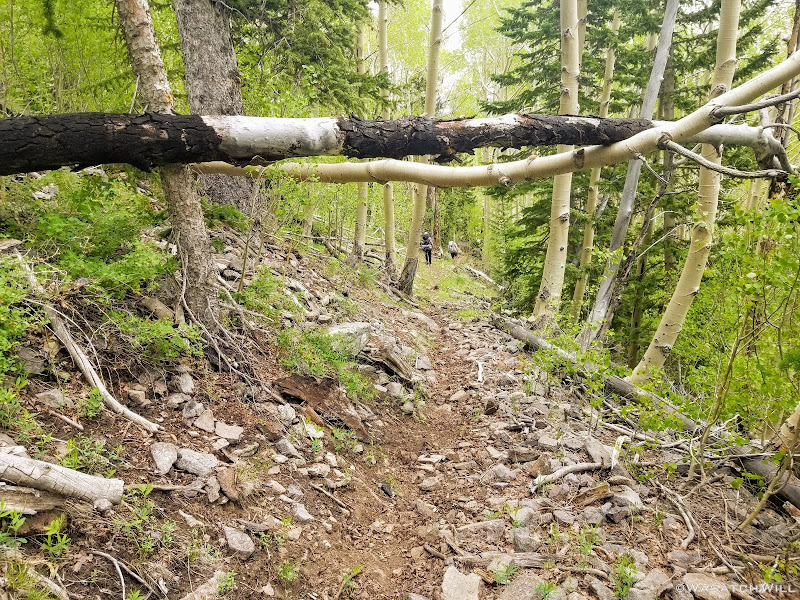
The route chosen would take us to the Pleasant Creek trailhead right off the highway. Rather than attempt the high clearance dirt road another mile up from the highway, we opted to park right there by the highway with Devin's sedan, and just hike the road.
Right as I put on my hiking shoes, I instantly realized something wasn't right.
"Oh no! I don't have any insoles in these shoes. I must have transplanted them to another pair back home and forgot to move them back. Dang!"
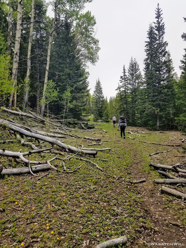
Welp! There was no turning back now. We only had to hike about 3.5 miles or so to the area we'd seek to establish our first camp, so I just carried on as a sole-less hiker.
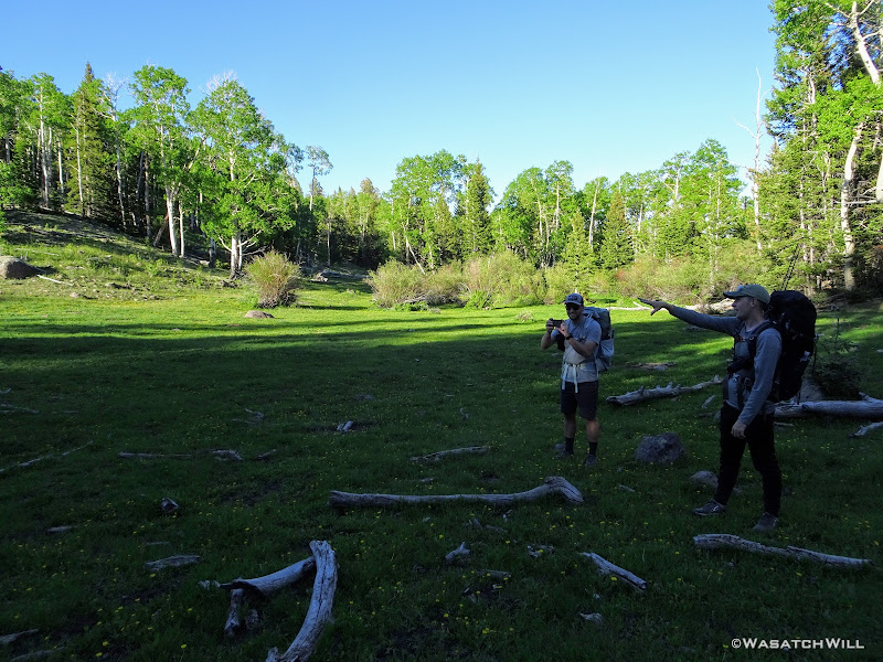
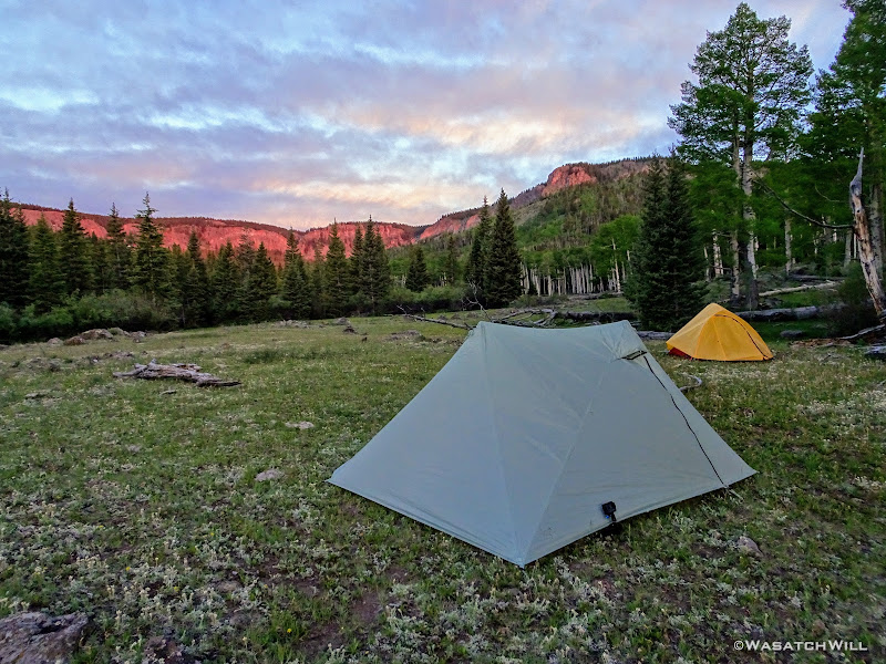
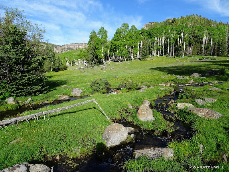
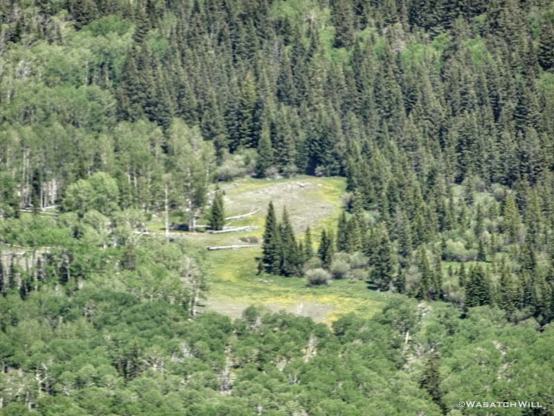
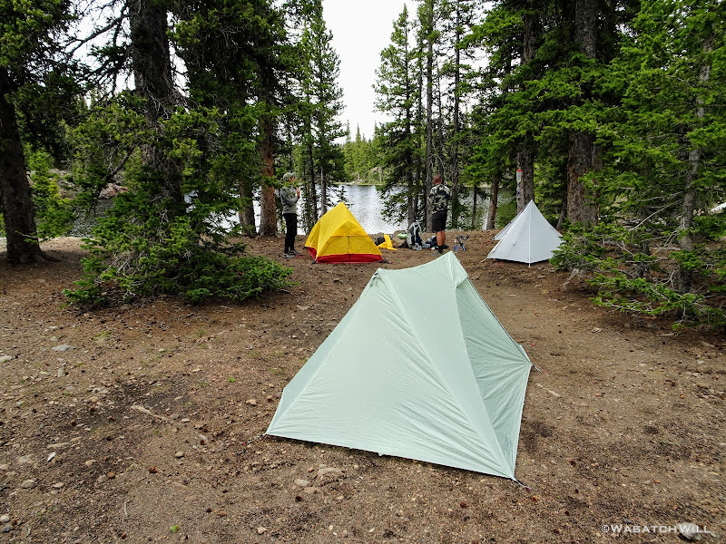
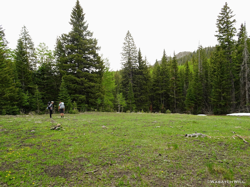
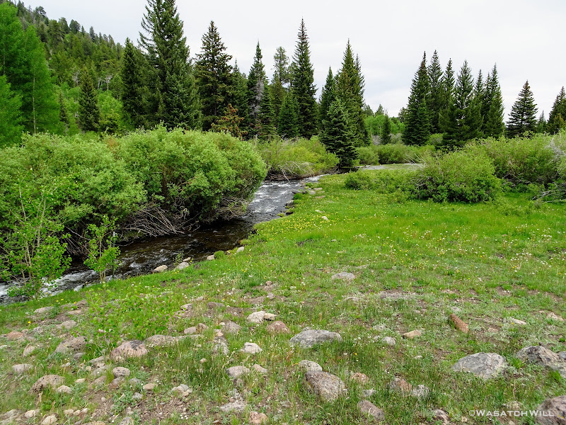
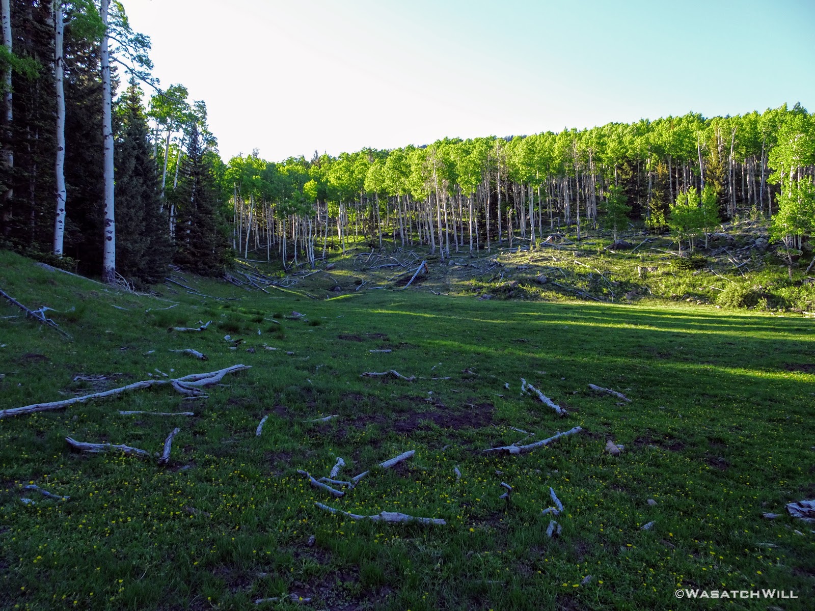
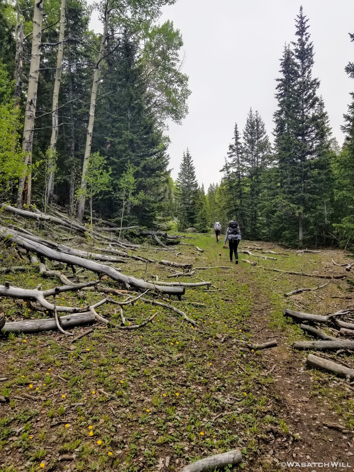
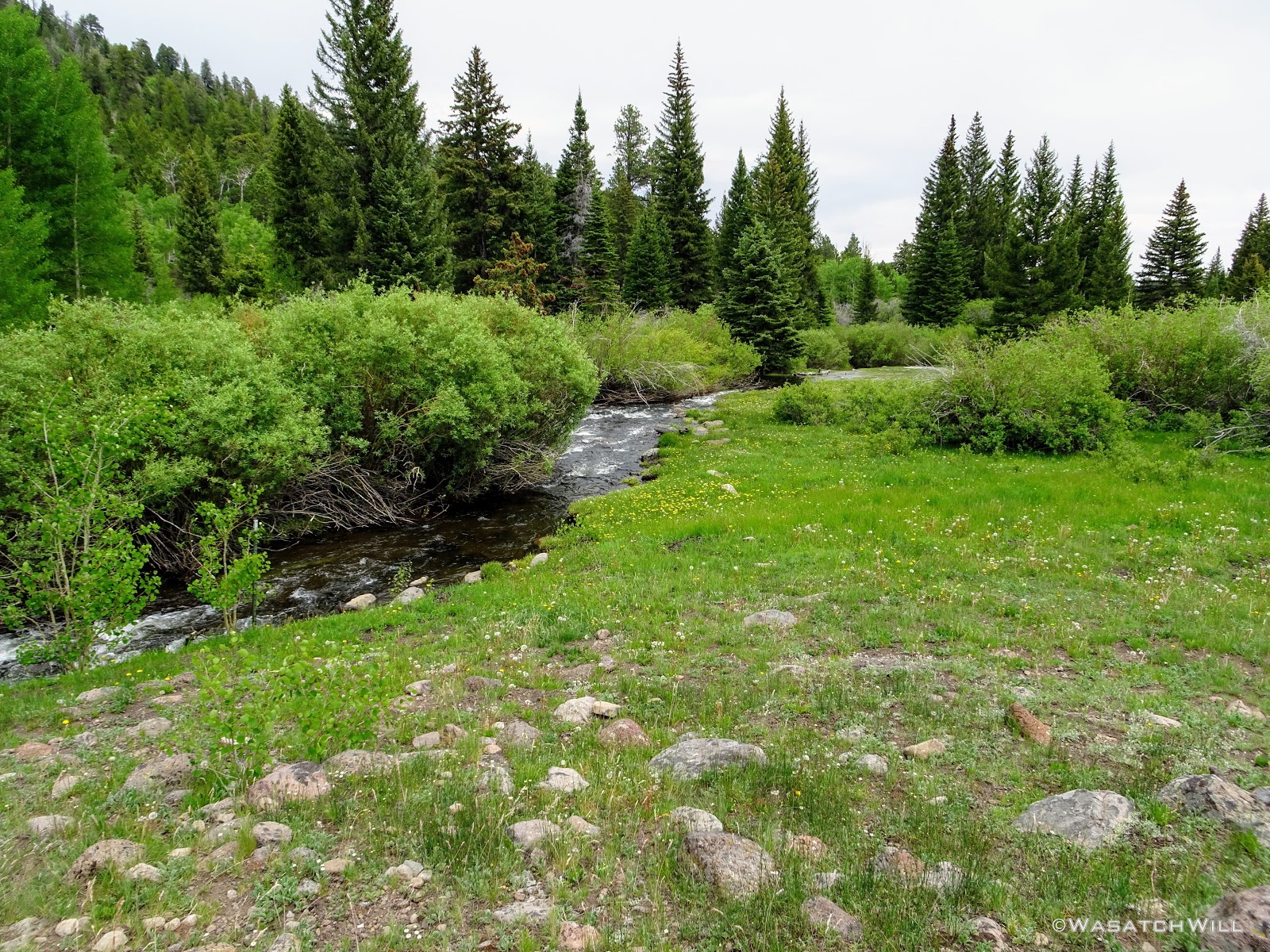
Our route would take us on a lolli-pop loop, but for the first night, we veered off the main trail about a mile up into some big meadows along side of Pleasant Creek to seek out a camp. The area looked promising on satellite maps and we figured we could do a bit of fishing in the creek running through there as well. Both of those thoughts delivered as imagined.
The meadows were pristine and serene, surrounded by a healthy mix of mature aspens and some conifers. We were surprised, stunned even, that we could see no sign of fire rings or camping activity anywhere. Therefore, we wouldn't be changing that with any campfire here of our own.

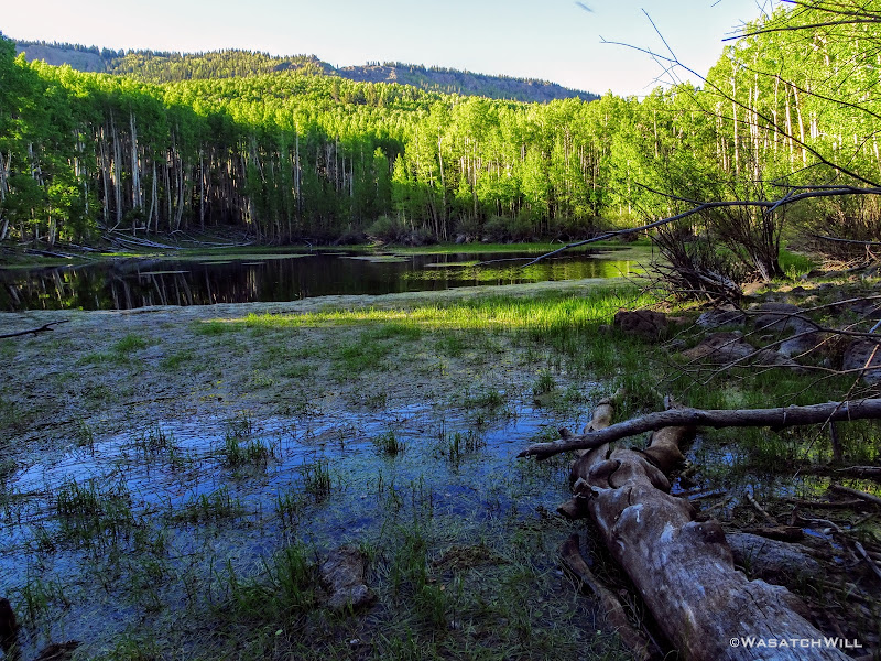
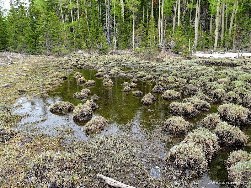
We had a look at Mima Lake before deciding to turn back down the other end of the meadow. Mosquitos were pretty brutal and the marshy little lake would have only made those matters worse to camp anywhere near it.
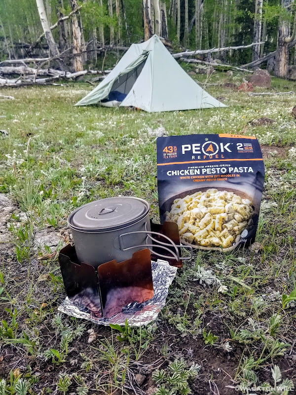
Once we had camp set up, we dove into our dinners. Devin had some extra Peak Refuel meals and offered one of their new flavors for me to try. Chicken Pesto Pasta. It was amazing! Probably the best rehydrated meal in a pouch I've ever had.
We then hung our food and tried a bit of fishing at the creek with what light we had left without much luck before retiring to bed for the night.
Day 2
Saturday - June 29, 2019
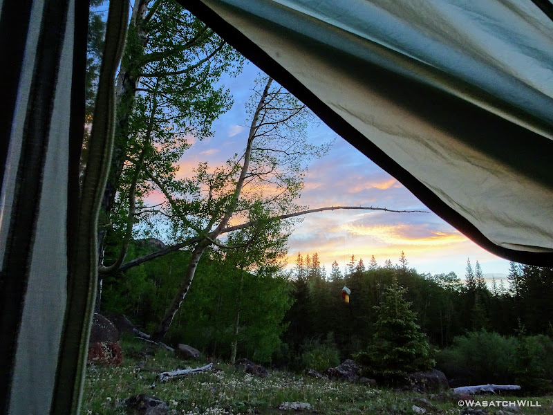
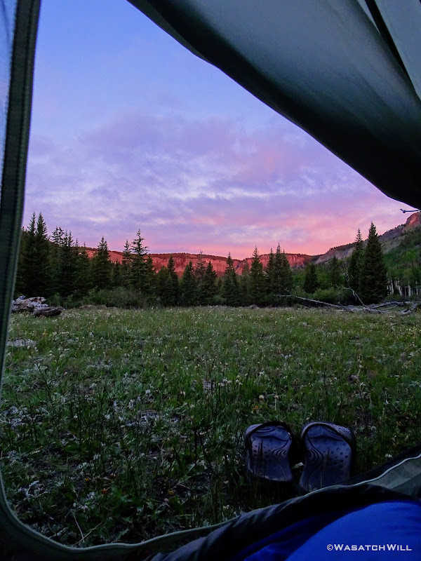
While Devin and Dane opted to sleep in a bit, I chose to wake up for the sunrise. It turned out to be worth the early rise because the colors were pretty great!

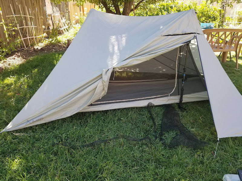
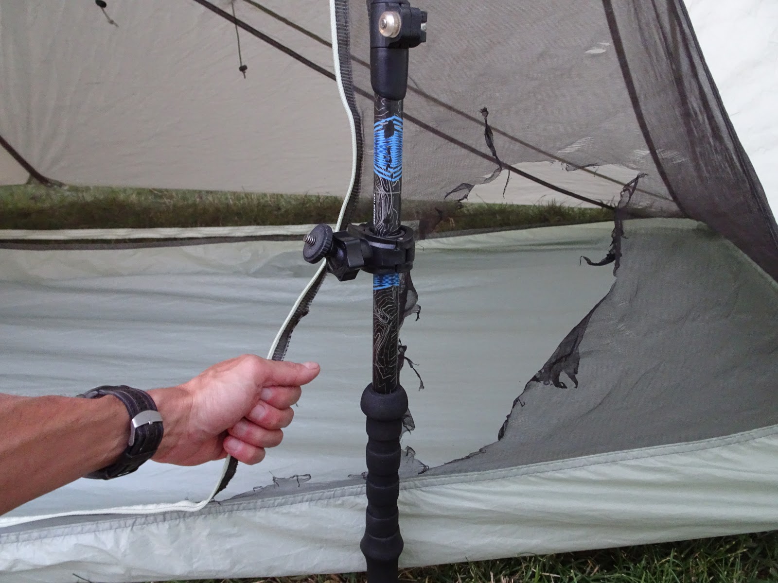
I took the liberty of retrieving our food bags and providing room service with tent-side food deliveries to the other tents. I then returned to my tent where I decided to heat up some water for hot chocolate and oatmeal on my alcohol stove. The plan was to do some reading while the water came to a boil. That turned out to be a big mistake. In taking my attention away from the stove, I failed to realize a breeze had turned up, sending the flames spewing out from the stove out and onto my brand new tent I had just slept in for the first time, despite the stove being a couple feet away from the tent and having a windscreen all the way around it.
"#$%&@!!!"
It was a tent recently ordered from Drop.com called an X-Mid. Fortunately, the flames did not actually get to the fly at all and only melted out some large holes in the inner mesh section of the tent body.
-----------------------------------------------------------------------------------------------------------------
The damages:

I was ultimately able to make a crude repair back home by de-stitching the burned out panels of mesh and sewing in replacements I had cut to shape as best as I could match the old ones.
The repair:
-----------------------------------------------------------------------------------------------------------------
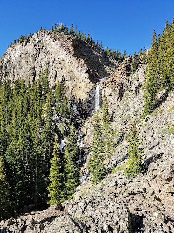
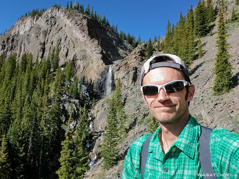
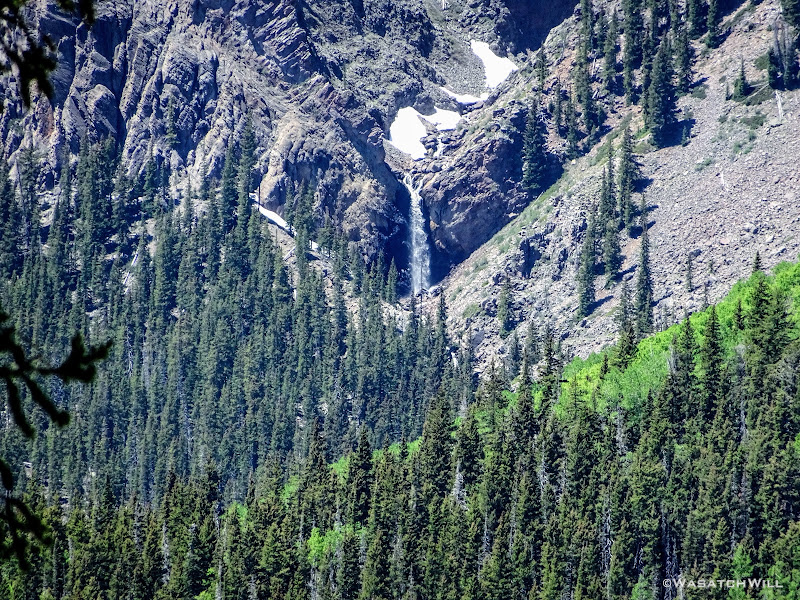
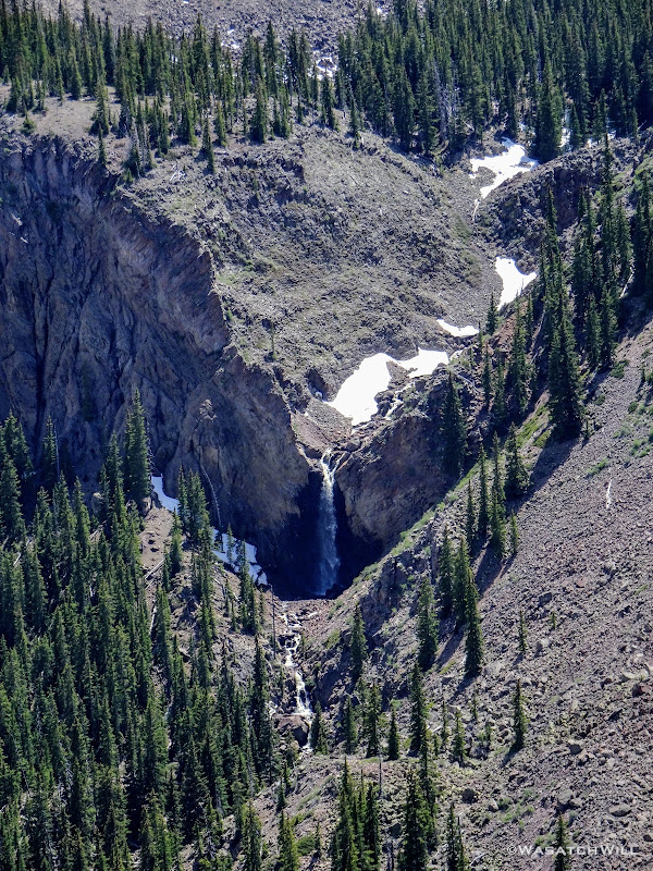
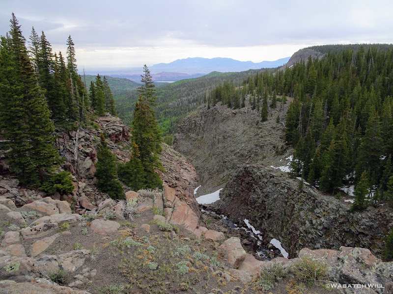
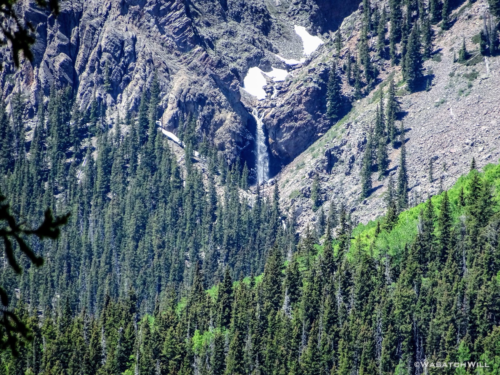
Once Dane and Devin awoke and got to see the aftermath of my little stove incident, we parted ways for the morning. They'd stay back around camp to fish the creek some more, where Devin went on to have great success catching several small fish. Meanwhile, I couldn't resist the temptation to chase down a waterfall looming about a mile and a half up the creek, a waterfall that drained the upper Pleasant Creek Gorge and separated the creek from the high top of the plateau and the lower level of the mountain we were camped at, and one in which we could barely make out in the distance in the cliffs above the treetops to the west.
With my feet armored with a double layer of cushy socks that turned out to really keep my feet much more comfortable through the rest of the trip, I set off on my way.
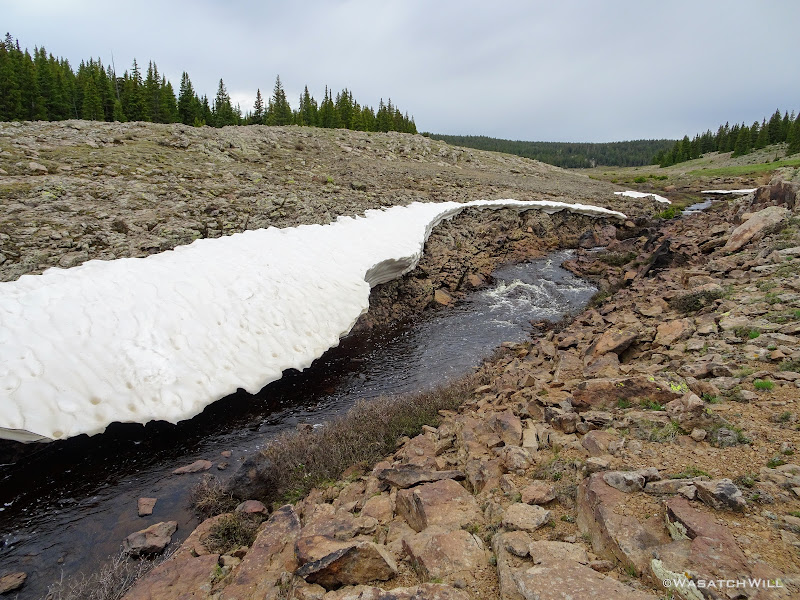
Despite topo maps showing a trail going virtually all the way to very near the falls, my experience found that it pretty much died once past Mima Lake and I was left to navigate the rest of the way with GPS, crossing through several more meadows and over a number of streams and creeks feeding into Pleasant Creek itself, the only one notable on the map being the one draining out of Meeks Draw.
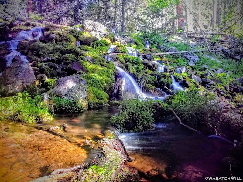
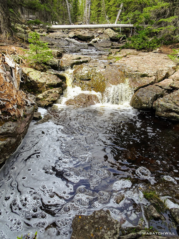
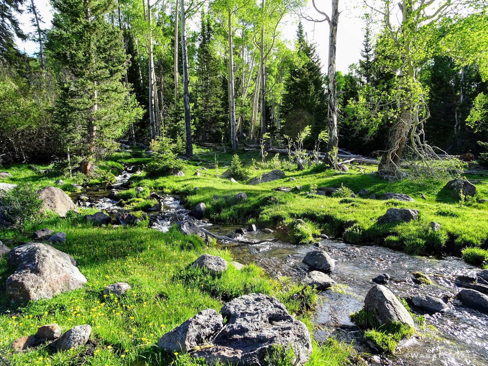
One particular creek crossing featured a gorgeous little cascade descending over green algae covered rocks. So beautiful!
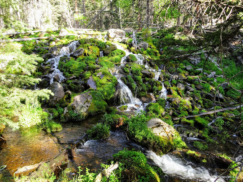
Because I don't typically carry a DSLR kit on backpacking trips, I whipped out a little ND filter I carry for taking long exposures on my phone on occasions just like this.
Moving on, I soon found myself in yet another meadow, this time littered with cattle skeletons.
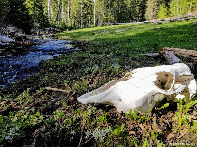
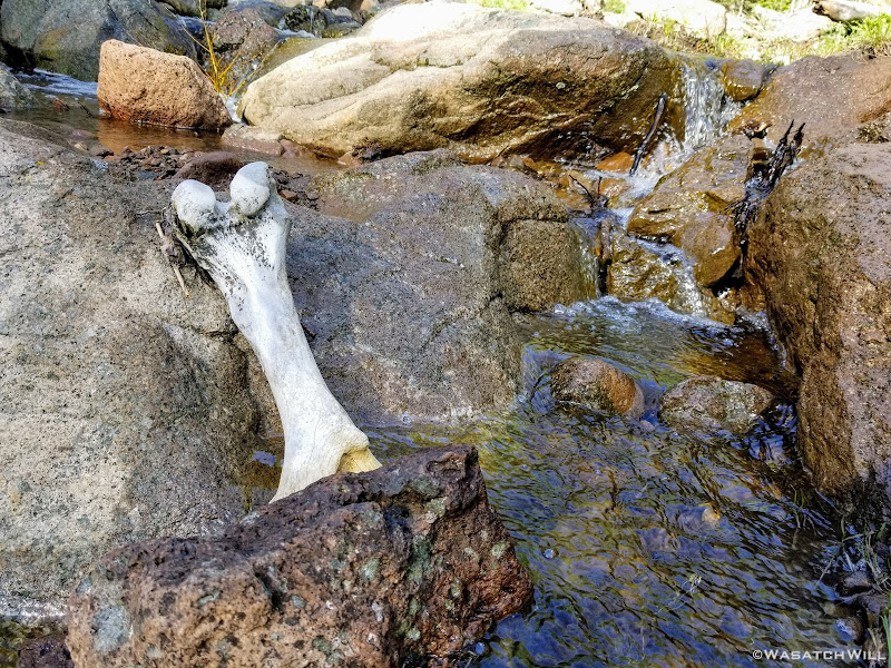
It had been a big long winter, but I'm pretty sure these cows died long before that. I went on to count probably a dozen or so different sets of cattle remains. What a waste of steak and hamburgers!
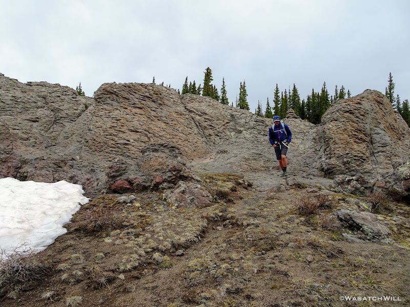
As I continued to gain ground up the creek, it soon sloped steeper upward. In the end, I had to make a couple more creek crossings and scramble up some significant boulder mounds.
And then...mission accomplished!
I now had to return to camp, so back down I went.
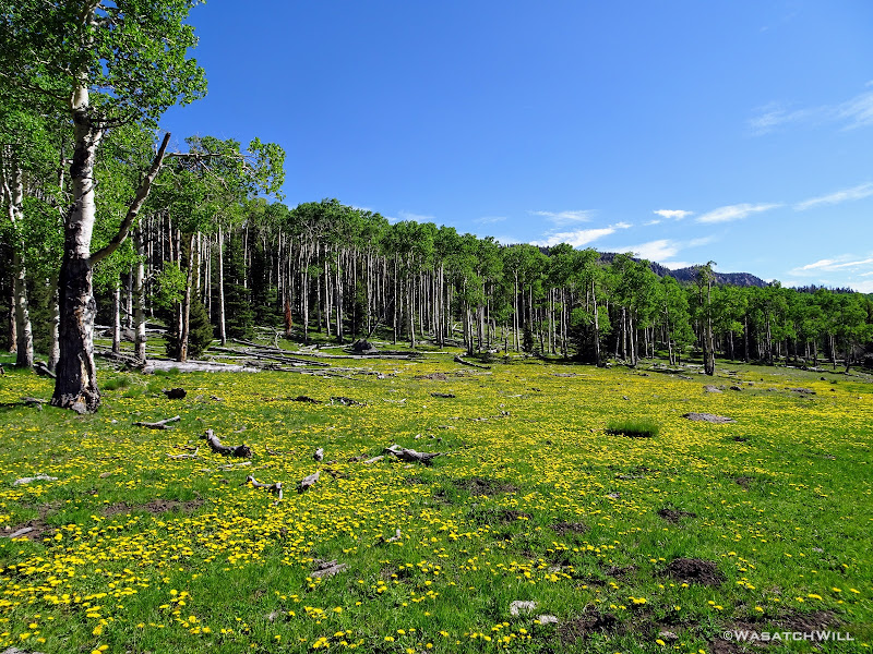
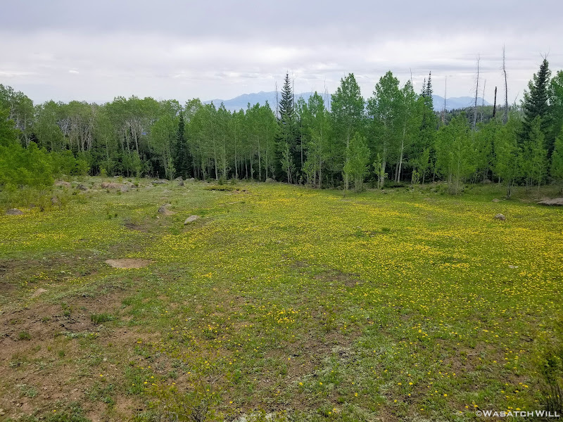
Usually, dandelions are considered a nuisance weed, or so it is in the developed world. But here, they were everywhere and they were welcome, creating a delightful yellow carpet across the meadows. They were indeed, beautiful!
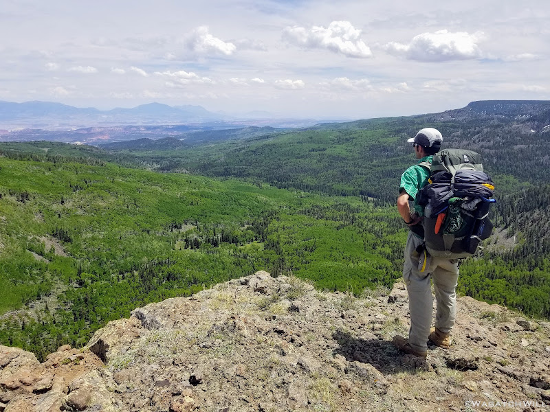
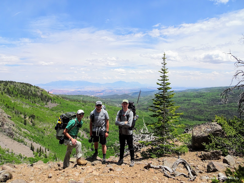
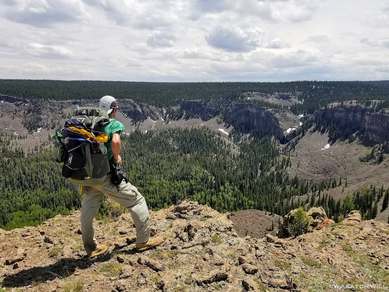
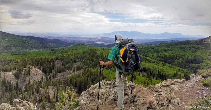
Back at camp, I reunited with Devin and Dane where we tossed our packs back on and began the trek back out to the main trail, then ultimately up to and above the rim. Pleasant Lake was our destination for this day's camp, with over 1000 feet to gain to get to it.
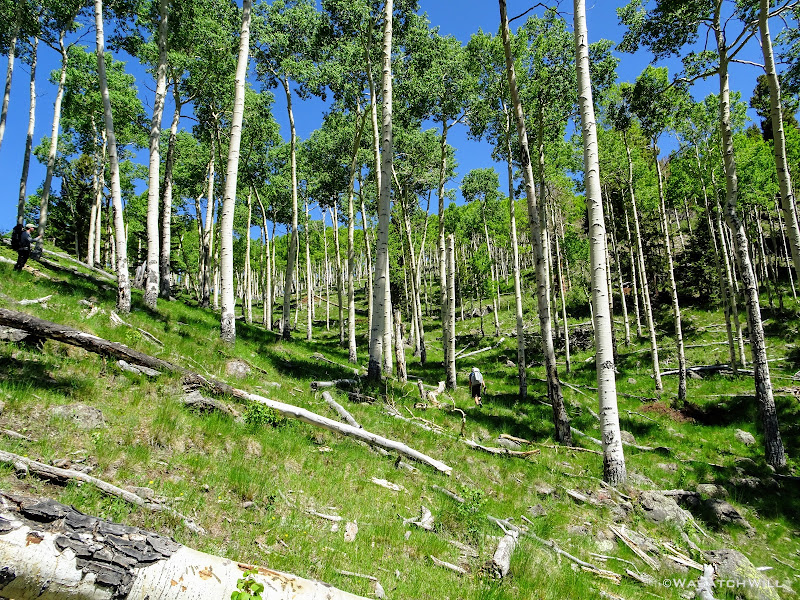
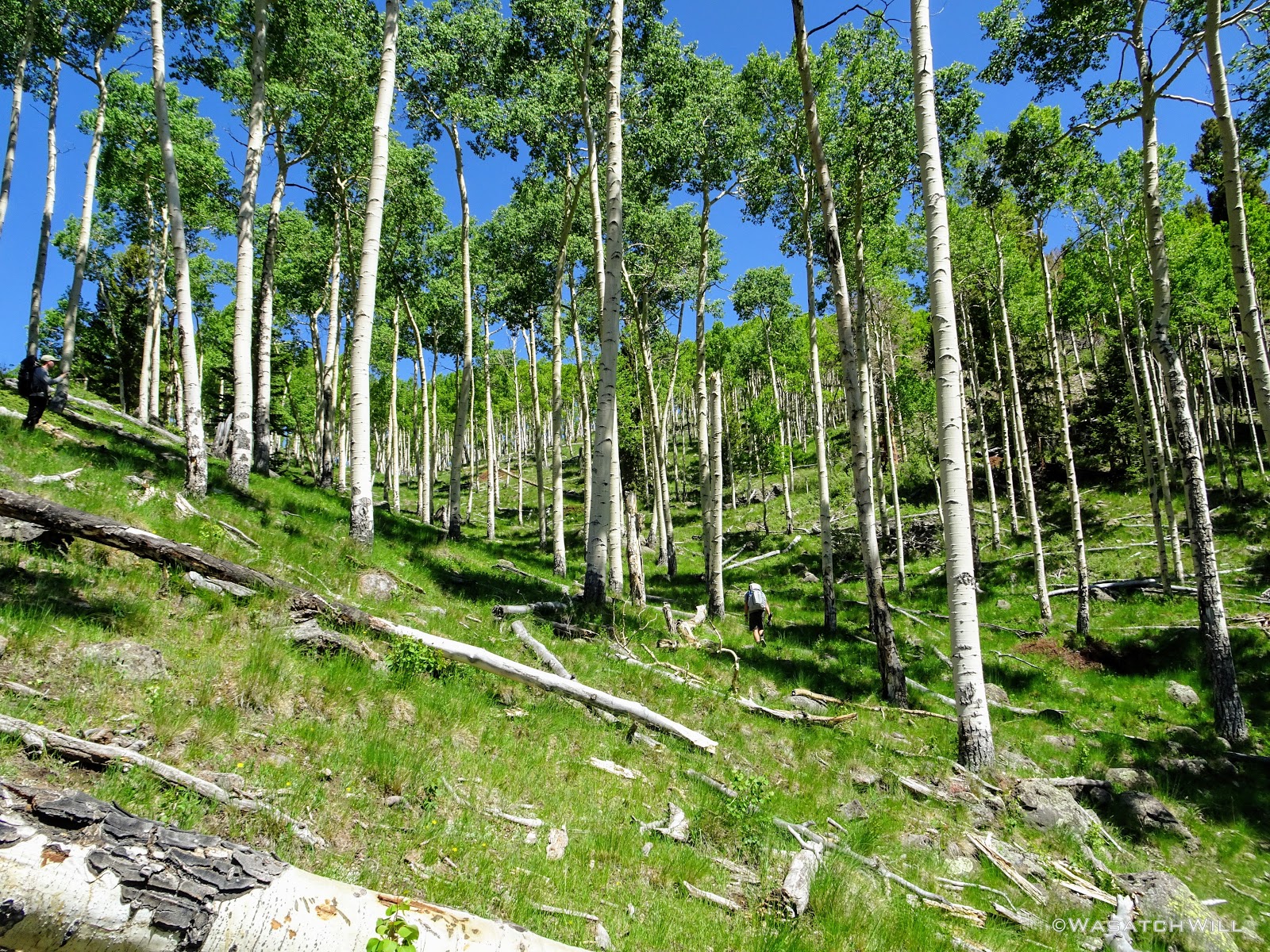
Along the way up to the rim, we'd pass through more groves of tall and vigorous aspens. These trees must have some stories to tell because they were obviously very old. Given their size, they're likely over 200 years old individually, and some sources suggest the root stock from which they spring forth from and which unites the individual trees into a single organism, may be up to 10,000 years old.
TEN THOUSAND YEARS OLD!!!
If that's not impressive enough, read up on Pando, a grove of aspens residing on Boulder Mountain's neighbor to the north, Thousand Lake Mountain, where that grove is determined to be even much older.
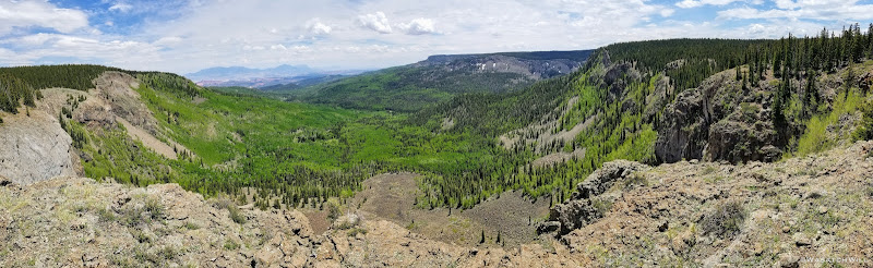
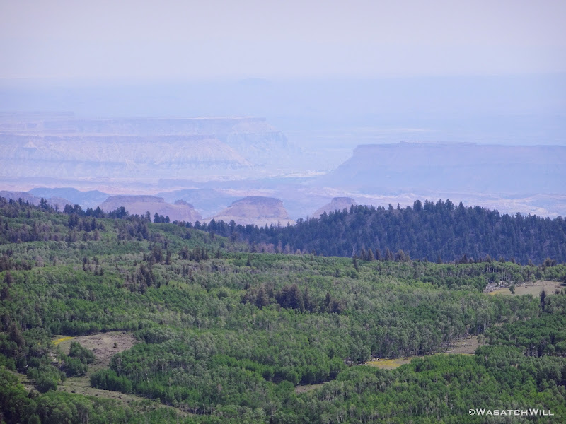
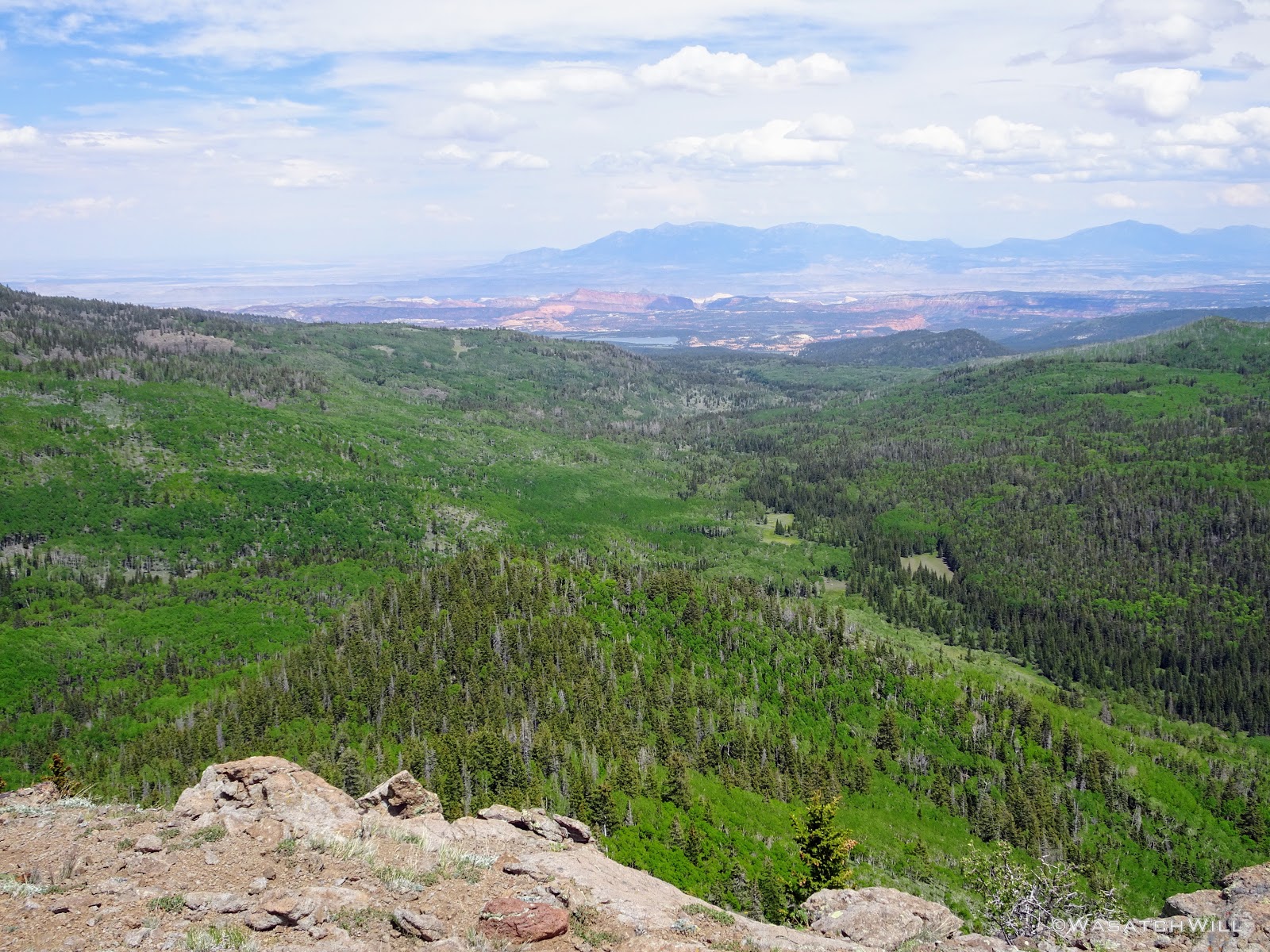
Out of the aspens and near the rim top, the views opened up big time! At some points we could look out and see the waterfall I had just hiked to earlier way back out in the distance.

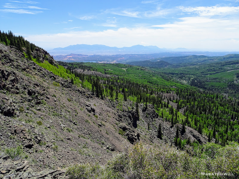
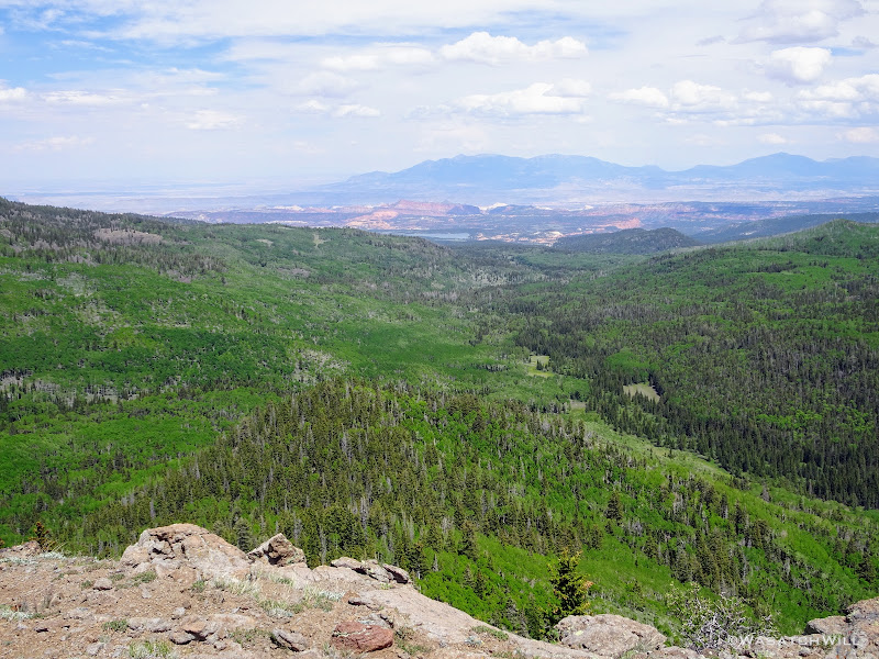
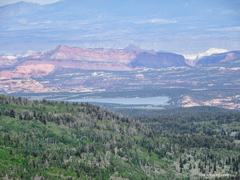
Out the other way lied the Henry Mountains on the horizon and the upper ridges of Capitol Reef National Park's Waterpocket Fold, and closer yet, Lower Bowns Reservoir.
We had not seen anyone since the first mile hiked the evening before until turning the final corner, where we stumbled into a group of around 10 mostly young women all having lunch atop an amazing overlook. We briefly chatted with them and found out they were on their way out from spending 4 days on the same route we were in progress of, only in the reverse direction. We'd not see anyone else again until we were back down near the trailhead the next day.
As we continued on from there, Devin reasoned that they had made up a wilderness therapy and rehab group consisting of a couple adult counselors and the rest likely being some at-risk youth in troubled circumstances.
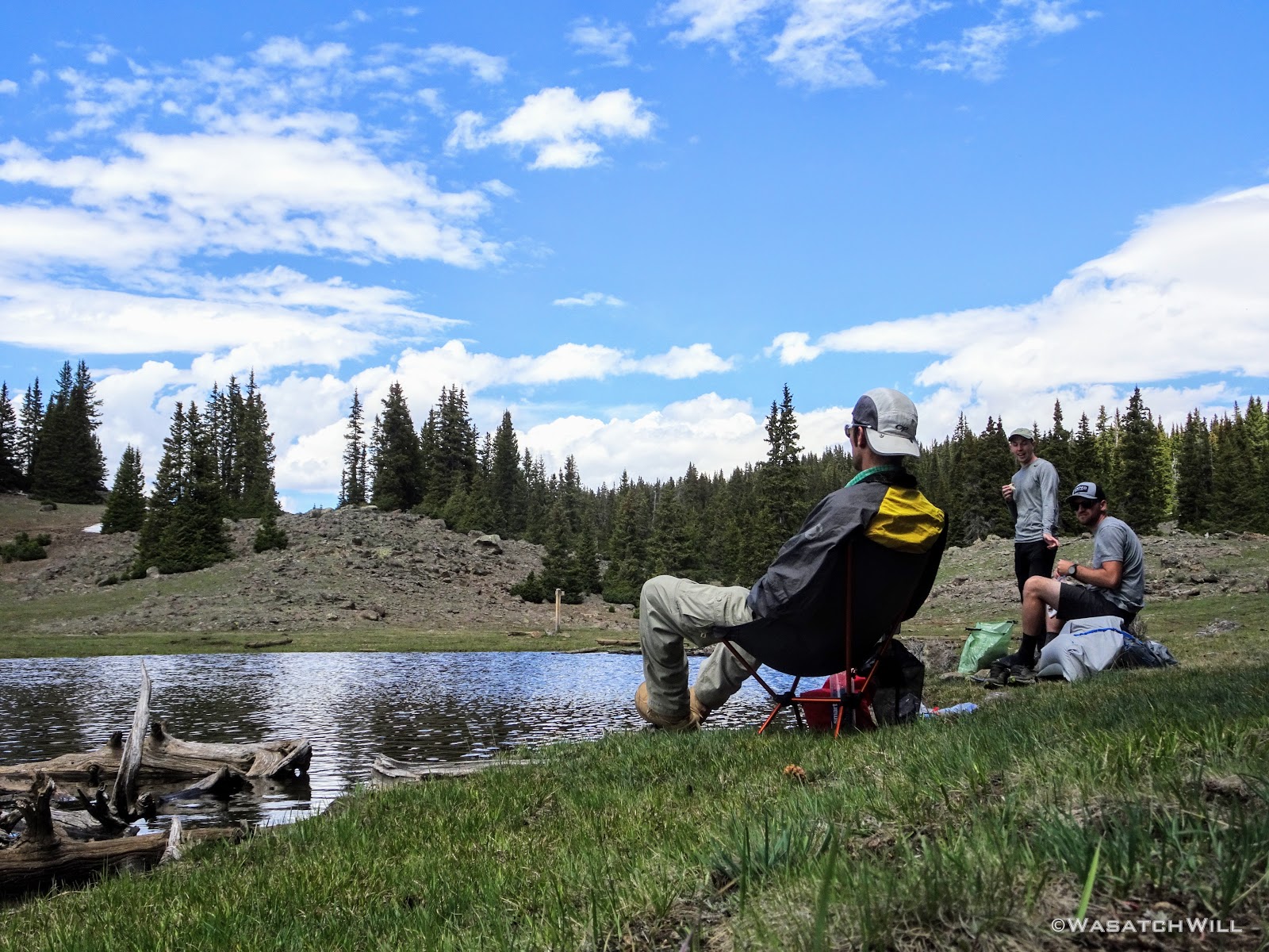
A short while later, we arrived at the shore of Meeks Lake where we paused for a nice long lunch break.

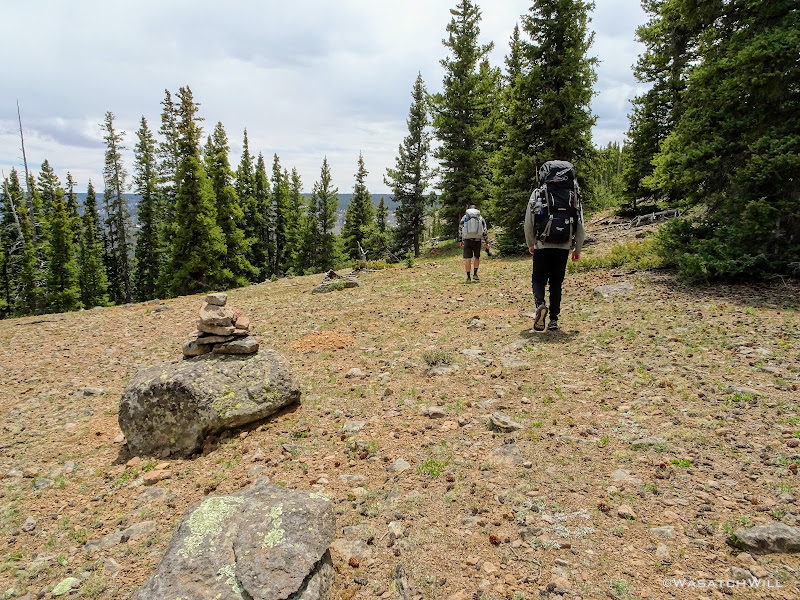
From there we returned to the edge of the rim and zig-zagged back and forth with it as we finished out the final leg over to Pleasant Lake. The trail would go from being very apparent through some sections to just a series of cairns and blazes on trees you had to keep an eye out for through other sections. Needless to say, we found it hard to make out cairns and blazes in spots, and when we realized we were probably off course a bit along those spots, we often had to pull out our phones to correct ourselves with our pre-loaded GPS maps. Just the way I like it!
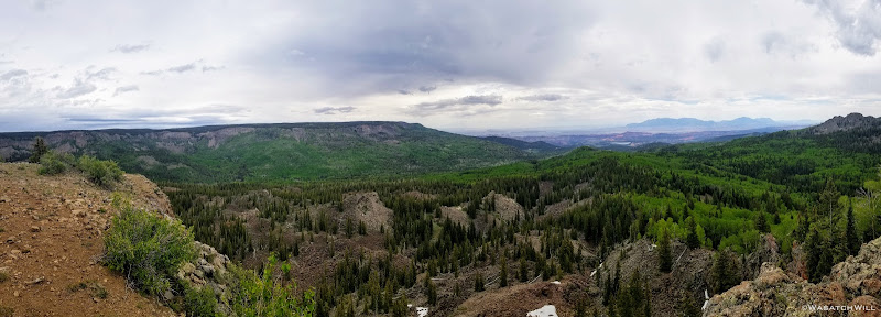
A couple more points along the rim presented us with more amazing, panoramic views. This was the the first...
And this was the next, about a mile later...
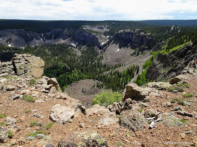
Facing one way, we could again look down and see the waterfall down in the distance dropping off the gorge and down the cliffs.
And the other way, again, the Henry Mountains, Capitol Reef, Lower Bowns Reservoir...
...and closer down, the meadow we had camped in the night before.
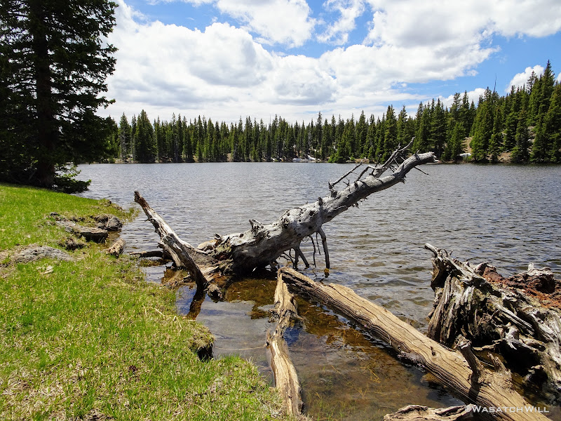
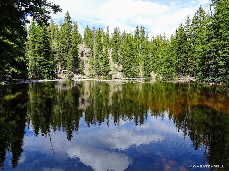
Just prior to arriving at Pleasant Lake, we passed by a few other small nameless lakes that were roaring with croaking frogs, but despite the overwhelming sound of them, we failed to spot any.
Finally, we crested up over a small hill that brought us to the edge of Pleasant Lake.
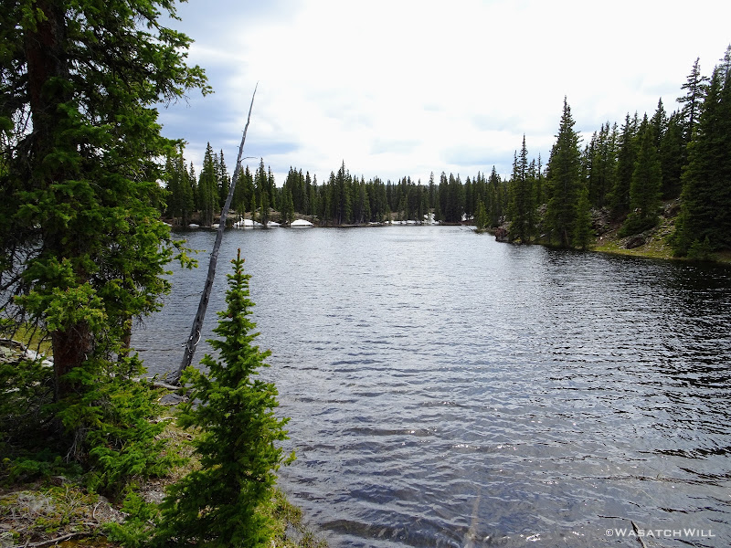
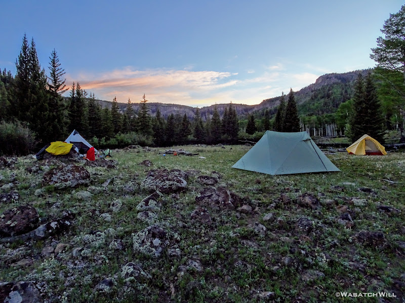
We scouted all around for an appropriate campsite and settled on the best we could find, which was a little closer to the lake than desired. Fortunately, the road to Pleasant Creek Meadows behind us was still snowed over so we had the entire area all to ourselves.
Once we got camp set up, we immediately got our fishing poles out and went about the lake trying to fish all the good looking spots. Not one of us ever got a hit of any sort. Through the evening, we never did see or hear a fish jump or brush the surface of the water, but we did count several fish carcasses lining the edge of the lake just under the water's surface. We concluded the lake must have suffered a complete winter kill.
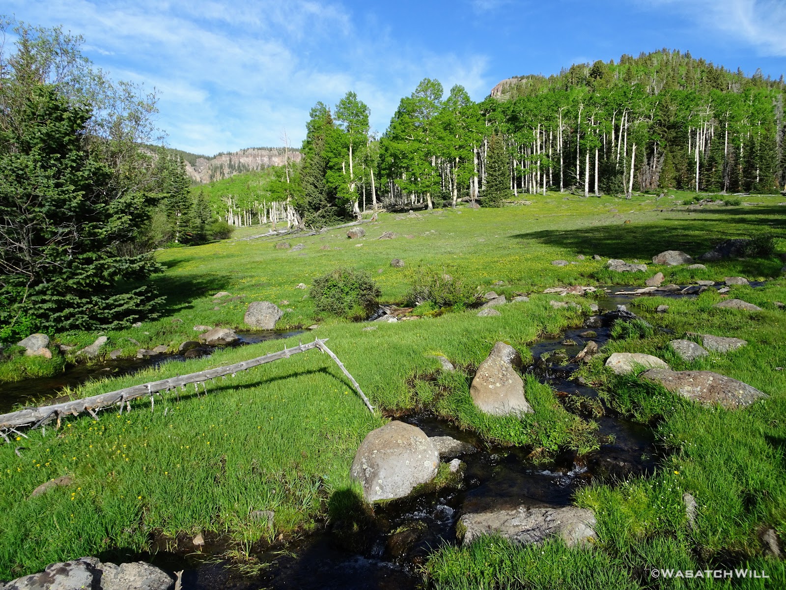
Having given up on the fishing, I wandered out to Pleasant Creek Meadows back out behind our camp. It was neat seeing how the remaining snow banks along the creek had been shaped and eroded.

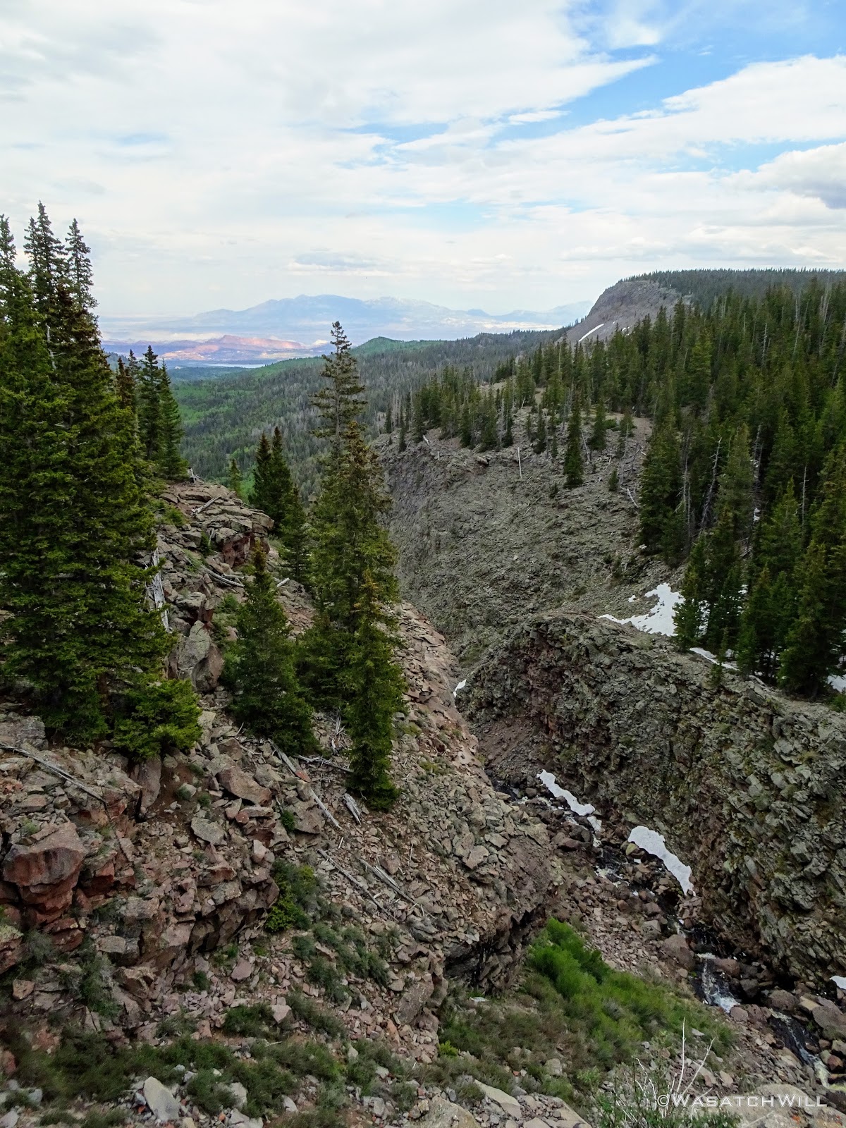
I followed the creek out to where it swiftly descended down to the gorge that then descended to the waterfall below and out of sight.

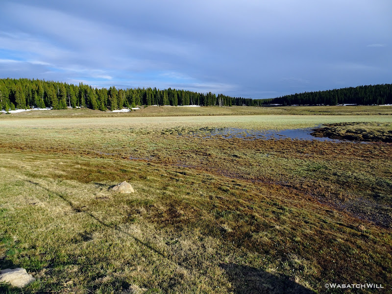
After taking in that view for a while, I went back up to camp where we all had our dinners. With a good bit of daylight left, we all decided to go back out to the meadow and go up creek in the other direction. There the meadow really opened up to become a massive wide open space.

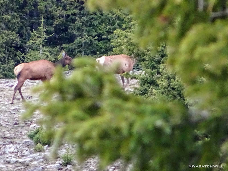
At the far edge of the meadow were a few female elk grazing about.
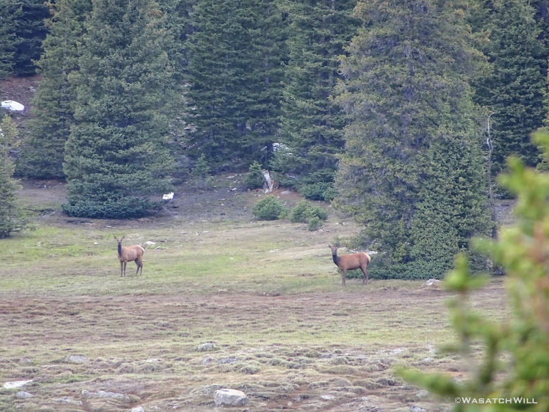
Devin had the idea to skirt around the edge of the meadow through the trees in an attempt to get some closer shots of them on camera. I soon followed around behind but by the time I reached a good spot, they had decided to move along deeper into the trees themselves.
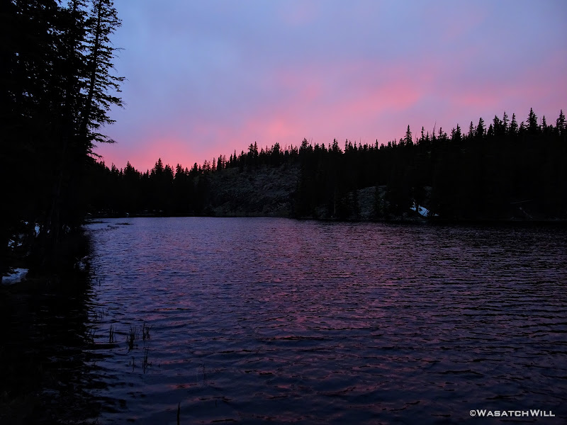
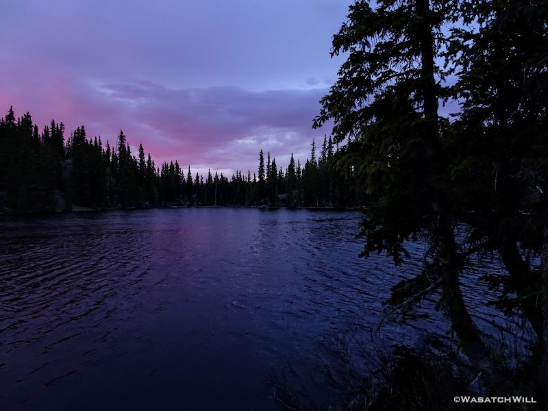
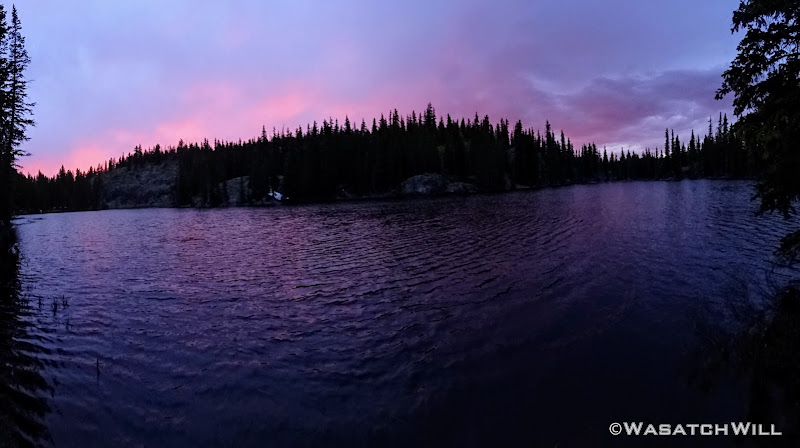
Satisfied with a good session of wildlife viewing, we returned to camp to settle down for the evening and were treated to a nice light show in the clouds after the sun had set. It was a big surprise because by then, it had become mostly overcast, leading us to think the sunset would not amount to much.
We had ourselves a brief little fire in an already erected fire pit at our site along with some hot chocolate to close out the night.
Day 3
Sunday - June 30, 2019
Our final day began with the skies more overcast. We had actually gotten a few light showers that passed over us through the earlier hours of the morning. There was no sign of the sun coming through to shine anytime soon, so we had to pack up wet tents and put on some apparel to shed the moderate but blustery wind blowing up into our camp and through the meadows. On our way out to finish out our route, I lead Dane and Devin back out to the overlook at the bottom edge of the meadow I had visited the night before.
Back up creek, we found a suitable place to cross over and crested over a unique and neat little rocky spine before disappearing back into the trees, where we welcomed the natural wind break they provided.
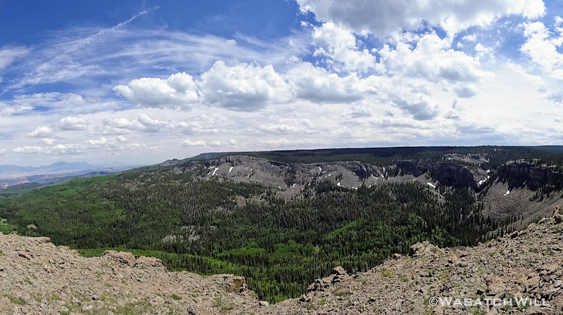
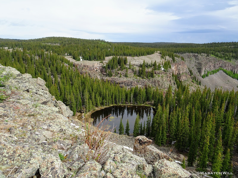
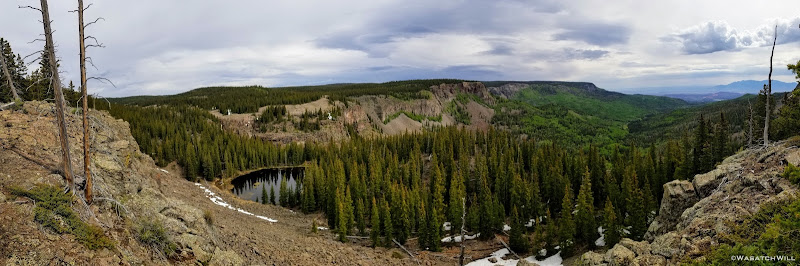
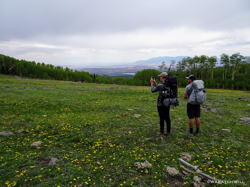
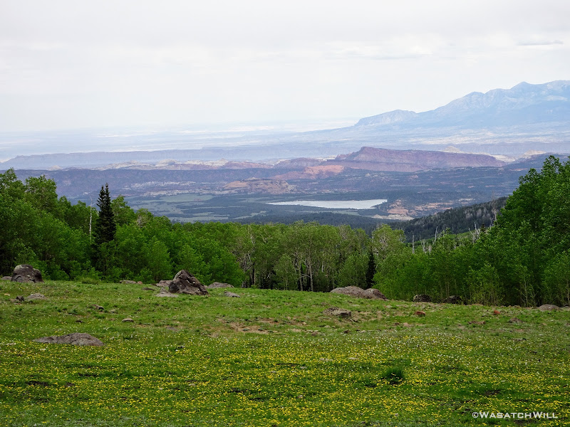
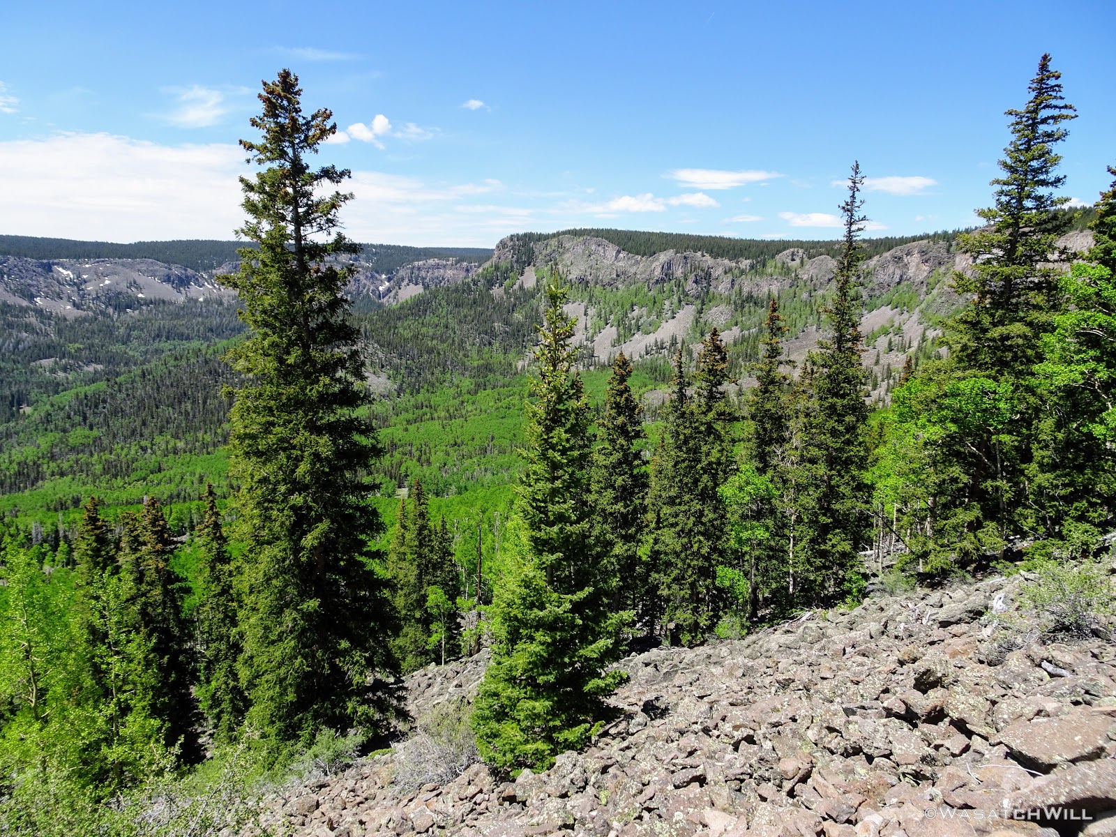
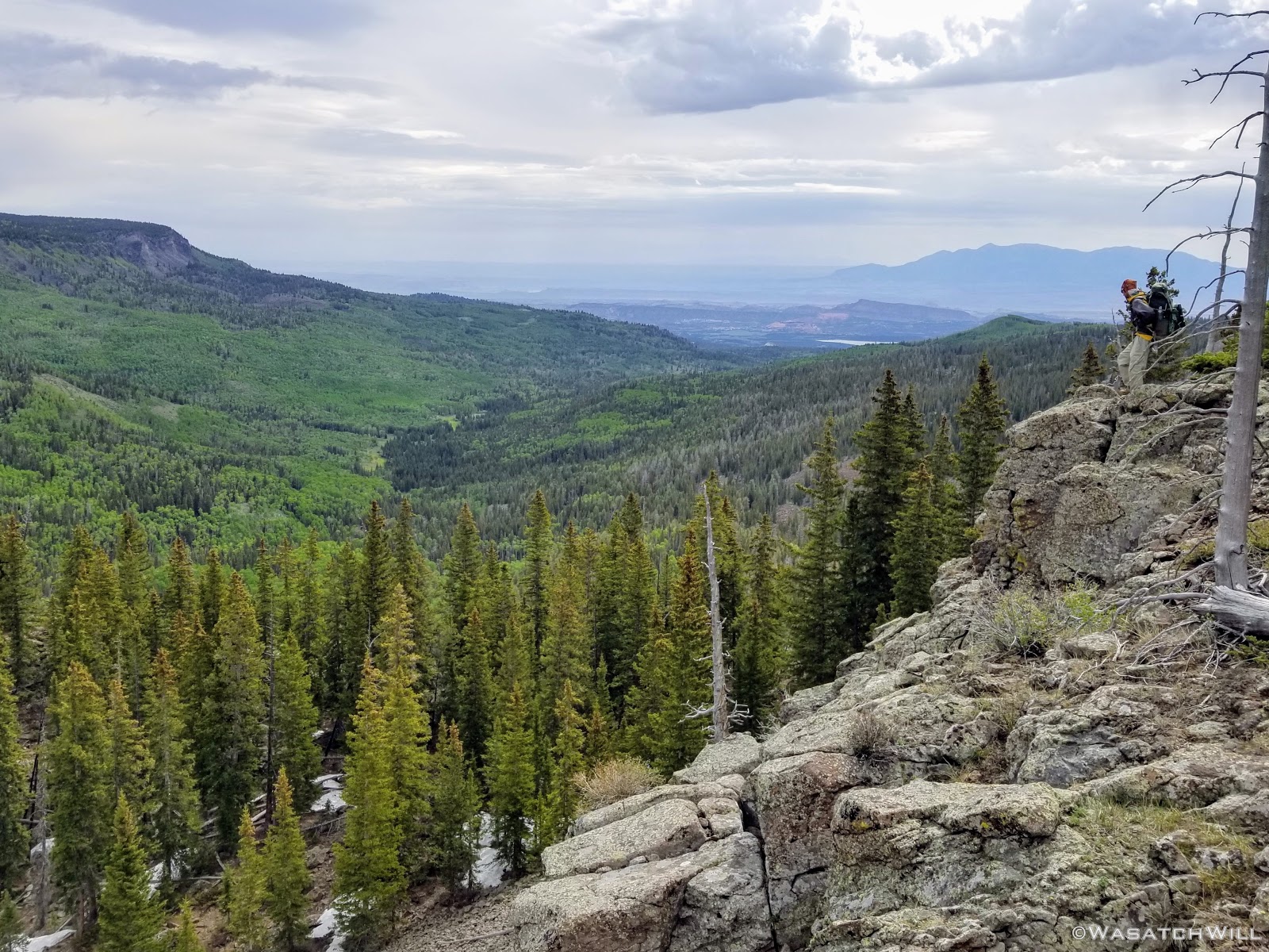
A couple miles mixed in with some more route finding brought us to yet another grand overlook along the edge of the rim. At this point, the weather started turning for the better as well, showing the promise of sunny skies to come. We enjoyed more views of the drainage we were ultimately circling around with this trip. A small nameless lake or large pond lied down below.

From that viewpoint, it was back into the trees, then back to the rim, and back into the trees, and so the story goes. The pattern was interrupted once with yet another creek crossing, that which drains out of Long Draw.
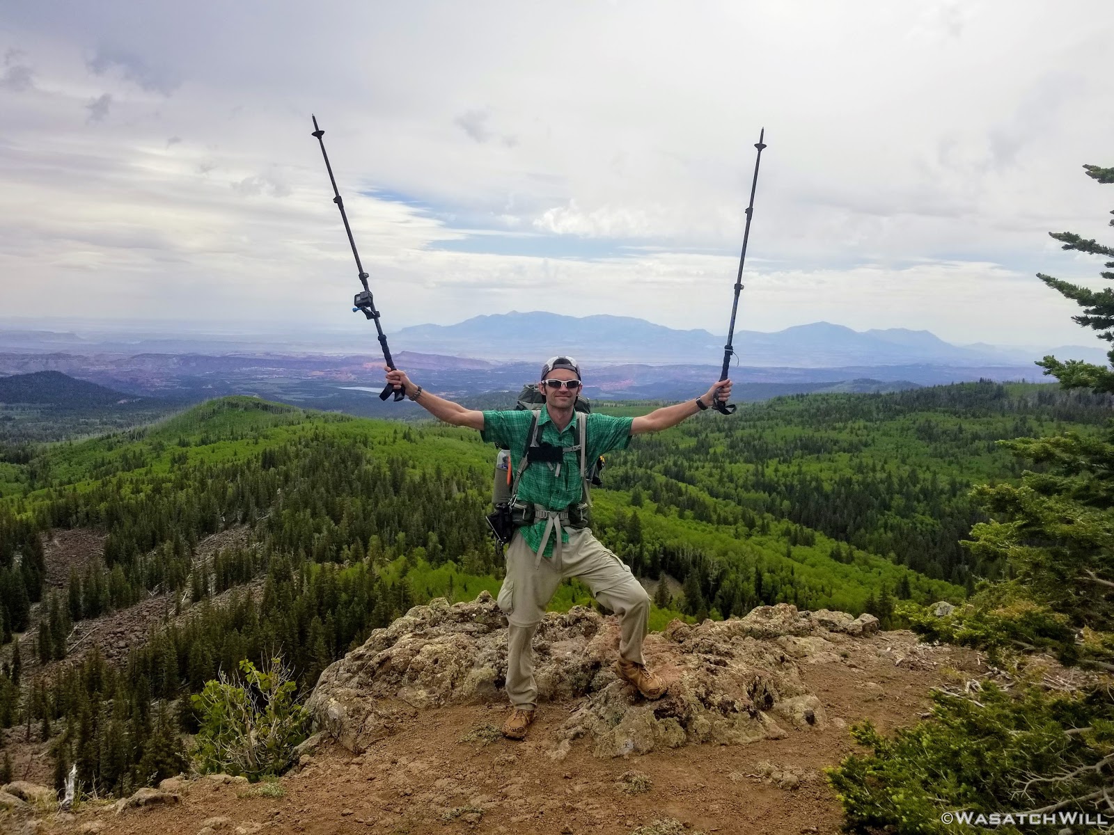
At one point out along the rim, we were able to look out and see the top of Capitol Reef's Golden Throne way out in the distance and even Factory Butte along the hazy horizon.
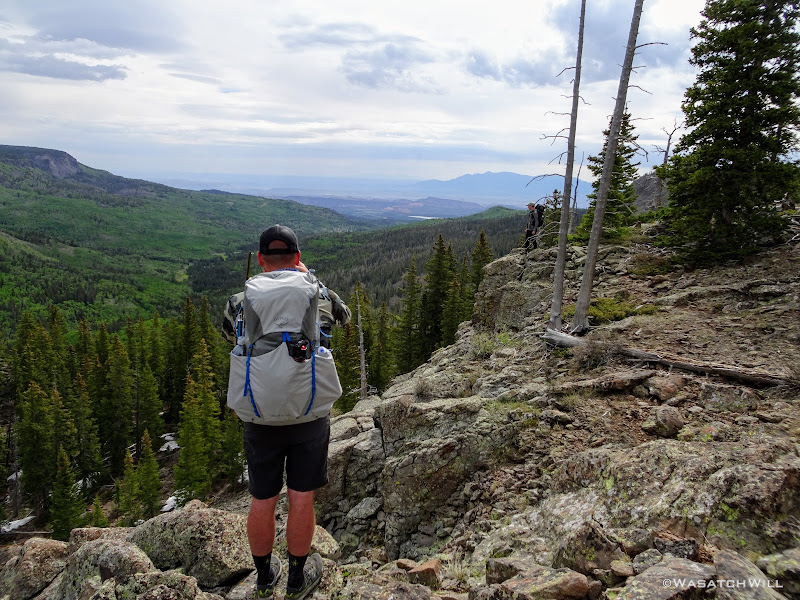
A little further on, and bang! One final view to end all views along the rim top before descending back down off the rim. And what a finale of a view it was! It was a no brainer to sit down and make that our lunch stop.
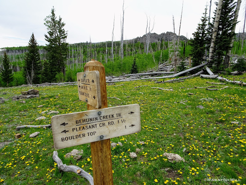
With our tummies satisfied, it was time to drop down off the rim and close out the loop and thus our trip. We had ambitions at the beginning of the trip to consider extending out the ridge walk to Bown Point, then coming down off the ridge from there, but opted to keep it conservative and descend down the Behunin Trail.
The way down provided another healthy mix of lush green groves of aspens and conifers broken up by peaceful meadows, both large and small. And yet, despite being on on the same side of the mountain with the same kind of vegetation, this trail down presented with a different personality from the one we took up which continued to keep things interesting and new.
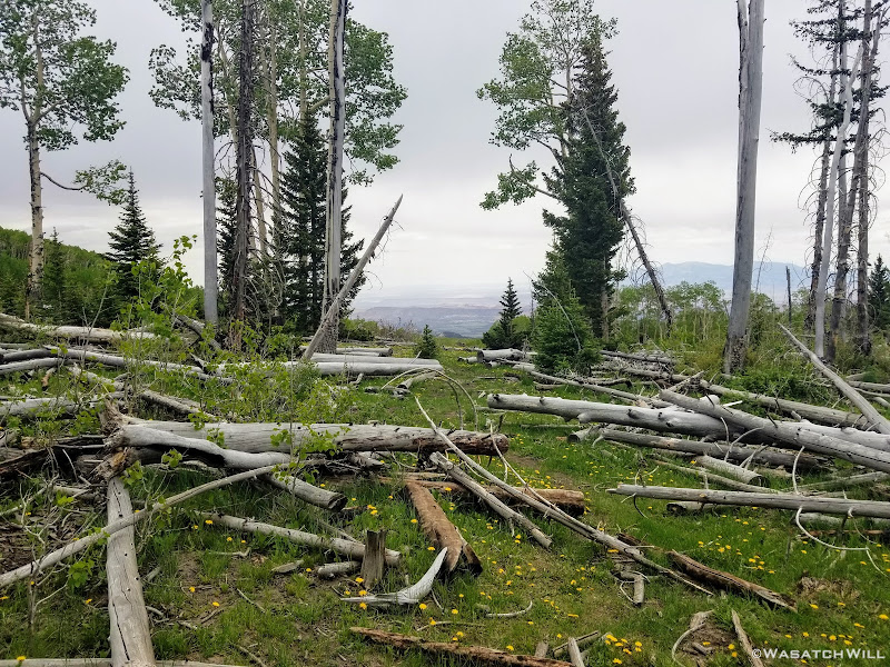
The grandaddy of all the meadows along the way down, Bear Flat, was about half way down. Oddly, this meadow was also surrounded by numerous dead tree trunks, unlike anywhere else along the route we had experienced up to this point,
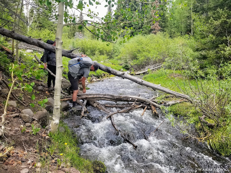
Another mile more brought us to one final crossing of Pleasant Creek.
It would've been a pretty effortless crossing had we just dunked our feet right through it. But no...our instinct to keep our feet warm and dry caused us to come up with a more creative solution: throw some downed logs and branches across a narrow spot and give ourselves a bit of a bridge.
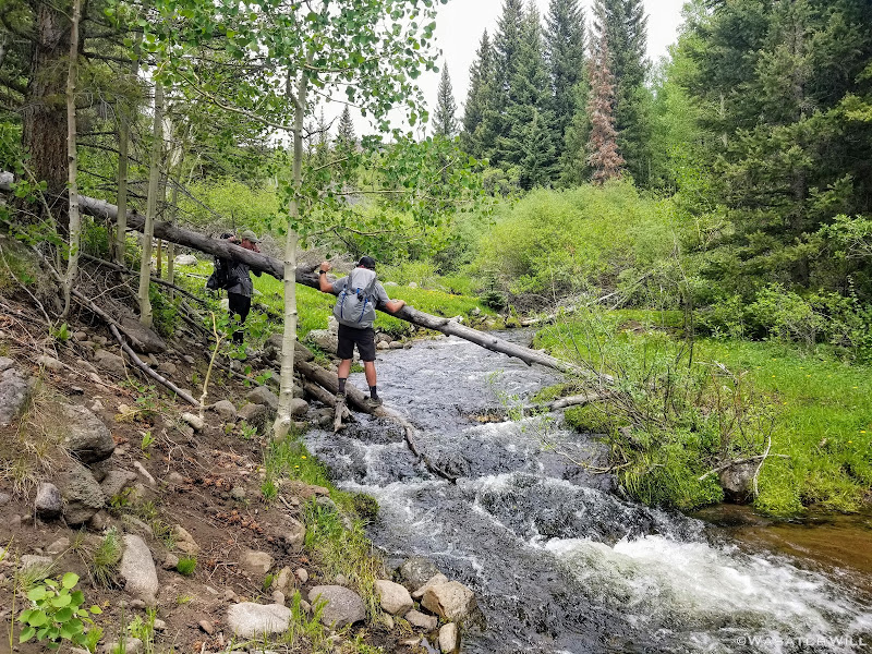
So that we did...
Having crossed and successfully preserved our dry feet, all we had to do was relink with the end of the high clearance dirt road and hike another mile and a half down it back to the car.
We made one final stop in Torrey for an early dinner to wrap up the trip prior to the drive back home.
I now feel fortunate to have backpacked the lower sections of Pleasant Creek where it runs into and through Capitol Reef National Park in addition to all along and around its head waters now. I've experienced it in two radically different worlds. Similar to a course that the Colorado and Green Rivers follow on a much larger scale, it is incredible to think that the same Pleasant Creek along the high rim of Boulder Mountain at almost 11,000 feet up in a high alpine environment is the same creek that runs through red rock and sandy desert as it cuts through Capitol Reef's Waterpocket Fold, ultimately descending nearly 6000 feet over a 30 mile course where it joins up with the Fremont River on the eastern flanks of Capitol Reef.
DAD JOKE: And as with my other trips along those lower stretches of Pleasant Creek, what a pleasant trip full of many pleasant surprises this trip turned out to be along the upper reaches of Pleasant Creek and Pleasant Lake.
I'm already looking forward to a day where I can take my wife up along this same route.
Video:
That changed this summer when my friend Devin reached out wanting to do a early season trip up into the Uintas. The snowmelt and high run-off factor as a result of the big winter we had ultimately scared us off from that idea though and so he came up with an idea to go backpacking down on Boulder Mountain. And what an idea that turned out to be! We made it happen and I was utterly blown away with how how much more awesome that mountain was than I could have ever imagined. Devin's friend, Dane, would join up with us, and thus, plans were finalized.
Day 1
Friday - June 28, 2019
The route chosen would take us to the Pleasant Creek trailhead right off the highway. Rather than attempt the high clearance dirt road another mile up from the highway, we opted to park right there by the highway with Devin's sedan, and just hike the road.
Right as I put on my hiking shoes, I instantly realized something wasn't right.
"Oh no! I don't have any insoles in these shoes. I must have transplanted them to another pair back home and forgot to move them back. Dang!"
Welp! There was no turning back now. We only had to hike about 3.5 miles or so to the area we'd seek to establish our first camp, so I just carried on as a sole-less hiker.
Our route would take us on a lolli-pop loop, but for the first night, we veered off the main trail about a mile up into some big meadows along side of Pleasant Creek to seek out a camp. The area looked promising on satellite maps and we figured we could do a bit of fishing in the creek running through there as well. Both of those thoughts delivered as imagined.
The meadows were pristine and serene, surrounded by a healthy mix of mature aspens and some conifers. We were surprised, stunned even, that we could see no sign of fire rings or camping activity anywhere. Therefore, we wouldn't be changing that with any campfire here of our own.

We had a look at Mima Lake before deciding to turn back down the other end of the meadow. Mosquitos were pretty brutal and the marshy little lake would have only made those matters worse to camp anywhere near it.

Once we had camp set up, we dove into our dinners. Devin had some extra Peak Refuel meals and offered one of their new flavors for me to try. Chicken Pesto Pasta. It was amazing! Probably the best rehydrated meal in a pouch I've ever had.

We then hung our food and tried a bit of fishing at the creek with what light we had left without much luck before retiring to bed for the night.

Day 2
Saturday - June 29, 2019
While Devin and Dane opted to sleep in a bit, I chose to wake up for the sunrise. It turned out to be worth the early rise because the colors were pretty great!


I took the liberty of retrieving our food bags and providing room service with tent-side food deliveries to the other tents. I then returned to my tent where I decided to heat up some water for hot chocolate and oatmeal on my alcohol stove. The plan was to do some reading while the water came to a boil. That turned out to be a big mistake. In taking my attention away from the stove, I failed to realize a breeze had turned up, sending the flames spewing out from the stove out and onto my brand new tent I had just slept in for the first time, despite the stove being a couple feet away from the tent and having a windscreen all the way around it.
"#$%&@!!!"
It was a tent recently ordered from Drop.com called an X-Mid. Fortunately, the flames did not actually get to the fly at all and only melted out some large holes in the inner mesh section of the tent body.
-----------------------------------------------------------------------------------------------------------------
The damages:
I was ultimately able to make a crude repair back home by de-stitching the burned out panels of mesh and sewing in replacements I had cut to shape as best as I could match the old ones.
The repair:

-----------------------------------------------------------------------------------------------------------------
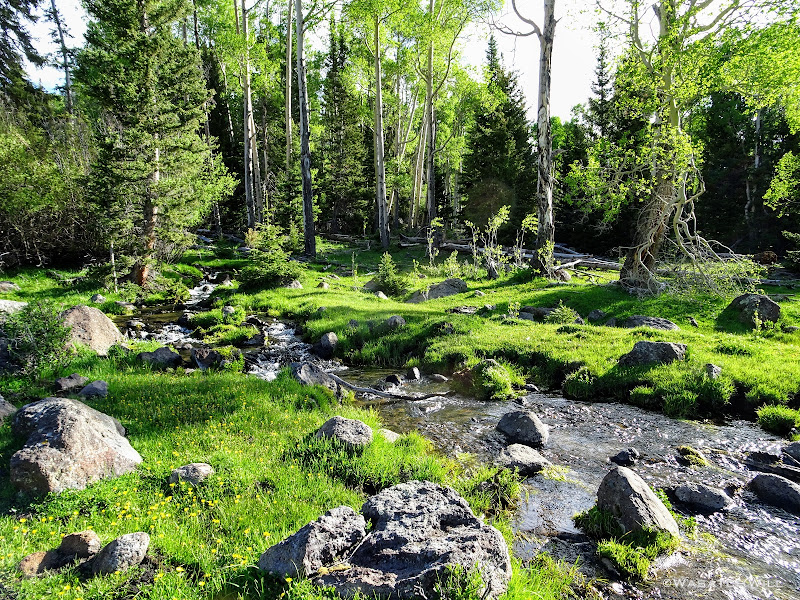
Once Dane and Devin awoke and got to see the aftermath of my little stove incident, we parted ways for the morning. They'd stay back around camp to fish the creek some more, where Devin went on to have great success catching several small fish. Meanwhile, I couldn't resist the temptation to chase down a waterfall looming about a mile and a half up the creek, a waterfall that drained the upper Pleasant Creek Gorge and separated the creek from the high top of the plateau and the lower level of the mountain we were camped at, and one in which we could barely make out in the distance in the cliffs above the treetops to the west.
With my feet armored with a double layer of cushy socks that turned out to really keep my feet much more comfortable through the rest of the trip, I set off on my way.
Despite topo maps showing a trail going virtually all the way to very near the falls, my experience found that it pretty much died once past Mima Lake and I was left to navigate the rest of the way with GPS, crossing through several more meadows and over a number of streams and creeks feeding into Pleasant Creek itself, the only one notable on the map being the one draining out of Meeks Draw.


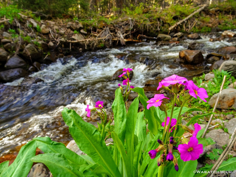
One particular creek crossing featured a gorgeous little cascade descending over green algae covered rocks. So beautiful!

Because I don't typically carry a DSLR kit on backpacking trips, I whipped out a little ND filter I carry for taking long exposures on my phone on occasions just like this.

Moving on, I soon found myself in yet another meadow, this time littered with cattle skeletons.


It had been a big long winter, but I'm pretty sure these cows died long before that. I went on to count probably a dozen or so different sets of cattle remains. What a waste of steak and hamburgers!
As I continued to gain ground up the creek, it soon sloped steeper upward. In the end, I had to make a couple more creek crossings and scramble up some significant boulder mounds.
And then...mission accomplished!


I now had to return to camp, so back down I went.
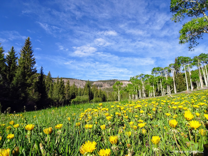
Usually, dandelions are considered a nuisance weed, or so it is in the developed world. But here, they were everywhere and they were welcome, creating a delightful yellow carpet across the meadows. They were indeed, beautiful!

Back at camp, I reunited with Devin and Dane where we tossed our packs back on and began the trek back out to the main trail, then ultimately up to and above the rim. Pleasant Lake was our destination for this day's camp, with over 1000 feet to gain to get to it.
Along the way up to the rim, we'd pass through more groves of tall and vigorous aspens. These trees must have some stories to tell because they were obviously very old. Given their size, they're likely over 200 years old individually, and some sources suggest the root stock from which they spring forth from and which unites the individual trees into a single organism, may be up to 10,000 years old.
TEN THOUSAND YEARS OLD!!!
If that's not impressive enough, read up on Pando, a grove of aspens residing on Boulder Mountain's neighbor to the north, Thousand Lake Mountain, where that grove is determined to be even much older.
Out of the aspens and near the rim top, the views opened up big time! At some points we could look out and see the waterfall I had just hiked to earlier way back out in the distance.
Out the other way lied the Henry Mountains on the horizon and the upper ridges of Capitol Reef National Park's Waterpocket Fold, and closer yet, Lower Bowns Reservoir.

We had not seen anyone since the first mile hiked the evening before until turning the final corner, where we stumbled into a group of around 10 mostly young women all having lunch atop an amazing overlook. We briefly chatted with them and found out they were on their way out from spending 4 days on the same route we were in progress of, only in the reverse direction. We'd not see anyone else again until we were back down near the trailhead the next day.
As we continued on from there, Devin reasoned that they had made up a wilderness therapy and rehab group consisting of a couple adult counselors and the rest likely being some at-risk youth in troubled circumstances.
A short while later, we arrived at the shore of Meeks Lake where we paused for a nice long lunch break.

From there we returned to the edge of the rim and zig-zagged back and forth with it as we finished out the final leg over to Pleasant Lake. The trail would go from being very apparent through some sections to just a series of cairns and blazes on trees you had to keep an eye out for through other sections. Needless to say, we found it hard to make out cairns and blazes in spots, and when we realized we were probably off course a bit along those spots, we often had to pull out our phones to correct ourselves with our pre-loaded GPS maps. Just the way I like it!

A couple more points along the rim presented us with more amazing, panoramic views. This was the the first...


And this was the next, about a mile later...


Facing one way, we could again look down and see the waterfall down in the distance dropping off the gorge and down the cliffs.

And the other way, again, the Henry Mountains, Capitol Reef, Lower Bowns Reservoir...

...and closer down, the meadow we had camped in the night before.

Just prior to arriving at Pleasant Lake, we passed by a few other small nameless lakes that were roaring with croaking frogs, but despite the overwhelming sound of them, we failed to spot any.

Finally, we crested up over a small hill that brought us to the edge of Pleasant Lake.

We scouted all around for an appropriate campsite and settled on the best we could find, which was a little closer to the lake than desired. Fortunately, the road to Pleasant Creek Meadows behind us was still snowed over so we had the entire area all to ourselves.

Once we got camp set up, we immediately got our fishing poles out and went about the lake trying to fish all the good looking spots. Not one of us ever got a hit of any sort. Through the evening, we never did see or hear a fish jump or brush the surface of the water, but we did count several fish carcasses lining the edge of the lake just under the water's surface. We concluded the lake must have suffered a complete winter kill.
Having given up on the fishing, I wandered out to Pleasant Creek Meadows back out behind our camp. It was neat seeing how the remaining snow banks along the creek had been shaped and eroded.

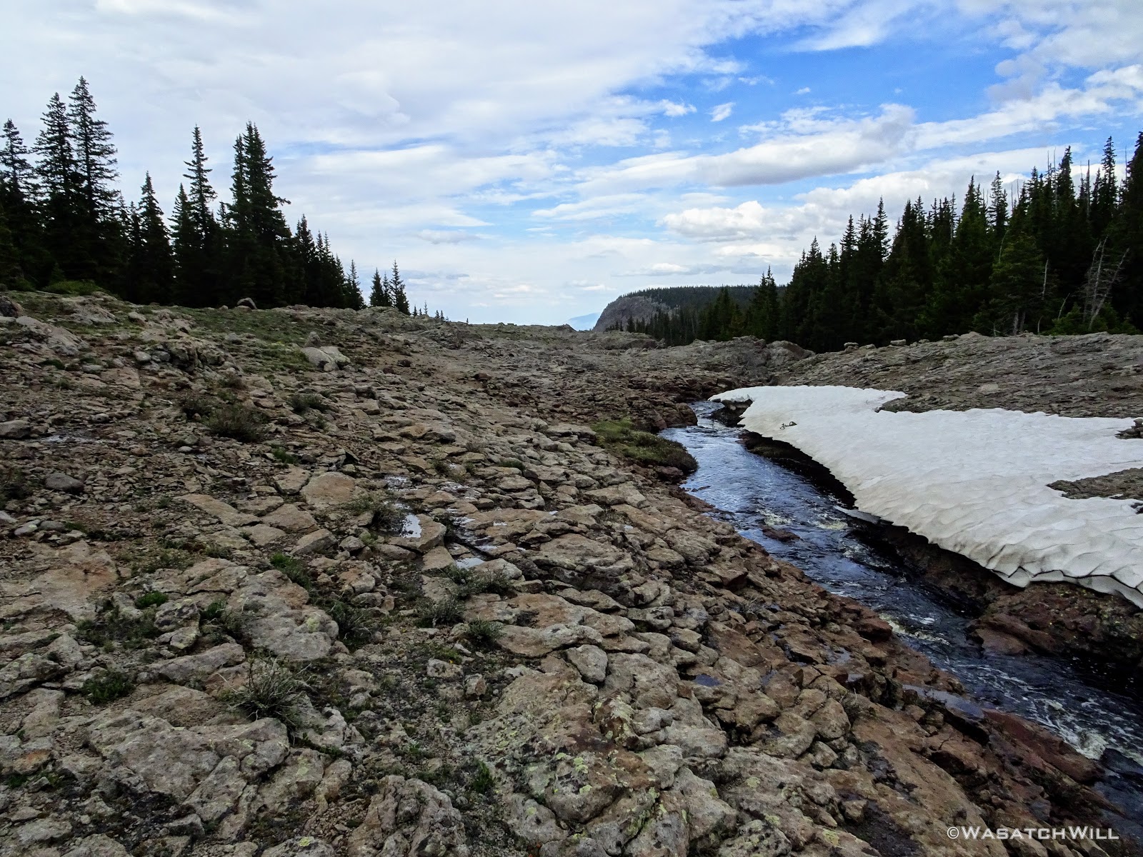
I followed the creek out to where it swiftly descended down to the gorge that then descended to the waterfall below and out of sight.
After taking in that view for a while, I went back up to camp where we all had our dinners. With a good bit of daylight left, we all decided to go back out to the meadow and go up creek in the other direction. There the meadow really opened up to become a massive wide open space.


At the far edge of the meadow were a few female elk grazing about.

Devin had the idea to skirt around the edge of the meadow through the trees in an attempt to get some closer shots of them on camera. I soon followed around behind but by the time I reached a good spot, they had decided to move along deeper into the trees themselves.

Satisfied with a good session of wildlife viewing, we returned to camp to settle down for the evening and were treated to a nice light show in the clouds after the sun had set. It was a big surprise because by then, it had become mostly overcast, leading us to think the sunset would not amount to much.


We had ourselves a brief little fire in an already erected fire pit at our site along with some hot chocolate to close out the night.
Day 3
Sunday - June 30, 2019
Our final day began with the skies more overcast. We had actually gotten a few light showers that passed over us through the earlier hours of the morning. There was no sign of the sun coming through to shine anytime soon, so we had to pack up wet tents and put on some apparel to shed the moderate but blustery wind blowing up into our camp and through the meadows. On our way out to finish out our route, I lead Dane and Devin back out to the overlook at the bottom edge of the meadow I had visited the night before.

Back up creek, we found a suitable place to cross over and crested over a unique and neat little rocky spine before disappearing back into the trees, where we welcomed the natural wind break they provided.


A couple miles mixed in with some more route finding brought us to yet another grand overlook along the edge of the rim. At this point, the weather started turning for the better as well, showing the promise of sunny skies to come. We enjoyed more views of the drainage we were ultimately circling around with this trip. A small nameless lake or large pond lied down below.


From that viewpoint, it was back into the trees, then back to the rim, and back into the trees, and so the story goes. The pattern was interrupted once with yet another creek crossing, that which drains out of Long Draw.

At one point out along the rim, we were able to look out and see the top of Capitol Reef's Golden Throne way out in the distance and even Factory Butte along the hazy horizon.

A little further on, and bang! One final view to end all views along the rim top before descending back down off the rim. And what a finale of a view it was! It was a no brainer to sit down and make that our lunch stop.


With our tummies satisfied, it was time to drop down off the rim and close out the loop and thus our trip. We had ambitions at the beginning of the trip to consider extending out the ridge walk to Bown Point, then coming down off the ridge from there, but opted to keep it conservative and descend down the Behunin Trail.

The way down provided another healthy mix of lush green groves of aspens and conifers broken up by peaceful meadows, both large and small. And yet, despite being on on the same side of the mountain with the same kind of vegetation, this trail down presented with a different personality from the one we took up which continued to keep things interesting and new.


The grandaddy of all the meadows along the way down, Bear Flat, was about half way down. Oddly, this meadow was also surrounded by numerous dead tree trunks, unlike anywhere else along the route we had experienced up to this point,


Another mile more brought us to one final crossing of Pleasant Creek.
It would've been a pretty effortless crossing had we just dunked our feet right through it. But no...our instinct to keep our feet warm and dry caused us to come up with a more creative solution: throw some downed logs and branches across a narrow spot and give ourselves a bit of a bridge.

So that we did...

Having crossed and successfully preserved our dry feet, all we had to do was relink with the end of the high clearance dirt road and hike another mile and a half down it back to the car.
We made one final stop in Torrey for an early dinner to wrap up the trip prior to the drive back home.
I now feel fortunate to have backpacked the lower sections of Pleasant Creek where it runs into and through Capitol Reef National Park in addition to all along and around its head waters now. I've experienced it in two radically different worlds. Similar to a course that the Colorado and Green Rivers follow on a much larger scale, it is incredible to think that the same Pleasant Creek along the high rim of Boulder Mountain at almost 11,000 feet up in a high alpine environment is the same creek that runs through red rock and sandy desert as it cuts through Capitol Reef's Waterpocket Fold, ultimately descending nearly 6000 feet over a 30 mile course where it joins up with the Fremont River on the eastern flanks of Capitol Reef.
DAD JOKE: And as with my other trips along those lower stretches of Pleasant Creek, what a pleasant trip full of many pleasant surprises this trip turned out to be along the upper reaches of Pleasant Creek and Pleasant Lake.
I'm already looking forward to a day where I can take my wife up along this same route.
Video: