Thorofare loop (almost) Cabin Creek, Hawk's Rest, Ishawooa Creek 8/11-19

Joined
Jul 24, 2020
Messages
9
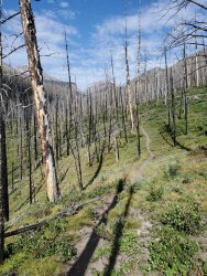
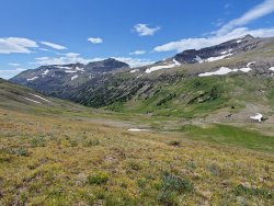
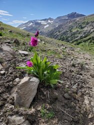
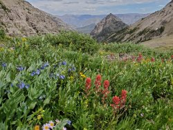
Hi - First, thanks for the planning help commenters. I ended up starting two weeks later than expected, but two weeks earlier than I usually go. The 85-mile route was up the South Fork of the Shoshone, Marsten Creek, Yellowstone River, Thorofare, Open Creek, Silvertip, Pass Creek to Ishawooa. After driving up I got in a couple miles for a late camp on very dry ground. It must have been a good snow year given all the snow still up high and the creek flows, but not much rain judging by the overall dryness. The hike up the South Fork was nice and being enjoyed by at least three other parties (one said there were more people out than any time in the last 20 years). Seven creek and river crossings, all but one deep enough for Crocs. I had a nice camp at the Shoshone/Marsten confluence and saw both mule and whitetail deer in the morning. Heading up Marsten Creek I saw the first grizzly in a berry patch about 40 yards off the trail. It was a solid climb up to Marsten Pass where the flowers and views were lovely. 20200813_145959.jpg
I camped below Younts Peak in the first big meadow.
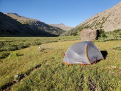
20200813_184639.jpg
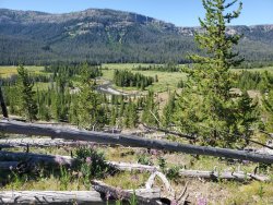
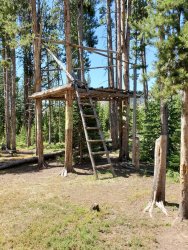
It was a day and half to Hawk's Rest and I camped at Cabin Creek.
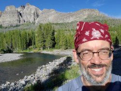
20200814_182646.jpg
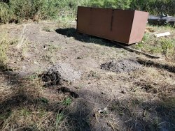
A bit after taking this picture I was walking back to camp from my cooking area at dusk when I spotted a large black bear in the berry patch. It headed off toward my cooking area so I was happy to find my food hanging where I left it. The beaver ponds above Hawk's Rest had great birds, including a beautiful pair of Trumpeter Swans. Turns out they're replacing the bridge across the Yellowstone at Hawk's Rest so there was a contractor camp and Forest Service engineer, the only people I'd see from Marsten to the end of the trip. Fortunately the helicopter didn't appear that day. Heading up the Thorofare had been a dream of mine since the '80s when I worked in Yellowstone and the upper sections of the creeks (Open, Silvertip, Pass) were my favorite parts of the trip. Open Creek had the second grizzly sighting, just walking up the trail. I stopped for 30 minutes to give it a good head
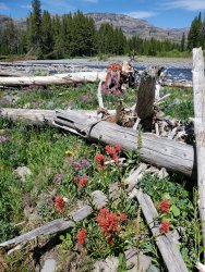
start! 20200815_152356.jpg
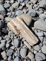
Lots of petrified wood has washed down. Below is the meadow at the top of Silvertip Creek. It took until these upper meadows to start seeing a fair amount of animal sign. I think the critters were staying up high due to the dry conditions. Silvertip trail had the only significant amount of wolf tracks and scat. Sorry to miss them this year. Surprisingly little moose sign, but plenty of bighorn sign on the ridges.
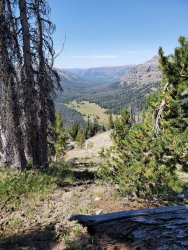
20200817_114335.jpg

My next to last camp in upper Pass Creek, where I saw 3 bull elk and deer.
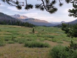
20200817_194834.jpg

The hike out Ishawooa was straightforward, if energized by a fresh set of grizzly prints and piles of scat for first several miles. I passed by one established horse camp in the first third of the canyon and there was another obvious campsite about 2/3s of the way down. Other than that, there were a couple of creekside flat areas where camping is feasible. Mine was a couple of miles up from the mouth of the canyon. I made it to the trailhead and caught a ride up to Cabin Creek within a minute! While the critters weren't as plentiful as I'd like, it was great scenery and solitude. The trails were all in good enough shape and followable, although trail junctions weren't all posted. Cheers!
 
Love the photos. I get excited every time I see a new trip report from this area. Looks like you had a great trip and covered a whole lot of ground!
 
great stuff. was in this area last year and saw a bear right there in marston as well. the berries in there were great. probably a good time to be a bear. thanks for sharing.
 
Now Thanks for Posting and loved your photos! Also your photos brought back many good memories.
 
I'm fixated on this area for my coming August backpacking trip....What do you all think about a ginormous "lollipop" loop around Thunder Mountain, coming in and exiting at Ishawooa Trailhead? How many days do you think I'd need for something like this, averaging 8 miles a day?
 
Forest Dweller, Now sounds nice! You will Absolutely Love It! Now off the top of my head, to really see and experience the area, maybe a couple of weeks. This is with averaging 8 miles a day. Maybe it could be done in a shorter time period, but one doesn't want to rush things either.

Now if doing the loop, there is a bunch of very scenic areas right nearby off the beaten path. One is the upper huge and gorgeous meadows in Hidden Creek. The upper area of Thorofare Creek is gorgeous also with lots of nearby offtrail hiked possible to some very nice isolated locations. And the area around Yount's Peak, here one could spend days in the area. Lots of Bears near Yount's Peak. Plus the Whole Thorofare -Upper Yellowstone River area also. As for myself, my reply for the loop with seeing all the little nooks and crannies in the area, maybe all summer. And even spending all summer in the area, one would not see it all.

Now in August of 2007 climbed to the top of Thunder Mountain. It was Great! Someone came with me on this trip. We accessed the peak from the Hidden Creek side and descended down to the North Fork of the Yellowstone. I found a huge Bighorn Sheep Ram Skull on top which I packed out and still have.

Now I myself am thinking again be back in this country next summer. There is tons of excellent wild country all around in here where one could stay for days and weeks enjoying life. Wishing You The Best!
 
Last edited:
This area is at or near the top of my list. I've already done a 90+ mile loop through southeast Yellowstone, but I want to get south of the park next time around. I only get a couple weeks a year though, so it will have to wait until next year (if we get permits for Glacier this year).
 
Forest Dweller, Now sounds nice! You will Absolutely Love It! Now off the top of my head, to really see and experience the area, maybe a couple of weeks. This is with averaging 8 miles a day. Maybe it could be done in a shorter time period, but one doesn't want to rush things either.

Now if doing the loop, there is a bunch of very scenic areas right nearby off the beaten path. One is the upper huge and gorgeous meadows in Hidden Creek. The upper area of Thorofare Creek is gorgeous also with lots of nearby offtrail hiked possible to some very nice isolated locations. And the area around Yount's Peak, here one could spend days in the area. Lots of Bears near Yount's Peak. Plus the Whole Thorofare -Upper Yellowstone River area also. As for myself, my reply for the loop with seeing all the little nooks and crannies in the area, maybe all summer. And even spending all summer in the area, one would not see it all.

Now in August of 2007 climbed to the top of Thunder Mountain. It was Great! Someone came with me on this trip. We accessed the peak from the Hidden Creek side and descended down to the North Fork of the Yellowstone. I found a huge Bighorn Sheep Ram Skull on top which I packed out and still have.

Now I myself am thinking again be back in this country next summer. There is tons of excellent wild country all around in here where one could stay for days and weeks enjoying life. Wishing You The Best!

Kmatjhwy, I can get out there for 2 weeks...it's this area and it's gorgeous meadows, wildflowers, clear creeks and mountain views that I mostly want to experience...Where would you recommend I try to get to in 8 or 9 days, trying to keep things at approximately 8 miles a day for my wife? If I couldn't see all incredible meadows and drainages how would I prioritize? Upper Yellowstone (North / South)? Upper Thorofare? Open Creek? Hidden Creek? Bridger Lake? Hawks Rest?
 
Forest Dweller, Hi Again! Hope I can help you out. But I never like telling someone what to do. Do think that you need to get a map out and decide for yourself what and where you would like to go and see.

But hope to help you out. It is big country on only 8 miles a day. I personally have been all over this country but took all summer, and so many a summer multiple times to really see and experience this country.

Now for a hint, Now I do not know how financially well off you are but some of the local outfitters could pack you back into Hawks Rest and the Thorofare / Yellowstone Meadows one way with dropping you off then you just hiking out one way. The outfitters with their horses can make it from the trailhead to Hawks Rest on one lengthy all day trip.

Now for the various places and distance wise with hiking.

Hawks Rest / Bridger Lake / The Thorofare

This area is generally near 30 miles or more from any of the trailheads. A good hiker can do it in two or maybe three days oneway. But away from Hawks Rest itself ... the country is incredible in every direction. I have camped here often in the early summer and hiking everywhere nearby and loved every minute of it. At times various horse parties visit Hawks Rest, so you will more likely see people here.

The Upper Yellowstone with the North and South Fork

It is generally for myself a good two day hike at least from Hawks Rest to up around Yount's Peak. Up from Hawks Rest at near 7 to 8 miles is some beautiful meadows which I call Castle Creek Meadows for Castle Creek flows into the Upper Yellowstone nearby. A nice camp spot with bear boxes is located in the far side of the meadows. The Upper Yellowstone is gorgeous and not many people get up that way. Some nice waterfalls in the Upper Yellowstone especially the South Fork. There is a trail up the South Fork but just a routes or routes up the North Fork. Up around Yount's Peak it is superb country with the alpine country everywhere around. There is a route - old trail that goes from the South Fork over to the head of the North Fork. Both of the head alpine bowls of the Yellowstone near Yount's is Gorgeous. Many bears in the area. There is a route thru a mountain notch from the North Fork of the Yellowstone to the very upper part of Thorofare Creek.

Open Creek - Silvertip Creek - Pass Creek - North Fork Butte Creek

Now Open Creek is misnamed in my opinion.Lots of forests up in Open Creek. Only near its head does it open up into meadows. The Upper end of Open Creek is like a huge box canyon so to speak and gorgeous. Silvertip Creek's head is gorgeous with nice meadows and isolation reigns. It can be easily accessed by both Pass and Open Creek. Now the upper part of Pass Creek is simply gorgeous with long lengthy meadows, mountains all around, and everything. In mid summer nice wildflower displays in Pass Creek. Good Bear Country. The head of North Fork of Butte Creek is also simply gorgeous and isolation reigns. Very Scenic. There is a trail that goes up North Forth of By The Creek from the Thorofsre Creek/River. North Fork of Butte Creek can also be easily accessed from Pass Creek ... One goes over a low pass and very scenic that divides the two.

Upper Thorofare Creek

The Very Upper Thorofare Creek is very scenic with the meadows in the valley and the mountains all around. A good trail goes up the valley. One could spend days and days and days in here. Connection with a route over to the Yount's Peak area, not often talked about but I know of, thru a mountain notch to the Yellowstone's North Fork.

Hidden Creek

It is off of the Thorofare River. One has to cross the river to get to Hidden Creek. A good trail goes up to an outfitted camp in here. A smaller trail continues on to the upper meadows. The Upper meadows are Gorgeous. It is one of the more beautiful spots in the whole area with the meadows then the high cliffed peaks all around. A nice waterfall up the valley behind the upper meadows tops it off. Huge Thunder Mountain rises up beyond the upper meadows. Makes also a good dayhike up from Thorofare Creek below.

Lower Thorofare Creek

Forested and lengthy. Could take several days to hike at 8 miles a day from Hawks Rest to the Upper Thorofare Creek Area.

Ishawooa Creek - Deer Creek

Both of these creek Drainages if going up has a huge elevation climb. Deer Creek is quite steep but only like 8 or so miles long. Ishawooa lots less steep but twice as long. At 8 miles a day, it would probably take two days to go Ishawooa. There is little Spruce Meadows at the head of Ishawooa - nice and could camp here. The pass at the head of Ishawooa separates Ishawooa from the Pass Creek Drainage. I prefer Ishawooa over Deer Creek anyday.

Lots of country to cover in a week but possible in two weeks, this is by foot. Have been over it all and l I ove it! There is also the access from the Buffalo Valley - Turpin Meadows Trailhead, or the SE part of Yellowstone Park. The S E part of Yellowstone Park, the Teton Wilderness, the Washakie Wilderness, the France Peak area and other adjacent roadless country combined make up the South Absaroka
Wildland Complex ... All Wilderness ... is over 2,000,000 acres in size. So lots of good wild country here as it has always been ... Wild and Nice!!!

Hope this helps. Wishing You The Best!
 
Last edited:
Forest Dweller, Hi Again! Hope I can help you out. But I never like telling someone what to do. Do think that you need to get a map out and decide for yourself what and where you would like to go and see.
.........................................................................................
Hope this helps. Wishing You The Best!

Incredibly thorough and helpful. Your information combined with a few books that I bought on the area should help me make decisions and plans. I'm very grateful. I'm not sure I can see it all, and unfortunately upper Hidden Creek and upper Open Creek are in opposite directions but these are 2 areas I would like to personally experience. Also the meadows in the North Fork of the Yellowstone. I believe you said that it was possible to go over Thunder Mountain, to the North Fork from Hidden Creek? Is that difficult or particularly tricky or dangerous?
 
Yes you can go over Thunder Mountain, be back later with the information. Have to get ready for work now.
 
Yes you can go over Thunder Mountain, be back later with the information. Have to get ready for work now.
Also, I'd prefer to navigate as close to a straight line as possible to save time and cut distance but avoiding very scary or dangerous exposure, especially with my wife, has to be a priority.

Also, I know this is all subjective but what would you categorize as essential to experience / can't miss if someone were in the area and couldn't see all of it. MAYBE if I pack carefully it could be an 8 or 9 day trip. And depending on cost being dropped off by an outfitter could be a possibility.

Maybe to help you tell me what can't be missed I'll tell you what I like: lush, green, wildflowers, meadows, forest on edges of meadows leading up to hills / mountains...crystal clear streams, waterfalls off of cliffs etc!

I understand that

Hidden Creek
Open Creek
Thorofare Creek
North Fork Buffalo
and
North Fork Yellowstone

are like essential areas but something will have to be left out...
 
Last edited:
Now as for going over Thunder Mountain, this is the way it went. Hidden Creek has two forks. It is the East Fork which has the gorgeous meadows at the upper end. Where the two forks come together is where an outfitted camp is. There is a small trail or route going up each branch from the outfitter area.

Now the way I went was in going up Hidden Creek to the outfitter camp, then continuing up to the west branch or fork to near it's upper end. Then here I climbed up the slope, a walkup, on the East or left side to the top. Here was a nice ridge extending from Thunder Mountain. Then walked along this ridge and camped in the very high basin near the top of the East Branch or Fork right below Thunder Mountain. There is a nice basin here for camping. Right nearby is an 11,000 foot pass to the North Fork of the Yellowstone drainage. From this pass it is an easy climb to the top of South Thunder peak at near11,800 feet or so. Thunder Mountain has several summits. From that basin to the Pass then there is a easily sloping drainage down to the North Fork of the Yellowstone. This drainage down was an easy stroll except for a line of cliffs with a waterfall along the way. To get around the cliffs, found a break in the cliffs to the left of the waterfall which was really easy to down climb thru and not dangerous whatsoever. It was really just a short or very short down climb. In this subdrainage, there were abundant signs of Grizzlies all around here in August. The view from the top of South Thunder Peak was nice.

But this Thunder Mountain area is far from anywhere and it would take a minimum of three days for a good hiker to get there one way from the nearest trailhead at the very least. So this means three days in and three days out but easily more.
 
Now on what you posted for essential and non-essential. I would leave out the Open Creek Area, pretty forested drainage. And for what you want to see, would leave out the North Fork of the Buffalo. The North Fork of the Buffalo is some ways away from the other areas. Plus the North Fork of the Buffalo burned in a fire in 2012. The Upper parts are highly scenic but burned in this fire in places. Hiking here all along the Continental Divide from near Two Ocean Pass all the way over to hear Yount's Peak is also really nice and super wild with many nice nooks and crannies.

Now Upper Pass Creek is gorgeous with the huge meadows. The Upper Thorofare Creek is nice with it's abundant meadows. The South Fork of the Yellowstone is gorgeous with mountain meadows, forests and cliffs, waterfalls, then the huge alpine basin with Yount's Peak. Near here also is Marston Creek which has a trail going down to the South Fork of the Shoshone which could be a route in coming back out also. The lower parts of the South Fork of the Shoshone is in a canyon near a mile deep with high cliffed peaks on either side. There is some nice meadows up a short ways from where the Marston Creek meets the South Fork of the Shoshone. Also if you get near Yount's Peak, Yount's Peak is an easy climb with a tremendous view! Do highly recommend it!

Some ideas could be to take an outfitter to Hawks Rest. Then go up the Upper Yellowstone and the South Fork to the alpine basin. Then over to the North Fork of the Yellowstone's head basin. Up a nearby subdrainage, thru a mountain notch and down to the Upper Thorofare River, down the Thorofare River, see Hidden Creek if one has the time nearby. Then up Pass Creek or North Fork of By the Creek to Upper Pass Creek and it's meadows, and down Ishawooa Creek.

Now you could do this in reverse with after Yount's Peak, go out via Marston Creek and down the South Fork of the Shoshone also. I have also done trips where I left Turpin Meadows , went to Hawks Rest, up to Yount's Peak, then out to Cody via Pass Creek and Ishawooa Creek. I then resupplied in Cody and went back to Jackson Hole over the mountains. Much Much Much to see in all of this area. Now in only 8 or 9 days do feel you will be barely scratching the surface do think.

It is all up to you. Just some thoughts here. It is some big big country. You could spend a multiple of summers in here like myself with still not seeing everything.

Wishing You The Best!
 
Similar threads
Thread starter Title Forum Replies Date
B Thorofare loop from Deer Creek Trip Planning 20
shredhiker Aerial footage of the Thorofare General Discussion 22
TractorDoc Yellowstone's Thorofare and the Teton Wilderness 08/09/2023 - 08/18/2023 Part Nine / Day Nine + Ten! Backpacking 20
TractorDoc Yellowstone's Thorofare and the Teton Wilderness 08/09/2023 - 08/18/2023 Part Eight / Day Eight Backpacking 14
TractorDoc Yellowstone's Thorofare and the Teton Wilderness 08/09/2023 - 08/18/2023 Part Seven / Day Seven Backpacking 13
TractorDoc Yellowstone's Thorofare and the Teton Wilderness 08/09/2023 - 08/18/2023 Part Six / Day Six Backpacking 28
TractorDoc Yellowstone's Thorofare and the Teton Wilderness 08/09/2023 - 08/18/2023 Part Five / Day Five Backpacking 16
TractorDoc Yellowstone's Thorofare and the Teton Wilderness 08/09/2023 - 08/18/2023 Part Four / Day Four Backpacking 15
TractorDoc Yellowstone's Thorofare and the Teton Wilderness 08/09/2023 - 08/18/2023 Part Three / Day Three Backpacking 10
TractorDoc Yellowstone's Thorofare and the Teton Wilderness 08/09/2023 - 08/18/2023 -- Part Two / Day Two Backpacking 6
TractorDoc Yellowstone's Thorofare and the Teton Wilderness 08/09/2023 - 08/18/2023 --Part One / Day One Backpacking 10
shredhiker Thorofare, Heart Lake, Snake River Sept. 2023 Backpacking 15
scatman Yellowstone's Thorofare, Headwaters of Thorofare Creek, Majo Pass, Younts Peak, Bob's Canyon, and Cub Creek - August 9, 2023 - Days 7 through 10 Backpacking 34
scatman Yellowstone's Thorofare, Headwaters of Thorofare Creek, Majo Pass, Younts Peak, Bob's Canyon, and Cub Creek - August 9, 2023 - Days 1 through 6 Backpacking 56
Bob The Thorofare to Brooks Lake - 9 Days in Pictures Backpacking 10
J Anyone in the Thorofare in the past couple of weeks? Trip Planning 0
F Shakedown - Yellowstone Thorofare Trip Planning 13
TheMountainRabbit Southern Absaroka & Thorofare Mountain (Teton/Washakie Wilderness) - July 2023 Backpacking 23
J Pacific Creek or North Buffalo Fork? Teton Wilderness, Thorofare ,etc. Trip Planning 10
F Thorofare/South Boundary/Wolverine Creek Trip Planning 2
C Thorofare Trip - September 2023 Trip Planning 3
ridings82 Album Thorofare Photography 4
Christo Water availability:Thorofare Yellowstone Trip Planning 6
marmot_boi Thorofare trip Trip Planning 4
norwegianxplorer Greater Yellowstone part 2, from the Headwaters of Yellowstone River, through the Thorofare, Overlook Mountain, Rampart Creek Backpacking 9
TeamJenkins17 Thorofare/Teton Wilderness Trip Trip Planning 12
TeamJenkins17 Yellowstone Thorofare to Brooks lake trip next year. Trip Planning 6
tropicalwanderer YNP : 8/31-9/7 : Heart Lake to Nine Mile via CDT, South Boundary and Thorofare Trip Planning 9
S Deer Creek into the Thorofare Trip Planning 6
E Thorofare mid september 2018 Trip Planning 16
K The Thorofare and the Absaroka Wilderness Backpacking 9
J Thorofare 2018 Trip Planning 14
Jason Bradshaw Thorofare Trail Backpacking 7
J Invite Packrafting the Thorofare area Meet Up (Members Only) 5
V Yellowstone - Thorofare - Solo? Trip Planning 15
Keith Yellowstone Thorofare (8/11/14 to 8/17/14) Backpacking 7
Joey Invite Yellowstone's Thorofare and Gallatin/Sky Rim area Meet Up (Members Only) 4
G Escalante area 4-5 night backpack trip suggestions in late September. Loop if possible. Limit technical sections if any. Thanks! Backpacking 6
TrailScot Escalante Loop via Dry Hollow and Boulder Mail Trail - September 2023 Backpacking 8
TractorDoc Paintbrush Canyon / Cascade Canyon Loop -- Grand Teton NP September 11, 2023 Hiking & Camping 9
D Grand Teton Cascade Loop Trip Planning 1
TrailScot Upper Paria Loop Hike - September 2023 Backpacking 4
M Mee/Knowles Canyon Loop, Grand Junction Colorado Backpacking 4
randakag Rawah Wilderness "Lollipop" Loop - September 2023 Backpacking 7
Ugly Oh Mother! A Mountain Loop Backpacking 12
Jackson Lollipop Loop in the Pintlers Backpacking 6
Timber High Sierra - North Lake to South Lake Loop - Layover Day Trip Planning 9
RockyMntCol Cloud Peak Wilderness Loop Trip Planning 1
BJett Part 3 - Tour de Canyon Country. Lower Escalante Loop Hiking & Camping 0
scatman City Creek Loop - April 23, 2023 Hiking & Camping 8

Similar threads

Back
Top