IntrepidXJ
ADVENTR
- Joined
- Jan 17, 2012
- Messages
- 3,488
Friday-Sunday, November 4-6, 2011
The Original Trip Report on ADVENTR.CO
The Wave, located just south of the Utah-Arizona state line in the Vermilion Cliffs Wilderness Area, is one of those places that every photographer and hiker wants to visit. It's hard to blame them because it is such a unique and amazing area. Unfortunately, because of it's popularity, the BLM has a permit system in place that allows only twenty people per day the chance to experience this remarkable area. If you've read my blog for any length of time you might know that I am averse towards any kind of permit when I go out exploring, so in the past I have usually avoided those places. This year I have made an effort to finally visit some of those places that require a permit, including The Maze and the White Rim. A few months ago I decided that I would try to get a permit so that I could hopefully visit The Wave this year, too. Since there are only 20 permits per day, it can be difficult to obtain one. For anyone not familiar with the Coyote Buttes North permit system, ten of the permits for each day are awarded in a lottery three months in advance and the other ten are distributed in person the day before. I guess I was pretty lucky since I managed to snag two permits in advance on my first try. Once I had my permits, Amanda and I decided to make a long three day weekend out of the trip.
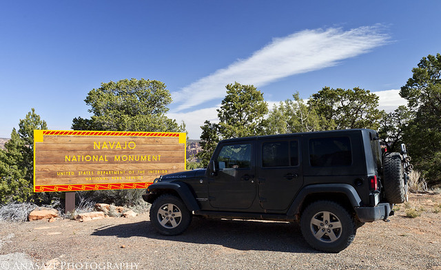
We left early on Friday morning and drove down through Monument Valley since Amanda hadn't been through there before. Shortly after passing through Kayenta we turned off the main highway so we could make a quick visit to Navajo National Monument. We took the short Sandal Trail to on overlook of the Betatakin Ruins. The viewpoint was still pretty far away from the large alcove containing the ruins so I'm glad I had my long lens with me. We were lucky that most of the ruins were all in the sunlight, so I didn't have to deal with a large shadow in part of the scene.
Navajo National Monument by IntrepidXJ, on Flickr
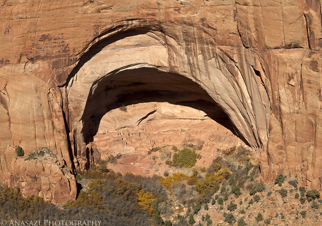
This huge alcove contains the Betatakin Ruins.
Betatakin Alcove by IntrepidXJ, on Flickr
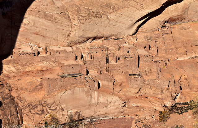
A closer look at the ruins found here.
Betatakin Ruins by IntrepidXJ, on Flickr
Here's a view of the large alcove in it's canyon setting for a little better sense of scale.
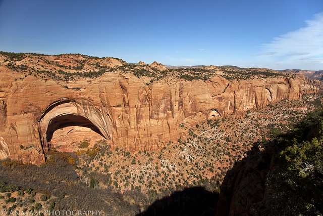
Betatakin Overlook by IntrepidXJ, on Flickr
In the future I am going to have to return to the park and take the ranger-guided tour down to the ruins, which is only offered on the weekends during this time of the year. I'd also like to make the trek to Keet Seel one day, too.
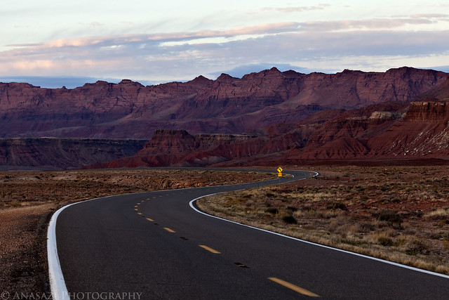
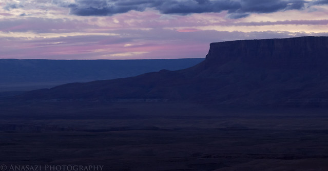
From Navajo National Monument we countinued across the Navajo Nation to Page, Arizona. Amanda hadn't been here before so I took her over to the Glen Canyon Dam Visitor's Center so that she could check it out. After checking into our hotel and grabbing some dinner we headed over to the Horseshoe Bend overlook for sunset. At first it looked like there might be an awesome sunset, but in the end there was only one small section of the sky that got any color. It was still a cool place to photograph at sunset.
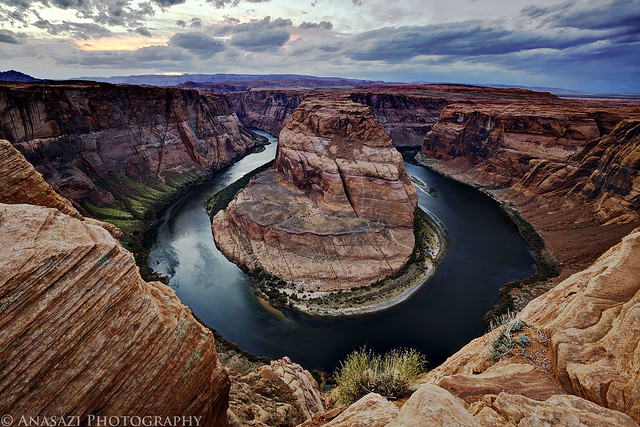
Horseshoe Bend by IntrepidXJ, on Flickr
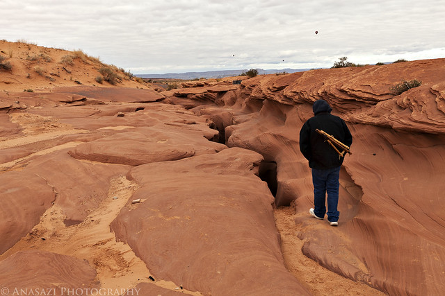
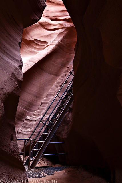
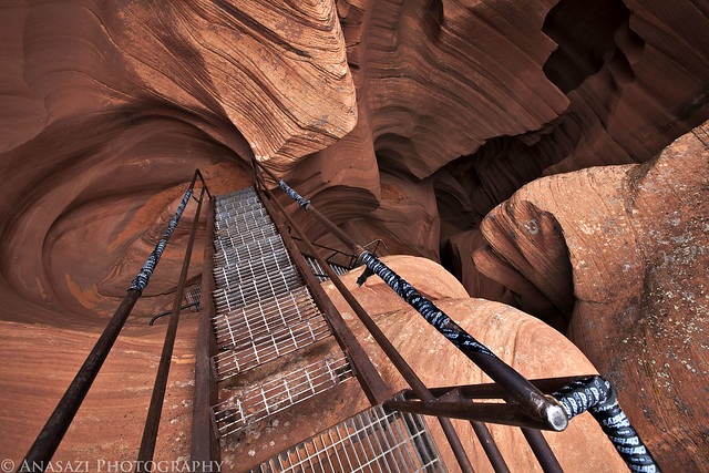
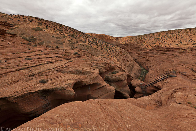
On Saturday morning we were up bright and early so we could visit The Wave. We drove to the Wire Pass Trailhead, where we found only one other vehicle, and then started the hike to The Wave. It was a cold and windy morning, and was supposed to stay that way all day. When we started the hike there was a thin layer of snow and ice on the ground, but as soon as the sun came out, it all melted off. The wind and the quick moving clouds made for some great skies and constantly changing lighting conditions for photography, but also kept us cold and sand-blasted us all day.
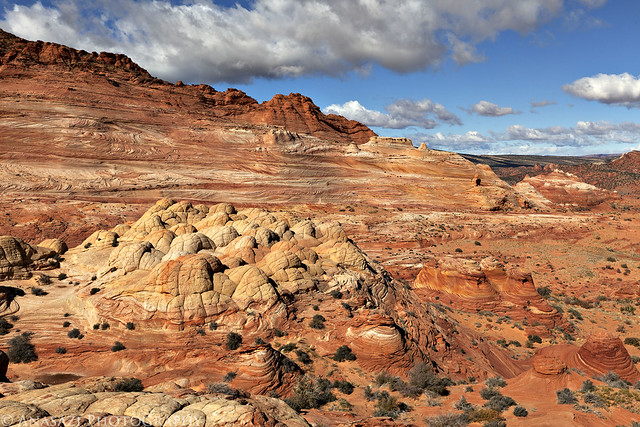
Here's a few photos I took on our hike to reach The Wave. There is spectacular scenery all over the place!
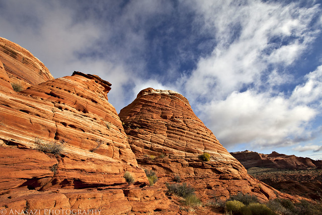
Hiking Scenery by IntrepidXJ, on Flickr
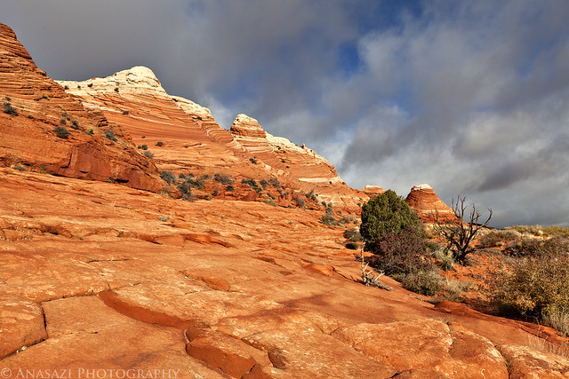
Sandstone by IntrepidXJ, on Flickr
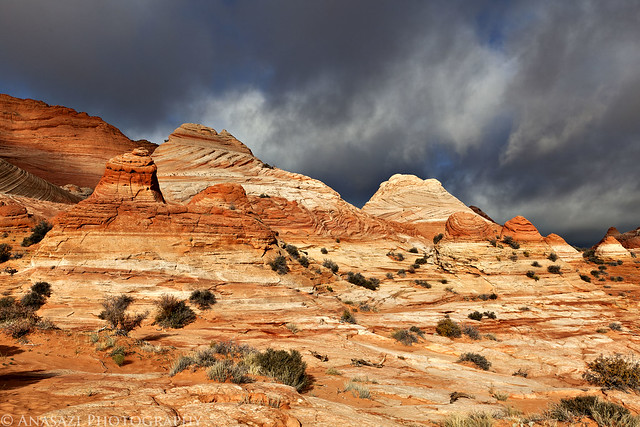
Scenery by IntrepidXJ, on Flickr
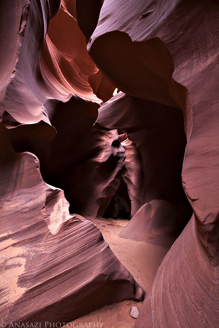
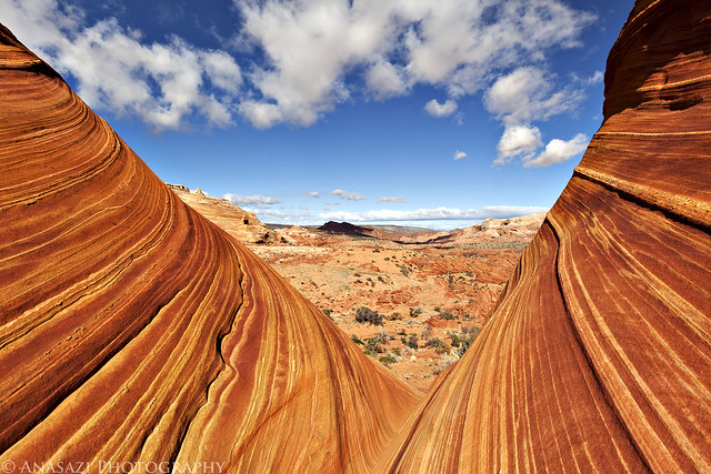
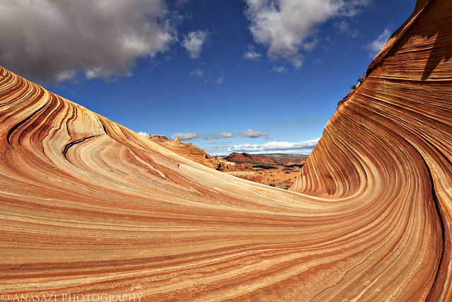
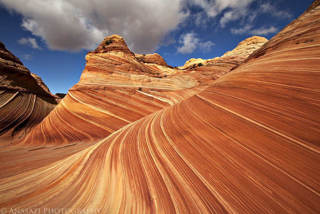
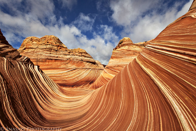
After a few miles of hiking we finally reached The Wave! Again we got lucky here, too. The one vehicle in the parking lot belong to a guy who had hiked in even earlier than us. By the time we reached The Wave he was heading off to do some more exploring elsewhere. We had the place to ourselves for a few hours to explore and photograph as we pleased. We didn't see another person until after lunchtime. It was great! This is an amazing place, so I'll let the photos speak for themselves...
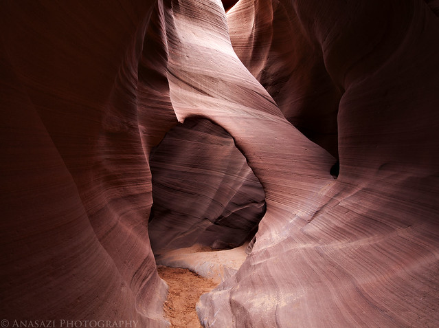
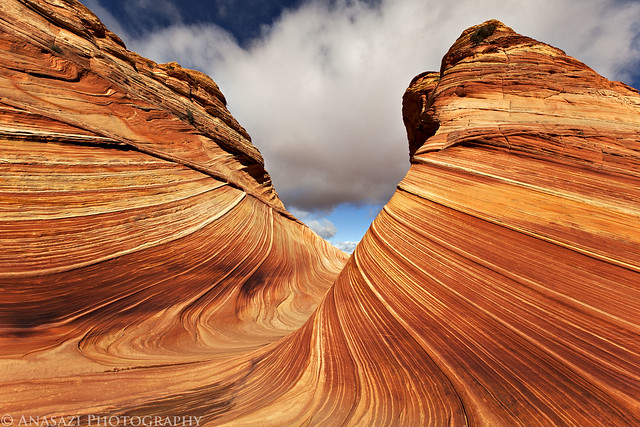
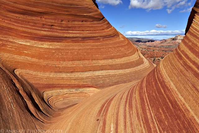
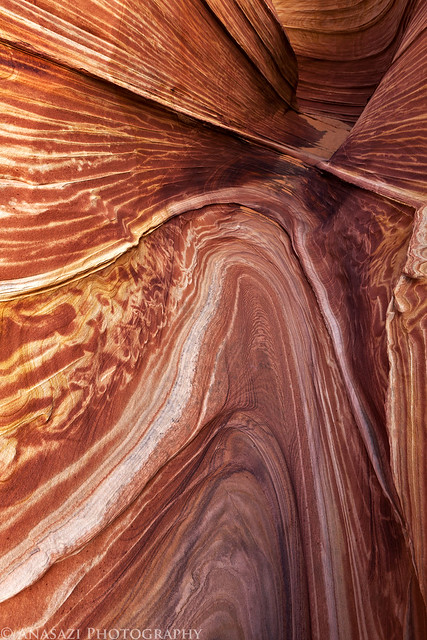
This is probably one of my favorite photos from the day taken in a narrow passage with nice reflected light.
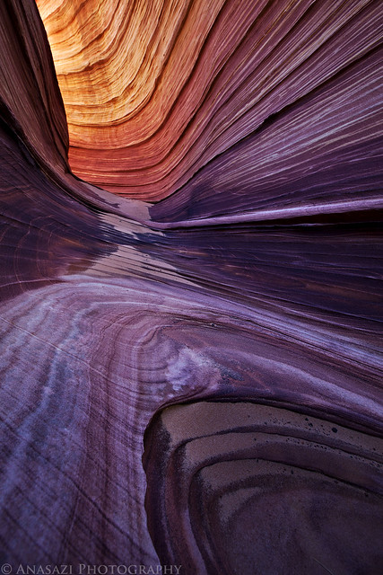
The Passage by IntrepidXJ, on Flickr
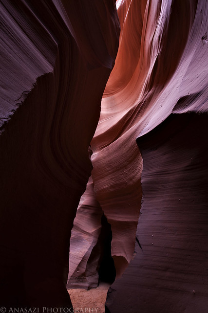
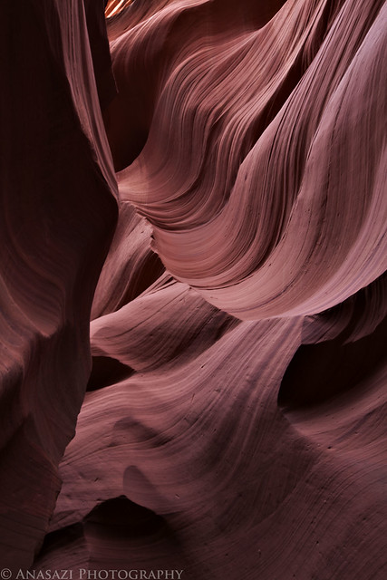
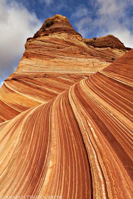
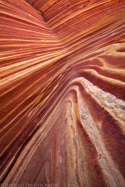
There are so many different lines found here to have fun with!
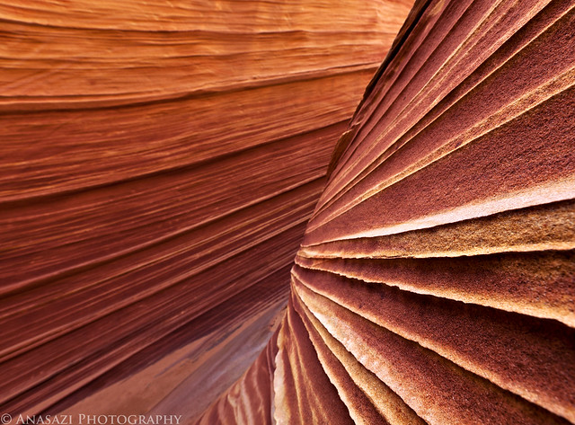
Colors & Lines by IntrepidXJ, on Flickr
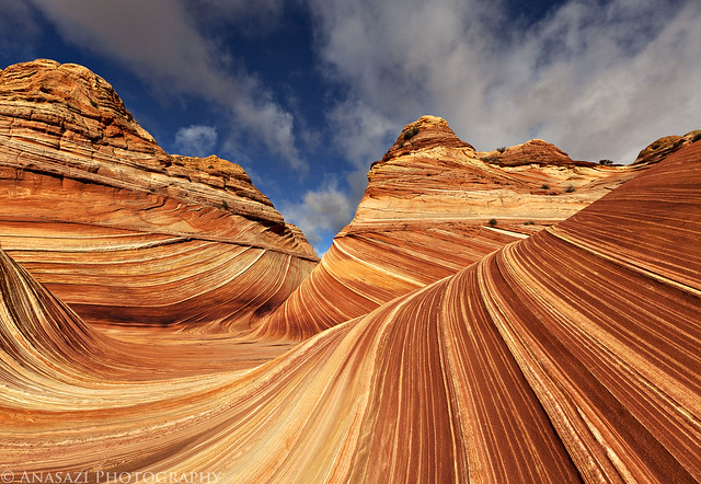
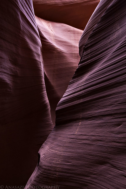
Wave I by IntrepidXJ, on Flickr
Wave II by IntrepidXJ, on Flickr
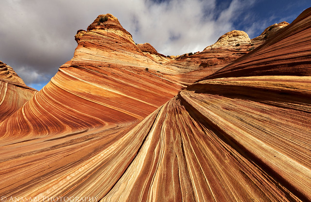
Wave III by IntrepidXJ, on Flickr
Wave IV by IntrepidXJ, on Flickr
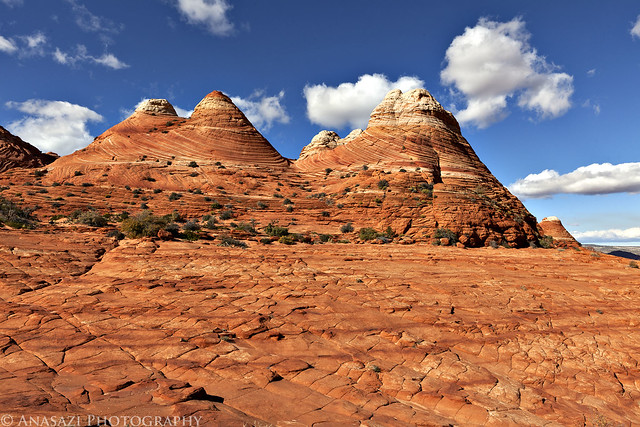
Since this was our first visit to Coyote Buttes North, we spent most of the time in the vicinity around The Wave and didn't explore too much of the surrounding area. I did end up doing a little exploring nearby and climbed up for a higher view of the area. I had wanted to visit Melody Arch but the wind and blowing sand was pretty bad the higher I climbed, so I changed my mind about that one. I will have to do some more exploring of the area when I return in February for my birthday weekend!
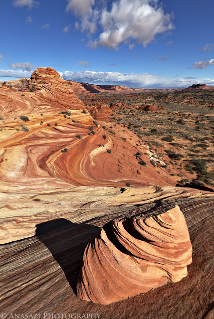
A view from above. Part of The Wave can be seen in the middle-left.
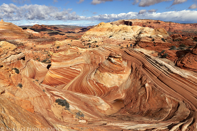
Wave Overview by IntrepidXJ, on Flickr
A moderate-sized hoodoo high above Coyote Buttes North.
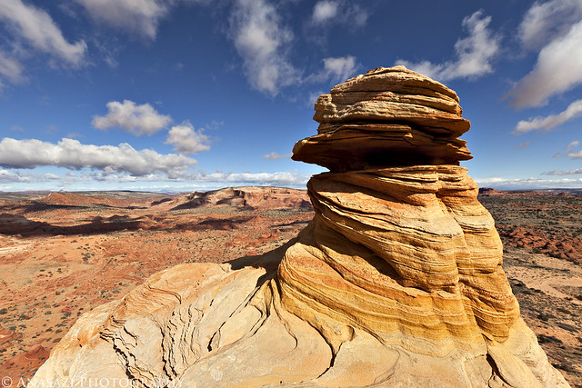
Above by IntrepidXJ, on Flickr
A little goblin and plenty more colorful sandstone to be found.
The Goblin by IntrepidXJ, on Flickr
Great View by IntrepidXJ, on Flickr
The Middle by IntrepidXJ, on Flickr
Stripes by IntrepidXJ, on Flickr
Framed View by IntrepidXJ, on Flickr
Wave Frame by IntrepidXJ, on Flickr
Wave V by IntrepidXJ, on Flickr
This is another photo of 'The Passage' but with a different composition and in different light. It's amazing how much different it looks in different lighting.
Passage II by IntrepidXJ, on Flickr
The Wave VI by IntrepidXJ, on Flickr
I would have liked to stay until sunset, but the cold, wind and sand had taken their toll on us so we headed back to the Jeep a little early.
One more photo I took as we hiked back to the Wire Pass Trailhead.
Hiking Back by IntrepidXJ, on Flickr
The Original Trip Report on ADVENTR.CO
The Wave, located just south of the Utah-Arizona state line in the Vermilion Cliffs Wilderness Area, is one of those places that every photographer and hiker wants to visit. It's hard to blame them because it is such a unique and amazing area. Unfortunately, because of it's popularity, the BLM has a permit system in place that allows only twenty people per day the chance to experience this remarkable area. If you've read my blog for any length of time you might know that I am averse towards any kind of permit when I go out exploring, so in the past I have usually avoided those places. This year I have made an effort to finally visit some of those places that require a permit, including The Maze and the White Rim. A few months ago I decided that I would try to get a permit so that I could hopefully visit The Wave this year, too. Since there are only 20 permits per day, it can be difficult to obtain one. For anyone not familiar with the Coyote Buttes North permit system, ten of the permits for each day are awarded in a lottery three months in advance and the other ten are distributed in person the day before. I guess I was pretty lucky since I managed to snag two permits in advance on my first try. Once I had my permits, Amanda and I decided to make a long three day weekend out of the trip.
We left early on Friday morning and drove down through Monument Valley since Amanda hadn't been through there before. Shortly after passing through Kayenta we turned off the main highway so we could make a quick visit to Navajo National Monument. We took the short Sandal Trail to on overlook of the Betatakin Ruins. The viewpoint was still pretty far away from the large alcove containing the ruins so I'm glad I had my long lens with me. We were lucky that most of the ruins were all in the sunlight, so I didn't have to deal with a large shadow in part of the scene.
Navajo National Monument by IntrepidXJ, on Flickr
This huge alcove contains the Betatakin Ruins.
Betatakin Alcove by IntrepidXJ, on Flickr
A closer look at the ruins found here.
Betatakin Ruins by IntrepidXJ, on Flickr
Here's a view of the large alcove in it's canyon setting for a little better sense of scale.
Betatakin Overlook by IntrepidXJ, on Flickr
In the future I am going to have to return to the park and take the ranger-guided tour down to the ruins, which is only offered on the weekends during this time of the year. I'd also like to make the trek to Keet Seel one day, too.
From Navajo National Monument we countinued across the Navajo Nation to Page, Arizona. Amanda hadn't been here before so I took her over to the Glen Canyon Dam Visitor's Center so that she could check it out. After checking into our hotel and grabbing some dinner we headed over to the Horseshoe Bend overlook for sunset. At first it looked like there might be an awesome sunset, but in the end there was only one small section of the sky that got any color. It was still a cool place to photograph at sunset.
Horseshoe Bend by IntrepidXJ, on Flickr
On Saturday morning we were up bright and early so we could visit The Wave. We drove to the Wire Pass Trailhead, where we found only one other vehicle, and then started the hike to The Wave. It was a cold and windy morning, and was supposed to stay that way all day. When we started the hike there was a thin layer of snow and ice on the ground, but as soon as the sun came out, it all melted off. The wind and the quick moving clouds made for some great skies and constantly changing lighting conditions for photography, but also kept us cold and sand-blasted us all day.
Here's a few photos I took on our hike to reach The Wave. There is spectacular scenery all over the place!
Hiking Scenery by IntrepidXJ, on Flickr
Sandstone by IntrepidXJ, on Flickr
Scenery by IntrepidXJ, on Flickr
After a few miles of hiking we finally reached The Wave! Again we got lucky here, too. The one vehicle in the parking lot belong to a guy who had hiked in even earlier than us. By the time we reached The Wave he was heading off to do some more exploring elsewhere. We had the place to ourselves for a few hours to explore and photograph as we pleased. We didn't see another person until after lunchtime. It was great! This is an amazing place, so I'll let the photos speak for themselves...
This is probably one of my favorite photos from the day taken in a narrow passage with nice reflected light.
The Passage by IntrepidXJ, on Flickr
There are so many different lines found here to have fun with!
Colors & Lines by IntrepidXJ, on Flickr
Wave I by IntrepidXJ, on Flickr
Wave II by IntrepidXJ, on Flickr
Wave III by IntrepidXJ, on Flickr
Wave IV by IntrepidXJ, on Flickr
Since this was our first visit to Coyote Buttes North, we spent most of the time in the vicinity around The Wave and didn't explore too much of the surrounding area. I did end up doing a little exploring nearby and climbed up for a higher view of the area. I had wanted to visit Melody Arch but the wind and blowing sand was pretty bad the higher I climbed, so I changed my mind about that one. I will have to do some more exploring of the area when I return in February for my birthday weekend!
A view from above. Part of The Wave can be seen in the middle-left.
Wave Overview by IntrepidXJ, on Flickr
A moderate-sized hoodoo high above Coyote Buttes North.
Above by IntrepidXJ, on Flickr
A little goblin and plenty more colorful sandstone to be found.
The Goblin by IntrepidXJ, on Flickr
Great View by IntrepidXJ, on Flickr
The Middle by IntrepidXJ, on Flickr
Stripes by IntrepidXJ, on Flickr
Framed View by IntrepidXJ, on Flickr
Wave Frame by IntrepidXJ, on Flickr
Wave V by IntrepidXJ, on Flickr
This is another photo of 'The Passage' but with a different composition and in different light. It's amazing how much different it looks in different lighting.
Passage II by IntrepidXJ, on Flickr
The Wave VI by IntrepidXJ, on Flickr
I would have liked to stay until sunset, but the cold, wind and sand had taken their toll on us so we headed back to the Jeep a little early.
One more photo I took as we hiked back to the Wire Pass Trailhead.
Hiking Back by IntrepidXJ, on Flickr