PaulMags
Member
- Joined
- Feb 14, 2022
- Messages
- 26
The SEUG Circuit
As detailed earlier, I am starting a new position in early-mid June. As such, I gave myself the gift of time to packraft and walk to connect the four national park units that comprise the South East Utah Group.
Connecting the parks and seeing the lands in between allowed me to immerse myself in the natural beauty of the Colorado Plateau of southeastern Utah and immerse myself into the historical and cultural landscape that makes up this unique part of the world.
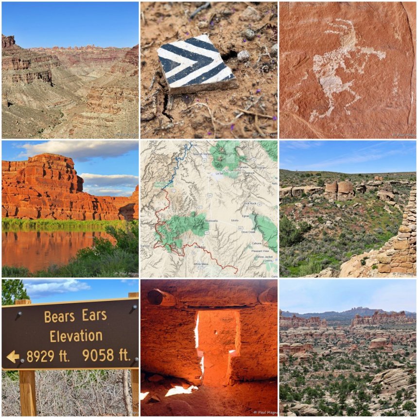
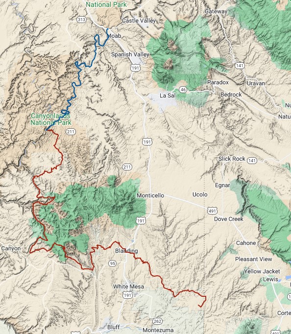
The SEUG Circuit route
As mentioned, the purpose of this route entailed connecting the four NPS units that make up the SEUG and the places in between. I also walked through two additional monuments, one USFS wilderness area, and even (very briefly) went through a state park.
I pack rafted just under 70 miles on the Colorado (Grand) River and hiked ~180 miles after this portion for approximately 250 miles of travel through SE Utah.
In brief –
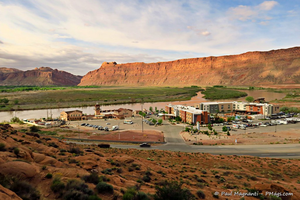
Alas, the newer hotel obscures this important view scape. The broad and flat area is where generations of people crossed before a bridge got constructed in the early 20th century.
I have the “Can I just paddle now???” grimace.
Link to video courtesy of Joan
I went by too quickly to take a good photo of the boundary on the river. You get the idea!
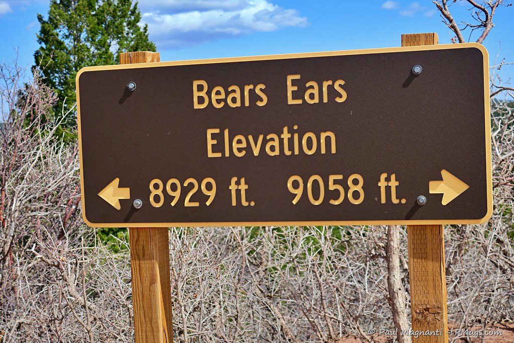
I walked through the saddle in between the ears.
What I liked about this route is that any trailheads along the way put me a 2 to 3 hrs, at the most, drive away from my home. It makes me even more grateful for the region I now call home with all its outdoor opportunities, history, and cultural aspects, and one fantastic person to share it all within the coming years.
Resources we used for planning and traveling in the field
First, the initial idea started off somewhat as a jest via Joan.
With some time off, she suggested I should walk to “all the parks” (another joke in itself about the “Mighty 5” campaign), but the more we talked about it, the more it made sense. What better way to see the four parks that make up the SEUG than to travel there? And with a “water trail” (the river) beckoning from almost our literal front door, I could make use of the packraft on a multi-night trip, too!
Thus the idea came forth.
Joan is just into map geekery and planning as I am, and between the two of us, we plotted a route drawing upon our shared experience and knowledge of the area.
We used the following resources beyond our knowledge and experience –
Permits and red tape
I had to procure a river permit and a separate zoned backpacking permit for Canyonlands via rec.gov (sigh). My views about rec.gov aside, I found the permit process easy. It helps I live in Moab and easily picked up my permit at the backcountry office in the SEUG HQ at the edge of town. I did need to use wag bags for the river portion of the trip as well.
Joan procured us car camping sites at Hovenweep and Natural Bridges, which made for handy resupply and easily extended stays at these two gems.
Otherwise, I easily dispersed camp everywhere else along this route.
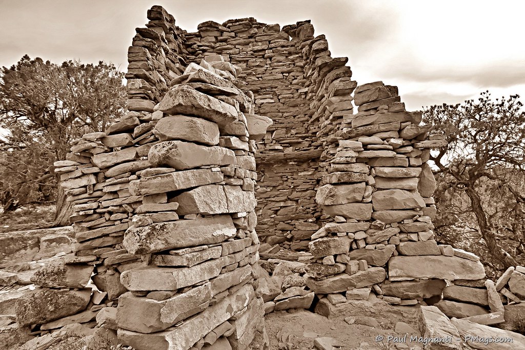
Different park; same idea. From NPS.gov
Resupply
Resupply could not be more straightforward for me. Logistics went easily when living so close by and with friends in the area.
Their (apparently well-known!) climbing friend provided mobile support and shared the magic with me, too.
For the gear wonks, that’s an LHG Melly clone I started using for camping/traveling. I find it comfy and warm but not suitable for my backpacking style—more to come..at some point.

Joan met me about a mile from the end with breakfast burritos and cold drinks.
Better than “cow water!”
Issues
Honestly, due to our knowledge and experience in the area, we already knew the general flow of the route even before we started looking at it in more detail.
My route had no technical sections, and everything went as expected.
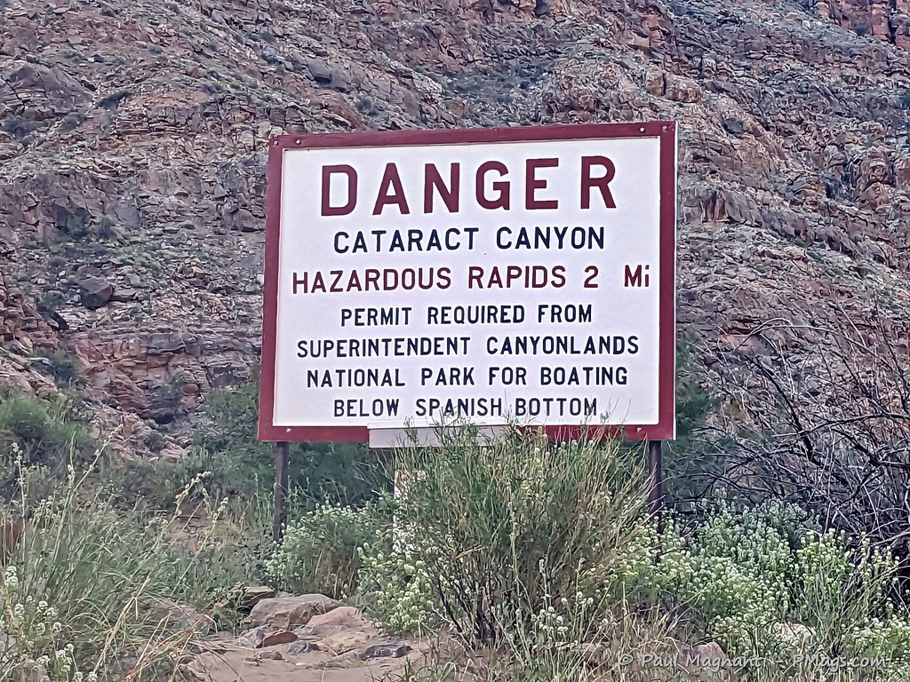
If there were any issues this year, it was water…or rather, too much!
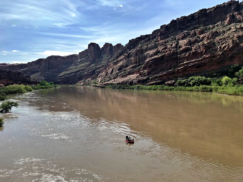
During this very high snow year and wet spring, the river portion was RAGING. I did all but one mile of the river (by choice) in two days. That’s more a tribute to the flow than my paddling skills. After the confluence, I think I averaged about 6 MPH. Very fast for an Alpacka Scout packraft!
PCO Joan.
Because of the high water, I could not see the three river sites I wanted to visit. The tamarisk and willows inhibited a safe landing unless I wanted to risk puncturing my raft. Even the known camp spots seemed hard to get to for more traditional rafts.
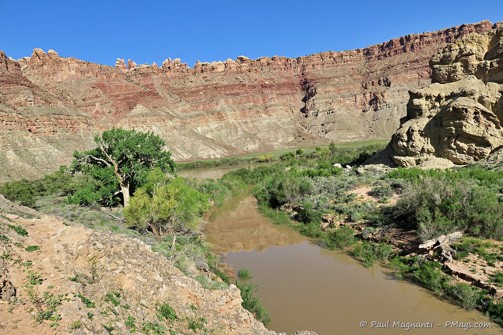
I think it’s telling that Spanish Bottom, usually a wide and shallow sandbar, essentially, well, had no bottom this year.
Back in 2019.
Spanish Bottom, and the hiking trail from here, both under feet of water.
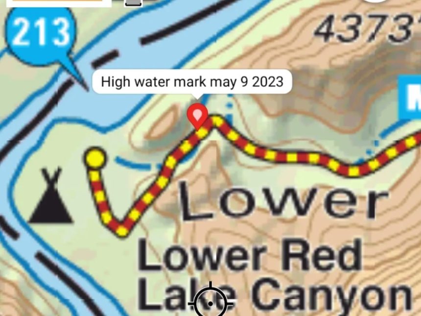
And the map tells the tale.
Otherwise, abundant water (if silty sometimes!) through the whole route. The only time I had less than optimal water ended as my last night when I had to gather water from a stock tank. Even I treated that water!
Gear
I know there’s much interest in gear. You can read my take on my general gear loadout (which needs slight updating) and packrafting gear.
More specifically –
The Why
Of course, this trip did not just mean miles covered, gear used, or even seeing the four NPS units. Instead, for me, it meant connecting the parks and the areas in between and traveling, at least partially, on many of the historical corridors used by Ancestral Pueblo, post-Columbian people, LDS pioneers, and many others who came this way long before myself.
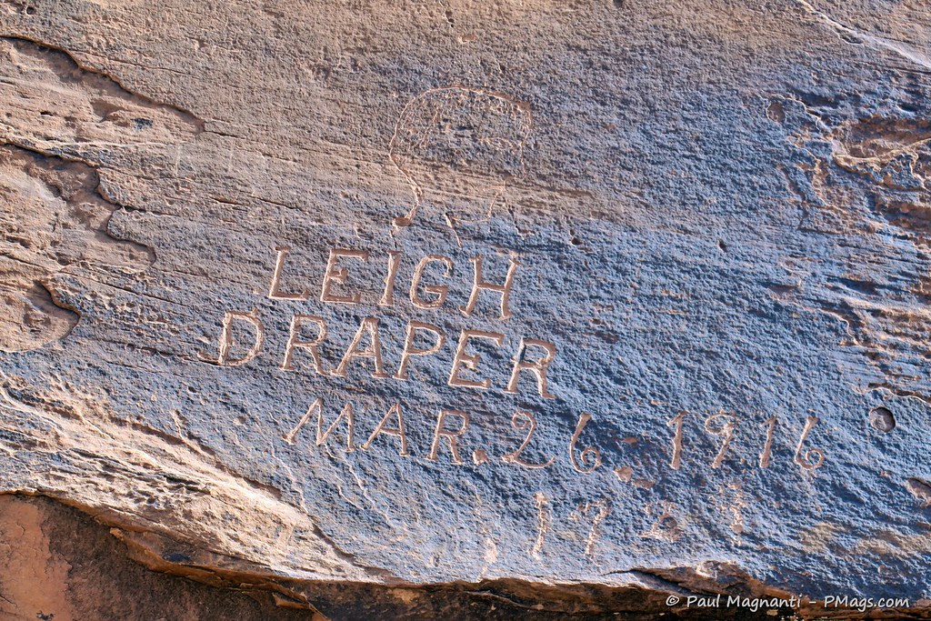
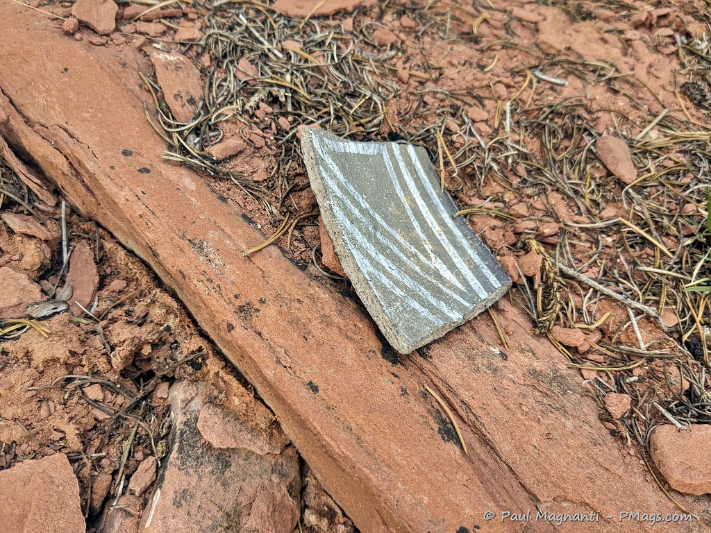
You can only travel so many non-technical ways through canyon country. And when you see structures, images, and even 100-yr old inscriptions, you realize how interconnected all these places are overall.
They are not isolated monuments and wilderness areas. They are areas just as connected, and often near or on, our modern towns and rivers.
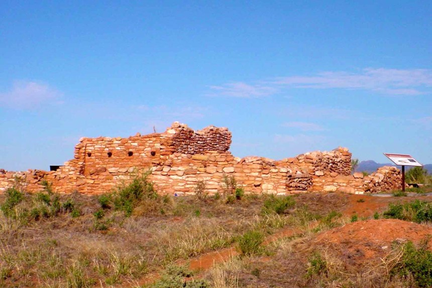
Edge of the Cedars great house. From Utah.gov
And traveling by foot or paddle, you feel more interconnected with this landscape in a way an auto does not replicate.
I am grateful for the opportunity to again travel for an extended time through this region. It gives me a deeper appreciation for this corner of the world I now call home.
More photos
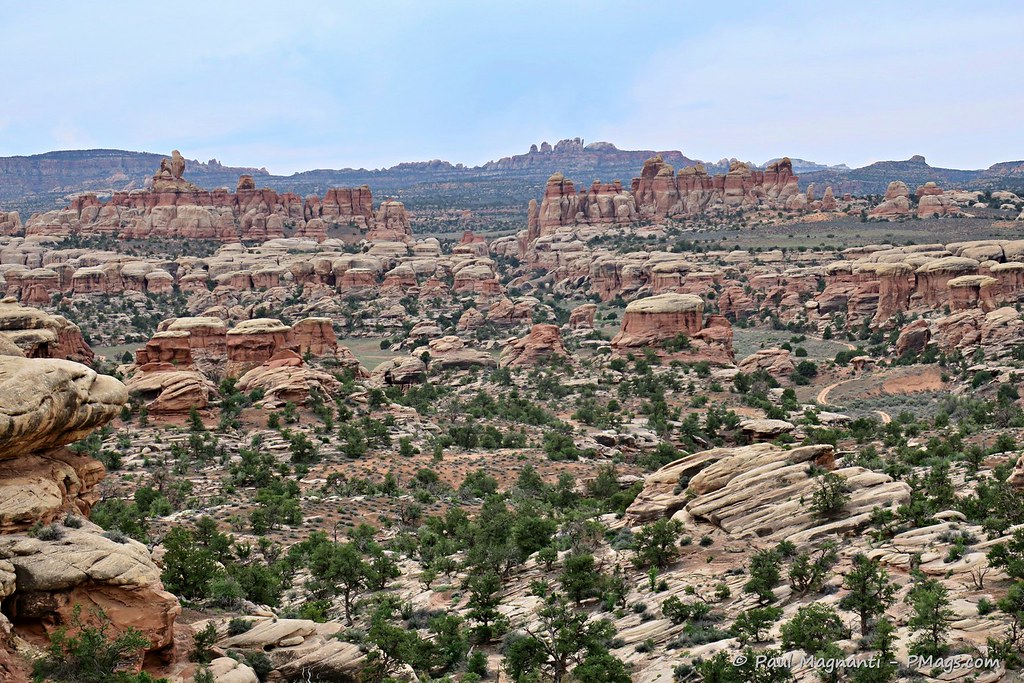
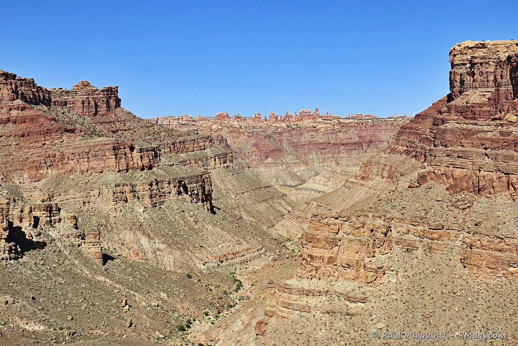
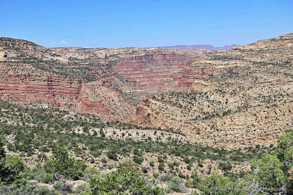
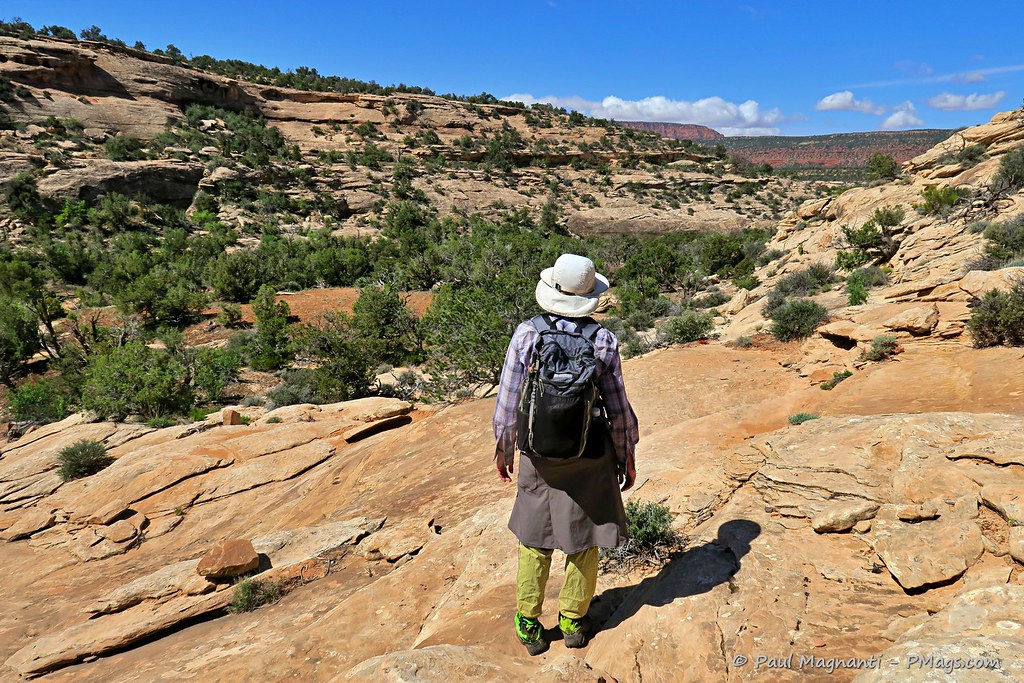
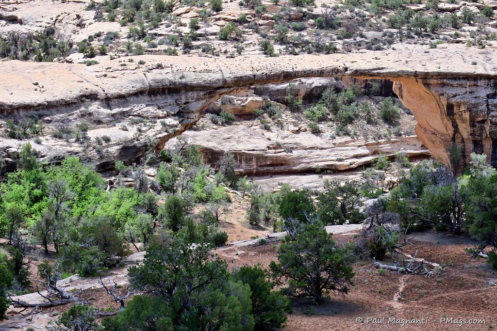
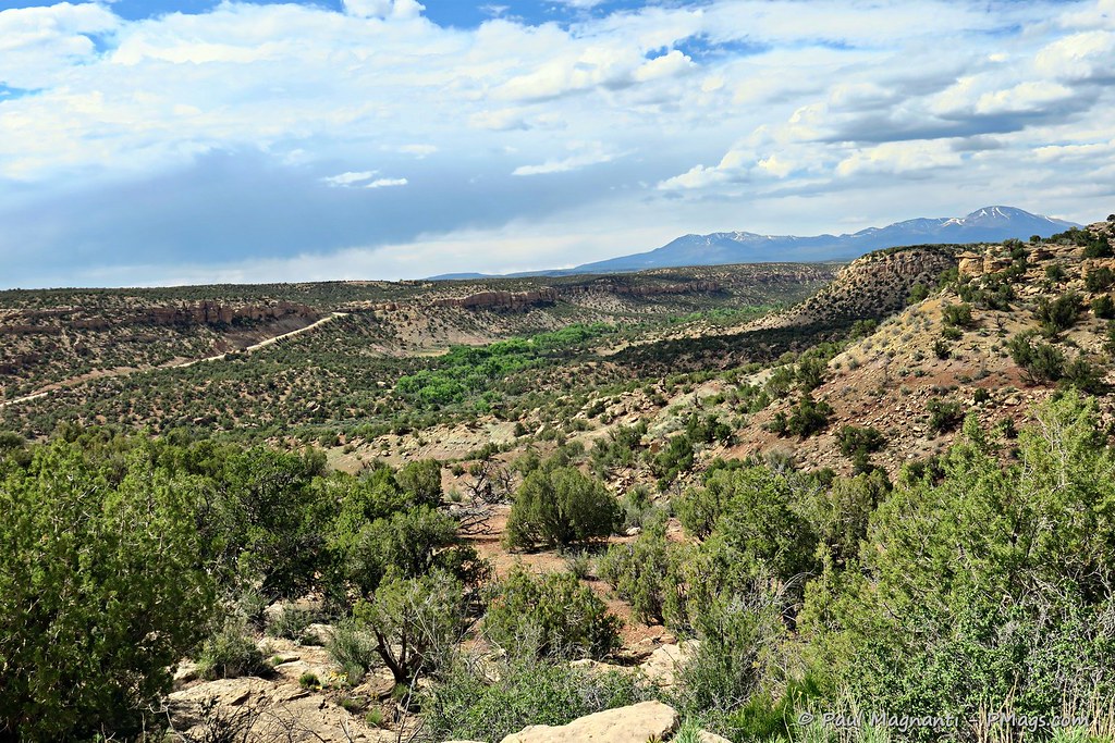
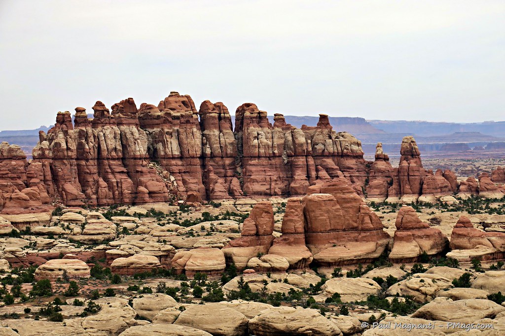
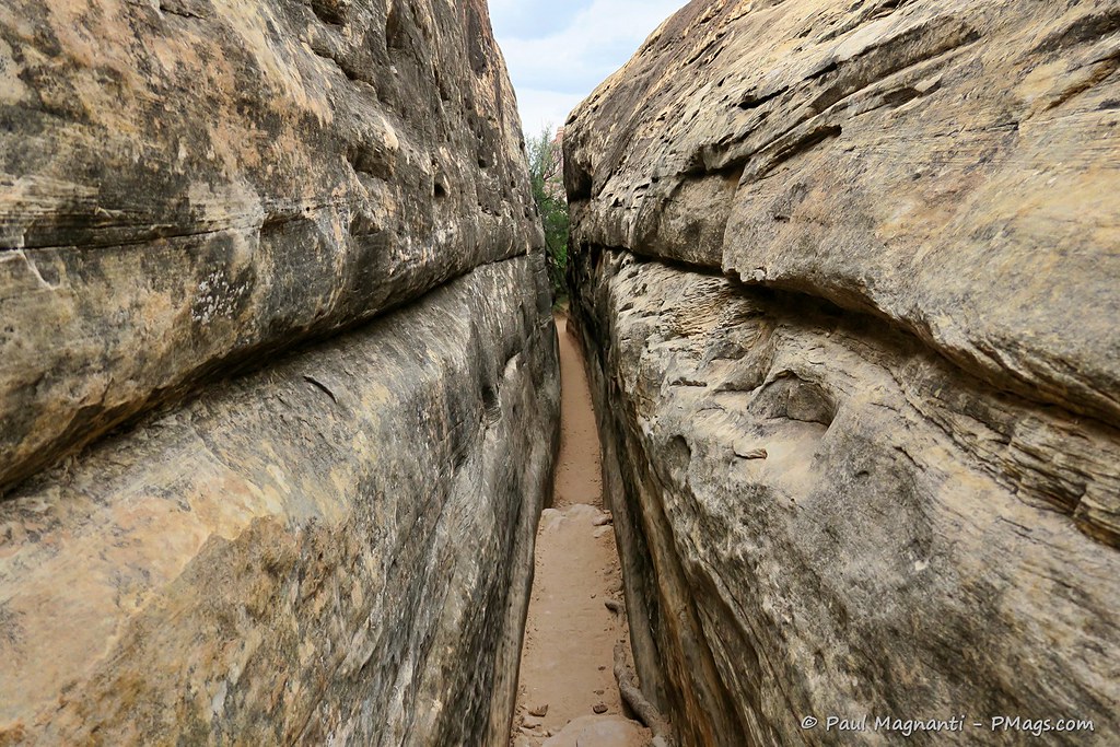
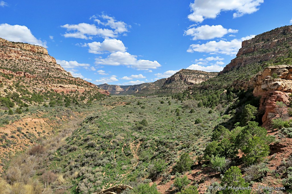
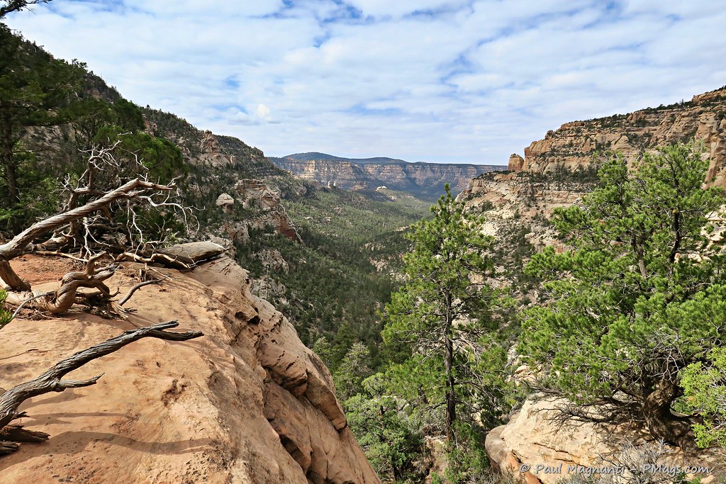
Though a relatively short trek of “only” ~250 miles, there is much to see and experience in such a stretch.
Here are some more photos of the places where I journeyed.
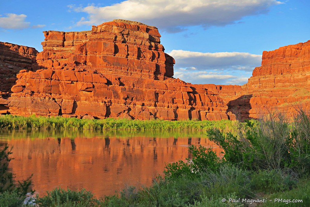
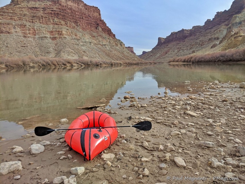
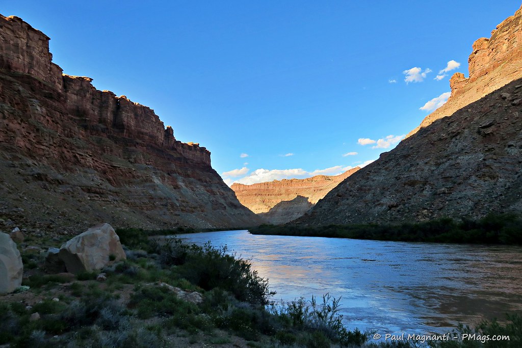
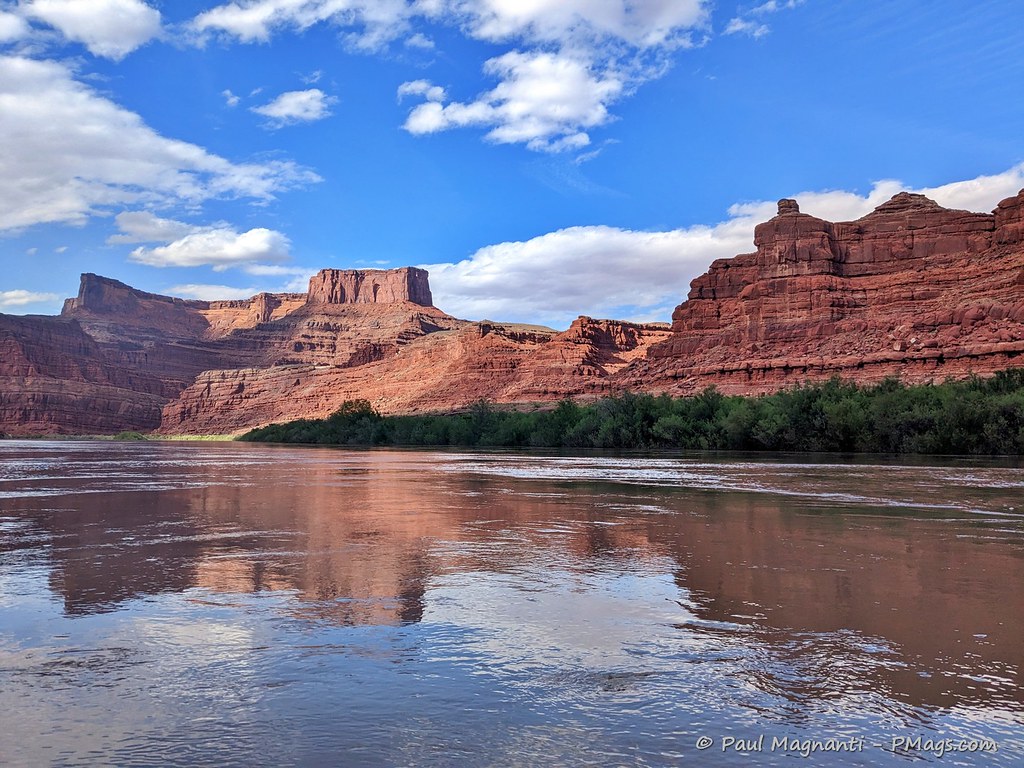
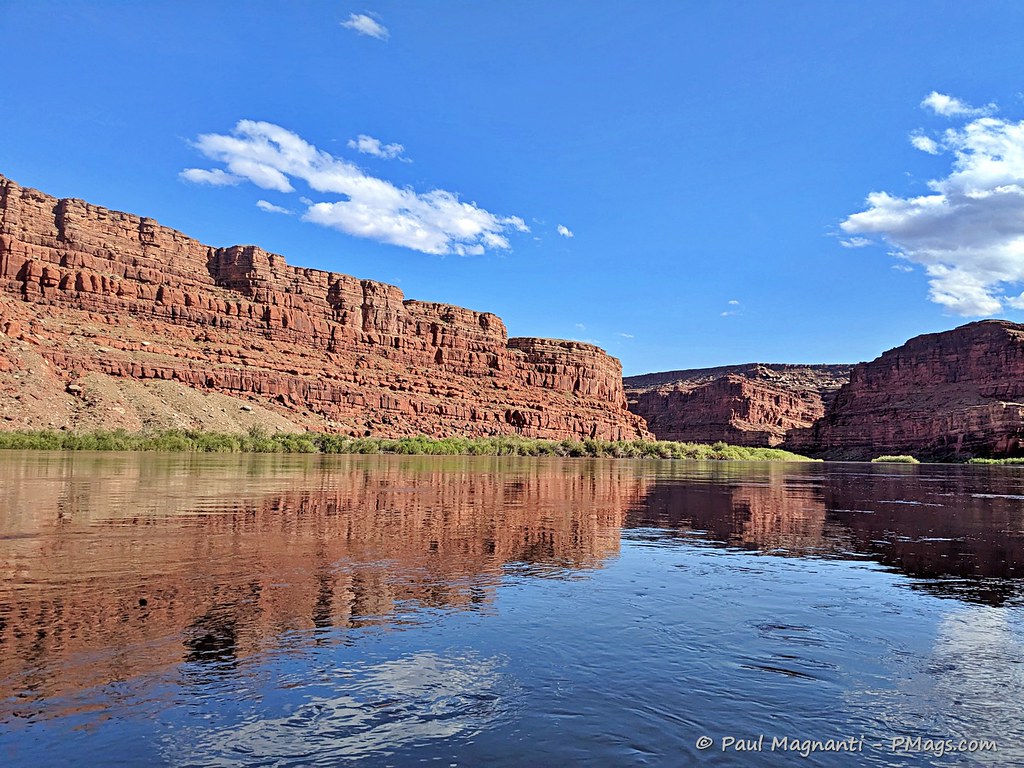
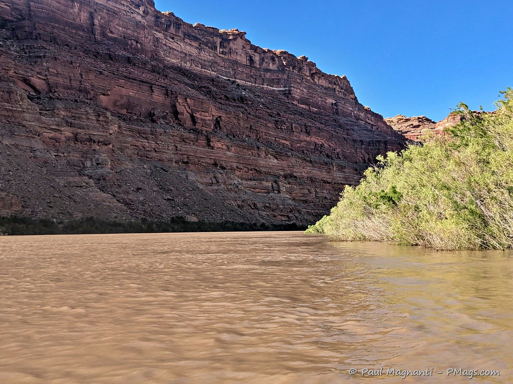
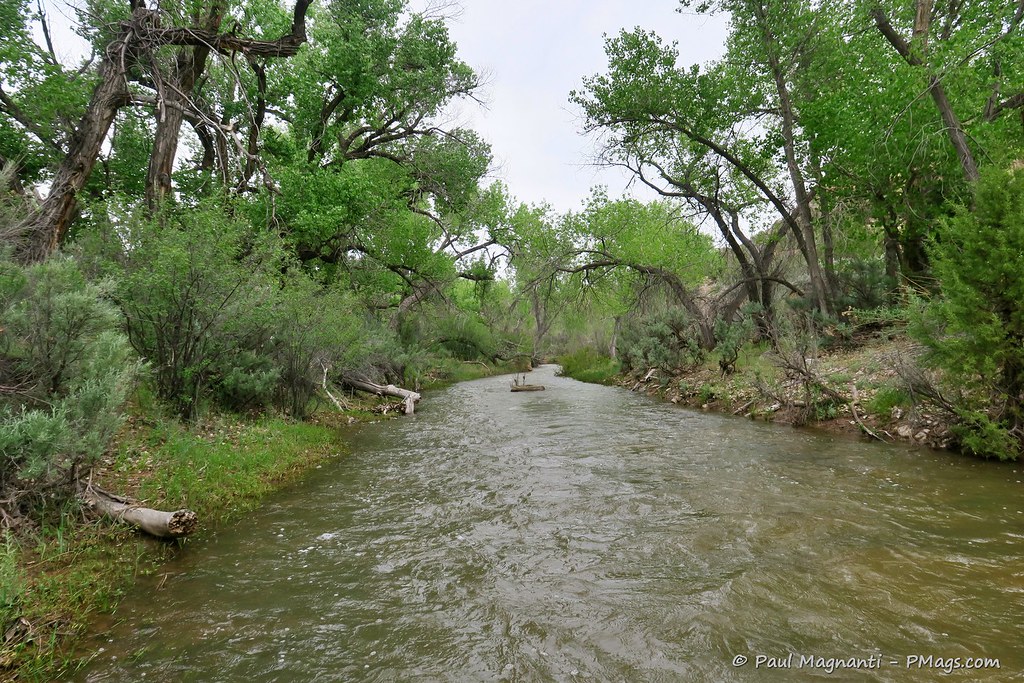
The not-quite-seventy miles of the river provided some sublime views with red rock canyons and the sun reflecting on the walls –
“The Confluence” is where the two rivers form the lower Colorado River. And arguably one of the most critical places in the modern American West.
My exit ramp is coming up!
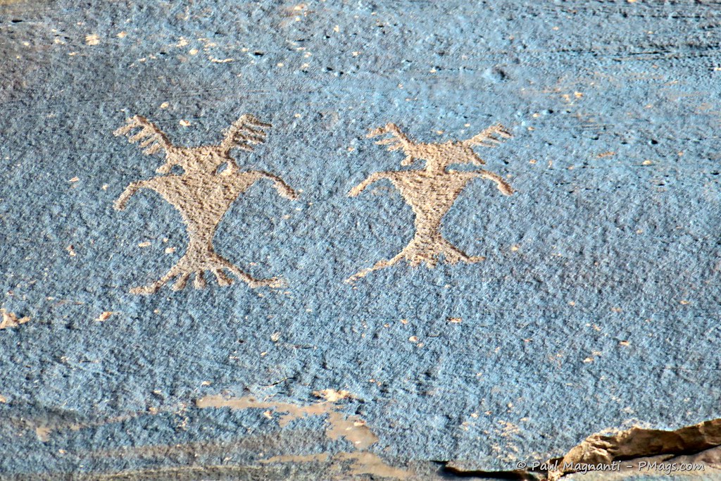
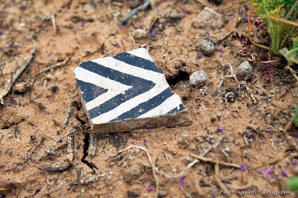
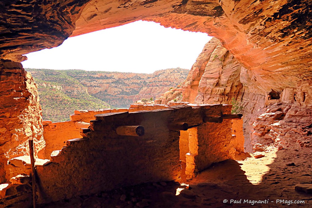
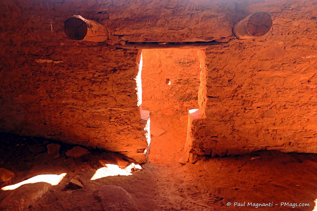
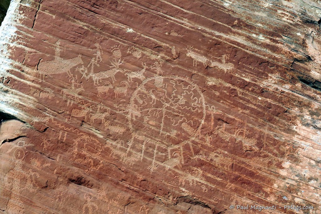
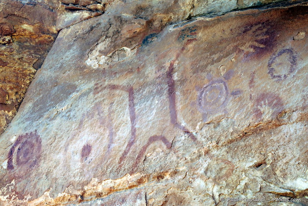
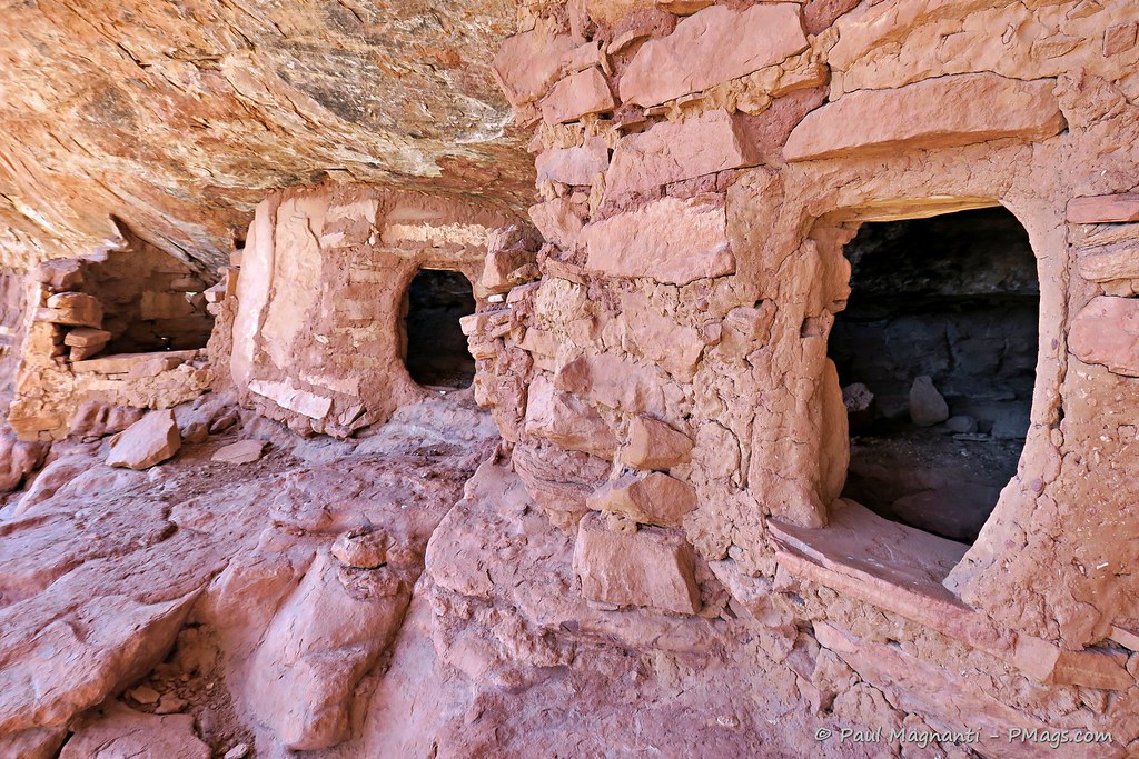
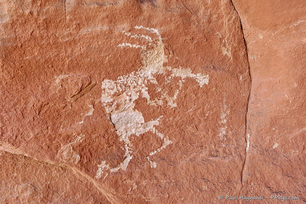
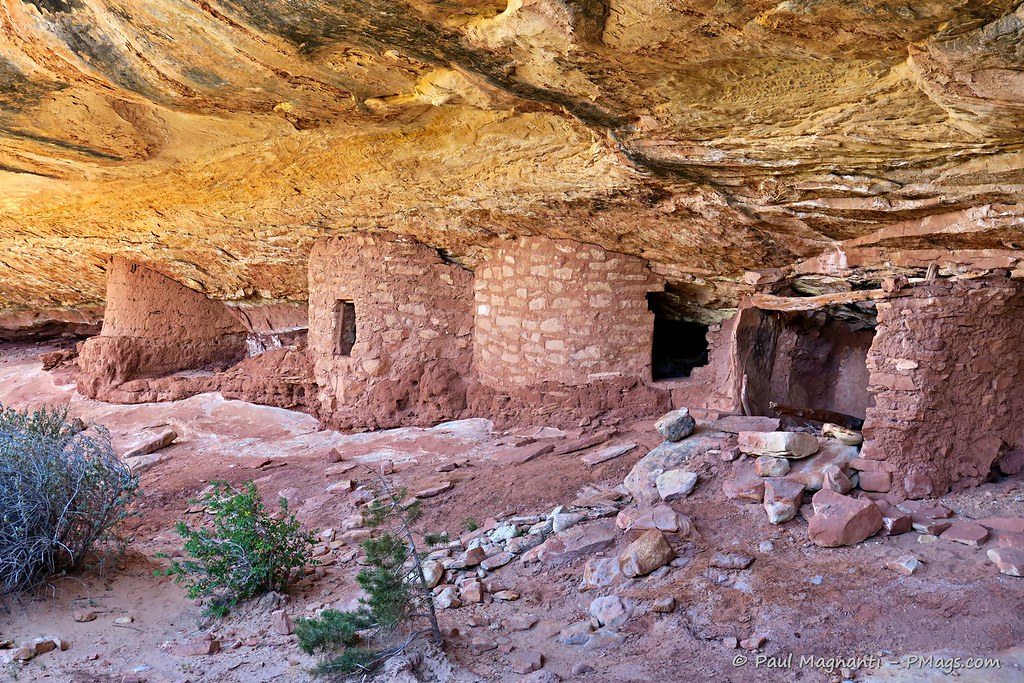
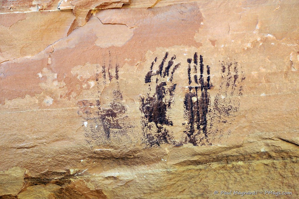
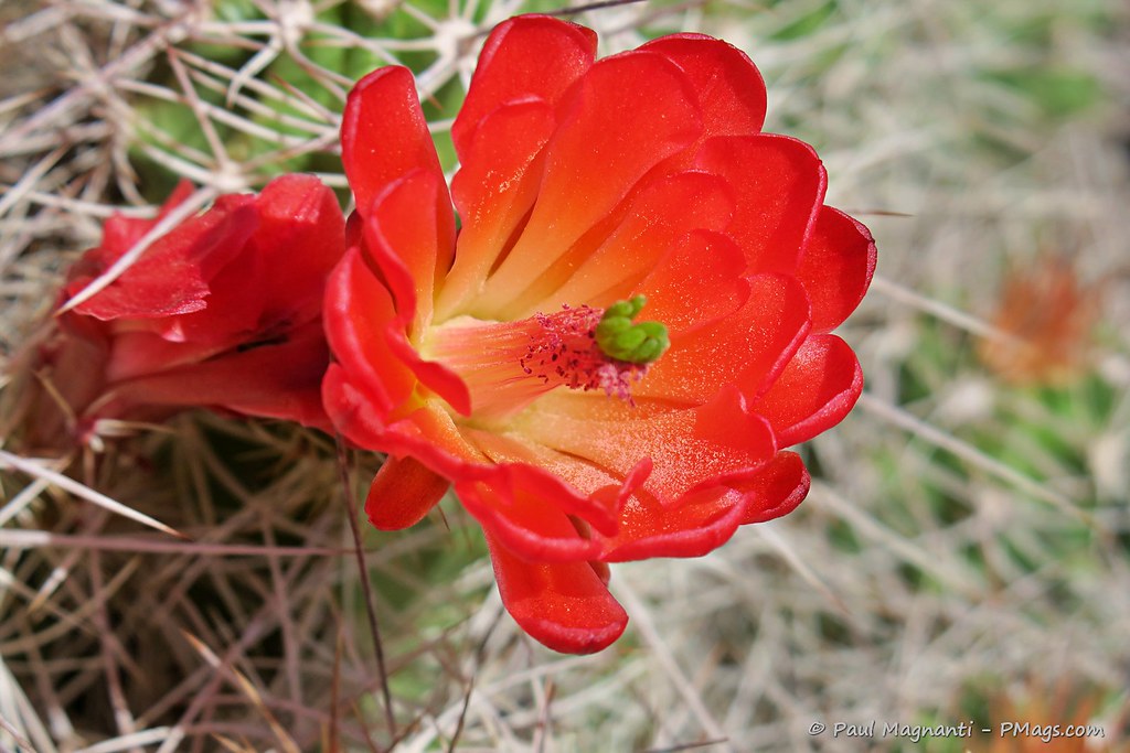
And I never cease to find wonder in following in the footsteps of people who came long before me –


PCO Joan
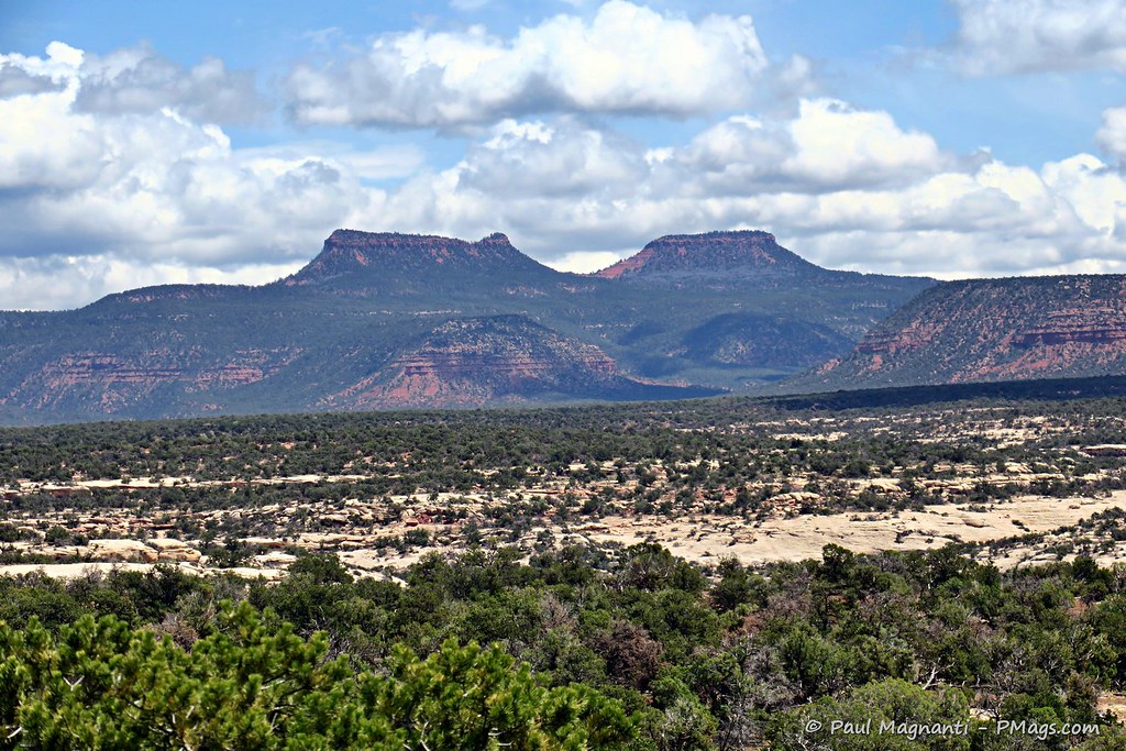
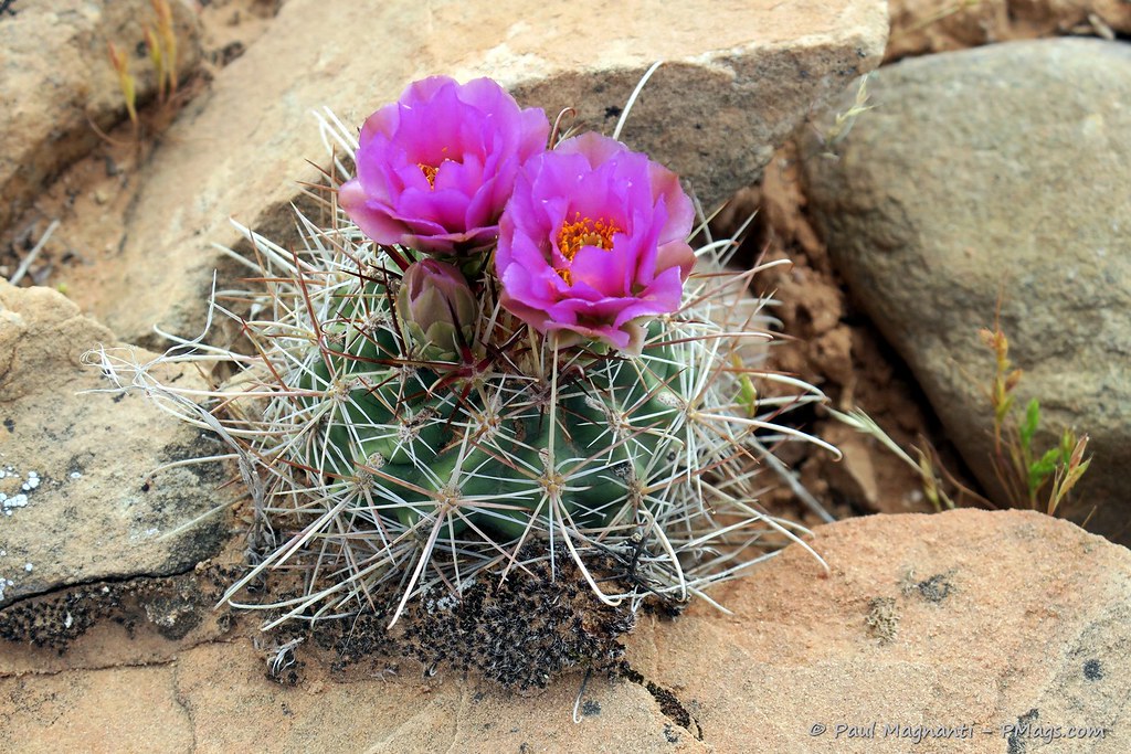
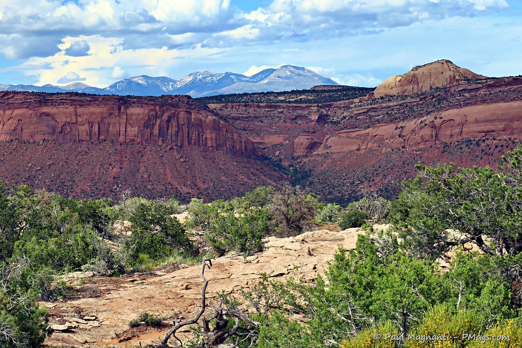
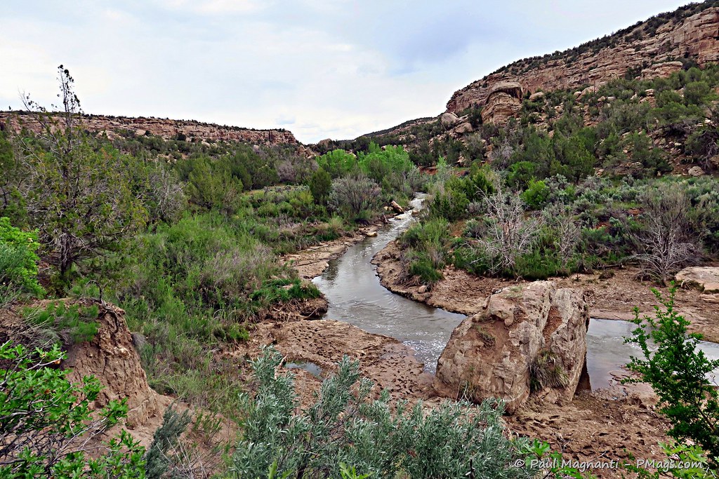
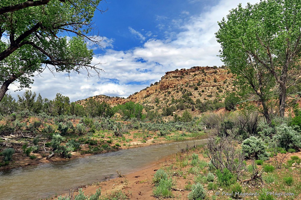
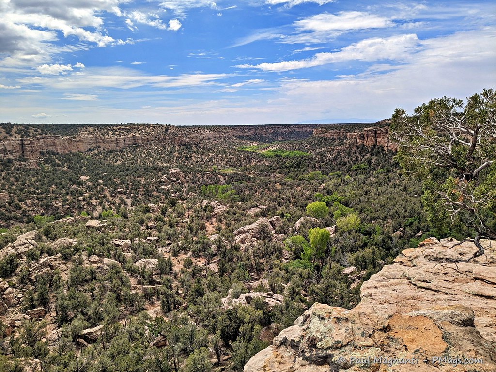
And the scenic beauty of South East Utah never stops inspiring –

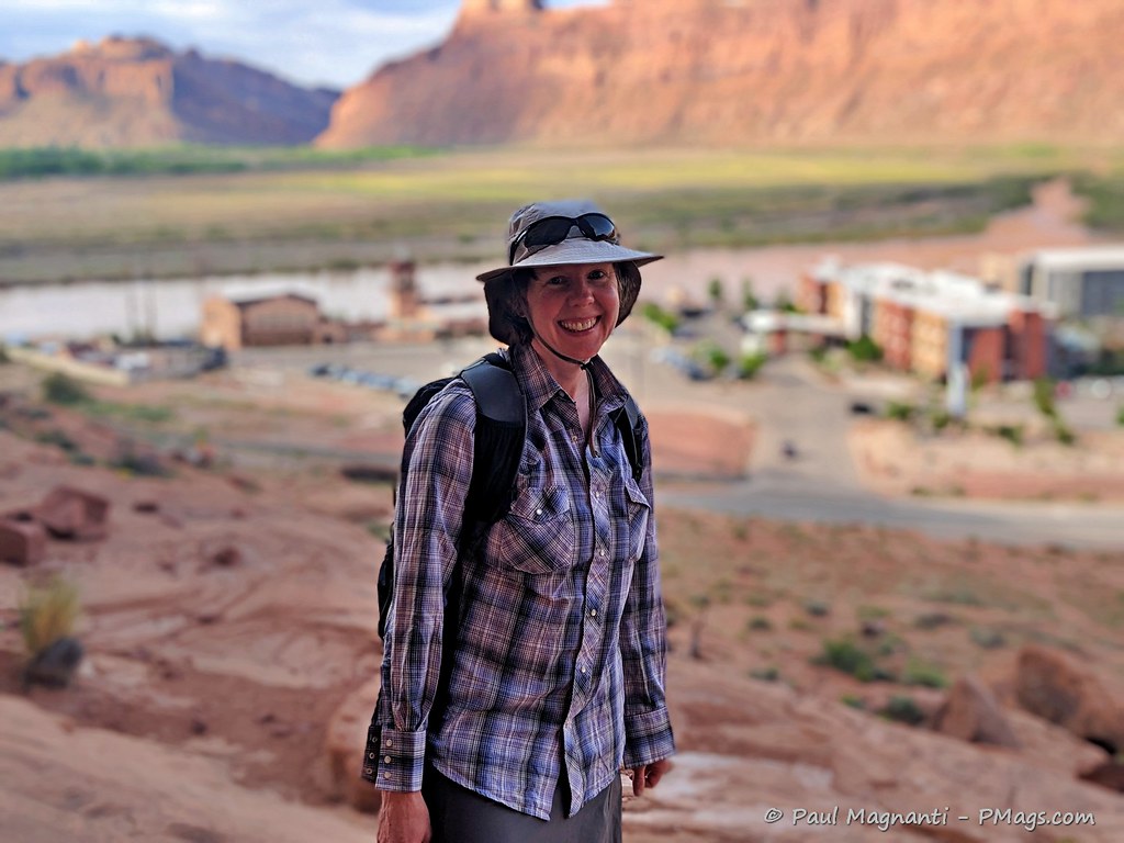
And I continue to be grateful for Joan’s love, support, a shared passion for the wild places, and getting to share this life we created for ourselves –
~~~~
Here’s to many more years of traveling through the Colorado Plateau!
As detailed earlier, I am starting a new position in early-mid June. As such, I gave myself the gift of time to packraft and walk to connect the four national park units that comprise the South East Utah Group.
Connecting the parks and seeing the lands in between allowed me to immerse myself in the natural beauty of the Colorado Plateau of southeastern Utah and immerse myself into the historical and cultural landscape that makes up this unique part of the world.
The SEUG Circuit route
As mentioned, the purpose of this route entailed connecting the four NPS units that make up the SEUG and the places in between. I also walked through two additional monuments, one USFS wilderness area, and even (very briefly) went through a state park.
I pack rafted just under 70 miles on the Colorado (Grand) River and hiked ~180 miles after this portion for approximately 250 miles of travel through SE Utah.
In brief –
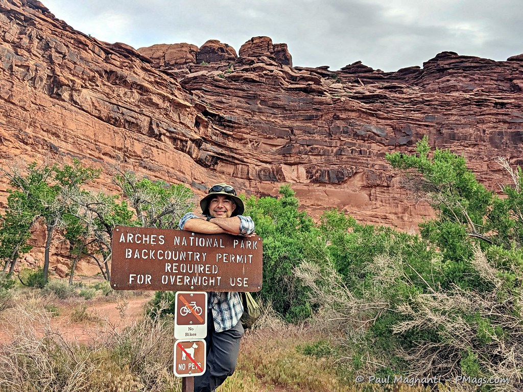
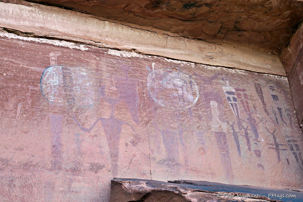
- I started at Courthouse Wash in Arches National Park and viewed the well-known and significant Courthouse Wash Panel that overlooks the historical American Indian Crossing of the Colorado River.
Alas, the newer hotel obscures this important view scape. The broad and flat area is where generations of people crossed before a bridge got constructed in the early 20th century.
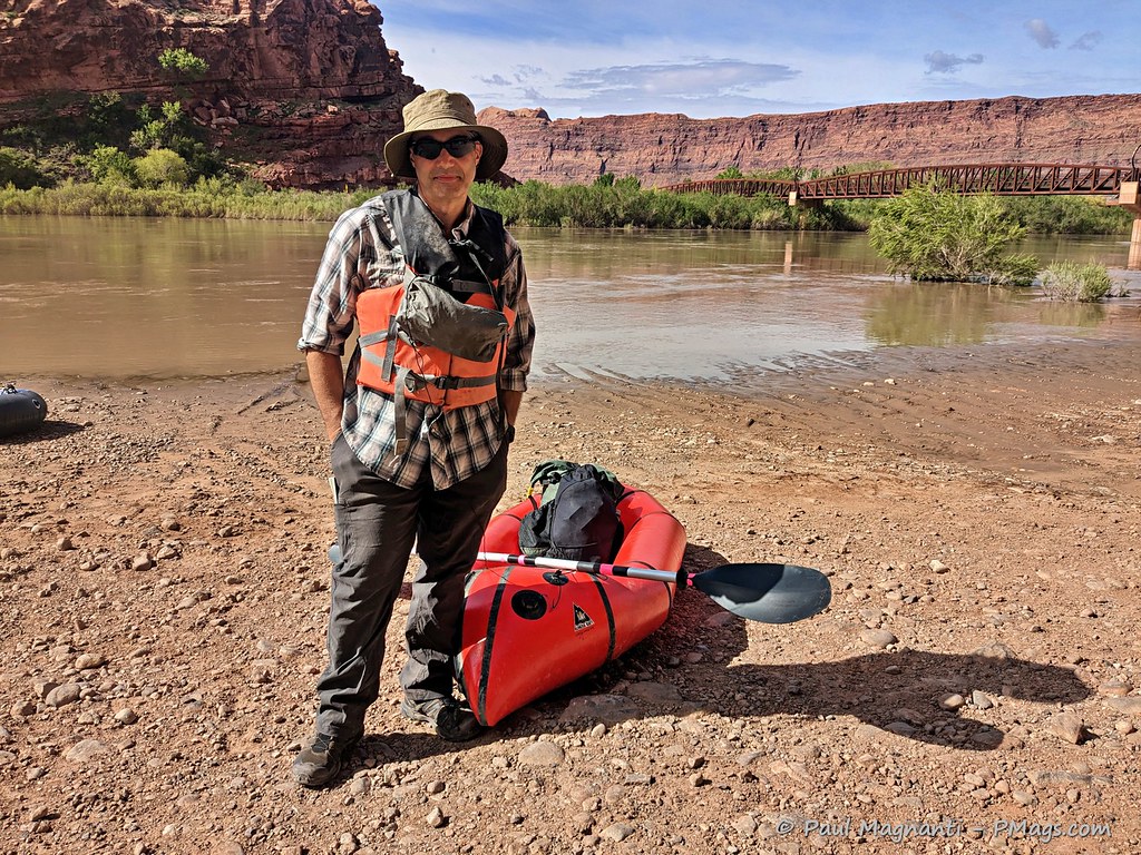
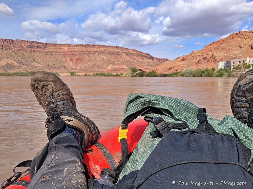
- From there, I walked the Moab boat launch, inflated my packraft, and paddled just under seventy miles of the Colorado (Grand) River just past the confluence with the Green River and to Spanish Bottom.
I have the “Can I just paddle now???” grimace.
Link to video courtesy of Joan
I went by too quickly to take a good photo of the boundary on the river. You get the idea!
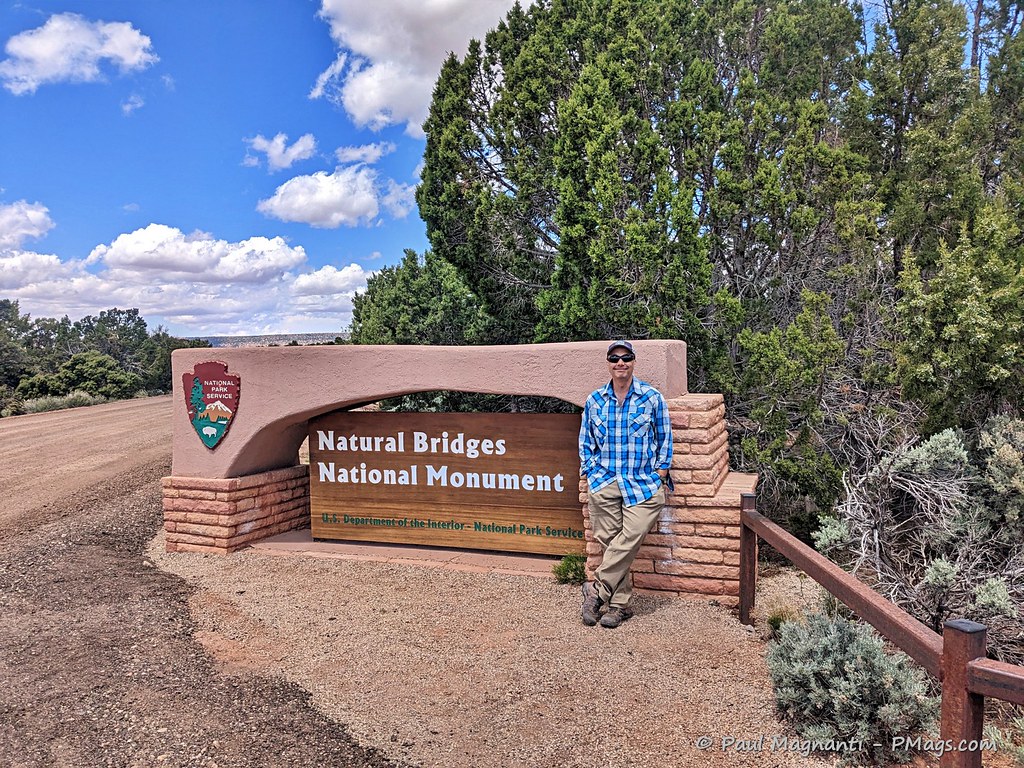
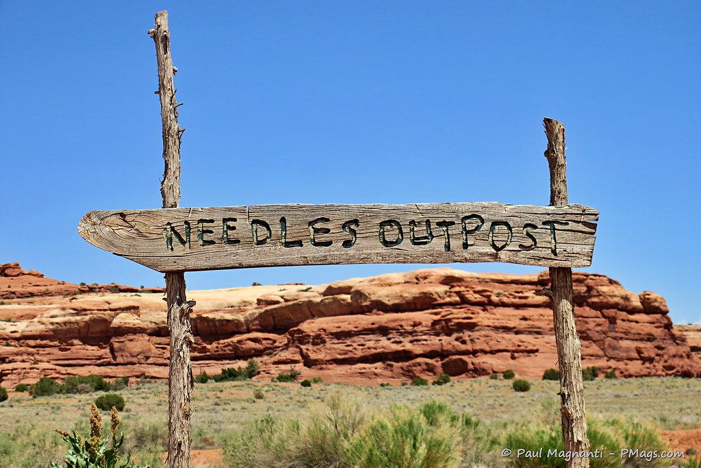
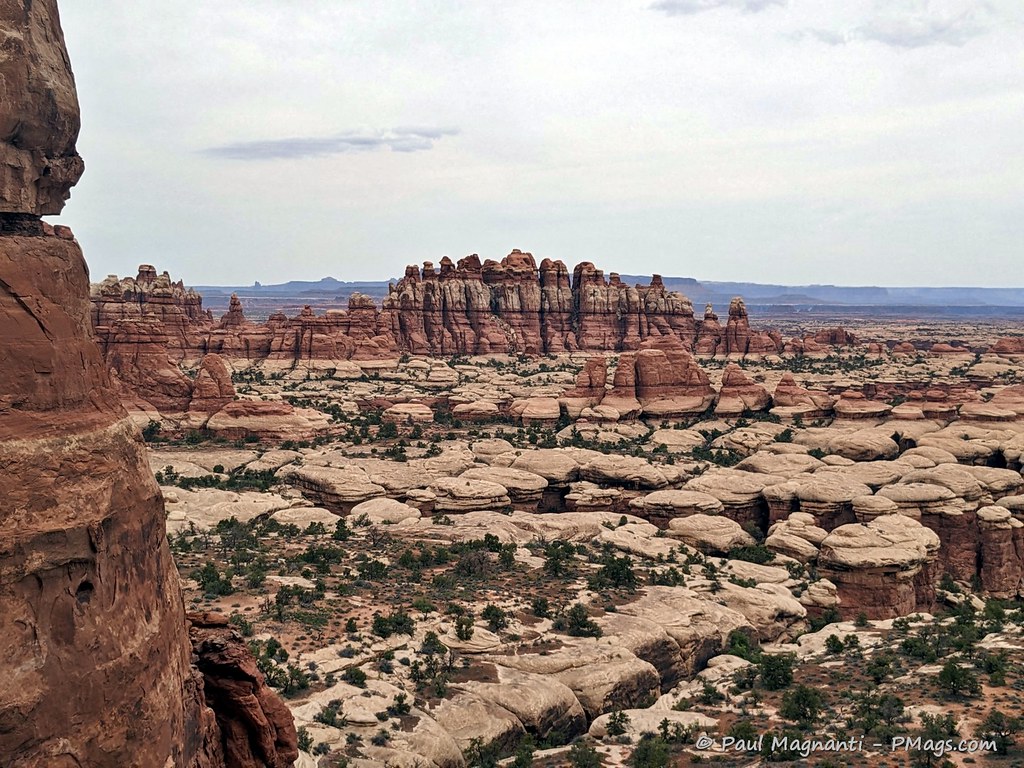
- I landed at Spanish Bottom, made my way through the Needles District, resupplied and dropped off my packrafting gear at Needles Outpost (private campground just outside the park boundary), and hiked out of the Needles and made my way via the “places in between” to Natural Bridges National Monument.
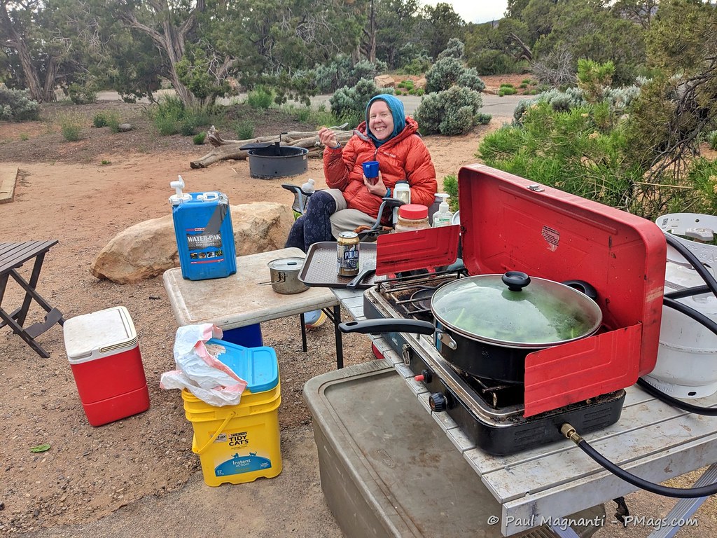
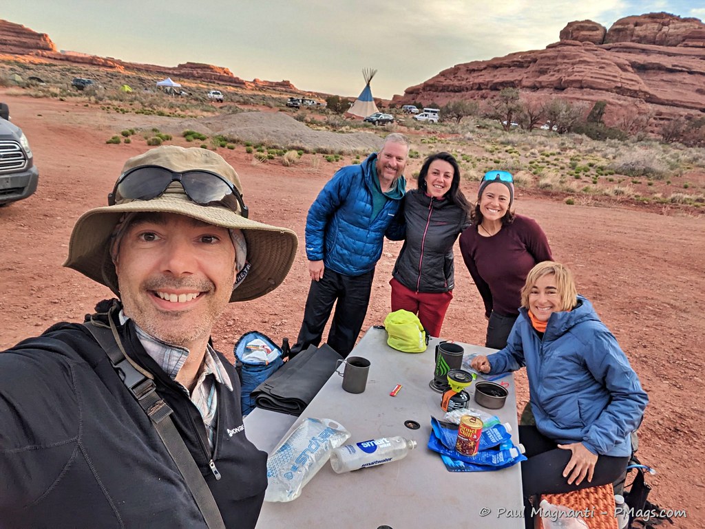
- At Natural Bridges National Monument, Joan (one of my closest friends, favorite backpacking partner, and amazing wife) met up with me for not only resupply but also fresh food, our deluxe car camping setup, cold beer, and changes of clothes (comfy and warm car camping clothes, fresh backpacking clothes). We spent the weekend hiking, relaxing, and eating some good food. Did I mention beer, too?
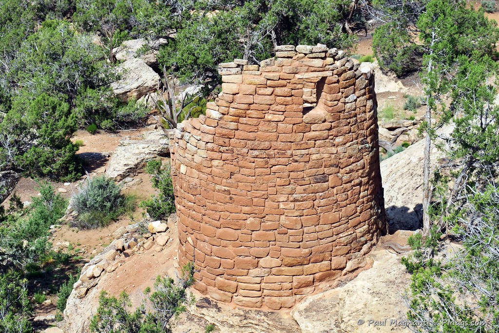
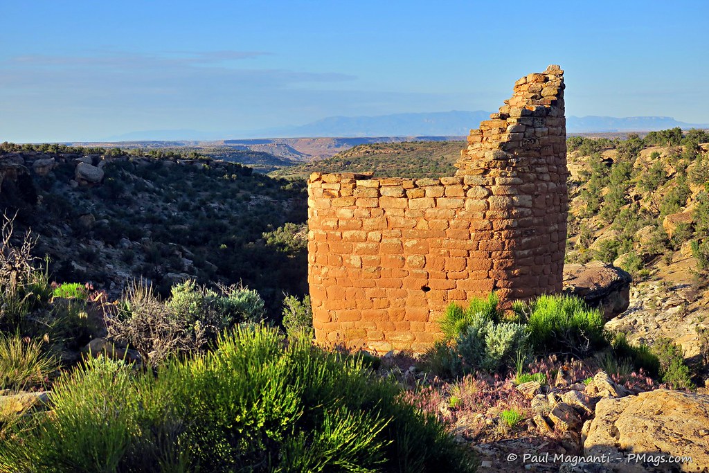
- I went through Bears Ears National Monument to Blanding, UT. I briefly stopped at the Edge of the Cedars State Park Museum. Alas, too early in the morning to check out the museum and the onsite Chacoan Great House. I’ve gone there a few times before, and gratifying to connect the cultural areas I’ve seen (more below) on foot to this critical site. In Blanding, I bought more food for the final push to Hovenweep.
I walked through the saddle in between the ears.
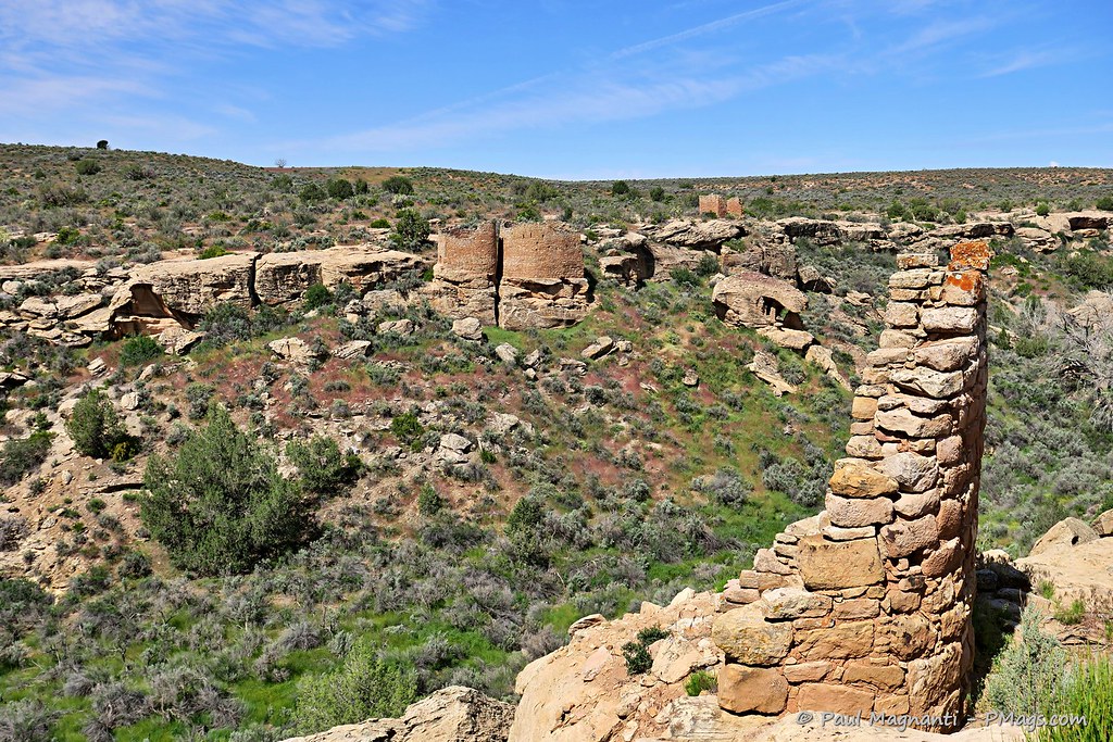
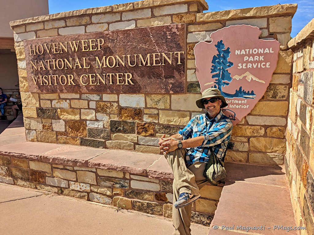
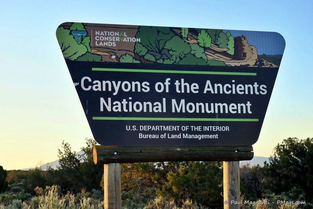
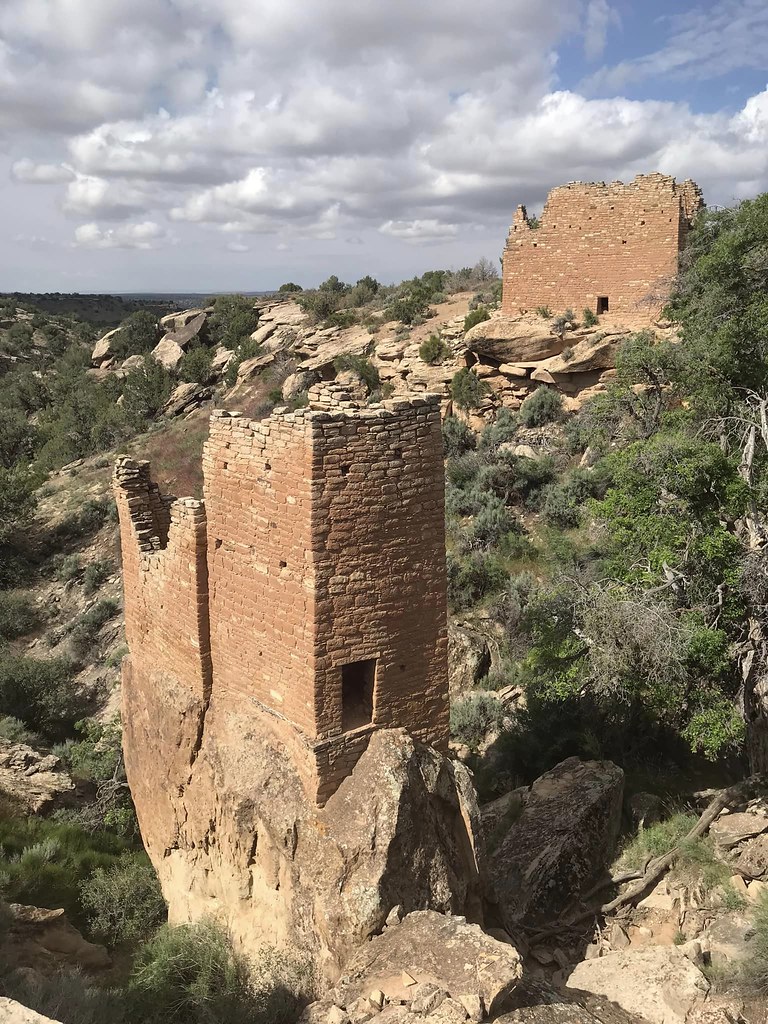
- Finally, from Blanding, UT, I went through more places in between, briefly went into the Canyons of the Ancients National Monument, and walked to Hovenweep National Monument to finish my trek. Joan again met up with me, and we spent two nights enjoying both Hovenweep and the adjacent BLM Canyons of the Ancients National Monument.
What I liked about this route is that any trailheads along the way put me a 2 to 3 hrs, at the most, drive away from my home. It makes me even more grateful for the region I now call home with all its outdoor opportunities, history, and cultural aspects, and one fantastic person to share it all within the coming years.
Resources we used for planning and traveling in the field
First, the initial idea started off somewhat as a jest via Joan.
With some time off, she suggested I should walk to “all the parks” (another joke in itself about the “Mighty 5” campaign), but the more we talked about it, the more it made sense. What better way to see the four parks that make up the SEUG than to travel there? And with a “water trail” (the river) beckoning from almost our literal front door, I could make use of the packraft on a multi-night trip, too!
Thus the idea came forth.
Joan is just into map geekery and planning as I am, and between the two of us, we plotted a route drawing upon our shared experience and knowledge of the area.
We used the following resources beyond our knowledge and experience –
- Jamie Green’s many “Across Utah!” variations gave us some ideas for this route and many in the past. Arguably, he’s the most experienced long-distance Utah backpacker, and his site provides lots of inspiration.
- The Belknap Canyonlands River Map and Kelsey’s Canyonlands National Park River Guide gave valuable information for the packrafting portion.
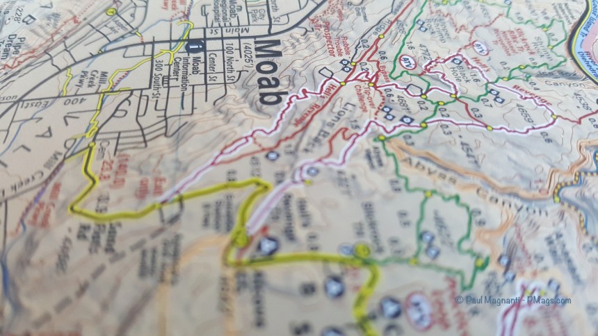
- The Utah Benchmark Atlas gave us a helpful overall planning view for print maps with the Latitude 40 Moab West, NatGeo Manti-La Sal NF map, and custom-printed USGS 7.5″ quads for the remainder.
- I plotted out the route with CalTopo, virtually ground-truthed it via the desktop version of Google Earth, and imported/tweaked it with Gaia GPS.
- In the field, I used print maps at night mainly. During the day, I typically used a combo of Gaia GPS and Avenza (Lat 40 Moab East). I found the Lat 40 map worked particularly well for the river portion.
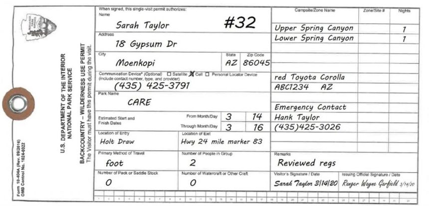
Permits and red tape
I had to procure a river permit and a separate zoned backpacking permit for Canyonlands via rec.gov (sigh). My views about rec.gov aside, I found the permit process easy. It helps I live in Moab and easily picked up my permit at the backcountry office in the SEUG HQ at the edge of town. I did need to use wag bags for the river portion of the trip as well.
Joan procured us car camping sites at Hovenweep and Natural Bridges, which made for handy resupply and easily extended stays at these two gems.
Otherwise, I easily dispersed camp everywhere else along this route.
Different park; same idea. From NPS.gov
Resupply
Resupply could not be more straightforward for me. Logistics went easily when living so close by and with friends in the area.
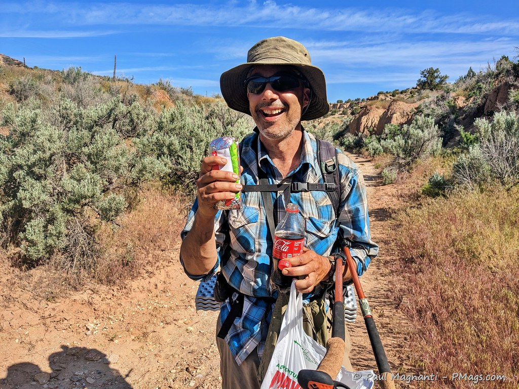
- I picked up a package, got a camp spot, and bought some goodies at the Needles Outpost. Many Hayduke hikes also use this resupply spot, and I shared my campsite with them for the evening. The owners were friendly enough to let me do a reverse maildrop, and I packed up and dropped off my packrafting gear. A friend who works at Canyonlands picked it up for me, and Joan picked up that package on the way to see me at Hovenweep.
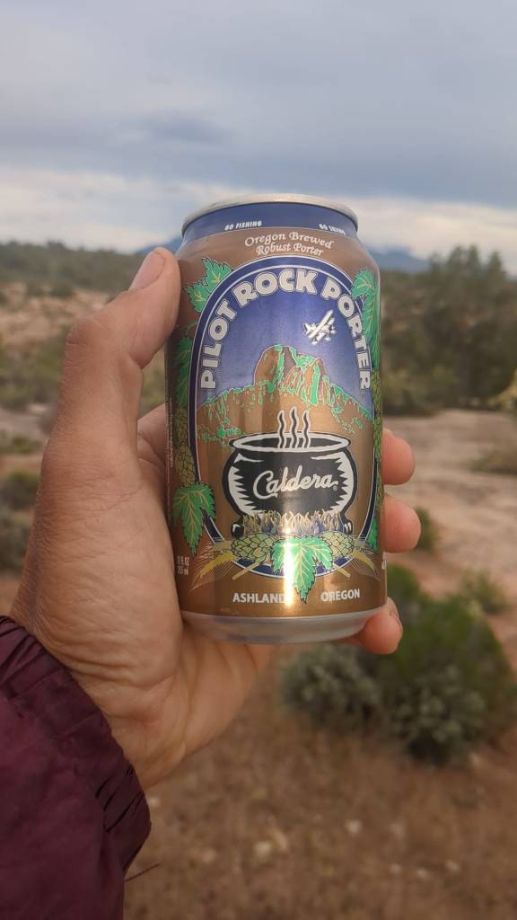
Their (apparently well-known!) climbing friend provided mobile support and shared the magic with me, too.
- As mentioned, Joan met me at Natural Bridges, and we spent the weekend together up there. The shave, deep sponge bath, clean clothes, fresh food, etc., along with her generosity, made this the best town stop ever!
For the gear wonks, that’s an LHG Melly clone I started using for camping/traveling. I find it comfy and warm but not suitable for my backpacking style—more to come..at some point.
- I bought some supplies in Blanding, where there is a good-sized grocery store. And the excellent Edge of the Cedars State Park Museum. Well worth checking out if you have the opportunity.
- Finally, Joan met me at Hovenweep, where I washed up, shaved, changed into clean clothes, and enjoyed town-stop-like amenities without the town stop. And three days in Hovenweenp and the nearby Canyons the Ancients is never a bad thing!
Joan met me about a mile from the end with breakfast burritos and cold drinks.
Better than “cow water!”
Issues
Honestly, due to our knowledge and experience in the area, we already knew the general flow of the route even before we started looking at it in more detail.
My route had no technical sections, and everything went as expected.
If there were any issues this year, it was water…or rather, too much!
During this very high snow year and wet spring, the river portion was RAGING. I did all but one mile of the river (by choice) in two days. That’s more a tribute to the flow than my paddling skills. After the confluence, I think I averaged about 6 MPH. Very fast for an Alpacka Scout packraft!
PCO Joan.
Because of the high water, I could not see the three river sites I wanted to visit. The tamarisk and willows inhibited a safe landing unless I wanted to risk puncturing my raft. Even the known camp spots seemed hard to get to for more traditional rafts.
I think it’s telling that Spanish Bottom, usually a wide and shallow sandbar, essentially, well, had no bottom this year.
Back in 2019.
Spanish Bottom, and the hiking trail from here, both under feet of water.
And the map tells the tale.
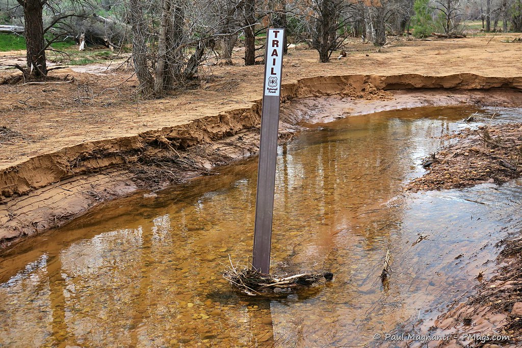
Otherwise, abundant water (if silty sometimes!) through the whole route. The only time I had less than optimal water ended as my last night when I had to gather water from a stock tank. Even I treated that water!
Gear
I know there’s much interest in gear. You can read my take on my general gear loadout (which needs slight updating) and packrafting gear.
More specifically –
- I swear by Western snap polycotton shirts for their breathability, price, durability, sun protection, and comfort while hiking.
- I used the ULA Circuit for the packrafting portion of the trip and swapped it to my ULA CDT at Natural Bridges. Both packs continue as workhorses for me, esp when it comes to water carries.
- Because of the higher water levels, swifter current, and a relatively small schlep of gear from the river to dropping it off, I opted for the more oversized, if heavier, paddles, as detailed in my packrafting gear link.
- The LHG silpoly rain jacket (2022 version) worked well on the river, especially during overcast and windy afternoons.
- The simple utility of two 1.5-liter bottles and a 1-liter sports drink bottle continues to suit my needs.
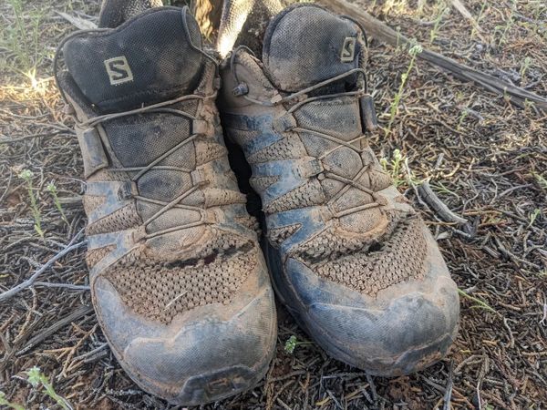
- Finally, I’ve been on a quest to replace my beloved Salomon Ultra X 3s. I gave the Salomon Ultra X 4s a 300-mile test run counting recent trips. I’ll provide an in-depth review. I like them, but not as much as the 3s.
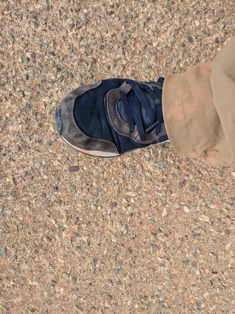
- Special mention – $4, Blanding thrift store Nikes. When the shoes above rapidly disintegrated (after Joan offered to bring me new shoes in my resupply, no less!), I bought a pair of shoes in the one Blanding, UT, thrift store. The $4 shoes managed to last just under 50 miles. I’ll take it!
The Why
Of course, this trip did not just mean miles covered, gear used, or even seeing the four NPS units. Instead, for me, it meant connecting the parks and the areas in between and traveling, at least partially, on many of the historical corridors used by Ancestral Pueblo, post-Columbian people, LDS pioneers, and many others who came this way long before myself.
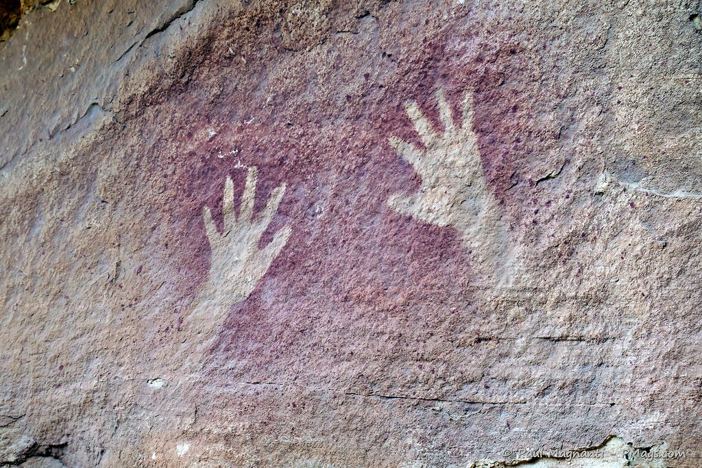
You can only travel so many non-technical ways through canyon country. And when you see structures, images, and even 100-yr old inscriptions, you realize how interconnected all these places are overall.
They are not isolated monuments and wilderness areas. They are areas just as connected, and often near or on, our modern towns and rivers.
Edge of the Cedars great house. From Utah.gov
And traveling by foot or paddle, you feel more interconnected with this landscape in a way an auto does not replicate.
I am grateful for the opportunity to again travel for an extended time through this region. It gives me a deeper appreciation for this corner of the world I now call home.
More photos
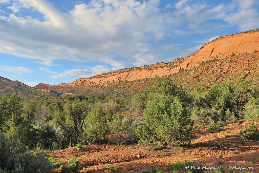
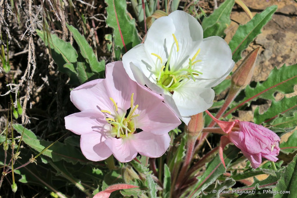
Though a relatively short trek of “only” ~250 miles, there is much to see and experience in such a stretch.
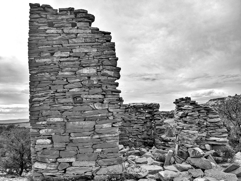
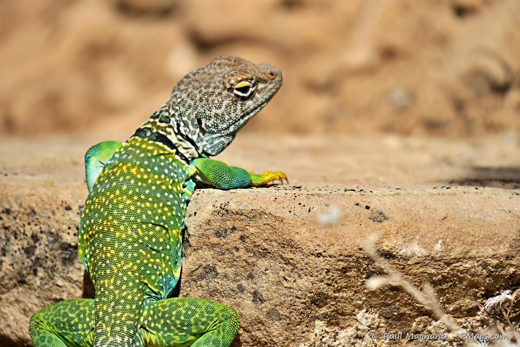
Here are some more photos of the places where I journeyed.
The not-quite-seventy miles of the river provided some sublime views with red rock canyons and the sun reflecting on the walls –
“The Confluence” is where the two rivers form the lower Colorado River. And arguably one of the most critical places in the modern American West.
My exit ramp is coming up!
And I never cease to find wonder in following in the footsteps of people who came long before me –
PCO Joan
And the scenic beauty of South East Utah never stops inspiring –
And I continue to be grateful for Joan’s love, support, a shared passion for the wild places, and getting to share this life we created for ourselves –
~~~~
Here’s to many more years of traveling through the Colorado Plateau!