IntrepidXJ
ADVENTR
- Joined
- Jan 17, 2012
- Messages
- 3,493
Saturday & Sunday, November 10-11, 2012
The Original Trip Report on ADVENTR.CO
For a little over a year now I've been pretty obsessed with exploring and photographing the unusual and spectacular sandstone formations of The Paria Plateau. I've been to Coyote Buttes North five times, Coyote Buttes South two times, and the White Pocket three times and have come back with some nice images and had a lot of fun. There is just so much to see up there I could probably spend a lifetime exploring the area and not see it all. Unfortunately, I feel it's time for me to take a little break from this area so I can concentrate on exploring some other areas on the Colorado Plateau for a while. This will probably be my last trip report from The Paria Plateau for a little while. Don't get me wrong, I might head back down there once or twice next year, but I certainly won't be driving down six or seven times like I've done this past year.
After work on Friday, Amanda and I started our drive south down to Page once again. There were some pretty good storms moving through the area which slowed us down a little and gave us some very strong winds to drive through. We eventually made it to our hotel, just a little later than I had anticipated. We quickly got to bed so I could be up bright and early for the sunrise on Saturday morning.
Since I had no plans to get up super early and hike into Coyote Buttes North before sunrise, I decided to head over to Horseshoe Bend for the sunrise while Amanda slept in a little later at the hotel. I had the place to myself for the sunrise which was a pleasant experience. About 20 minutes before the actual sunrise there was a nice glow that lit up the sandstone.
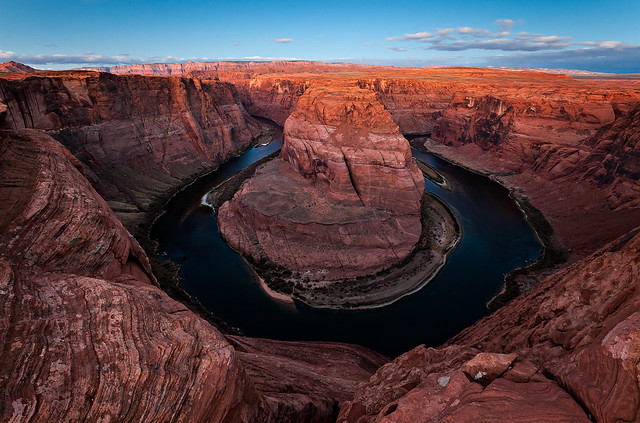
Horseshoe Bend Dawn by IntrepidXJ, on Flickr
My shadow on the golden sandstone as the sun rises behind me.
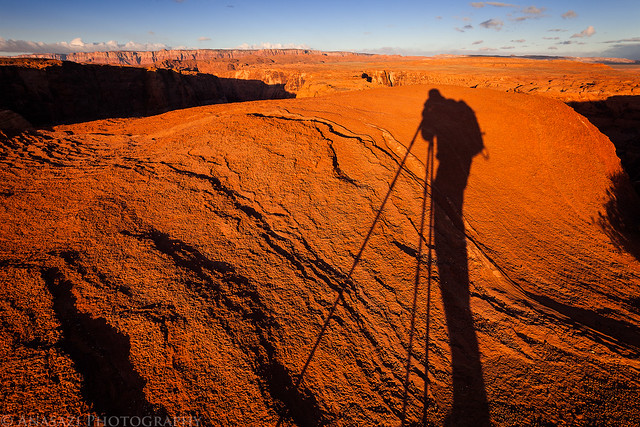
Long Shadow by IntrepidXJ, on Flickr
I just love warm morning light on sandstone, which there is no shortage of here.
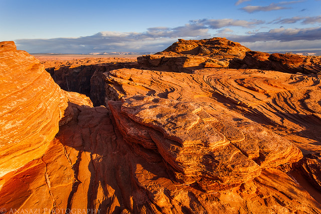
Sandstone Sunrise by IntrepidXJ, on Flickr
After returning to the hotel, Amanda and I had some breakfast and then drove over to the Wire Pass trailhead so we could start our hike to Coyote Buttes North and The Wave. This would be my fifth visit to the area and Amanda's third. It was actually just one week over a year since we first visited The Wave together. It was pretty cold out and the wind was blowing pretty good, but it was turning out to be a great day for photography with plenty of clouds moving through the sky and constantly changing light, which are some of my favorite conditions!
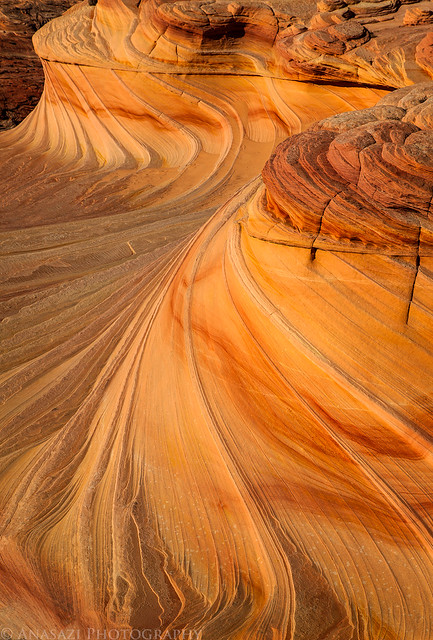
As usual, we first hiked to The Wave to get a few photos before the shadows would get in the way. I actually climbed up above The Wave first for this shot.
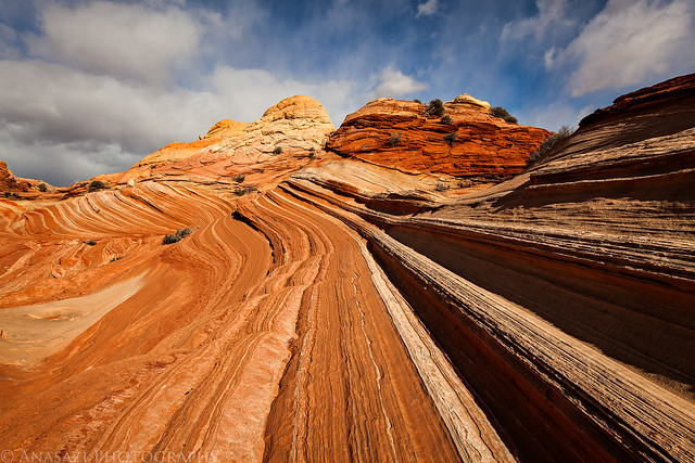
Above The Wave by IntrepidXJ, on Flickr
A typical Wave photo.
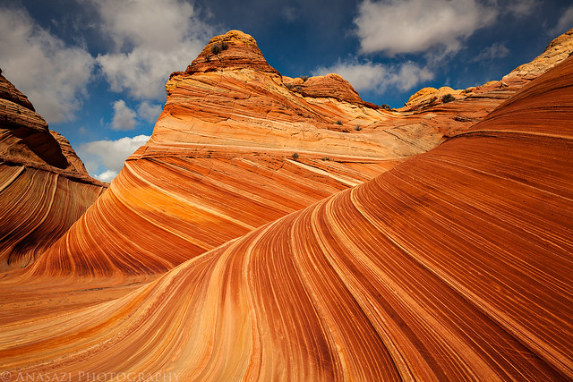
Lovely Lines by IntrepidXJ, on Flickr
A closer look.
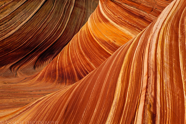
Lines & Curves by IntrepidXJ, on Flickr
Amanda took this photo of me before we moved on.
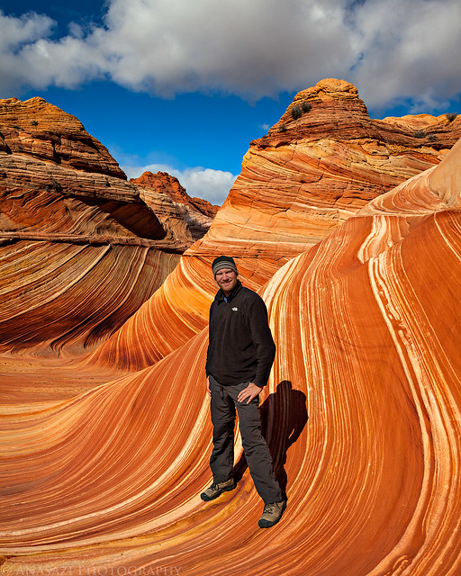
Cold Day at The Wave by IntrepidXJ, on Flickr
Climbing up to the top of Top Rock I stopped for a quick photo of this formation that reminds me of a barber's pole.
Barber Pole by IntrepidXJ, on Flickr
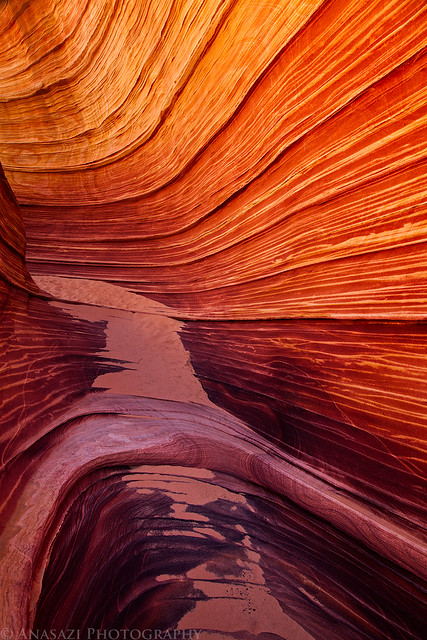
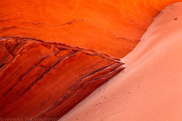
My next destination was the intriguing sand dune alcove. I had spotted this alcove from above back in February, but didn't have time to visit it then. I was looking forward to an in-depth visit and wasn't disappointed! Here's a view of the sand dune from inside the alcove.
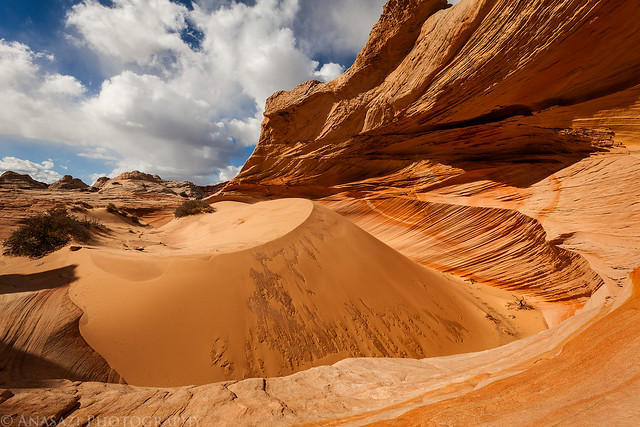
Sand Dune Alcove by IntrepidXJ, on Flickr
If you look closely at the top of the dune, you can see sand blowing off the top of it. It was very windy in this alcove, and it's no surprise that a dune has formed in here. The stripe in the sandstone behind the dune is pretty cool, too.
Wind by IntrepidXJ, on Flickr
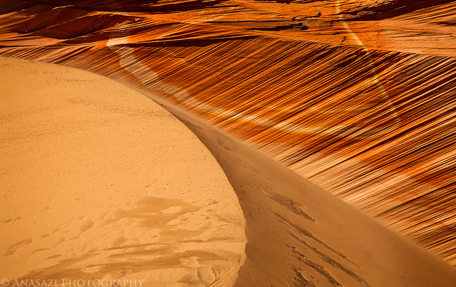
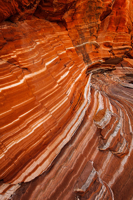
I spent some time inside the alcove photographing the interesting lines and shapes found here, and the reflected light created some nice warm colors. I just had to wait a few times when the sun went behind some clouds. Here's a few of the abstract images I created inside.
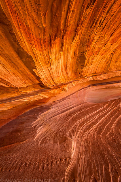
Concurrent by IntrepidXJ, on Flickr
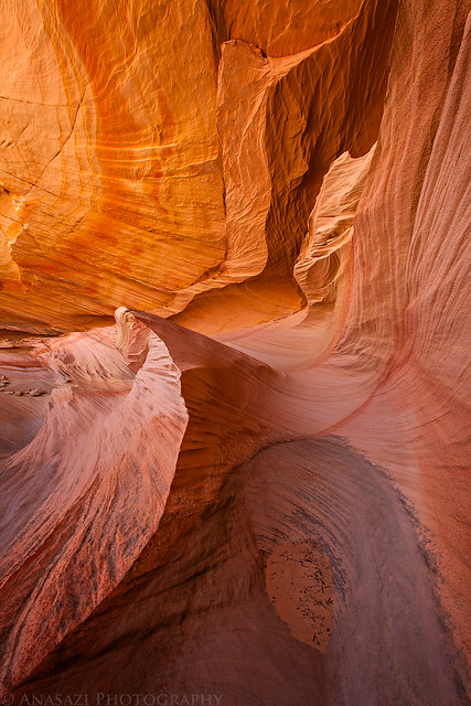
Sandstone Wave by IntrepidXJ, on Flickr
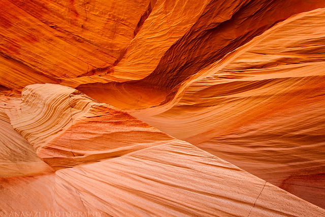
Alcove Lines by IntrepidXJ, on Flickr
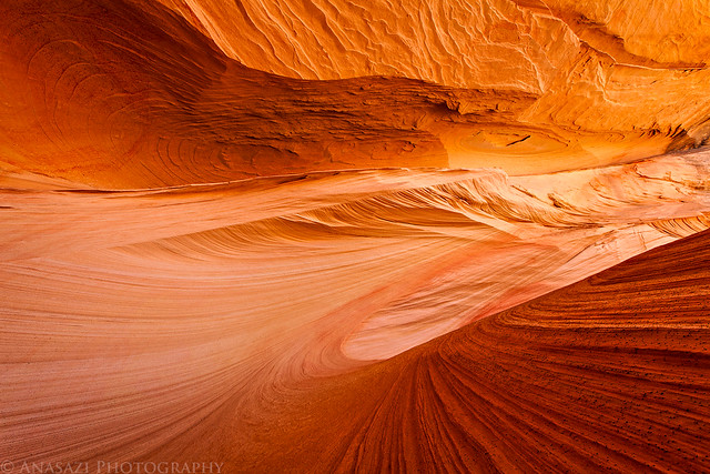
Warm Curves by IntrepidXJ, on Flickr
After leaving the sand dune alcove I made my way over to Melody Arch. Here's a view from inside the alcove looking out at the arch.
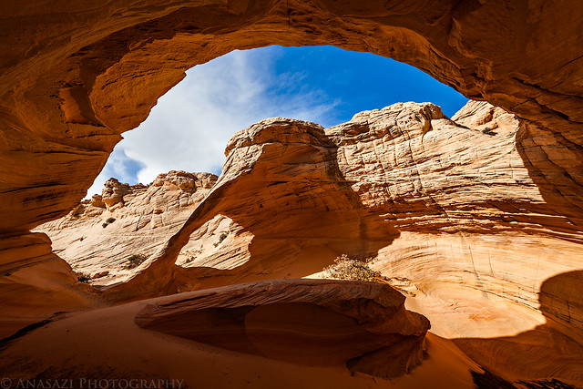
Inside by IntrepidXJ, on Flickr
Looking out through the window in the back of the alcove towards the teepees.
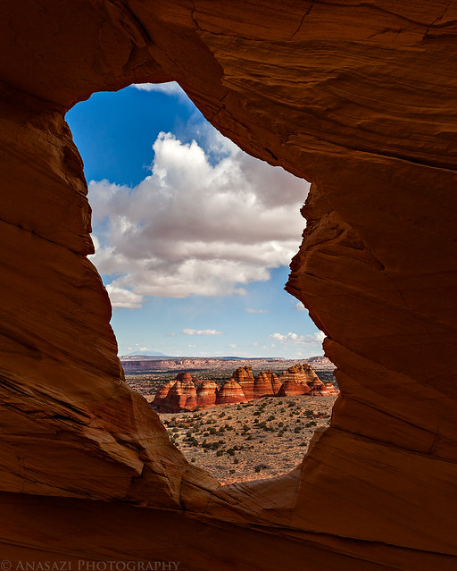
Teepees Through the Arch by IntrepidXJ, on Flickr
There were storms visible around us for much of the day, but they all missed us until I was hiking down from Top Rock. Then I got hit by a snowstorm, or perhaps it was an ice storm. Little round balls of snow or ice were falling from the sky. In the photo below you can see them falling from the sky and collecting in the cracks of the sandstone. Luckily the storm didn't stick around long and continued on it's way.
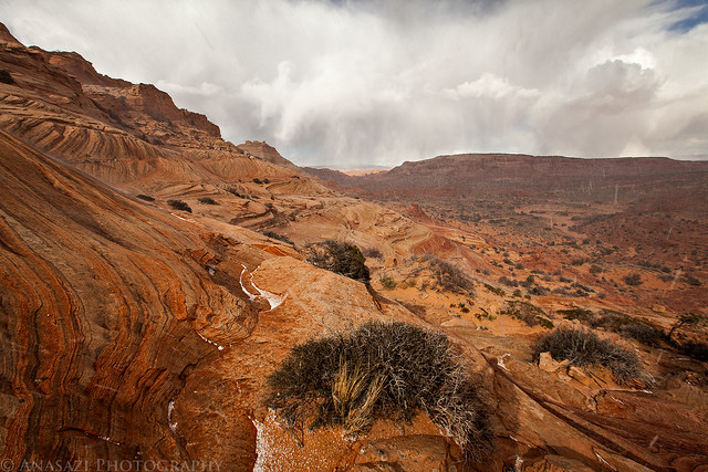
Snow! by IntrepidXJ, on Flickr
Looking back towards the storm that dumped a little snow on us.
Coyote Buttes Storm by IntrepidXJ, on Flickr
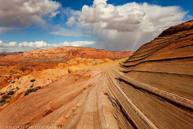
At this point Amanda was very cold and tired of the wind, so she started hiking back. I still wanted to photograph the Second Wave in the late afternoon light, so we planned for me to catch up to her since I'm a much faster hiker. I gave her the keys to my Jeep just in case she did beat me back.
A close look at the Second Wave.
Second Wave by IntrepidXJ, on Flickr
Another storm in the distance over the Second Wave.
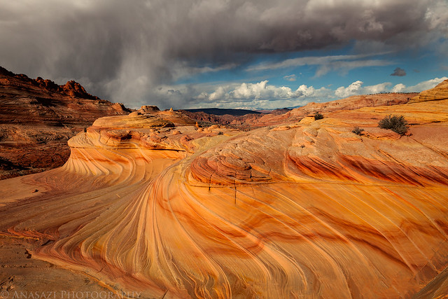
Second Wave Storm by IntrepidXJ, on Flickr
The view as I was starting my hike back to meet up with Amanda.
Coyote Buttes Snowstorm by IntrepidXJ, on Flickr
On my way back through The Wave I got a little sidetracked and stopped for a few photos in The Passage.
Passageway by IntrepidXJ, on Flickr
When I was done I quickly caught up with Amanda and we finished the hike back to the Jeep together. We had a cold but great day exploring Coyote Buttes North. We drove back to Page, grabbed some dinner and retired back to our warm hotel room.
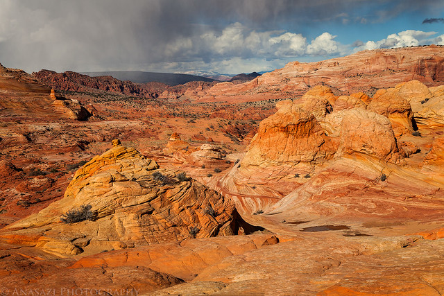
On Sunday morning we drove back onto the Paria Plateau to do a little more exploring in the Sand Hills. Amanda had not been with me on any of my previous visits to The White Pocket, so we started out by stopping there.
Following the cattle trail into the heart of The White Pocket.
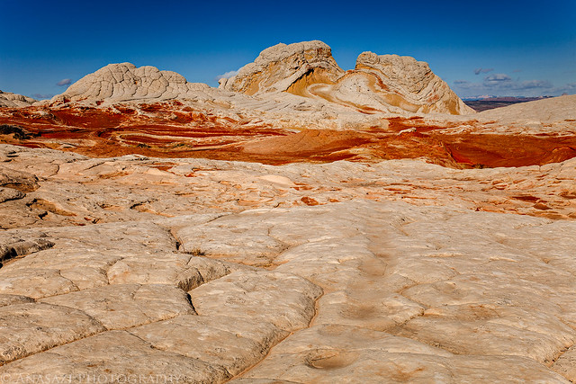
Cattle Trail by IntrepidXJ, on Flickr
We had missed the great sunrise light, but I took a little time to find some lines and reflected light in a few shaded areas.
Cracks & Curves by IntrepidXJ, on Flickr
Three by IntrepidXJ, on Flickr
After leaving The White Pocket we drove some of the lesser used roads in the area that I have not been on before. Like the other roads in the area, they were very soft sand.
While searching for rock art this stripe down the light sandstone caught my eye.

Wide Stripe by IntrepidXJ, on Flickr
I did manage to find a few petroglyphs. This was the best panel I found all day.
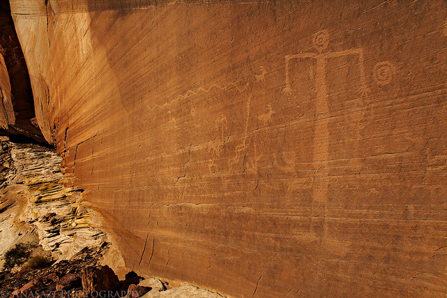
Big Spiral Head by IntrepidXJ, on Flickr
There is no shortage of colorful sandstone to be found.
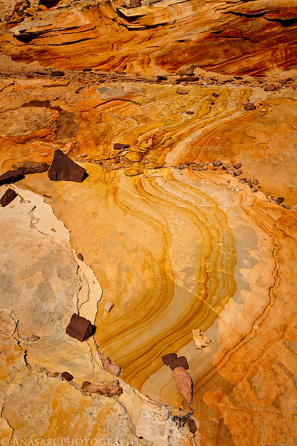
Yellow by IntrepidXJ, on Flickr
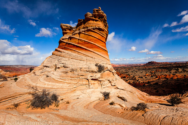
Though the light was harsh and the sky was clear, I just couldn't pass this unusual hoodoo without taking a quick photo.
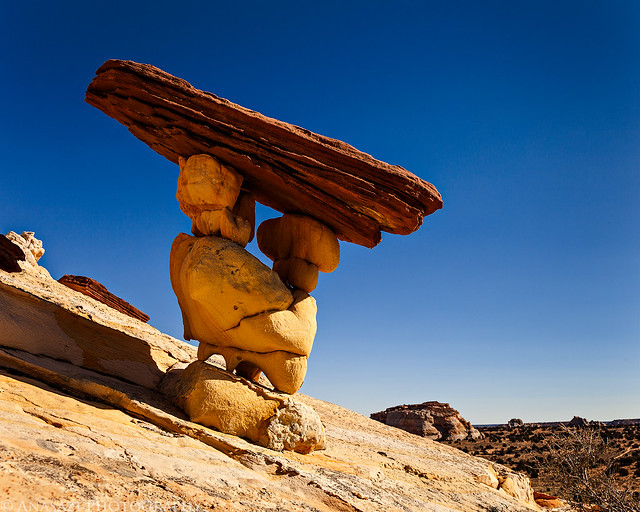
Sand Hills Hoodoo by IntrepidXJ, on Flickr
We ended up driving past the Hole in the Rock Arch.
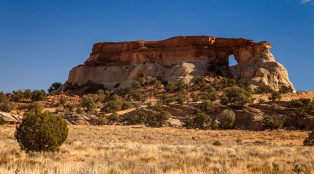
Hole in the Rock Arch by IntrepidXJ, on Flickr
After driving back down off the plateau I stopped to find another petroglyph panel. It was hidden in this narrow slot.
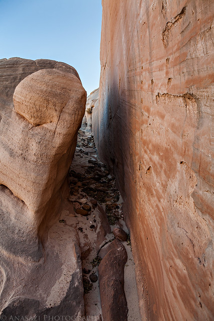
Hidden Panel Slot by IntrepidXJ, on Flickr
These petroglyphs are pretty unique, but they were also very difficult to photograph. There was almost no light in the slot, and the petroglyphs were carved into a light colored sandstone making them hard to see. I found that high contrast black and white makes them a little more visible in my photos. Here's an anthropomorph and a few designs.
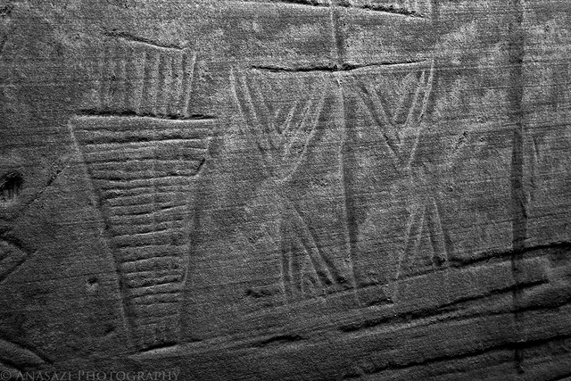
Hidden Anthropomorph by IntrepidXJ, on Flickr
Another very unusual figure. This one was probably four or five feet tall.
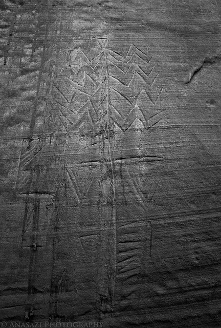
Triangles by IntrepidXJ, on Flickr
Before driving back to Page we made a quick stop at a formation known as The Nautilus. It's a small area, but there are some interesting lines and curves in this white sandstone. I thought they looked better in black and white.
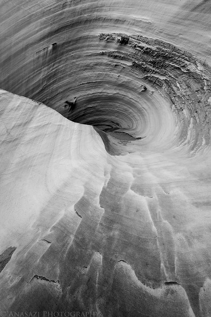
Down the Drain by IntrepidXJ, on Flickr
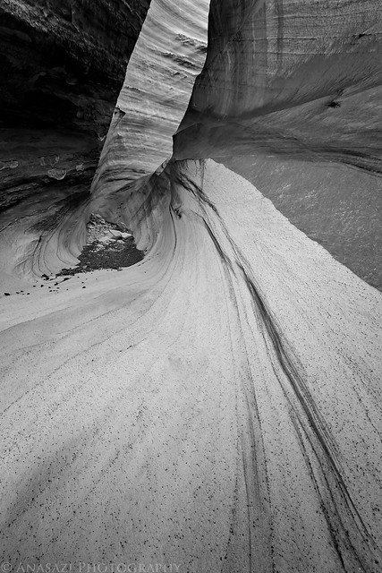
In the Nautilus by IntrepidXJ, on Flickr
On our way back to Page we stopped at the Wahweap Overlook to catch the sunset. There were no clouds in the sky, but I liked the shoreline contrasting with the deep blue water of Lake Powell.
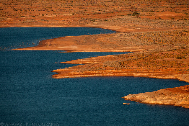
Shoreline by IntrepidXJ, on Flickr
>> The Paria Plateau Photo Gallery
Featured image for home page:

The Original Trip Report on ADVENTR.CO
For a little over a year now I've been pretty obsessed with exploring and photographing the unusual and spectacular sandstone formations of The Paria Plateau. I've been to Coyote Buttes North five times, Coyote Buttes South two times, and the White Pocket three times and have come back with some nice images and had a lot of fun. There is just so much to see up there I could probably spend a lifetime exploring the area and not see it all. Unfortunately, I feel it's time for me to take a little break from this area so I can concentrate on exploring some other areas on the Colorado Plateau for a while. This will probably be my last trip report from The Paria Plateau for a little while. Don't get me wrong, I might head back down there once or twice next year, but I certainly won't be driving down six or seven times like I've done this past year.
After work on Friday, Amanda and I started our drive south down to Page once again. There were some pretty good storms moving through the area which slowed us down a little and gave us some very strong winds to drive through. We eventually made it to our hotel, just a little later than I had anticipated. We quickly got to bed so I could be up bright and early for the sunrise on Saturday morning.
Since I had no plans to get up super early and hike into Coyote Buttes North before sunrise, I decided to head over to Horseshoe Bend for the sunrise while Amanda slept in a little later at the hotel. I had the place to myself for the sunrise which was a pleasant experience. About 20 minutes before the actual sunrise there was a nice glow that lit up the sandstone.
Horseshoe Bend Dawn by IntrepidXJ, on Flickr
My shadow on the golden sandstone as the sun rises behind me.
Long Shadow by IntrepidXJ, on Flickr
I just love warm morning light on sandstone, which there is no shortage of here.
Sandstone Sunrise by IntrepidXJ, on Flickr
After returning to the hotel, Amanda and I had some breakfast and then drove over to the Wire Pass trailhead so we could start our hike to Coyote Buttes North and The Wave. This would be my fifth visit to the area and Amanda's third. It was actually just one week over a year since we first visited The Wave together. It was pretty cold out and the wind was blowing pretty good, but it was turning out to be a great day for photography with plenty of clouds moving through the sky and constantly changing light, which are some of my favorite conditions!
As usual, we first hiked to The Wave to get a few photos before the shadows would get in the way. I actually climbed up above The Wave first for this shot.
Above The Wave by IntrepidXJ, on Flickr
A typical Wave photo.
Lovely Lines by IntrepidXJ, on Flickr
A closer look.
Lines & Curves by IntrepidXJ, on Flickr
Amanda took this photo of me before we moved on.
Cold Day at The Wave by IntrepidXJ, on Flickr
Climbing up to the top of Top Rock I stopped for a quick photo of this formation that reminds me of a barber's pole.
Barber Pole by IntrepidXJ, on Flickr
My next destination was the intriguing sand dune alcove. I had spotted this alcove from above back in February, but didn't have time to visit it then. I was looking forward to an in-depth visit and wasn't disappointed! Here's a view of the sand dune from inside the alcove.
Sand Dune Alcove by IntrepidXJ, on Flickr
If you look closely at the top of the dune, you can see sand blowing off the top of it. It was very windy in this alcove, and it's no surprise that a dune has formed in here. The stripe in the sandstone behind the dune is pretty cool, too.
Wind by IntrepidXJ, on Flickr
I spent some time inside the alcove photographing the interesting lines and shapes found here, and the reflected light created some nice warm colors. I just had to wait a few times when the sun went behind some clouds. Here's a few of the abstract images I created inside.
Concurrent by IntrepidXJ, on Flickr
Sandstone Wave by IntrepidXJ, on Flickr
Alcove Lines by IntrepidXJ, on Flickr
Warm Curves by IntrepidXJ, on Flickr
After leaving the sand dune alcove I made my way over to Melody Arch. Here's a view from inside the alcove looking out at the arch.
Inside by IntrepidXJ, on Flickr
Looking out through the window in the back of the alcove towards the teepees.
Teepees Through the Arch by IntrepidXJ, on Flickr
There were storms visible around us for much of the day, but they all missed us until I was hiking down from Top Rock. Then I got hit by a snowstorm, or perhaps it was an ice storm. Little round balls of snow or ice were falling from the sky. In the photo below you can see them falling from the sky and collecting in the cracks of the sandstone. Luckily the storm didn't stick around long and continued on it's way.
Snow! by IntrepidXJ, on Flickr
Looking back towards the storm that dumped a little snow on us.
Coyote Buttes Storm by IntrepidXJ, on Flickr
At this point Amanda was very cold and tired of the wind, so she started hiking back. I still wanted to photograph the Second Wave in the late afternoon light, so we planned for me to catch up to her since I'm a much faster hiker. I gave her the keys to my Jeep just in case she did beat me back.
A close look at the Second Wave.
Second Wave by IntrepidXJ, on Flickr
Another storm in the distance over the Second Wave.
Second Wave Storm by IntrepidXJ, on Flickr
The view as I was starting my hike back to meet up with Amanda.
Coyote Buttes Snowstorm by IntrepidXJ, on Flickr
On my way back through The Wave I got a little sidetracked and stopped for a few photos in The Passage.
Passageway by IntrepidXJ, on Flickr
When I was done I quickly caught up with Amanda and we finished the hike back to the Jeep together. We had a cold but great day exploring Coyote Buttes North. We drove back to Page, grabbed some dinner and retired back to our warm hotel room.
On Sunday morning we drove back onto the Paria Plateau to do a little more exploring in the Sand Hills. Amanda had not been with me on any of my previous visits to The White Pocket, so we started out by stopping there.
Following the cattle trail into the heart of The White Pocket.
Cattle Trail by IntrepidXJ, on Flickr
We had missed the great sunrise light, but I took a little time to find some lines and reflected light in a few shaded areas.
Cracks & Curves by IntrepidXJ, on Flickr
Three by IntrepidXJ, on Flickr
After leaving The White Pocket we drove some of the lesser used roads in the area that I have not been on before. Like the other roads in the area, they were very soft sand.
While searching for rock art this stripe down the light sandstone caught my eye.
Wide Stripe by IntrepidXJ, on Flickr
I did manage to find a few petroglyphs. This was the best panel I found all day.
Big Spiral Head by IntrepidXJ, on Flickr
There is no shortage of colorful sandstone to be found.
Yellow by IntrepidXJ, on Flickr
Though the light was harsh and the sky was clear, I just couldn't pass this unusual hoodoo without taking a quick photo.
Sand Hills Hoodoo by IntrepidXJ, on Flickr
We ended up driving past the Hole in the Rock Arch.
Hole in the Rock Arch by IntrepidXJ, on Flickr
After driving back down off the plateau I stopped to find another petroglyph panel. It was hidden in this narrow slot.
Hidden Panel Slot by IntrepidXJ, on Flickr
These petroglyphs are pretty unique, but they were also very difficult to photograph. There was almost no light in the slot, and the petroglyphs were carved into a light colored sandstone making them hard to see. I found that high contrast black and white makes them a little more visible in my photos. Here's an anthropomorph and a few designs.
Hidden Anthropomorph by IntrepidXJ, on Flickr
Another very unusual figure. This one was probably four or five feet tall.
Triangles by IntrepidXJ, on Flickr
Before driving back to Page we made a quick stop at a formation known as The Nautilus. It's a small area, but there are some interesting lines and curves in this white sandstone. I thought they looked better in black and white.
Down the Drain by IntrepidXJ, on Flickr
In the Nautilus by IntrepidXJ, on Flickr
On our way back to Page we stopped at the Wahweap Overlook to catch the sunset. There were no clouds in the sky, but I liked the shoreline contrasting with the deep blue water of Lake Powell.
Shoreline by IntrepidXJ, on Flickr
>> The Paria Plateau Photo Gallery
Featured image for home page:


")