- Joined
- Dec 23, 2013
- Messages
- 4,331
Trip Overview
This was a nine day, vast majority off-trail, 64 mile loop beginning and ending at the Mallard Lake Trailhead at Old Faithful starting on June the 5th with @Joey . Our plan was to explore lakes and river drainages that are off the official trail system in Yellowstone along with seeing areas that have had very little human presence.
For those who want to see all the images for the trip, here is the link
Old Faithful Loop Trip Images
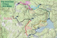
Day 1 – to Mallard Lake (3.4 miles)
Just before Joey showed up at the backcountry office, the gentleman on duty had to leave for the Observation Point Trail because a bear had been reported on the trail. He assured me he would get our permit for us even if he returned after the office had closed at 4:30 pm. Well, Joey showed up about ten minutes after he left so we waited patiently for his return. He ended up returning around 5:00 and issued our permit without too many questions or issues with our route. I might add at this point we had to pay $3.00 a night for our backcountry privilege or buy a season pass for $25.00. This fee was implemented just this year; before, unless reserving in advance, there was no charge to camp in the backcountry. We both ended up buying the season pass.
After he issued our permit, it began to hail which eventually turned over to a pouring rain. Since Joey’s cousin was in the Park at the time, we met him and his wife for a beer at the Bear Pit in the Old Faithful Inn to wait out the storm. Eventually the rain let up and we made our way to the trailhead, where we gathered our gear before heading off. My pack plus water and cameras weighed in right at 60 lbs.
There was some construction at the cabins at Old Faithful, so we had to walk the fence line of a fenced off area to reach the trailhead. Once at the trailhead we began our trek to Mallard Lake, the first leg of our loop.
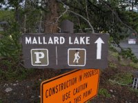
Mallard Lake Trailhead
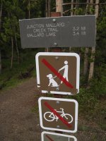
Official trailhead
After crossing the Firehole River, it is essentially a steady climb to the lake. Most of the hike is through burn from the 1988 fires. An occasional glimpse behind us reveals steam rising up from thermal features in the Upper Geyser Basin. As we continue to climb, off to our left we see a mule deer that doesn’t seem too concerned of our presence. Further up, about one mile from the lake, the drainage starts to narrow and get steeper. After this steep section the grade lessens and soon we are dropping down to Mallard Lake. On our way down, we pass the trail junction sign for the Mallard Creek Trail that heads off to the northwest. Our current trail plus the Mallard Creek Trail and the connecting trails back to Old Faithful would make for a great eleven mile loop day hike. I will need to attempt this in the future.
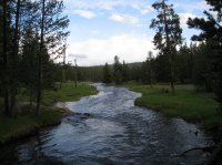
The Firehole River
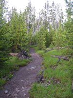
Mallard Lake Trail
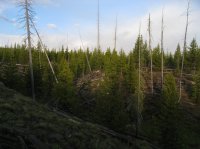
A deer across the drainage
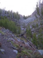
Trail begins to get steep
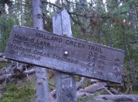
Junction sign for the Mallard Creek Trail
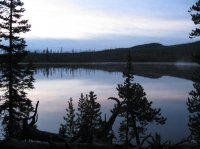
Mallard lake at dusk
It’s almost nine o’clock when we finally reach the lake and our campsite for the night 0B2. Once at the sight, we set up our tents on wet ground and proceed to the cooking area to make dinner. I’m starving! We eat a quick dinner and call it a day. We will need our rest for the off-trail section of our hike tomorrow. The frogs are croaking extremely loud as I drift off to sleep.
Day 2 – Teal Lake, Herron Creek, DeLacy Meadows and Shoshone Lake (9.1 miles)
After a short hike our first day, today we will really be getting after it. But first, the morning light on Mallard Lake makes for some good picture opportunities and I take full advantage. There are a few ducks on the lake and they quack at me as I make my way to our neighboring campsite 0B3 to see what it is like. It turns out that OB3 is a pretty nice site. There is actually a third campsite on the lake (0B1) too, but I didn’t have time to investigate it.
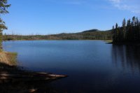
Mallard Lake in the morning light
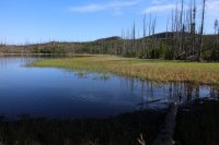
Eastern shore of Mallard Lake
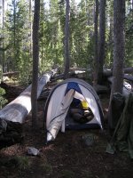
My tent at 0B2
A quick breakfast and break down of camp and we are ready to make our way to our first goal of the day, Teal Lake. After backtracking along the Mallard Lake Trail for approximately .3 miles, we turn to the southeast and venture off-trail for the first but certainly not the last time on this trip. Once off-trail the going slows down considerably. There are numerous downed trees that must be either stepped over or avoided if possible. The train is uneven, with drainages running through. At times we were uncertain if a drainage would take us to the lake or not. More often than not, we would descend into a drainage and then eventually climb up and out on the other side. There are also ponds and marshy terrain along our route. At this point the marshy areas are easy to avoid but that would not be the case for a good portion of our trip. We run into some bear scat through this section. If we hadn’t already, it was time to keep our wits about us.
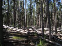
Let the bushwhacking begin!
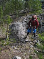
Joey and rock or perhaps rock and Joey
Just over an hour and a half, we reach the northwest portion of Teal Lake. Now I have to say that I am quite disappointed in the lake. Teal Lake is a narrow elongated lake that runs in a slightly northwest to southeast fashion. The problem is that the entire middle of the lake is dry, such as there is a small northwest portion and a small south east portion. Truthfully, this just didn’t do it for me. We stopped at the second piece of the lake to eat before pushing on to Herron Creek.
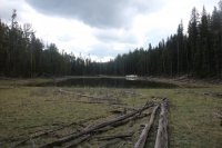
Teal Lake
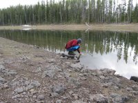
Joey, refilling his water bottle at Teal Lake
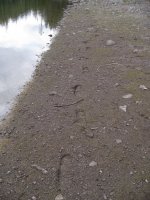
Scatman tracks at Teal Lake - or maybe the mysterious @kcwins left these?
Before leaving the lake, we both refilled our water bottles and checked the sky – storm clouds moving in. The section between the lake and the creek turned out to be rough going. The downfall got thicker and we were introduced to some kind of bushy shrub that occasionally was thigh high as we made our way through it. At this time, it began to rain off and on which was a real inconvenience; having to put on rain gear and then take it off again when the sun popped back out. If I left my rain gear on while it wasn’t raining, I would over heat and become uncomfortable. It was also annoying to have to take my pack off, change, and then put the pack on again every ten to fifteen minutes. This made it hard to get into any kind of rhythm while I was hiking. I guess that is just the life of a backpacker on some days.
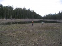
Joey, leaving Teal Lake - I love this shot
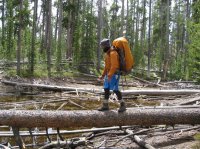
Joey, crossing a large pond / marshy area
There is a ridge to the north of Teal Lake and we had been hugging this ridge as we approach Herron Creek. The drop down to the creek was steep and generally nasty going. We eventually heard the sound of water and know that we are close. Just a few hundred more feet and we had made it to Herron Creek, where we stopped to eat lunch.
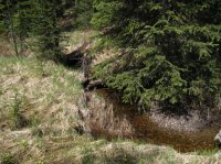
Herron Creek
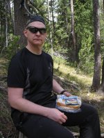
Tuna time! Where is that elk carcass?
After lunch, the rain begins to pick up as we make our way down the drainage heading towards the Grand Loop Road. Between 0.3 and 0.4 miles down the creek, we were treated to Sundial Falls, which is a waterfall about fifteen feet in height and classified as a “cascade” falls. We worked our way around the falls, taking pictures while we went. Just past the falls the rain began to pick up in intensity and in another 0.6 miles we had reached the road.
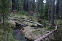
Hiking along Herron Creek
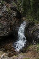
Sundial Falls
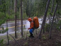
Reaching the Grand Loop Road
We then hiked the along the road for a quarter mile until we reached the DeLacy Creek Trailhead. The DeLacy Creek Trail will lead us to Shoshone Lake and our night’s campsite 8S3, which is still four miles away. The trail down to the lake was muddy and it was sloppy hiking. The views of DeLacy Creek Meadows on the other hand made up for the mushy route. Eventually we had our first glimpse of Shoshone Lake and we drove hard to reach it. Once at the lake, we had to hike along the beach, cross DeLacy Creek, pass campsite 8S2 before reaching our camp for the night.
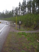
DeLacy Creek Trailhead
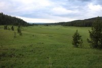
DeLacy Meadows
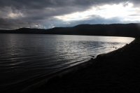
Shoshone Lake
While passing campsite 8S2, we noticed a group (6-8?) of young men with one older gentleman. It turns out that the older guy was their leader and they were all young men were working at the Park for the summer and were part of a Christian youth group. The leader was from Vermont and he would come out every year and lead this group into the backcountry for a couple of nights. He claimed that the young men had never had the opportunity to camp in the wilderness before. While all of this was fine and dandy, I just wanted to get to our campsite (still a half mile away) and get some food into me. I was cold and hungry but the leader liked to talk and kept asking us questions about our trip. Finally he let us go and we made our way to camp.
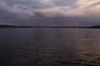
Shoshone Lake, Mount Sheridan in the distance and a partial rainbow
It was around eight o’clock when we got everything situated in camp and it was time for dinner. I was beat, so I ate quickly and turned in wondering what tomorrow would bring.
Day 3 – Pocket Lake, Headwaters of Shoshone Creek, Shoshone Creek, Shoshone Lake (9.1 miles)
We woke up to a foggy morning on the lake, not really sure how long it will take to burn off. Today’s hike will take us to Pocket Lake, off-trail to the headwaters of Shoshone Creek, hike along Shoshone Creek to the Shoshone Lake Trail, follow the trail to the North Shore Shoshone Lake Trail and then take this trail to campsite 8R5 on the west side of Shoshone Lake. Our first order of business was to find the unofficial route up to Pocket Lake. Just over half a mile from camp and before you cross what I refer to as Pocket Creek (unnamed on maps) there are two parallel logs spread out about two feet from one another. This marks the beginning of the unofficial trail to Pocket Lake.
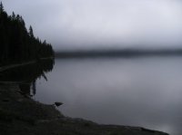
Fog on Shoshone Lake
The route to pocket lake is an uphill one of 1.2 miles. This unofficial route had downfall across it in many places, but at least we didn’t have to think about where to go. Essentially, just follow the path to the lake. As we worked our way towards the lake, we noticed bear den on the opposite side of the creek, slightly above us at the base of a tree. Before long, we reached the lake and worked our way around the marshy north side of the lake to a small grassy area on the northwest side where we stopped and took a few minutes to get something to eat and refill our water bottles. Of course by now it had started to rain which meant a quick change into our rain gear.
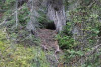
Bear den on the way to Pocket Lake
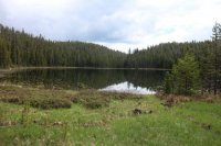
Pocket Lake
Pocket Lake sits in a deep basin and after lunch it was time for us to climb up and out of this basin. I wasn’t too thrilled with the task at hand but it didn’t take too long to get to the top, though I was huffing and puffing by the time I got there. From this point it was relatively easy bushwhacking towards the headwaters of Shoshone Creek. The downfall was spread out along this section and easy to maneuver around or step over. Finally the trees opened up and what was supposed to be our headwaters pond turned out to be dry. Because the pond was dry, it took us awhile to determine where the actual drainage was that we were to follow to the western end of Shoshone Lake. Once we were confident we were on the right path, it was a good distance before there was running water in the creek. When we finally had a nice flow, we stopped and ate our lunch in a small meadow along the creek.
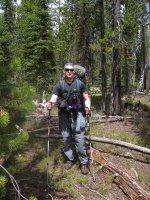
At the top of the ridge above Pocket Lake
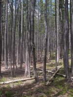
Bushwhacking to the headwaters of Shoshone Creek
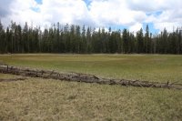
The dry pond that is the official headwaters of Shoshone Creek
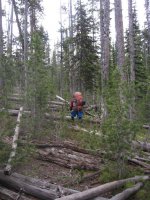
Joey, hiking down the drainage
The majority of the rest of the day was spent hiking along Shoshone Creek. I really enjoy hiking along a meandering stream particularly through meadows. I find it very relaxing. Along the way we saw a Grey Owl fly onto a tree branch across the creek and meadow and we also ran into some small thermal features along the creek. The owl looked like it had a rather large wingspan as it flew to the tree.
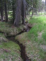
Shoshone Creek
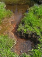
Thermal Feature along Shoshone Creek
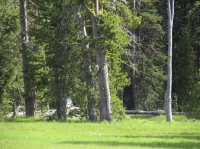
Grey Owl in tree across the meadow
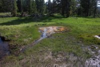
Thermal feature along Shoshone Creek
In just another mile we reached the Shoshone Lake Trail and proceeded to hike in a southeasterly fashion towards our campsite. This trail parallels Shoshone Creek which has grown into a big stream at this point. The trail took us up above the creek and there are plenty of wonderful views looking down and up ahead. Within a mile and a half we reached a trail junction. At the junction, we turned left onto the North Shore Shoshone Lake Trail and follow it until we see the signpost for our campsite 8R5. If we had continued to the right at the junction we would have ended up at Shoshone Geyser Basin which we would be exploring the following day.
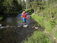
Joey, crossing Shoshone Creek
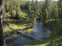
Hiking along Shoshone Creek
It turns out the signpost for 8R5 is not exactly at the campsite; we still had another quarter mile to make it to the lake. 8R5 is another wonderful campsite on Shoshone Lake. While I haven’t stayed at all of the sites on the lake, the seven of them that I have camped at have all been excellent sites. We arrived around seven o’clock and there is some time to enjoy the lake before eating dinner and calling it a night. While gazing out over the lake, we see swans, geese and pelicans along with some ducks.
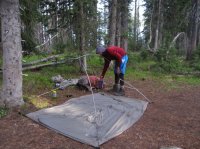
Joey, setting up his tent at campsite 8R5
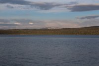
Shoshone Lake with Mount Sheridan in the distance
Day 4 – Shoshone Geyser Basin, Cold Mountain Creek, Headwaters of Cold Mountain Creek, Douglas Knob (5.7 miles +2)
Shoshone Geyser Basin was first on our docket today and it was roughly 0.5 miles away. We arrived at the basin and immediately went about taking pictures of all the neat thermal features. Shoshone Creek flows through the middle of the basin and adds even more beauty to the basin. Some of the Geysers along the way had names like Little Giant, Little Bulger, Shield, Bronze, Union and Washtub. The Geyser Basin is definitely worth the hike or paddle in to see it. The colors at the basin were spectacular, with greys and rusts and the turquoise water color of some of the geysers. Lizards were darting back and forth between the rocks as we approached various features. We ended up spending over an hour exploring the different thermal features all around us.
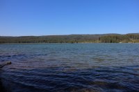
Shoshone Lake in the morning - Looking in the direction of the Cold Mountain Creek drainage that we will be hiking up later in the day.
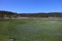
Approaching Shoshone Geyser Basin
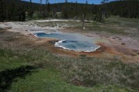
Thermal feature at Shoshone Geyser Basin
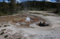
Thermal feature at Shoshone Geyser Basin
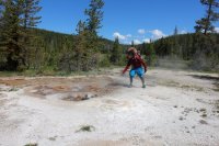
Joey in action!
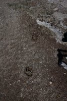
Wolf Tracks at Shoshone Geyser Basin
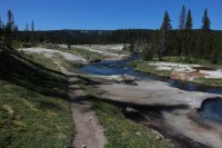
Firehole River running through Shoshone Geyser Basin
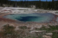
Thermal feature at Shoshone Geyser Basin
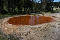
Thermal feature at Shoshone Geyser Basin
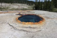
Thermal feature at Shoshone Geyser Basin
Done with the basin, we headed into the meadows on the west side of Shoshone Lake and this is where the marshy part of our trip began in earnest. The trail through the meadows was underwater and the only relief for us was elevated footbridges over small streams working their way through the meadows. To add to the marshy mess we had another interesting crossing of Shoshone Creek to attempt. Once across the creek we continued on until we reached Cold Mountain Creek, where we hiked up a little ways and took a break. Eating some snacks at break, we saw two backpackers heading towards the southern part of Shoshone Lake. They did not notice us sitting on a log in the distance to the west eating our trail mix. These two would be the last people we would see for five days.
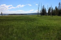
The marsh lands west of Shoshone Lake
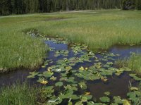
Lily pads in the marsh
Our hike up Cold Mountain Creek began with making our way through the rest of the marshy meadows along the creek. Soon the ground dried out as we approached the canyon that the creek flows down. As we hiked along the creek, we soon became aware to the south of the creek a large rock face that was weeping with water. It reminded me a bit of Glacier National Park. As we continued to make our way along the drainage, I said to Joey, “This is a hidden gem and no one ever gets to see it.” Eventually, we had to leave the drainage and gain the ridge above because the route was getting to treacherous. Once on top of the ridge, we ran into a game/human trail that we followed to the next side drainage. Now this trail looked suspiciously like a human trail to me and my curiosity was peaked.
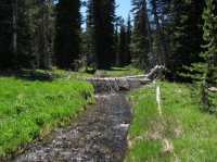
Cold Mountain Creek
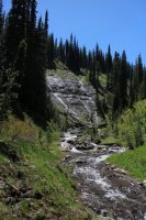
Weeping rock along Cold Mountain Creek
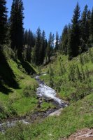
Cold Mountain Creek
At the junction of this side drainage with Cold Mountain Creek, the trail turned up the side drainage. We had a dilemma on our hands. Now I must tell everybody a little bit about myself. When you turn me loose on a trail that I am unfamiliar with, it is my natural instinct to find where the trail leads to, what is its purpose, and who or what uses it? So we decided to follow the trail thinking it might put us out on the southern side of Douglas Knob. We hiked up the trail for about one mile before snow and marsh made it impossible to follow with any accuracy anymore. Perhaps this is the elusive northern trail on to the Pitchstone Plateau. A bit disappointed, we turned around and headed back to Cold Mountain Creek and pick back up our originally planned route to Douglas Knob.
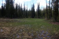
Losing and trying to find again the trail in the marsh
After an hour or so we began to reach the upper portions of the drainage (the headwaters) and we have to climb a steep ridge to a small saddle before dropping down an unnamed drainage and following this drainage to Douglas Knob. On top of the ridge and looking back to the east, Mount Sheridan and the Absaroka Range are visible. We take a quick break before heading down the drainage to the west. Fortunately for us the upper part of the drainage was filled with snow which made our descent much easier. Once the snow ended we followed the unnamed stream all the way to our campsite 9D3 located on the edge of the meadows just north of Douglas Knob. While mosquitoes had been bad throughout our trip thus far, the mosquitoes at 9D3 were particularly aggravating. I must have eaten at least fifty of them as they flew into my dinner. There was just no way to keep them out. Yum protein! From our campsite we have a great view of Douglas Knob and the surrounding meadows.
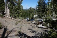
The headwaters of Cold Mountain Creek
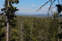
View from the top - Absaroka Range in the distance
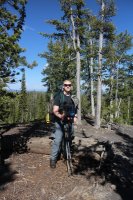
Scatman on top
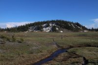
Douglas Knob
Day 5 – Trischman Knob, Headwaters of the Firehole River, Madison Lake, The Firehole River and Meadows (8.0 miles)
We began our day by hiking northwest through the meadows next to Douglas Knob, following Littles Fork which flows in the opposite direction into the Bechler Canyon and Cascade Corner. Soon we found ourselves near Trischman Knob where the headwaters of the Firehole River are located. Taking some time to take a few pictures with Trischman as our background, we moved on to the north and found ourselves at the top of a ridge with a steep drop to Madison Lake. We were able to find a steep chute full of snow and were able to hike/slide/ski down it which saved us quite a bit of time on our way to the lake.
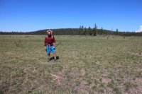
Joey, at Trischman Knob
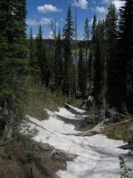
The chute we descended to Madison Lake
When we arrived at the bottom of the chute, the trees opened up to a gorgeous view of Madison Lake. We decided to take a break at the lake on a small peninsula with some trees on it. As I rounded some small willow bushes on the peninsula, a Canadian goose, which had been bedded down, jumped up and rushed to the water’s edge, scaring the shit out of me! He/She squawked at me for some time while I ate a snack by the lake. I thought the view at Madison Lake was one of the highlights of the trip – just beautiful. Of course the frogs were as loud as they could be. I loved it!
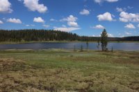
Madison Lake
After getting some nourishment in our systems, we left the lake and continued on down the upper Firehole River and its expansive marshes. Water was everywhere, sometimes boot deep. We took our time trying to navigate through the shallow portions of the swampy area. Perhaps hallway through the marsh, we noticed something off to our right and went to inspect what it was exactly. When we got to the object, it turns out that it was a large sack that looked like it had been there awhile. We were able to find a tag on the sack that said that it had been made by the U.S. Sack Corporation out of Grand Junction, Colorado. My thoughts were that maybe it had been used in some firefighting operation and had forgotten to be removed.
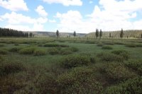
Upper Firehole Meadows
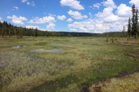
Upper Firehole Meadows
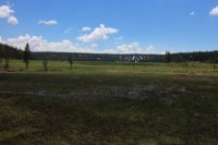
Looking back towards Madison Lake
We continued on through the marsh, seeing more bear scat, discovering lots of small ponds, and dealing with clouds of mosquitoes. Soon though, we found ourselves back in the trees following the river through forest. Once in the woods, we found a nice place to rest and eat lunch. What a peaceful setting by the river, one of the many places I’ve found in the Park over the years where I could have sat there for the rest of the day and just let the river and the clouds roll on by. But, we had places to go and soon we were on the move again heading towards a steep drop in the river and four sets of falls known as Quadruple Cascades, 1 through 4, that range in height from fifteen to twenty feet. As we were making our way through the cascades, it was difficult to distinguish where one stopped and where the next cascade began. Working our way towards cascade #4, it began to get extremely steep so we decided to work our way up to the top of the ridge and go from there. After wearing ourselves out hiking to the top, we eventually got to the point where we had to find a way off the ridge and drop down to the next set of meadows where our campsite, 0A3 was located. Fortunately for us, we found a game trail that made the descent easier to take and in a few minutes we were back along the Firehole.
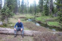
On lunch break along the Firehole River
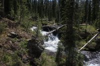
Cascades along the Firehole River
At this point, it began to rain heavily, so after a tricky crossing of the Firehole, we decide to wait the storm out sitting under some trees listening to the thunder overhead. After thirty minutes or so the rain let up and we were on our way again. The trees gave way to lush green meadows and we continued to follow the Firehole all the way to camp. When we reached camp, it had begun to drizzle again so we waited a bit to set up our tents, before eating dinner and calling it a day.
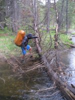
Joey, attempting a tricky crossing of the Firehole
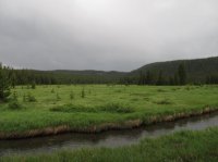
The meadows along the Firehole River
Day 6 – Leaping Falls, Dashing Falls, The Madison Plateau, Summit Lake (7.5 miles)
Today, we were following an unnamed stream from campsite 0A3 up and onto the Madison Plateau, then hiking in the drainage on the plateau for a few miles before making our way through burn from the ’88 fires and on to Summit Lake.
We left earlier than usual this morning expecting it to be a tough day of hiking. We picked up the stream quickly and followed it for a short distance where we came upon Leaping Falls. The problem ahead of us was that the falls were plunging over a cliff and we would have to find a way around the cliffs to continue to follow the drainage onto the plateau. We worked our way to the east and found what appeared to me to be a straight up route to get us on top. This was definitely the hardest stretch of the trip, while not a great distance, I found myself stopping frequently to gather my breath before continuing on. Joey, who is like a mountain goat, made it with ease! Once on top, we continued along the drainage and soon we saw a second waterfall named Dashing Falls. As we worked our way past the falls we encountered our second predicament of the day, the drainage split with both heading off to our left which was the direction of travel we wanted to go. We went back and forth over which one was the correct route and eventually we decided on the wrong one, but after hiking a short distance we soon corrected our ways and got back on the right track.
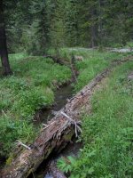
Unnamed stream we are following onto the Madison Plateau
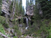
Leaping Falls
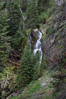
Dashing Falls
Now back in the right drainage, the water soon disappeared and we were left with large boulders to negotiate. We decided it was time to climb the ridge again and so we did. Eventually, we came even with the dry stream again and at this point we took a break. The drainage at this point was beginning to widen but it still had a lot of downfall in it so it was actually easier to walk just above it. As we continued along the drainage, it in due course became even wider and now we could hike right up the middle of it and this made for easy travel. The further we went; narrow grassy areas appeared on either side that would slowly widen as we made our way along the plateau. Eventually, we found ourselves in a full blown meadow where a pond was located; this pond was to be our water source. Before we could refill the skies let loose again this time with a good lightning show along with some impressive hail.
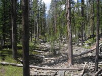
Drainage we followed on the plateau
We decide to wait this storm out also and when it had calmed down a bit I went and refilled my water bottle. Of course the storm had disturbed the silt in the shallow pond so my water tasted like dirt when I drank it later on. Along the shore of the pond we found some cool remains of an elk that included an intact skull, antlers and some of its vertebrae. Some of the ribcage was visible in the north end of the pond. Perhaps wolves had taken the buck down.
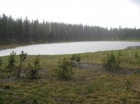
Hailing at the pond
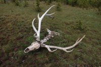
Elf skull and antlers
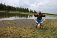
Joey, holding the antlers
After leaving the pond, we had a short distance to hike through the rest of the meadow before we hit the dreaded burn area. We stopped at the burn boundary and I ate my MET-Rx Colossal Brownie for extra energy to get me through. For those who haven’t hike through burn, it can be a real bitch, depending on the amount of downfall and the thickness of new growth. As it turned out, we were in luck because the new growth was more dispersed. On the other hand, the entirety of downfall was now wet and slippery after our storm had passed through. Well, there was no way around it so we both just gritted our teeth and drove ahead.
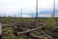
Hiking through the burn
As we exited the burn, the rain began to pick up again. This time it felt like a cold front was passing through and I felt a bit chilled. I couldn’t wait to reach Summit Lake. It was not long before we could see the lake through the trees and soon we were on the submerged Summit Lake Trail heading for campsite 0E1. We reached our campsite and again had to wait for it to stop raining in order to set up our tents. Later, we made a small fire (our first of the trip) and enjoyed dinner before the sun went down. Just after dusk, we had a splendid sunset to watch before heading to bed. I was worn out after today and was looking forward to a good night’s sleep.
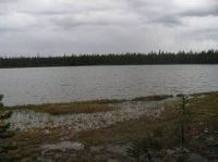
Summit Lake in the rain
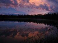
Sunset at Summit Lake
Day 7 – Day Hike to Smoke Jumper Hot Springs, Bear Encounter (6.0 miles round trip)
We woke up to a gorgeous day! This would be the best weather day since we started. Summit Lake is picture perfect in the morning sunlight and the frogs are back at it. Joey mentions that he heard something near the bear pole last night but he couldn’t quite make it out due to all the noise the frogs were making. This is also the first day that we have had an opportunity to dry our gear out in a thorough manner.
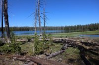
Summit Lake in the morning
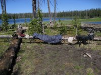
Drying our gear
After drying our gear, we set off west along the Summit Lake Trail (Continental Divide Trail) for about one mile. We then turned off the trail and hiked to Little Summit Lake before moving on to some of the thermal areas. The thermal areas at Smoke Jumper Hot Springs are spread out so we hiked from thermal area to thermal area. On our way to one of the thermal areas from Little Summit Lake, we came across a tent, tent poles in their sack underwater in a pond, a partially shredded sleeping bag and a Ziploc full of knick-knacks. We spent the next fifteen minutes looking for a backpack and a body. We didn’t find anything but we couldn’t understand why somebody would abandon their tent and sleeping back in a remote location. I took a GPS point of the location in order to report it to the backcountry office when we were done with our trip.
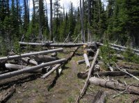
Summit Lake Trail (Continental Divide Trail)
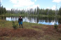
Joey at Little Summit Lake
As we arrived at our second thermal area, a larger area than the first, we spent some time taking pictures and circling the small lake that made up a majority of the area. Heading west along the north side, I heard Joey say “bear.” He said it a normal voice and I thought he was just talking about bears. But then he let me know with a little more authority that there was a black bear behind us. I turned around and sure enough where we had been standing two minutes before there was a black bear. At first, we weren’t very alarmed but as he continued to move in our direction we started giving a little ground at first. We yelled “Hey Bear!” but to no avail; he just kept coming towards us. We continued to yell at him as we got our bear spray ready just in case. As he approached within thirty feet, he finally moved to our right and into the trees. Another good adrenaline rush!
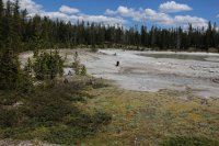
Black bear making his way towards us.
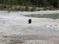
Black Bear getting closer
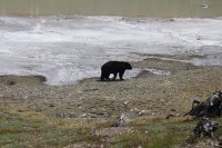
Too close for comfort
We moved on to the next area and saw the same bear running past us at the top of the thermal basin. After the bear passed, we saw two deer that at first didn’t notice us, but once they did they fled. We went back to examining the thermal features. While smoke Jumpers isn’t as nice as Shoshone Geyser Basin; it still had its charms. We explored other smaller thermal areas on our way back to the trail and one large area just south and adjacent to the trail. I don’t believe this area technically is part of Smoke Jumper.
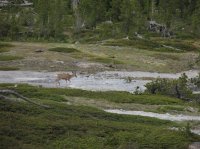
Deer at thermal area
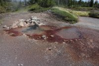
Thermal feature at Smoke Jumper Hot Springs
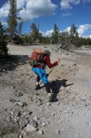
Joey in action
We then made our way back to camp where we built a nice campfire and actually had the time to enjoy it. We discussed the bear encounter over and over while eating dinner. Did we handle the situation correctly? Did we not? It’s funny how these situations always happen rather quickly without a lot of deliberation involved. Oh well, in my book it is always exciting to see a bear in the wild. After dinner, we enjoyed the fire for a while before turning in for the evening.
Day 8 – Headwaters of the Little Firehole River, The Little Firehole River, The Little Firehole River Meadows (7.1 miles)
Originally we had wanted to head north off-trail from our campsite to the headwaters of the Little Firehole River, but instead we retraced our path from the day before towards Smoke Jumper Hot Springs and hiked to the headwaters from there. Once we reached the headwaters, we just followed the river all the way to camp. The nice thing about this day was that we had a steady wind blowing all day which helped keep the mosquitoes at bay. Weather wise it was another perfect day.
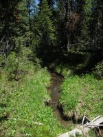
Headwaters of the Little Firehole River
Dropping of the plateau turned out to be a rugged journey. The bushwhacking through this section was the worst since day two between Teal Lake and Herron Creek; fortunately for us our packs were quite a bit lighter along this stretch than they had been on the second day. When we finally made it down, we broke out into a meadow full of wildflowers. We stopped to break for lunch and spent a long time enjoying the view.
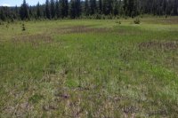
Elephant Heads in a meadow along the upper meadows of the Little Firehole River
When we finally decided to leave, we had one more forested section to hike through before we would reach the Little Firehole Meadows. We made our way through the wooded area and then hiked out into the meadows. The Little Firehole Meadows were tremendous! Up ahead we could see the location of our campsite on the other end of the meadows. We made a straight bee-line for it. Just before reaching camp, we had to ford the Little Firehole River. After getting across, we were just a short walk from campsite 0D2.
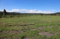
The Little Firehole Meadows
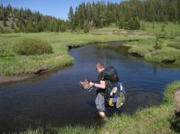
Fording the Little Firehole
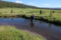
Joey, fording the Little Firehole
At camp, we set up our tents on the edge of the meadows. A pronghorn antelope and two sandhill cranes kept us company at this site for the rest of the evening and into the next day. I believe OD2 is one of the finer backcountry campsites I’ve stayed at in Yellowstone. The view of the meadows is wonderful and you get a great view of the Madison Plateau in the distance. The hike in from Mystic Falls isn’t the most scenic, I found this out the next day hiking out, but it is still worth it. Above us, we have a line of clouds that must be the edge of a front that are slowly moving over us. When we crashed for the night it began to sprinkle slightly. I’m hoping it won’t be rainy day hiking out.
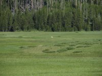
Antelope in the meadow
Day 9 – The Little Firehole River, Mystic Falls, Biscuit Basin, Old Faithful, The Bear Pit (8.0 miles)
Our last day would put us back on a trail for the entire day, the first time this had happened since our hike into Mallard Lake on the first day. The weather was splendid again as we headed out. At first the trail follows the Little Firehole River but soon climbs the ridge above while leaving the river. The next few miles are hiked through at first forest and then burn area. Certainly not the most scenic stretch of our trip, but soon Mystic Falls would make up for that. After hiking for a couple of hours, we took a quick break along the trail. Moving on after break, we came to an opening and we could see Old Faithful in the distance, only about five miles away. Soon we were dropping down quickly towards Mystic Falls. Before we reached the falls, we could see people down below hiking in from Biscuit Basin to see the falls. The first people we had seen in five days. We stopped at the Mystic Falls overlook and took some pictures. Then it was on to Biscuit Basin, where there are many thermal pools and geysers. Once through the basin, we crossed the Grand Loop Road and picked up the trail that would take us to Old Faithful.
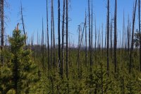
Burn from the 1988 fires - I'm glad we didn't have to off-trail through this. Mount Holmes can vaguely be seen through the trees.
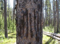
Bear markings along the trail
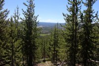
Old Faithful in the distance
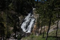
Mystic Falls
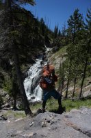
Joey in action
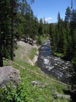
The Little Firehole River
The trail to Old Faithful took us through more thermal areas. Up ahead of us, Old Faithful went off. A fitting end to a great trip! We made our way back to our vehicles for a quick change of clothes before heading to the backcounrty office to report the gear we found by Smoke Jumpers and then on to the Bear Pit (bar at the Old Faithful Inn) for a beer and a toast for a successful trip.
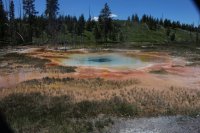
Thermal feature on the way to Old Faithful
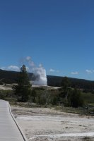
Old Faithful erupting
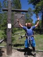
Joey, celebrating at the Observation Point Trailhead where on the first day the person manning the backcountry office had to go for a bear sighting that delayed us from getting our permit before the office closed for the day.
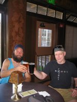
Celebrating a great trip at the Bear Pit doing what we do best; sucking down a beer (Cold Smoke)
Thoughts - Another great trip but a tough trip! I did feel like the bushwhack on day two took me right up to the edge of my physical limitations. I was pretty tired by the end of the day. I want my youth back! I believe that off-trail hiking requires more focus than just hiking along a trail from point A to point B. You are forced to continually make decisions: What is the best way around the downfall? Is this the correct drainage? Will this game trail lead us in the general direction we want to go or will there be a grizzly bear day bedding for the day along it? Will the decisions that I make now mean more difficulty ahead and run me out of energy for the next day’s travel? On past trips, I have incorporated a day or two of off-trail adventure usually as a day hike to some remote location that interested me, but occasionally as part of hiking form one campsite to the next. I found this time that over a number of consecutive days of bushwhacking that I also started to get some mental fatigue as well. Not that I wouldn’t do it again because I definitely would; it’s just my observation along the way.
I’m sure if one did this trip later in the year (August/September time frame) most of the marshy areas would be dry and the mosquitoes would be more manageable. It is certainly a route where you won’t see many other people along the way. I can’t believe this is my third trip up onto the Madison Plateau. Not many people make it up there anymore; it’s kind of the forgotten area of Yellowstone. If you are the adventuresome type then this trip comes highly recommended.
Again, here is a link to all my images for this trip.
Old Faithful Loop Images
Featured image for home page:
This was a nine day, vast majority off-trail, 64 mile loop beginning and ending at the Mallard Lake Trailhead at Old Faithful starting on June the 5th with @Joey . Our plan was to explore lakes and river drainages that are off the official trail system in Yellowstone along with seeing areas that have had very little human presence.
For those who want to see all the images for the trip, here is the link
Old Faithful Loop Trip Images

Day 1 – to Mallard Lake (3.4 miles)
Just before Joey showed up at the backcountry office, the gentleman on duty had to leave for the Observation Point Trail because a bear had been reported on the trail. He assured me he would get our permit for us even if he returned after the office had closed at 4:30 pm. Well, Joey showed up about ten minutes after he left so we waited patiently for his return. He ended up returning around 5:00 and issued our permit without too many questions or issues with our route. I might add at this point we had to pay $3.00 a night for our backcountry privilege or buy a season pass for $25.00. This fee was implemented just this year; before, unless reserving in advance, there was no charge to camp in the backcountry. We both ended up buying the season pass.
After he issued our permit, it began to hail which eventually turned over to a pouring rain. Since Joey’s cousin was in the Park at the time, we met him and his wife for a beer at the Bear Pit in the Old Faithful Inn to wait out the storm. Eventually the rain let up and we made our way to the trailhead, where we gathered our gear before heading off. My pack plus water and cameras weighed in right at 60 lbs.
There was some construction at the cabins at Old Faithful, so we had to walk the fence line of a fenced off area to reach the trailhead. Once at the trailhead we began our trek to Mallard Lake, the first leg of our loop.

Mallard Lake Trailhead

Official trailhead
After crossing the Firehole River, it is essentially a steady climb to the lake. Most of the hike is through burn from the 1988 fires. An occasional glimpse behind us reveals steam rising up from thermal features in the Upper Geyser Basin. As we continue to climb, off to our left we see a mule deer that doesn’t seem too concerned of our presence. Further up, about one mile from the lake, the drainage starts to narrow and get steeper. After this steep section the grade lessens and soon we are dropping down to Mallard Lake. On our way down, we pass the trail junction sign for the Mallard Creek Trail that heads off to the northwest. Our current trail plus the Mallard Creek Trail and the connecting trails back to Old Faithful would make for a great eleven mile loop day hike. I will need to attempt this in the future.

The Firehole River

Mallard Lake Trail

A deer across the drainage

Trail begins to get steep

Junction sign for the Mallard Creek Trail

Mallard lake at dusk
It’s almost nine o’clock when we finally reach the lake and our campsite for the night 0B2. Once at the sight, we set up our tents on wet ground and proceed to the cooking area to make dinner. I’m starving! We eat a quick dinner and call it a day. We will need our rest for the off-trail section of our hike tomorrow. The frogs are croaking extremely loud as I drift off to sleep.
Day 2 – Teal Lake, Herron Creek, DeLacy Meadows and Shoshone Lake (9.1 miles)
After a short hike our first day, today we will really be getting after it. But first, the morning light on Mallard Lake makes for some good picture opportunities and I take full advantage. There are a few ducks on the lake and they quack at me as I make my way to our neighboring campsite 0B3 to see what it is like. It turns out that OB3 is a pretty nice site. There is actually a third campsite on the lake (0B1) too, but I didn’t have time to investigate it.

Mallard Lake in the morning light

Eastern shore of Mallard Lake

My tent at 0B2
A quick breakfast and break down of camp and we are ready to make our way to our first goal of the day, Teal Lake. After backtracking along the Mallard Lake Trail for approximately .3 miles, we turn to the southeast and venture off-trail for the first but certainly not the last time on this trip. Once off-trail the going slows down considerably. There are numerous downed trees that must be either stepped over or avoided if possible. The train is uneven, with drainages running through. At times we were uncertain if a drainage would take us to the lake or not. More often than not, we would descend into a drainage and then eventually climb up and out on the other side. There are also ponds and marshy terrain along our route. At this point the marshy areas are easy to avoid but that would not be the case for a good portion of our trip. We run into some bear scat through this section. If we hadn’t already, it was time to keep our wits about us.

Let the bushwhacking begin!

Joey and rock or perhaps rock and Joey
Just over an hour and a half, we reach the northwest portion of Teal Lake. Now I have to say that I am quite disappointed in the lake. Teal Lake is a narrow elongated lake that runs in a slightly northwest to southeast fashion. The problem is that the entire middle of the lake is dry, such as there is a small northwest portion and a small south east portion. Truthfully, this just didn’t do it for me. We stopped at the second piece of the lake to eat before pushing on to Herron Creek.

Teal Lake

Joey, refilling his water bottle at Teal Lake

Scatman tracks at Teal Lake - or maybe the mysterious @kcwins left these?
Before leaving the lake, we both refilled our water bottles and checked the sky – storm clouds moving in. The section between the lake and the creek turned out to be rough going. The downfall got thicker and we were introduced to some kind of bushy shrub that occasionally was thigh high as we made our way through it. At this time, it began to rain off and on which was a real inconvenience; having to put on rain gear and then take it off again when the sun popped back out. If I left my rain gear on while it wasn’t raining, I would over heat and become uncomfortable. It was also annoying to have to take my pack off, change, and then put the pack on again every ten to fifteen minutes. This made it hard to get into any kind of rhythm while I was hiking. I guess that is just the life of a backpacker on some days.

Joey, leaving Teal Lake - I love this shot

Joey, crossing a large pond / marshy area
There is a ridge to the north of Teal Lake and we had been hugging this ridge as we approach Herron Creek. The drop down to the creek was steep and generally nasty going. We eventually heard the sound of water and know that we are close. Just a few hundred more feet and we had made it to Herron Creek, where we stopped to eat lunch.

Herron Creek

Tuna time! Where is that elk carcass?
After lunch, the rain begins to pick up as we make our way down the drainage heading towards the Grand Loop Road. Between 0.3 and 0.4 miles down the creek, we were treated to Sundial Falls, which is a waterfall about fifteen feet in height and classified as a “cascade” falls. We worked our way around the falls, taking pictures while we went. Just past the falls the rain began to pick up in intensity and in another 0.6 miles we had reached the road.

Hiking along Herron Creek

Sundial Falls

Reaching the Grand Loop Road
We then hiked the along the road for a quarter mile until we reached the DeLacy Creek Trailhead. The DeLacy Creek Trail will lead us to Shoshone Lake and our night’s campsite 8S3, which is still four miles away. The trail down to the lake was muddy and it was sloppy hiking. The views of DeLacy Creek Meadows on the other hand made up for the mushy route. Eventually we had our first glimpse of Shoshone Lake and we drove hard to reach it. Once at the lake, we had to hike along the beach, cross DeLacy Creek, pass campsite 8S2 before reaching our camp for the night.

DeLacy Creek Trailhead

DeLacy Meadows

Shoshone Lake
While passing campsite 8S2, we noticed a group (6-8?) of young men with one older gentleman. It turns out that the older guy was their leader and they were all young men were working at the Park for the summer and were part of a Christian youth group. The leader was from Vermont and he would come out every year and lead this group into the backcountry for a couple of nights. He claimed that the young men had never had the opportunity to camp in the wilderness before. While all of this was fine and dandy, I just wanted to get to our campsite (still a half mile away) and get some food into me. I was cold and hungry but the leader liked to talk and kept asking us questions about our trip. Finally he let us go and we made our way to camp.

Shoshone Lake, Mount Sheridan in the distance and a partial rainbow
It was around eight o’clock when we got everything situated in camp and it was time for dinner. I was beat, so I ate quickly and turned in wondering what tomorrow would bring.
Day 3 – Pocket Lake, Headwaters of Shoshone Creek, Shoshone Creek, Shoshone Lake (9.1 miles)
We woke up to a foggy morning on the lake, not really sure how long it will take to burn off. Today’s hike will take us to Pocket Lake, off-trail to the headwaters of Shoshone Creek, hike along Shoshone Creek to the Shoshone Lake Trail, follow the trail to the North Shore Shoshone Lake Trail and then take this trail to campsite 8R5 on the west side of Shoshone Lake. Our first order of business was to find the unofficial route up to Pocket Lake. Just over half a mile from camp and before you cross what I refer to as Pocket Creek (unnamed on maps) there are two parallel logs spread out about two feet from one another. This marks the beginning of the unofficial trail to Pocket Lake.

Fog on Shoshone Lake
The route to pocket lake is an uphill one of 1.2 miles. This unofficial route had downfall across it in many places, but at least we didn’t have to think about where to go. Essentially, just follow the path to the lake. As we worked our way towards the lake, we noticed bear den on the opposite side of the creek, slightly above us at the base of a tree. Before long, we reached the lake and worked our way around the marshy north side of the lake to a small grassy area on the northwest side where we stopped and took a few minutes to get something to eat and refill our water bottles. Of course by now it had started to rain which meant a quick change into our rain gear.

Bear den on the way to Pocket Lake

Pocket Lake
Pocket Lake sits in a deep basin and after lunch it was time for us to climb up and out of this basin. I wasn’t too thrilled with the task at hand but it didn’t take too long to get to the top, though I was huffing and puffing by the time I got there. From this point it was relatively easy bushwhacking towards the headwaters of Shoshone Creek. The downfall was spread out along this section and easy to maneuver around or step over. Finally the trees opened up and what was supposed to be our headwaters pond turned out to be dry. Because the pond was dry, it took us awhile to determine where the actual drainage was that we were to follow to the western end of Shoshone Lake. Once we were confident we were on the right path, it was a good distance before there was running water in the creek. When we finally had a nice flow, we stopped and ate our lunch in a small meadow along the creek.

At the top of the ridge above Pocket Lake

Bushwhacking to the headwaters of Shoshone Creek

The dry pond that is the official headwaters of Shoshone Creek

Joey, hiking down the drainage
The majority of the rest of the day was spent hiking along Shoshone Creek. I really enjoy hiking along a meandering stream particularly through meadows. I find it very relaxing. Along the way we saw a Grey Owl fly onto a tree branch across the creek and meadow and we also ran into some small thermal features along the creek. The owl looked like it had a rather large wingspan as it flew to the tree.

Shoshone Creek

Thermal Feature along Shoshone Creek

Grey Owl in tree across the meadow

Thermal feature along Shoshone Creek
In just another mile we reached the Shoshone Lake Trail and proceeded to hike in a southeasterly fashion towards our campsite. This trail parallels Shoshone Creek which has grown into a big stream at this point. The trail took us up above the creek and there are plenty of wonderful views looking down and up ahead. Within a mile and a half we reached a trail junction. At the junction, we turned left onto the North Shore Shoshone Lake Trail and follow it until we see the signpost for our campsite 8R5. If we had continued to the right at the junction we would have ended up at Shoshone Geyser Basin which we would be exploring the following day.

Joey, crossing Shoshone Creek

Hiking along Shoshone Creek
It turns out the signpost for 8R5 is not exactly at the campsite; we still had another quarter mile to make it to the lake. 8R5 is another wonderful campsite on Shoshone Lake. While I haven’t stayed at all of the sites on the lake, the seven of them that I have camped at have all been excellent sites. We arrived around seven o’clock and there is some time to enjoy the lake before eating dinner and calling it a night. While gazing out over the lake, we see swans, geese and pelicans along with some ducks.

Joey, setting up his tent at campsite 8R5

Shoshone Lake with Mount Sheridan in the distance
Day 4 – Shoshone Geyser Basin, Cold Mountain Creek, Headwaters of Cold Mountain Creek, Douglas Knob (5.7 miles +2)
Shoshone Geyser Basin was first on our docket today and it was roughly 0.5 miles away. We arrived at the basin and immediately went about taking pictures of all the neat thermal features. Shoshone Creek flows through the middle of the basin and adds even more beauty to the basin. Some of the Geysers along the way had names like Little Giant, Little Bulger, Shield, Bronze, Union and Washtub. The Geyser Basin is definitely worth the hike or paddle in to see it. The colors at the basin were spectacular, with greys and rusts and the turquoise water color of some of the geysers. Lizards were darting back and forth between the rocks as we approached various features. We ended up spending over an hour exploring the different thermal features all around us.

Shoshone Lake in the morning - Looking in the direction of the Cold Mountain Creek drainage that we will be hiking up later in the day.

Approaching Shoshone Geyser Basin

Thermal feature at Shoshone Geyser Basin

Thermal feature at Shoshone Geyser Basin

Joey in action!

Wolf Tracks at Shoshone Geyser Basin

Firehole River running through Shoshone Geyser Basin

Thermal feature at Shoshone Geyser Basin

Thermal feature at Shoshone Geyser Basin

Thermal feature at Shoshone Geyser Basin
Done with the basin, we headed into the meadows on the west side of Shoshone Lake and this is where the marshy part of our trip began in earnest. The trail through the meadows was underwater and the only relief for us was elevated footbridges over small streams working their way through the meadows. To add to the marshy mess we had another interesting crossing of Shoshone Creek to attempt. Once across the creek we continued on until we reached Cold Mountain Creek, where we hiked up a little ways and took a break. Eating some snacks at break, we saw two backpackers heading towards the southern part of Shoshone Lake. They did not notice us sitting on a log in the distance to the west eating our trail mix. These two would be the last people we would see for five days.

The marsh lands west of Shoshone Lake

Lily pads in the marsh
Our hike up Cold Mountain Creek began with making our way through the rest of the marshy meadows along the creek. Soon the ground dried out as we approached the canyon that the creek flows down. As we hiked along the creek, we soon became aware to the south of the creek a large rock face that was weeping with water. It reminded me a bit of Glacier National Park. As we continued to make our way along the drainage, I said to Joey, “This is a hidden gem and no one ever gets to see it.” Eventually, we had to leave the drainage and gain the ridge above because the route was getting to treacherous. Once on top of the ridge, we ran into a game/human trail that we followed to the next side drainage. Now this trail looked suspiciously like a human trail to me and my curiosity was peaked.

Cold Mountain Creek

Weeping rock along Cold Mountain Creek

Cold Mountain Creek
At the junction of this side drainage with Cold Mountain Creek, the trail turned up the side drainage. We had a dilemma on our hands. Now I must tell everybody a little bit about myself. When you turn me loose on a trail that I am unfamiliar with, it is my natural instinct to find where the trail leads to, what is its purpose, and who or what uses it? So we decided to follow the trail thinking it might put us out on the southern side of Douglas Knob. We hiked up the trail for about one mile before snow and marsh made it impossible to follow with any accuracy anymore. Perhaps this is the elusive northern trail on to the Pitchstone Plateau. A bit disappointed, we turned around and headed back to Cold Mountain Creek and pick back up our originally planned route to Douglas Knob.

Losing and trying to find again the trail in the marsh
After an hour or so we began to reach the upper portions of the drainage (the headwaters) and we have to climb a steep ridge to a small saddle before dropping down an unnamed drainage and following this drainage to Douglas Knob. On top of the ridge and looking back to the east, Mount Sheridan and the Absaroka Range are visible. We take a quick break before heading down the drainage to the west. Fortunately for us the upper part of the drainage was filled with snow which made our descent much easier. Once the snow ended we followed the unnamed stream all the way to our campsite 9D3 located on the edge of the meadows just north of Douglas Knob. While mosquitoes had been bad throughout our trip thus far, the mosquitoes at 9D3 were particularly aggravating. I must have eaten at least fifty of them as they flew into my dinner. There was just no way to keep them out. Yum protein! From our campsite we have a great view of Douglas Knob and the surrounding meadows.

The headwaters of Cold Mountain Creek

View from the top - Absaroka Range in the distance

Scatman on top

Douglas Knob
Day 5 – Trischman Knob, Headwaters of the Firehole River, Madison Lake, The Firehole River and Meadows (8.0 miles)
We began our day by hiking northwest through the meadows next to Douglas Knob, following Littles Fork which flows in the opposite direction into the Bechler Canyon and Cascade Corner. Soon we found ourselves near Trischman Knob where the headwaters of the Firehole River are located. Taking some time to take a few pictures with Trischman as our background, we moved on to the north and found ourselves at the top of a ridge with a steep drop to Madison Lake. We were able to find a steep chute full of snow and were able to hike/slide/ski down it which saved us quite a bit of time on our way to the lake.

Joey, at Trischman Knob

The chute we descended to Madison Lake
When we arrived at the bottom of the chute, the trees opened up to a gorgeous view of Madison Lake. We decided to take a break at the lake on a small peninsula with some trees on it. As I rounded some small willow bushes on the peninsula, a Canadian goose, which had been bedded down, jumped up and rushed to the water’s edge, scaring the shit out of me! He/She squawked at me for some time while I ate a snack by the lake. I thought the view at Madison Lake was one of the highlights of the trip – just beautiful. Of course the frogs were as loud as they could be. I loved it!

Madison Lake
After getting some nourishment in our systems, we left the lake and continued on down the upper Firehole River and its expansive marshes. Water was everywhere, sometimes boot deep. We took our time trying to navigate through the shallow portions of the swampy area. Perhaps hallway through the marsh, we noticed something off to our right and went to inspect what it was exactly. When we got to the object, it turns out that it was a large sack that looked like it had been there awhile. We were able to find a tag on the sack that said that it had been made by the U.S. Sack Corporation out of Grand Junction, Colorado. My thoughts were that maybe it had been used in some firefighting operation and had forgotten to be removed.

Upper Firehole Meadows

Upper Firehole Meadows

Looking back towards Madison Lake
We continued on through the marsh, seeing more bear scat, discovering lots of small ponds, and dealing with clouds of mosquitoes. Soon though, we found ourselves back in the trees following the river through forest. Once in the woods, we found a nice place to rest and eat lunch. What a peaceful setting by the river, one of the many places I’ve found in the Park over the years where I could have sat there for the rest of the day and just let the river and the clouds roll on by. But, we had places to go and soon we were on the move again heading towards a steep drop in the river and four sets of falls known as Quadruple Cascades, 1 through 4, that range in height from fifteen to twenty feet. As we were making our way through the cascades, it was difficult to distinguish where one stopped and where the next cascade began. Working our way towards cascade #4, it began to get extremely steep so we decided to work our way up to the top of the ridge and go from there. After wearing ourselves out hiking to the top, we eventually got to the point where we had to find a way off the ridge and drop down to the next set of meadows where our campsite, 0A3 was located. Fortunately for us, we found a game trail that made the descent easier to take and in a few minutes we were back along the Firehole.

On lunch break along the Firehole River

Cascades along the Firehole River
At this point, it began to rain heavily, so after a tricky crossing of the Firehole, we decide to wait the storm out sitting under some trees listening to the thunder overhead. After thirty minutes or so the rain let up and we were on our way again. The trees gave way to lush green meadows and we continued to follow the Firehole all the way to camp. When we reached camp, it had begun to drizzle again so we waited a bit to set up our tents, before eating dinner and calling it a day.

Joey, attempting a tricky crossing of the Firehole

The meadows along the Firehole River
Day 6 – Leaping Falls, Dashing Falls, The Madison Plateau, Summit Lake (7.5 miles)
Today, we were following an unnamed stream from campsite 0A3 up and onto the Madison Plateau, then hiking in the drainage on the plateau for a few miles before making our way through burn from the ’88 fires and on to Summit Lake.
We left earlier than usual this morning expecting it to be a tough day of hiking. We picked up the stream quickly and followed it for a short distance where we came upon Leaping Falls. The problem ahead of us was that the falls were plunging over a cliff and we would have to find a way around the cliffs to continue to follow the drainage onto the plateau. We worked our way to the east and found what appeared to me to be a straight up route to get us on top. This was definitely the hardest stretch of the trip, while not a great distance, I found myself stopping frequently to gather my breath before continuing on. Joey, who is like a mountain goat, made it with ease! Once on top, we continued along the drainage and soon we saw a second waterfall named Dashing Falls. As we worked our way past the falls we encountered our second predicament of the day, the drainage split with both heading off to our left which was the direction of travel we wanted to go. We went back and forth over which one was the correct route and eventually we decided on the wrong one, but after hiking a short distance we soon corrected our ways and got back on the right track.

Unnamed stream we are following onto the Madison Plateau

Leaping Falls

Dashing Falls
Now back in the right drainage, the water soon disappeared and we were left with large boulders to negotiate. We decided it was time to climb the ridge again and so we did. Eventually, we came even with the dry stream again and at this point we took a break. The drainage at this point was beginning to widen but it still had a lot of downfall in it so it was actually easier to walk just above it. As we continued along the drainage, it in due course became even wider and now we could hike right up the middle of it and this made for easy travel. The further we went; narrow grassy areas appeared on either side that would slowly widen as we made our way along the plateau. Eventually, we found ourselves in a full blown meadow where a pond was located; this pond was to be our water source. Before we could refill the skies let loose again this time with a good lightning show along with some impressive hail.

Drainage we followed on the plateau
We decide to wait this storm out also and when it had calmed down a bit I went and refilled my water bottle. Of course the storm had disturbed the silt in the shallow pond so my water tasted like dirt when I drank it later on. Along the shore of the pond we found some cool remains of an elk that included an intact skull, antlers and some of its vertebrae. Some of the ribcage was visible in the north end of the pond. Perhaps wolves had taken the buck down.

Hailing at the pond

Elf skull and antlers

Joey, holding the antlers
After leaving the pond, we had a short distance to hike through the rest of the meadow before we hit the dreaded burn area. We stopped at the burn boundary and I ate my MET-Rx Colossal Brownie for extra energy to get me through. For those who haven’t hike through burn, it can be a real bitch, depending on the amount of downfall and the thickness of new growth. As it turned out, we were in luck because the new growth was more dispersed. On the other hand, the entirety of downfall was now wet and slippery after our storm had passed through. Well, there was no way around it so we both just gritted our teeth and drove ahead.

Hiking through the burn
As we exited the burn, the rain began to pick up again. This time it felt like a cold front was passing through and I felt a bit chilled. I couldn’t wait to reach Summit Lake. It was not long before we could see the lake through the trees and soon we were on the submerged Summit Lake Trail heading for campsite 0E1. We reached our campsite and again had to wait for it to stop raining in order to set up our tents. Later, we made a small fire (our first of the trip) and enjoyed dinner before the sun went down. Just after dusk, we had a splendid sunset to watch before heading to bed. I was worn out after today and was looking forward to a good night’s sleep.

Summit Lake in the rain

Sunset at Summit Lake
Day 7 – Day Hike to Smoke Jumper Hot Springs, Bear Encounter (6.0 miles round trip)
We woke up to a gorgeous day! This would be the best weather day since we started. Summit Lake is picture perfect in the morning sunlight and the frogs are back at it. Joey mentions that he heard something near the bear pole last night but he couldn’t quite make it out due to all the noise the frogs were making. This is also the first day that we have had an opportunity to dry our gear out in a thorough manner.

Summit Lake in the morning

Drying our gear
After drying our gear, we set off west along the Summit Lake Trail (Continental Divide Trail) for about one mile. We then turned off the trail and hiked to Little Summit Lake before moving on to some of the thermal areas. The thermal areas at Smoke Jumper Hot Springs are spread out so we hiked from thermal area to thermal area. On our way to one of the thermal areas from Little Summit Lake, we came across a tent, tent poles in their sack underwater in a pond, a partially shredded sleeping bag and a Ziploc full of knick-knacks. We spent the next fifteen minutes looking for a backpack and a body. We didn’t find anything but we couldn’t understand why somebody would abandon their tent and sleeping back in a remote location. I took a GPS point of the location in order to report it to the backcountry office when we were done with our trip.

Summit Lake Trail (Continental Divide Trail)

Joey at Little Summit Lake
As we arrived at our second thermal area, a larger area than the first, we spent some time taking pictures and circling the small lake that made up a majority of the area. Heading west along the north side, I heard Joey say “bear.” He said it a normal voice and I thought he was just talking about bears. But then he let me know with a little more authority that there was a black bear behind us. I turned around and sure enough where we had been standing two minutes before there was a black bear. At first, we weren’t very alarmed but as he continued to move in our direction we started giving a little ground at first. We yelled “Hey Bear!” but to no avail; he just kept coming towards us. We continued to yell at him as we got our bear spray ready just in case. As he approached within thirty feet, he finally moved to our right and into the trees. Another good adrenaline rush!

Black bear making his way towards us.

Black Bear getting closer

Too close for comfort
We moved on to the next area and saw the same bear running past us at the top of the thermal basin. After the bear passed, we saw two deer that at first didn’t notice us, but once they did they fled. We went back to examining the thermal features. While smoke Jumpers isn’t as nice as Shoshone Geyser Basin; it still had its charms. We explored other smaller thermal areas on our way back to the trail and one large area just south and adjacent to the trail. I don’t believe this area technically is part of Smoke Jumper.

Deer at thermal area

Thermal feature at Smoke Jumper Hot Springs

Joey in action
We then made our way back to camp where we built a nice campfire and actually had the time to enjoy it. We discussed the bear encounter over and over while eating dinner. Did we handle the situation correctly? Did we not? It’s funny how these situations always happen rather quickly without a lot of deliberation involved. Oh well, in my book it is always exciting to see a bear in the wild. After dinner, we enjoyed the fire for a while before turning in for the evening.
Day 8 – Headwaters of the Little Firehole River, The Little Firehole River, The Little Firehole River Meadows (7.1 miles)
Originally we had wanted to head north off-trail from our campsite to the headwaters of the Little Firehole River, but instead we retraced our path from the day before towards Smoke Jumper Hot Springs and hiked to the headwaters from there. Once we reached the headwaters, we just followed the river all the way to camp. The nice thing about this day was that we had a steady wind blowing all day which helped keep the mosquitoes at bay. Weather wise it was another perfect day.

Headwaters of the Little Firehole River
Dropping of the plateau turned out to be a rugged journey. The bushwhacking through this section was the worst since day two between Teal Lake and Herron Creek; fortunately for us our packs were quite a bit lighter along this stretch than they had been on the second day. When we finally made it down, we broke out into a meadow full of wildflowers. We stopped to break for lunch and spent a long time enjoying the view.

Elephant Heads in a meadow along the upper meadows of the Little Firehole River
When we finally decided to leave, we had one more forested section to hike through before we would reach the Little Firehole Meadows. We made our way through the wooded area and then hiked out into the meadows. The Little Firehole Meadows were tremendous! Up ahead we could see the location of our campsite on the other end of the meadows. We made a straight bee-line for it. Just before reaching camp, we had to ford the Little Firehole River. After getting across, we were just a short walk from campsite 0D2.

The Little Firehole Meadows

Fording the Little Firehole

Joey, fording the Little Firehole
At camp, we set up our tents on the edge of the meadows. A pronghorn antelope and two sandhill cranes kept us company at this site for the rest of the evening and into the next day. I believe OD2 is one of the finer backcountry campsites I’ve stayed at in Yellowstone. The view of the meadows is wonderful and you get a great view of the Madison Plateau in the distance. The hike in from Mystic Falls isn’t the most scenic, I found this out the next day hiking out, but it is still worth it. Above us, we have a line of clouds that must be the edge of a front that are slowly moving over us. When we crashed for the night it began to sprinkle slightly. I’m hoping it won’t be rainy day hiking out.

Antelope in the meadow
Day 9 – The Little Firehole River, Mystic Falls, Biscuit Basin, Old Faithful, The Bear Pit (8.0 miles)
Our last day would put us back on a trail for the entire day, the first time this had happened since our hike into Mallard Lake on the first day. The weather was splendid again as we headed out. At first the trail follows the Little Firehole River but soon climbs the ridge above while leaving the river. The next few miles are hiked through at first forest and then burn area. Certainly not the most scenic stretch of our trip, but soon Mystic Falls would make up for that. After hiking for a couple of hours, we took a quick break along the trail. Moving on after break, we came to an opening and we could see Old Faithful in the distance, only about five miles away. Soon we were dropping down quickly towards Mystic Falls. Before we reached the falls, we could see people down below hiking in from Biscuit Basin to see the falls. The first people we had seen in five days. We stopped at the Mystic Falls overlook and took some pictures. Then it was on to Biscuit Basin, where there are many thermal pools and geysers. Once through the basin, we crossed the Grand Loop Road and picked up the trail that would take us to Old Faithful.

Burn from the 1988 fires - I'm glad we didn't have to off-trail through this. Mount Holmes can vaguely be seen through the trees.

Bear markings along the trail

Old Faithful in the distance

Mystic Falls

Joey in action

The Little Firehole River
The trail to Old Faithful took us through more thermal areas. Up ahead of us, Old Faithful went off. A fitting end to a great trip! We made our way back to our vehicles for a quick change of clothes before heading to the backcounrty office to report the gear we found by Smoke Jumpers and then on to the Bear Pit (bar at the Old Faithful Inn) for a beer and a toast for a successful trip.

Thermal feature on the way to Old Faithful

Old Faithful erupting

Joey, celebrating at the Observation Point Trailhead where on the first day the person manning the backcountry office had to go for a bear sighting that delayed us from getting our permit before the office closed for the day.

Celebrating a great trip at the Bear Pit doing what we do best; sucking down a beer (Cold Smoke)
Thoughts - Another great trip but a tough trip! I did feel like the bushwhack on day two took me right up to the edge of my physical limitations. I was pretty tired by the end of the day. I want my youth back!
I’m sure if one did this trip later in the year (August/September time frame) most of the marshy areas would be dry and the mosquitoes would be more manageable. It is certainly a route where you won’t see many other people along the way. I can’t believe this is my third trip up onto the Madison Plateau. Not many people make it up there anymore; it’s kind of the forgotten area of Yellowstone. If you are the adventuresome type then this trip comes highly recommended.
Again, here is a link to all my images for this trip.
Old Faithful Loop Images
Featured image for home page:

Last edited:

