- Joined
- Dec 23, 2013
- Messages
- 4,110
On August 31st, @Joey and I began a nine day, 82 mile loop through the Gros Ventre Wilderness in Wyoming. @Artemus would join us for the first night before heading off to summit Antoinette Peak and then make his way down Swift Creek and back to the trailhead to form his own three day mini-loop. As we drove towards the Shoal Falls Trailhead along Granite Creek Road, Antoinette Peak and Corner Peak soon came into view. None of us had hiked/backpacked in the Gros Ventre before and this view near the trailhead increased the anticipation of our trip. We arrived at the trailhead about 10:30 am and gathered our gear together before heading out.
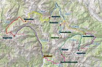
Trip overview map
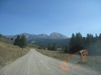
First view of the Gros Ventre driving up Granite Creek Road
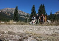
@Artemus , Scatman and @Joey at the Shoal Falls Trailhead
Day 1 – Shoal Falls Trailhead to Shoal Creek Drainage (8.9 miles)
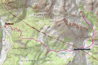
Route Map Day 1
Immediately after leaving the trailhead we began to climb a small ridge gaining about 1600 feet in just under three miles. Most of the time, we found ourselves hiking along the trail through forest with occasional openings that afforded us excellent views of the Gros Ventre Range east of Granite Creek.
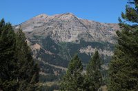
Unnamed peaks 10,623 and 10,654
Occasional patches of wildflowers along the way enticed us to stop and take pictures. Towards the top of the ridge, the trail opened up into late season meadows with glimpses of the Gros Ventre Range opening up to the east of us.
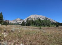
Unnamed Peaks 11,095 and 10,493
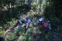
On break
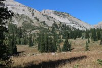
Unnamed Peak 10,493
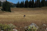
@Artemus, doing an Irish jig
Soon we came to an excellent vantage point that looked down on the Shoal Creek drainage with Shoal Falls and the hanging valley it descends from clearly visible to the east. @Artemus made the comment that this would make an excellent campsite and I would have to agree with him. After taking some pictures of the scene, we steeply descended to a group of ponds at the bottom near Shoal Creek where we took a break to fuel up for what appeared from the map to be a near vertical climb to Shoal Lake. After break, we set off first with a ford of Shoal Creek before beginning our climb up the drainage. Beavers had been busy along the creek. This would not be the last encounter with their handiwork on our trip.
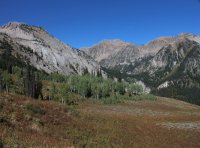
Great view into the Shoal Creek Dranaige
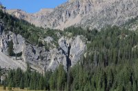
Shoal Falls in the shadow
The climb began immediately after crossing the creek and on our way to the hanging valley I stop to catch my breath numerous times. @Artemus pointed out that the trail was “Getting After It” in reference to the Swift Creek Trail he had read a description of that he would be descending in a couple of days. There was no question to me it was getting after it. And it seemed to be getting after it at my expense! Once we were level with the top of the falls, we had a slight reprieve for a short distance before the climbing began again. Just as I thought we were about to reach the top, the terrain would stretch out further in front of us with more up, up, up. Since we had gotten a late start to begin with, it became clear we would not reach our desired destination, Shoal Lake before nightfall. We stopped and made camp about 1 mile south of the lake when darkness started settling in. The site we chose had a splendid view of the Shoal Creek drainage along with the surrounding mountains, including Palmer Peak to the east, Steamboat Peak to the northeast and Corner Peak to the northwest. Shoal Lake remained hidden from our view, tucked in a small basin below Corner Peak.
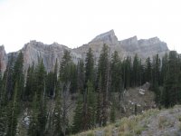
Southern ridge between Unnamed Peaks 11, 095 and 10,493
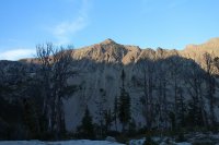
View to the east from camp
We set up our tents and began to make our dinner when @Joey heard a voice in the dark. It was @Ben Cowan who had hiked in to meet us. He was a little surprised that we had not reached the lake. Ben joined us for dinner. While eating we gazed up at the plentiful stars while discussing our hike in. Being pretty tired, I turned in first knowing tomorrow would be another challenging day.
Day 2 - Shoal Creek Drainage to Brewster Lake (12.8 Miles)
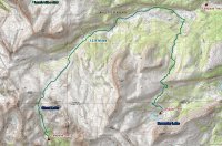
Route Map Day 2
Today we would begin by climbing four hundred feet to Shoal Lake then an additional five hundred more to the pass above the lake. Shoal Lake sits just below Corner Peak and when we reached the lake some of us refilled our water bottles and ate a quick snack. The next five hundred feet was a steeper climb than the hike up to the lake, but soon we found ourselves at the pass that separates the Shoal Creek Drainage from the headwaters of the Gros Ventre River. The view from the pass was spectacular with Black Peak to the north of us, Darwin Peak to the east and Steamboat Peak nestled almost on top of us.
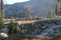
@Ben and @Artemus eating breakfast
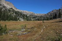
Heading to Shoal Lake
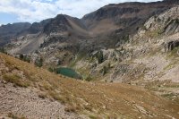
Looking down on Shoal Lake
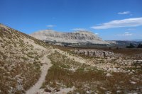
Black Peak
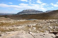
Darwin Peak
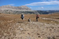
@Artemus , @Ben and @Joey on the pass
At this point, @Artemus was due to make his own path back to the trailhead with hopes of summiting Antoinette Peak before heading down Swift Creek. We took some time to take some group photos on the pass before Art wished us luck on the rest of our journey, said his goodbyes, and then he was off. The trail from this point down into the Gros Ventre Drainage was non-existent so we had to follow cairns until eventually @Ben Cowan happened upon the trail. The trail led us down to the Gros Ventre River where we followed the river for about four miles. At this point, we arrived at a hunting camp (the first of many we would run into in the wilderness) where we had to cross the river. Once on the other side, we took a break among the willows before beginning our climb up Grizzly Basin.
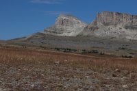
Southwestern end of the Black Peak Ridge and Unnamed Peak 11,204
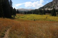
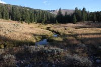
Willow thickets along the headwaters of the Gros Ventre River
Darwin Peak
Before beginning our climb, we had some difficulty finding the correct trail near Chateau Lake. Once we determined that we were on the right trail, we steadily climbed up the basin towards an unnamed pass that separates Grizzly Basin from the Dry Fork Drainage where Brewster Lake is located. In the upper reaches of the basin @Ben Cowan saw two deer and I watched a snowshoe hare hop across the trail, and true to its name we saw bear track along the trail while in upper reaches of the basin. Towards the top of the basin, I started to tire out and slowed down considerably. I looked forward to the downhill stretch to the lake.
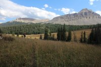
Grizzly Basin
At the pass, daylight began to fade and we arrived at Brewster Lake in the dark. We set up camp and made dinner before turning in for the night. We would have to wait until morning to see the beauty of Brewster Lake and the surrounding scenery.
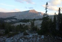
View from the pass
Day 3 – Brewster Lake to the Gros Ventre River (8.3 Miles)
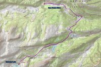
Route Map Day 3
I woke up this morning to just a tremendous view - Brewster Lake with Triangle Peak rising from its southern shore to 11,535 ft.! It doesn’t get much better than this. Definitely one of the highlights of the trip. After eating breakfast, we headed off for our Gros Ventre River destination. At first, we had a slight climb before dropping down into the Dry Fork Drainage. Due to blow down the trail became hard to follow but soon was picked up again as we made our way towards Lunch Lake. It’s about three miles from Brewster to Lunch Lake and we made good time. Arriving at the lake, we took a break along the northeast shore and took some time to enjoy the view.
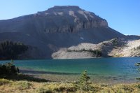
Brewster Lake
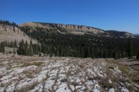
Ridge to the north of Dry Fork
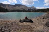
@Ben and @Joey at Lunch Lake
Leaving the lake, we soon came to a trail junction where we stayed to our left and took what I term the Gros Ventre River Cutoff Trail. This cutoff would take us up and over a small ridge before dropping to the Gros Ventre River. As we began the climb up the ridge, it was obvious that the Forest Service had been doing some trail work along this stretch with new posts to mark the way along and some work on the trail itself. On the way down to the River, we saw a wolf track on the trail and we could make out some horses on the other side of the Gros Ventre River. It turns out that these horses belonged to an outfitter who was bringing four ladies from Minnesota into the Gros Ventre for a wilderness experience, but we wouldn’t learn this until later in the day.
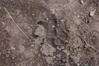
Wolf Track on the Gros Ventre Cutoff Trail
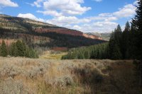
Making our way down to the Gros Ventre River
Upon arriving at the river, @Ben Cowan and I removed our hiking shoes/boots and Ben proceeded to cross the river barefoot while I slipped into my sandals to cross. Joey on the other hand had gaiters on and just made a mad dash to the other side. I never asked him if his feet got wet but it was sure entertaining to watch. We then proceeded up the Gros Ventre River. It was a little over two and a half miles to our next campsite which we hoped would be somewhere near the next trail junction. Along the way we ran into our first group of cows in the wilderness. The Wilderness Act provides for grazing in a designated wilderness area if it was an established program before the wilderness was created. The Gros Ventre Wilderness was established in 1984 so the grazing rights must have been grandfathered in. Anyway, the cows seemed pretty congenial and we carried on without incident. We then arrived at a long east-west meadow filled with willows. We were going to try and find a camp spot somewhere on the western side of the meadow. As we neared the end of the meadow, we ran into the outfitter whose horses we had seen earlier and had a nice chat with them and their guests. We ended up setting up camp just across Bear Cabin Creek from them. It was nice to get to camp before dark and be able to have a campfire and not have to eat dinner in a rush and also have some time to converse with Ben and Joey about our trip up to that point.
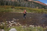
@Joey crossing the Gros Ventre River in style
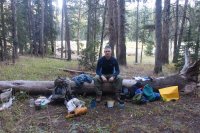
Scatman at campsite #3
Day 4 – The Gros Ventre River to The Six Lakes (8.6 Miles)
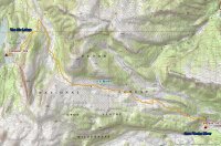
Route Map Day 4
On day four, we woke up to horses. Surrounded by horses! The outfitter’s horses had come to visit our campsite sometime in the early morning. As I ate breakfast, one of the horses grazed right up to my backside while I was sitting on a log. All the horses were shackled except for one. They eventually made their way back towards there camp as we finished up. Starting today, and for the rest of the trip, I left camp earlier than Ben and Joey. Since both are stronger hikers than I am, I would head off early and take a few more breaks until they caught up with me on the trail.
I started off by hiking back to the trail junction and then taking a left and headed up the Bear Cabin Creek Trail. On the climb to the top of the ridge, I came across bear tracks that were headed in the opposite direction as me. Once on top of the ridge, the trail followed a more gradual slope to an unnamed pass that was more manageable than previous passes we had crossed. This pass, miles ahead, divides the Bear Cabin Creek Drainage from the Jagg Creek Drainage. After hiking for an hour and a half and a stop for a short break, Ben and Joey caught up to me.
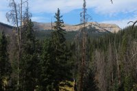
Black Peak
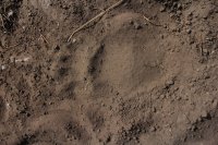
Bear Track on the Bear Cabin Creek Trail
The path ahead to the pass was all high country meadows with far off views in most directions. While hiking through the meadows, we were able to see a black bear along the tree line to the east. And not five minutes after seeing the bear, a bald eagle took flight from a tree to the west of us. Anytime you are able to see a bear in the wild is a special day and add on to that a bald eagle. Wow! We still had a couple of miles to go to the pass. Once on the pass, two deer took off for the trees and we stopped for a break. From our vantage point, we could see the Wind River Range to the south and mountains in the Teton Wilderness to the northwest.
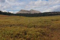
View from the Bear Cabin Creek Trail
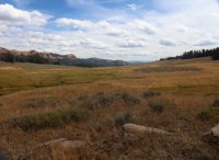
Looking back down the Bear Cabin Creek Drainage
After our break and just beginning to head down the other side, we ran into an old cowboy herding his cows from the north side of the pass back to the meadows on the south side. We chatted with him for a few minutes. He told us that he would keep his cows up in the high country until the 8th of October. I told him that he had one of the best jobs in the world being able to work in this beautiful wilderness every day.
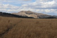
View from the pass - Crystal Peak
The descent down the northwest side of the pass was steeper than the ascent and the trail took us through forest before popping us out into the meadows along Jagg Creek. As we made our way into the meadow, off to our left was a small valley where the headwaters of Jagg Creek lies and it was just gorgeous. I think if the world were to end tomorrow, I would want a small cabin in that valley to live out the rest of my days!
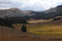
Small valley where I am going to spend the rest of my days.
We soon crossed a rather small Jagg Creek and not before long reached the trail junction that would lead us up to The Six Lakes. It took us about an hour from the junction to reach the lakes and when we arrived it was fairly easy to tell five of the six lakes, but the sixth one was hard to pinpoint what with various small ponds around. We weren’t sure which pond was actually the sixth lake. Another oddity was that the largest of the six (twelve) lakes hardly had any water in it. I’m still perplexed by this. Thinking originally that we would camp at the big lake, we decide instead to make camp at the second largest lake on a point above the lake. This campsite had a wonderful view of the lake, a large basin and Black Peak in the distance. The only drawback was that the wind seemed to blow endlessly at this location. We arrived again with plenty of time to set up camp and eat before calling it a day.
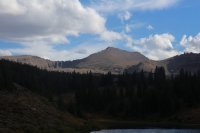
Black Peak
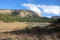
One of The Six Lakes
Day 5 – Day Hike to Black Peak Ridge Basin and Joey and Ben summiting Black Peak (4.7 and 6.8 Miles Respectively)
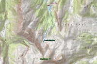
Route Map Day 5
Day five, a rest day of sorts. We planned a day hike to the basin above the lake that we are camped at and Ben and Joey will extend and summit Black Peak. We head off, worked our way around the east side of the lake, picked a drainage and then bushwhacked up to the basin. It took us about an hour and a half to reach the point where Joey and Ben would continue on and I turned around and headed back to camp.
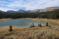
The view from our campsite on the second largest of The Six Lakes
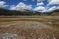
Looking back at Crystal Peak
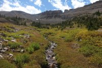
Making our way up the basin
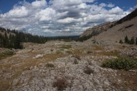
View back down the drainage towards The Six Lakes
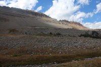
My lunch view
Before they attempted their summit push, we ate lunch with spectacular views all around us. After wishing them a safe trip, I began to make my way back to camp. On my way back I followed a different drainage than the one we had taken up to the basin. Along the way I found an elk jaw bone and a small waterfall. Even more interesting to me was that the stream, which had a reasonable amount of water in it dried up, so that the last third of my hike was along a dry stream bed.
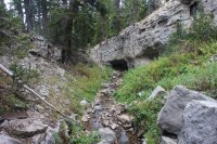
Stream I followed back to camp
After a couple of hours Joey and Ben returned from Black Peak and said that it was one of the highlights of their trips so far with fantastic 360⁰ views. They could see the Tetons to the north and the Wind Rivers to the south. They also mentioned that it was quite windy and had snow flurried on them while on top.
Well, it was a good day all around. I needed the off day to get the pack off my back for a day and let my old body rest a bit for the rest of the trip.
Day 6 – The Six Lakes to Crystal Creek (11.0 Miles)
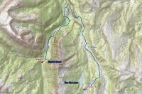
Route Map Day 6
During the night a storm moved in and we got quite a bit of rain and high winds. The weather would subside for fifteen or twenty minutes and then let loose again. In the morning, I took advantage of one of these breaks and ate breakfast after which it started raining again, so I packed all my gear away inside my tent. When the next short break came I rolled up my wet tent, attached it to the bottom of my backpack and headed off for Crystal Creek. It did not take Joey and Ben long to catch me this day and we continued to hike down to Jagg Creek then north along the trail in varying degrees of rain.
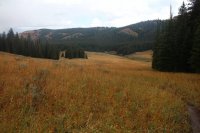
Hiking in the rain
In the early afternoon, the skies began to clear and our spirits lifted. After hiking through the forest, we came to a meadow where a hunting camp was set up next to Jagg Creek that had a couple of Tepees set up within its perimeter but no people were present as we passed by. At the far end of the meadow with the hunting camp, we passed a cabin before heading into the forest once again. Once in the trees we began a descent, steep at times, into the Crystal Creek Drainage where the trail emptied out into another long meadow. While descending, we could see across the valley a relatively recent landslide on Crystal Creek. It looked from our vantage point that it had formed a small lake on the creek behind the slide. We soon hit an unmarked trail junction that I’ll call the Crystal Creek Cutoff. Ben was up ahead of us and we could tell by his shoe prints that he had taken the cutoff trail so we followed. Eventually we had to cross Crystal Creek and climb up the embankment where we ran into another trail junction.
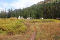
Hunter's camp on Jagg Creek
Today, a friend of ours (Quin) was going to meet up with us at the trail junction for the Jagg Creek Trail and the Crystal Creek Trail. Quin would be hiking in from the Crystal Creek Trailhead, wait at the junction for us and then continue on with us for the next three days. Well because we had taken the cutoff trail, we hadn’t actually passed the junction where Quin was waiting for us. So Ben and Joey hiked down to the junction to retrieve Quin. I waited at the junction for them to return and while waiting I could hear a noise. I thought, “Maybe it’s an elk?” But it turned out to be an outfitter with his three horses instead. He had been setting up his camp in the backcountry for the following week; had finished and was heading out of the backcountry. We exchanged pleasantries and he was on his way.
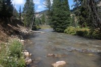
Crystal Creek
Quin, Ben and Joey returned to the junction and we began making our way up Crystal Creek. The trail had changed since the landslide. It is now on the north side of the creek instead of the south side like it is shown on the map. The piece of the mountain that had given away looked like it carried a lot of force with it. We passed by the small lake that had formed due to the slide and it still had dead trees rising up out of the water. The whole scene had a very eerie feel to it plus everything was deadly quite.
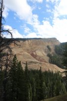
Relatively recent landslide on Crystal Creek
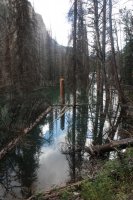
Small lake formed on Crystal Creek from the slide
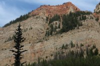
View from the Crystal Creek Trail
We continued on up the canyon, eventually passing the hunter’s camp that he had set up, crossed Crystal Creek again and finally made it to the trail junction of the West Fork Trail where we established our campsite for the night.
Day 7 – Crystal Creek to an Unnamed Pond located in the Flat Creek Drainage (9.7 Miles)
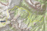
Route Map Day 7
We anticipated lots of up today as we made our way up the West Fork Trail and up and over an unnamed pass before dropping down to a pond in the Flat Creek Drainage. The climbing began right off the bat after crossing Crystal Creek (a cold crossing by the way). It took me some time to gain the ridge and soon I ran into an unsigned trail junction. It was clear that one direction was the trail most used but the other direction seemed to agree with my map. After about twenty minutes of indecision I chose the frequently traveled one and it all worked out. The trail eventually dropped a few contours then passed a pond where I stopped for a break and this is where everyone caught up to me. We then followed the contour along the ridge before a slight up, then a drop down to the West Fork Meadows.
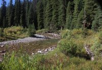
West Fork flowing into Crystal Creek
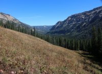
View back down the Crystal Creek Drainage
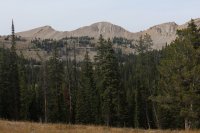
View from the West Fork Trail
At the meadows, which happened to be the site of another hunting camp, we took a break, refilled our water bottles and put on some warmer clothes for our climb to the pass. The sun had gone behind a thin vail of clouds and the warmth was not penetrating through, plus the wind had picked up and things were beginning to get chilly. It took us a few minutes to find where the trail actually went up the hill but soon Ben was on it and we fell in line behind him. We had a fourteen hundred foot climb in about two miles to look forward to that included the unnamed pass and some addition up beyond the pass. Of course as we gained altitude, the views became better and better.
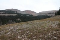
Heading towards the pass
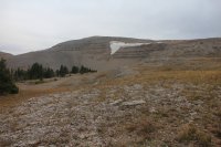
Snowfield on Unnamed Peak 10,827
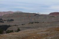
Heading towards the pass
After reaching the sign at the pass the trail became non-existent, instead replace by large cairns that we followed along the mountain top. As we went from cairn to cairn, Ben’s thermometer read 35 degrees and with the wind chill it had to be below freezing up top. The views were tremendous, with the Tetons and Jackson Hole coming into view. We at last came to the last cairn and made our way down off the ridge where after some searching we picked up the trail down into the Flat Creek Drainage. As we made our way towards our campsite, we passed more bear track on the trail. We got to the point where we had to leave the trail and hike a couple hundred yards to an unnamed pond where we located a campsite on the west end of the pond. The light was fading by this time and we quickly set up camp and ate some dinner before turning in for the evening.
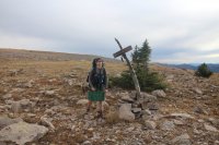
Scatman at the pass. I'm pooped!
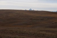
Tetons coming into view
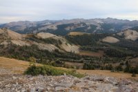
Looking down into the Flat Creek Drainage
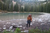
@Joey at the unnamed pond - our campsite for night #7
Day 8 – Unnamed Pond to Turquoise Lake (10.0 Miles)
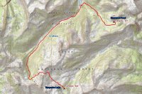
Route Map Day 8
We’ve another pass to cross today so I’m up early and on the trail before the others. I quickly came to a meadow where the trail disappeared after crossing a small stream on the edge of the meadow. It took me some time to pick up the trail again and after leaving the meadow, I began a very steep, two mile descent to Flat Creek. These trails certainly weren’t built with humans in mind! Once down, I came to flat creek where I took a quick break then made a directional arrow out of some rocks to let the others know which way I was heading, due to the fact that there were a number of trails shooting off in different directions at the creek. The route up Flat Creek was mostly wooded and was quite enjoyable. At my next break, the others caught up to me and they stopped and made lunch before our climb began up to the pass. After our break, we had to cross Flat Creek, then almost immediately cross it again. We had about a mile and a half of slightly uphill hiking before it got serious again.
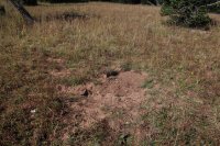
Grizzly dig in the meadow where I temporarily lost the trail
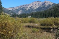
Looking down the Flat Creek Drainage
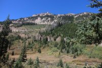
View from the Flat Creek Trail
We had about 2.5 miles and 1,600 ft. to reach the pass and it’s just a steady dose of up the entire way. My knees began to scream at me but the views are just getting better and better as we go up. We finally reached a trail junction before the pass and Ben took some time to refill his water bottle at a stream which provided me with a well needed rest, though it doesn’t last long. Continuing on our way, Quin spooked a grizzly bear just before the pass. The bear ran off down the Flat Creek Drainage. I’m guessing he was up this high for the white bark pine nuts. The Tetons showed themselves again just before we gained the pass. It’s always an inspiration to see the range. At last we reached the pass and the view down the Granite Creek side is wonderful too.
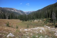
Starting our climb towards the pass - looking back down the Flat Creek Drainage
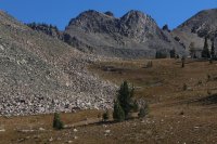
Close to the pass
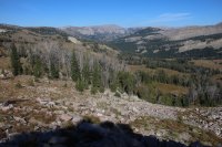
View from the pass down the Granite Creek Drainage
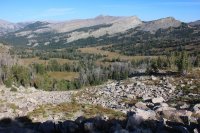
View from the pass down the Granite Creek Drainage
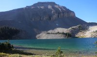
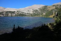
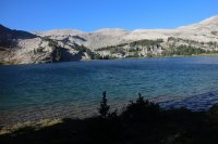
We made quick time to Turquoise Lake from the pass and set up camp. Turquoise Lake has a number of campsites located around it and seems like a pretty popular destination, certainly more so than the other high country lakes that we stayed at. The amount of use certainly doesn’t take away from its beauty though, nestled in among the surrounding mountains.
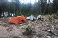
Campsite on Turquoise Lake
Day 9 – Turquoise Lake to the Shoal Falls Trailhead (12.8 Miles)
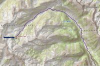
Route Map Day 9 - Part A
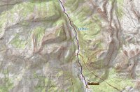
Route Map Day 9 - Part B
Day nine’s stretch was a relatively easy, although longer, hike down Granite Creek. Along the way, we passed willow thickets along the creek (Joey saw three moose in one thicket), a few beaver ponds and of course the views on either side of the canyon were first rate with the towering mountains looming above.
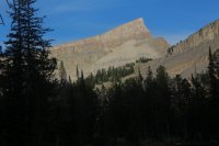
View from our campsite on Turquoise Lake
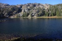
Turquoise Lake
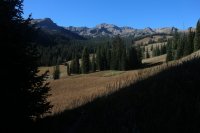
View back up the Granite creek drainage
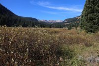
View back up the Granite Creek Drainage
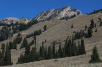
Pyramid Peak
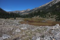
Looking back up the Granite Creek Drainage
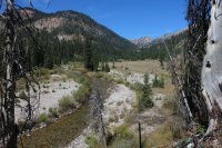
Granite Creek
After reaching then crossing the wilderness boundary, we soon arrived at the Granite Creek Hot Springs where you can soak in the warm waters for a fee. Our trailhead was still a mile and a half away so we did not linger long at the springs.
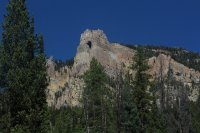
The Open Door
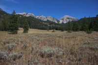
Back to where we started
At last, our vehicles and the trailhead came into view and after one more small climb we were done.
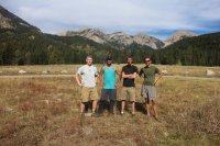
We made it! Scatman, @Joey , @Ben and Quin at the Shoal Falls Trailhead
Thoughts – The Gros Ventre Wilderness is a hidden gem! Nestled in between the Tetons and the Wind Rivers it tends to get overlooked by many but is well worth your time to explore. There is definitely a lot of vertical in the wilderness. At least the route we completed with five passes to cross. The trails were made with horses in mind not humans. There were not many switchbacks along the way, just straight up or straight down it seemed. My knees certainly paid a price for this trip. The overall scenery was excellent with varying landscapes to hike through. The wildlife we encountered included: a black bear, a grizzly bear, an elk, 6 deer, 3 moose, a bald eagle, an osprey, a snowshoe hare, a grouse, a few hawks, some voles, ducks, two woodpeckers and a couple of vultures. All in all a great trip. Thanks to Joey, Ben, Art and Quin for accompanying me on some or all of the trip. You guys are great backpacking companions and made the trip even more enjoyable, though you did hike me into the ground! If any of you would like to contribute to this report with pictures, videos, commentary or perhaps the truth to my rantings, please feel free to add your two cents worth.
For those who want to experience the full essence of the Gros Ventre Wilderness, here is a link to all the images I took along the way.
Gros Ventre Wilderness Trip Images
Enjoy!
Featured image for home page:

Trip overview map

First view of the Gros Ventre driving up Granite Creek Road

@Artemus , Scatman and @Joey at the Shoal Falls Trailhead
Day 1 – Shoal Falls Trailhead to Shoal Creek Drainage (8.9 miles)

Route Map Day 1
Immediately after leaving the trailhead we began to climb a small ridge gaining about 1600 feet in just under three miles. Most of the time, we found ourselves hiking along the trail through forest with occasional openings that afforded us excellent views of the Gros Ventre Range east of Granite Creek.

Unnamed peaks 10,623 and 10,654
Occasional patches of wildflowers along the way enticed us to stop and take pictures. Towards the top of the ridge, the trail opened up into late season meadows with glimpses of the Gros Ventre Range opening up to the east of us.

Unnamed Peaks 11,095 and 10,493

On break

Unnamed Peak 10,493

@Artemus, doing an Irish jig
Soon we came to an excellent vantage point that looked down on the Shoal Creek drainage with Shoal Falls and the hanging valley it descends from clearly visible to the east. @Artemus made the comment that this would make an excellent campsite and I would have to agree with him. After taking some pictures of the scene, we steeply descended to a group of ponds at the bottom near Shoal Creek where we took a break to fuel up for what appeared from the map to be a near vertical climb to Shoal Lake. After break, we set off first with a ford of Shoal Creek before beginning our climb up the drainage. Beavers had been busy along the creek. This would not be the last encounter with their handiwork on our trip.

Great view into the Shoal Creek Dranaige

Shoal Falls in the shadow
The climb began immediately after crossing the creek and on our way to the hanging valley I stop to catch my breath numerous times. @Artemus pointed out that the trail was “Getting After It” in reference to the Swift Creek Trail he had read a description of that he would be descending in a couple of days. There was no question to me it was getting after it. And it seemed to be getting after it at my expense! Once we were level with the top of the falls, we had a slight reprieve for a short distance before the climbing began again. Just as I thought we were about to reach the top, the terrain would stretch out further in front of us with more up, up, up. Since we had gotten a late start to begin with, it became clear we would not reach our desired destination, Shoal Lake before nightfall. We stopped and made camp about 1 mile south of the lake when darkness started settling in. The site we chose had a splendid view of the Shoal Creek drainage along with the surrounding mountains, including Palmer Peak to the east, Steamboat Peak to the northeast and Corner Peak to the northwest. Shoal Lake remained hidden from our view, tucked in a small basin below Corner Peak.

Southern ridge between Unnamed Peaks 11, 095 and 10,493

View to the east from camp
We set up our tents and began to make our dinner when @Joey heard a voice in the dark. It was @Ben Cowan who had hiked in to meet us. He was a little surprised that we had not reached the lake. Ben joined us for dinner. While eating we gazed up at the plentiful stars while discussing our hike in. Being pretty tired, I turned in first knowing tomorrow would be another challenging day.
Day 2 - Shoal Creek Drainage to Brewster Lake (12.8 Miles)

Route Map Day 2
Today we would begin by climbing four hundred feet to Shoal Lake then an additional five hundred more to the pass above the lake. Shoal Lake sits just below Corner Peak and when we reached the lake some of us refilled our water bottles and ate a quick snack. The next five hundred feet was a steeper climb than the hike up to the lake, but soon we found ourselves at the pass that separates the Shoal Creek Drainage from the headwaters of the Gros Ventre River. The view from the pass was spectacular with Black Peak to the north of us, Darwin Peak to the east and Steamboat Peak nestled almost on top of us.

@Ben and @Artemus eating breakfast

Heading to Shoal Lake

Looking down on Shoal Lake

Black Peak

Darwin Peak

@Artemus , @Ben and @Joey on the pass
At this point, @Artemus was due to make his own path back to the trailhead with hopes of summiting Antoinette Peak before heading down Swift Creek. We took some time to take some group photos on the pass before Art wished us luck on the rest of our journey, said his goodbyes, and then he was off. The trail from this point down into the Gros Ventre Drainage was non-existent so we had to follow cairns until eventually @Ben Cowan happened upon the trail. The trail led us down to the Gros Ventre River where we followed the river for about four miles. At this point, we arrived at a hunting camp (the first of many we would run into in the wilderness) where we had to cross the river. Once on the other side, we took a break among the willows before beginning our climb up Grizzly Basin.

Southwestern end of the Black Peak Ridge and Unnamed Peak 11,204

Willow thickets along the headwaters of the Gros Ventre River

Darwin Peak
Before beginning our climb, we had some difficulty finding the correct trail near Chateau Lake. Once we determined that we were on the right trail, we steadily climbed up the basin towards an unnamed pass that separates Grizzly Basin from the Dry Fork Drainage where Brewster Lake is located. In the upper reaches of the basin @Ben Cowan saw two deer and I watched a snowshoe hare hop across the trail, and true to its name we saw bear track along the trail while in upper reaches of the basin. Towards the top of the basin, I started to tire out and slowed down considerably. I looked forward to the downhill stretch to the lake.

Grizzly Basin
At the pass, daylight began to fade and we arrived at Brewster Lake in the dark. We set up camp and made dinner before turning in for the night. We would have to wait until morning to see the beauty of Brewster Lake and the surrounding scenery.

View from the pass
Day 3 – Brewster Lake to the Gros Ventre River (8.3 Miles)

Route Map Day 3
I woke up this morning to just a tremendous view - Brewster Lake with Triangle Peak rising from its southern shore to 11,535 ft.! It doesn’t get much better than this. Definitely one of the highlights of the trip. After eating breakfast, we headed off for our Gros Ventre River destination. At first, we had a slight climb before dropping down into the Dry Fork Drainage. Due to blow down the trail became hard to follow but soon was picked up again as we made our way towards Lunch Lake. It’s about three miles from Brewster to Lunch Lake and we made good time. Arriving at the lake, we took a break along the northeast shore and took some time to enjoy the view.

Brewster Lake

Ridge to the north of Dry Fork

@Ben and @Joey at Lunch Lake
Leaving the lake, we soon came to a trail junction where we stayed to our left and took what I term the Gros Ventre River Cutoff Trail. This cutoff would take us up and over a small ridge before dropping to the Gros Ventre River. As we began the climb up the ridge, it was obvious that the Forest Service had been doing some trail work along this stretch with new posts to mark the way along and some work on the trail itself. On the way down to the River, we saw a wolf track on the trail and we could make out some horses on the other side of the Gros Ventre River. It turns out that these horses belonged to an outfitter who was bringing four ladies from Minnesota into the Gros Ventre for a wilderness experience, but we wouldn’t learn this until later in the day.

Wolf Track on the Gros Ventre Cutoff Trail

Making our way down to the Gros Ventre River
Upon arriving at the river, @Ben Cowan and I removed our hiking shoes/boots and Ben proceeded to cross the river barefoot while I slipped into my sandals to cross. Joey on the other hand had gaiters on and just made a mad dash to the other side. I never asked him if his feet got wet but it was sure entertaining to watch. We then proceeded up the Gros Ventre River. It was a little over two and a half miles to our next campsite which we hoped would be somewhere near the next trail junction. Along the way we ran into our first group of cows in the wilderness. The Wilderness Act provides for grazing in a designated wilderness area if it was an established program before the wilderness was created. The Gros Ventre Wilderness was established in 1984 so the grazing rights must have been grandfathered in. Anyway, the cows seemed pretty congenial and we carried on without incident. We then arrived at a long east-west meadow filled with willows. We were going to try and find a camp spot somewhere on the western side of the meadow. As we neared the end of the meadow, we ran into the outfitter whose horses we had seen earlier and had a nice chat with them and their guests. We ended up setting up camp just across Bear Cabin Creek from them. It was nice to get to camp before dark and be able to have a campfire and not have to eat dinner in a rush and also have some time to converse with Ben and Joey about our trip up to that point.

@Joey crossing the Gros Ventre River in style

Scatman at campsite #3
Day 4 – The Gros Ventre River to The Six Lakes (8.6 Miles)

Route Map Day 4
On day four, we woke up to horses. Surrounded by horses! The outfitter’s horses had come to visit our campsite sometime in the early morning. As I ate breakfast, one of the horses grazed right up to my backside while I was sitting on a log. All the horses were shackled except for one. They eventually made their way back towards there camp as we finished up. Starting today, and for the rest of the trip, I left camp earlier than Ben and Joey. Since both are stronger hikers than I am, I would head off early and take a few more breaks until they caught up with me on the trail.
I started off by hiking back to the trail junction and then taking a left and headed up the Bear Cabin Creek Trail. On the climb to the top of the ridge, I came across bear tracks that were headed in the opposite direction as me. Once on top of the ridge, the trail followed a more gradual slope to an unnamed pass that was more manageable than previous passes we had crossed. This pass, miles ahead, divides the Bear Cabin Creek Drainage from the Jagg Creek Drainage. After hiking for an hour and a half and a stop for a short break, Ben and Joey caught up to me.

Black Peak

Bear Track on the Bear Cabin Creek Trail
The path ahead to the pass was all high country meadows with far off views in most directions. While hiking through the meadows, we were able to see a black bear along the tree line to the east. And not five minutes after seeing the bear, a bald eagle took flight from a tree to the west of us. Anytime you are able to see a bear in the wild is a special day and add on to that a bald eagle. Wow! We still had a couple of miles to go to the pass. Once on the pass, two deer took off for the trees and we stopped for a break. From our vantage point, we could see the Wind River Range to the south and mountains in the Teton Wilderness to the northwest.

View from the Bear Cabin Creek Trail

Looking back down the Bear Cabin Creek Drainage
After our break and just beginning to head down the other side, we ran into an old cowboy herding his cows from the north side of the pass back to the meadows on the south side. We chatted with him for a few minutes. He told us that he would keep his cows up in the high country until the 8th of October. I told him that he had one of the best jobs in the world being able to work in this beautiful wilderness every day.

View from the pass - Crystal Peak
The descent down the northwest side of the pass was steeper than the ascent and the trail took us through forest before popping us out into the meadows along Jagg Creek. As we made our way into the meadow, off to our left was a small valley where the headwaters of Jagg Creek lies and it was just gorgeous. I think if the world were to end tomorrow, I would want a small cabin in that valley to live out the rest of my days!

Small valley where I am going to spend the rest of my days.
We soon crossed a rather small Jagg Creek and not before long reached the trail junction that would lead us up to The Six Lakes. It took us about an hour from the junction to reach the lakes and when we arrived it was fairly easy to tell five of the six lakes, but the sixth one was hard to pinpoint what with various small ponds around. We weren’t sure which pond was actually the sixth lake. Another oddity was that the largest of the six (twelve) lakes hardly had any water in it. I’m still perplexed by this. Thinking originally that we would camp at the big lake, we decide instead to make camp at the second largest lake on a point above the lake. This campsite had a wonderful view of the lake, a large basin and Black Peak in the distance. The only drawback was that the wind seemed to blow endlessly at this location. We arrived again with plenty of time to set up camp and eat before calling it a day.

Black Peak

One of The Six Lakes
Day 5 – Day Hike to Black Peak Ridge Basin and Joey and Ben summiting Black Peak (4.7 and 6.8 Miles Respectively)

Route Map Day 5
Day five, a rest day of sorts. We planned a day hike to the basin above the lake that we are camped at and Ben and Joey will extend and summit Black Peak. We head off, worked our way around the east side of the lake, picked a drainage and then bushwhacked up to the basin. It took us about an hour and a half to reach the point where Joey and Ben would continue on and I turned around and headed back to camp.

The view from our campsite on the second largest of The Six Lakes

Looking back at Crystal Peak

Making our way up the basin

View back down the drainage towards The Six Lakes

My lunch view
Before they attempted their summit push, we ate lunch with spectacular views all around us. After wishing them a safe trip, I began to make my way back to camp. On my way back I followed a different drainage than the one we had taken up to the basin. Along the way I found an elk jaw bone and a small waterfall. Even more interesting to me was that the stream, which had a reasonable amount of water in it dried up, so that the last third of my hike was along a dry stream bed.

Stream I followed back to camp
After a couple of hours Joey and Ben returned from Black Peak and said that it was one of the highlights of their trips so far with fantastic 360⁰ views. They could see the Tetons to the north and the Wind Rivers to the south. They also mentioned that it was quite windy and had snow flurried on them while on top.
Well, it was a good day all around. I needed the off day to get the pack off my back for a day and let my old body rest a bit for the rest of the trip.
Day 6 – The Six Lakes to Crystal Creek (11.0 Miles)

Route Map Day 6
During the night a storm moved in and we got quite a bit of rain and high winds. The weather would subside for fifteen or twenty minutes and then let loose again. In the morning, I took advantage of one of these breaks and ate breakfast after which it started raining again, so I packed all my gear away inside my tent. When the next short break came I rolled up my wet tent, attached it to the bottom of my backpack and headed off for Crystal Creek. It did not take Joey and Ben long to catch me this day and we continued to hike down to Jagg Creek then north along the trail in varying degrees of rain.

Hiking in the rain
In the early afternoon, the skies began to clear and our spirits lifted. After hiking through the forest, we came to a meadow where a hunting camp was set up next to Jagg Creek that had a couple of Tepees set up within its perimeter but no people were present as we passed by. At the far end of the meadow with the hunting camp, we passed a cabin before heading into the forest once again. Once in the trees we began a descent, steep at times, into the Crystal Creek Drainage where the trail emptied out into another long meadow. While descending, we could see across the valley a relatively recent landslide on Crystal Creek. It looked from our vantage point that it had formed a small lake on the creek behind the slide. We soon hit an unmarked trail junction that I’ll call the Crystal Creek Cutoff. Ben was up ahead of us and we could tell by his shoe prints that he had taken the cutoff trail so we followed. Eventually we had to cross Crystal Creek and climb up the embankment where we ran into another trail junction.

Hunter's camp on Jagg Creek
Today, a friend of ours (Quin) was going to meet up with us at the trail junction for the Jagg Creek Trail and the Crystal Creek Trail. Quin would be hiking in from the Crystal Creek Trailhead, wait at the junction for us and then continue on with us for the next three days. Well because we had taken the cutoff trail, we hadn’t actually passed the junction where Quin was waiting for us. So Ben and Joey hiked down to the junction to retrieve Quin. I waited at the junction for them to return and while waiting I could hear a noise. I thought, “Maybe it’s an elk?” But it turned out to be an outfitter with his three horses instead. He had been setting up his camp in the backcountry for the following week; had finished and was heading out of the backcountry. We exchanged pleasantries and he was on his way.

Crystal Creek
Quin, Ben and Joey returned to the junction and we began making our way up Crystal Creek. The trail had changed since the landslide. It is now on the north side of the creek instead of the south side like it is shown on the map. The piece of the mountain that had given away looked like it carried a lot of force with it. We passed by the small lake that had formed due to the slide and it still had dead trees rising up out of the water. The whole scene had a very eerie feel to it plus everything was deadly quite.

Relatively recent landslide on Crystal Creek

Small lake formed on Crystal Creek from the slide

View from the Crystal Creek Trail
We continued on up the canyon, eventually passing the hunter’s camp that he had set up, crossed Crystal Creek again and finally made it to the trail junction of the West Fork Trail where we established our campsite for the night.
Day 7 – Crystal Creek to an Unnamed Pond located in the Flat Creek Drainage (9.7 Miles)

Route Map Day 7
We anticipated lots of up today as we made our way up the West Fork Trail and up and over an unnamed pass before dropping down to a pond in the Flat Creek Drainage. The climbing began right off the bat after crossing Crystal Creek (a cold crossing by the way). It took me some time to gain the ridge and soon I ran into an unsigned trail junction. It was clear that one direction was the trail most used but the other direction seemed to agree with my map. After about twenty minutes of indecision I chose the frequently traveled one and it all worked out. The trail eventually dropped a few contours then passed a pond where I stopped for a break and this is where everyone caught up to me. We then followed the contour along the ridge before a slight up, then a drop down to the West Fork Meadows.

West Fork flowing into Crystal Creek

View back down the Crystal Creek Drainage

View from the West Fork Trail
At the meadows, which happened to be the site of another hunting camp, we took a break, refilled our water bottles and put on some warmer clothes for our climb to the pass. The sun had gone behind a thin vail of clouds and the warmth was not penetrating through, plus the wind had picked up and things were beginning to get chilly. It took us a few minutes to find where the trail actually went up the hill but soon Ben was on it and we fell in line behind him. We had a fourteen hundred foot climb in about two miles to look forward to that included the unnamed pass and some addition up beyond the pass. Of course as we gained altitude, the views became better and better.

Heading towards the pass

Snowfield on Unnamed Peak 10,827

Heading towards the pass
After reaching the sign at the pass the trail became non-existent, instead replace by large cairns that we followed along the mountain top. As we went from cairn to cairn, Ben’s thermometer read 35 degrees and with the wind chill it had to be below freezing up top. The views were tremendous, with the Tetons and Jackson Hole coming into view. We at last came to the last cairn and made our way down off the ridge where after some searching we picked up the trail down into the Flat Creek Drainage. As we made our way towards our campsite, we passed more bear track on the trail. We got to the point where we had to leave the trail and hike a couple hundred yards to an unnamed pond where we located a campsite on the west end of the pond. The light was fading by this time and we quickly set up camp and ate some dinner before turning in for the evening.

Scatman at the pass. I'm pooped!

Tetons coming into view

Looking down into the Flat Creek Drainage

@Joey at the unnamed pond - our campsite for night #7
Day 8 – Unnamed Pond to Turquoise Lake (10.0 Miles)

Route Map Day 8
We’ve another pass to cross today so I’m up early and on the trail before the others. I quickly came to a meadow where the trail disappeared after crossing a small stream on the edge of the meadow. It took me some time to pick up the trail again and after leaving the meadow, I began a very steep, two mile descent to Flat Creek. These trails certainly weren’t built with humans in mind! Once down, I came to flat creek where I took a quick break then made a directional arrow out of some rocks to let the others know which way I was heading, due to the fact that there were a number of trails shooting off in different directions at the creek. The route up Flat Creek was mostly wooded and was quite enjoyable. At my next break, the others caught up to me and they stopped and made lunch before our climb began up to the pass. After our break, we had to cross Flat Creek, then almost immediately cross it again. We had about a mile and a half of slightly uphill hiking before it got serious again.

Grizzly dig in the meadow where I temporarily lost the trail

Looking down the Flat Creek Drainage

View from the Flat Creek Trail
We had about 2.5 miles and 1,600 ft. to reach the pass and it’s just a steady dose of up the entire way. My knees began to scream at me but the views are just getting better and better as we go up. We finally reached a trail junction before the pass and Ben took some time to refill his water bottle at a stream which provided me with a well needed rest, though it doesn’t last long. Continuing on our way, Quin spooked a grizzly bear just before the pass. The bear ran off down the Flat Creek Drainage. I’m guessing he was up this high for the white bark pine nuts. The Tetons showed themselves again just before we gained the pass. It’s always an inspiration to see the range. At last we reached the pass and the view down the Granite Creek side is wonderful too.

Starting our climb towards the pass - looking back down the Flat Creek Drainage

Close to the pass

View from the pass down the Granite Creek Drainage

View from the pass down the Granite Creek Drainage
We made quick time to Turquoise Lake from the pass and set up camp. Turquoise Lake has a number of campsites located around it and seems like a pretty popular destination, certainly more so than the other high country lakes that we stayed at. The amount of use certainly doesn’t take away from its beauty though, nestled in among the surrounding mountains.

Campsite on Turquoise Lake
Day 9 – Turquoise Lake to the Shoal Falls Trailhead (12.8 Miles)

Route Map Day 9 - Part A

Route Map Day 9 - Part B
Day nine’s stretch was a relatively easy, although longer, hike down Granite Creek. Along the way, we passed willow thickets along the creek (Joey saw three moose in one thicket), a few beaver ponds and of course the views on either side of the canyon were first rate with the towering mountains looming above.

View from our campsite on Turquoise Lake

Turquoise Lake

View back up the Granite creek drainage

View back up the Granite Creek Drainage

Pyramid Peak

Looking back up the Granite Creek Drainage

Granite Creek
After reaching then crossing the wilderness boundary, we soon arrived at the Granite Creek Hot Springs where you can soak in the warm waters for a fee. Our trailhead was still a mile and a half away so we did not linger long at the springs.

The Open Door

Back to where we started
At last, our vehicles and the trailhead came into view and after one more small climb we were done.

We made it! Scatman, @Joey , @Ben and Quin at the Shoal Falls Trailhead
Thoughts – The Gros Ventre Wilderness is a hidden gem! Nestled in between the Tetons and the Wind Rivers it tends to get overlooked by many but is well worth your time to explore. There is definitely a lot of vertical in the wilderness. At least the route we completed with five passes to cross. The trails were made with horses in mind not humans. There were not many switchbacks along the way, just straight up or straight down it seemed. My knees certainly paid a price for this trip. The overall scenery was excellent with varying landscapes to hike through. The wildlife we encountered included: a black bear, a grizzly bear, an elk, 6 deer, 3 moose, a bald eagle, an osprey, a snowshoe hare, a grouse, a few hawks, some voles, ducks, two woodpeckers and a couple of vultures. All in all a great trip. Thanks to Joey, Ben, Art and Quin for accompanying me on some or all of the trip. You guys are great backpacking companions and made the trip even more enjoyable, though you did hike me into the ground! If any of you would like to contribute to this report with pictures, videos, commentary or perhaps the truth to my rantings, please feel free to add your two cents worth.
For those who want to experience the full essence of the Gros Ventre Wilderness, here is a link to all the images I took along the way.
Gros Ventre Wilderness Trip Images
Enjoy!
Featured image for home page:


 Maybe next year across the Mirror Plateau in Yellowstone. This is the first trip that I've been on where my knees started bothering me.