NorthwestWanderer
Member
- Joined
- May 3, 2018
- Messages
- 292
Hello everyone!
I finally finished the movie and am able to get around to post the trip report. It will probably take a day for youtube to process the 4K resolution and 360p looks bad.
Early/Mid-july I went with my friends Aaron and Sarah to do the Bailey Range Traverse in Olympic National Park. It was physically exhausting and challenging. Luckily I had lots of time to condition for the trip since it was in july unlike the Character Traverse of last year in which I only had 1 week of conditioning.
The Baileys are a range in Olympic National Park east of Mount Olympus. A collection of super isolated peaks. The Bailey Range traverse can be done in a plethora of ways. Aaron planned for us to take one of the harder ways. We won't be using any of the bypasses forcing us to use mountaineering gear. That being said, from my reading, the bypasses look pretty tough as well. Some nasty gullies.
---------------
Day 1 | Trailhead > Elwha River Road Walk > Olympic Hot Springs
8.15 Miles | 2200 feet Elevation gain.
---------------
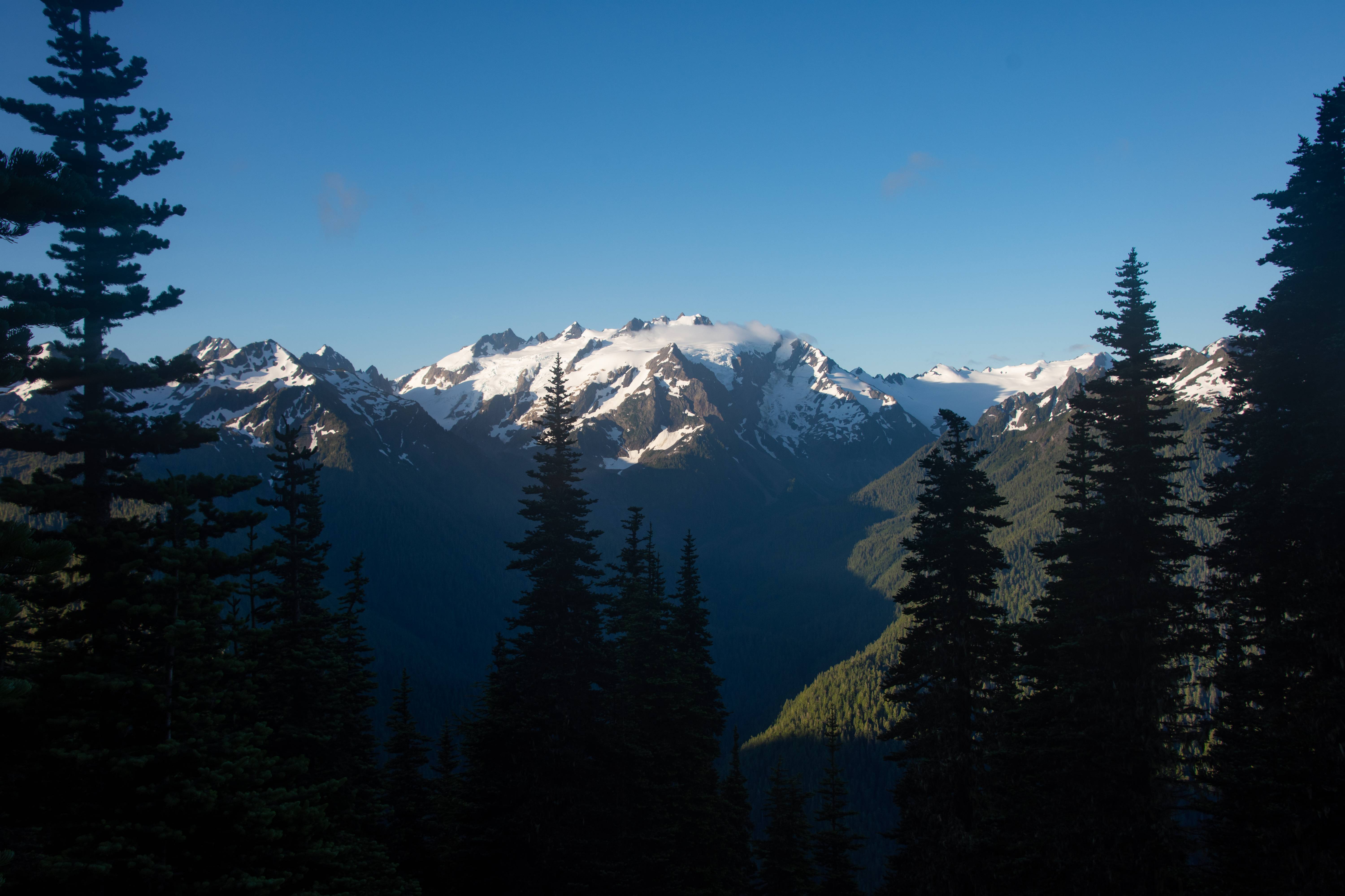
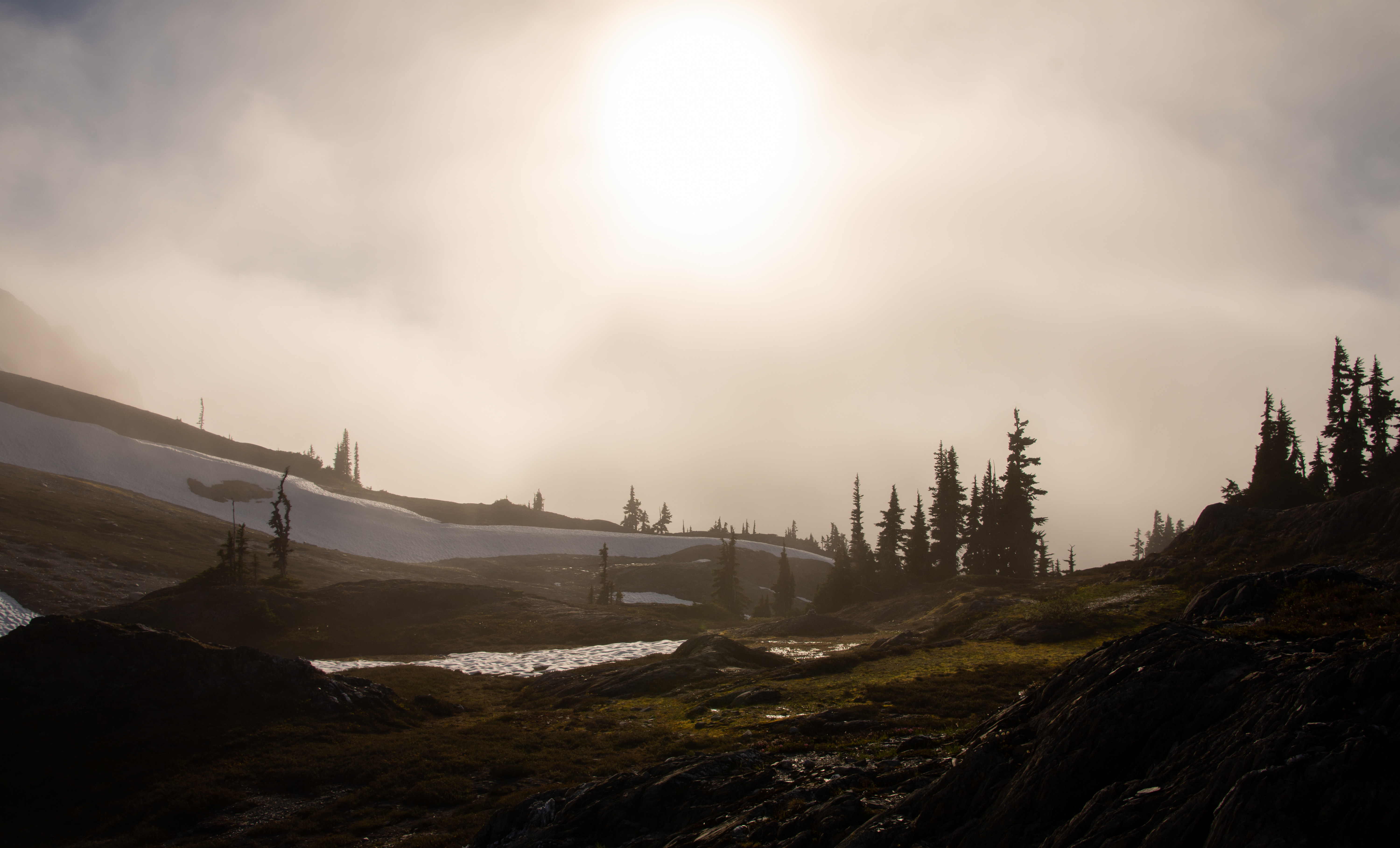
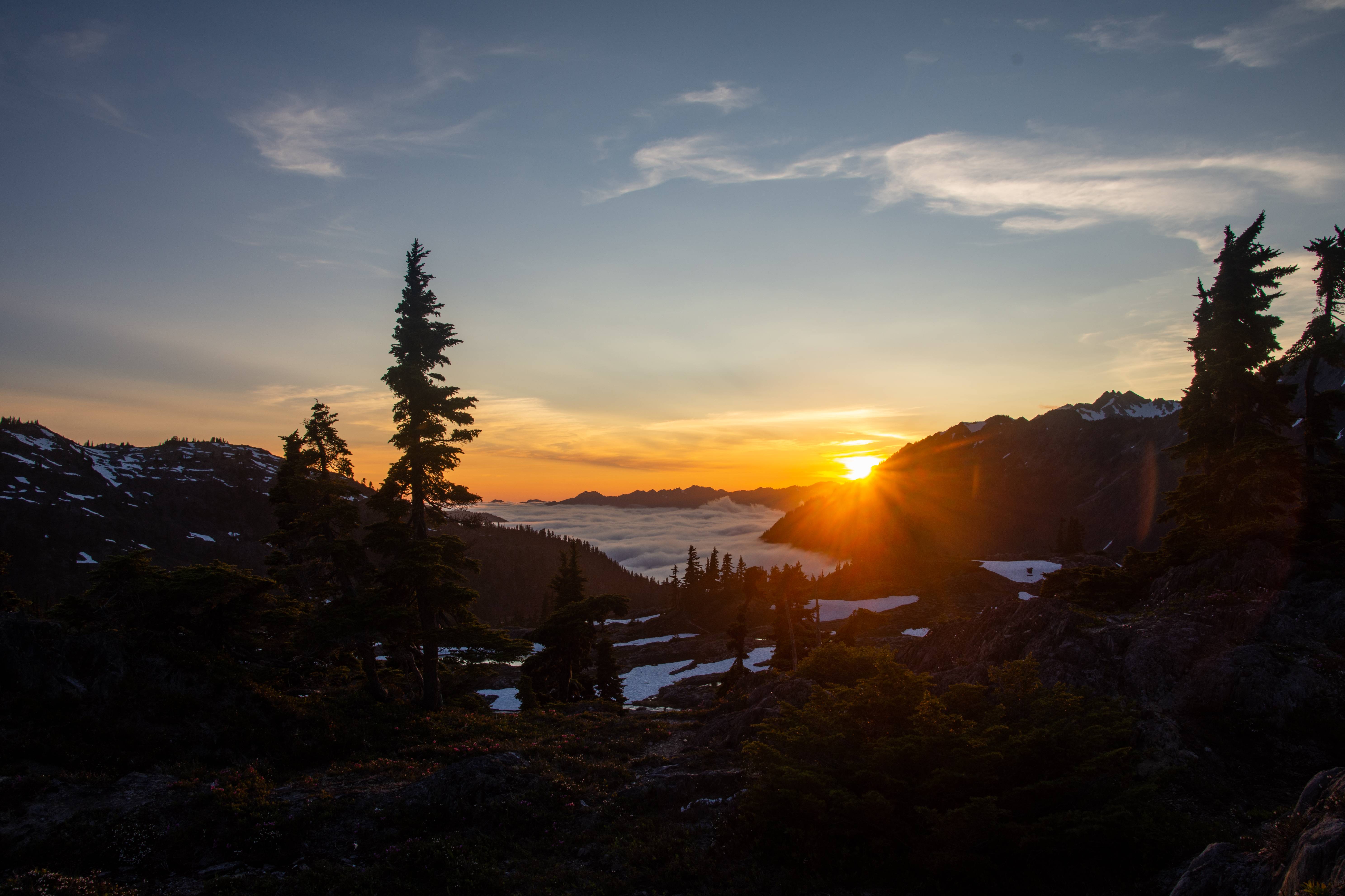
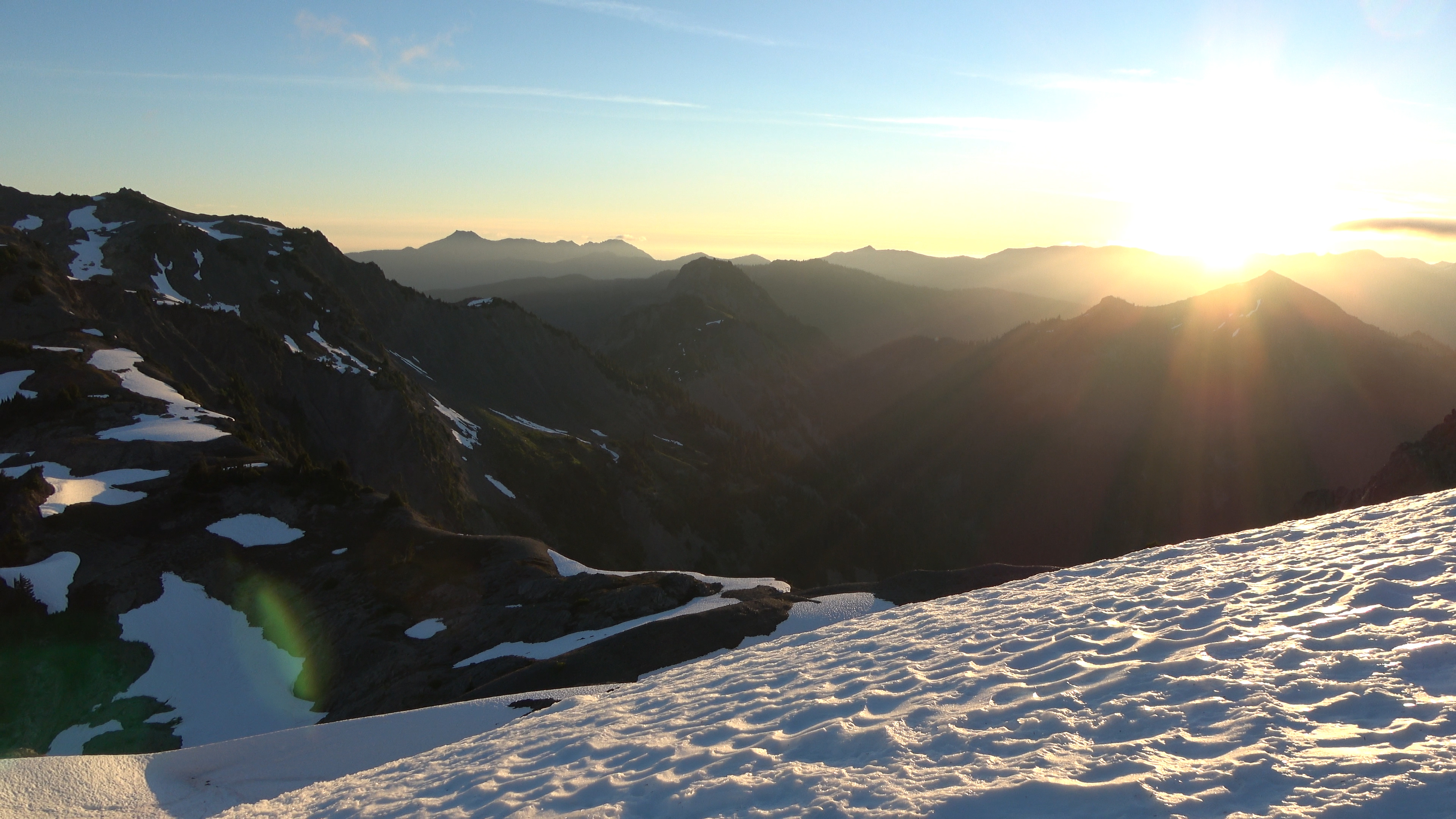
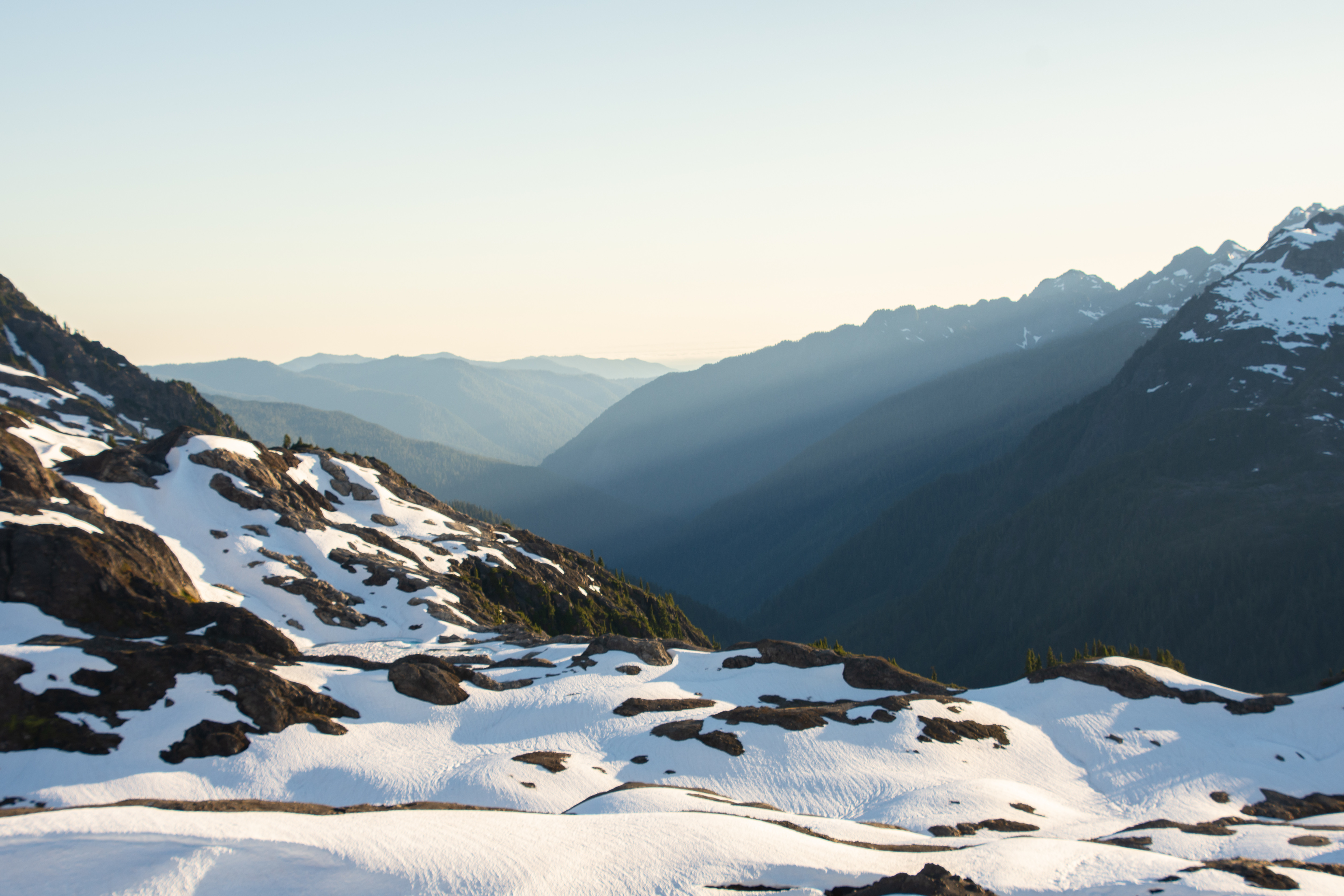
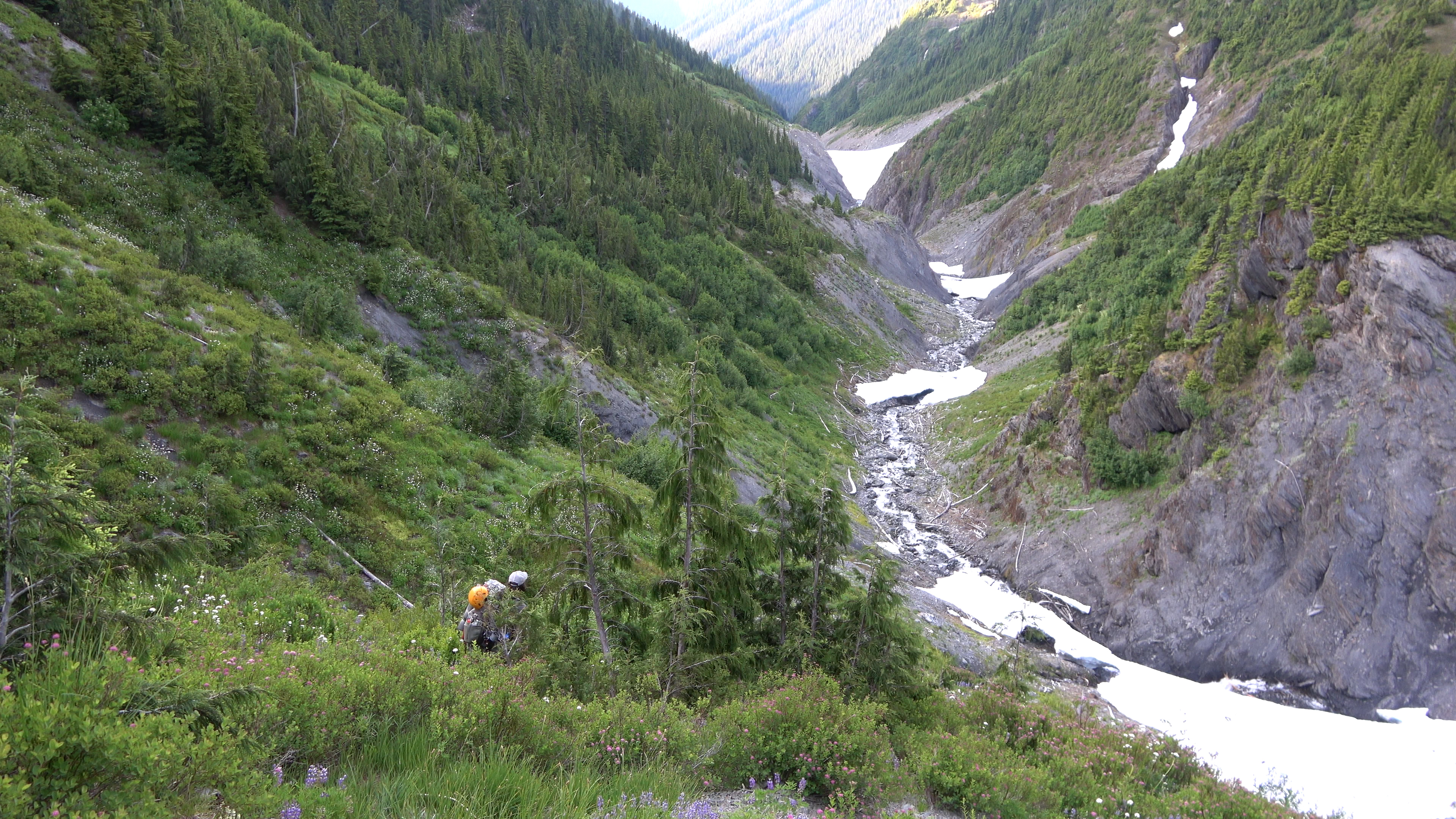
Day 1 was fairly uneventful, met at trailhead and walked the Elwha river road to the old trailhead. When the elwha dam got removed the river took the road with it and it will most likely never be repaired. Making the interior of the Olympics even more remote than they already were. We got to the Boulder creek hotsprings CG and chilled at the hot springs for a bit. They were pretty alright. I'm not much of a hot springs guy especially during the hot summer. Couldn't wait to get to the high country. Had a pretty forest camp with an actual view as well!
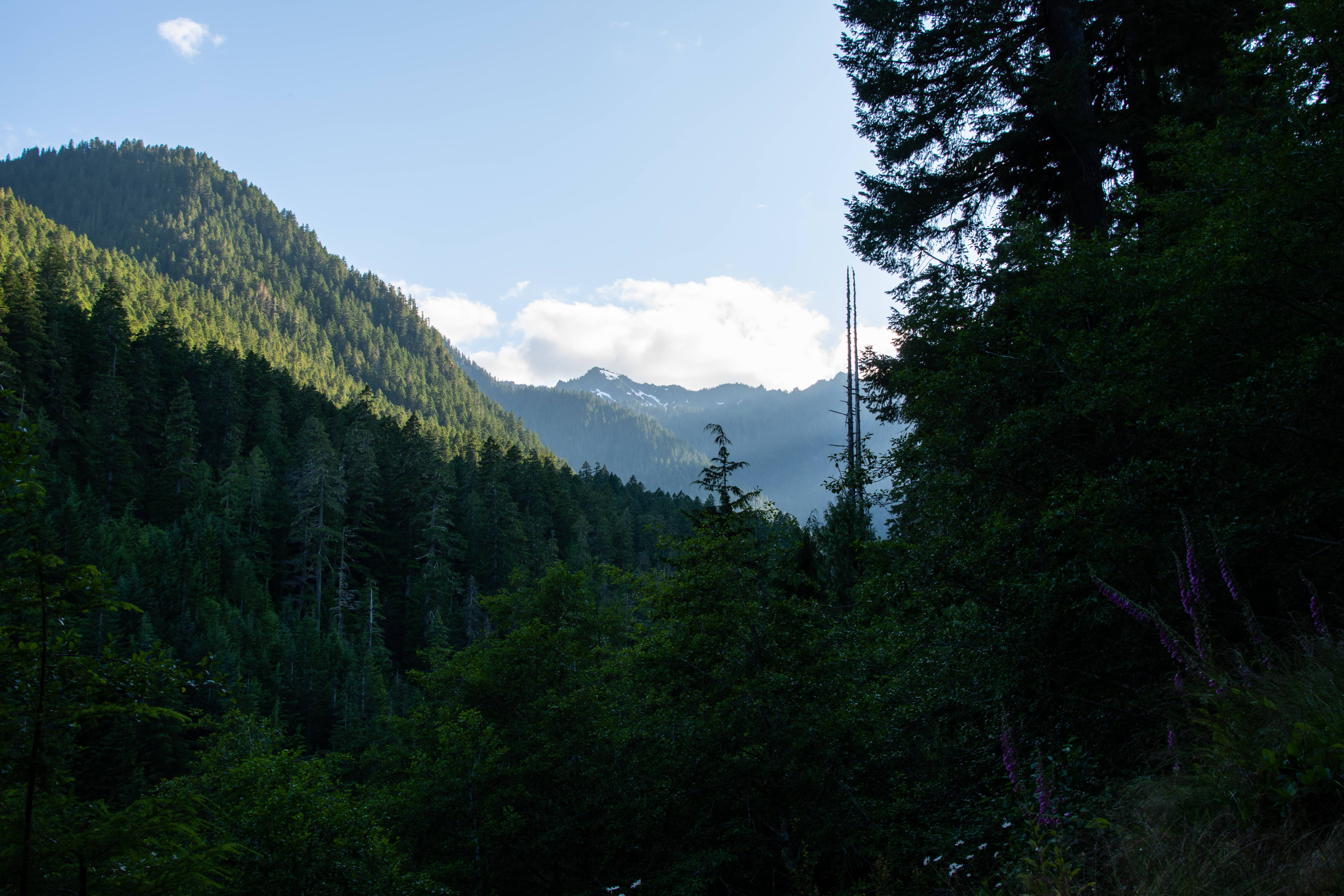
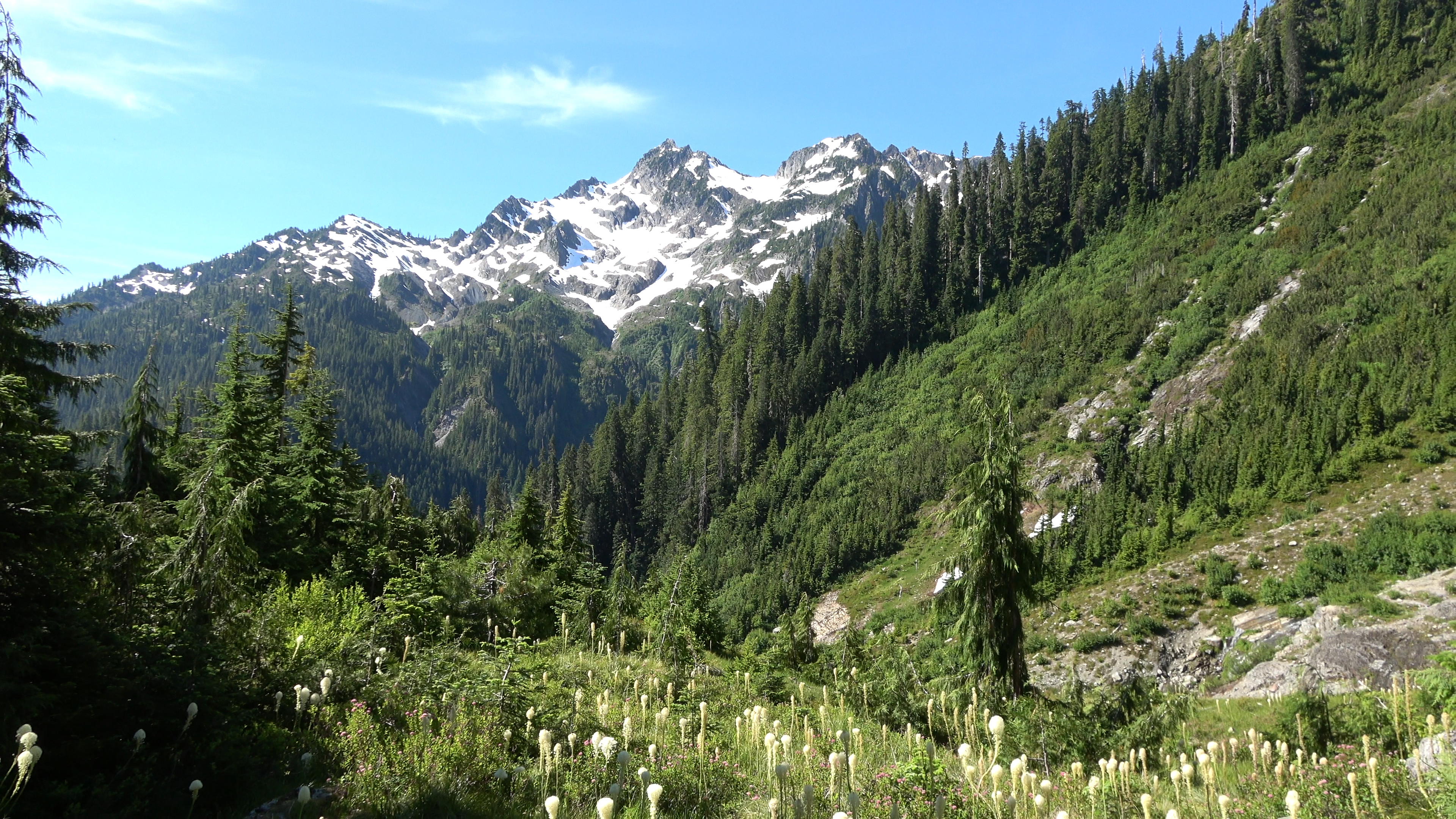
View from camp. Headed up that way for Day 2.
---------------
Day 2 | Boulder Springs CG > Appleton Pass > Soleduc Park
8.9 Miles | 4981 feet Elevation gain.
---------------
The morning walk was uneventful until we got to some excellent waterfalls before returning to the forest grind. Though beautiful forest, I'm addicted to meadows and all that jazz. Our packs were extremely heavy with mountaineering gear and the we had to use bear kegs (park service rules for the traverse) though ursacks can easily be done, there is no shortage of trees anywhere in Olympic National Park. Though I do understand they must cater to the lowest common denominator. We passed a camper who was sleeping still in the AM and didn't have his ursack tied to a tree he just had it laying nicely on the ground. Ready for Mr. Bear to walk off with it.
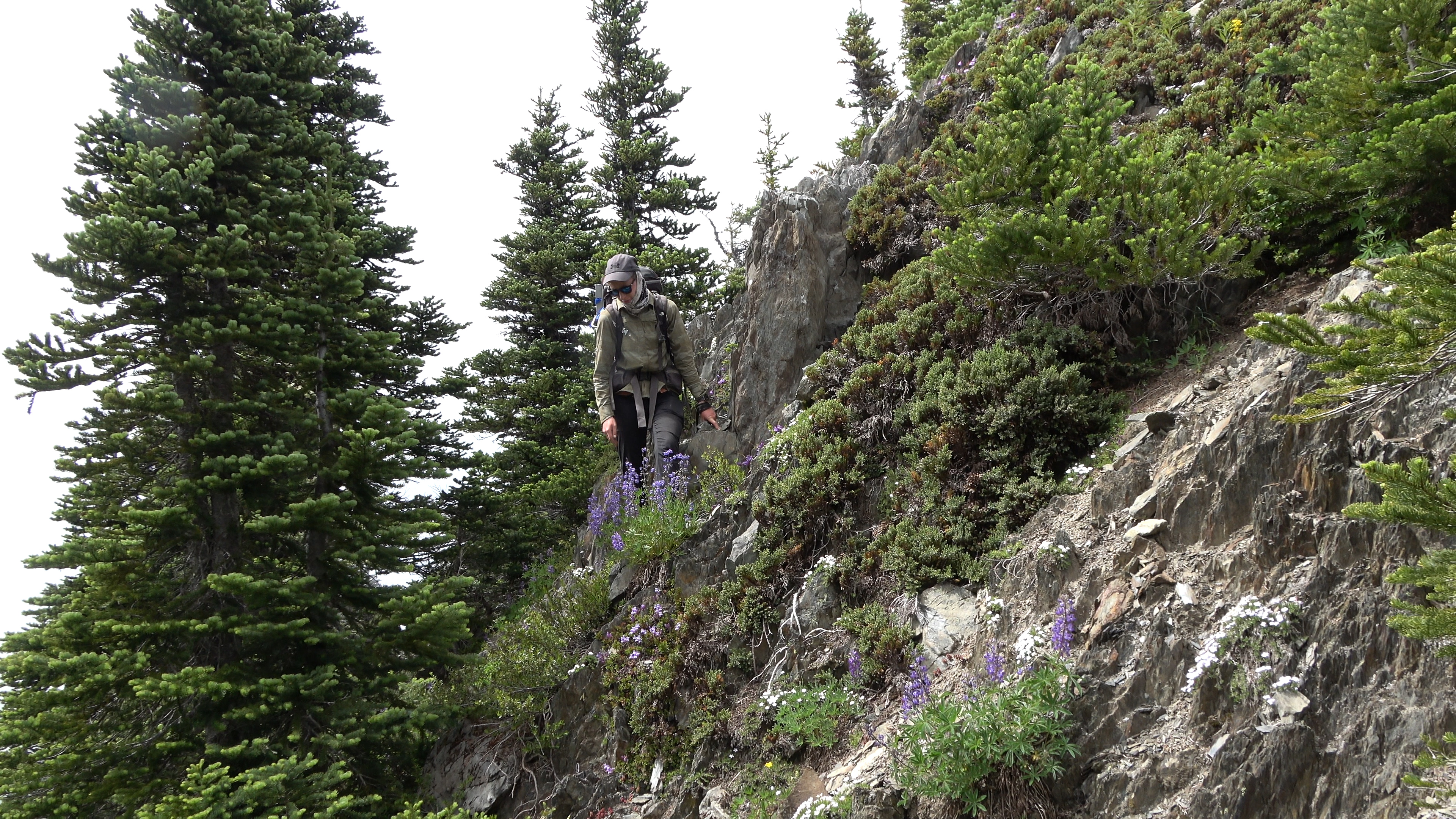
Appleton Pass had some snow below it and the steep (Olympics are STEEP!) terrain made us whip out our ice axes before we even started the traverse. The pass was awesome we had lunch there then continued traversing ridges of Soleduc Park and Peak 5700. The trail the whole way from Appleton Pass to Cat Basin was leveled like this \ luckily my feet are ugly and its hard for me to get blisters. Sarah got her first blister of the trip on this "Side hilling" trail.
We got to the meadows and camped with Cat Peak in view. The real fun starts tomorrow. I didn't take much photos on Day 1 or 2, mainly just video.
A bear chilled at a higher meadow above us all night vegging hard. Didn't get a pic but got video of him.
---------------
Day 3 | Soleduck Park > The Catwalk > Mt. Carrie > Carrie Morraine > Ruth Col > Stephen Lake Basin
7.64 Miles | 5138 feet Elevation gain.
---------------
The first mile of the day was trailed then from here on out we were on cross country travel and scrambling. Our first obstacle was the cat walk. A thing arm connected to the lower Mt. Carrie meadows with lots of exposure. If you take it slow though you shouldn't have issues. I wouldn't advise on falling here though or anywhere on this traverse for that matter. We saw a 2nd bear this morning. Very big black bear. VERY BIG. Didn't get a photo of him but got video.
Our cross country leg begins. First objective is to get around Cat peak (in frame) then start the "Cat Walk". The meadows in this range in general are much more pleasant to walk in than the meadows in the drier more eastern part of the olympics which have 10000 mole / squirrel holes hidden in the grass, waiting to take your ankle as a casualty.
The start of the catwalk. A 1-2 foot wide rock arm with trees on it. The park ranger told us "things WILL get ripped off your packs here." Luckily we heeded the warning and battened down our stuff pretty good and didn't lose anything. It ripped aarons water bottle out but he had a carabiner holding it in place.
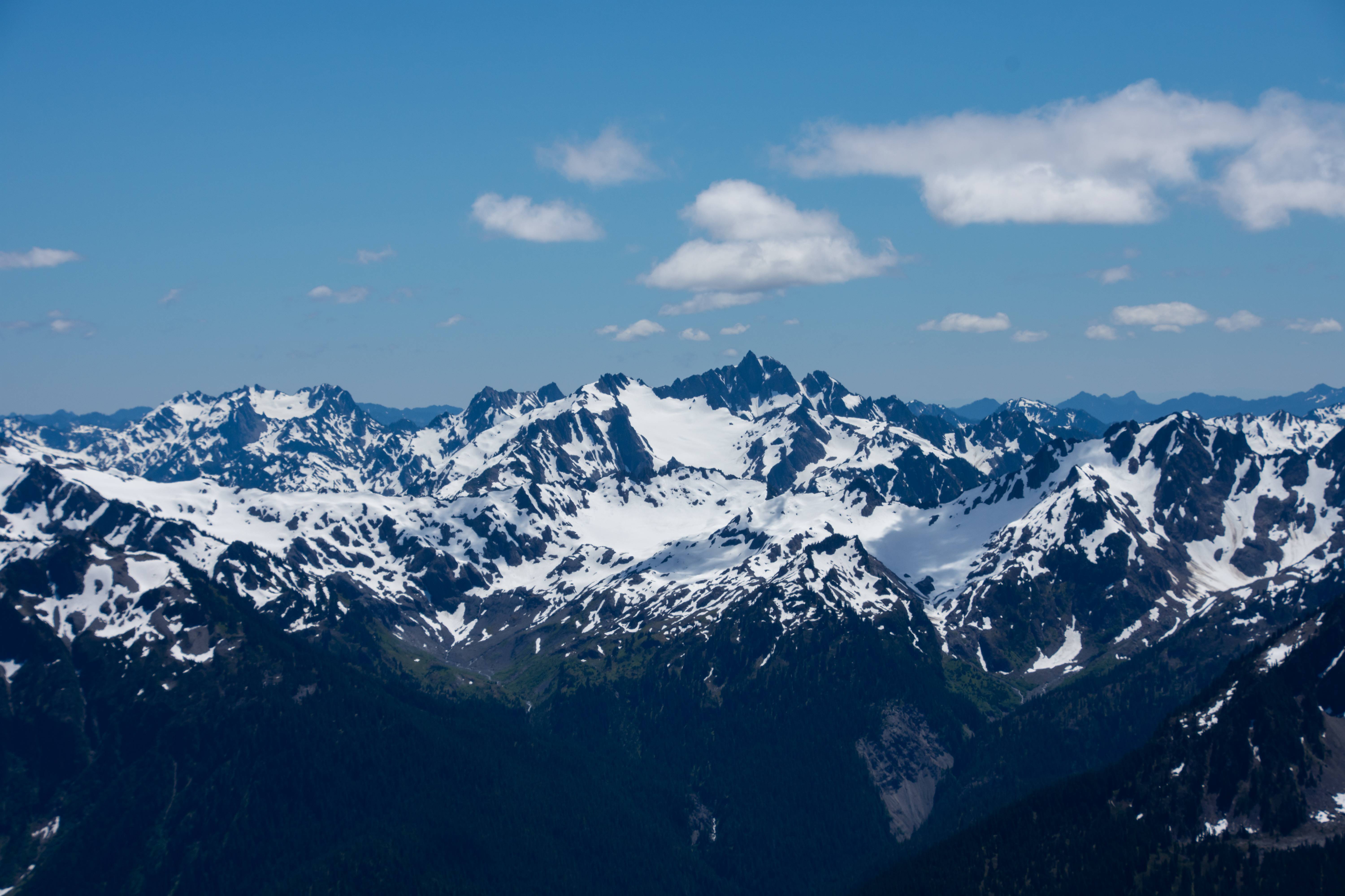
First view of mount Olympus. Shooting from sea level up to almost 8000 feet in 3-4 miles. From all the places I've backpacked on thing that is striking with the Olympics is the crazy vertical relief. Most peaks there are only 6000ft but the valley below them is only 1000 feet above sea level at most. This makes for some dramatically big looking mountains and deep spooky valleys. (Though I think the valleys of the western cascades are spookier given the history of both areas.)
The glacial ice and snow was so thick on Olympus that it almost looked like it was bubbling up and over the rocks.
A good majority of the cat walk I had my camera away because I didn't want to lose it, break it, or fall as I needed two hands 98% of the time.
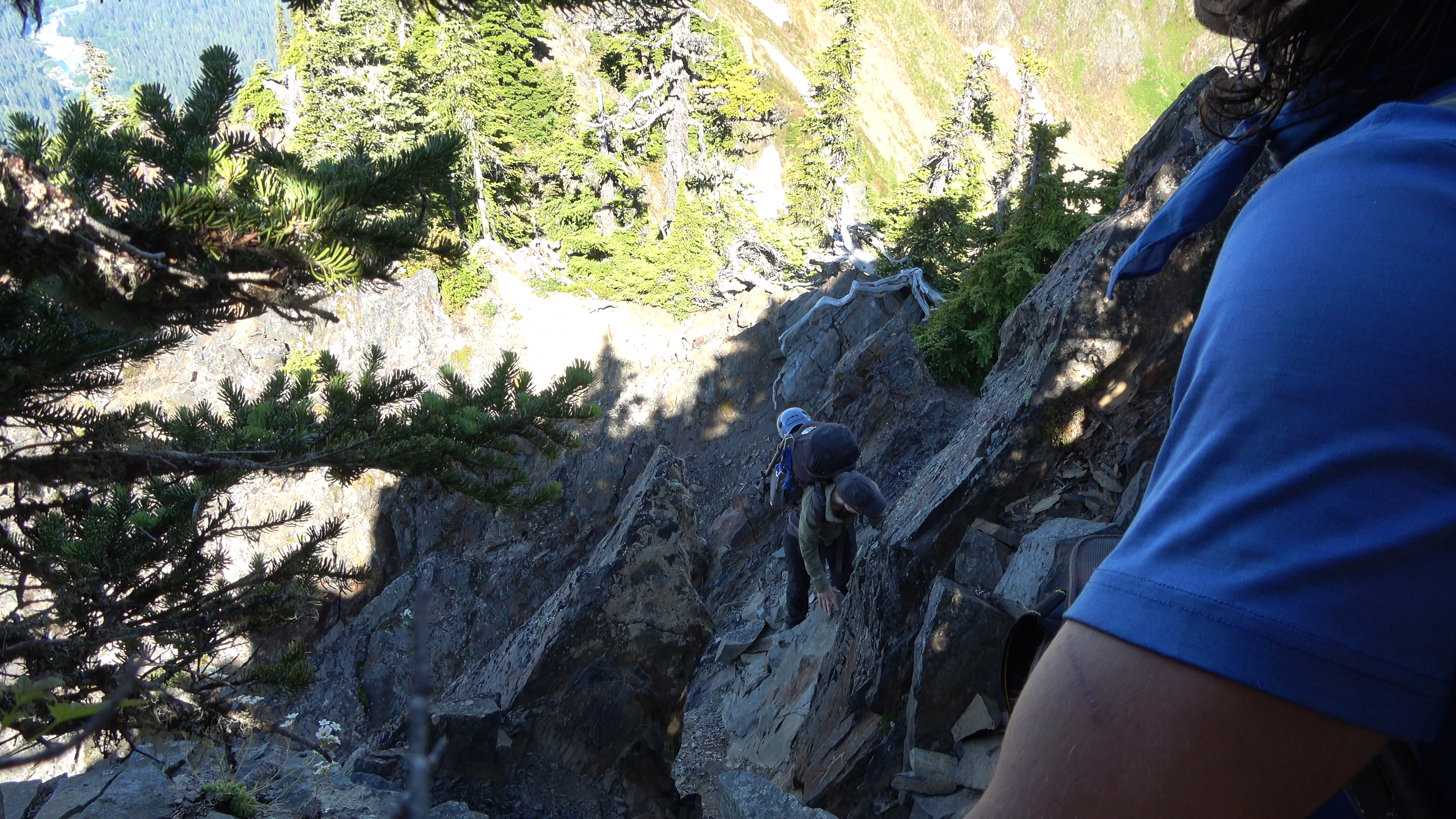
Don't fall. Doing this in full mountaineering packs wasn't very fun.
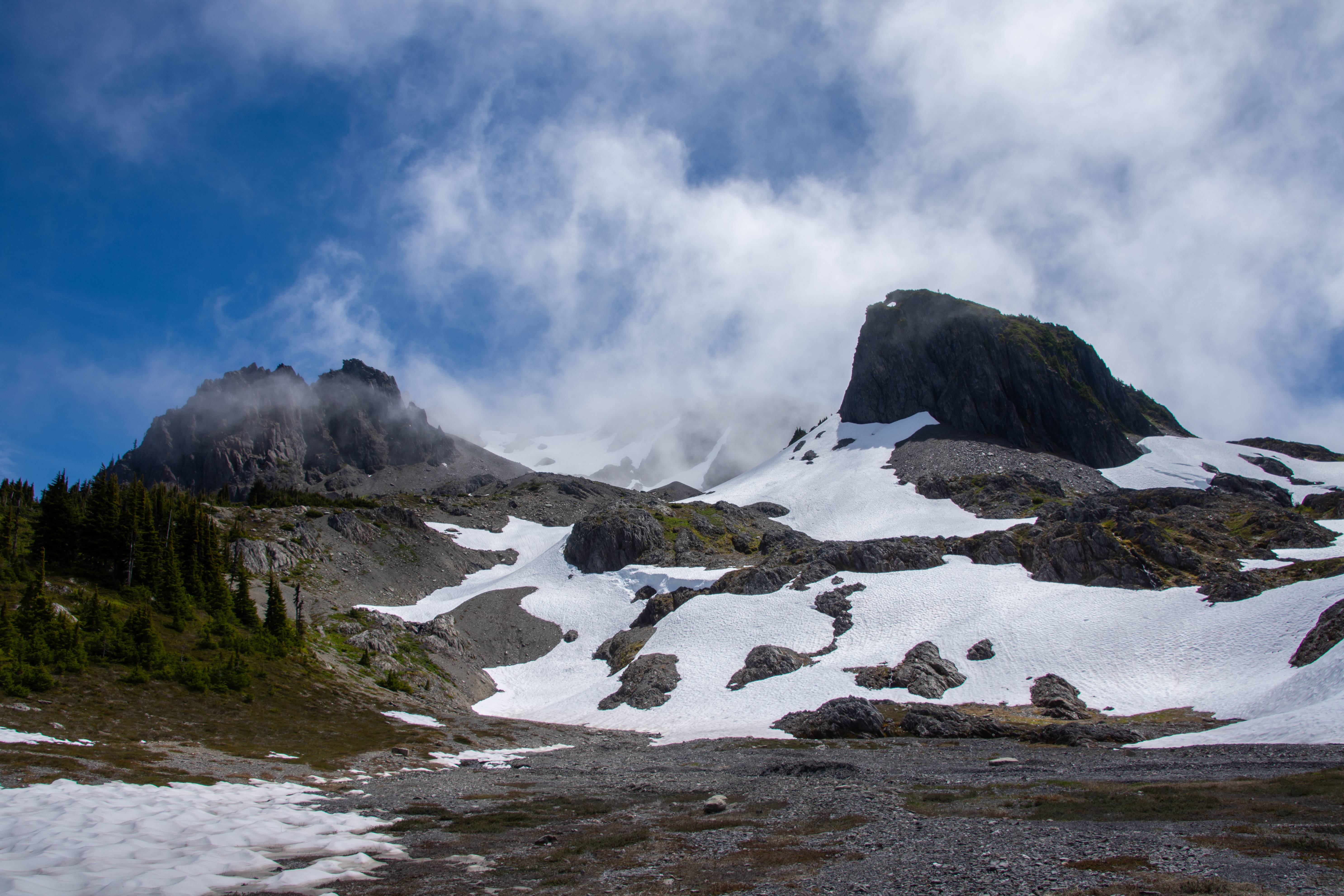
We pushed up some steep meadows and got to our first wall where we began to traverse Carrie. It was too damn hot out. But the views made it worth it. Peaks for days.

The last push up to the summit of Mt. Carrie. We came from the lower snowfield. You can see Night #2's camp back center camera in the green behind the snowy guy (Cat Peak) in center camera.
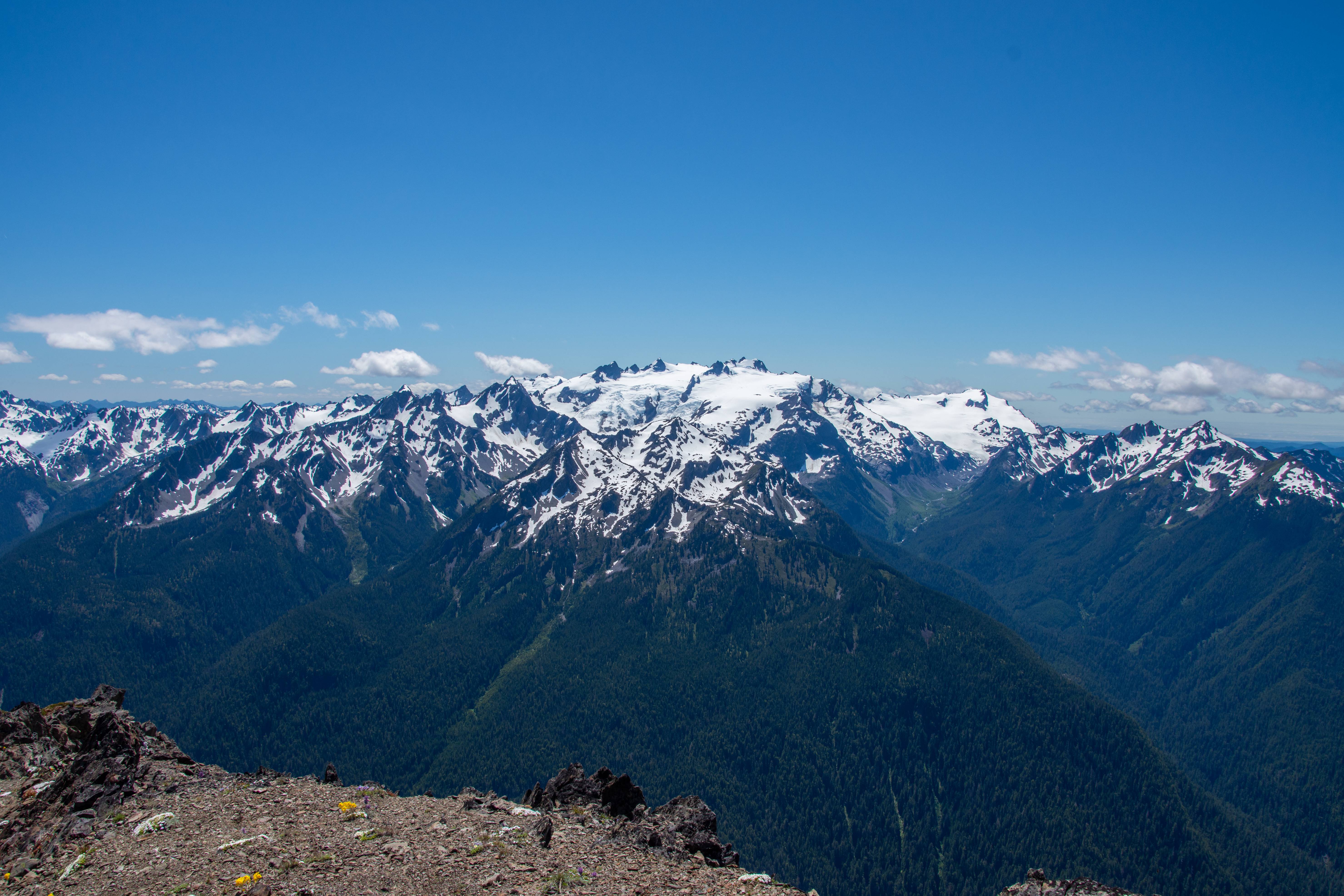
Summit view of Olympus
The Baileys
The Ice Lobe
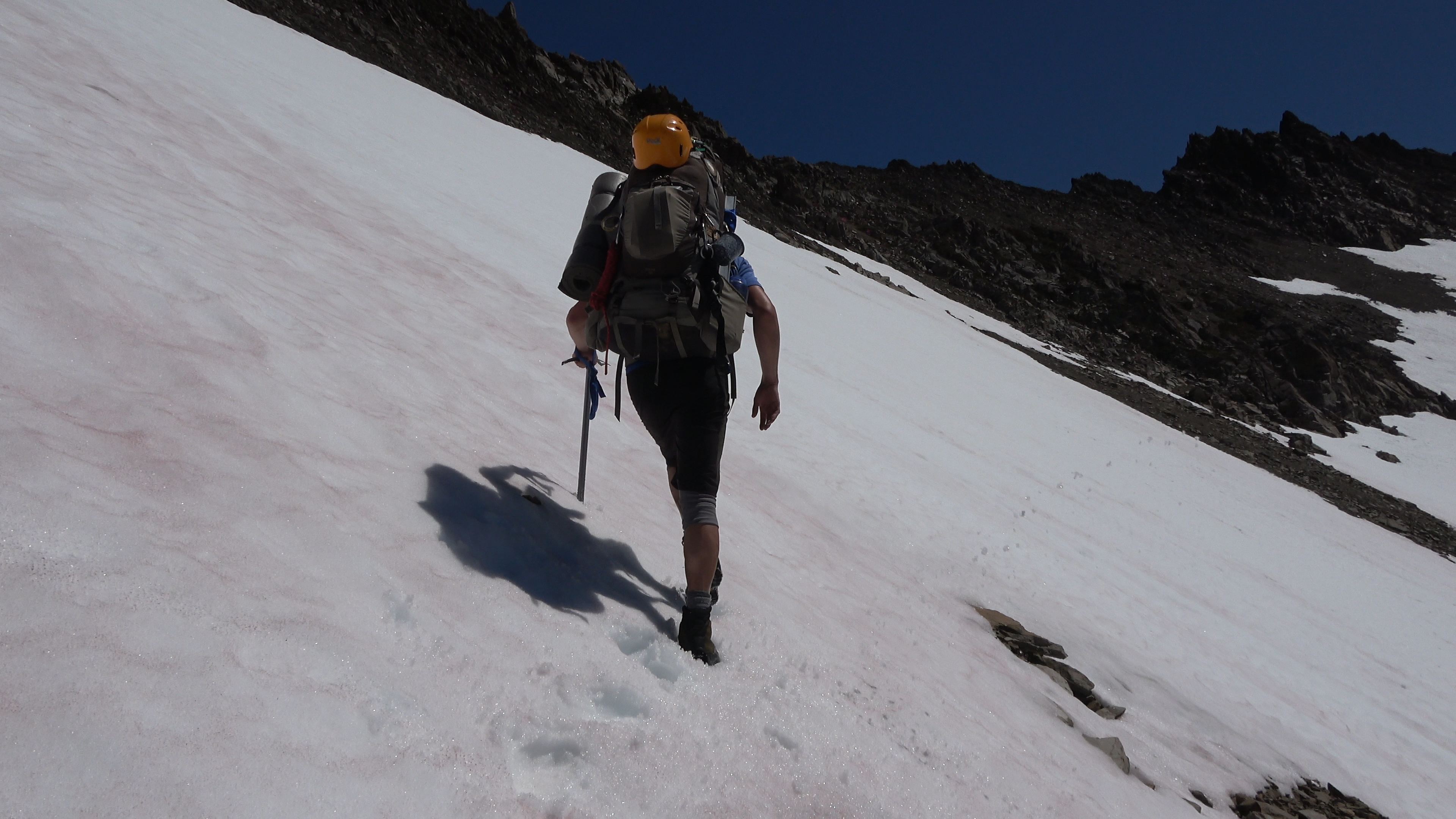
Time to gear up for a glacier walk. I've seen reports of people doing this section un-roped but better safe than sorry. The north side of the berm has some nasty crevasse action.
In this photo as well you can see a tiny bergschrund just to the right of my orange crampons being poorly hidden by snow. Don't step in that.
We geared up and began our descent of the snow berm.
Elk poo. I bet that bastard didn't even rope up. You can see some crevasse action to the right of sarah and left further up. Off camera there were some big boi's.
Still headed down. Our objective is that low snowfield so we can get some water as we were all out. Then we would have to go up and over those peaks in center camera.
Sarah checking out the crevasses and the ice lobe.
Break time! We made it down and can drink that cold n' fresh water! WE came from above that head wall with the waterfalls through that crevassed snow on the left.
Our next line of attack. Straight up that.
One last look of this beautiful and lonely basin. Next time I told aaron this should be a camp night. This trail-less basin was too big and offered too much to explore to just pass through it. But alas, we had to.
We went up and over to the steep col. I got video of some of it but no pics. We descended a very steep and loose snowfield then pushed on to Stephen Lake basin. Losing light fast. We've been at it for 14 hours so far. Hardly felt like it though there was constant beauty to distract you.
---------------
Day 4 | Stephen Lake Basin > Stephen Arm > The 2nd Catwalk > Ferry Basin
4.83 Miles | 3137 feet Elevation gain. 100% cross country.
---------------
We woke up and enjoyed the sunrise in our basin of solitude. Haven't seen a person since the end of Day 2 and it will be this way until Day 7.
Looking back to the peak, col and snowfields we came down from.
View from my tent.
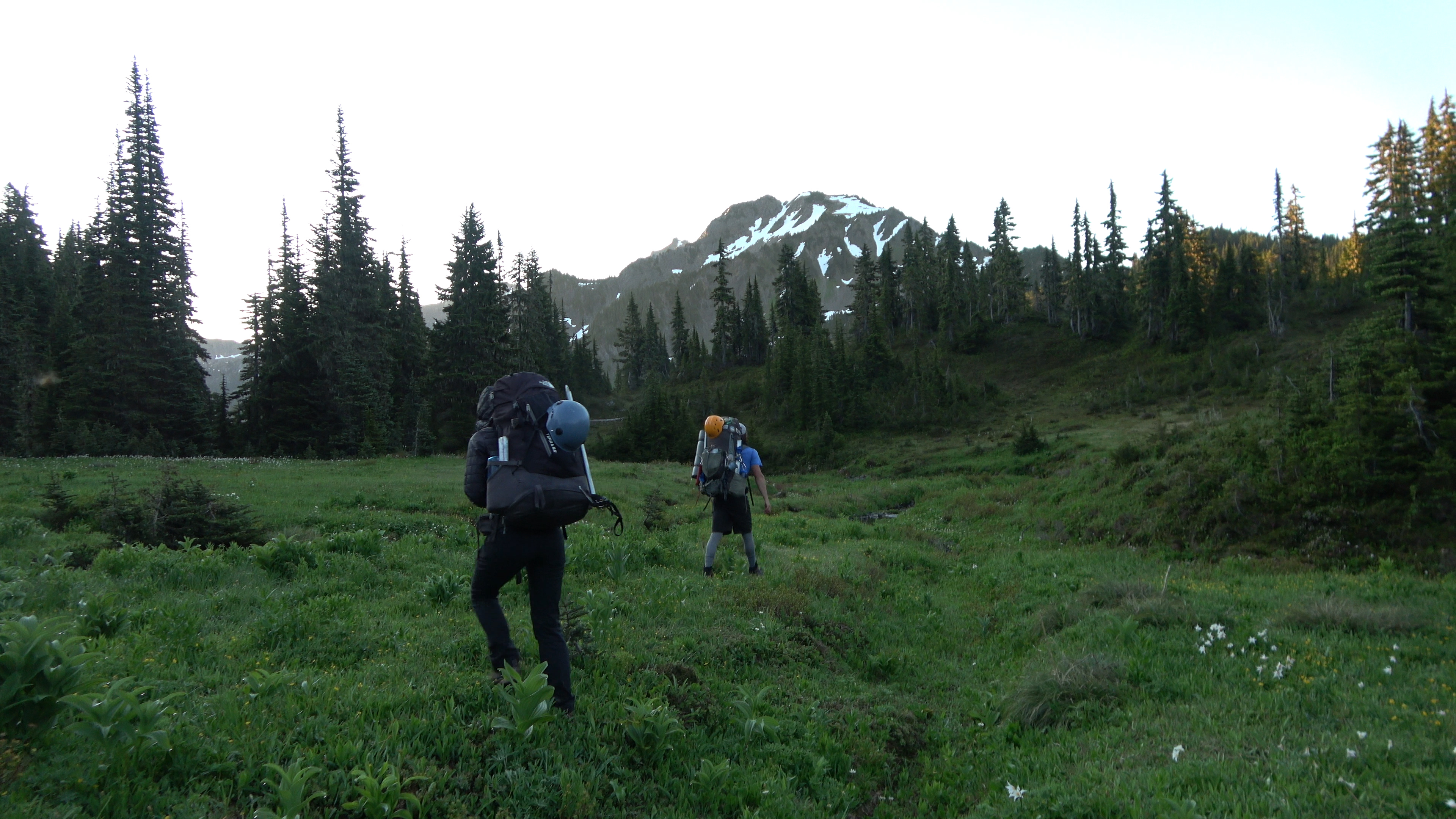
Do we have to start walking?
Walking down a meadow-y gully
We completed walking down a maze of ledges and cliff bands to the basin floor and looked for a spot to cross the stephen lake outfall. We founded a very braided area that was only 2-3 feet deep making the crossing a success.
Next we climbed up some steep heather slopes and had a few class III and IV moves before reaching a bench where we began traversing Stephen peak. We all finally got to see Stephen's Comb. In this photo we will be shooting to just left of the spires where you can see the tops of little trees.
View from the bench looking off to god knows where.
Our view of Ferry Basin. It cliffs out and drops fast behind those trees so we ridge walked (left) off camera into the 2nd Catwalk. This one I didn't enjoy as much as the first one because of the heavier brush and several nasty gully crossings.
2nd Catwalk. We are being punished for wanting to see beautiful remote sections of Olympic National Park. A fair trade though IMO.
DONT. FALL.
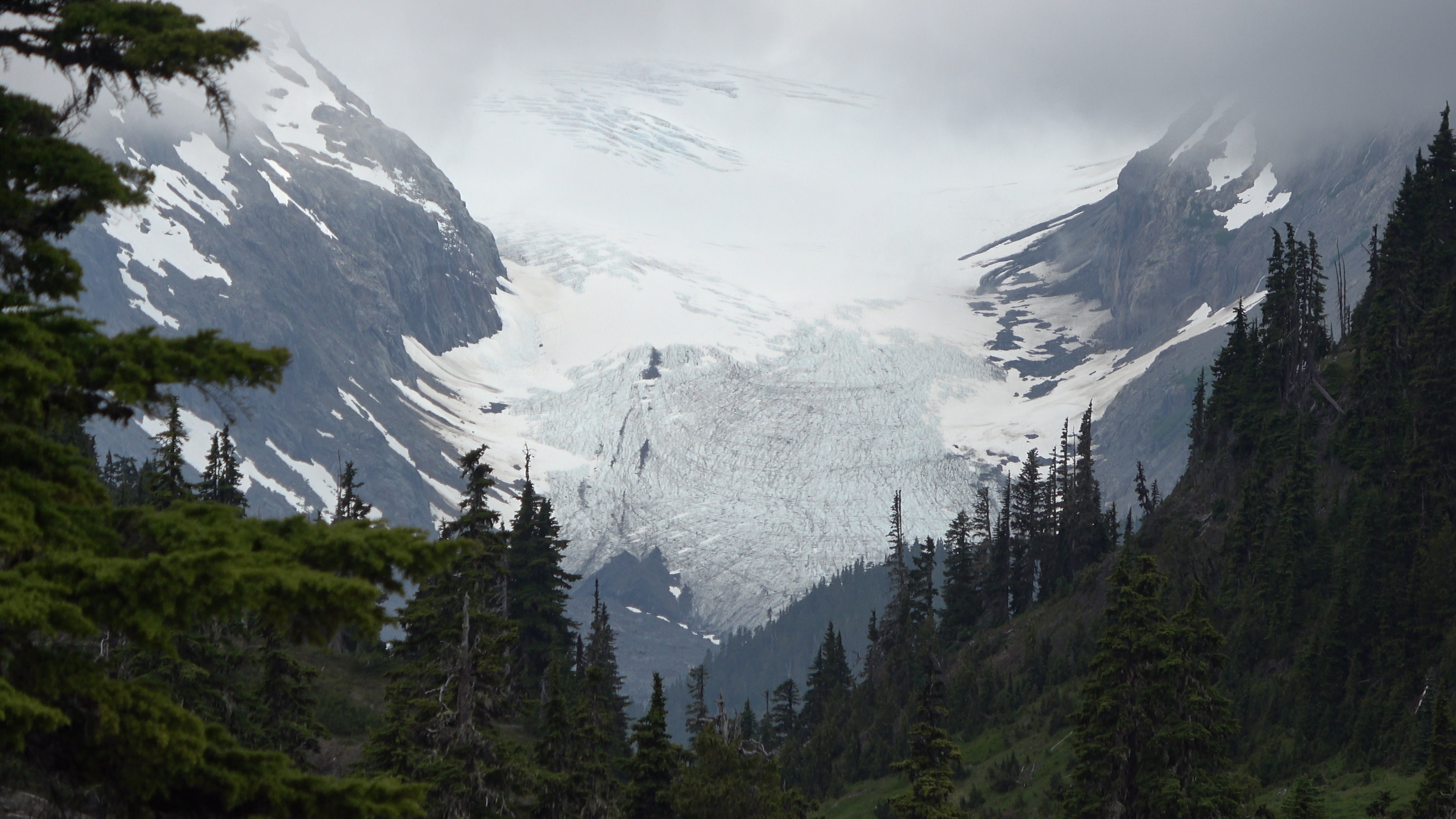
Can't remember the name, Aaron knew though. But this is a view from the 2nd Cat walk of a mighty glacier on Olympus. This one is supposedly 200-300 feet thick, the thickest glacier in the lower 48 states. This suprised me given how crazy big some of the glaciers are on Baker, Rainier and the Picketts in North Cascades National park. They don't call her Mount Olympus for nothing I guess.
We got off the 2nd cat walk and walked down to a small lake where we had lunch before punching up further into Ferry Basin.
We made it to camp and 60 feet away we had our own little waterfall!
A nasty wall of clouds rolled and socked us in the rest of the evening. Extremely dewy and wet. As the clouds/fog rolled through at 15ish mph I can head the moisture hit the rain fly like it was actually raining. The next bit of the traverse (The actual Baileys) we would like an AM start as we aren't fans of the heat and being out on the snow during the day is like a desert. There will be no AM start though as the clouds stayed...
Socked in.
---------------
Day 5 | REST DAY
Random exploring without a pack.
---------------
This area was my favorite camp of the trip.
We stayed socked in most of Day 5's morning so we pulled the plug and used our rest day for Ferry Basin, something we were hoping to use at Dodwell-Rixon Pass. Oh well. The clouds cleared a bit but there was a nasty inversion and as the sun rose it started picking up the clouds and filling up the high country again. For the traverse we needed visibility so we could see what the hell we were doing. EXPLORE TIME!
Sweet basin bro.
Olympus creepin'
Now that it's the evening the inversion has chilled out. This made us nervous for our AM start for Day 6 though. We didn't want the clouds to stick around and then rise again on our traverse. We were going through our food fast though and had to do it no matter what.
Bear almost 1 mile away. He is chilling below the 2nd Catwalk. I wonder if he was watching us that day thinking we had mental issues.
Like I mentioned before, bear kegs are REQUIRED on the Bailey traverse. If you don't have one or bring one the park service will FORCE you to use theirs. Here is an abandoned bear keg Aaron found in Ferry Basin. The Baileys must have broken this man, too hard for him and in a last ditch effort to save himself from further pain he lightens his load by tossing the park service bear keg numbered 147. We set it near our camp in the open and let the park service back country rangers know about it at the end of our trip.
Inversion sunset.
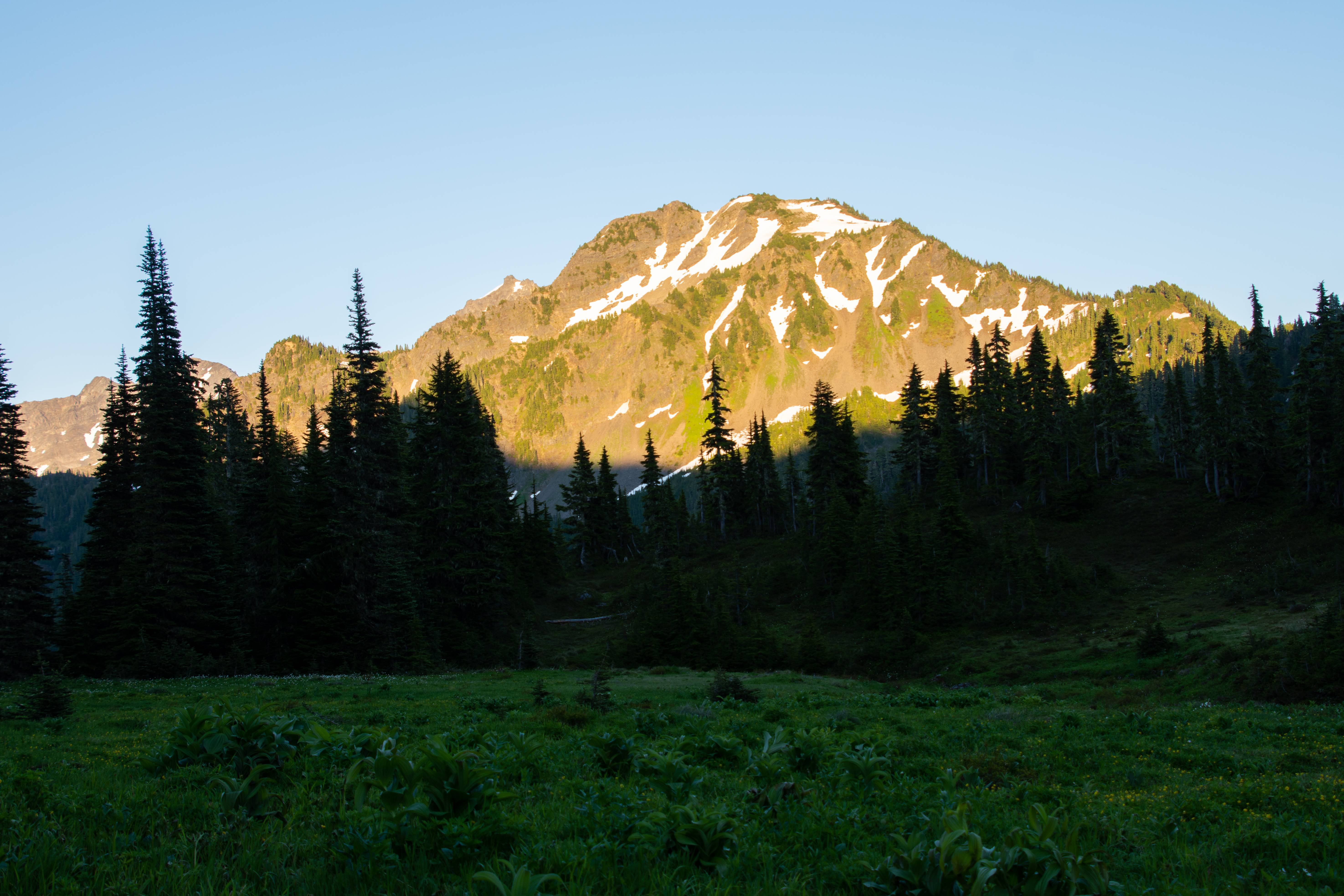
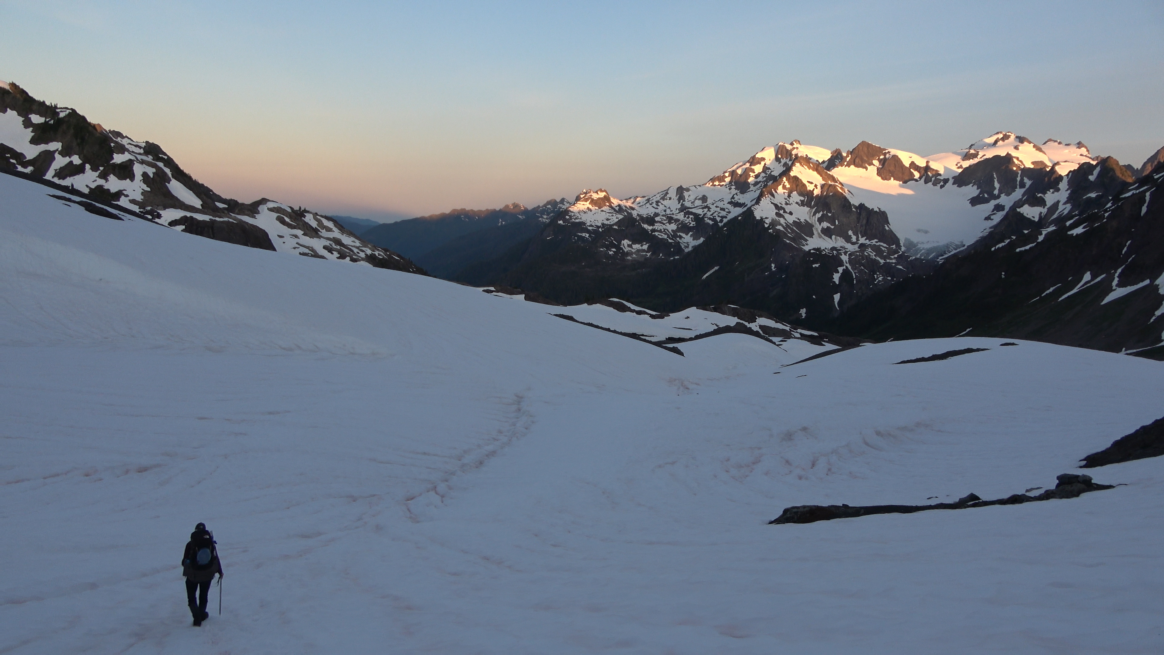
Alpenglow on Pulitzer and Ferry. We will be up in there tomorrow morning.
---------------
Day 6 | Ferry Basin > Mt. Pulitzer > Lone Tree Pass > The Traverse > Bear Pass
5.13 Miles | 2806 feet Elevation gain. 100% cross country.
---------------
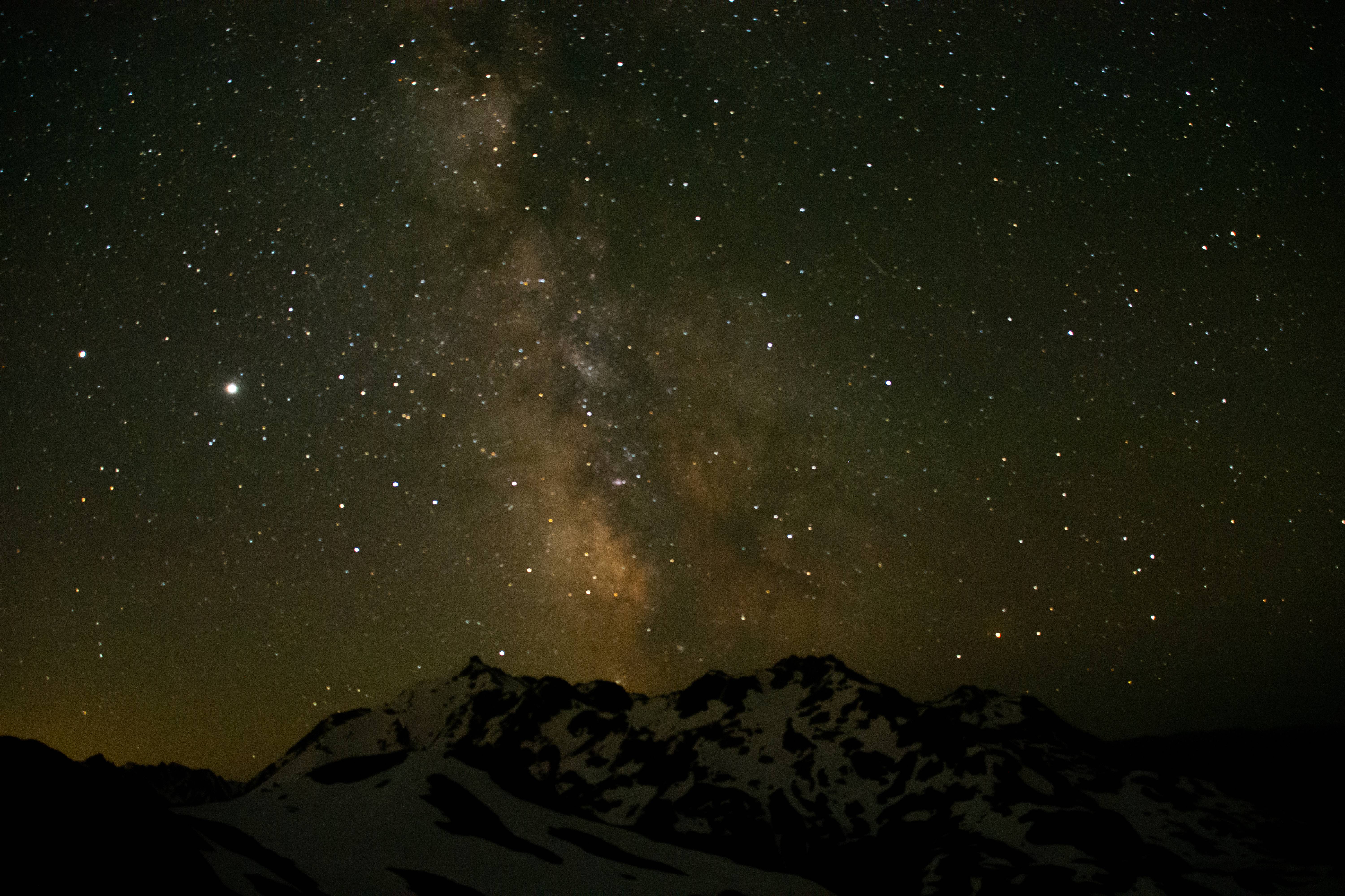
My favorite day of the trip. It wasn't too hard, the scenery was excellent and the alpine start was bad ass. We got up at 3:30 AM and were out with our headlamps at 4AM walking under the milky way. Slowly the horizon began to light up as sunrise came about...
Bear shit up high on a snowfield.
Sunrise and... MOON RISE!?
Climbing up steep snow in the morning light.
The cool air felt amazing after the last few days of sweltering weather. The heat will come in hard later in the day though...
UFO cloud.
We got around Ferry, Pullitzer and another peak I forgot the name of to Lone Tree Pass. We heard an elk bugle here, bellowing up from the dark valley... In early july. We sat for a bit waiting for another shot. But the elk remained quiet. So we continued.
Awesome sunrise! On the other hand the nice cool air was nice while it lasted
Lone tree pass is down on that ridge where we heard the elk. We came from the peak top on the top left of the photo.
The last photo was taken from the center-rightish of this photo from the rounded snowy spot. We walked through the high shelf onto these rocks where we got rid of our crampons.
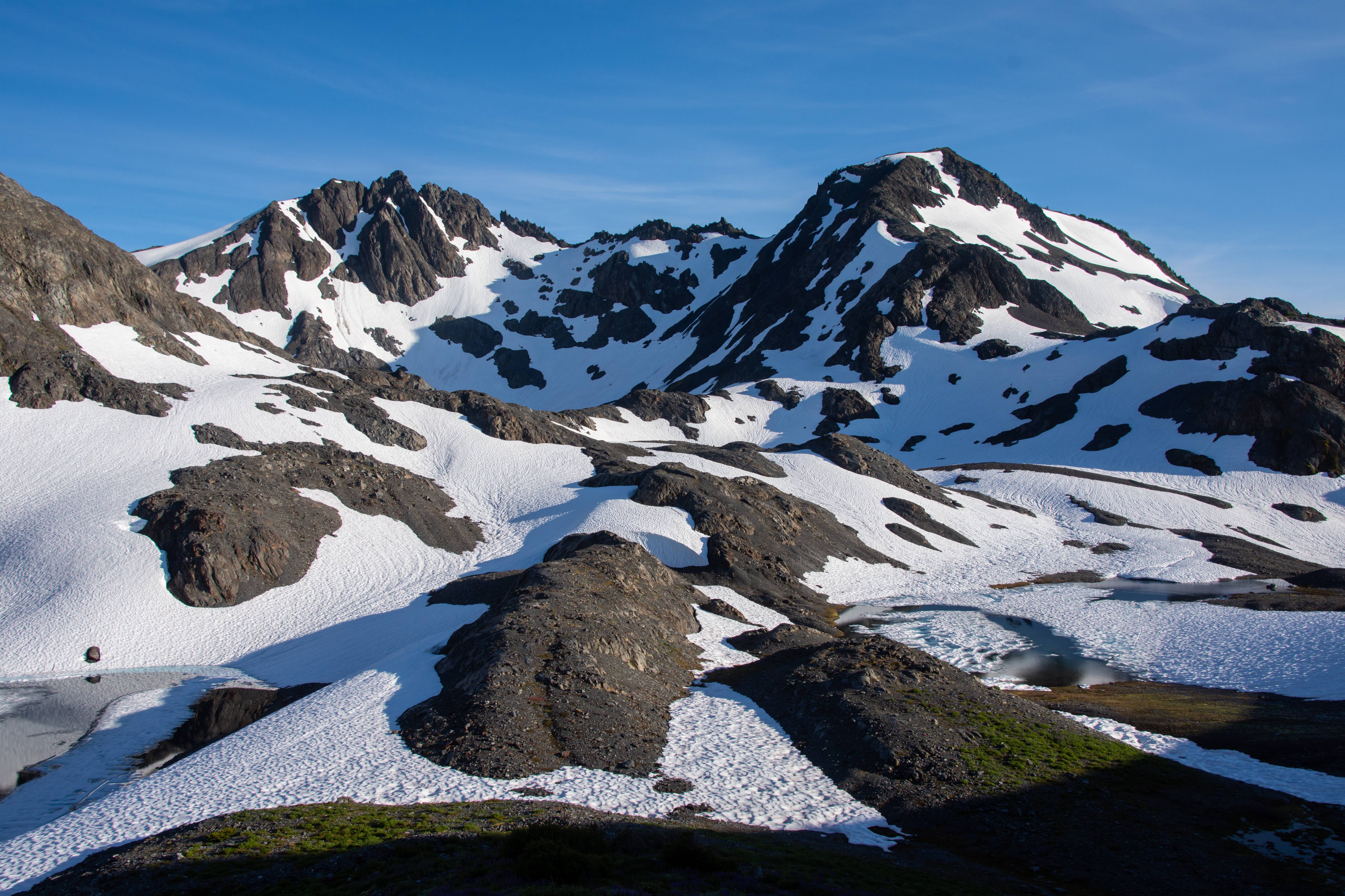
Lots of work left to do. Ridge walk to the close high point furthest left of center camera. Mt. Queets in the distance.
Cloud Comb. We will walk through the center and up the snowfield to off camera left of the spires.
Up on a ridge. We will have descend a steep gully to the ridge below on the left. Nasty cornice on left.
Lots of snow still mid-july in the Olympics.
We made it to Bear Pass and Dodwell-Rixon is in sight! Still lots of snow. Going to be tricky finding a camp spot. Not the biggest fan of camping on snow.
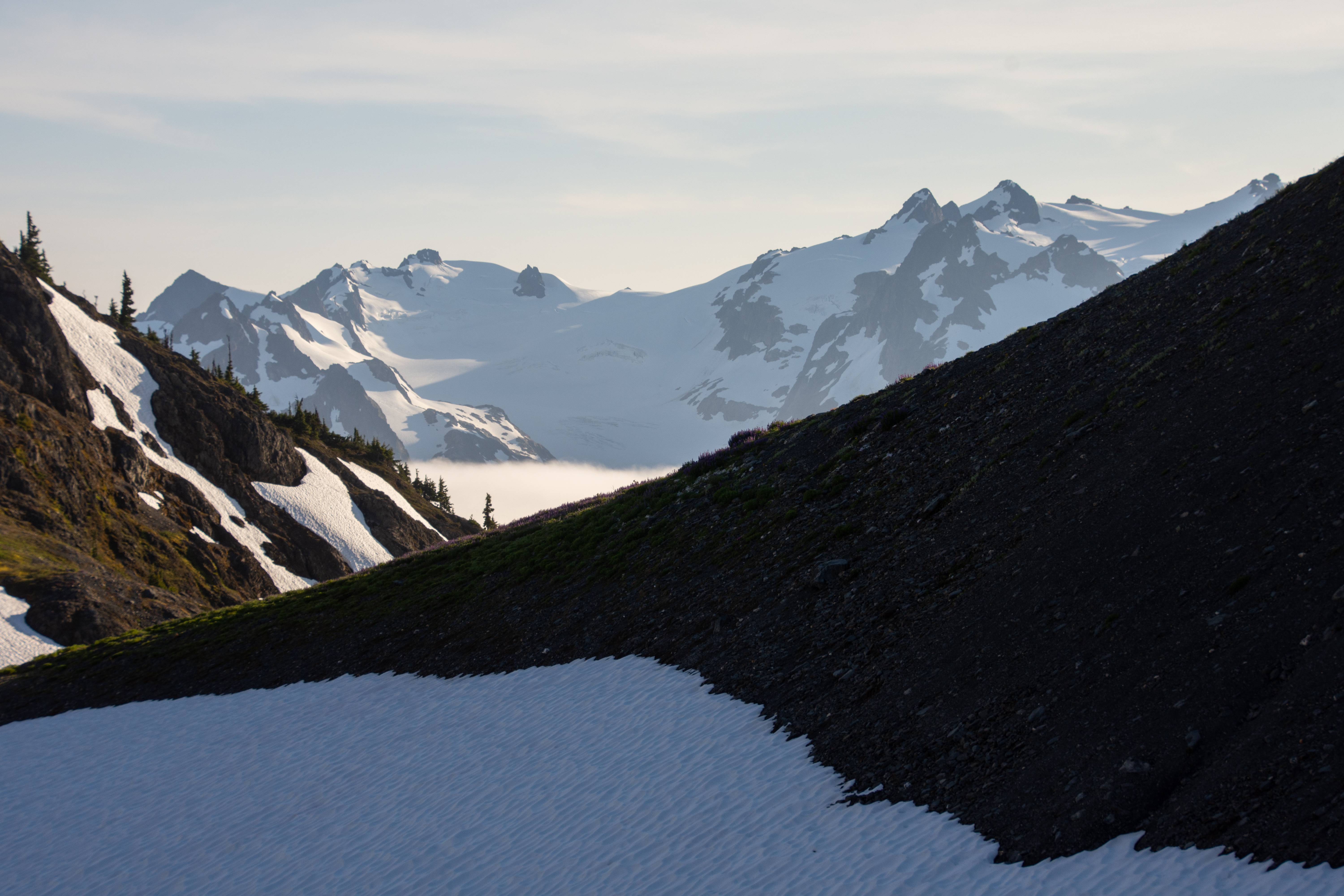
Meadows and Mount Olympus massif. Some people have not done Bear Pass and continued on to Olympus and made a loop of it. Knowing how miserable the snowfinger and Elwha basin the next day will be I think next time that will be a better option. Staying high.
Baby version of Sahale Arm in the Cascades.
Olympus massif looking thicc
Near camp.
Mt. Queets and a nice pool.
Sunset.
Nightsky. Didn't focus it correctly. Had several camera mishaps on this trip that I'm still sad about.
1. This shot wasn't in focus but looked in focus through the viewfinder so the whole timelapse is kind of out of focus.
2. Night sky timelapse before our AM start just vanished. Like without a trace like it all got deleted.
3. Half of my sunset timelapse from night 5 vanishes as well... Maybe it's time for a new SD card. One that I can trust lol
But that couldn't be it because I went on a 6 day eagle cap traverse after this and all the photos stayed. Maybe my USB cable transfer is bad? I'm still mad about it. F****** f***!
---------------
Day 7 | Dodwell-Rixon Pass > Elwha Snowfinger > Elwha Basin "the maze" > Chicago camp > Hayes River
15.6 Miles | 2206 feet Elevation gain & 5864 feet of Elevation loss. 80% cross country.
---------------
This was the 2nd hardest day of the trip in my opinion. The hardest being day 3. Though not as cardio tough it was slow going. You really had to watch your steps and the bush whacking, though not too bad, was very confusing in the maze (Elwha Basin). Truly a cognitive day.
Good morning Olympus. We leave camp and head to Dodwell Rixon Pass.
Looking good so far...
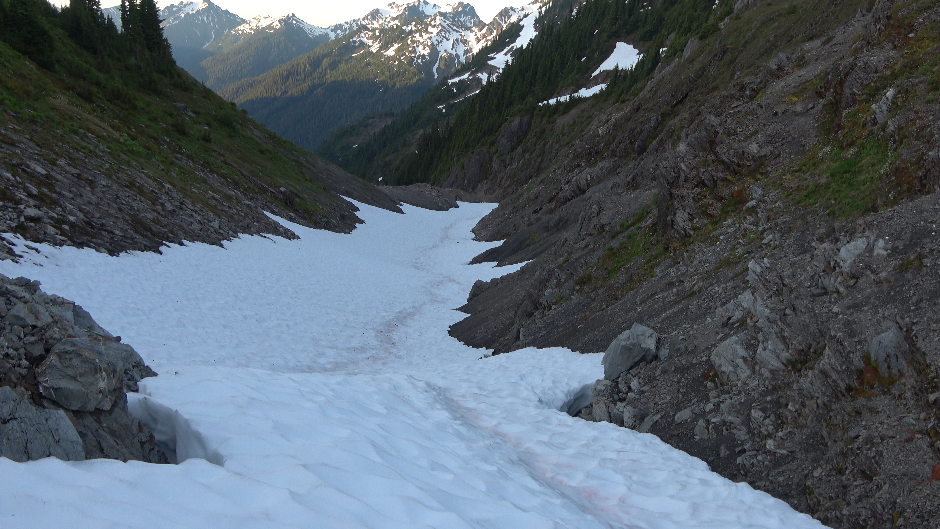
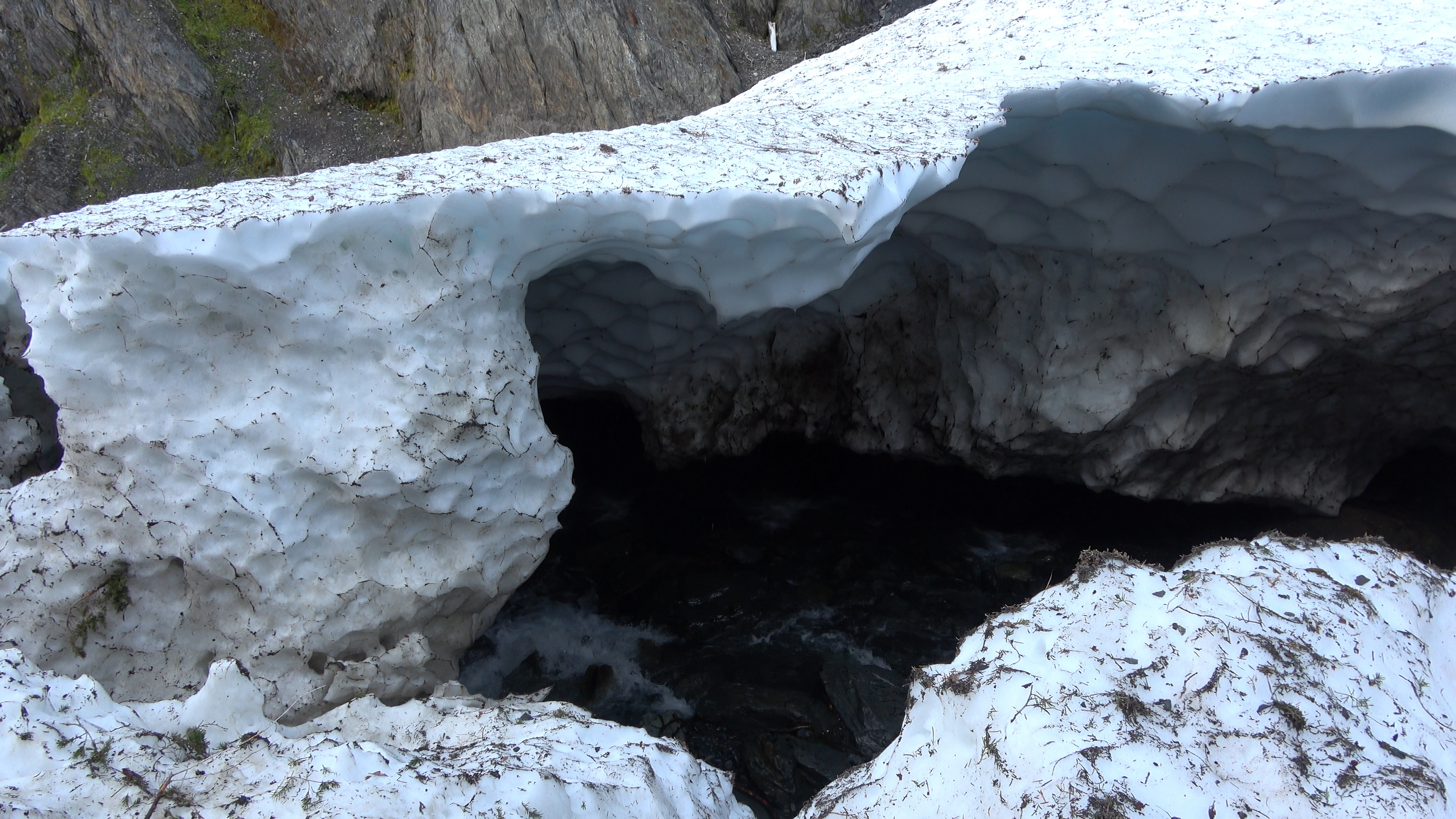
Ah crap. The Elwha snowfinger is in shambles... The old guard of WA backpackers said that in the 60-80s the snowfinger would be present year round and extend all the way to the maze. Making the canyon a quick and easy endeavor. Now due to climate change or whatever powers that be the finger is disappearing...
Side hilling the canyon down. Don't fall.
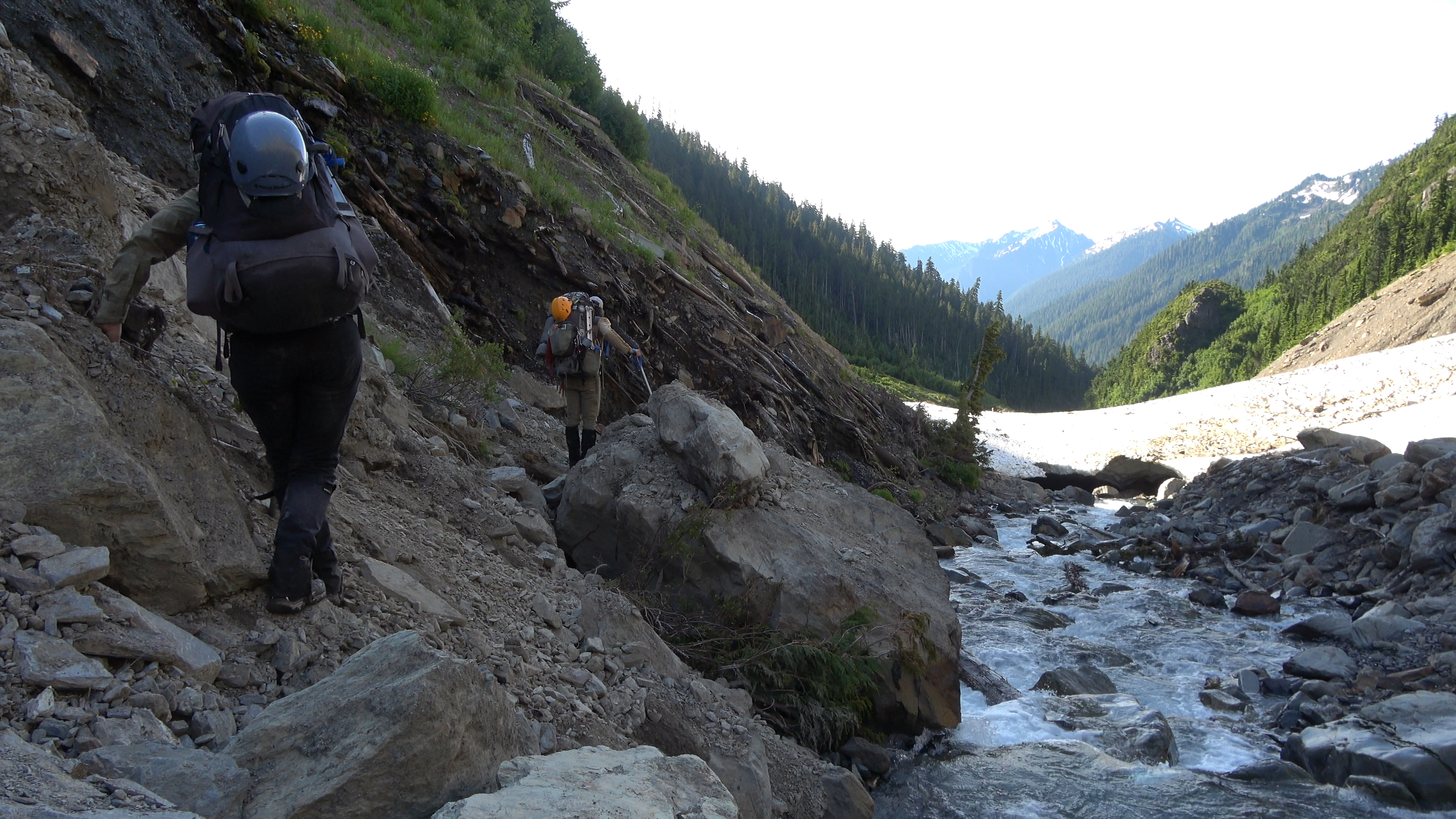
Less exposure! yay! Hopefully that snow up ahead continues on for a bit so we don't have to side hill! (It didn't.)
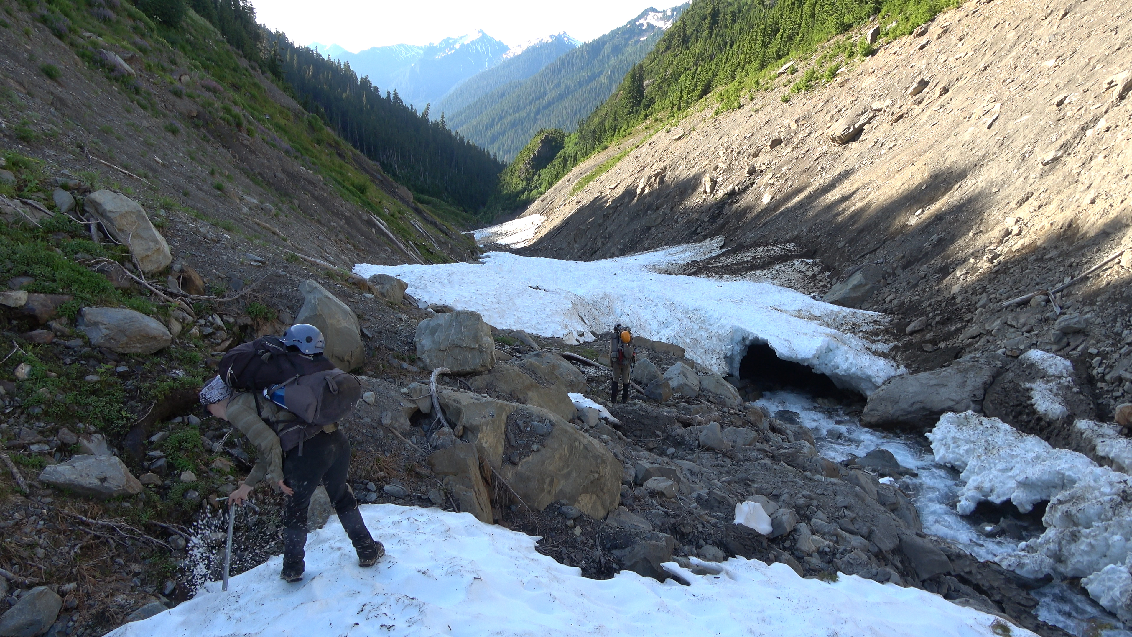
Terrain is now getting a bit more tolerable as we enter the last .5 mile stretch of the finger. Sarah checks for overhand before stepping over and dropping the 5 feet down off the snow onto rock.
Well I was wrong. It got really bad again and we had to side hill up and over through steep and slippery grass. Not fun. I gave up once we got down and figured my feet will just have to deal with being wet the rest of the trip and I walked on the braids and through the stream sometimes up to my crotch. I covered ground fast this way but I still had to wait for Aaron and Sarah as they were being smarter about it and avoiding getting their feet wet. Oh well, if my feet get all ugly pruned and destroyed they can. I ain't no foot model.
We made it! ELWHA BASIN! Our troubles weren't over. They don't call this basin the maze for the hell of it. We knew where we had to go but it still took us two hours just to find a way through the thick slide alder. It was hot and actually kind of frustrating as we had to make time. We would have to hike out a day early because we were going through food way too quickly just trying to keep our energy up. For instance sarah's fit bit thing said on Day 3 we burned anywhere from 5-6000 calories.
Once we punched through and crossed a deep stream we found the trail. WE did it! We have completed the Bailey range traverse. Now we hauled ass to Chicago camp to have lunch and then push as far as we can after that.

My friend I startled. He likes berries.
We ate at Chicago camp where we saw a group of hikers who we overheard making fun of us lol. Never change washington.
Onward the push went until we decided to camp at Hayes river where I actually met one of my 3 subscribers on youtube! Robert was awesome and made a fire for us as we set up camp. You are awesome robert!!!
---------------
Day 8 | Hayes River Camp > Whole Elwha Drainage > back to vehicle
24.05 Miles | 3581 feet Elevation gain & 5020 feet of Elevation loss.
---------------
I didn't take any photos but a few on this grind of an exit. I ate the last of my food (one idahoan mashed potatoes) for lunch and continued on walking. The road walk back kind of sucked. My feet were already aching bad and the compact dirt road and then asphalt didn't do me any favors. I took an ibuprofen to help shut it up.
Sweet bridge park service. We crossed over the Elwha, yes look how much it grew since the snowfinger!
When we got back to the vehicles I had a strong urge to go get a burger at my favorite restraunt in Port Angeles called Coyote BBQ and Pub. They are closed on Mondays though... It was a monday. I got mcdonalds instead which gave me more pain a few hours later than all of the Baileys did lol
Doing this traverse again in 2022 with a few modifications.
I finally finished the movie and am able to get around to post the trip report. It will probably take a day for youtube to process the 4K resolution and 360p looks bad.
Early/Mid-july I went with my friends Aaron and Sarah to do the Bailey Range Traverse in Olympic National Park. It was physically exhausting and challenging. Luckily I had lots of time to condition for the trip since it was in july unlike the Character Traverse of last year in which I only had 1 week of conditioning.
The Baileys are a range in Olympic National Park east of Mount Olympus. A collection of super isolated peaks. The Bailey Range traverse can be done in a plethora of ways. Aaron planned for us to take one of the harder ways. We won't be using any of the bypasses forcing us to use mountaineering gear. That being said, from my reading, the bypasses look pretty tough as well. Some nasty gullies.
---------------
Day 1 | Trailhead > Elwha River Road Walk > Olympic Hot Springs
8.15 Miles | 2200 feet Elevation gain.
---------------
Day 1 was fairly uneventful, met at trailhead and walked the Elwha river road to the old trailhead. When the elwha dam got removed the river took the road with it and it will most likely never be repaired. Making the interior of the Olympics even more remote than they already were. We got to the Boulder creek hotsprings CG and chilled at the hot springs for a bit. They were pretty alright. I'm not much of a hot springs guy especially during the hot summer. Couldn't wait to get to the high country. Had a pretty forest camp with an actual view as well!
View from camp. Headed up that way for Day 2.
---------------
Day 2 | Boulder Springs CG > Appleton Pass > Soleduc Park
8.9 Miles | 4981 feet Elevation gain.
---------------
The morning walk was uneventful until we got to some excellent waterfalls before returning to the forest grind. Though beautiful forest, I'm addicted to meadows and all that jazz. Our packs were extremely heavy with mountaineering gear and the we had to use bear kegs (park service rules for the traverse) though ursacks can easily be done, there is no shortage of trees anywhere in Olympic National Park. Though I do understand they must cater to the lowest common denominator. We passed a camper who was sleeping still in the AM and didn't have his ursack tied to a tree he just had it laying nicely on the ground. Ready for Mr. Bear to walk off with it.
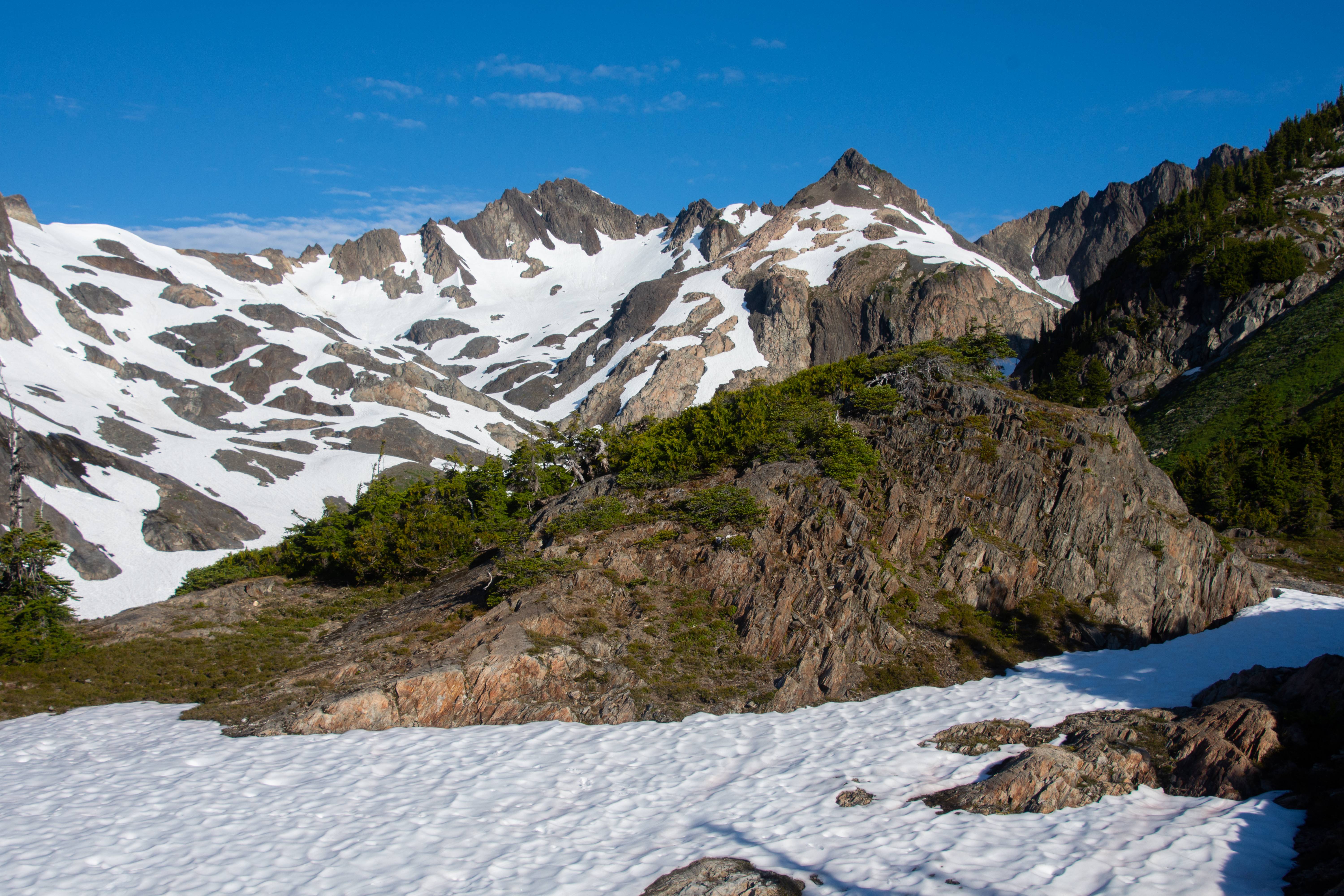
Appleton Pass had some snow below it and the steep (Olympics are STEEP!) terrain made us whip out our ice axes before we even started the traverse. The pass was awesome we had lunch there then continued traversing ridges of Soleduc Park and Peak 5700. The trail the whole way from Appleton Pass to Cat Basin was leveled like this \ luckily my feet are ugly and its hard for me to get blisters. Sarah got her first blister of the trip on this "Side hilling" trail.
We got to the meadows and camped with Cat Peak in view. The real fun starts tomorrow. I didn't take much photos on Day 1 or 2, mainly just video.
A bear chilled at a higher meadow above us all night vegging hard. Didn't get a pic but got video of him.
---------------
Day 3 | Soleduck Park > The Catwalk > Mt. Carrie > Carrie Morraine > Ruth Col > Stephen Lake Basin
7.64 Miles | 5138 feet Elevation gain.
---------------
The first mile of the day was trailed then from here on out we were on cross country travel and scrambling. Our first obstacle was the cat walk. A thing arm connected to the lower Mt. Carrie meadows with lots of exposure. If you take it slow though you shouldn't have issues. I wouldn't advise on falling here though or anywhere on this traverse for that matter. We saw a 2nd bear this morning. Very big black bear. VERY BIG. Didn't get a photo of him but got video.
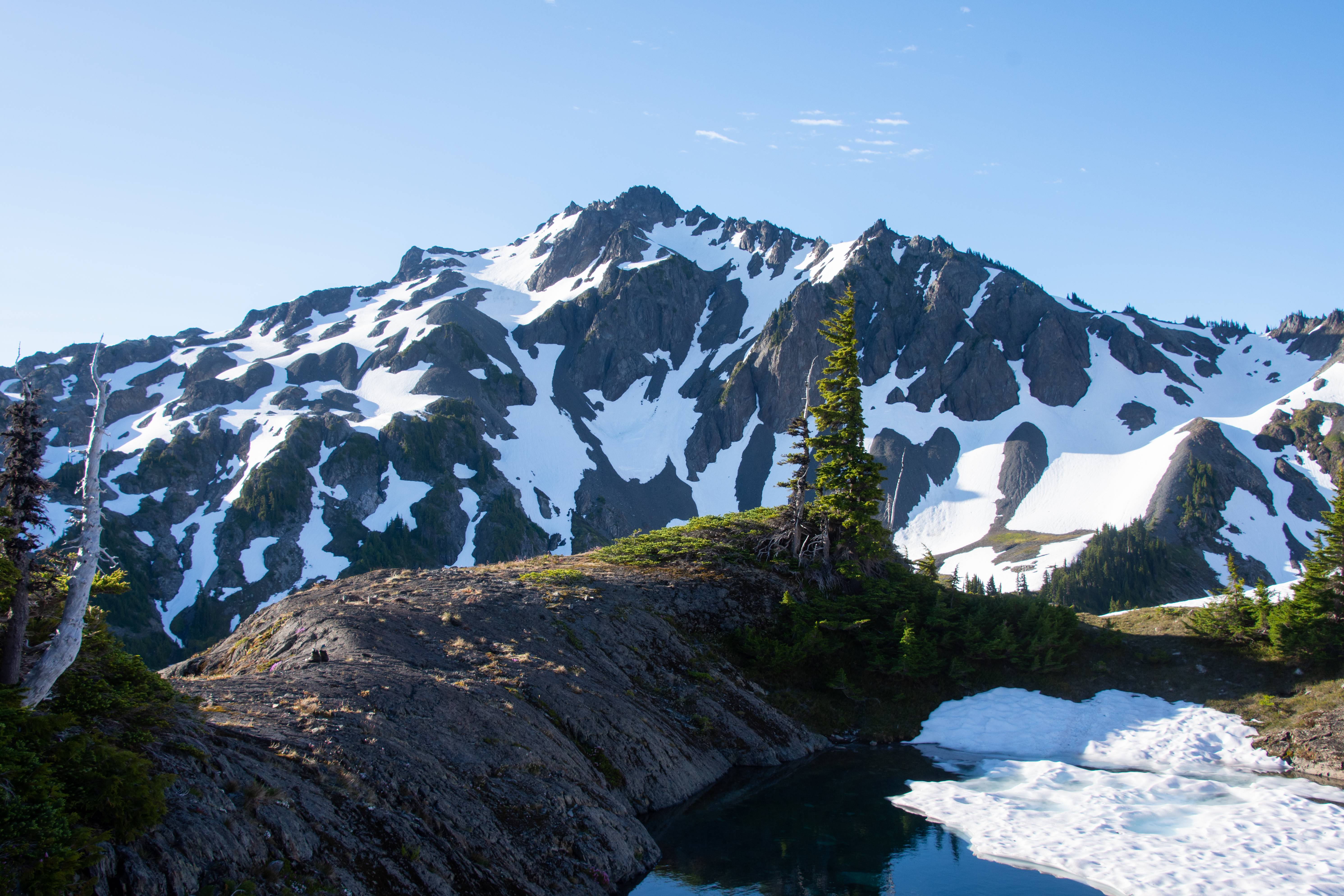
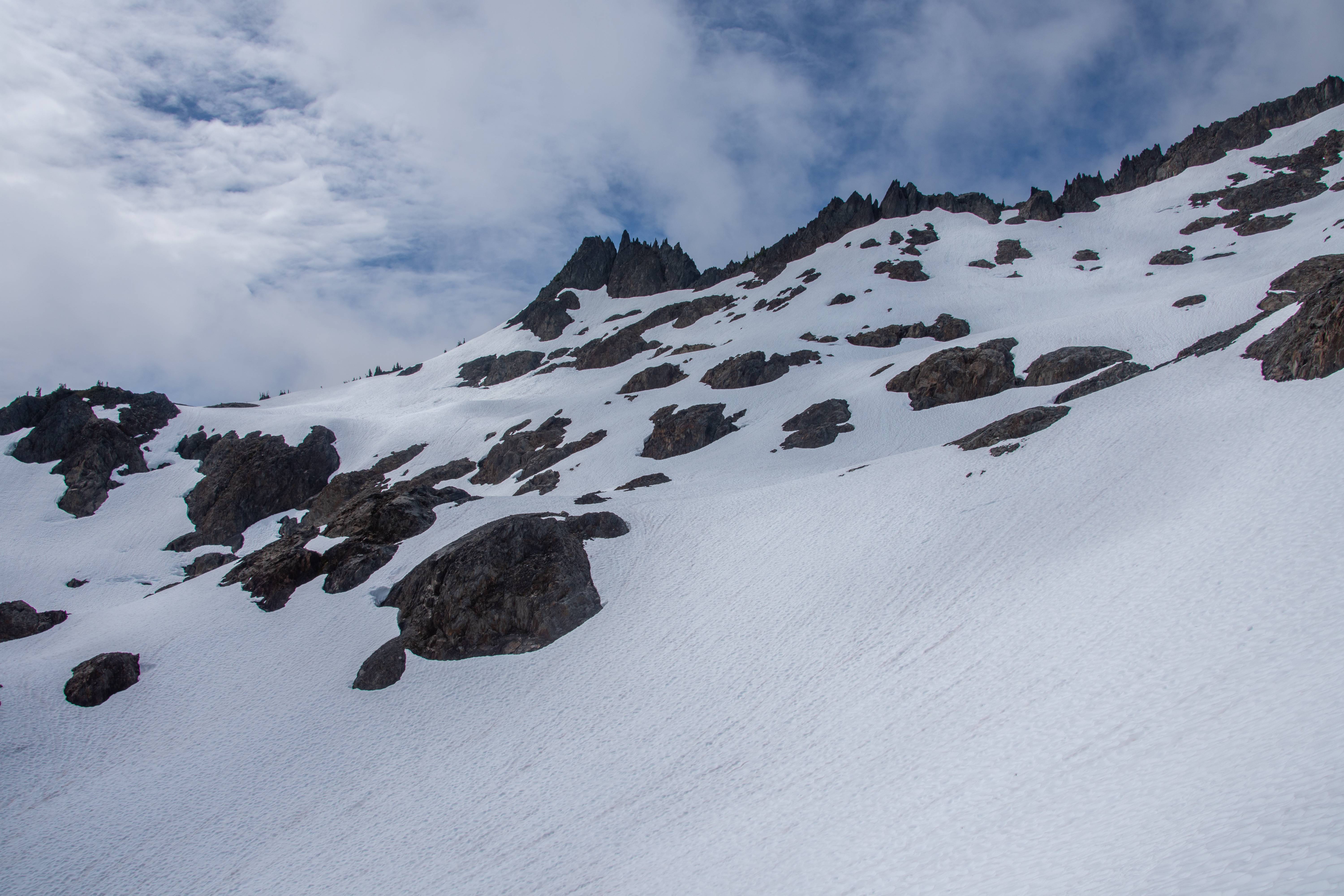
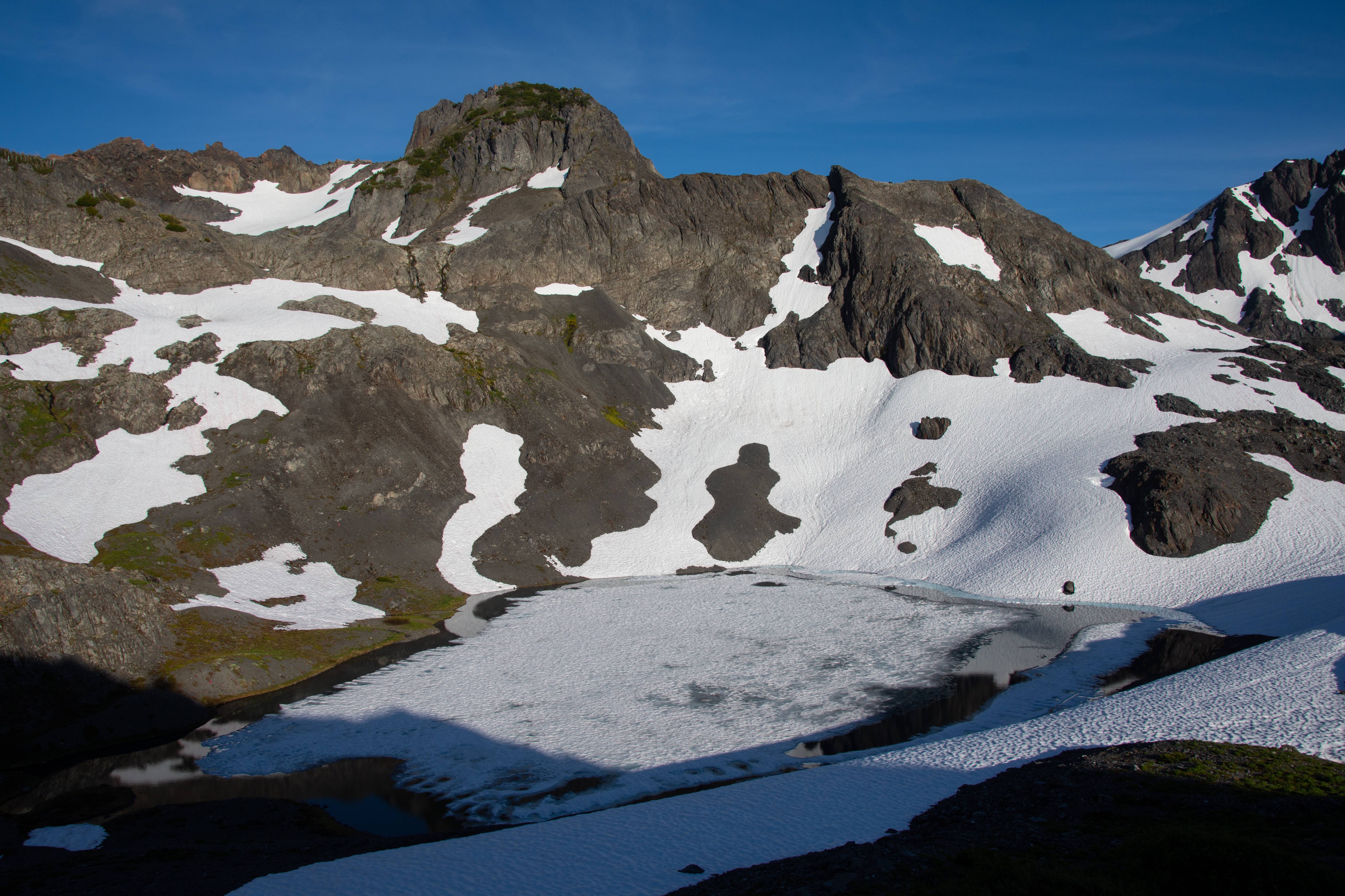
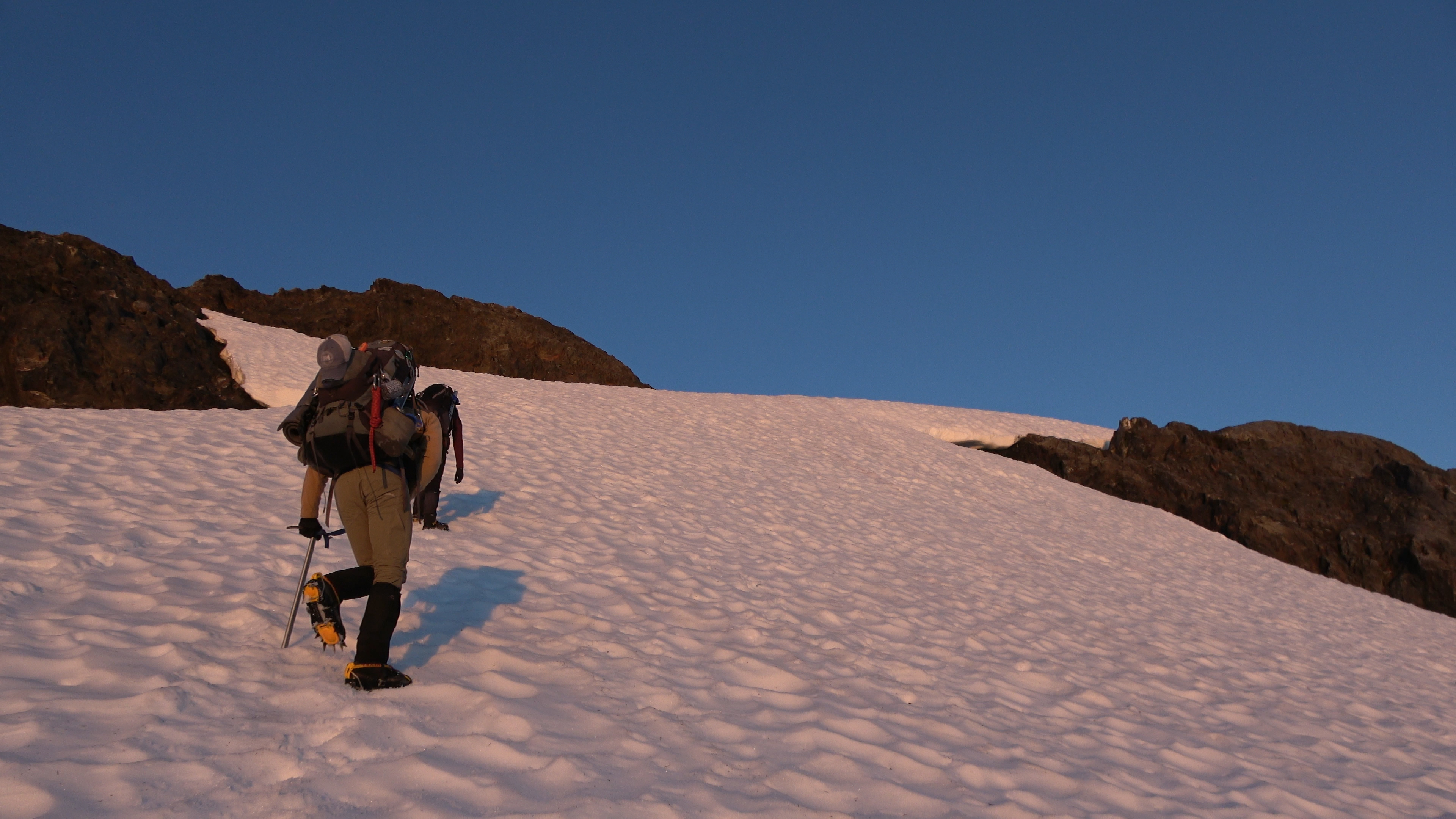
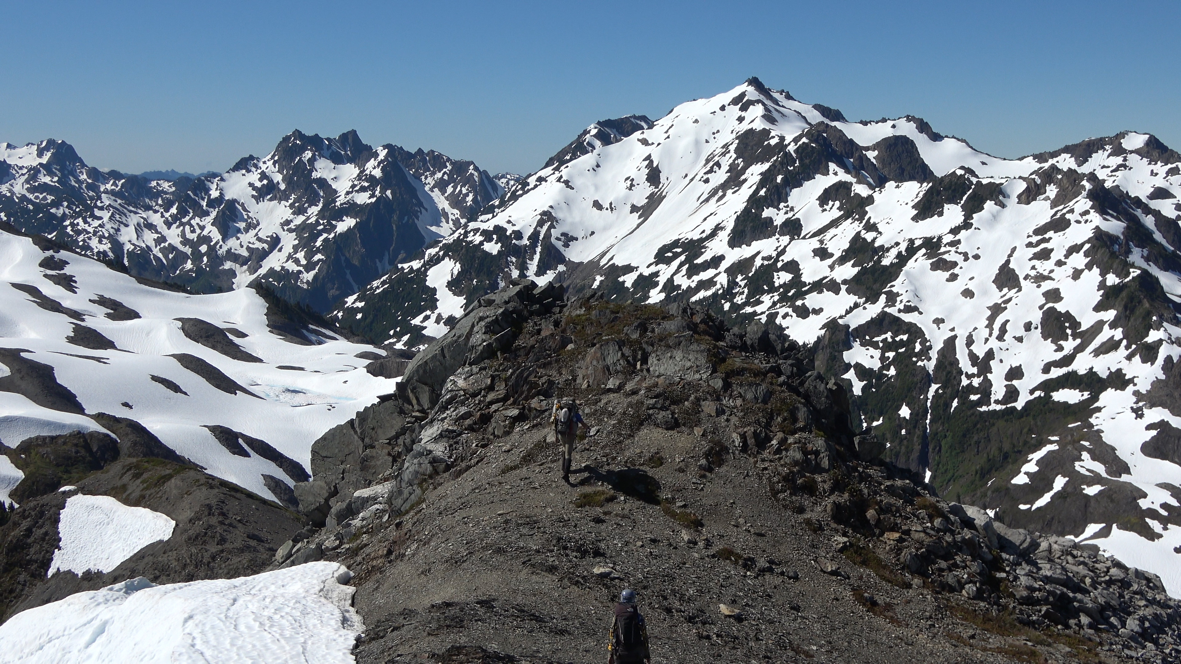
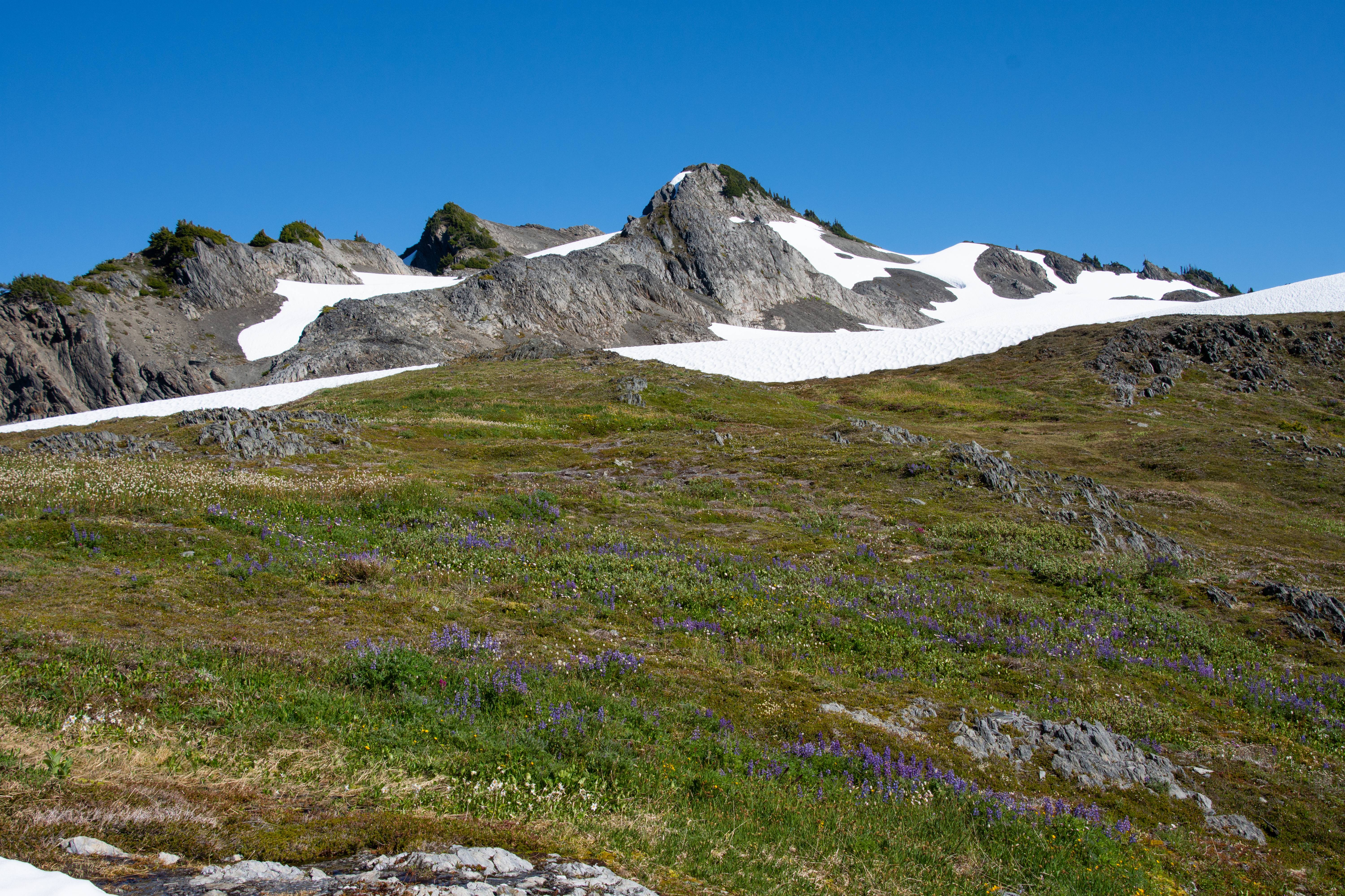
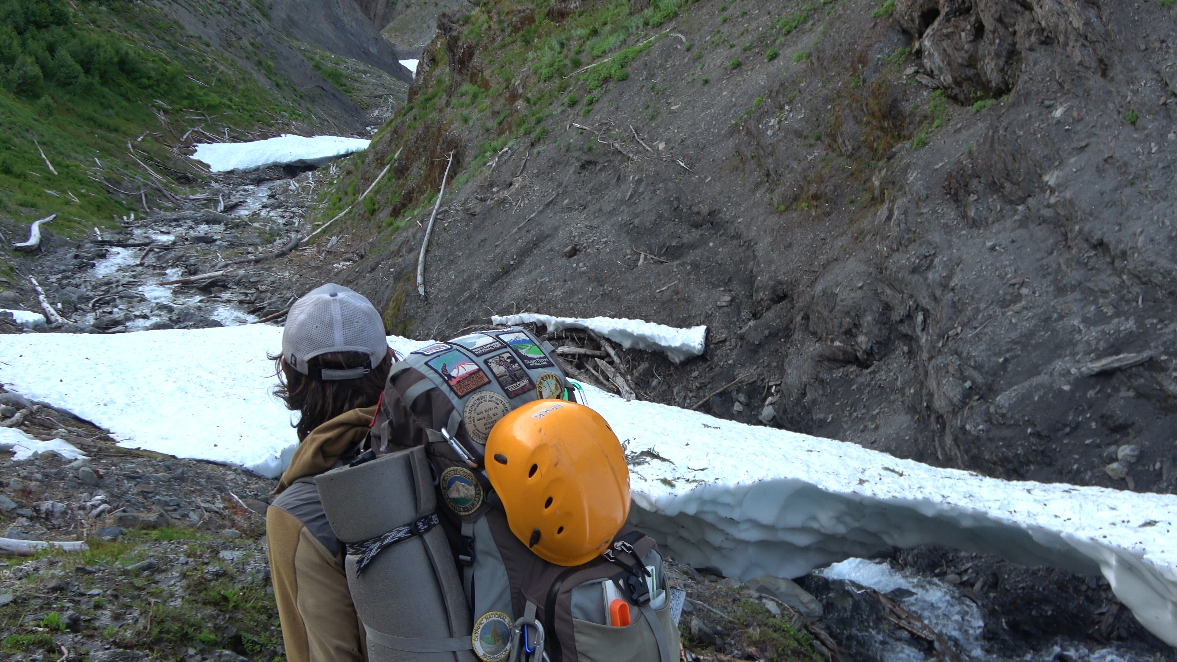
Our cross country leg begins. First objective is to get around Cat peak (in frame) then start the "Cat Walk". The meadows in this range in general are much more pleasant to walk in than the meadows in the drier more eastern part of the olympics which have 10000 mole / squirrel holes hidden in the grass, waiting to take your ankle as a casualty.
The start of the catwalk. A 1-2 foot wide rock arm with trees on it. The park ranger told us "things WILL get ripped off your packs here." Luckily we heeded the warning and battened down our stuff pretty good and didn't lose anything. It ripped aarons water bottle out but he had a carabiner holding it in place.
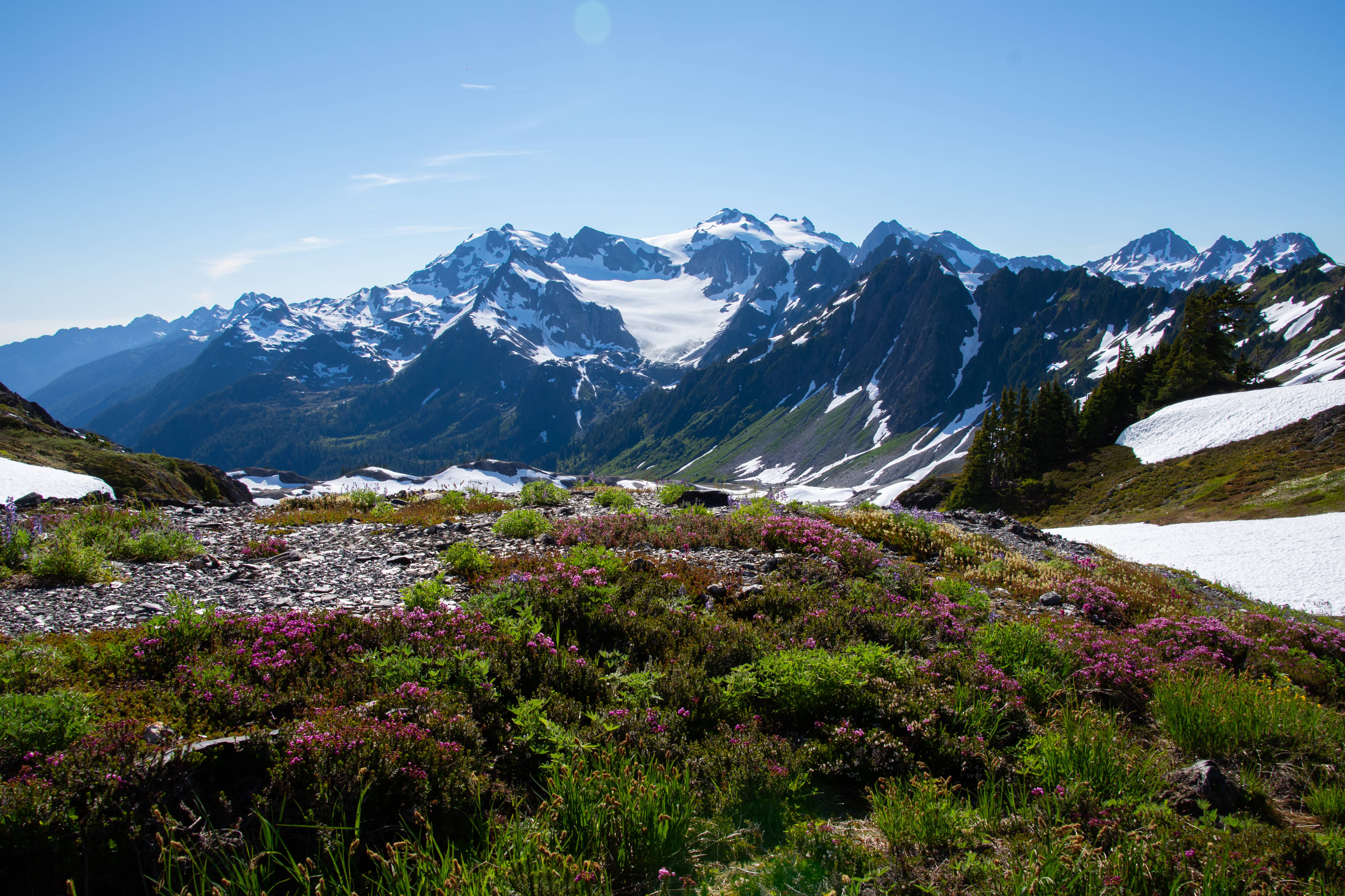
First view of mount Olympus. Shooting from sea level up to almost 8000 feet in 3-4 miles. From all the places I've backpacked on thing that is striking with the Olympics is the crazy vertical relief. Most peaks there are only 6000ft but the valley below them is only 1000 feet above sea level at most. This makes for some dramatically big looking mountains and deep spooky valleys. (Though I think the valleys of the western cascades are spookier given the history of both areas.)
The glacial ice and snow was so thick on Olympus that it almost looked like it was bubbling up and over the rocks.
A good majority of the cat walk I had my camera away because I didn't want to lose it, break it, or fall as I needed two hands 98% of the time.
Don't fall. Doing this in full mountaineering packs wasn't very fun.
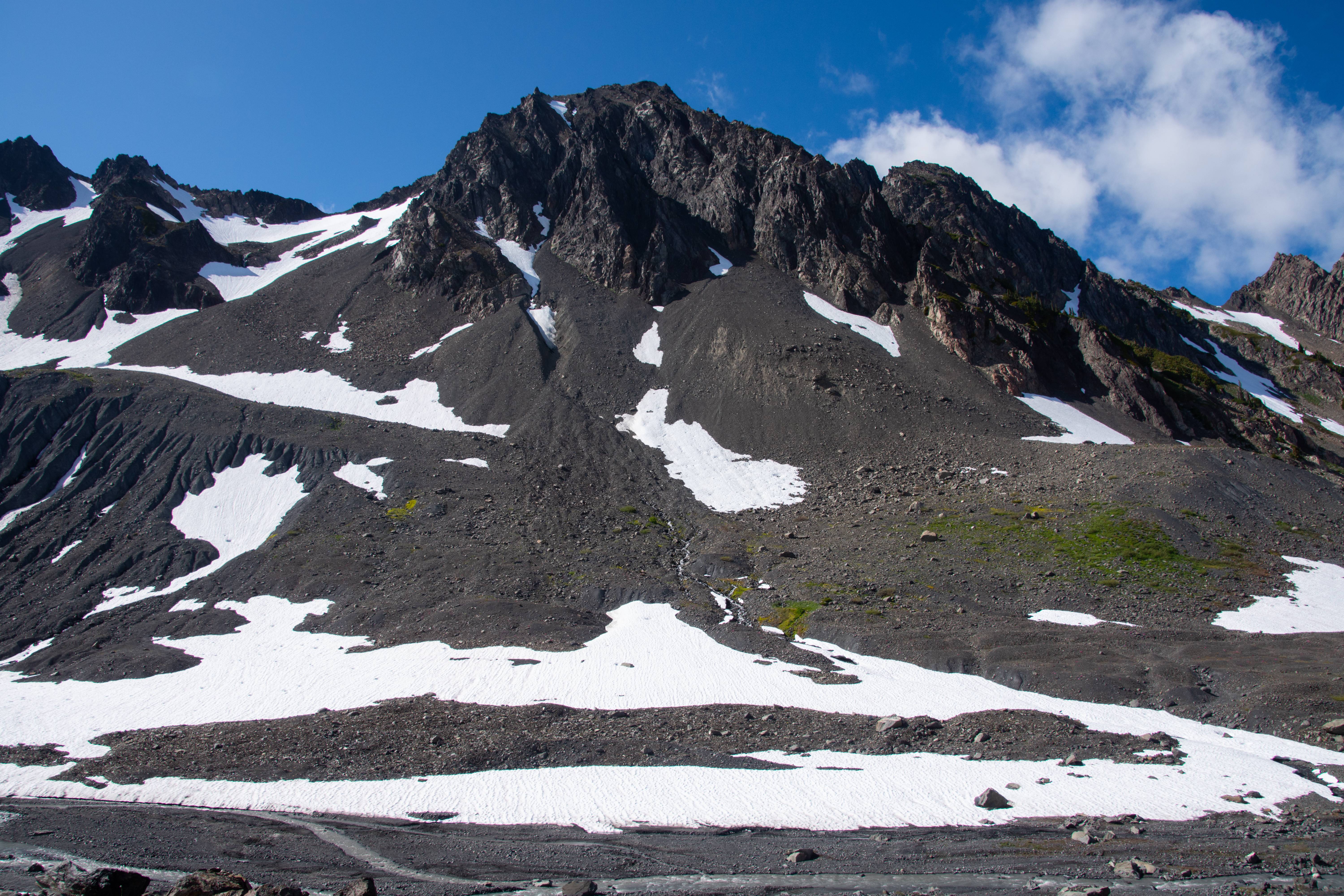
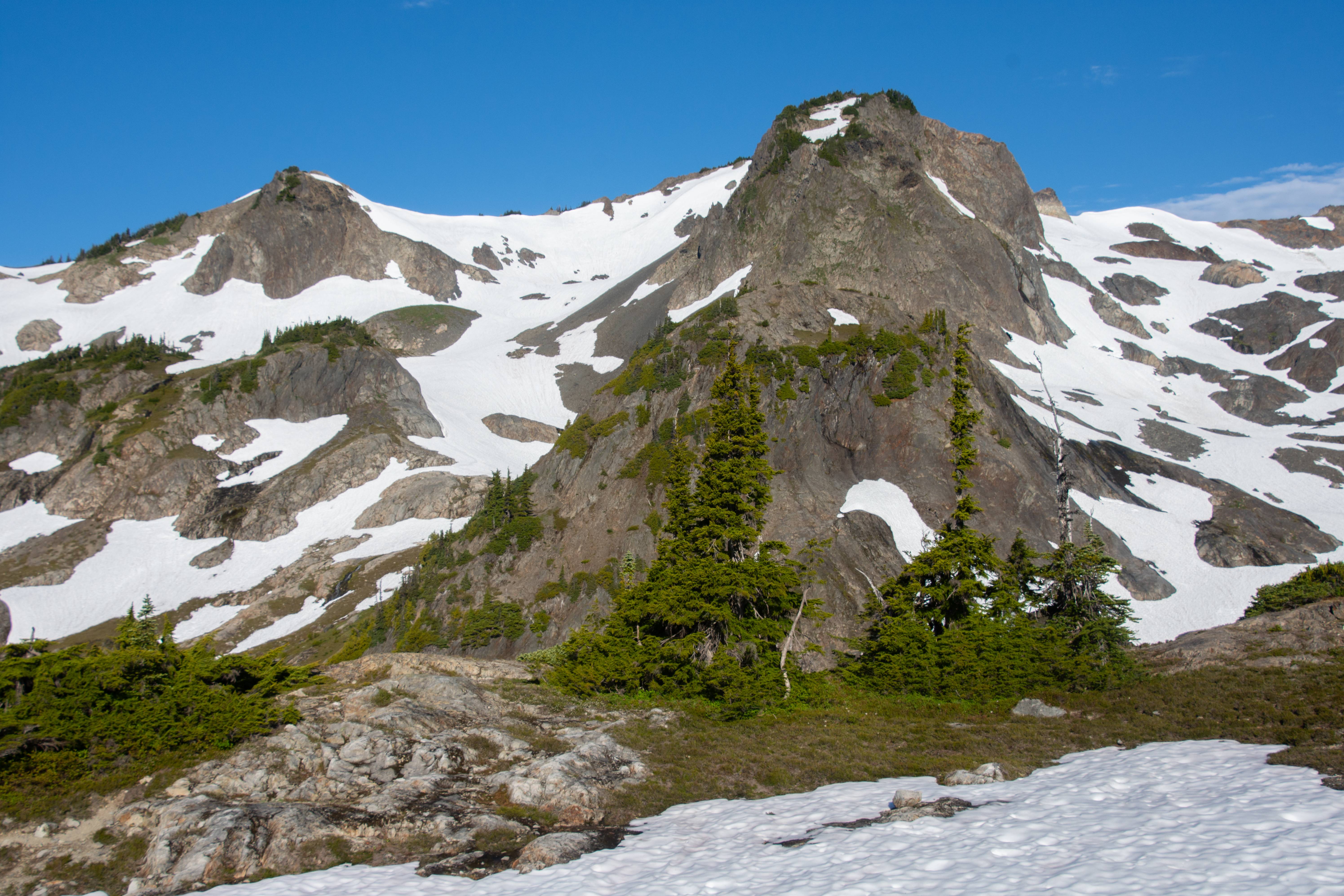
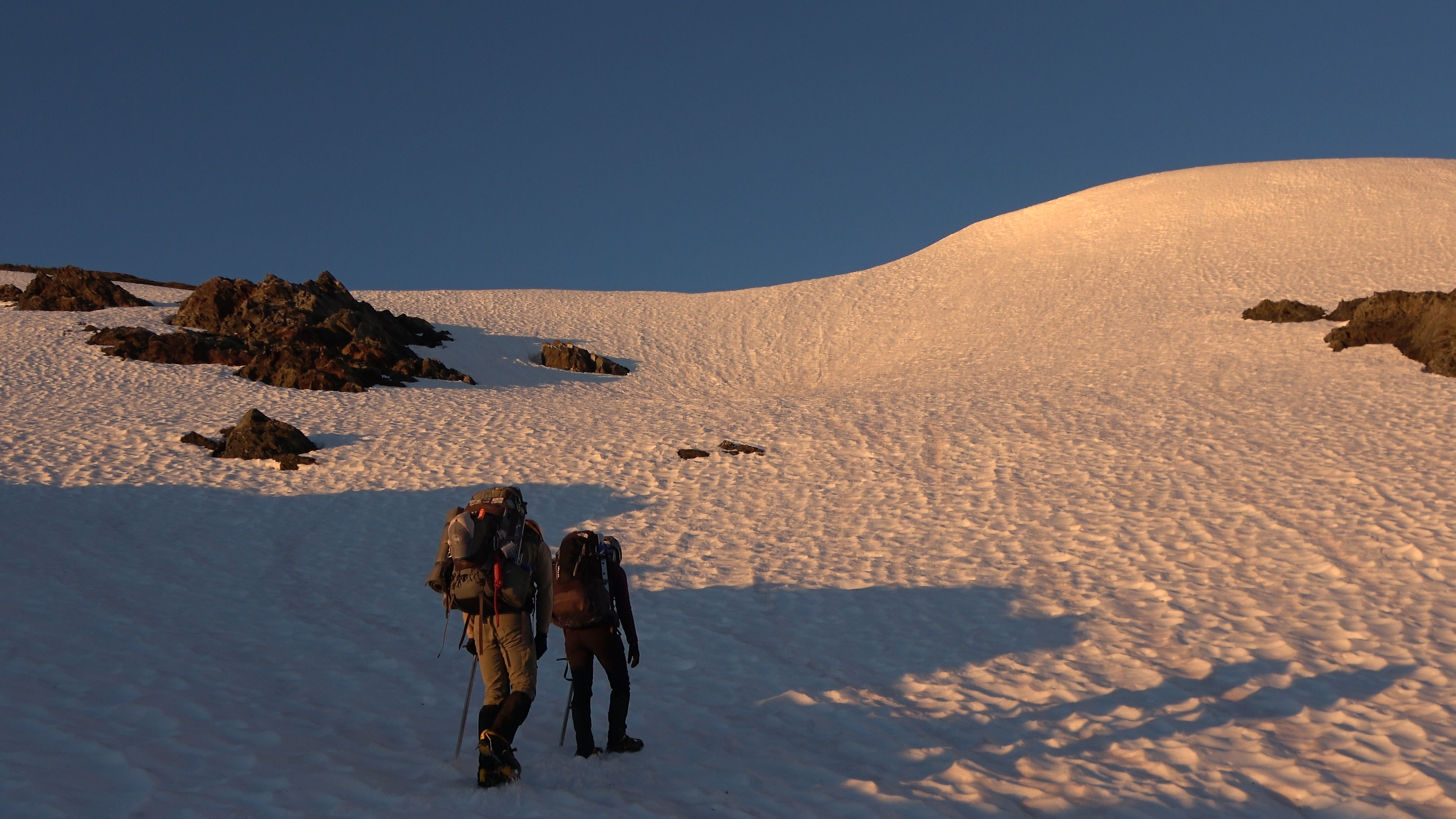
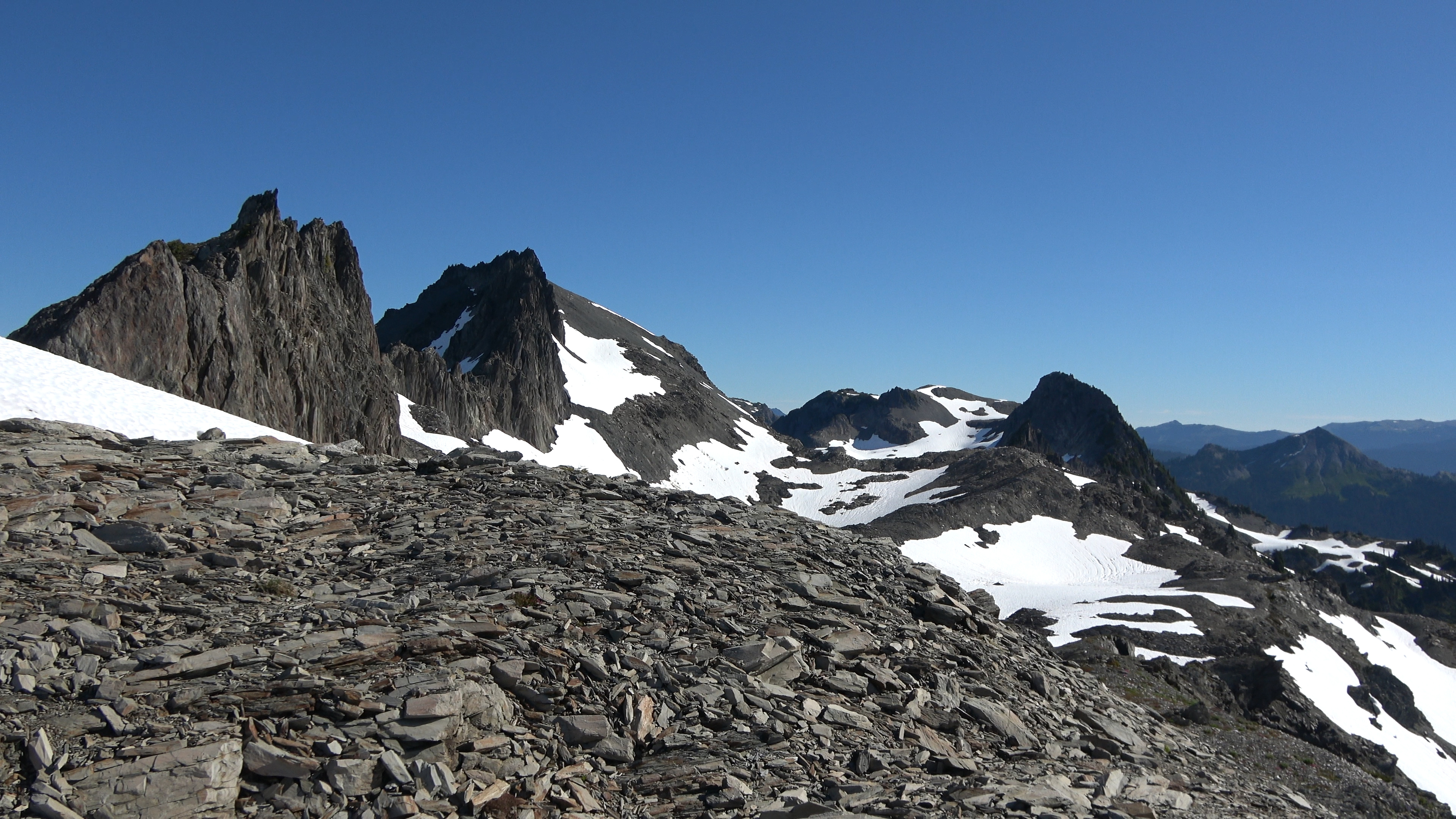
We pushed up some steep meadows and got to our first wall where we began to traverse Carrie. It was too damn hot out. But the views made it worth it. Peaks for days.
The last push up to the summit of Mt. Carrie. We came from the lower snowfield. You can see Night #2's camp back center camera in the green behind the snowy guy (Cat Peak) in center camera.
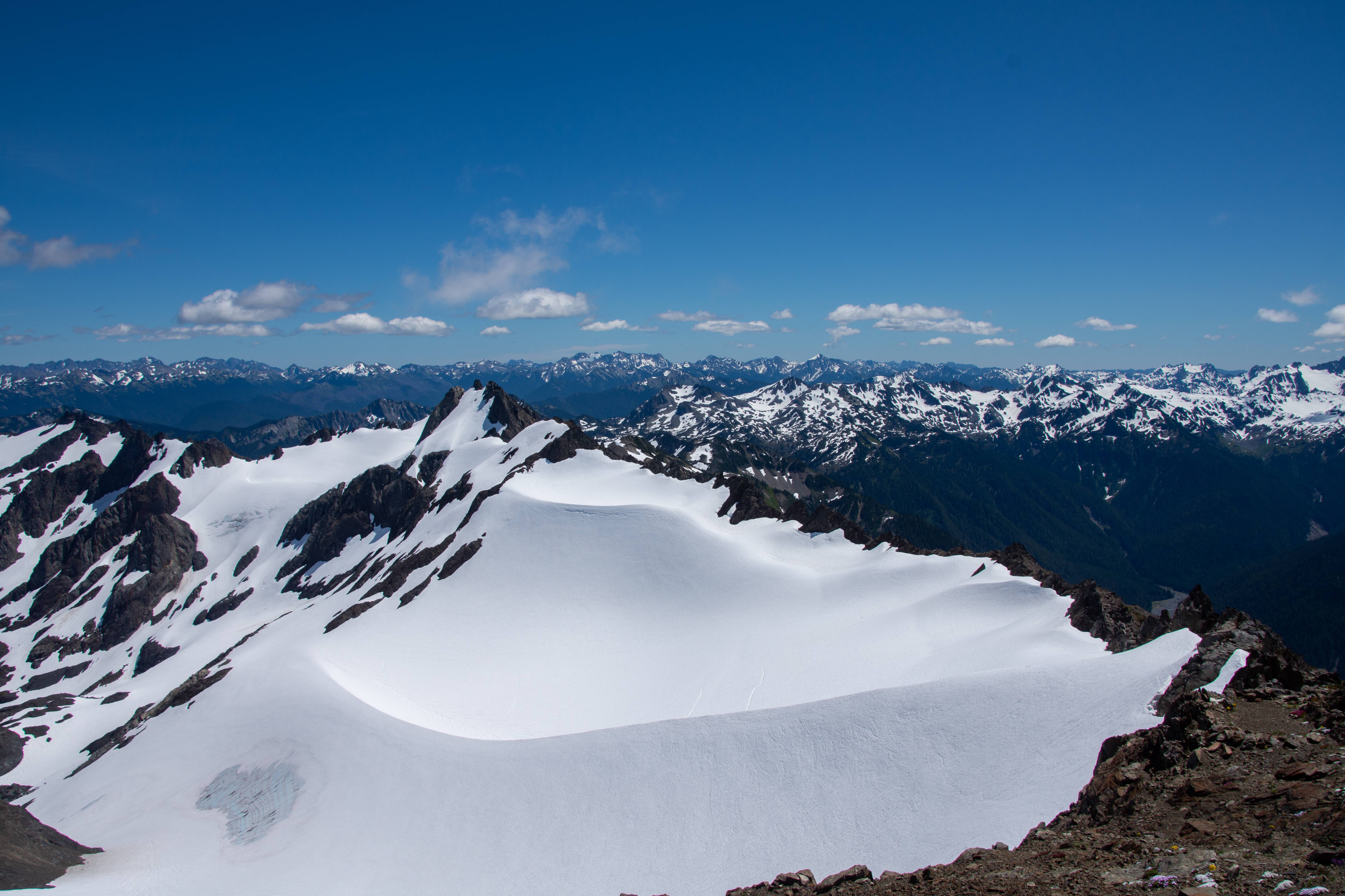
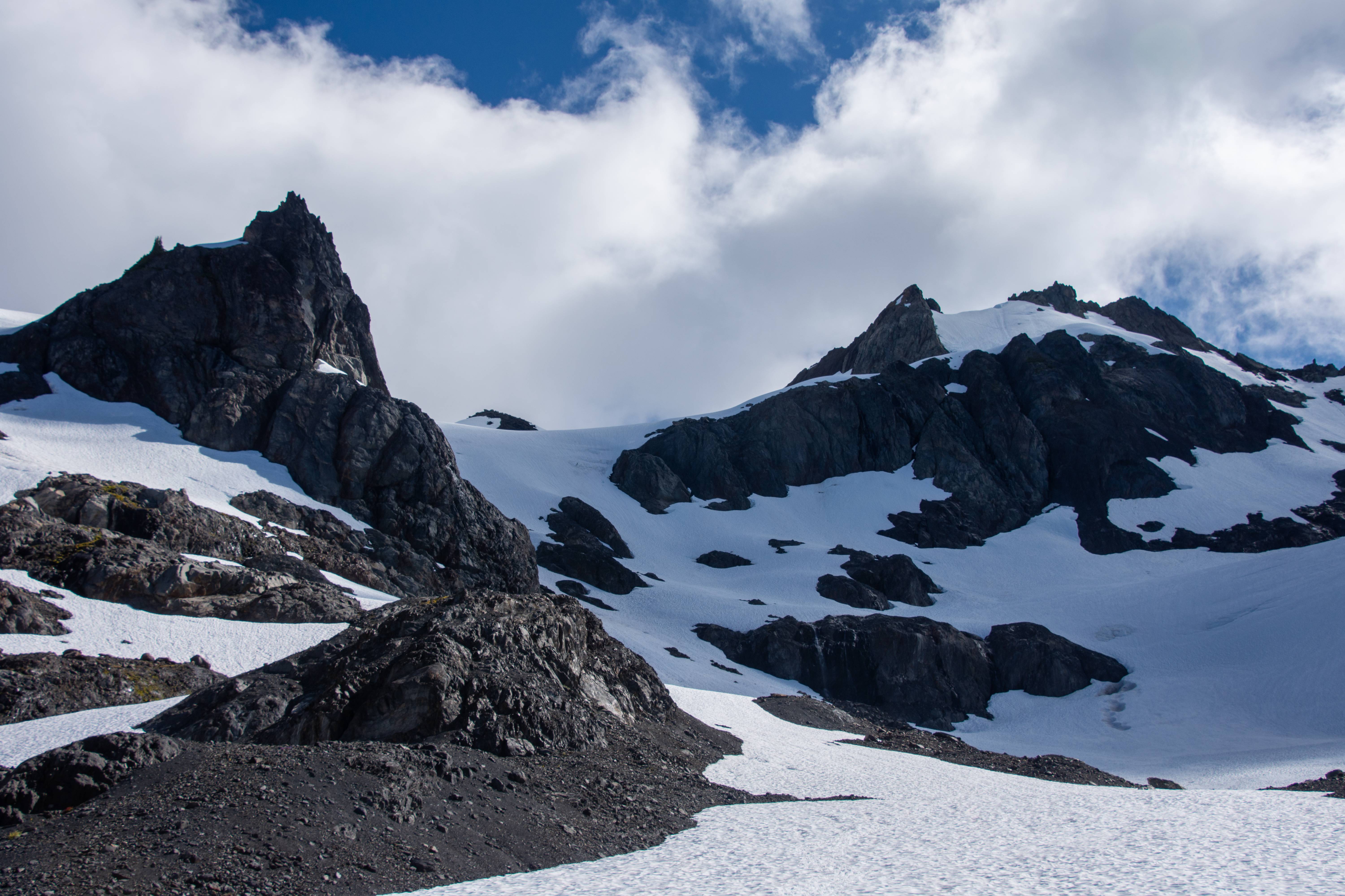
Summit view of Olympus
The Baileys
The Ice Lobe
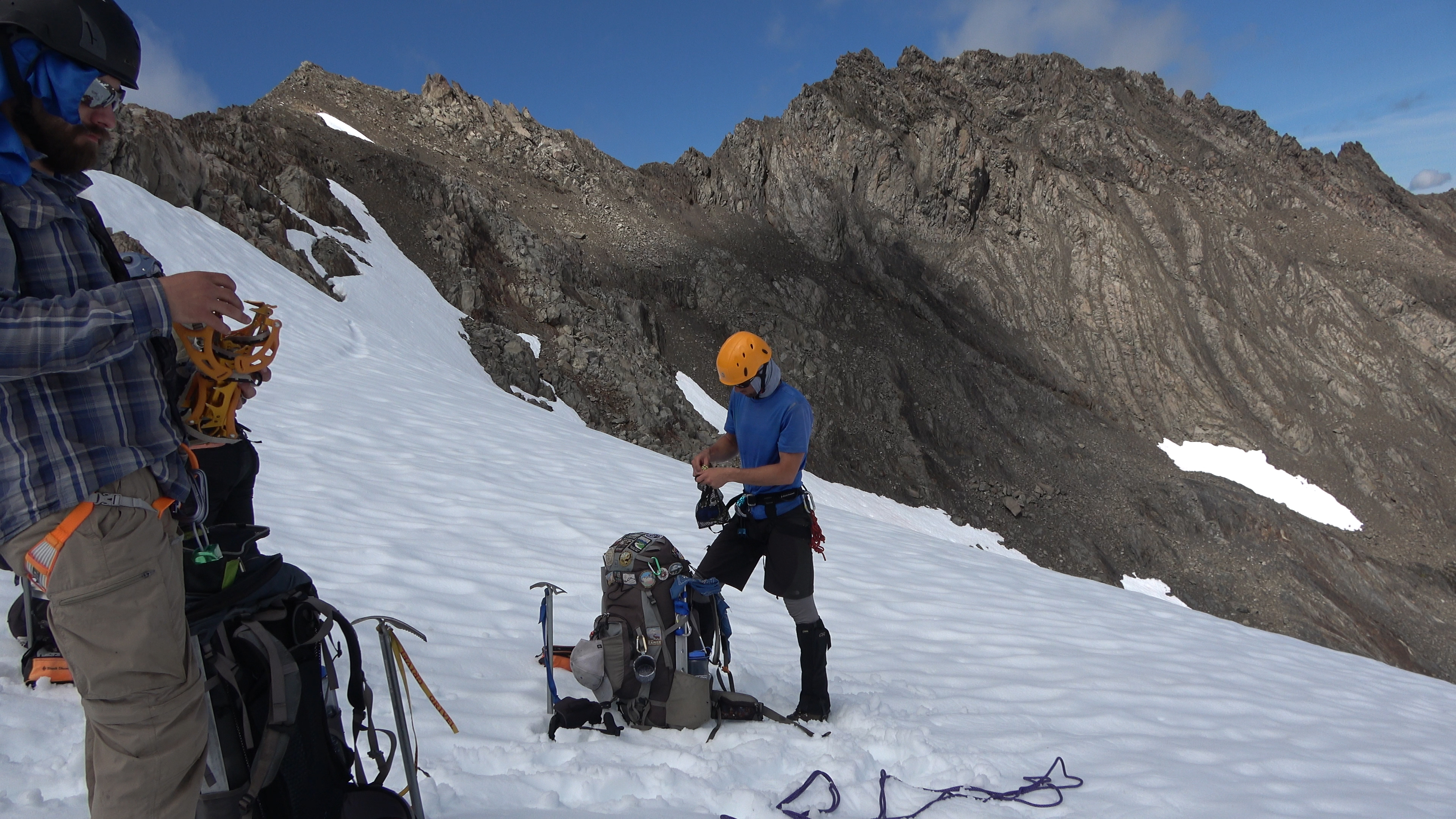
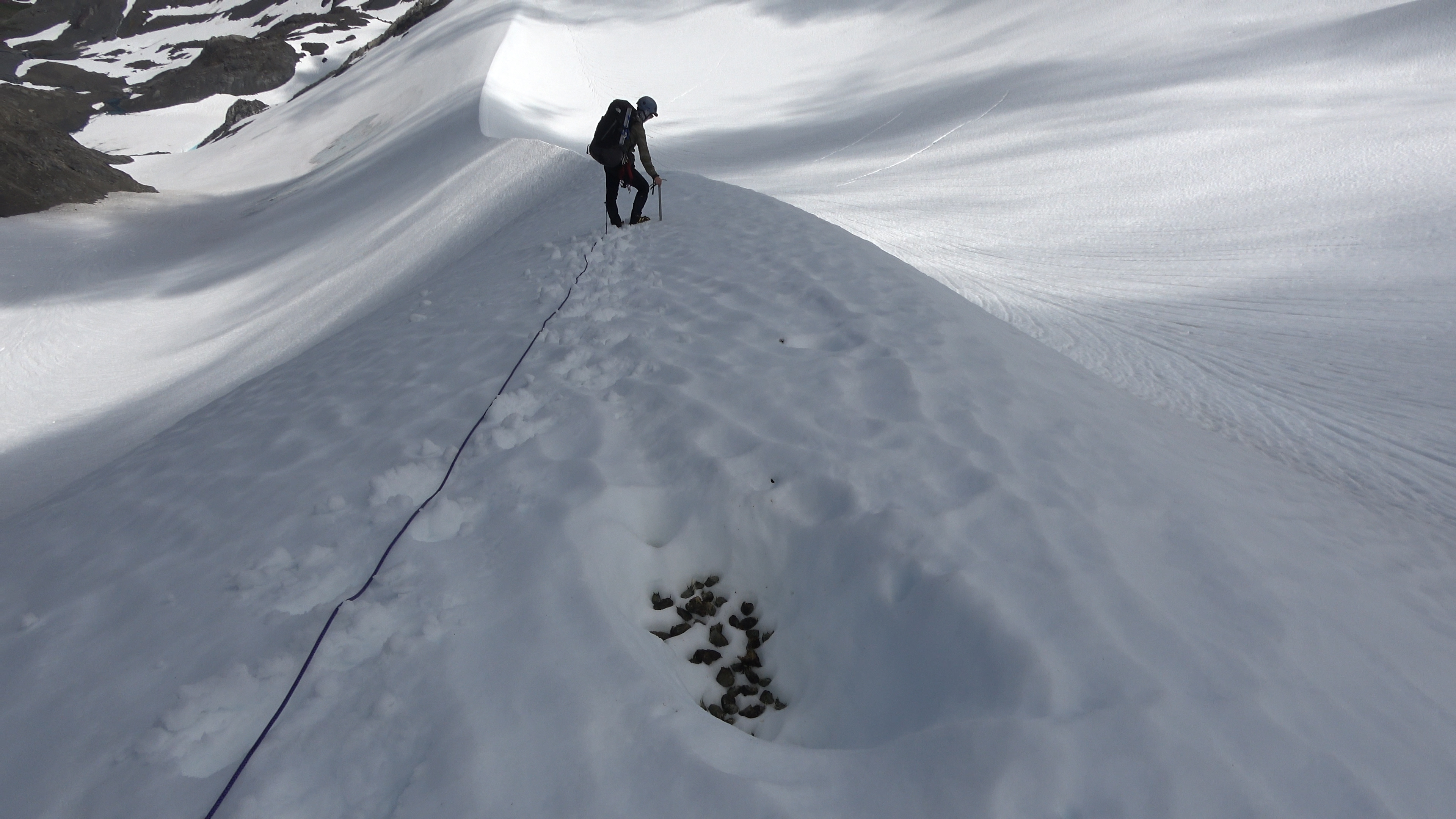
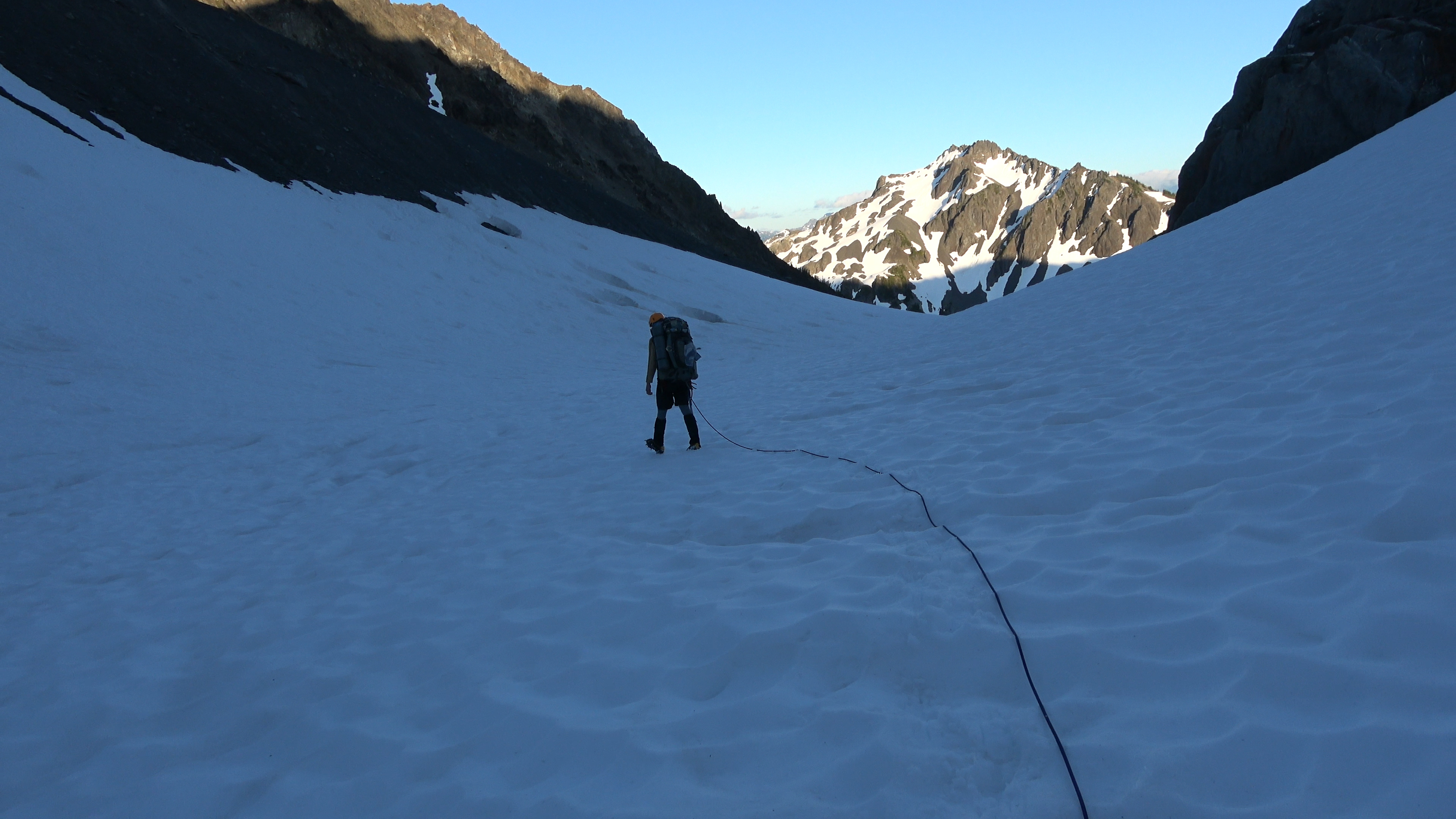
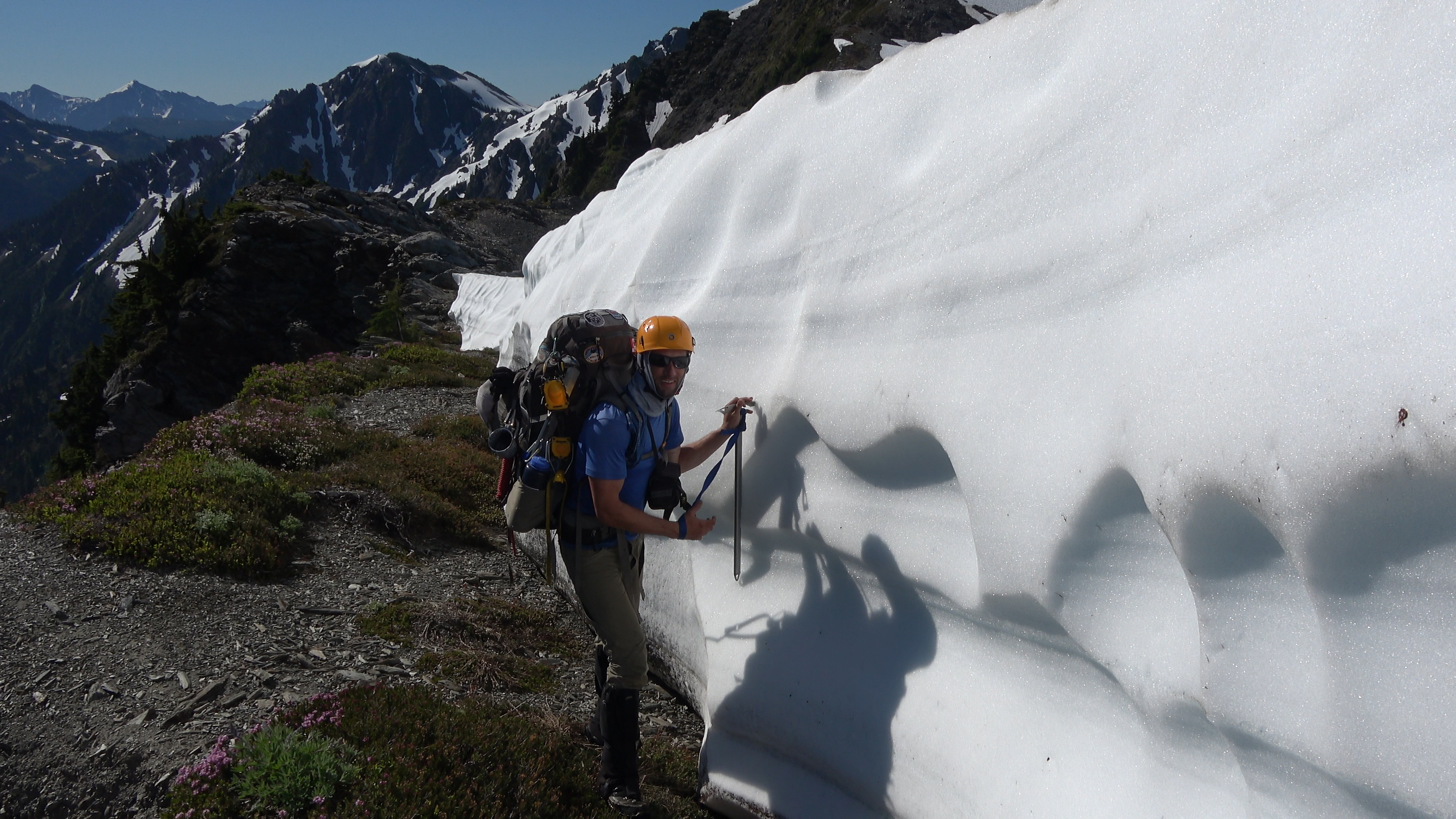
Time to gear up for a glacier walk. I've seen reports of people doing this section un-roped but better safe than sorry. The north side of the berm has some nasty crevasse action.
In this photo as well you can see a tiny bergschrund just to the right of my orange crampons being poorly hidden by snow. Don't step in that.
We geared up and began our descent of the snow berm.
Elk poo. I bet that bastard didn't even rope up. You can see some crevasse action to the right of sarah and left further up. Off camera there were some big boi's.
Still headed down. Our objective is that low snowfield so we can get some water as we were all out. Then we would have to go up and over those peaks in center camera.
Sarah checking out the crevasses and the ice lobe.
Break time! We made it down and can drink that cold n' fresh water! WE came from above that head wall with the waterfalls through that crevassed snow on the left.
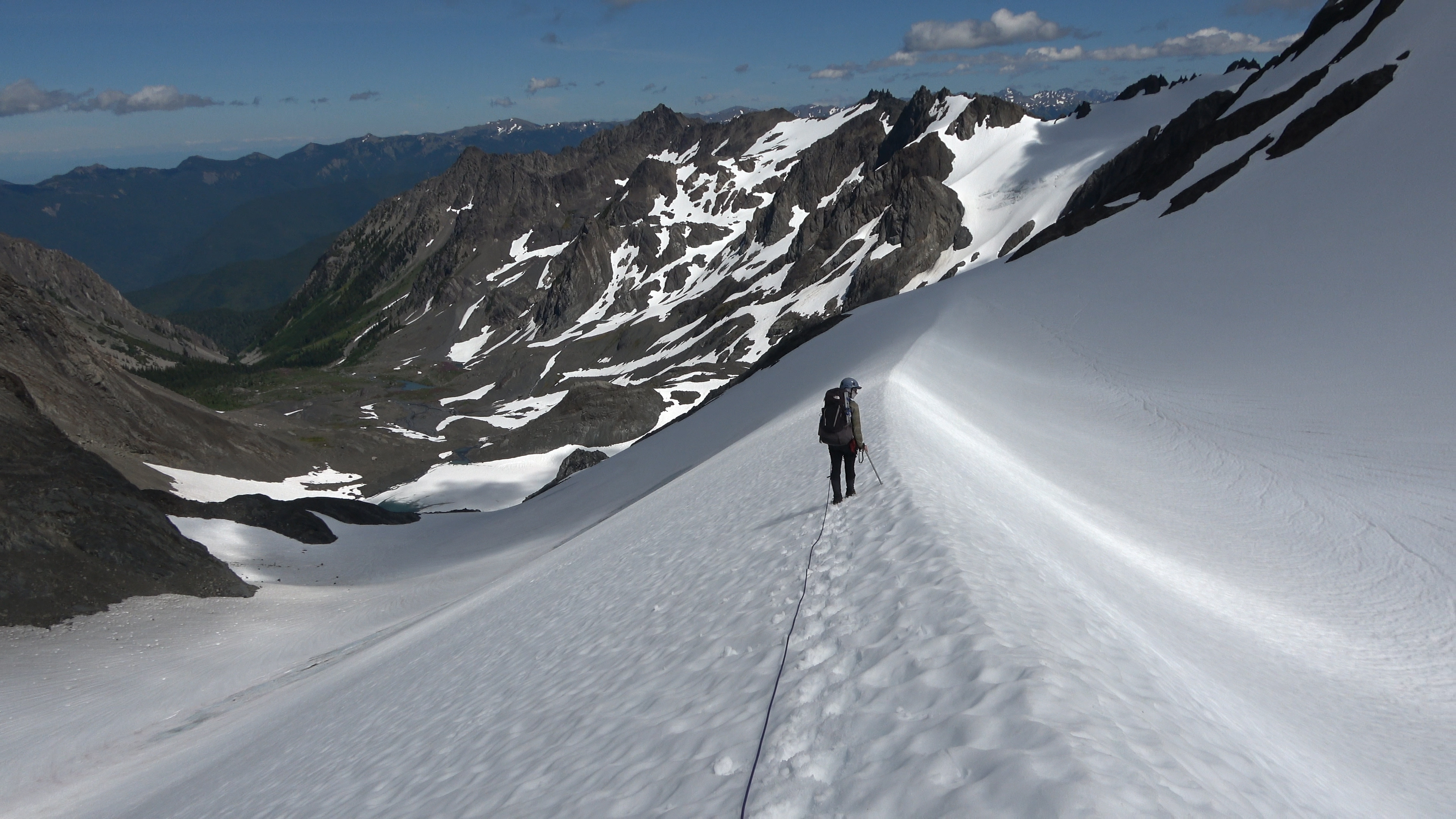
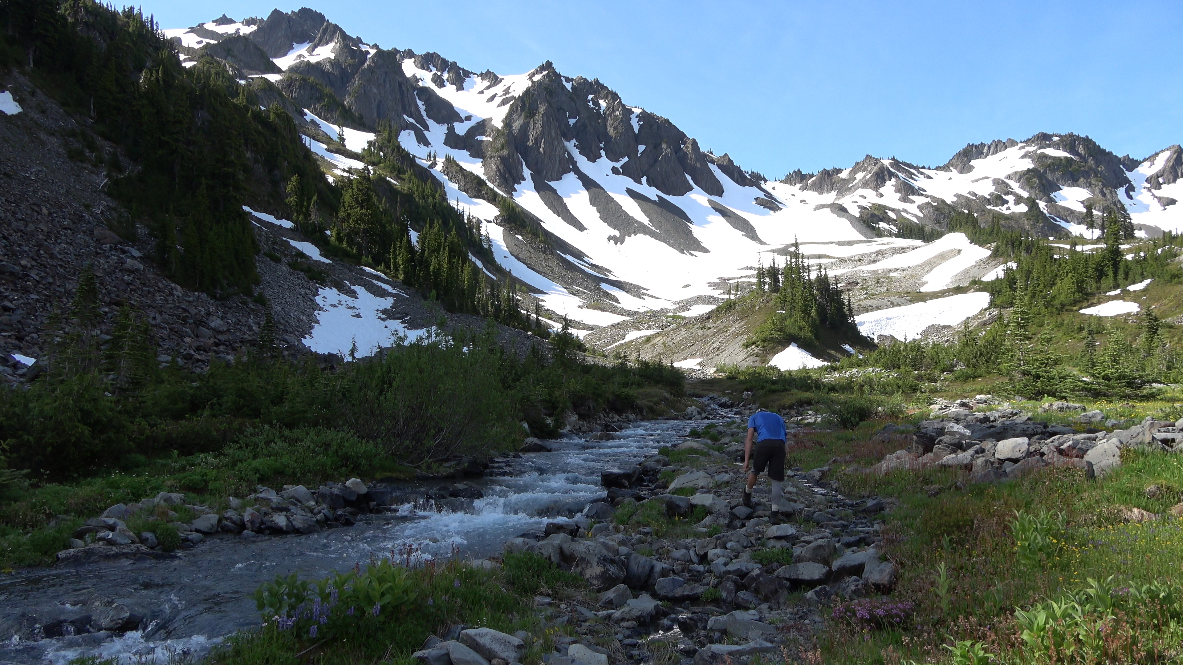
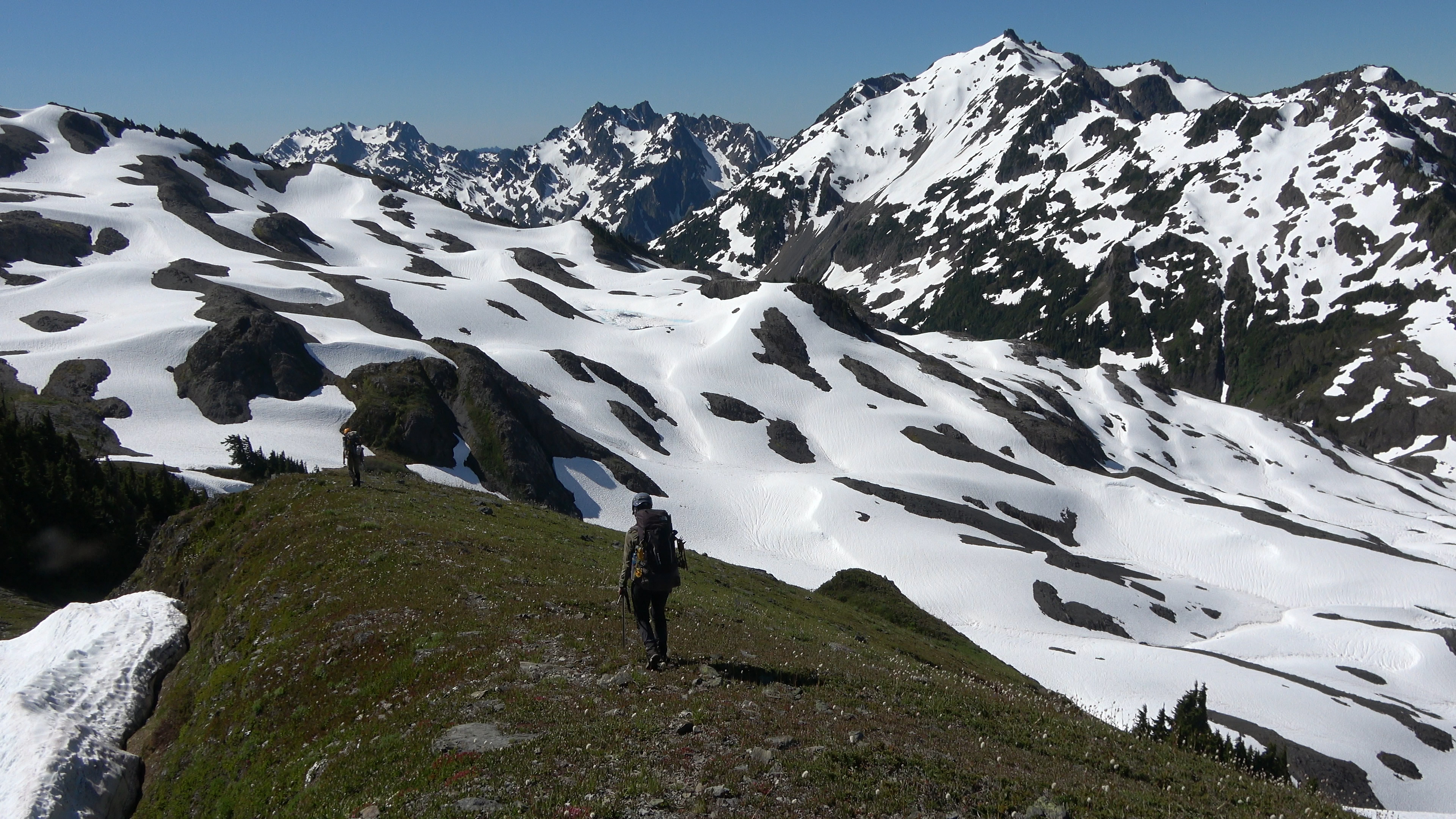
Our next line of attack. Straight up that.
One last look of this beautiful and lonely basin. Next time I told aaron this should be a camp night. This trail-less basin was too big and offered too much to explore to just pass through it. But alas, we had to.
We went up and over to the steep col. I got video of some of it but no pics. We descended a very steep and loose snowfield then pushed on to Stephen Lake basin. Losing light fast. We've been at it for 14 hours so far. Hardly felt like it though there was constant beauty to distract you.
---------------
Day 4 | Stephen Lake Basin > Stephen Arm > The 2nd Catwalk > Ferry Basin
4.83 Miles | 3137 feet Elevation gain. 100% cross country.
---------------
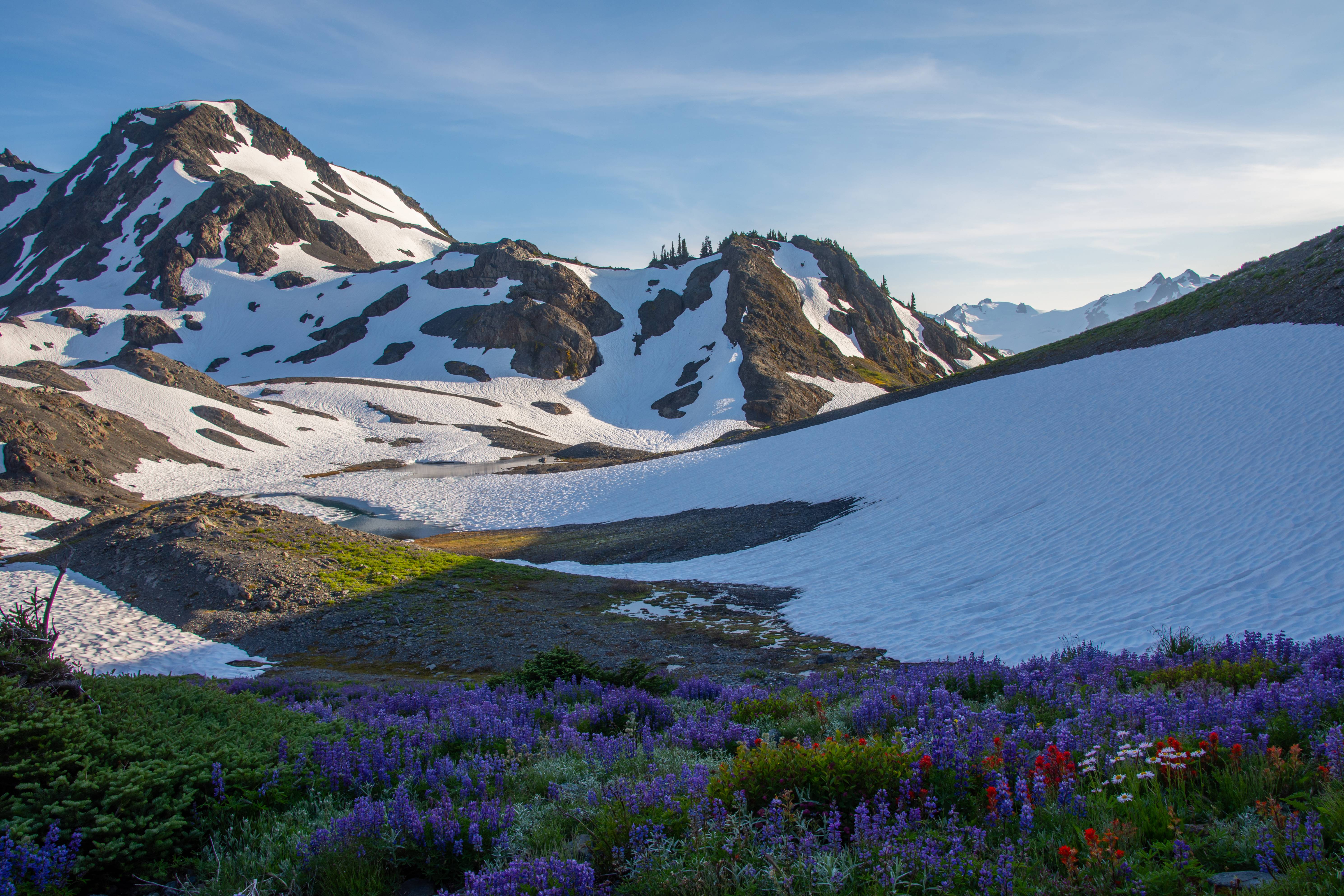
We woke up and enjoyed the sunrise in our basin of solitude. Haven't seen a person since the end of Day 2 and it will be this way until Day 7.
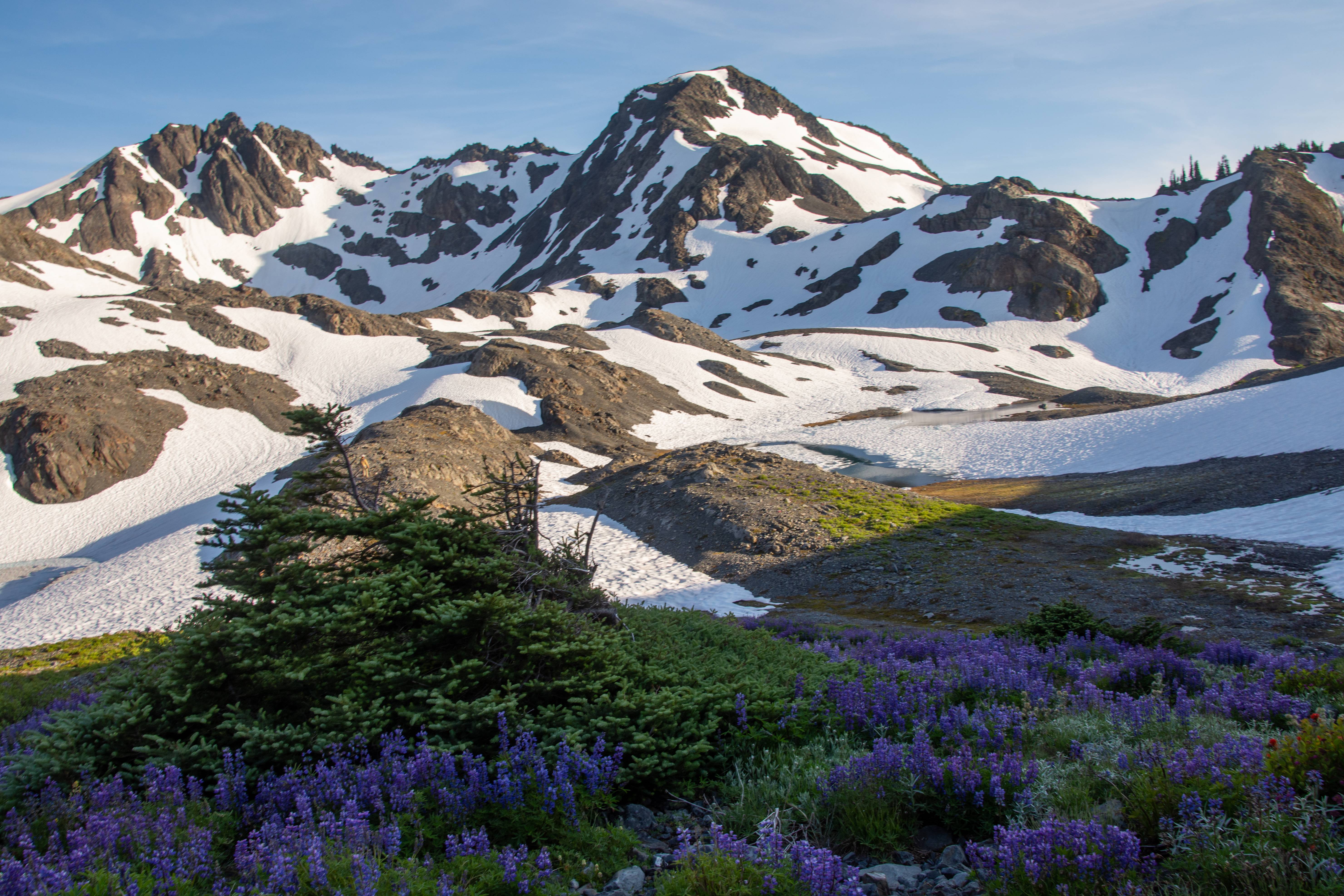
Looking back to the peak, col and snowfields we came down from.
View from my tent.
Do we have to start walking?
Walking down a meadow-y gully
We completed walking down a maze of ledges and cliff bands to the basin floor and looked for a spot to cross the stephen lake outfall. We founded a very braided area that was only 2-3 feet deep making the crossing a success.
Next we climbed up some steep heather slopes and had a few class III and IV moves before reaching a bench where we began traversing Stephen peak. We all finally got to see Stephen's Comb. In this photo we will be shooting to just left of the spires where you can see the tops of little trees.
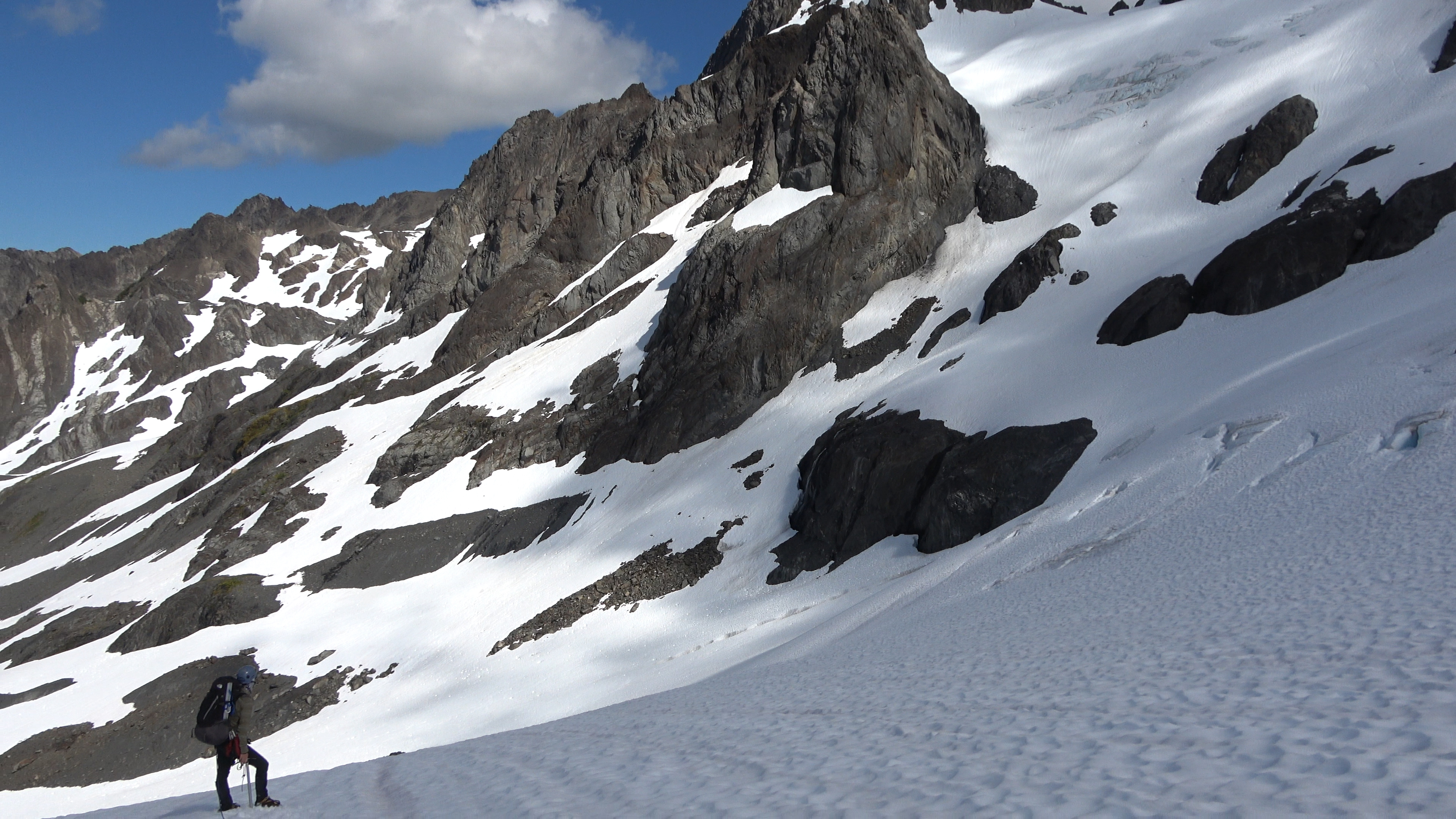
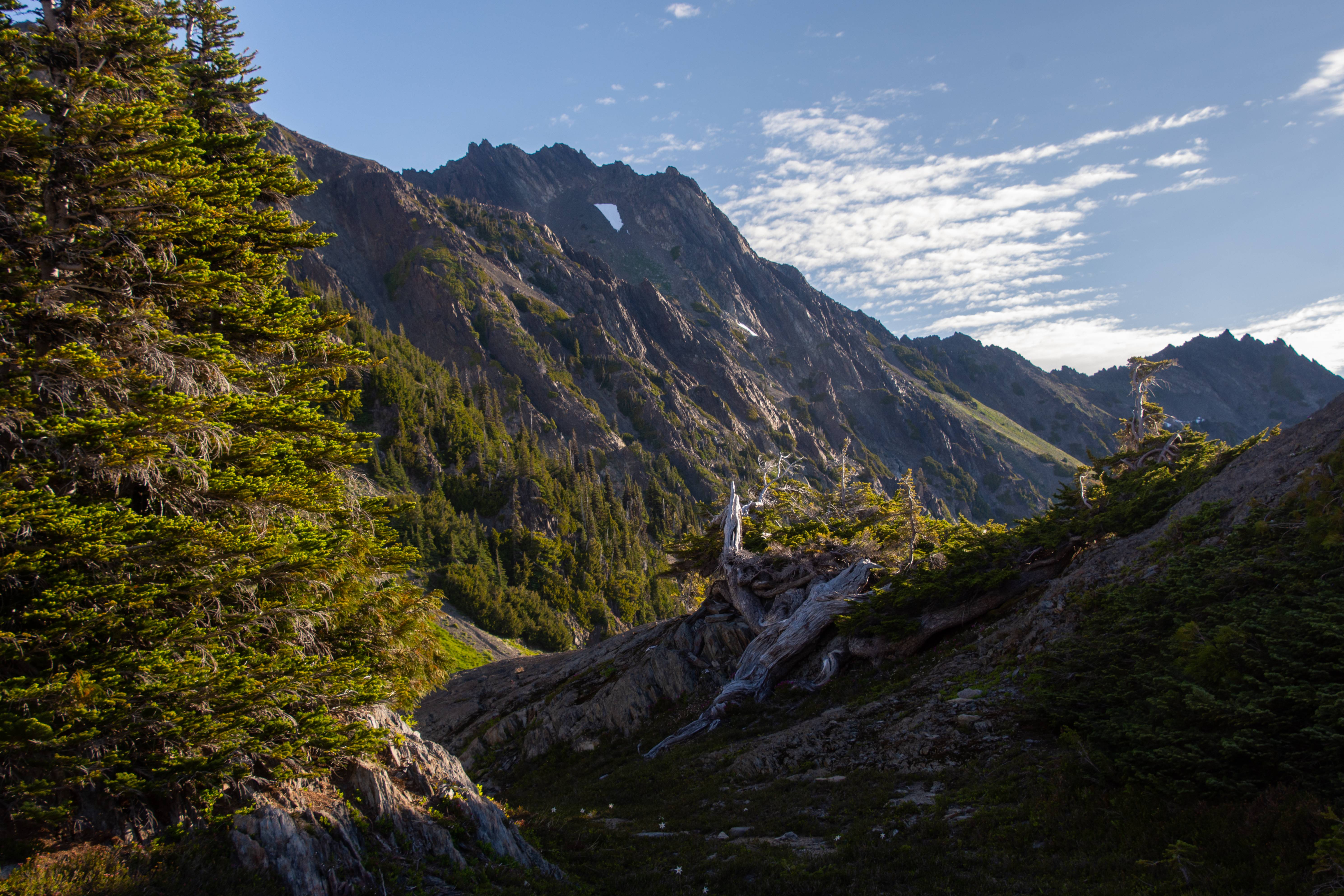
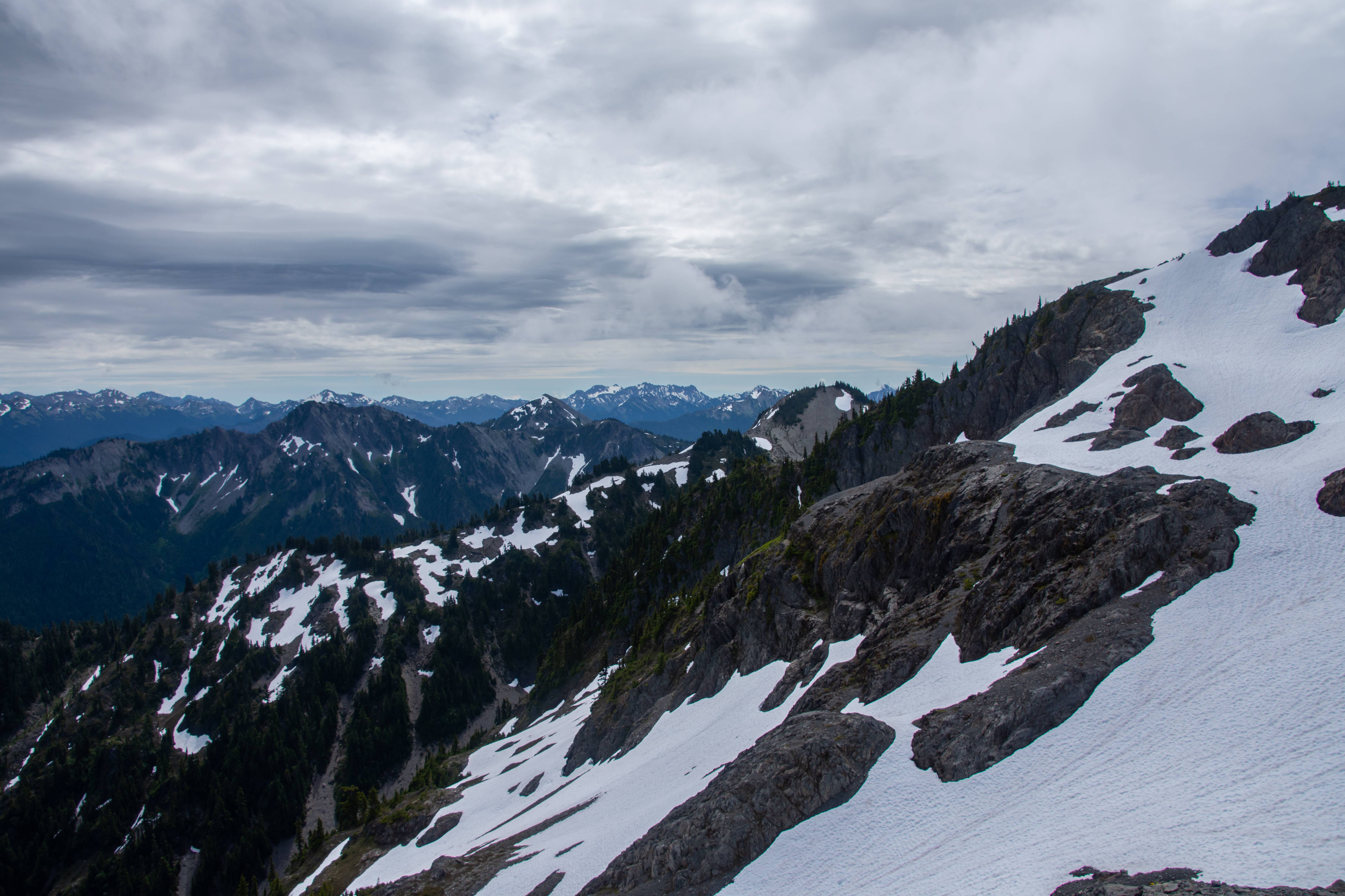
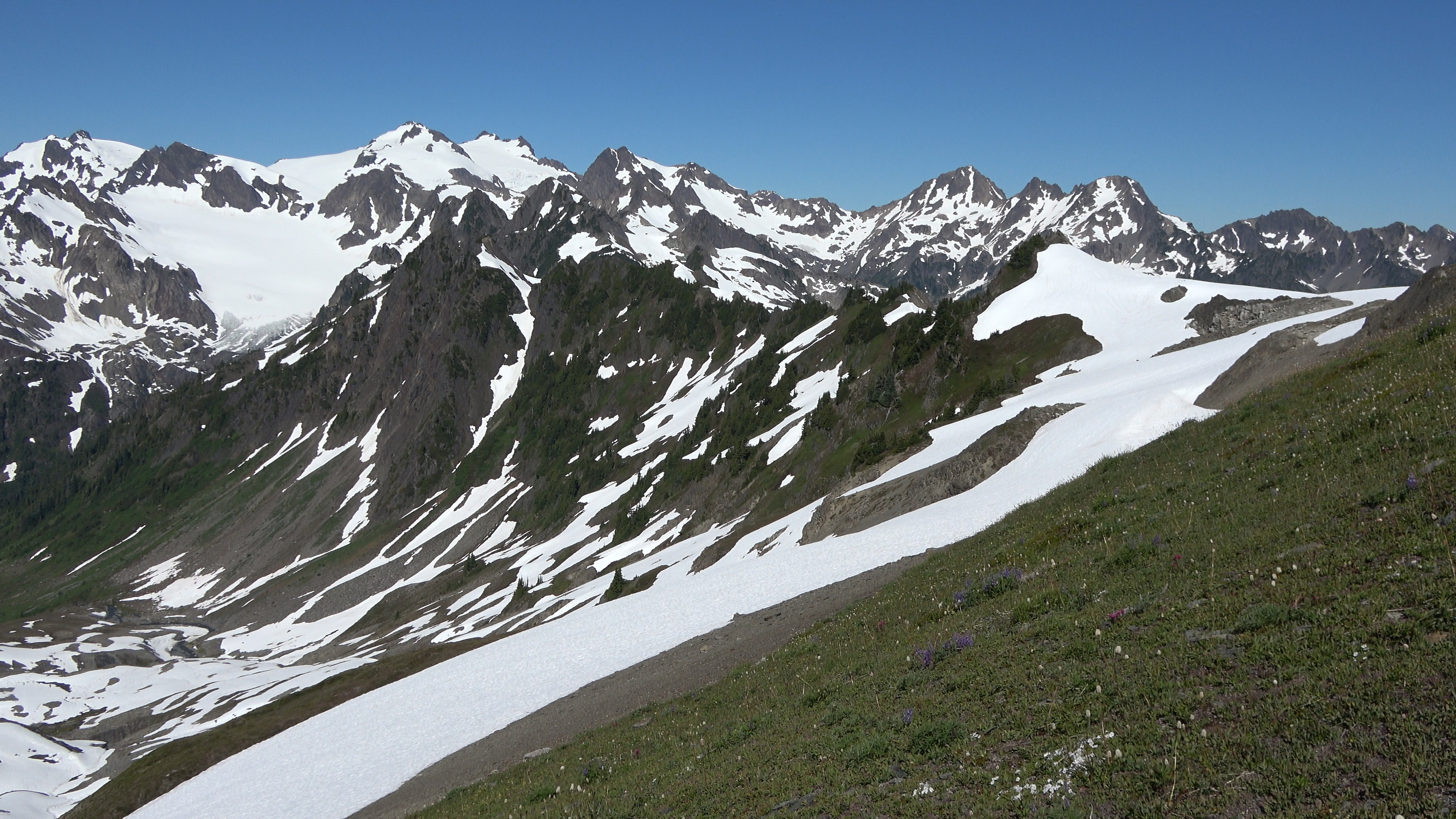
View from the bench looking off to god knows where.
Our view of Ferry Basin. It cliffs out and drops fast behind those trees so we ridge walked (left) off camera into the 2nd Catwalk. This one I didn't enjoy as much as the first one because of the heavier brush and several nasty gully crossings.
2nd Catwalk. We are being punished for wanting to see beautiful remote sections of Olympic National Park. A fair trade though IMO.
DONT. FALL.
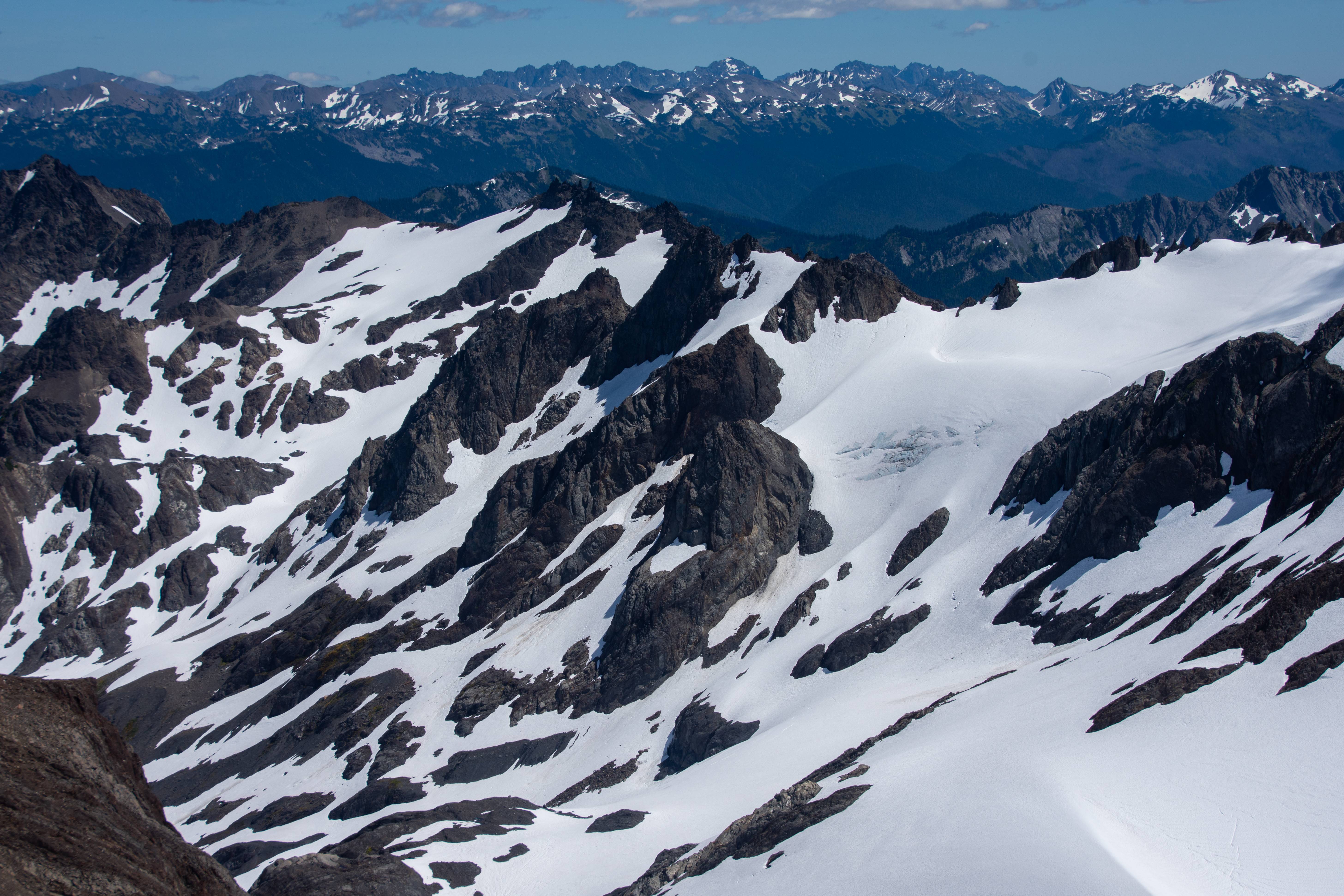
Can't remember the name, Aaron knew though. But this is a view from the 2nd Cat walk of a mighty glacier on Olympus. This one is supposedly 200-300 feet thick, the thickest glacier in the lower 48 states. This suprised me given how crazy big some of the glaciers are on Baker, Rainier and the Picketts in North Cascades National park. They don't call her Mount Olympus for nothing I guess.
We got off the 2nd cat walk and walked down to a small lake where we had lunch before punching up further into Ferry Basin.
We made it to camp and 60 feet away we had our own little waterfall!
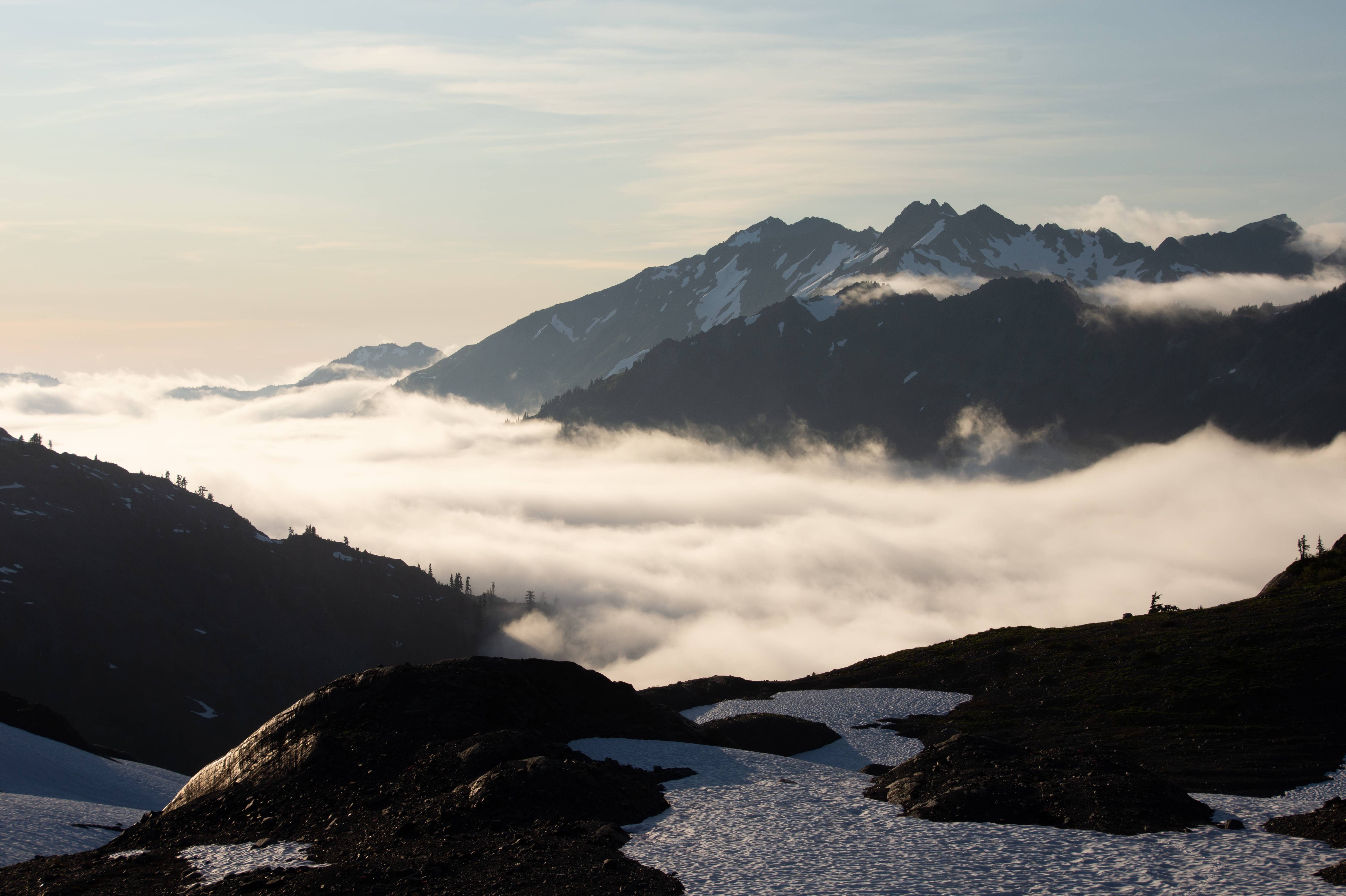
A nasty wall of clouds rolled and socked us in the rest of the evening. Extremely dewy and wet. As the clouds/fog rolled through at 15ish mph I can head the moisture hit the rain fly like it was actually raining. The next bit of the traverse (The actual Baileys) we would like an AM start as we aren't fans of the heat and being out on the snow during the day is like a desert. There will be no AM start though as the clouds stayed...
Socked in.
---------------
Day 5 | REST DAY
Random exploring without a pack.
---------------
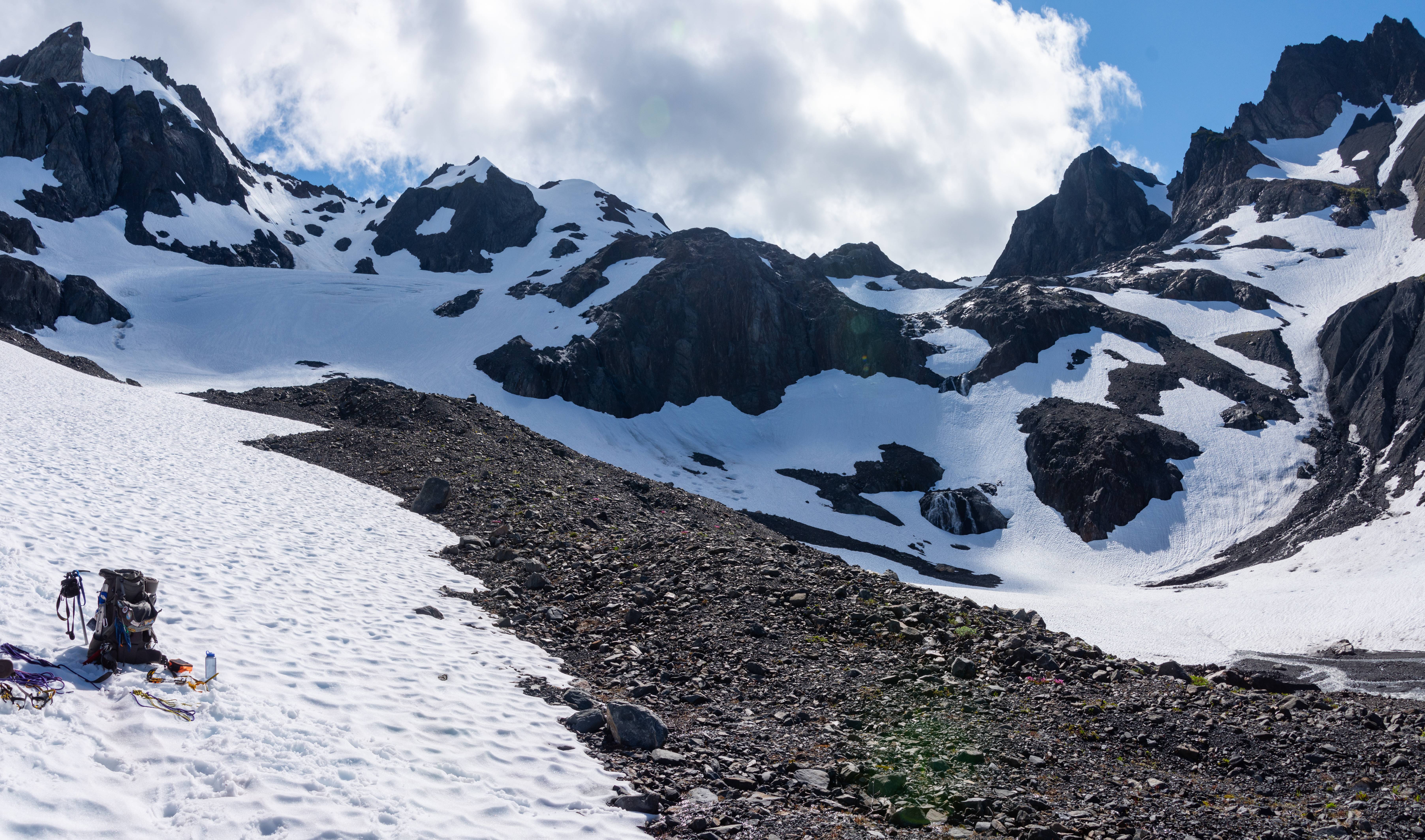
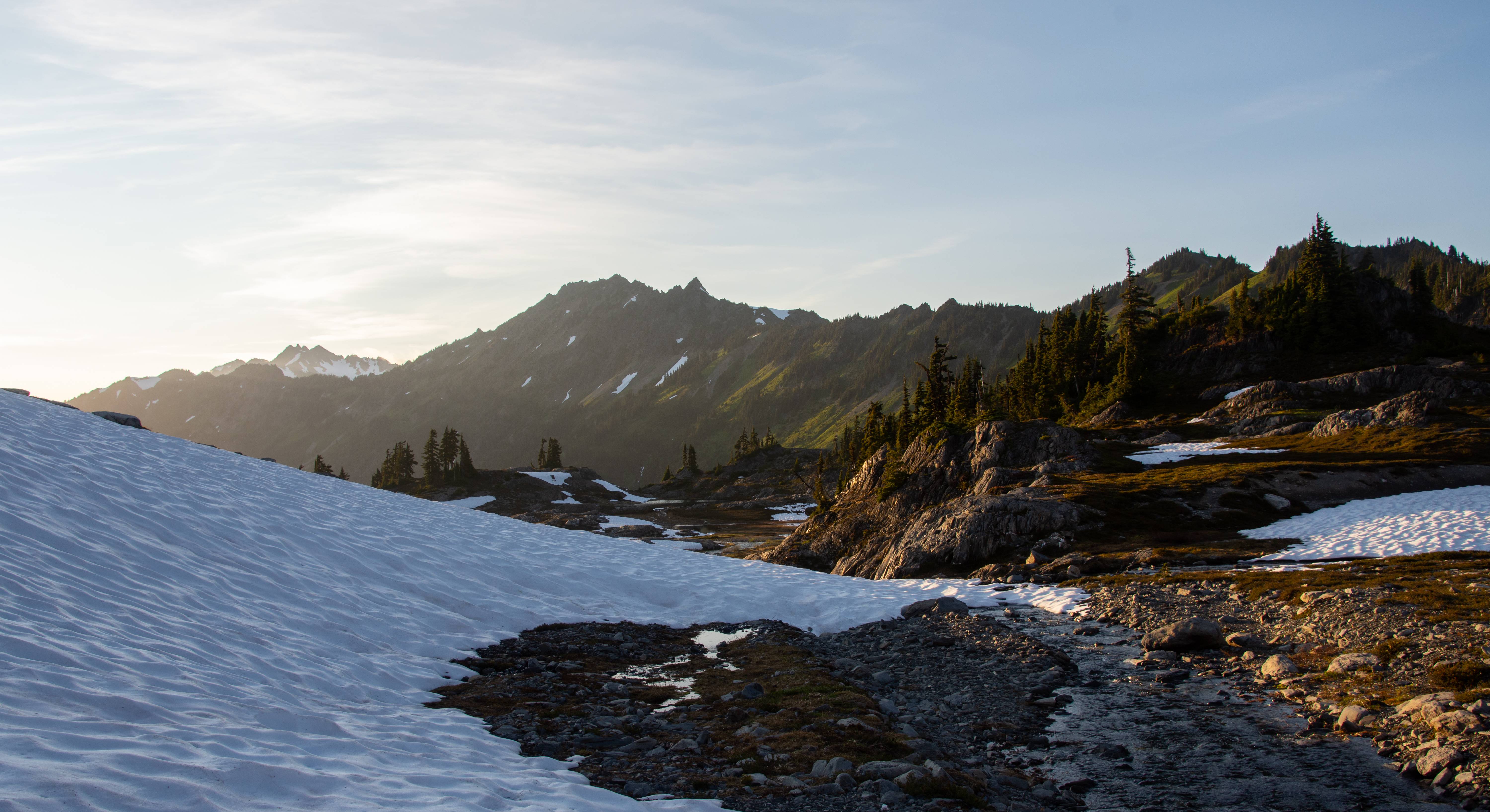
This area was my favorite camp of the trip.
We stayed socked in most of Day 5's morning so we pulled the plug and used our rest day for Ferry Basin, something we were hoping to use at Dodwell-Rixon Pass. Oh well. The clouds cleared a bit but there was a nasty inversion and as the sun rose it started picking up the clouds and filling up the high country again. For the traverse we needed visibility so we could see what the hell we were doing. EXPLORE TIME!
Sweet basin bro.
Olympus creepin'
Now that it's the evening the inversion has chilled out. This made us nervous for our AM start for Day 6 though. We didn't want the clouds to stick around and then rise again on our traverse. We were going through our food fast though and had to do it no matter what.
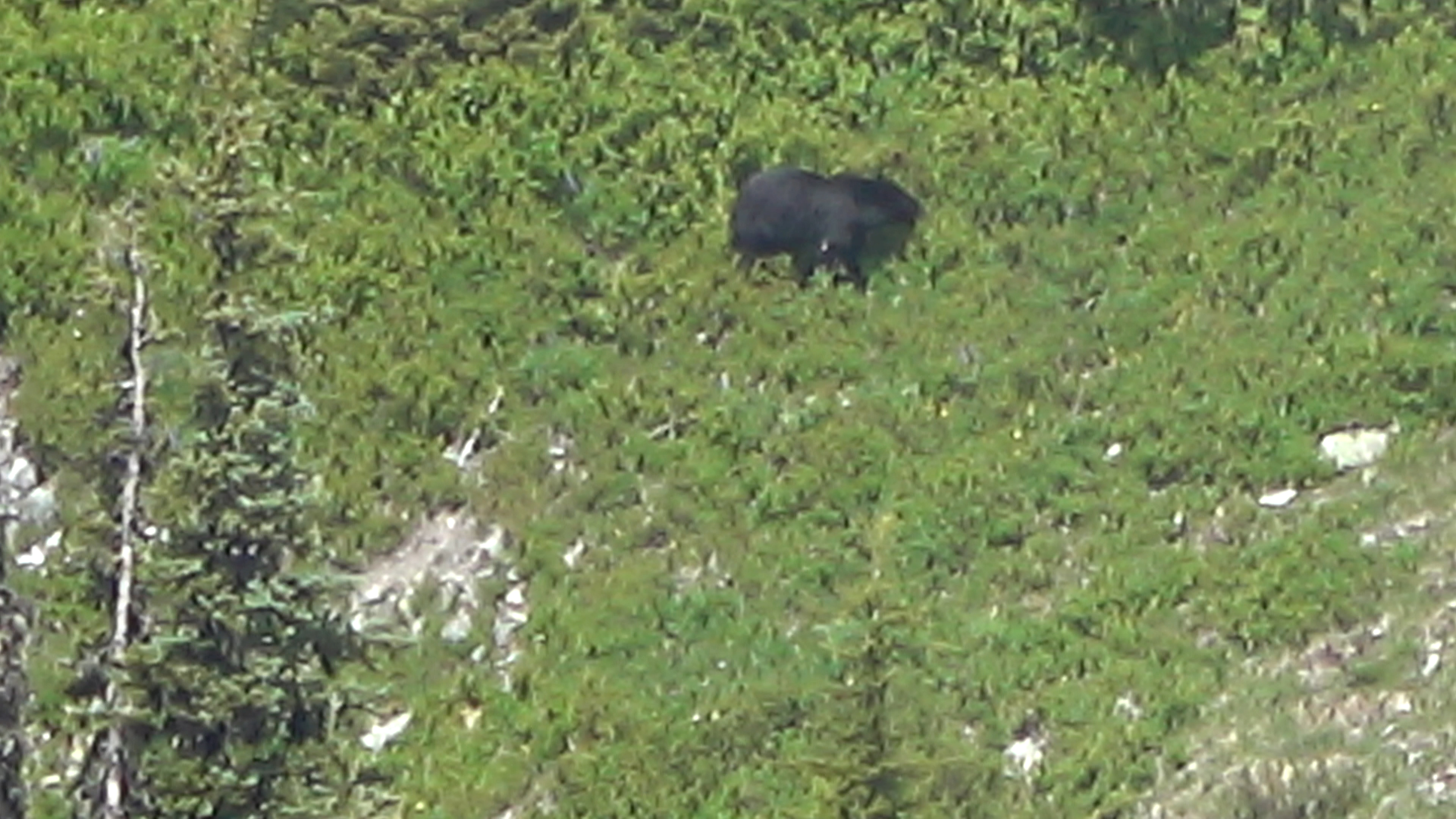
Bear almost 1 mile away. He is chilling below the 2nd Catwalk. I wonder if he was watching us that day thinking we had mental issues.
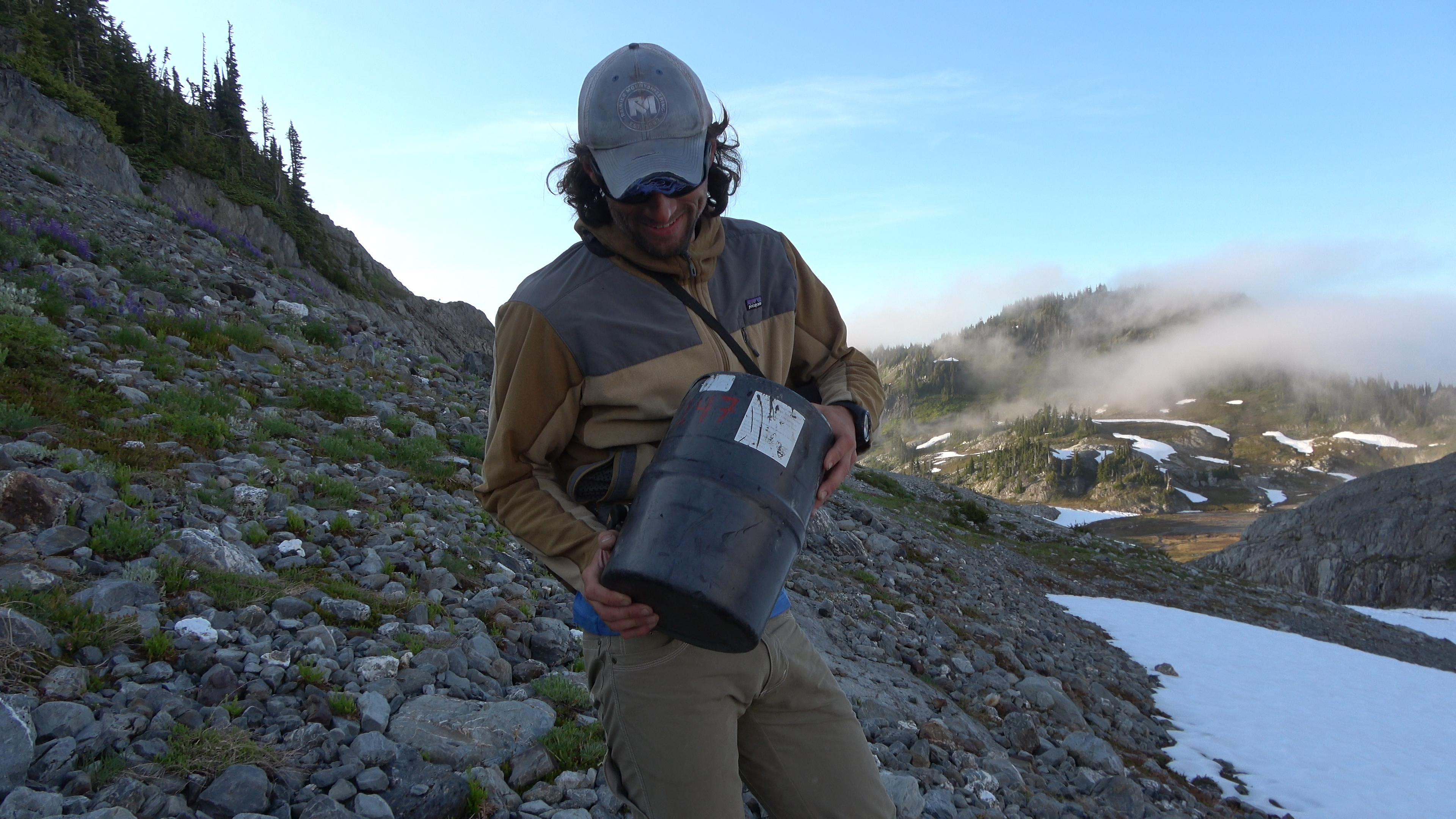
Like I mentioned before, bear kegs are REQUIRED on the Bailey traverse. If you don't have one or bring one the park service will FORCE you to use theirs. Here is an abandoned bear keg Aaron found in Ferry Basin. The Baileys must have broken this man, too hard for him and in a last ditch effort to save himself from further pain he lightens his load by tossing the park service bear keg numbered 147. We set it near our camp in the open and let the park service back country rangers know about it at the end of our trip.
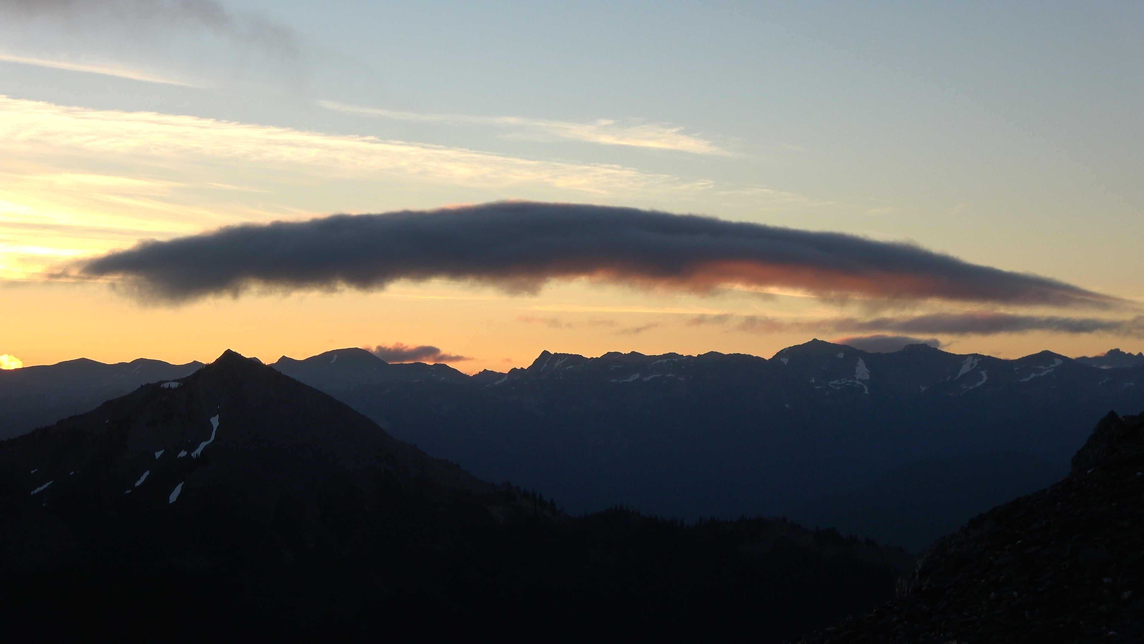
Inversion sunset.
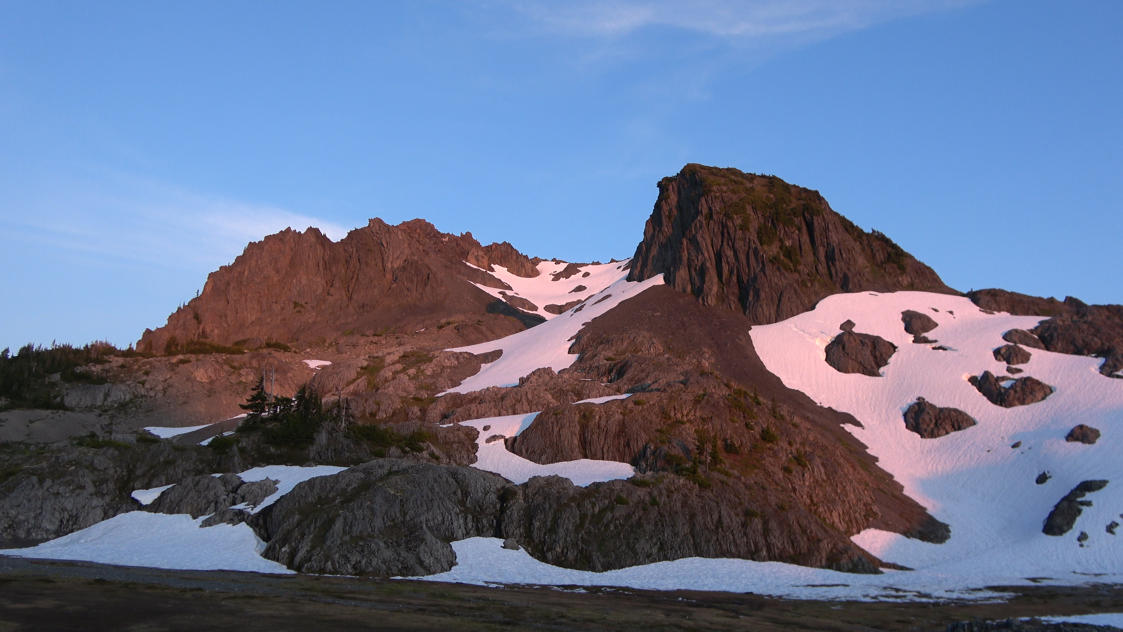
Alpenglow on Pulitzer and Ferry. We will be up in there tomorrow morning.
---------------
Day 6 | Ferry Basin > Mt. Pulitzer > Lone Tree Pass > The Traverse > Bear Pass
5.13 Miles | 2806 feet Elevation gain. 100% cross country.
---------------
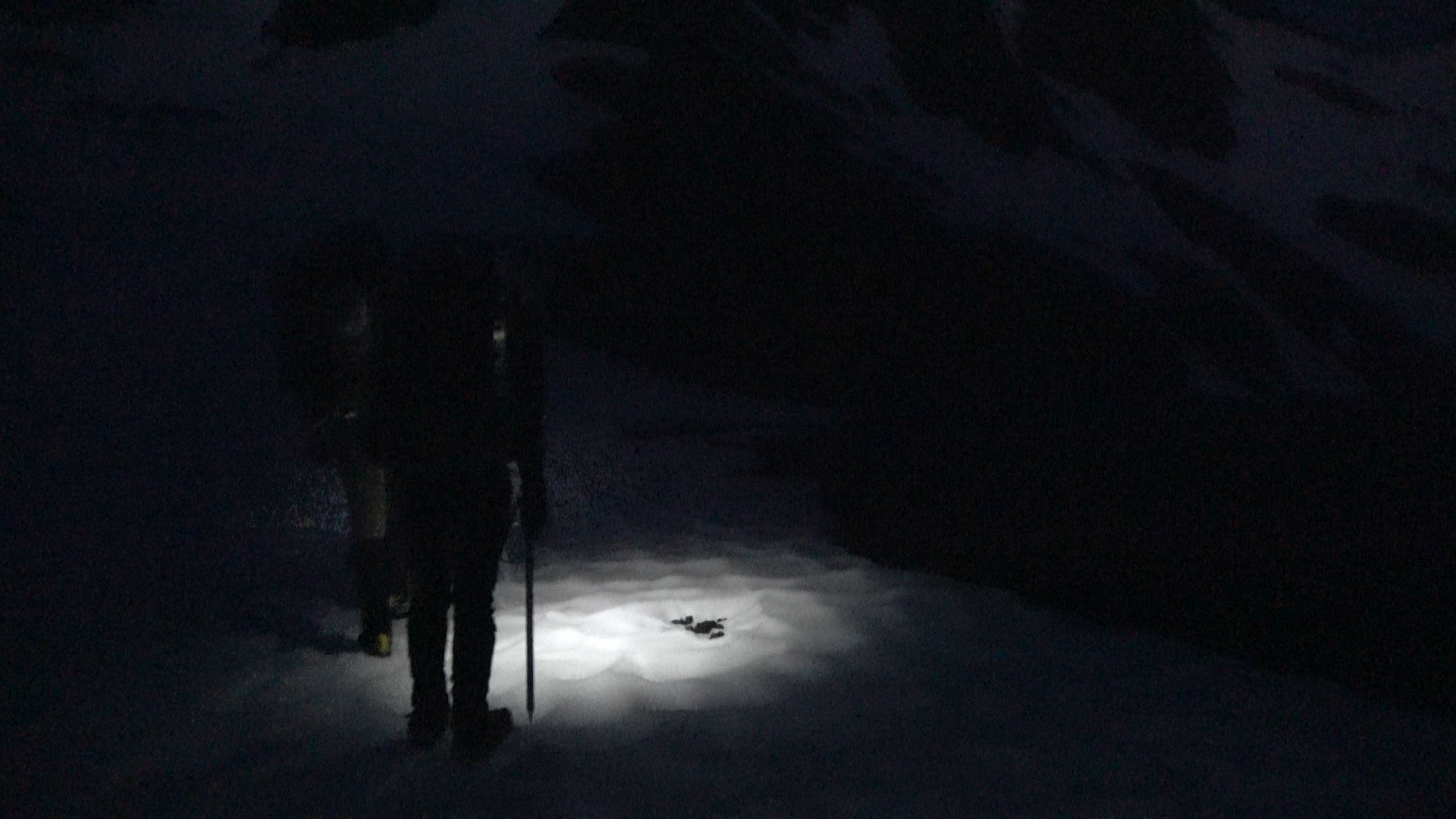
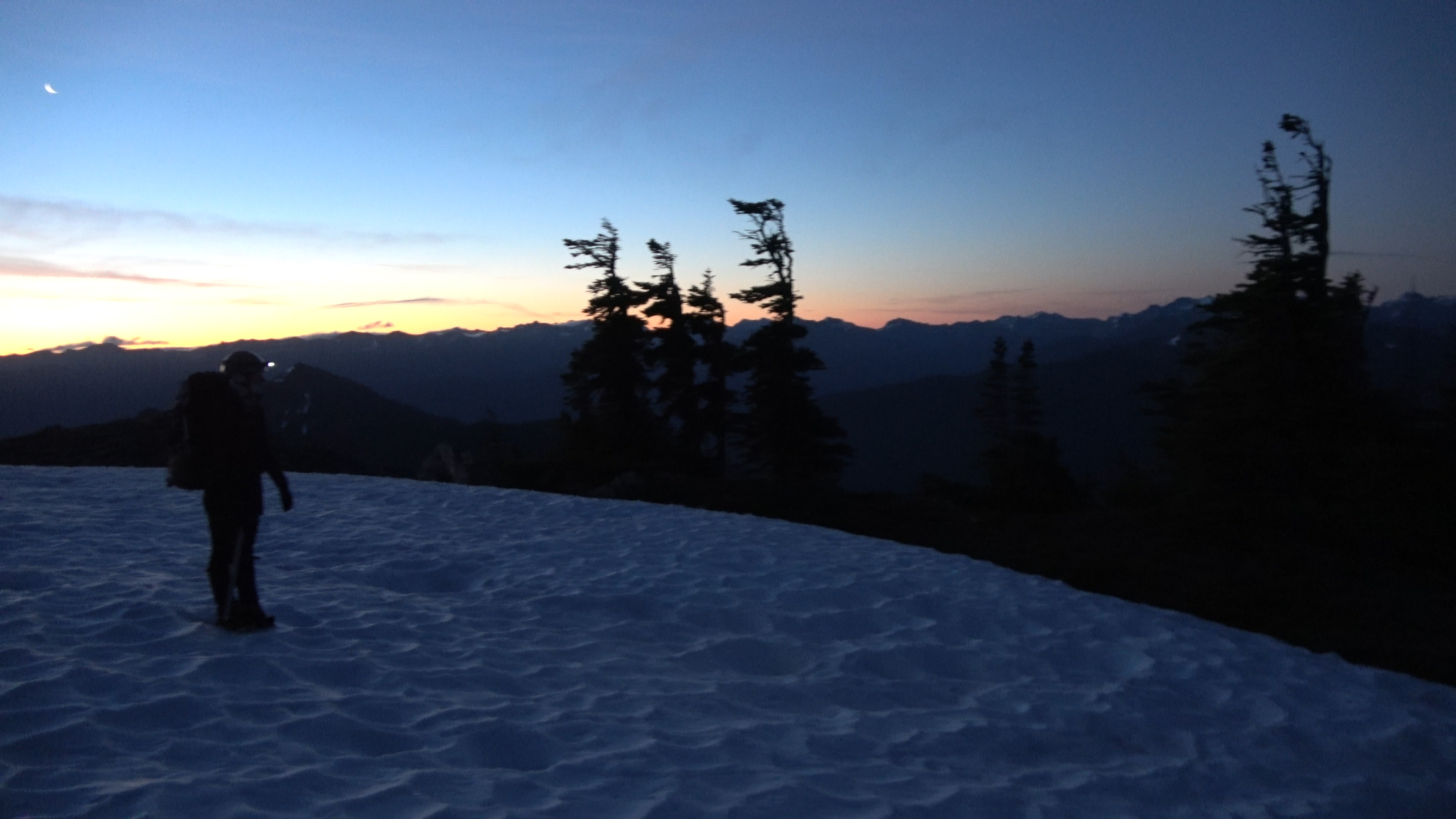
My favorite day of the trip. It wasn't too hard, the scenery was excellent and the alpine start was bad ass. We got up at 3:30 AM and were out with our headlamps at 4AM walking under the milky way. Slowly the horizon began to light up as sunrise came about...
Bear shit up high on a snowfield.
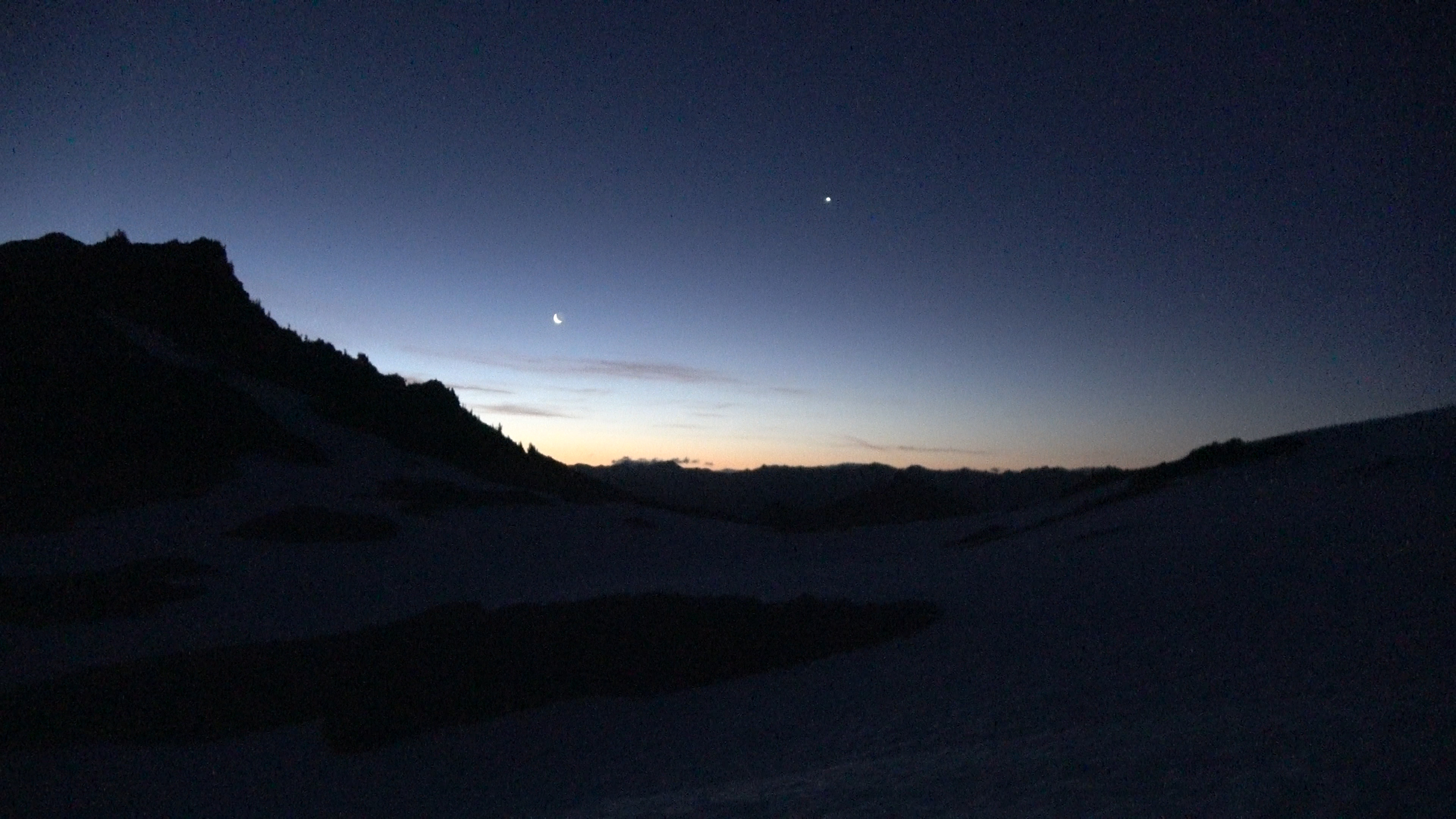
Sunrise and... MOON RISE!?
Climbing up steep snow in the morning light.
The cool air felt amazing after the last few days of sweltering weather. The heat will come in hard later in the day though...
UFO cloud.
We got around Ferry, Pullitzer and another peak I forgot the name of to Lone Tree Pass. We heard an elk bugle here, bellowing up from the dark valley... In early july. We sat for a bit waiting for another shot. But the elk remained quiet. So we continued.
Awesome sunrise! On the other hand the nice cool air was nice while it lasted
Lone tree pass is down on that ridge where we heard the elk. We came from the peak top on the top left of the photo.
The last photo was taken from the center-rightish of this photo from the rounded snowy spot. We walked through the high shelf onto these rocks where we got rid of our crampons.
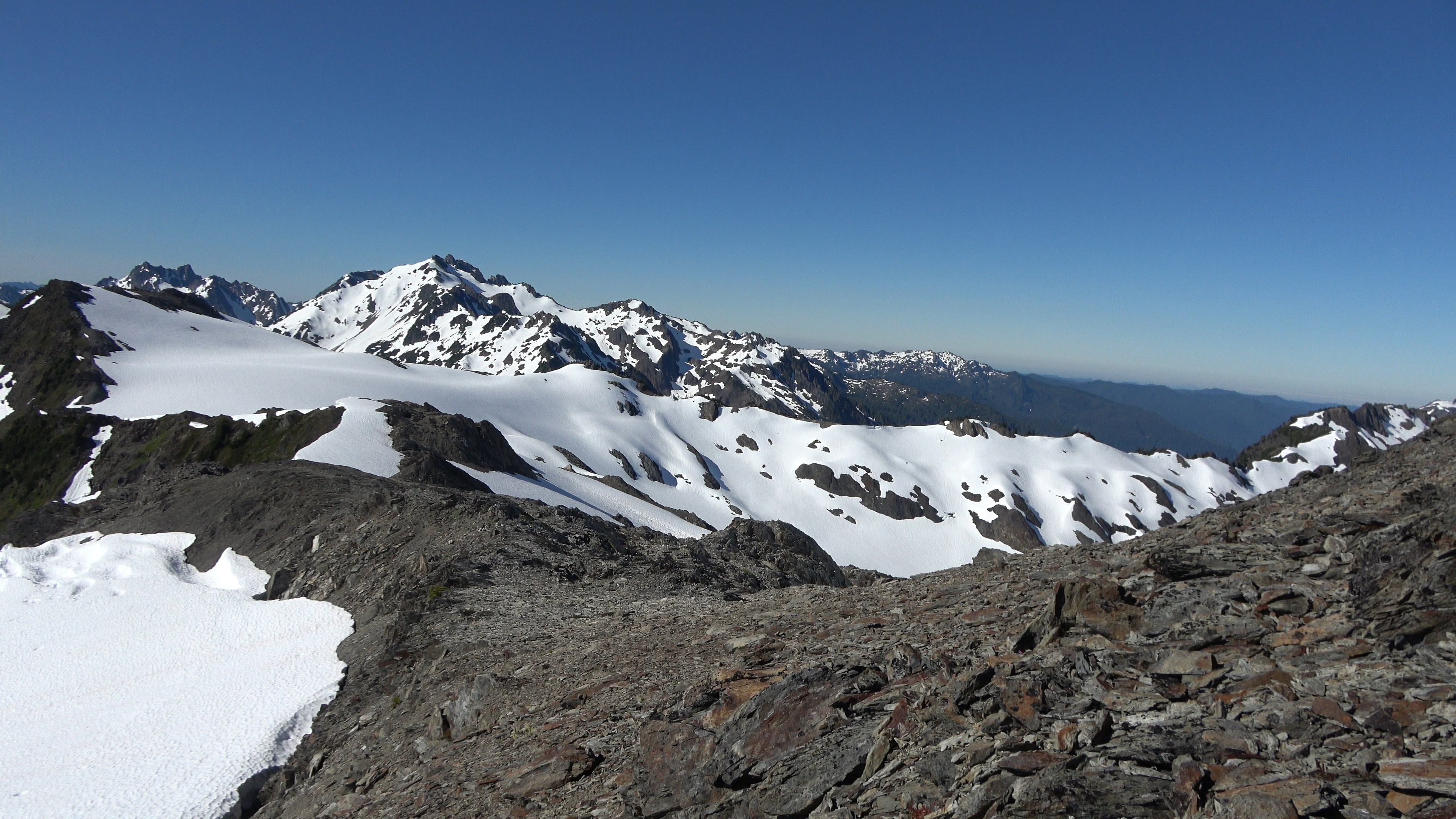
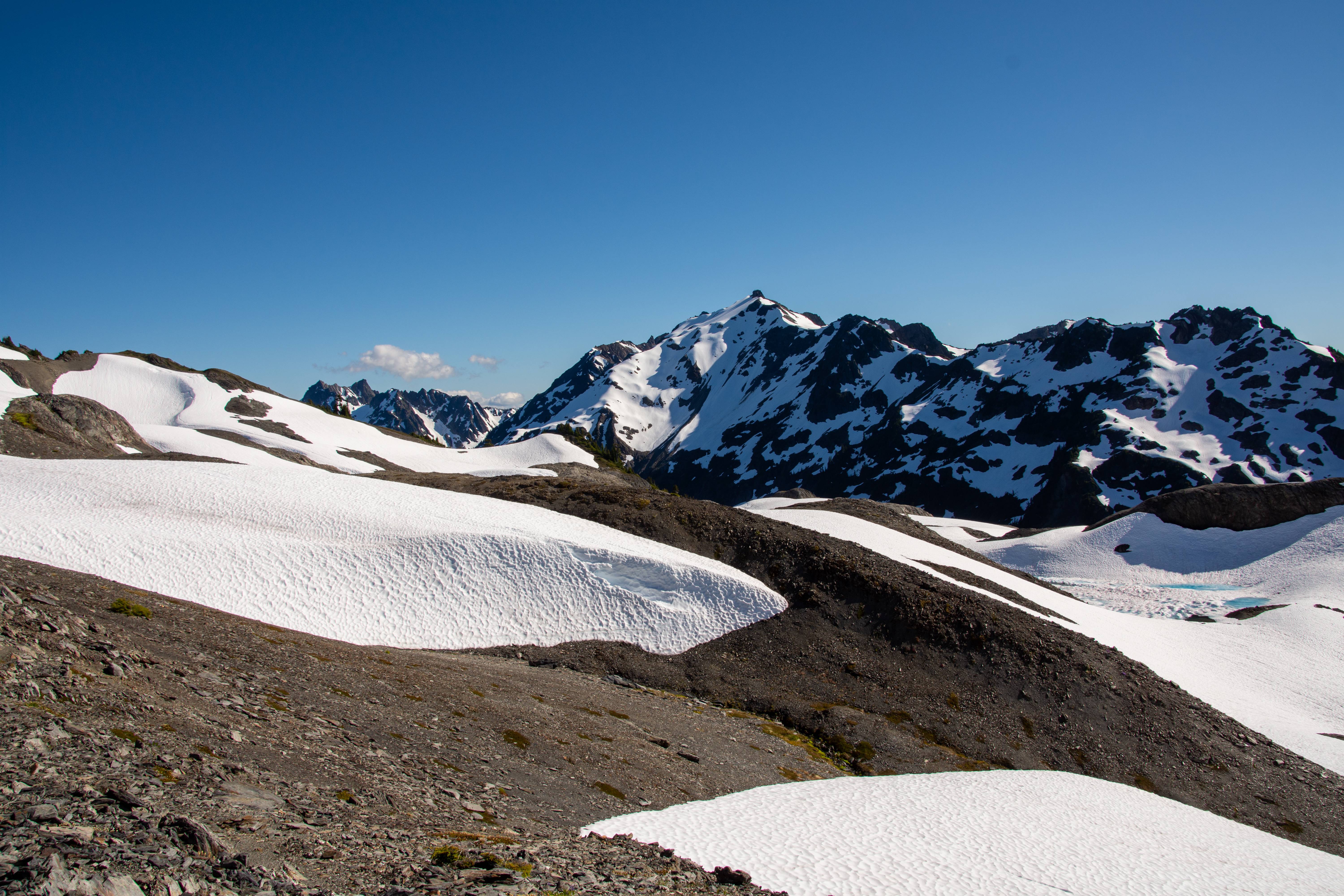
Lots of work left to do. Ridge walk to the close high point furthest left of center camera. Mt. Queets in the distance.
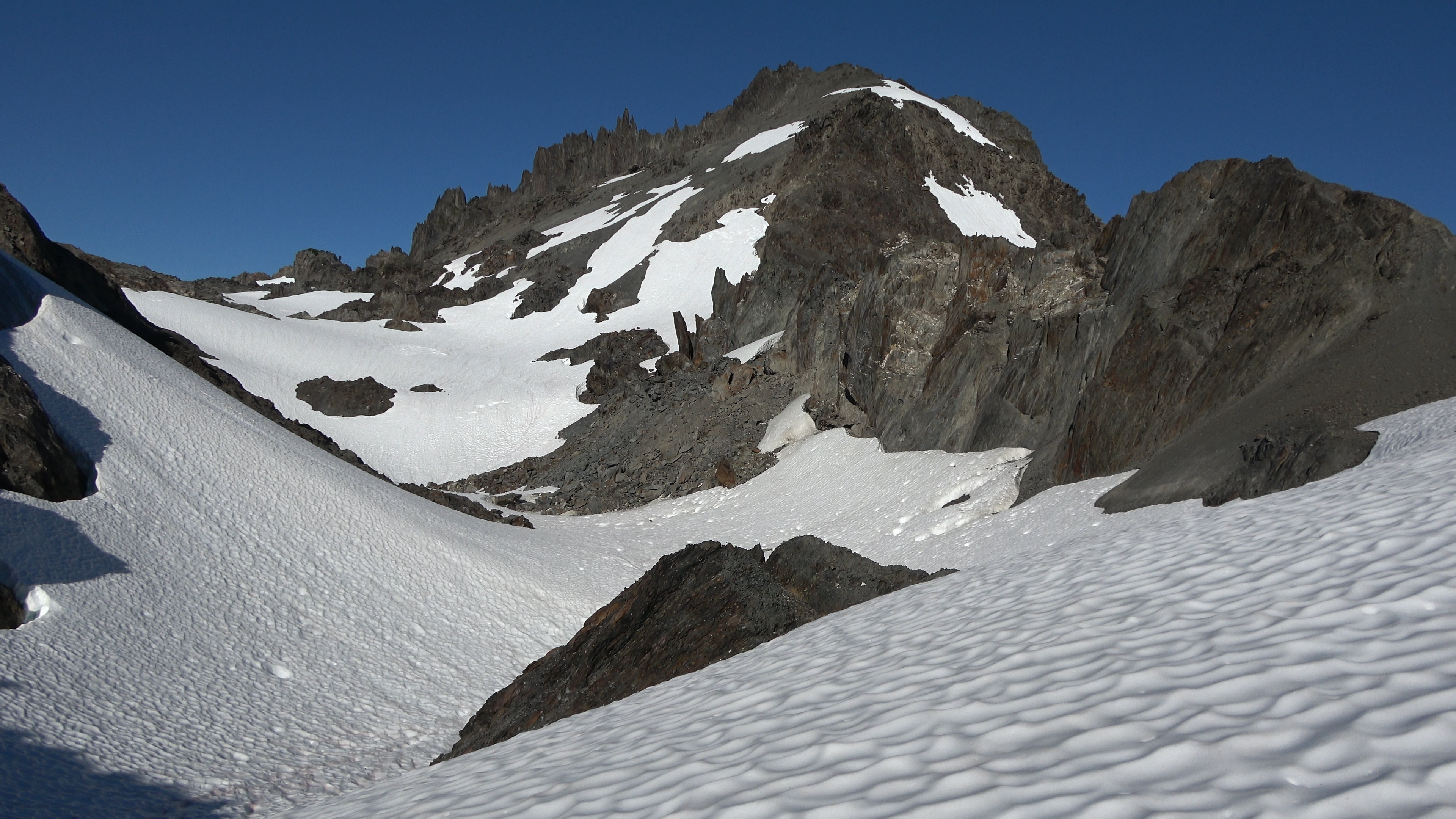
Cloud Comb. We will walk through the center and up the snowfield to off camera left of the spires.
Up on a ridge. We will have descend a steep gully to the ridge below on the left. Nasty cornice on left.
Lots of snow still mid-july in the Olympics.
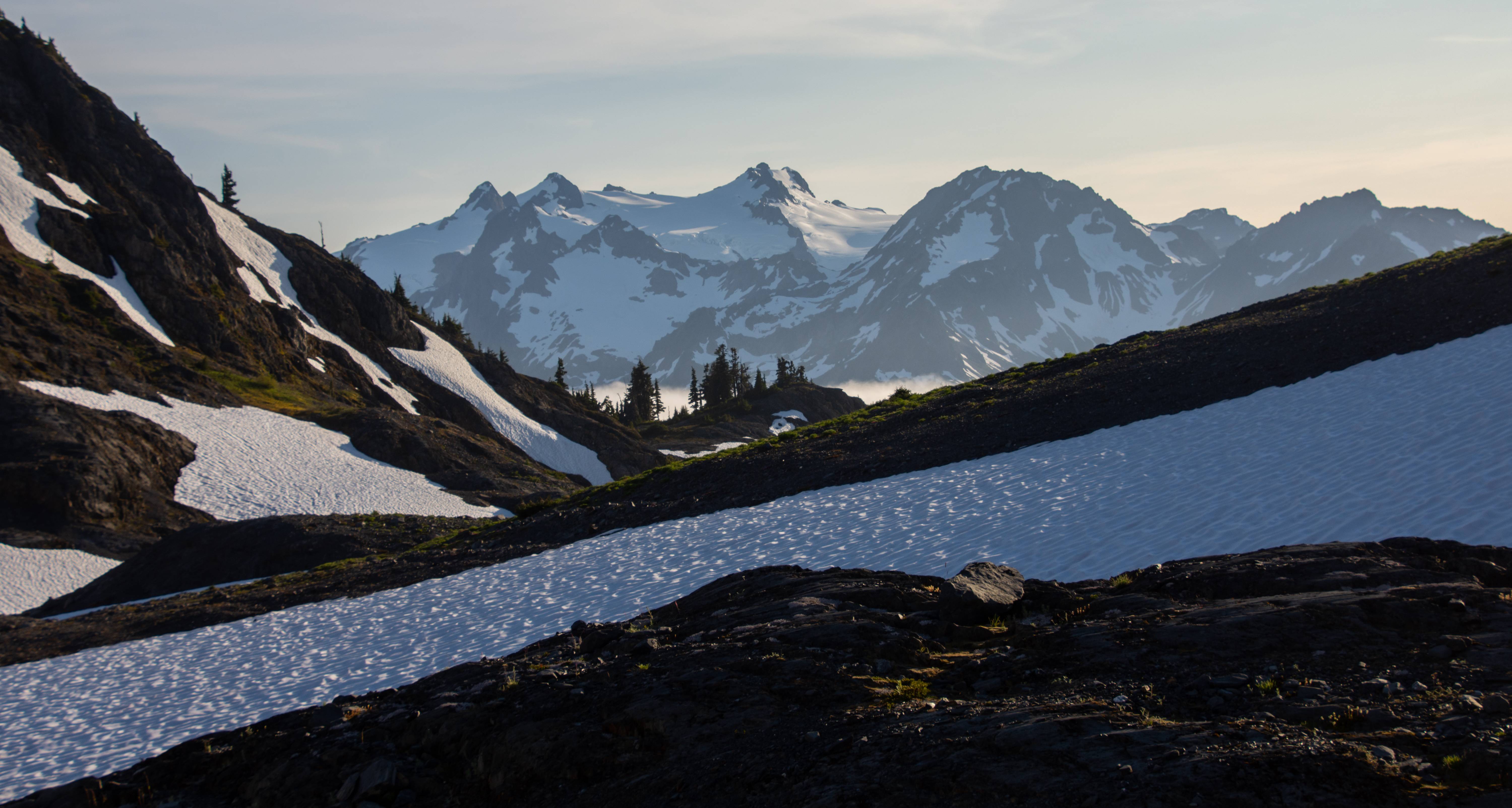
We made it to Bear Pass and Dodwell-Rixon is in sight! Still lots of snow. Going to be tricky finding a camp spot. Not the biggest fan of camping on snow.
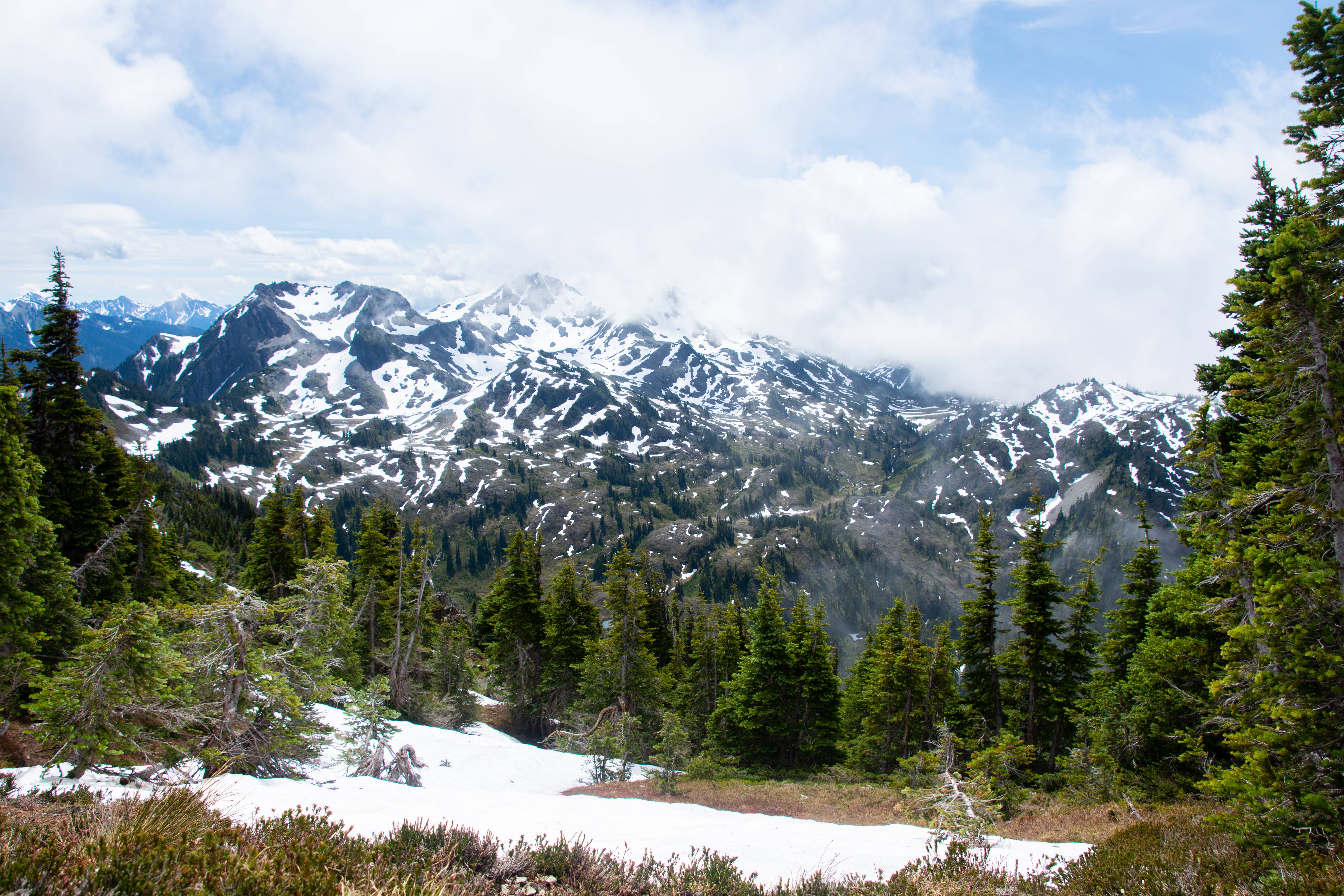
Meadows and Mount Olympus massif. Some people have not done Bear Pass and continued on to Olympus and made a loop of it. Knowing how miserable the snowfinger and Elwha basin the next day will be I think next time that will be a better option. Staying high.
Baby version of Sahale Arm in the Cascades.
Olympus massif looking thicc
Near camp.
Mt. Queets and a nice pool.
Sunset.
Nightsky. Didn't focus it correctly. Had several camera mishaps on this trip that I'm still sad about.
1. This shot wasn't in focus but looked in focus through the viewfinder so the whole timelapse is kind of out of focus.
2. Night sky timelapse before our AM start just vanished. Like without a trace like it all got deleted.
3. Half of my sunset timelapse from night 5 vanishes as well... Maybe it's time for a new SD card. One that I can trust lol
But that couldn't be it because I went on a 6 day eagle cap traverse after this and all the photos stayed. Maybe my USB cable transfer is bad? I'm still mad about it. F****** f***!
---------------
Day 7 | Dodwell-Rixon Pass > Elwha Snowfinger > Elwha Basin "the maze" > Chicago camp > Hayes River
15.6 Miles | 2206 feet Elevation gain & 5864 feet of Elevation loss. 80% cross country.
---------------
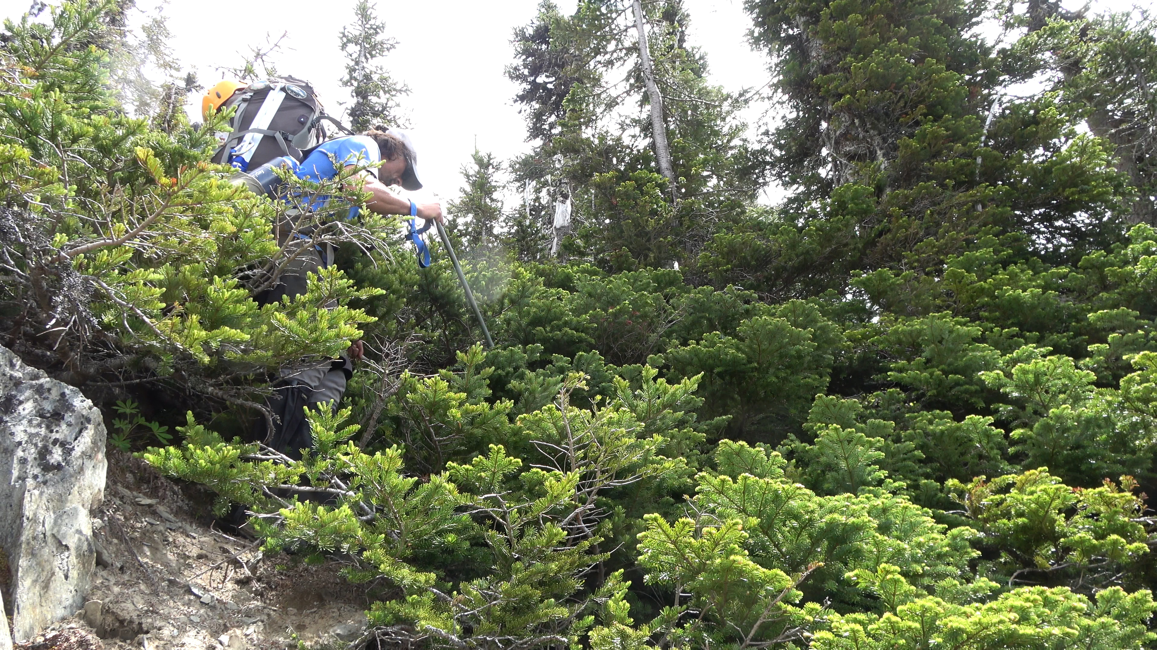
This was the 2nd hardest day of the trip in my opinion. The hardest being day 3. Though not as cardio tough it was slow going. You really had to watch your steps and the bush whacking, though not too bad, was very confusing in the maze (Elwha Basin). Truly a cognitive day.
Good morning Olympus. We leave camp and head to Dodwell Rixon Pass.
Looking good so far...
Ah crap. The Elwha snowfinger is in shambles... The old guard of WA backpackers said that in the 60-80s the snowfinger would be present year round and extend all the way to the maze. Making the canyon a quick and easy endeavor. Now due to climate change or whatever powers that be the finger is disappearing...
Side hilling the canyon down. Don't fall.
Less exposure! yay! Hopefully that snow up ahead continues on for a bit so we don't have to side hill! (It didn't.)
Terrain is now getting a bit more tolerable as we enter the last .5 mile stretch of the finger. Sarah checks for overhand before stepping over and dropping the 5 feet down off the snow onto rock.
Well I was wrong. It got really bad again and we had to side hill up and over through steep and slippery grass. Not fun. I gave up once we got down and figured my feet will just have to deal with being wet the rest of the trip and I walked on the braids and through the stream sometimes up to my crotch. I covered ground fast this way but I still had to wait for Aaron and Sarah as they were being smarter about it and avoiding getting their feet wet. Oh well, if my feet get all ugly pruned and destroyed they can. I ain't no foot model.
We made it! ELWHA BASIN! Our troubles weren't over. They don't call this basin the maze for the hell of it. We knew where we had to go but it still took us two hours just to find a way through the thick slide alder. It was hot and actually kind of frustrating as we had to make time. We would have to hike out a day early because we were going through food way too quickly just trying to keep our energy up. For instance sarah's fit bit thing said on Day 3 we burned anywhere from 5-6000 calories.
Once we punched through and crossed a deep stream we found the trail. WE did it! We have completed the Bailey range traverse. Now we hauled ass to Chicago camp to have lunch and then push as far as we can after that.
My friend I startled. He likes berries.
We ate at Chicago camp where we saw a group of hikers who we overheard making fun of us lol. Never change washington.
Onward the push went until we decided to camp at Hayes river where I actually met one of my 3 subscribers on youtube! Robert was awesome and made a fire for us as we set up camp. You are awesome robert!!!
---------------
Day 8 | Hayes River Camp > Whole Elwha Drainage > back to vehicle
24.05 Miles | 3581 feet Elevation gain & 5020 feet of Elevation loss.
---------------
I didn't take any photos but a few on this grind of an exit. I ate the last of my food (one idahoan mashed potatoes) for lunch and continued on walking. The road walk back kind of sucked. My feet were already aching bad and the compact dirt road and then asphalt didn't do me any favors. I took an ibuprofen to help shut it up.
Sweet bridge park service. We crossed over the Elwha, yes look how much it grew since the snowfinger!
When we got back to the vehicles I had a strong urge to go get a burger at my favorite restraunt in Port Angeles called Coyote BBQ and Pub. They are closed on Mondays though... It was a monday. I got mcdonalds instead which gave me more pain a few hours later than all of the Baileys did lol
Doing this traverse again in 2022 with a few modifications.
")


")