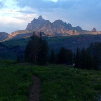
Bob
Trailmaster
- Joined
- Mar 3, 2013
- Messages
- 4,762
Total distance covered was about 62 miles……The complete Teton Highline (Crest) route, not the shortened Tram ride route.
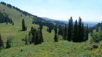
Day 1 - Drove to the parking area for the Cascade Creek trailhead on the Ashton-Flagg ranch Road. Started at the east end of Lake of the Woods on a trail less section. This was an immediate 1000 ft uphill start to the first camp at 4.2 miles. Our first camp was next to a small pond surrounded by willows. We took about 4 hours hiking through not to thick timber.
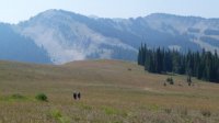
Day 2 – Hit the 008 trail from Berry creek a short distance from camp. Saw a group of 10 hiking near this junction. Stayed on trail from here past Jackass Pass and towards Conant Pass. At Carrot Knoll we dropped off trail into Grizzly Creek headed for a trail on the South side of Young’s Point…. It’s not there anymore. No real trail out of Red Canyon either, looks to be abandoned until the junction of the 155 trail. A decent trail all the way to our second camp in North Bitch Creek. Passed moose and grouse along the creek. 8 miles today.
Day 3 – Headed up to Nord Pass on trail. A long 1400 ft climb thru scattered timber and open. Dropped into Camp Lk basin, looks to have fish, then to South Bitch Creek, about 1000 ft down. Camped where the trail turns to go up to Dead Horse Pass. 7.8 miles today.
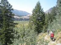
Day 4 – Still on the 008 trail headed up to Dead Horse Pass, about a 1400 ft climb. Trail follows a nice stream thru a Spruce/fir forest, lots of Huckleberries then opens to alpine. Dropped into Badger Creek, 1000 ft down. Met four horsemen coming up, not very friendly. Headed up to Green Lakes, saw two more horsemen farther up the trail towards the pass. Passed two hikers who said they were going to Lake Solitude by that night….I thought good luck that’s a long way before dark. Never saw them again. Camped by a small unnamed lake in Granite Basin after 7.9 miles. Had about 4 hours of rain early morning.
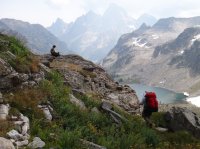
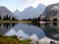
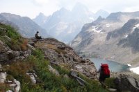
Day 5 – After a couple hour rain delay, headed out off trail to the head of the cirque Leigh Cyn, great views even if smoky. Had an easy contour around Littles Peak at about 10,200 ft, wildflowers really nice here. View to backside of Teton trident awesome. Crossed a narrow rocky backbone and across a couple of glaciers to the head of a ravine to drop down to Lake Solitude. Met a family of mountain goats who were very photogenic. The chute to Lk Solitude is steep and has a lot of LOOSE rock, we were glad to be going down it. Views to Lk Solitude and down Cascade Crk are great. Headed on down to the South Fork junction, best huckleberries were here…you could smell them. As expected the hiker traffic picked up here, pushed on to Hurricane Pass and camped just out of the park at the first crest near schoolroom glacier at dark. 10.9 miles, the elevation gains were about +900 ft, -2,600 ft and +2600 ft for the day.
Day 6 – Short day, 3.2 miles and dropped a 1000 ft. Headed for the Basin Lks in Alaska Basin. A lot of people camped at Sunset Lk, which we didn’t think much of (for all the hype). Camped on the west side of the largest Basin Lk. A really good swimming rock and WAY beautiful area. Did a day hike to Static Pk and relaxed a bit.
Day 7 – Lots of small up and down elevation changes. Crossed Death Shelf, beautiful hiking. Camped at Fox Pass after 5.3 miles. Had a pair of owls staying near camp and buzzed us most of the night.
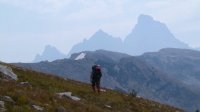
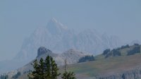
Day 8 – Passed Marion Lk, was nice. Cut up the Game Crk trail headed for the Moose Lk Basin. Trail was very obscure but had some of the best views of the Trident. Way interesting geology across this plateau. Easy drop-in to the largest lake in the Basin. Not very good campsites so we continued to the junction of the 38a and 3001 trails. Nice camp with running water close. Gained about 900 ft and lost about 1800 elevation in 6.6 miles.
Day 9 – Last day. Hiked up Phillips Pass, a couple of surprise STEEP trail sections. From the Pass to trails end was very nice, scenic hiking. A lot of day hikers, especially to Ski Lk. Ended at the highway after 7.3 miles.
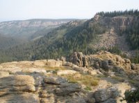
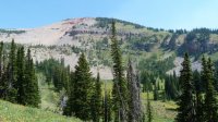
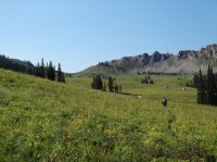
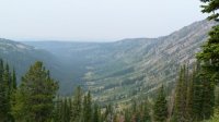
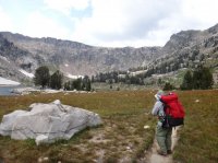
Wrap up – Overall a really good hike, even with the typical August Idaho smoke. September would lend clearer views. Wildlife mostly not there, I suspect because it was hotter than normal, more Marmots than anything else. Not much to fish if you are looking for that. Glacial canyons are huge, but not particularly tough to go up and down. Park trails are like highways, forest trails more direct. More people than I like to see. Off trail can be pretty rough.
Video slide show here, make sure you click HD:
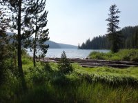
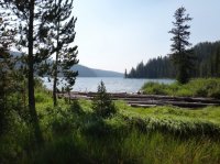
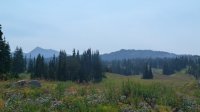
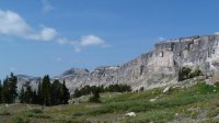
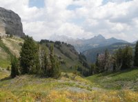
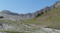
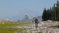
Featured image for home page:
Day 1 - Drove to the parking area for the Cascade Creek trailhead on the Ashton-Flagg ranch Road. Started at the east end of Lake of the Woods on a trail less section. This was an immediate 1000 ft uphill start to the first camp at 4.2 miles. Our first camp was next to a small pond surrounded by willows. We took about 4 hours hiking through not to thick timber.
Day 2 – Hit the 008 trail from Berry creek a short distance from camp. Saw a group of 10 hiking near this junction. Stayed on trail from here past Jackass Pass and towards Conant Pass. At Carrot Knoll we dropped off trail into Grizzly Creek headed for a trail on the South side of Young’s Point…. It’s not there anymore. No real trail out of Red Canyon either, looks to be abandoned until the junction of the 155 trail. A decent trail all the way to our second camp in North Bitch Creek. Passed moose and grouse along the creek. 8 miles today.
Day 3 – Headed up to Nord Pass on trail. A long 1400 ft climb thru scattered timber and open. Dropped into Camp Lk basin, looks to have fish, then to South Bitch Creek, about 1000 ft down. Camped where the trail turns to go up to Dead Horse Pass. 7.8 miles today.
Day 4 – Still on the 008 trail headed up to Dead Horse Pass, about a 1400 ft climb. Trail follows a nice stream thru a Spruce/fir forest, lots of Huckleberries then opens to alpine. Dropped into Badger Creek, 1000 ft down. Met four horsemen coming up, not very friendly. Headed up to Green Lakes, saw two more horsemen farther up the trail towards the pass. Passed two hikers who said they were going to Lake Solitude by that night….I thought good luck that’s a long way before dark. Never saw them again. Camped by a small unnamed lake in Granite Basin after 7.9 miles. Had about 4 hours of rain early morning.
Day 5 – After a couple hour rain delay, headed out off trail to the head of the cirque Leigh Cyn, great views even if smoky. Had an easy contour around Littles Peak at about 10,200 ft, wildflowers really nice here. View to backside of Teton trident awesome. Crossed a narrow rocky backbone and across a couple of glaciers to the head of a ravine to drop down to Lake Solitude. Met a family of mountain goats who were very photogenic. The chute to Lk Solitude is steep and has a lot of LOOSE rock, we were glad to be going down it. Views to Lk Solitude and down Cascade Crk are great. Headed on down to the South Fork junction, best huckleberries were here…you could smell them. As expected the hiker traffic picked up here, pushed on to Hurricane Pass and camped just out of the park at the first crest near schoolroom glacier at dark. 10.9 miles, the elevation gains were about +900 ft, -2,600 ft and +2600 ft for the day.
Day 6 – Short day, 3.2 miles and dropped a 1000 ft. Headed for the Basin Lks in Alaska Basin. A lot of people camped at Sunset Lk, which we didn’t think much of (for all the hype). Camped on the west side of the largest Basin Lk. A really good swimming rock and WAY beautiful area. Did a day hike to Static Pk and relaxed a bit.
Day 7 – Lots of small up and down elevation changes. Crossed Death Shelf, beautiful hiking. Camped at Fox Pass after 5.3 miles. Had a pair of owls staying near camp and buzzed us most of the night.
Day 8 – Passed Marion Lk, was nice. Cut up the Game Crk trail headed for the Moose Lk Basin. Trail was very obscure but had some of the best views of the Trident. Way interesting geology across this plateau. Easy drop-in to the largest lake in the Basin. Not very good campsites so we continued to the junction of the 38a and 3001 trails. Nice camp with running water close. Gained about 900 ft and lost about 1800 elevation in 6.6 miles.
Day 9 – Last day. Hiked up Phillips Pass, a couple of surprise STEEP trail sections. From the Pass to trails end was very nice, scenic hiking. A lot of day hikers, especially to Ski Lk. Ended at the highway after 7.3 miles.
Wrap up – Overall a really good hike, even with the typical August Idaho smoke. September would lend clearer views. Wildlife mostly not there, I suspect because it was hotter than normal, more Marmots than anything else. Not much to fish if you are looking for that. Glacial canyons are huge, but not particularly tough to go up and down. Park trails are like highways, forest trails more direct. More people than I like to see. Off trail can be pretty rough.
Video slide show here, make sure you click HD:


Featured image for home page:


