Teton Crest Trail - August 2017

HomerJ

Member
Joined
Jan 19, 2012
Messages
1,199
Last August some friends and I did our first ever backpacking trip in the Tetons. It was such a fun trip! I had been wanting to do the TCT for many years!

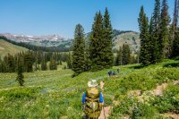
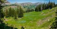
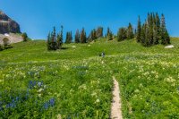
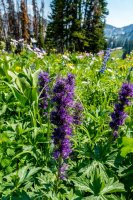
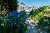
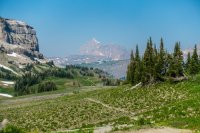
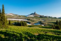
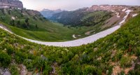
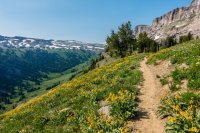
Because of work schedules and vacations days we were only able to do a 3 day trip. We cheated and took the tram at Teton Village and hiked to Fox Creek Pass the first day. There was a lot more up and down than I expected in between the top of the tram and the pass. It was a little over 8 miles to our campsite on the pass. There was still a lot of patches of snow left from the heavy snowfall they got that winter! The wildflowers were spectacular! I'm ready to go back!!!

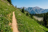
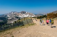
Leaving the tram
DSC04400.jpg

Descending Rendevous Mountain from the tram. You can see the trail below climbing the ridge in the middle.
DSC04401.jpg

DSC04403.jpg

DSC04404.jpg

DSC04406.jpg

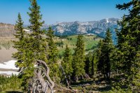
South Fork of Granite Creek
DSC04409-Edit.jpg

DSC04421-Edit.jpg

DSC04423.jpg

DSC04426-Edit.jpg

DSC04429.jpg

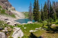
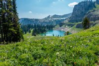
Marion Lake
DSC04430.jpg

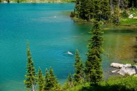
Marion Lake was beautiful! Would have been great to camp here. We took a small lake and one member of our party took a quick dip in the lake. On the climb out of the lake to Fox Creek Pass I was regretting I didn't jump in too.

Swimming in Marion Lake
DSC04437.jpg

Marion Lake
DSC04438-Edit.jpg

DSC04441.jpg
Marion Lake
DSC04445.jpg

DSC04447.jpg

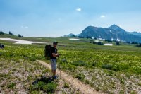
Most everyone was pretty tired by the time we made it to the top of the pass. The pass is over 1.5 miles across with the only water being on the far side. I was in a hurry to get there and find a campsite and kept having to stop and let everyone catch up.

On Fox Creek Pass
DSC04450.jpg

Fossil Mountain
DSC04452.jpg

Grand Teton from Fox Creek Pass
DSC04454.jpg

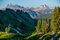
After finally getting to the far end of the pass, we dropped our packs and scouted for a campsite. We found quite a few and pick one and quickly had camp setup. We ended up with a campsite with great views just outside of it!

Grand Teton and Death Canyon
DSC04462.jpg

DSC04463-Edit.jpg

Spearhead Peak on Fox Creek Pass
DSC04470.jpg

Death Canyon
DSC04476-Edit.jpg

Day2:
This day we would hike across Death Canyon Shelf! I had been wanting to hike the shelf ever since I learned of the TCT. I must have built it up too much in my head because I didn't think it was spectacular, but the air was more smokey this day from the forest fires in the North West States. It was still great though!

Heading across the Death Canyon Shelf
DSC04486-Pano.jpg

Death Canyon Shelf
DSC04489.jpg

Death Canyon Shelf
DSC04490-Edit.jpg

After the small climb up to Mount Meek Pass we soon got our first glimpse of Alaska Basin.

First views of Alaska Basin - Sheep Steps Section
DSC04497-Edit.jpg

DSC04504.jpg
DSC04505.jpg

DSC04507.jpg

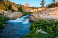
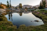
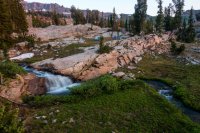
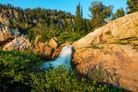
After hitting the trail that goes up to Buck Mountain Pass in Alaska Basin, we hunted around and found a campsite. The place we camped ended up being one of my favorite campsites! It was on a nice flat shelf with a nice stream on one side that had a nice 8' or so waterfall below and a small pond on the other side and good views down Teton Canyon. It could have used a few more trees for shade, but other than that it was great!

After setting up camp it was only around 2pm, so we all headed over to one of the bigger lakes (none are very big) where we found of others jumping off of a large rock into the lake. Some of our group started jumping in too and enjoying the refreshing mountain lake. One person in our party got a small leach on his toe while swimming in the lake and had to remove it. I missed getting a picture of it. There are a lot of these small lakes in Alaska Basin with cascading streams connecting them.

Rock jumping/swimming in Alaska Basin
DSC04522-Edit-2.jpg

DSC04526-Edit.jpg

After everyone was done swimming we continued to explore Alaska Basin. Most everyone dropped down to another of the bigger lakes in the basin, while a friend and I decided to hike up to Buck Mountain Pass.

Alaska Basin - Buck Mountain is the prominent peak near the right side
DSC04546-Pano.jpg

Buck Mountain
DSC04556-Edit-2.jpg

There was a huge snow drift/cornice on the other side of the pass. We wanted to hike over to where we could look down into Death Canyon, but wasn't sure we could get back up the snow cornice as it was quite steep. While we were hanging out at the pass a solo backpacker came up from Death Canyon. We waited in case he needed help getting up the cornice. The backpacker had an ice ax and had to use it to chop steps up the cornice. He slipped at one point and I thought He was going to slide all the way back down, but he caught himself. When he was close enough I had my friend hold onto me and extended my trekking pole out to him and pulled him up the last 5'. After watching him we decided we wouldn't try it. ;)

If you look really close in the photo below, you can see the backpacker coming up the cornice. It was a lot higher and steeper than it looked.

Buck Mountain Pass
DSC04567-Edit.jpg

After getting back to camp the light started to get really nice and I wondered around taking photos!

Beautiful waterfall just below our campsite
DSC04589.jpg

Just above camp
DSC04595.jpg

DSC04599-Edit.jpg

Meadow below camp
DSC04605-Pano.jpg

DSC04607.jpg

Waterfall and our campsite
DSC04619.jpg

Alaska Basin ended up exceeding all my expectations and was by far the highlight of the trip for all of us! I would love to go back and explore it more!

Day3:
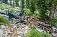
The next morning we packed up and head out. The trail down Teton Canyon really drops a lot, especially the first half.

DSC04630.jpg

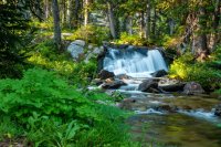
Waterfall through the trees
DSC04637.jpg

DSC04648.jpg

Eventually we made it to the trailhead and the car that we had left for us the night before we began our hike. When we got there some guy had pulled off to park and had driven off a steep ledge right next to where a small stream crosses the road just as you enter the parking lot. His rear tire was in the air and we all thought he was lucky he didn't roll it. The tall grass and weeds had hid the steep drop from him. Unfortunately I didn't think to take a picture of it. After a big truck pulled him back on we headed off to shower, eat, and then back over to Teton Village to retrieve the other car, and then headed home.
 
Looks great. That camp site with the waterfalls is sweet.

How long to get rid of those dayhikers at the start? And did this require getting permits? Doesn't read like you were locked into a specific site each night.
 
Based on the 2 campsites, no permit was needed.

There is a trail in Death Canyon, just west of the patrol cabin, that leads up to Static Peak Divide (Stewarts Draw) then around to Buck Mountain Pass. A lot of hikers will "dayhike" this to the top of Static Peak. It's a really steep up from the valley floor to Static Peak Divide. Then an easy up to the summit or around to Buck Mountain Pass. Sounds like fun with all that snow. Here's us going up and over Buck Mountain Pass in July 2011. This was a side trip from the Basin.
1935430_10150510920017822_1697278078_n.jpg

Thanks for sharing your trip!
 
Everything looks so lush and alive. Like a dream of a hike, all the views are beautiful. The waterfalls are gorgeous. Thanks for the share!
 
Fantastic. i hiked most of the Crest trail out there one time at the very end of June, and i've got to say Death Canyon Shelf and Alaska Basin look way better not covered in snow. you had better weather too, the Grand looks way better not behind a cloud. that campsite in Alaska Basin looks like one of the best.
 
Amazing! The photography, writeup, everything. I need to get back there and see more. Thanks for putting this together.
 
And did this require getting permits? Doesn't read like you were locked into a specific site each night.
Like @Chuck the Mauler mentioned, no permits needed for where we camped as they are outside the park boundaries. Only restrictions is no campfires at either place. I didn't miss it as bad as I thought I would.
 
Beautiful shots. Despite being underwhelmed by that Death Canyon Shelf section, your pictures still make the views look as spectacular as any. One of these years, I'd like to try a similar 3 day trip, only my idea has been to start up Darby Canyon, go up above the caves, then drop down into Fox Canyon for the first night, then tackle Fox Creek Pass, hike the shelf, and settle into Alaska for the 2nd night. From there, the idea would be to traverse the ridge from Hurricane Pass up to Table Mountain, then down the Table Mountain trail, finishing off at the Teton Canyon trailhead there. Whenever I can make it happen with someone else willing to drive another car up, I'd love it if I could find that same site in Alaska Basin too. Excellent find! Thanks for the TR.

Question: How did you store your food and stuff at night? Bear canisters?

Edit: Found your 2nd night campsite! ;) Now it'll be a tough one between that and going a mile further up to settle into one around Sunset Lake.
 
Last edited:
Beautiful pictures! Thanks for sharing! Love the Tetons! I must get up there one of these days.
 
Thanks for sharing your adventure! I need to get out there one of these days ... so many places to go & explore ...
 
Beautiful shots. Despite being underwhelmed by that Death Canyon Shelf section, your pictures still make the views look as spectacular as any. One of these years, I'd like to try a similar 3 day trip, only my idea has been to start up Darby Canyon, go up above the caves, then drop down into Fox Canyon for the first night, then tackle Fox Creek Pass, hike the shelf, and settle into Alaska for the 2nd night. From there, the idea would be to traverse the ridge from Hurricane Pass up to Table Mountain, then down the Table Mountain trail, finishing off at the Teton Canyon trailhead there. Whenever I can make it happen with someone else willing to drive another car up, I'd love it if I could find that same site in Alaska Basin too. Excellent find! Thanks for the TR.

Question: How did you store your food and stuff at night? Bear canisters?

Edit: Found your 2nd night campsite! ;) Now it'll be a tough one between that and going a mile further up to settle into one around Sunset Lake.
Thanks Will. I still thought Death Canyon Shelf was great... Just not what I had built it up in my mind to be was all... I thought the same thing of the Cirque of the Towers in the Winds... LOL!

That route sounds interesting. I looked at going from Hurricane Pass over to Table Rock and then down too. Looking at Google Earth it looked like a scramble so we opted out of that. I later found a report of someone doing that and it didn't sound like it was all that bad. How is the climb up out of Darby and down into Fox Creek. From what I heard, the trail in Fox Creek isn't that good, but coming over from Darby Canyon would put you near Fox Creek Pass so you wouldn't have a long hike up Fox Creek!

We had reserved two bear canisters from the Outdoor Rec Center at USU, but when we went to pick them up they only had one left. It was a Bear Vault 500, so the larger model. We (5 people) were only able to get less than half our food into it the first night. The rest we hung. Good hanging trees are fairly sparse at Fox Creek Pass, but I don't think it would be a problem at Alaska Basin.

This little report gives a sense of what the area above Wind Cave looks like and how you can crest over and down into Fox Canyon. Based on the pics in that report (they didn't go all the way down only because they didn't want to have to come back up) and from looking over maps and stuff, there used to be an old trail or route that did go down a steep little gully off the pass with Darby Canyon to join up with Fox Creek. I believe it has been referred to as simply 10K Pass by some, because of its elevation. Interestingly enough though, that's only thing I can find online that shows off any of that area up there. I figure once down the steepest part, you can go cross country right below the Teton Crest junction...and probably camp in the same vicinity as you would have the first night.

As for Hurricane Pass to Table Mountain, that looks like a typical ridge scramble. Even Caltopo shows a route for it based on someone's track they uploaded and made available via OpenStreetMap.
 
Last August some friends and I did our first ever backpacking trip in the Tetons. It was such a fun trip! I had been wanting to do the TCT for many years!

Because of work schedules and vacations days we were only able to do a 3 day trip. We cheated and took the tram at Teton Village and hiked to Fox Creek Pass the first day. There was a lot more up and down than I expected in between the top of the tram and the pass. It was a little over 8 miles to our campsite on the pass. There was still a lot of patches of snow left from the heavy snowfall they got that winter! The wildflowers were spectacular! I'm ready to go back!!!

Leaving the tram
View attachment 62568

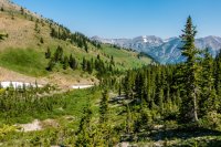
Descending Rendevous Mountain from the tram. You can see the trail below climbing the ridge in the middle.
View attachment 62569

View attachment 62570

View attachment 62571

View attachment 62572

South Fork of Granite Creek
View attachment 62573

View attachment 62574

View attachment 62575

View attachment 62576

View attachment 62577

Marion Lake
View attachment 62578

Marion Lake was beautiful! Would have been great to camp here. We took a small lake and one member of our party took a quick dip in the lake. On the climb out of the lake to Fox Creek Pass I was regretting I didn't jump in too.

Swimming in Marion Lake
View attachment 62579

Marion Lake
View attachment 62580

View attachment 62581
Marion Lake
View attachment 62582

View attachment 62583

Most everyone was pretty tired by the time we made it to the top of the pass. The pass is over 1.5 miles across with the only water being on the far side. I was in a hurry to get there and find a campsite and kept having to stop and let everyone catch up.

On Fox Creek Pass
View attachment 62584

Fossil Mountain
View attachment 62585

Grand Teton from Fox Creek Pass
View attachment 62586

After finally getting to the far end of the pass, we dropped our packs and scouted for a campsite. We found quite a few and pick one and quickly had camp setup. We ended up with a campsite with great views just outside of it!

Grand Teton and Death Canyon
View attachment 62587

View attachment 62588

Spearhead Peak on Fox Creek Pass
View attachment 62589

Death Canyon
View attachment 62590

Day2:
This day we would hike across Death Canyon Shelf! I had been wanting to hike the shelf ever since I learned of the TCT. I must have built it up too much in my head because I didn't think it was spectacular, but the air was more smokey this day from the forest fires in the North West States. It was still great though!

Heading across the Death Canyon Shelf
View attachment 62591

Death Canyon Shelf
View attachment 62592

Death Canyon Shelf
View attachment 62593

After the small climb up to Mount Meek Pass we soon got our first glimpse of Alaska Basin.

First views of Alaska Basin - Sheep Steps Section
View attachment 62594

View attachment 62595
View attachment 62596

View attachment 62597

After hitting the trail that goes up to Buck Mountain Pass in Alaska Basin, we hunted around and found a campsite. The place we camped ended up being one of my favorite campsites! It was on a nice flat shelf with a nice stream on one side that had a nice 8' or so waterfall below and a small pond on the other side and good views down Teton Canyon. It could have used a few more trees for shade, but other than that it was great!

After setting up camp it was only around 2pm, so we all headed over to one of the bigger lakes (none are very big) where we found of others jumping off of a large rock into the lake. Some of our group started jumping in too and enjoying the refreshing mountain lake. One person in our party got a small leach on his toe while swimming in the lake and had to remove it. I missed getting a picture of it. There are a lot of these small lakes in Alaska Basin with cascading streams connecting them.

Rock jumping/swimming in Alaska Basin
View attachment 62598

View attachment 62599

After everyone was done swimming we continued to explore Alaska Basin. Most everyone dropped down to another of the bigger lakes in the basin, while a friend and I decided to hike up to Buck Mountain Pass.

Alaska Basin - Buck Mountain is the prominent peak near the right side
View attachment 62600

Buck Mountain
View attachment 62601

There was a huge snow drift/cornice on the other side of the pass. We wanted to hike over to where we could look down into Death Canyon, but wasn't sure we could get back up the snow cornice as it was quite steep. While we were hanging out at the pass a solo backpacker came up from Death Canyon. We waited in case he needed help getting up the cornice. The backpacker had an ice ax and had to use it to chop steps up the cornice. He slipped at one point and I thought He was going to slide all the way back down, but he caught himself. When he was close enough I had my friend hold onto me and extended my trekking pole out to him and pulled him up the last 5'. After watching him we decided we wouldn't try it. ;)

If you look really close in the photo below, you can see the backpacker coming up the cornice. It was a lot higher and steeper than it looked.

Buck Mountain Pass
View attachment 62602

After getting back to camp the light started to get really nice and I wondered around taking photos!

Beautiful waterfall just below our campsite
View attachment 62603

Just above camp
View attachment 62604

View attachment 62605

Meadow below camp
View attachment 62606

View attachment 62607

Waterfall and our campsite
View attachment 62608

Alaska Basin ended up exceeding all my expectations and was by far the highlight of the trip for all of us! I would love to go back and explore it more!

Day3:
The next morning we packed up and head out. The trail down Teton Canyon really drops a lot, especially the first half.
View attachment 62609

Waterfall through the trees
View attachment 62610

View attachment 62611

Eventually we made it to the trailhead and the car that we had left for us the night before we began our hike. When we got there some guy had pulled off to park and had driven off a steep ledge right next to where a small stream crosses the road just as you enter the parking lot. His rear tire was in the air and we all thought he was lucky he didn't roll it. The tall grass and weeds had hid the steep drop from him. Unfortunately I didn't think to take a picture of it. After a big truck pulled him back on we headed off to shower, eat, and then back over to Teton Village to retrieve the other car, and then headed home.
great TR thanks!....can't wait to get there this coming Aug.
 
Similar threads
Thread starter Title Forum Replies Date
A Teton Crest Trail Shuttle Resource Discussions 3
Mikjik86 4 Days Backpacking Grand Teton Wilderness/Teton Crest Trail - Wyoming, July, 2021 Backpacking 0
A Teton Crest Trail Trip Planning 3
Rockskipper Grand Teton Renews Historic Crest Trail General Discussion 9
wabenho Teton Crest Trail - August 2020 Backpacking 13
yoBear2116 Doing a shuttle on the Teton Crest Trail Trip Planning 4
P Teton Crest Trail via Coal Creek/Moose Meadow trails Trip Planning 2
woodmaker_58 Table Mt to Hurricane Pass/ Teton Crest Trail Trip Planning 5
C Teton Crest Trail permit campsite distance problem Trip Planning 10
Brian Bucca Tips for scoring a walk in permit for Teton Crest trail Trip Planning 0
G Teton Crest Trail Itinerary Trip Planning 3
linkin22luke Shuttle for the Teton Crest Trail Trip Planning 1
jdfut66 Teton Crest Trail - August 2018 Backpacking 6
D Teton Crest Trail questions Trip Planning 6
jdfut66 Teton Crest Trail backup plan Trip Planning 5
C Teton Crest Trail - end of August 2018 Trip Planning 0
Cburton Teton Crest Trail Permit Issues - Help! Trip Planning 15
jkgear Campsite suggestions for Teton Crest Trail Trip Planning 18
AKay09 Teton Crest Trail, GTNP - 09/2016 *Pic Heavy!* Backpacking 23
AKay09 Teton Crest Trail September Weather? Trip Planning 4
Joey An 8 Day off trail backpack through the Crest of Grand Teton National Park Backpacking 22
isleroyaleguy Teton Crest trail. ...Doug and Anita Tour 2015...final chapter! Backpacking 6
isleroyaleguy Teton Crest trail. ..Doug and Anita Tour 2015...part 2 Backpacking 4
pstm13 Teton Crest Trail July 13th-17th 2015 Backpacking 21
pstm13 Teton Crest Trail July 13th-17th (ish) Meet Up (Members Only) 1
Bob Teton Crest Trail Resource Discussions 0
Nickrgough Teton Crest Trail 9/3 - 9/7 Backpacking 8
dgosche Teton Crest July Trip Planning 2
wabenho Teton Crest Questions Trip Planning 9
Caleb Teton Crest Trip 2018 Trip Planning 22
Ben Teton Crest (mostly) loop, june 28 - july 2 Backpacking 13
TractorDoc Paintbrush Canyon / Cascade Canyon Loop -- Grand Teton NP September 11, 2023 Hiking & Camping 9
Bob Teton Wilderness July 2024 Trip Planning 38
D Grand Teton Cascade Loop Trip Planning 1
TheMountainRabbit Request: Grand Teton Ascent Trip Planning 0
TractorDoc Yellowstone's Thorofare and the Teton Wilderness 08/09/2023 - 08/18/2023 Part Nine / Day Nine + Ten! Backpacking 20
TractorDoc Yellowstone's Thorofare and the Teton Wilderness 08/09/2023 - 08/18/2023 Part Eight / Day Eight Backpacking 14
TractorDoc Yellowstone's Thorofare and the Teton Wilderness 08/09/2023 - 08/18/2023 Part Seven / Day Seven Backpacking 13
TractorDoc Yellowstone's Thorofare and the Teton Wilderness 08/09/2023 - 08/18/2023 Part Six / Day Six Backpacking 28
TractorDoc Yellowstone's Thorofare and the Teton Wilderness 08/09/2023 - 08/18/2023 Part Five / Day Five Backpacking 16
TheMountainRabbit Ortenburger Lake, Talus Lake, & Glacier Peak (Grand Teton NP) - October 2023 Backpacking 14
TractorDoc Yellowstone's Thorofare and the Teton Wilderness 08/09/2023 - 08/18/2023 Part Four / Day Four Backpacking 15
TractorDoc Yellowstone's Thorofare and the Teton Wilderness 08/09/2023 - 08/18/2023 Part Three / Day Three Backpacking 10
TractorDoc Yellowstone's Thorofare and the Teton Wilderness 08/09/2023 - 08/18/2023 -- Part Two / Day Two Backpacking 6
TractorDoc Yellowstone's Thorofare and the Teton Wilderness 08/09/2023 - 08/18/2023 --Part One / Day One Backpacking 10
TheMountainRabbit Invite Grand Teton NP, October 7th-10th 2023 Meet Up (Members Only) 0
TheMountainRabbit Southern Absaroka & Thorofare Mountain (Teton/Washakie Wilderness) - July 2023 Backpacking 23
J Pacific Creek or North Buffalo Fork? Teton Wilderness, Thorofare ,etc. Trip Planning 10
Bob Teton Wilderness Trip Planning 2
W Paper map for Teton Wilderness (Younts Peak) Gear 4

Similar threads

Back
Top