SteveR
Member
- Joined
- Sep 22, 2016
- Messages
- 1,020
Last week we travelled several hours to the SW of Calgary, to spend 3 days camping and hiking in Castle Provincial Park in SW Alberta. This is a relatively new park, finally designated as such under the previous NDP government, after many years of debate about increasing the protection of this unique area that borders Waterton Lakes National Park, which of course is contiguous with Glacier in Montana. Fortunately, despite the change in politics more recently- the park remains- although some of the restrictions on ATV use have been lifted by the current conservative government. Anyhow, enough of that. On our middle day we did a truly outstanding hike...
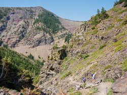
After setting up a shuttle, as we would be finishing 7 km south of our start point, the trail wound up from our campsite through forest with scattered meadows.
Then- around a corner and into the hard work of the day- a long steep grind up an exposed gully, and some scrambly slopes above. With a forecast high of 30 C, we were already sweating by this point.
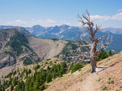
Upon reaching a shoulder, the angle moderates and views open up of peaks to the west. Picturesque dead trees add interest on the final pull to Table Mountain.
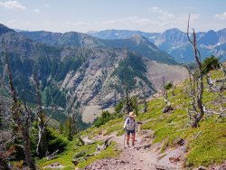
Not there yet! "There" is ultimately that undulating ridge and bald peak at middle distance.
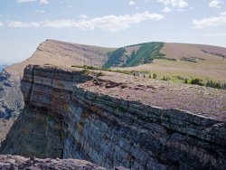
Despite the sometimes gruelling trail, and the prospect of a tricky descent the same way over a few sections of loose rock and rubbly slabs- Table is a popular spot- although most hikers stop here instead of continuing further on easy terrain to the true summit in the distance. We had gone to the summit as an out and back on our previous visit to the Castle in 2018. Today- we have other plans...
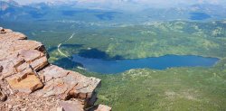
That's our campsite on Beaver Mines Lake, 700 vertical m below.
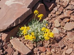
All the dead trees testify to the harsh environment up here, but some hardy survivors find a way.
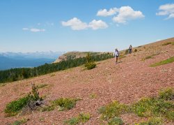
Leaving the summit trail behind for a traverse and descent across slopes of red shale and scattered trees, towards the second peak of the day.
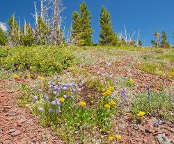
The flowers along here seem to grow largely in groups of multiple species, for mutual benefit.
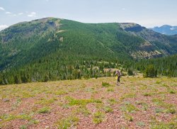
Almost done the descent to a treed saddle, with the next ridgetop ahead. This is largely an off-trail route, but after finding some flagging tape, we picked up a primitive beaten in trail that led us easily to the top.
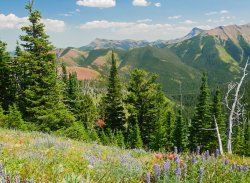
Openings along the climb featured flowers, and views out to foothills and prairie to the east.
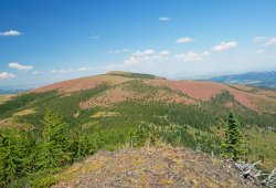
A rocky knoll partway up gives views of our route across the red shale ridge, with the summit of Table beyond.
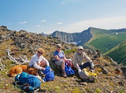
On top with Piper, Jo, Nancy and Arnold. A good breeze made the hot weather (for Albertans!) more tolerable, but with the heat as well as the scenery, another break was called for.
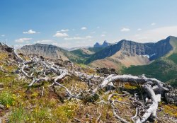
Summit view to the SE, with Castle Peak a prominent landmark for much of the way.
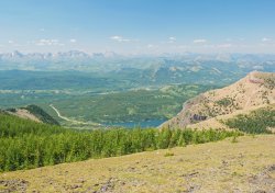
A look NW to the lake and the Table Mountain trail at right, with peaks of the divide in the distance. Remnant snow patches in the larch forest below gave a welcome top-up to our water, and a great snow rolling session for Piper.
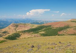
Another view of our route from Table, with a possible thunderhead building near the Livingstone range far to the north. Nothing like that near us though. Keen eyes might spot a red trail marker on the grassy slope below, which was surprising as this is not an official trail. I suspect this and the one other, which we encountered a bit further on, have been put here by parks to steer hikers to the correct ridge, as there are several options to go wrong here.
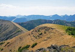
Ahead to much of the remainder of our day: across the flat area, down to the col, up the light coloured ridge, around the corner to another peak (hidden), then the undulating ridge of red shale and larch trees from left to right.
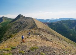
Halfway into the descent, with a couple of short hands-on scrambly bits to easily negotiate after this level spot.
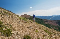
Our next highpoint- the "red peak"- comes into view as we round the corner on a traversing line.
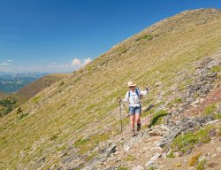
Rather than follow the broken ridgeline to the minor bump above, we choose a lower sheep/hiker trail to expedite progress.
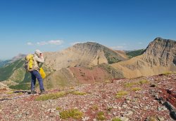
Back on the ridge, just below the red peak.
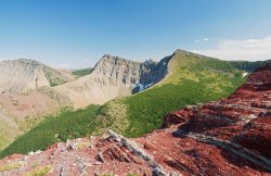
There's that Castle peeking out again!
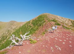
Dropping off westwards into the late afternoon sun after yet another break, on the red peak above. Part of the ridge route showing at left.
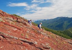
Descent off the red ridge. Are we done yet? No- there's still one short uphill to go the the summit of Whistler Mountain!

Whistler summit panorama, showing much of our route from Table at left to Red Peak at right.
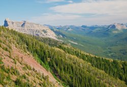
From the shoulder of Whistler- Castle Peak on Windsor Mountain finally reveals its whole self, above the long South Castle River valley.
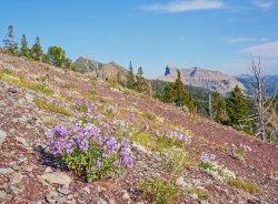
Clumps of Creeping Beardtongue on the west slopes of Whistler.
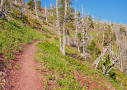
Back on trail again for the often steep, continuous descent to our waiting truck. Whistler Mountain was once home to a fire lookout, only evidenced by a crumbling concrete pad, and the road that serviced it- now reclaimed to singletrack width.
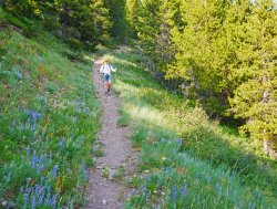
Welcome shade and flower glades ease the long, knee testing drop to valley bottom.
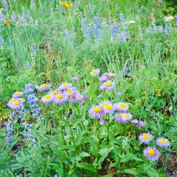
After some discussion with botanist Arnold along the way today, about the distinctions between Aster and Fleabane- I'm still just guessing that these are the latter.
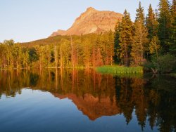
Back at the Beaver Mines Lake campground after the shuttle, in time for a sunset view of the two summits of Table Mountain, and a cooling dip in the lake. Although only about 14 km, with roughly 1300 m of accumulated height gain, this felt like a longer hike on a hot day. Definitely one to repeat!

After setting up a shuttle, as we would be finishing 7 km south of our start point, the trail wound up from our campsite through forest with scattered meadows.
Then- around a corner and into the hard work of the day- a long steep grind up an exposed gully, and some scrambly slopes above. With a forecast high of 30 C, we were already sweating by this point.

Upon reaching a shoulder, the angle moderates and views open up of peaks to the west. Picturesque dead trees add interest on the final pull to Table Mountain.

Not there yet! "There" is ultimately that undulating ridge and bald peak at middle distance.

Despite the sometimes gruelling trail, and the prospect of a tricky descent the same way over a few sections of loose rock and rubbly slabs- Table is a popular spot- although most hikers stop here instead of continuing further on easy terrain to the true summit in the distance. We had gone to the summit as an out and back on our previous visit to the Castle in 2018. Today- we have other plans...

That's our campsite on Beaver Mines Lake, 700 vertical m below.

All the dead trees testify to the harsh environment up here, but some hardy survivors find a way.

Leaving the summit trail behind for a traverse and descent across slopes of red shale and scattered trees, towards the second peak of the day.

The flowers along here seem to grow largely in groups of multiple species, for mutual benefit.

Almost done the descent to a treed saddle, with the next ridgetop ahead. This is largely an off-trail route, but after finding some flagging tape, we picked up a primitive beaten in trail that led us easily to the top.

Openings along the climb featured flowers, and views out to foothills and prairie to the east.

A rocky knoll partway up gives views of our route across the red shale ridge, with the summit of Table beyond.

On top with Piper, Jo, Nancy and Arnold. A good breeze made the hot weather (for Albertans!) more tolerable, but with the heat as well as the scenery, another break was called for.

Summit view to the SE, with Castle Peak a prominent landmark for much of the way.

A look NW to the lake and the Table Mountain trail at right, with peaks of the divide in the distance. Remnant snow patches in the larch forest below gave a welcome top-up to our water, and a great snow rolling session for Piper.

Another view of our route from Table, with a possible thunderhead building near the Livingstone range far to the north. Nothing like that near us though. Keen eyes might spot a red trail marker on the grassy slope below, which was surprising as this is not an official trail. I suspect this and the one other, which we encountered a bit further on, have been put here by parks to steer hikers to the correct ridge, as there are several options to go wrong here.

Ahead to much of the remainder of our day: across the flat area, down to the col, up the light coloured ridge, around the corner to another peak (hidden), then the undulating ridge of red shale and larch trees from left to right.

Halfway into the descent, with a couple of short hands-on scrambly bits to easily negotiate after this level spot.

Our next highpoint- the "red peak"- comes into view as we round the corner on a traversing line.

Rather than follow the broken ridgeline to the minor bump above, we choose a lower sheep/hiker trail to expedite progress.

Back on the ridge, just below the red peak.

There's that Castle peeking out again!

Dropping off westwards into the late afternoon sun after yet another break, on the red peak above. Part of the ridge route showing at left.

Descent off the red ridge. Are we done yet? No- there's still one short uphill to go the the summit of Whistler Mountain!

Whistler summit panorama, showing much of our route from Table at left to Red Peak at right.

From the shoulder of Whistler- Castle Peak on Windsor Mountain finally reveals its whole self, above the long South Castle River valley.

Clumps of Creeping Beardtongue on the west slopes of Whistler.

Back on trail again for the often steep, continuous descent to our waiting truck. Whistler Mountain was once home to a fire lookout, only evidenced by a crumbling concrete pad, and the road that serviced it- now reclaimed to singletrack width.

Welcome shade and flower glades ease the long, knee testing drop to valley bottom.

After some discussion with botanist Arnold along the way today, about the distinctions between Aster and Fleabane- I'm still just guessing that these are the latter.

Back at the Beaver Mines Lake campground after the shuttle, in time for a sunset view of the two summits of Table Mountain, and a cooling dip in the lake. Although only about 14 km, with roughly 1300 m of accumulated height gain, this felt like a longer hike on a hot day. Definitely one to repeat!
Last edited:
