Step Canyon access to Grand Gulch, Cedar Mesa

TrailScot

Member
.
Joined
Dec 2, 2019
Messages
144
Hi,

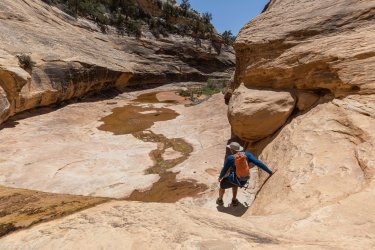
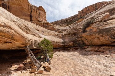
Does anyone have any experience of using Step Canyon as an entry/exit route to Grand Gulch ?

Kelsey makes the route sound relatively straightforward (!), but other trip reports that I've come across make it sound like a more difficult challenge.

Thanks for any advice.
 
I had some difficulties heading up Step after descending Pine, in the lower part of the canyon. It was a while ago so I don't remember exactly what the obstacle was, just that I did not feel comfortable climbing up with a pack. My $.02, Kelsey is not a good, accurate resource. You will get accurate and better input in BCP.
 
Last edited:
I would agree with @LarryBoy about Kelsey. His books are great for getting an idea, but can be pandora's box on the ground.
If you figure out how to get in through Step Canyon, please PM me as I'd love to know as well.
 
I don't know of anyone who has accessed GG from Step. I would think that if it were an easy way into GG, more people would be using it.

Yes, you're absolutely correct, Randy ... after finding no online reports for this route, I suspected as much; but hoped otherwise, after reading Kelsey's brief description
 
I have it as a entrance in.... From a old map a friend of mine had that helped lay out the GC boundaries.... So I'd assume it goes .... Other than that you are on your own.....

I have looked at a loop kinda the same years ago but never got to it

Always take a 40 ft piece of webbing in new Canyon country
 
In a recent visit to the Cedar Mesa area, I hoped to be able to find out if Step Canyon provided access to Grand Gulch.

I started just off Highway 276 at the cut-off to the Collins Trailhead, headed across the mesa, and dropped into Dripping Canyon. After negotiating the tricky ledge in the lower part of Dripping, I was soon hiking along the pleasant sandy trail in Grand Gulch. It was about 2.5 miles to the junction with Step Canyon.

The lower section of Step, below the Junction with Pine Canyon is very straightforward, with no significant obstacles. At times, it is necessary to step up from the drainage itself, since it is a little brushy in places and narrows into a slickrock 'slot'.

Soon after the junction, there is a high pour-off, with a bypass on the right-hand side. The bypass is not difficult, but requires a little consideration. Initially, a 6-foot high ledge is negotiated using a pile of rocks and tree branches left by previous hikers. After scaling this, the temptation is to rejoin the drainage by heading left, but it seems simpler to edge slightly right, and clamber up an easier slickrock slope.

A little further up the canyon is a large sandstone bowl, with a slickrock chute connecting the upper and lower sections. At the bottom of the chute is an ultra-smooth 4 foot high almost vertical section. If heading down-canyon, this would a straightforward slide down but, in the opposite direction, it's a little tricky. I placed a thick tree-trunk that was lying close by against the chute, and it was easy to clamber up.

After exiting Step Canyon a little later, I joined an old dirt road and made my way back to Highway 276. I hadn't initially realized that this was actually part of the 1880 Pioneer route, as they crossed Cedar Mesa. A few weeks previously, this group of 250 Mormon pioneers had already crossed the Colorado River after blasting an incredible passageway through vertical sandstone cliffs at the Hole-in-the-Rock. In a week's time they would be constructing another remarkable 'road' to cross Grand Gulch.

The dirt road that I followed had plenty of evidence of the pioneer route, which made it a great pleasure to walk in the evening sun, as I headed back to my car after an excellent day's hiking.​
 
Last edited:
First crux going down Step. This is the bottom of the steep pourover, its not bad just a friction climb. Looked much sketchier my first time looking down from the top.
2A4A6347.jpg

Second pourover, the real crux of Step. Like @TrailScot said, it's to the left going down canyon. Tough to see unless you're on top of it, some steep ledges will get you there. I dropped my pack but you could lower it with a short rope if you wanted, its not that tall. Easier going up, fun climb once you find it. Not really any exposure here, just some balance and friction moves.
2A4A6319.jpg
 

Attachments

  • 2A4A6347.jpg
    2A4A6347.jpg
    449.7 KB · Views: 5
  • 2A4A6319.jpg
    2A4A6319.jpg
    546.9 KB · Views: 4
First crux going down Step. This is the bottom of the steep pourover, its not bad just a friction climb. Looked much sketchier my first time looking down from the top.
View attachment 127421

Second pourover, the real crux of Step. Like @TrailScot said, it's to the left going down canyon. Tough to see unless you're on top of it, some steep ledges will get you there. I dropped my pack but you could lower it with a short rope if you wanted, its not that tall. Easier going up, fun climb once you find it. Not really any exposure here, just some balance and friction moves.
View attachment 127422

Great ... many thanks for that ... at least someone had their camera at the ready, when tackling these obstacles :) ... I completely forgot ...
 
In the second pic aren't the logs/rock pile canyon right?
sorry that was confusing...TrailScot came up from the bottom so it was right side for him. The downclimb is on the left looking down canyon.
 
The second pic is looking up canyon. If so it looks like the rock pile/logs would be canyon rt ( Rt looking down canyon )
Thanks
 
The second pic is looking up canyon. If so it looks like the rock pile/logs would be canyon rt ( Rt looking down canyon )
Thanks
That's a side canyon tributary of Step. I tried looking for a route up to explore but it's ledged out.
 
OK. That clears it up. Thanks. Hope you got to see all the great archaeology in the lower canyon.
 
Back
Top