pixie1339
Desperately Seeking Sandstone
- Joined
- Jan 21, 2012
- Messages
- 1,692
This will be the second trip report I’ve posted on BCP thus far, and I’m going to split it into two parts, so I guess that will make three. Part one will be from my visit to Valley Of Fire, and part two will be from the other side of Lake Mead, in the Gold Butte area. I’m going to try to get a few more up over the winter now that I seem to have solved the problem I was having with uploading my pictures to the site. @Miss Buffalo and I had planned a meet up in Southern Nevada a couple weeks prior, but when one of my cats became seriously ill I had to reschedule. Fortunately Yvonne was still able to join me for part of the trip.
My boss let me leave work at 3:00 on Thursday to begin my trip. My goal for the night was to camp in the Virgin River Canyon Campground. That gorge has always fascinated me, but I’ve never had the time when driving through before to stop and check it out. It was really neat to be able to have a better look at it. The downside of camping there is that a) it’s a campground, and b) you can hear the noise from I-15 at camp. I brought my trusty ear plugs, as always, so it didn’t prevent me from getting a good night’s sleep. Unfortunately I really wasn’t there long enough to get any really nice pictures, since I arrived just as the sun was setting, and I left just before sunrise the next morning, but there are places you can go to explore the area away from the freeway, so someday I will return.
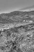
Sundown in the Virgin River Gorge
I arrived at Valley Of Fire Friday morning at 8:00 a.m., and was relieved to snag the only available spot at Arch Rock Campground. It was a nice little spot, too. It was tucked back into the red rocks, providing good privacy and shade. I set up camp and started exploring. The last time I visited Valley Of Fire was three years earlier, and I didn’t know then about some of the scenic gems you can find just a little off the beaten path, so my goal was to see how many of them I could find. I began on the Scenic Loop and visited Piano Rock and Windstone Arch. Before the trip I printed image files with the places I wanted to visit pinpointed on Google Earth to help me locate them. I was worried I wouldn’t find Windstone Arch because there were thick clouds over that part of the park in Google Earth’s image. I was able to figure out roughly where to park, but couldn’t see what I what landmarks I would be looking for. Luckily I found it without much trouble at all. Some asshat let his kid carve drawings on the inside of the cave, so you have to be careful how you crop your shot to not include the “artwork.” Arrggh!
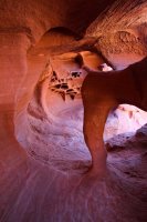
Windstone Arch
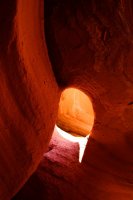
Windstone skylight
After that I drove over to The Cabins to see the petroglyphs behind the structure. I don’t know how I missed them last time because they were pretty obvious, but I didn’t know they were there, so I wasn’t looking for them either.
Now it was time to get to the part of the park I was really looking forward to spending some more time in, the area between Rainbow Vista and White Domes. It was getting pretty hot by this time. The high that day was around 85, and the only clouds in the sky were very distant high clouds, so I was in full sun all day. That may not sound too hot on paper, but it was a good 30 degrees higher than the high temps back home had been recently, so it felt pretty hot to me! I ended up hiking the Rainbow Vista trail to the Fire Canyon Overlook, but before I went to the overlook I detoured up above the trail to find Fire Canyon Arch. That area was really colorful, and I found the arch pretty easily. I had luck on my side during this trip because I managed to find everything I was looking for without breaking out the GPS. I guess it pays to do your homework.
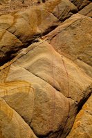
Colorful sandstone
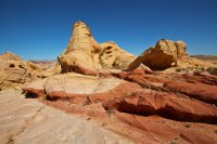
Fire Canyon Arch
Next I stopped at Striped Rock for some pictures and then re-hiked the White Domes trail. The parking lot is always full there, but the trail really is worth it. That area is awesome! I decided to check out some new scenery by veering left when the trail veers right to enter a small slot canyon. There were some neat slot sections that way, too, and no people. Then I returned to the trail and went through the other slot. There was one shot I was really looking forward to getting at the end of the slot, with some really pretty pink striped sandstone. It’s a clichéd Valley Of Fire shot, but I still wanted my own. The sun was casting shadows from a nearby tree right on that spot, so it didn’t work out, but at least I know now that if you want that shot you either need to go early or late in the day.
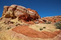
Striped Rock
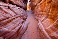
Candy striped slot
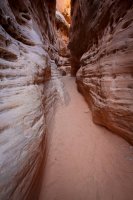
White Domes slot
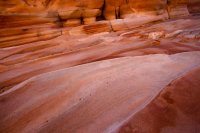
Next I headed out in search of Crazy Hill and Thunderstorm Arch. This was during the hottest part of the day, and I literally felt like I was cooking. I found Thunderstorm Arch pretty easily. It took me a little while to find Crazy Hill even though I passed right by it once. It looks different from the pictures I’ve seen, partly because the angle it’s usually photographed from makes it looks like a perfect dome (it’s not), and partly because it was in full sun, which doesn’t bring out the colors as well. I climbed up to a high point and there it was. I found some cool mini arches on my way back to the car.
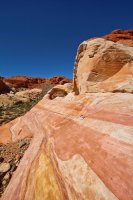
Thunderstorm Arch
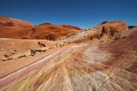
Crazy cool colors
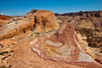
So that's Crazy Hill!
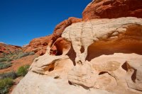
Land of a thousand arches
The main reason I wanted to camp in Valley Of Fire is because they have showers at the Atlatl Rock Campground, which you can use regardless of which campground you’re staying at. I would normally have waited until I was done hiking for the day to take a shower, but I needed to cool off and get out of the sun for a little while, so I left to take a cold shower. It was seriously one of the best showers of my life. I felt like I was in one of those Herbal Essences commercials. It was so refreshing! I figured hiking with wet hair would help keep me from overheating, so I went back out for my last stop of the day, the Fire Wave.
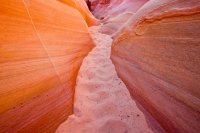
The Fire Wave has really exploded since I was at Valley Of Fire last time. I hadn’t even heard of it then, but now there’s an official trail for it. Rather than taking the trail, I decided to take the scenic route through Pink Canyon. There’s no trail, but it was easy enough to find. I hiked through Pink Canyon, a set of colorful but shallow narrows until I saw some red and white striped rocks on the right. Since those were similar to what the Fire Wave looks like I took that as my cue to leave the canyon and ascend to the left, and sure enough, I spotted it not far from where I left the wash. It’s pretty, but smaller than you would think, so it kind of sucks that so many people visit it now. To get the angle I was looking for I was in the way of others, so I didn’t get to take too many shots before I felt like I should move on. I had planned to stay until sunset, but there were no clouds, a fair amount of people, and I was really starting to look forward to getting off my feet, so I headed back to camp before sunset.
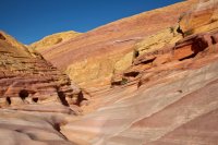
Entrance to Pink Canyon
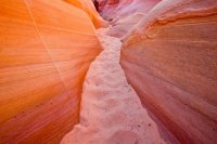
Pink Canyon
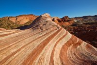
Late day at the Fire Wave
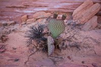
Crab eye cacti
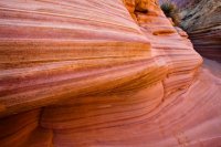
Striations
At camp, I had a nice, relaxing evening. I made tacos and had a few beers. There was an cute little mouse that was my camp visitor that night. As soon as I saw him I put my trash bag in the car so he wouldn’t get into it. I think he was hoping I’d leave something out for him, because at one point he ran right up in front of me, stared at me for a second, then took off.
The next morning I was up early again, and looking forward to the next leg of the trip. Yvonne and I would be meeting at 12:00 at Whitney Pocket that day, but I still had time to make a few more stops in Valley Of Fire first. I broke camp and visited Arch Rock for sunrise. The arch is small, but very pretty, and luckily I didn’t have to share it with anyone else. After that I stopped by the Visitor Center to photograph The Scream, and the Fat Bellied Marmot. The light was really nice that morning and no one else was out and about yet, so I took some road shots on my way to Elephant Rock. There are a lot of rock formations in the desert that look like one thing or another, but I can’t think of another that so strongly resembles its namesake as Elephant Rock. It’s such an awesome sight, and no visit to Valley Of Fire would be complete without it.
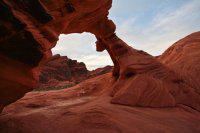
Early morning at Arch Rock
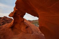
Framed
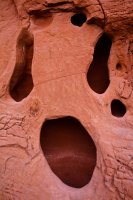
The Scream
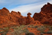
Fat Bellied Marmot
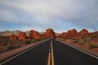
The Seven Sisters
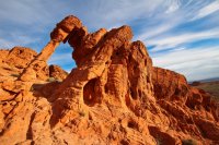
Elephant Rock
After that I started the drive to meet Yvonne. Along the way there was an old man hitchhiking, and despite the heap of shit I knew I would get from Rick about it, I picked him up. I don’t normally do that when I’m by myself, but I just had a feeling that it would be okay. The guy was in his 70’s, had no backpack or water with him, was about 10 miles from town, and it was already getting hot. He was a pretty nice guy. He said he’s from Kemmerer, Wyoming, but he travels south when the weather gets too cold up there. When you got close to town he asked if I was married. He said he’s always on the lookout for a good woman with a car and no obligations. Haha! I told him I was taken, and wished him good luck with his search as I dropped him off at the McDonald’s in Overton.
To be continued…
Featured image for home page:
My boss let me leave work at 3:00 on Thursday to begin my trip. My goal for the night was to camp in the Virgin River Canyon Campground. That gorge has always fascinated me, but I’ve never had the time when driving through before to stop and check it out. It was really neat to be able to have a better look at it. The downside of camping there is that a) it’s a campground, and b) you can hear the noise from I-15 at camp. I brought my trusty ear plugs, as always, so it didn’t prevent me from getting a good night’s sleep. Unfortunately I really wasn’t there long enough to get any really nice pictures, since I arrived just as the sun was setting, and I left just before sunrise the next morning, but there are places you can go to explore the area away from the freeway, so someday I will return.

Sundown in the Virgin River Gorge
I arrived at Valley Of Fire Friday morning at 8:00 a.m., and was relieved to snag the only available spot at Arch Rock Campground. It was a nice little spot, too. It was tucked back into the red rocks, providing good privacy and shade. I set up camp and started exploring. The last time I visited Valley Of Fire was three years earlier, and I didn’t know then about some of the scenic gems you can find just a little off the beaten path, so my goal was to see how many of them I could find. I began on the Scenic Loop and visited Piano Rock and Windstone Arch. Before the trip I printed image files with the places I wanted to visit pinpointed on Google Earth to help me locate them. I was worried I wouldn’t find Windstone Arch because there were thick clouds over that part of the park in Google Earth’s image. I was able to figure out roughly where to park, but couldn’t see what I what landmarks I would be looking for. Luckily I found it without much trouble at all. Some asshat let his kid carve drawings on the inside of the cave, so you have to be careful how you crop your shot to not include the “artwork.” Arrggh!

Windstone Arch

Windstone skylight
After that I drove over to The Cabins to see the petroglyphs behind the structure. I don’t know how I missed them last time because they were pretty obvious, but I didn’t know they were there, so I wasn’t looking for them either.
Now it was time to get to the part of the park I was really looking forward to spending some more time in, the area between Rainbow Vista and White Domes. It was getting pretty hot by this time. The high that day was around 85, and the only clouds in the sky were very distant high clouds, so I was in full sun all day. That may not sound too hot on paper, but it was a good 30 degrees higher than the high temps back home had been recently, so it felt pretty hot to me! I ended up hiking the Rainbow Vista trail to the Fire Canyon Overlook, but before I went to the overlook I detoured up above the trail to find Fire Canyon Arch. That area was really colorful, and I found the arch pretty easily. I had luck on my side during this trip because I managed to find everything I was looking for without breaking out the GPS. I guess it pays to do your homework.

Colorful sandstone

Fire Canyon Arch
Next I stopped at Striped Rock for some pictures and then re-hiked the White Domes trail. The parking lot is always full there, but the trail really is worth it. That area is awesome! I decided to check out some new scenery by veering left when the trail veers right to enter a small slot canyon. There were some neat slot sections that way, too, and no people. Then I returned to the trail and went through the other slot. There was one shot I was really looking forward to getting at the end of the slot, with some really pretty pink striped sandstone. It’s a clichéd Valley Of Fire shot, but I still wanted my own. The sun was casting shadows from a nearby tree right on that spot, so it didn’t work out, but at least I know now that if you want that shot you either need to go early or late in the day.

Striped Rock

Candy striped slot

White Domes slot

Next I headed out in search of Crazy Hill and Thunderstorm Arch. This was during the hottest part of the day, and I literally felt like I was cooking. I found Thunderstorm Arch pretty easily. It took me a little while to find Crazy Hill even though I passed right by it once. It looks different from the pictures I’ve seen, partly because the angle it’s usually photographed from makes it looks like a perfect dome (it’s not), and partly because it was in full sun, which doesn’t bring out the colors as well. I climbed up to a high point and there it was. I found some cool mini arches on my way back to the car.

Thunderstorm Arch

Crazy cool colors

So that's Crazy Hill!

Land of a thousand arches
The main reason I wanted to camp in Valley Of Fire is because they have showers at the Atlatl Rock Campground, which you can use regardless of which campground you’re staying at. I would normally have waited until I was done hiking for the day to take a shower, but I needed to cool off and get out of the sun for a little while, so I left to take a cold shower. It was seriously one of the best showers of my life. I felt like I was in one of those Herbal Essences commercials.
The Fire Wave has really exploded since I was at Valley Of Fire last time. I hadn’t even heard of it then, but now there’s an official trail for it. Rather than taking the trail, I decided to take the scenic route through Pink Canyon. There’s no trail, but it was easy enough to find. I hiked through Pink Canyon, a set of colorful but shallow narrows until I saw some red and white striped rocks on the right. Since those were similar to what the Fire Wave looks like I took that as my cue to leave the canyon and ascend to the left, and sure enough, I spotted it not far from where I left the wash. It’s pretty, but smaller than you would think, so it kind of sucks that so many people visit it now. To get the angle I was looking for I was in the way of others, so I didn’t get to take too many shots before I felt like I should move on. I had planned to stay until sunset, but there were no clouds, a fair amount of people, and I was really starting to look forward to getting off my feet, so I headed back to camp before sunset.

Entrance to Pink Canyon

Pink Canyon

Late day at the Fire Wave

Crab eye cacti

Striations
At camp, I had a nice, relaxing evening. I made tacos and had a few beers. There was an cute little mouse that was my camp visitor that night. As soon as I saw him I put my trash bag in the car so he wouldn’t get into it. I think he was hoping I’d leave something out for him, because at one point he ran right up in front of me, stared at me for a second, then took off.
The next morning I was up early again, and looking forward to the next leg of the trip. Yvonne and I would be meeting at 12:00 at Whitney Pocket that day, but I still had time to make a few more stops in Valley Of Fire first. I broke camp and visited Arch Rock for sunrise. The arch is small, but very pretty, and luckily I didn’t have to share it with anyone else. After that I stopped by the Visitor Center to photograph The Scream, and the Fat Bellied Marmot. The light was really nice that morning and no one else was out and about yet, so I took some road shots on my way to Elephant Rock. There are a lot of rock formations in the desert that look like one thing or another, but I can’t think of another that so strongly resembles its namesake as Elephant Rock. It’s such an awesome sight, and no visit to Valley Of Fire would be complete without it.

Early morning at Arch Rock

Framed

The Scream

Fat Bellied Marmot

The Seven Sisters

Elephant Rock
After that I started the drive to meet Yvonne. Along the way there was an old man hitchhiking, and despite the heap of shit I knew I would get from Rick about it, I picked him up. I don’t normally do that when I’m by myself, but I just had a feeling that it would be okay. The guy was in his 70’s, had no backpack or water with him, was about 10 miles from town, and it was already getting hot. He was a pretty nice guy. He said he’s from Kemmerer, Wyoming, but he travels south when the weather gets too cold up there. When you got close to town he asked if I was married. He said he’s always on the lookout for a good woman with a car and no obligations. Haha! I told him I was taken, and wished him good luck with his search as I dropped him off at the McDonald’s in Overton.
To be continued…
Featured image for home page:

