Snowshoeing American Fork Canyon - Pine Hollow to Tibble Fork Res

steve

Member
Joined
Dec 11, 2013
Messages
2,140
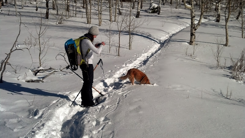
On Christmas day, my wife, Fender, and I decided to snowshoe from Pine Hollow to Tibble Fork (the same route we plan on camping at next week.) We parked one car at Tibble Fork Res, and took the other car to Pine Hollow to begin our trek. We started at 1:30 PM.

In the parking lot, we saw a guy playing one of those 20' long alps horns. It looked really nerdy from the car, but when I got out I was amazed. It was absolutely incredible. The notes would echo through all the canyons for at least 10 seconds after he stopped playing. It was similar to church bells echoing off the canyons. I was too quick to judge him. He was a seriously talented player. Video coming soon, once I get it from my wife's phone.

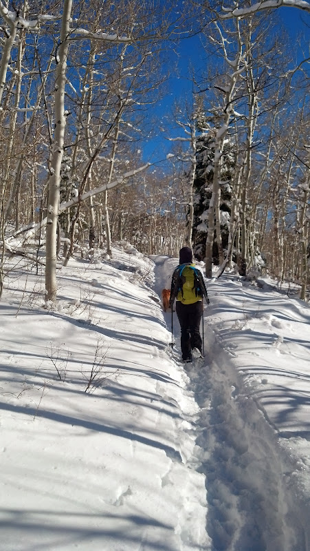
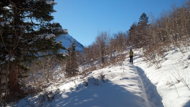
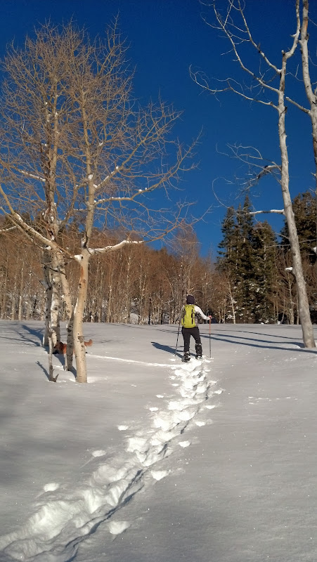
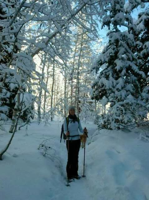
We started up the trail at 1:30. It was a warm, sunny day. We didn't need the snowshoes yet, so we strapped them on our packs and headed out with your yaktracks on.

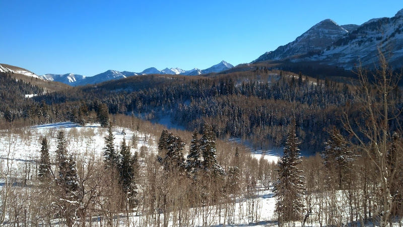
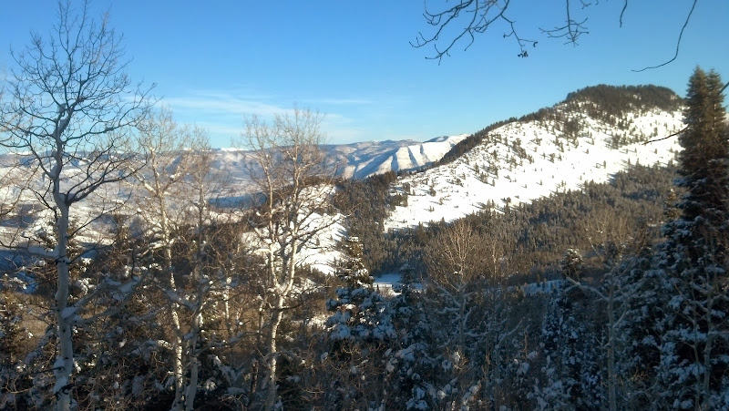
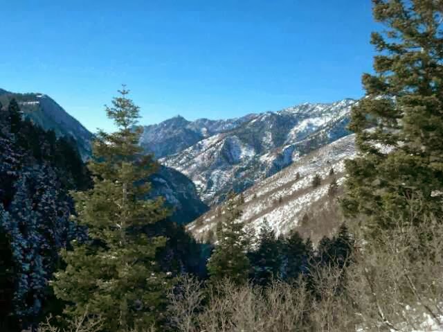
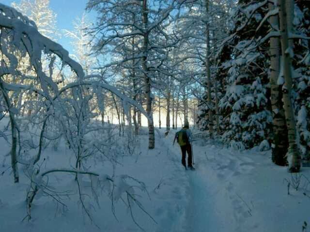
We got going and kept pealing layers off until we were just in our thermals. no gloves, jackets, or scarves; just sunglasses and thermals. Pretty soon we had climbed enough to look down into the valley.

Camera%252520HDR%252520Studio%252520-%2525201388079432974.jpg


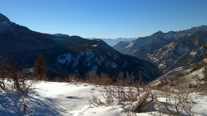
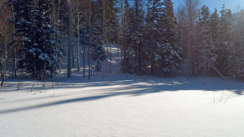
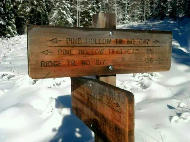
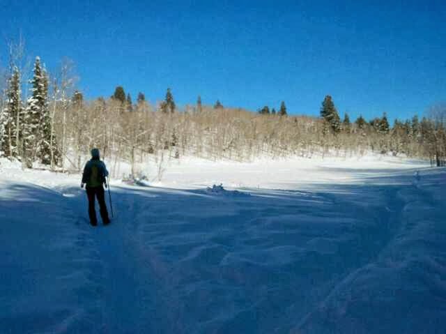
In short time we completed the first 1.5 miles and arrived at the first meadow. We continued on the Pine Hollow Trail (left), towards the second meadow.

Camera%252520HDR%252520Studio%252520-%2525201388078405438.jpg


Camera%252520HDR%252520Studio%252520-%2525201388079413451.jpg


Camera%252520HDR%252520Studio%252520-%2525201388079532395.jpg


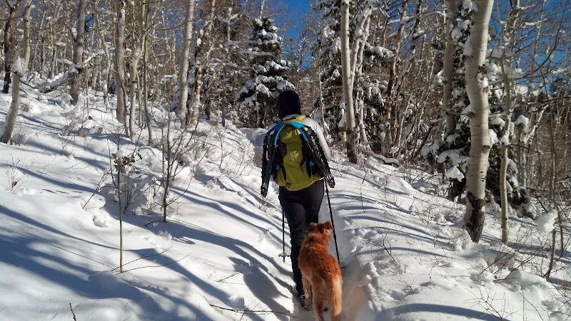
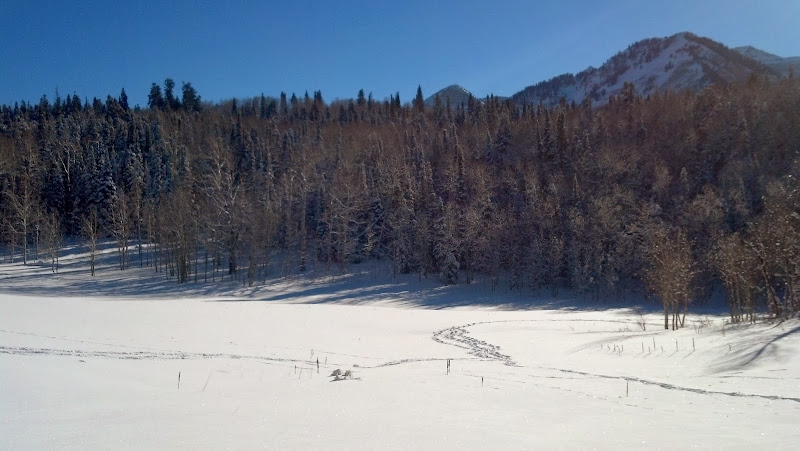
Another half mile later we arrived at the second meadow.

Camera%252520HDR%252520Studio%252520-%2525201388079556720.jpg


IMG_20131225_143518_181.jpg


IMG_20131225_143529_396.jpg


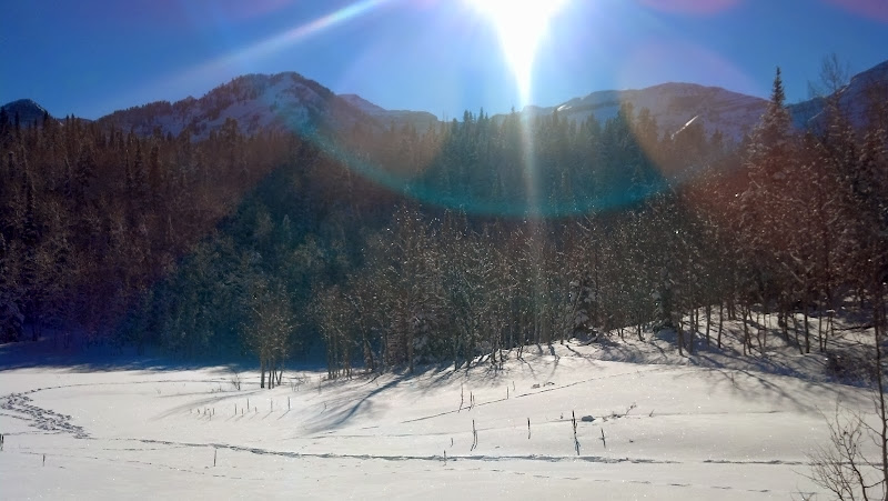
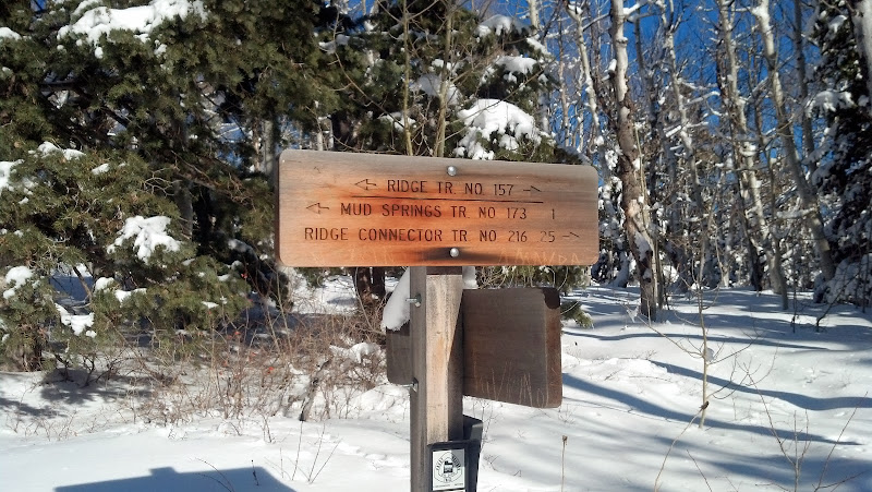
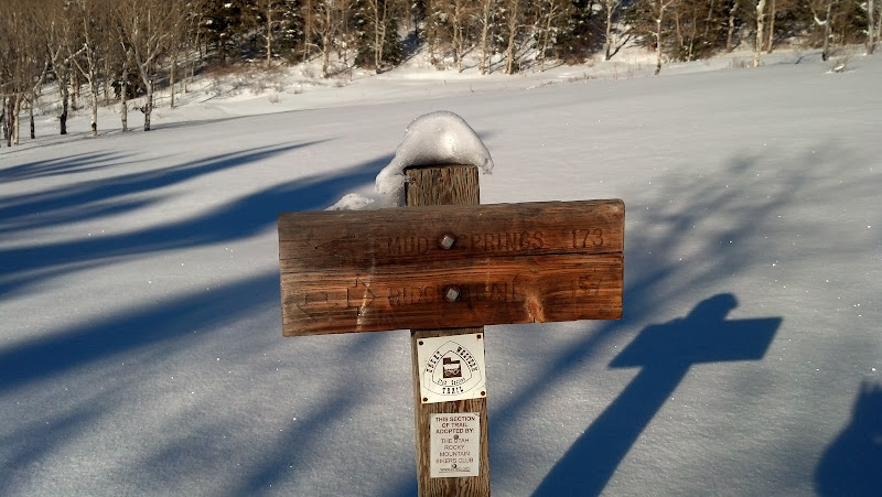
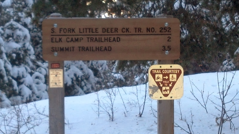
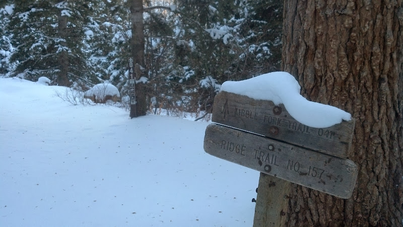
From there we continued left (East) to eventually connect to the ridge trail (157).
 
It amazes me how well dogs can smell. If my nose were as sensitive as a dog's nose, it would drive me crazy. From time to time Fender will catch a scent of something and just bury his head in the snow to smell it better.

IMG_20131225_143545_363.jpg


The trail was still nicely packed above the second meadow, so we still didn't use our snowshoes.

IMG_20131225_143756_806.jpg


IMG_20131225_143915_500.jpg


It was really warm here. I would guess around 45*. Snow was falling off the surrounding trees in big clumps. Pretty soon we had arrived at the junction for the ridge trail (157).

IMG_20131225_144050_146.jpg


We made another left (heading north) and continued on towards Mud Springs.

IMG_20131225_150010_297.jpg


The views from up here were stunning; it was a really clear day.

IMG_20131225_150054_195.jpg


Looking down into Alpine/Highland.

IMG_20131225_150911_535.jpg


IMG_20131225_150924_132.jpg
 
At this point, the snow started to get deeper and not as packed, so we strapped the snowshoes on. In about 200 yards, there was no more trail, it was all snowed over. We could still see a small indentation where the ground dipped. It looked like a small river covered in snow. We followed that trail on to get to mud springs. Breaking trail in knee-deep powder is an exhausting experience.
IMG_20131225_152357_583.jpg

Mud springs looked like nobody had been there all year since the recent snowstorm had buried everyone's tracks. We continued to the right (East) on the ridge trail.

We spotted our camp spot for next week when we'd be staying here:
IMG_20131225_152717_287.jpg

This is a steep section in the summer, and plowing knee-deep powder only made it even more exhausting. Forward progress was about 4 times slower than on the packed trail.
IMG_20131225_152441_015.jpg

Eventually we crested the ridge and could look down into Heber.
IMG_20131225_154119_583.jpg

It probably took us an hour to get from mud springs to connect to the 4-way intersection of trails 157, 41, and 252. If this had been tracked out already, it would have taken us 15 min max.


Eventually we did make it to the intersection, right as the sun was getting hidden by Mt Timpanogos.
IMG_20131225_161458_424.jpg

We headed down trail 41, which would eventually lead us to Tibble Fork Res.
IMG_20131225_161514_499.jpg

Trail 41 was mostly downhill, with some flat sections. Fortunately there wasn't any uphill. We were still plowing trail until we arrived at the junction of 40 and 41. From there it was a quick pace, and we arrived back at the car at 5:45, right as it was starting to get dark.

We ended up covering 7 miles exactly.

What a fun trip. I highly recommend this route, and I can't wait to do it again next week, broken up halfway with an overnight stay in between.
 
@sixstringsteve thanks for the trip report! I've got my family talked into following your foot steps tomorrow! I'm the only one with any experience so we probably won't go all the way to Tibble Fork, but we'll go as far as the first or second meadow depending on how everyone is doing. Thanks!
 
Cool! Let us know how it went. You shouldn't even need snowshoes up to the second meadow. Hiking boots should be fine.

You can download my gps tracks and follow along (although it's pretty tough to get lost). Once you arrive at the first meadow, stay left and it'll take you to the second meadow (only .5 miles past the 1st meadow). If you make it to the second meadow, spend 15 min exploring around the area, there are some great views around there, and some cool scenery. I like to cross the meadow and poke around there.

Have fun and be safe and wear lots of sunscreen. You should see plenty of other people up there if you go in the morning.
 
I did about half of this on Thursday with a group of people. I need to go back sometime and explore more. So many connecting trails and places to go
 
Being inspired by this trip report my family & I followed @sixstringsteve tracks Friday morning.

The weather was perfect: the skies were blue, the sun was shinning and temperatures were comfortable.

I think this was my first time up American Fork Canyon in the winter, so it was interesting seeing all the stuff you don't see when the trees are full of leaves.

Pine Hollow Trailhead is where the road closes, so there was quite a bit of action in the parking lot. Not only for those who snowshoe up the trail, but also there were several people on bikes, snowmobiles and ATV's going up the highway.

As was said there was no need for snowshoes at least as far as the first meadow. The trail is well packed and in the exposed areas almost all the snow was gone. Without snowshoes some crampon spikes would be helpful.

But because I'd rented gear for everyone we put on the snowshoes and climbed to the first meadow, where the kids decided they wanted to go back. It took us an hour, traveling at a very slow, stopping to look at the scenery pace. Honestly, I think the kids were bored, it wasn't enough of a challenge to engage them. (That's what I'm hoping, because I loved it.) So we explored around this meadow for half hour or so and then headed back down.

One other side note. We rented gear from BYU Outdoors and got NEOS Overshoes with our snowshoes & poles. Highly recommend these!
You just wear your athletic shoe, slip 'em into the NEOS boot, cinch 'em up and you're ready. Kept everyone's feet dry and warm.

Starting out.
IMG_0734.JPG

I think this is somewhere along the back side of Mount Timpanogos
IMG_0737.JPG


On the trail
IMG_0744.JPG

Meadow #1 up Pine Hollow Trail.
IMG_0745.JPG

Our photographer, Nancy, taking a selfie
IMG_0748.JPG

Having had enough of the packed trail, the boy & I explored around the trees in the untouched powder.
IMG_0754.JPG

The girls enjoying a good laugh (at my expense, I'm sure)
IMG_0756.JPG


MSR snowshoes & NEO overshoes
IMG_0758.JPG
 
Those overshoe things are a great idea. might have to look into next year as sometimes I prefer the comfort of my summer hiking shoes.
 
Those overshoes are cool. Great report Ned, the trail only gets better above the second meadow. I can't wait for another good storm to dump up there again.

There are quite a few trails starting at tibble fork as well.
 
Similar threads
Thread starter Title Forum Replies Date
kwc Adirondack Snowshoeing on a sunny day Winter Sports 0
kwc A Frosty Snowshoeing Adventure in the Southern Adirondacks Winter Sports 0
Outdoor_Fool Snowshoeing to Castner Glacier Ice Cave, Alaska Range Winter Sports 5
kwc Adirondack Snowshoeing Hiking & Camping 2
pstm13 Snowshoeing With Kids: So Much Fun it “Yurts.” Winter Sports 11
kwc Sunday Snowshoeing in the southern Adirondacks Hiking & Camping 3
Miya A First Attempt at Snowshoeing - Now I am Hooked Winter Sports 12
Outdoors24 Snowshoeing Cedar Breaks National Monument Winter Sports 2
Yvonne Snowshoeing Northgate Peaks, Zion NP, December 2018 Winter Sports 10
kwc some Adirondack snowshoeing ... Winter Sports 2
Shirt357 Winter hikes/snowshoeing near Fort Collins Trip Planning 8
kimbur96 Brainard Lake, CO snowshoeing Everything Else 0
swmalone Perry Canyon Snowshoeing Winter Sports 2
swmalone Looking for Softshell/snowshoeing pant suggestions Gear 6
danger02ward Snowshoeing Lewis Peak and Ben Lomand Peak Winter Sports 4
Lucas Erickson Winter Camping/Snowshoeing in Utah? Trip Planning 6
Howells Outdoors Snowshoeing the Old Sorrel Trail Hiking & Camping 11
IntrepidXJ West Bench Snowshoeing Winter Sports 2
steve Snowshoeing AF Canyon Winter Sports 15
steve Invite Snowshoeing/Hiking up AF Canyon Sat, 12/14/13 Meet Up (Members Only) 0
Yvonne Snowshoeing near Wildcat Trailhead, Kolob Terrace Winter Sports 5
Dave Invite January full moon snowshoeing Meet Up (Members Only) 26
pixie1339 Snowshoeing For Dummies Gear 23
IntrepidXJ Black Canyon Snowshoeing Winter Sports 2
Dave Invite Moonlight snowshoeing Meet Up (Members Only) 2
IntrepidXJ Snowshoeing to Water Dog Reservoir Winter Sports 3
IntrepidXJ Christmas Eve Snowshoeing on the Mesa Winter Sports 4
JamesM Snowshoeing Cedar Breaks National Monument Hiking & Camping 0
scatman The American Buffalo General Discussion 2
fossana Meet our first Native American DoI head, Deb Haaland General Discussion 5
DrNed Cell service in American Fork Canyon will be a reality by 2020 General Discussion 13
Parma American man first to solo across Antarctica unaided General Discussion 21
regehr Three of the Four American Fork Twin Peaks Hiking & Camping 10
Devin Ashby Silver Glance Lake - American Fork Canyon Backpacking 7
JamesM ASORA-American Southwest Outdoor Recreation Association General Discussion 1
andyjaggy American Fork Canyon General Discussion 0
DrNed Land Swap In American Fork Canyon General Discussion 8
Nick The American West 150 Years Ago General Discussion 6
steve Invite New Year's Eve Winter Backpacking: American Fork Canyon Meet Up (Members Only) 3
rayden8 Climbing in American Fork Canyon, UT Everything Else 0
R Getting to All American Man Trip Planning 3
R Salt Creek - All American Man Trip Planning 28
regehr (Uintas) Lake Fork Fun Backpacking 8
RockyMntCol Trip Planning Younts Peak / South Fork Yellowstone Trip Planning 12
J Pacific Creek or North Buffalo Fork? Teton Wilderness, Thorofare ,etc. Trip Planning 10
travel2walk Gros Ventre Wilderness: Granite Creek, West Fork Crystal Creek, Crystal Creek, & Swift Creek - June 2021 Backpacking 8
wsp_scott Big South Fork Bikepacking Backpacking 1
RyanP The Plug exit of Pictograph Fork (Maze) Trip Planning 15
BJett Big South Fork National River & Recreation Area Packraft/Backpack Loop (TN) Backpacking 6
wsp_scott Honey Creek (Big South Fork) Backpacking 9

Similar threads

Back
Top