Aldaron
Member
- Joined
- Jun 16, 2012
- Messages
- 1,487
Vacation this year took us up to Banff and Jasper National Parks in Canada. I had planned on going in September after the crowds had died down a little, but because of work responsibilities, we had to go in August. The plan was essentially to make the 14+ hour drive from Salt Lake, and then hike and backpack around the parks for a week. Just before we left, Alberta had terrible flooding that knocked out several bridges in Banff, but they did a phenomenal job of getting the roads back open in just a matter of days, and we were able to continue the trip as planned.
One of the backpacking trips we had planned was to do the Skyline Trail in Jasper. The guide book described this trail as one of the best backpacking routes in the Rocky Mountains, so that sounded like a pretty good option. The Park Service has specific backcountry "campgrounds," and limits the number of people at each site, so we needed a reservation. I was only planning a one night out and back, and we got the last spot for the site that I wanted. Jasper does camping much like I remember they do it in Glacier: there are specific sites you can camp at in the backcountry, but you share the site with other campers. So, unlike Yellowstone, for example, where you need to stay at a specific site that you get to yourself, these sites are shared with others.
After checking in with the ranger station the day before our trip, we spent the night in the town of Jasper and got up early in the morning to head out. We drove to the trailhead at Maligne Lake the day before, and it was crazy crowded in the afternoon, so I wanted to get ahead of that.
Maligne Lake

The first several miles were not hard at all, as the trail made an almost continual, but very gradual ascent up to Little Shovel Pass. But the first few miles up to Little Shovel Pass were also very uneventful: the trail was surrounded by thick forest. There were no views, and the trail was very muddy for a couple of miles. And while it had been raining a lot the past few days, you could tell the trail was often muddy, because there were social trails that had developed from people trying to work their way around the muddy sections. So, really, for the first half of the day, we were pretty disappointed in the trail.
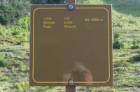
But once we got up to Little Shovel Pass, we climbed above tree-line, and the trail became really nice. We kept feeling like we should have seen grizzly bears or caribou up there (in fact, the ranger station told us that a grizzly had been spotted at the pass two days earlier), but we didn't see anything more than gigantic marmots and prairie dogs. But the views were really nice.
Little Shovel Pass
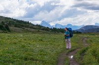

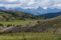
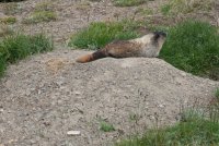
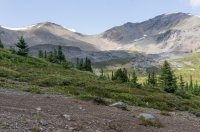
Me made it the 7.5 miles to the Snowbowl Campground early in the afternoon. We were the first ones there, so we got first dibs on a campsite. The campground was kind of uncomfortably cut out of the side of a hill in the trees, and none of the sites were very good. In fact, four of the sites were literally just a couple of steps from each other. The other four sites were a little more spread out, but you still had to walk through the sites to get to the food or trail. So we picked the site that was most out of the way and set up camp.
After resting for a bit, we continued a couple of miles up the trail. Here above tree-line, the views were really nice, but I would easily compare them to many of the views you would get above tree-line in Colorado. While the valleys where the roads run through the parks have some incredible granite mountains, it seemed, much like Zion, that the geography was different once you climbed out of those valleys. The mountains in the backcountry were beautiful, but they looked a lot like Colorado.
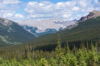
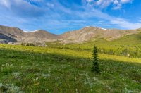
The rest of the evening was uneventful. The other sites were all full, but the people all kept to themselves. We got up fairly early the next day to look for wildlife on the hike out, but we didn't see anything other than a weasel or ferret of some kind.
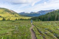
All in all, this was a great hike. It wasn't crowded at all. We ran into quite a few people the last few miles as we were hiking out (including one family that was carrying more gear than I think I've ever seen in the backcountry), but it wasn't too bad. And while the hike was great, we expected to see more wildlife than we did, and we expected more views than we had. It really felt like a hike in Colorado that took longer than usual to get above tree-line. That having been said, it was definitely worth doing, and I'm glad we made the trip. The beauty in Jasper and Banff is just incredible, and made it totally worth the drive.
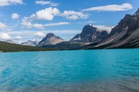
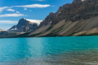
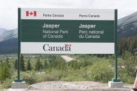
The following pictures aren't from this hike, but they're on the drive to the hike, so I figure they have a place here!
Bow Lake
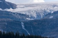
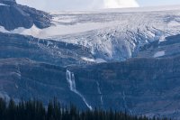
Athabasca Glacier
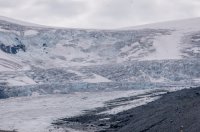
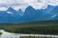
Athabasca Glacier
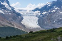
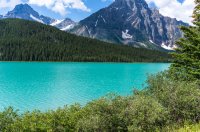
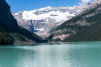
Lake Louise

Featured image for home page:
One of the backpacking trips we had planned was to do the Skyline Trail in Jasper. The guide book described this trail as one of the best backpacking routes in the Rocky Mountains, so that sounded like a pretty good option. The Park Service has specific backcountry "campgrounds," and limits the number of people at each site, so we needed a reservation. I was only planning a one night out and back, and we got the last spot for the site that I wanted. Jasper does camping much like I remember they do it in Glacier: there are specific sites you can camp at in the backcountry, but you share the site with other campers. So, unlike Yellowstone, for example, where you need to stay at a specific site that you get to yourself, these sites are shared with others.
After checking in with the ranger station the day before our trip, we spent the night in the town of Jasper and got up early in the morning to head out. We drove to the trailhead at Maligne Lake the day before, and it was crazy crowded in the afternoon, so I wanted to get ahead of that.
Maligne Lake

The first several miles were not hard at all, as the trail made an almost continual, but very gradual ascent up to Little Shovel Pass. But the first few miles up to Little Shovel Pass were also very uneventful: the trail was surrounded by thick forest. There were no views, and the trail was very muddy for a couple of miles. And while it had been raining a lot the past few days, you could tell the trail was often muddy, because there were social trails that had developed from people trying to work their way around the muddy sections. So, really, for the first half of the day, we were pretty disappointed in the trail.
But once we got up to Little Shovel Pass, we climbed above tree-line, and the trail became really nice. We kept feeling like we should have seen grizzly bears or caribou up there (in fact, the ranger station told us that a grizzly had been spotted at the pass two days earlier), but we didn't see anything more than gigantic marmots and prairie dogs. But the views were really nice.
Little Shovel Pass


Me made it the 7.5 miles to the Snowbowl Campground early in the afternoon. We were the first ones there, so we got first dibs on a campsite. The campground was kind of uncomfortably cut out of the side of a hill in the trees, and none of the sites were very good. In fact, four of the sites were literally just a couple of steps from each other. The other four sites were a little more spread out, but you still had to walk through the sites to get to the food or trail. So we picked the site that was most out of the way and set up camp.
After resting for a bit, we continued a couple of miles up the trail. Here above tree-line, the views were really nice, but I would easily compare them to many of the views you would get above tree-line in Colorado. While the valleys where the roads run through the parks have some incredible granite mountains, it seemed, much like Zion, that the geography was different once you climbed out of those valleys. The mountains in the backcountry were beautiful, but they looked a lot like Colorado.


The rest of the evening was uneventful. The other sites were all full, but the people all kept to themselves. We got up fairly early the next day to look for wildlife on the hike out, but we didn't see anything other than a weasel or ferret of some kind.


All in all, this was a great hike. It wasn't crowded at all. We ran into quite a few people the last few miles as we were hiking out (including one family that was carrying more gear than I think I've ever seen in the backcountry), but it wasn't too bad. And while the hike was great, we expected to see more wildlife than we did, and we expected more views than we had. It really felt like a hike in Colorado that took longer than usual to get above tree-line. That having been said, it was definitely worth doing, and I'm glad we made the trip. The beauty in Jasper and Banff is just incredible, and made it totally worth the drive.
The following pictures aren't from this hike, but they're on the drive to the hike, so I figure they have a place here!
Bow Lake


Athabasca Glacier


Athabasca Glacier


Lake Louise


Featured image for home page:

