Sequoia: Upper Kern and Lake South America

Jammer

❤2Hike
.
Joined
Feb 23, 2012
Messages
660
After skipping my traditional spring trip to Utah and spending way too much time cooped up in front of the computer, I finally escaped last month for a "local" trip to the Sequoia backcountry. I say "local" because I could do this entire trip self-sustained with only one stop at a gas pump along the way. It felt so good to get out into nature and disconnect for a while, but otherwise... it was a pretty miserable trip. :oops: I was probably a bit too ambitious for a my first hike in over a year being nearly 100 miles up and down through the high Sierras carrying a bear canister and 10 days of food. It was also much warmer than expected and the bugs were pretty relentless. Or... maybe I was just cranky from missing my red-rock canyons! In any case, here are some highlights and a link to the video report at the bottom. :thumbsup:

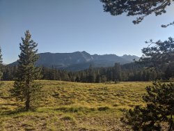
climbing up through the gnarly foxtail pines:
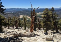
04_IMG_20200702_125144.jpg

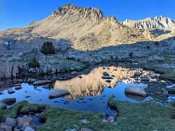
across from the Kaweah peaks::
06_IMG_20200703_190239.jpg

headed up toward the upper Kern Basin:
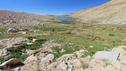
07_small_jamal.jpg

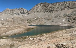
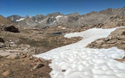
up near the headwaters of the Kern River:
16_IMG_20200705_114108.jpg

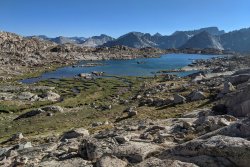
Lake South America:
15_IMG_20200705_122107.jpg

so many awesome lakes:
1_Video_Thumb3_no_text.jpg
08_IMG_20200705_180315.jpg

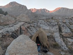
camping above 12,000':
20_IMG_20200705_201908.jpg

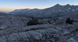
sundown on the Great Western Divide and the Kern Canyon (my route for the next few days):
22_IMG_20200705_195414.jpg

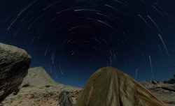
my "fireworks" on the 4th of July:
3_StarTrails.jpg

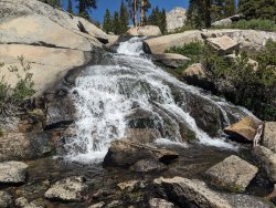
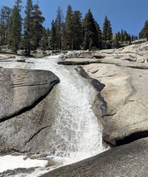
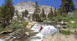
waterfall mania:
30_IMG_20200706_120123.jpg
31_IMG_20200706_144314.jpg
02_Waterfall.jpg

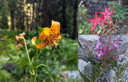
wildflowers:
05_Flowers.jpg

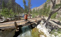
crossing the Kern at the High Sierra Trail:
58_Bridge_Shot.jpg

Even though is was kinda miserable... I'm still happy I got out and made it happen.

See more photos, the route map, and the full report on my site.

Or... here's the video if you prefer watching such things:

 
Sounds like if the bugs hadn’t been a problem the trip might have been much better! Nice route though and excellent pics!
 
Latter in the season the bugs would not have been as bad. My favorite trips in the Sierra have always been in early September.
 
Wow, another great TR, beautiful photos. We will watch the video this week on the big screen. Sorry about the Covid-15! Did you get it down to Covid-10 after that trip? Maybe you will get the chance to enjoy some bug free red rock scenery this fall. We were thinking of you last fall when we stood next to a few logs across a remote drainage in GSENM.
 
Sorry about the Covid-15! Did you get it down to Covid-10 after that trip?

I actually did lose 10lbs on this hike in just 8 days! A few pounds came right back, but still. I talk about it in the video that I have a bad habit of letting myself go a little every winter knowing that when spring comes around I'm crazy active and lose weight fairly quickly (except... not this spring!) I know that's not a healthy habit and will definitely catch up with me at some point if I don't stop doing it. Hoping that maybe a trip or two this fall will help kickstart that process!

Truth is... this could have been an awesome hike if I'd just prepped a bit better. A true local warm-up hike or two would have helped quite a bit. I also packed too much and could have been better equipped to fight the bugs. Next time! :)
 
That third pic looks like it could pass for something taken here in our Uinta range. I've been to a water park called Water Mania before as a kid. But Waterfall Mania looks to be much more interesting. Way to get out there and make the best of a sad situation.
 
Nice, I left out of Cottonwood Pass on 7/28 and returned over New Army on 8/3, covered some of the PCT and a couple off-trail basins. If you think coming down Rock Creek was tedious, you should have stayed on the PCT past the Siberian Pass trail. That is a stretch of trail I hope to never see again :)

Got to see a bit of the Upper Kern basin last summer, I'd definitely like to spend some more time in the area.

Thanks for the report, especially the part about the Kern below the HST. I've looked at the map and thought it would be an interesting hike, but way too many trees and snakes. I'll stick to basins at/above tree line :)

I'm still sorting photos for a trip report, but hopefully done soon.
 
Nice, I left out of Cottonwood Pass on 7/28 and returned over New Army on 8/3, covered some of the PCT and a couple off-trail basins. If you think coming down Rock Creek was tedious, you should have stayed on the PCT past the Siberian Pass trail. That is a stretch of trail I hope to never see again :)

Very cool -- did you go up into Miter Basin? Over to Crabtree? I'd considered this, but read a report before leaving that the snow was still pretty sketchy at the top. But, in hindsight this seems kinda hard to believe (and a ranger confirmed she thought it was unlikely as well.)

Actually I did stay on the PCT all the way down to Rock Creek. That section dropping down was not fun and I'm not quite sure why -- it just seemed like a grind.

I spent 2 nights in Crabtree basin and then went over Crabtree Pass into Miter Basin. I must have misread your report because it sounded like you cut across to Rock Creek and then down to the crossing, that is the way I wish I had gone :)
 

Don't like ads? Become a BCP Supporting Member and kiss them all goodbye. Click here for more info.

Back
Top