- Joined
- May 16, 2016
- Messages
- 1,453
7/28 - 8/6/22 (10 nights)
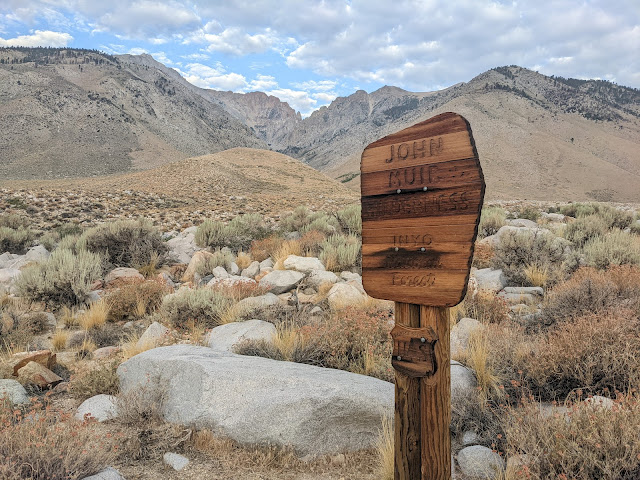
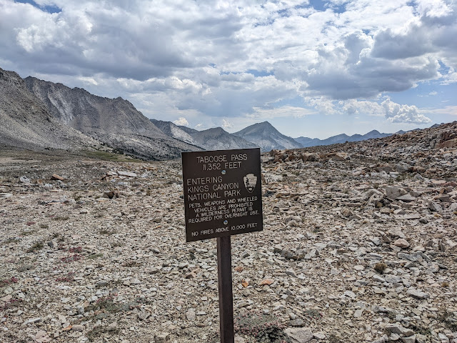
Taboose Pass (Inyo NF)
I had grand plans for a big loop out of Taboose Pass. A little bit on the JMT and a bunch of cross-country passes over 11 nights. I had lots of time and flexibility, so I could just see how things went.
Outline of my plans: Taboose -> Upper Basin -> Mather Pass -> Cirque Pass -> Potluck Pass -> Knapsack Pass -> Dusy Basin -> JMT -> Ladder Lake -> JMT -> Amphitheater Lake -> Cataract Creek Pass -> Dumbell Lakes -> Dumbell Pass -> Lakes Basin -> Cartridge Pass -> Bench Lake -> Taboose Pass
The weather forecast is filled with warnings of monsoon weather for the week, hopefully it won't be too bad.
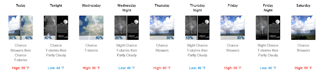
A little foreshadowing, it was bad! Rain everyday, a little bit of hail and graupel mixed in. And a couple days with biblical amounts of rain. Basically, it looked like the spring runoff for a couple of days.
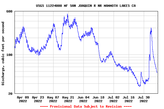
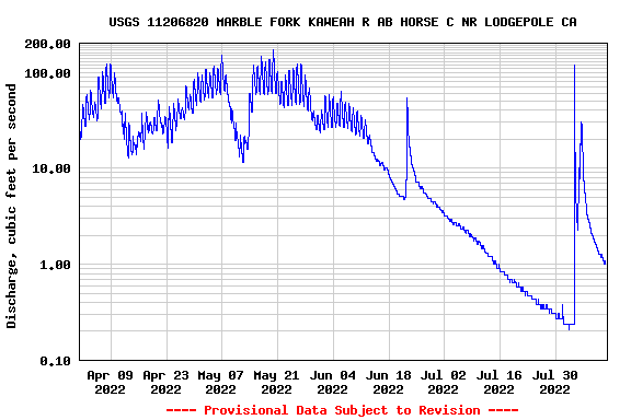
These graphs show river gauges on both sides of the Sierra.
East Side, a little north of where I was
West side, south of where I was
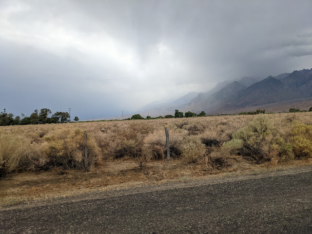
I flew into Reno, got my car and drove south to Taboose Pass. Nasty weather to the south, I hope I don't have to sleep in my tiny car.
Looks a little better to the west, maybe I'll get lucky.
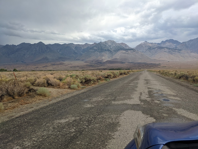
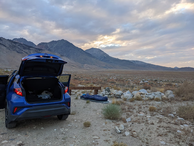
The road is in bad enough shape that I gave up trying to get all the way to the trailhead. Instead, I found a little pulloff about a mile short and set up camp. I got lucky with the weather and didn't have to squeeze into the car.
Day 1
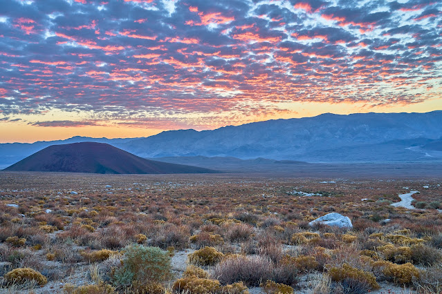
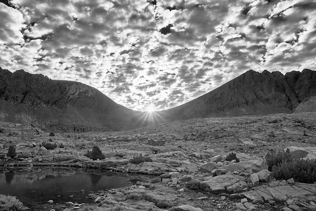
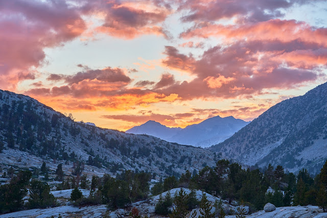
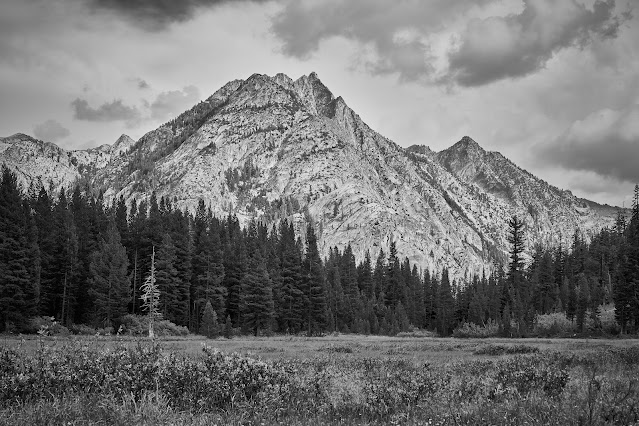
Fabulous sunrise over the White Mountains. Beautiful way to start the day but makes me nervous to see that many clouds already building.
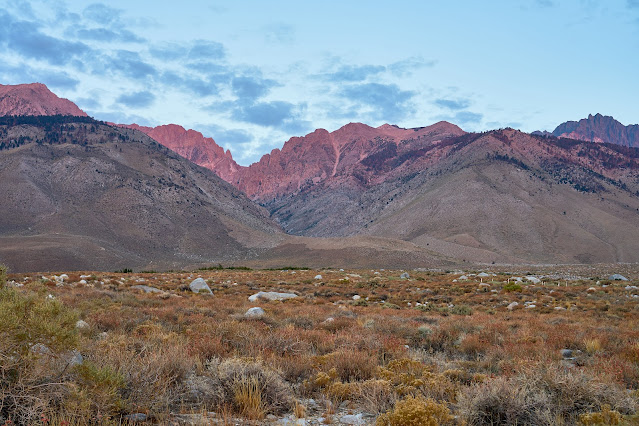
Hints of dawn on the Sierra Crest
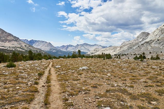
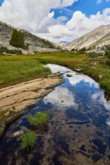
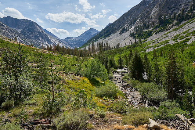
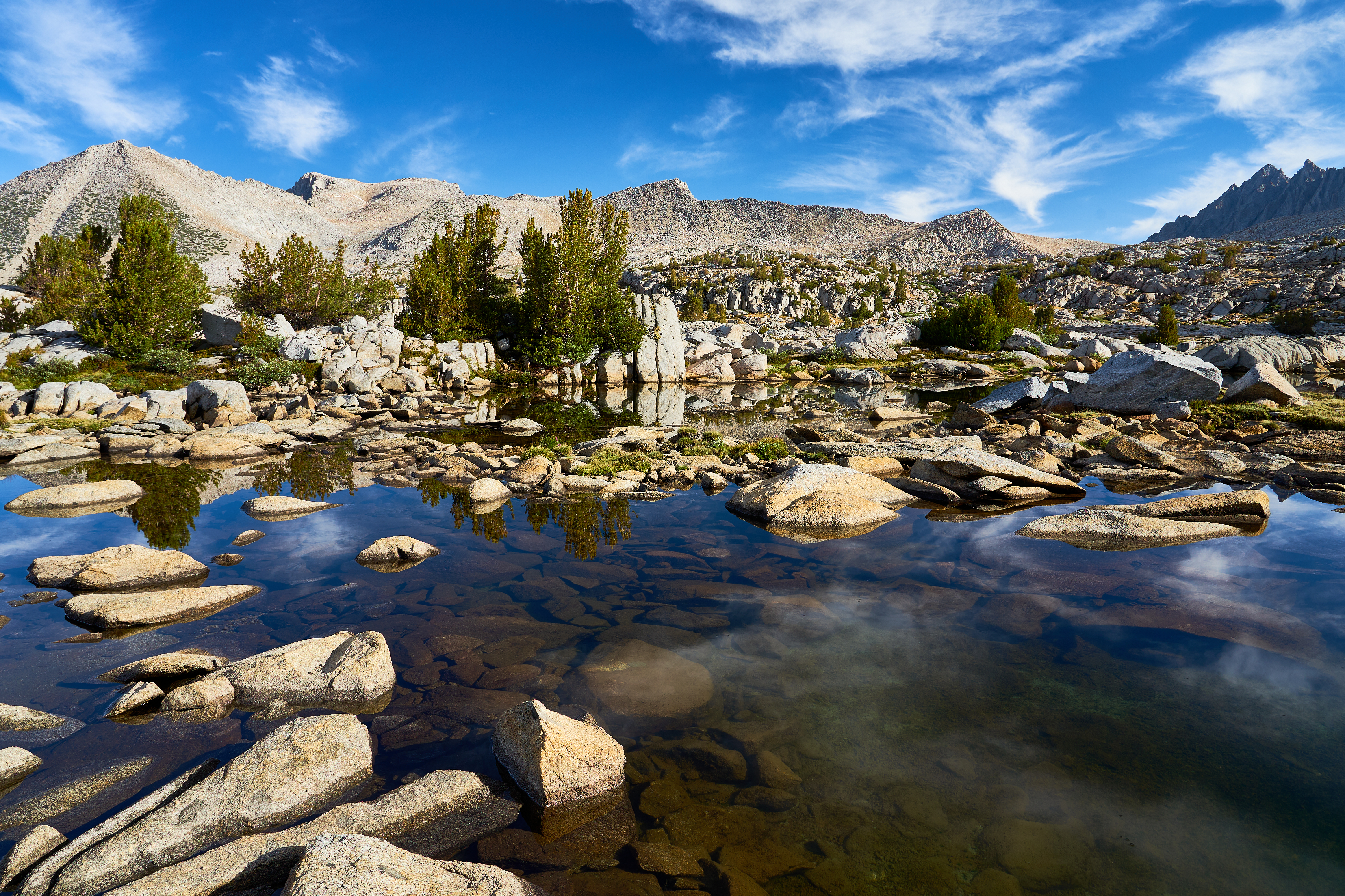
I was hiking a little after 6am, the time stamp on this photo is 6:46.
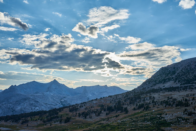
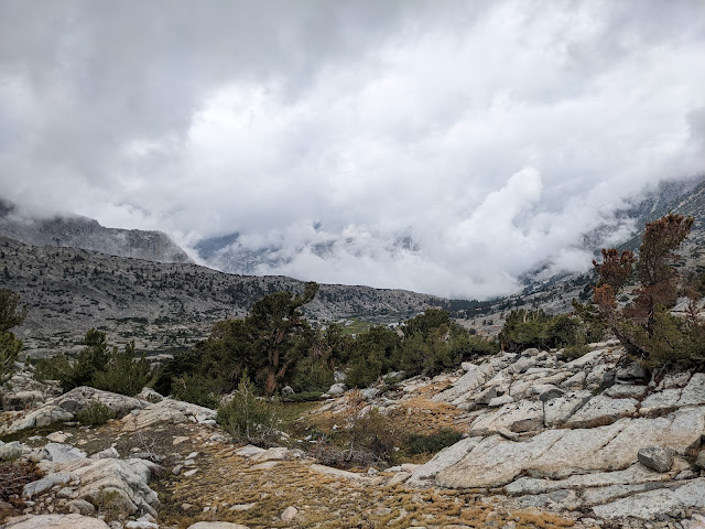
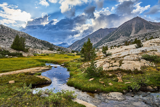
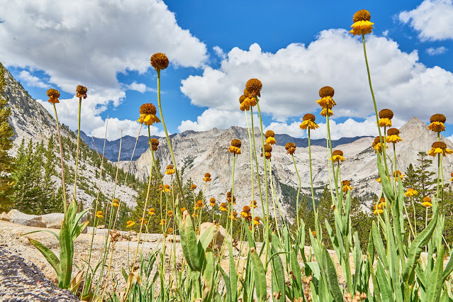
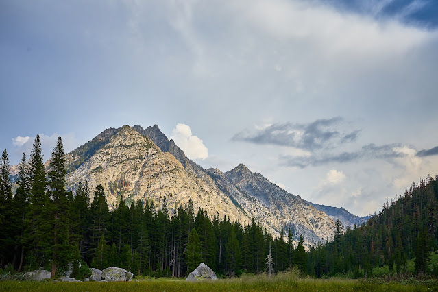
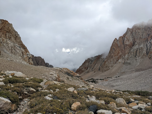
Clouds building over Taboose Pass
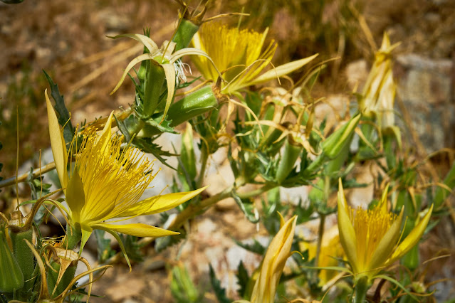
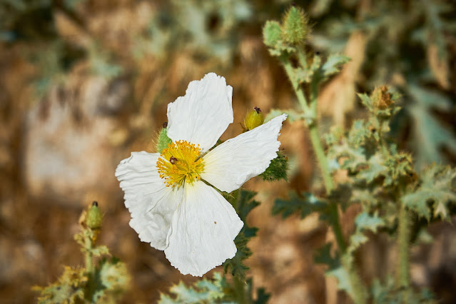
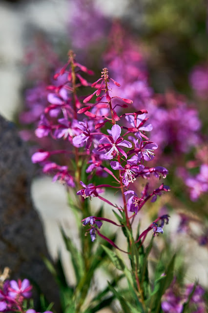
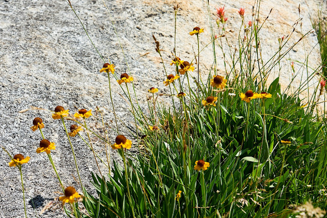
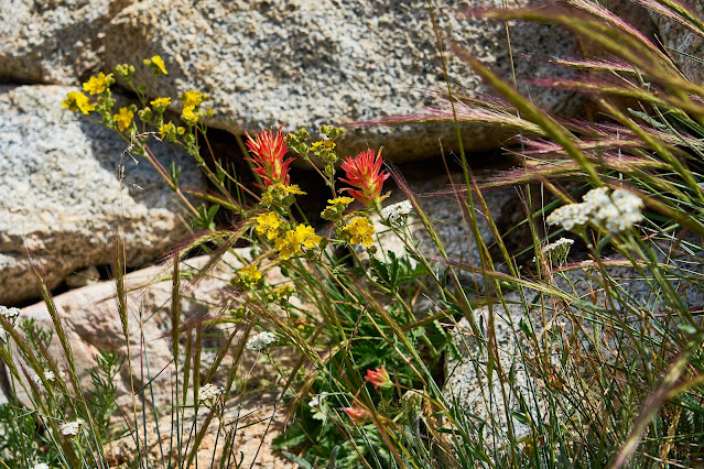
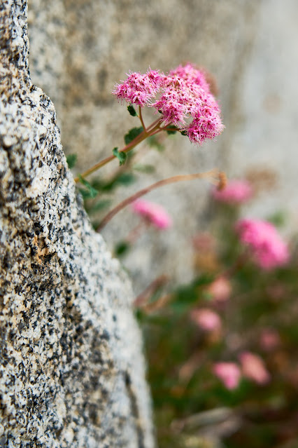
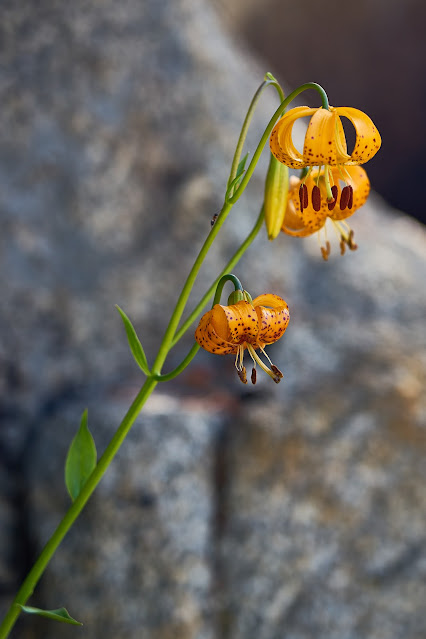
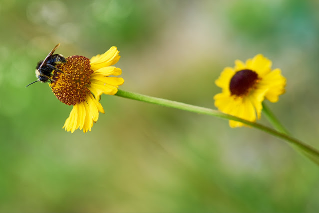
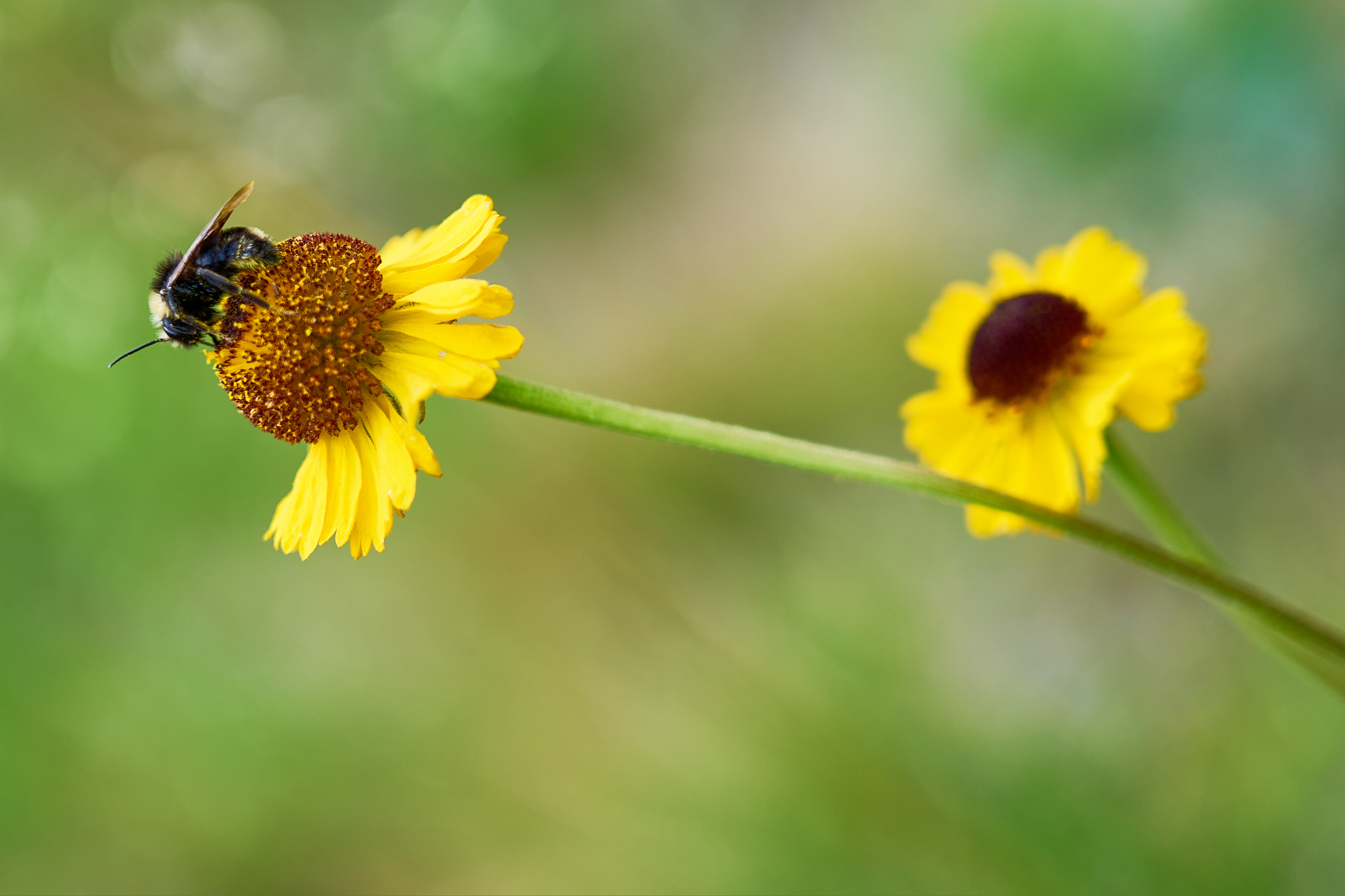
Not long after these flower photos, I got stung by a bee on my hand. It has been a long time since my last sting, but I did not have a good reaction, lots of swelling, but no breathing problems. I was hopeful that this time would not be as bad. I was less than an hour from the car, so if things started going sideways, I could hike back. I popped a couple Benadryl and hoped that it would help. I decided to hang out for about 30 minutes to see what was going to happen. My hand swelled a little, but didn't seem worth worrying about, so onward and upward.
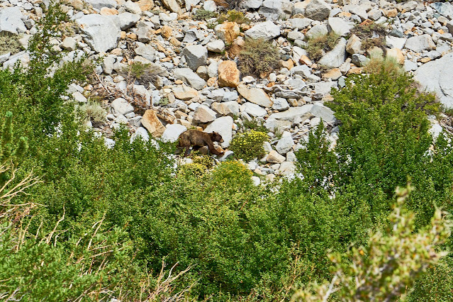
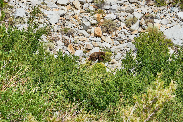
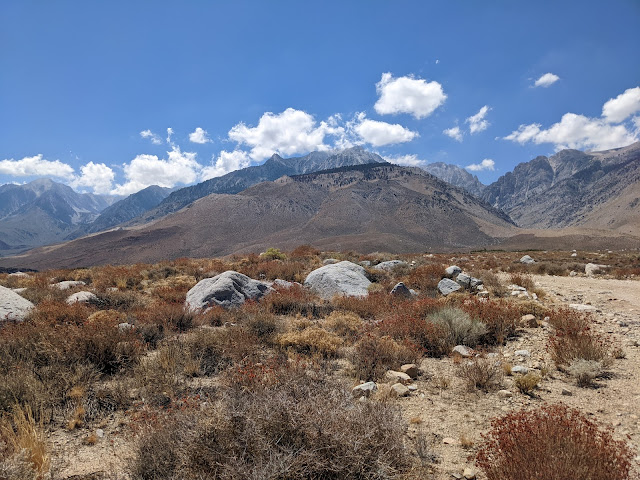
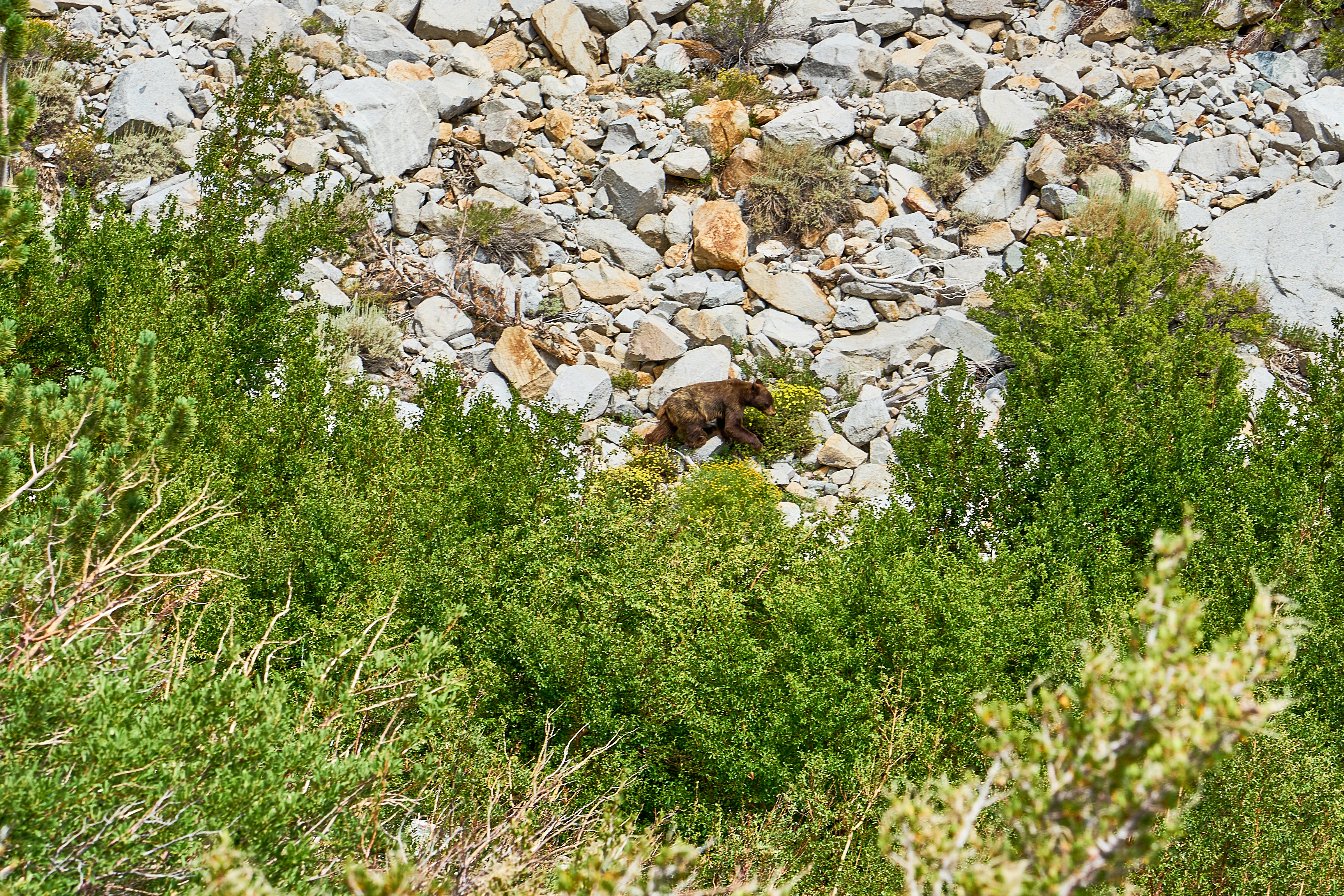
Bear way across the canyon
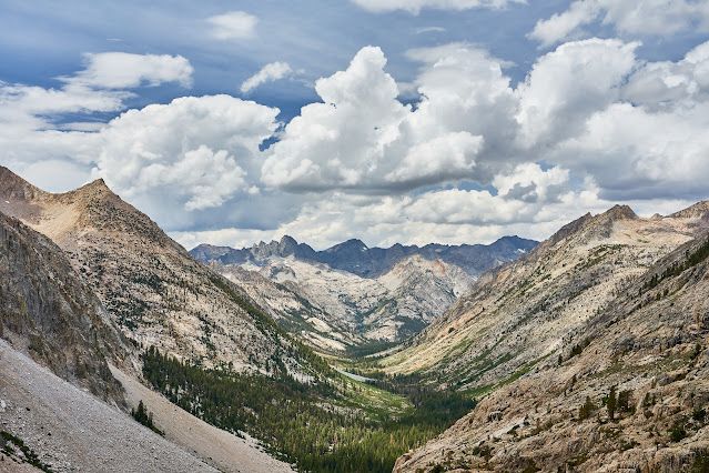
Looking East towards the valley
Clouds were building by the time I got to the top of the pass. The timestamp here is 3:25pm so about 9 hours of hiking with a couple short breaks (and one long for the bee sting) along the way, not bad for 8 miles and 6400' of elevation gain.
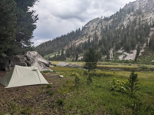
I found a place to setup camp and quickly filtered water and cooked dinner. I was able to finish dinner not long before the rain started.
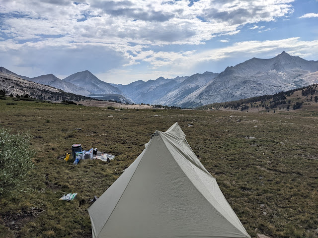
The rain did not last long, so I got a bit of a sunset, but it was windy and I was tired (still on east coast time) so I did not stay up very long.
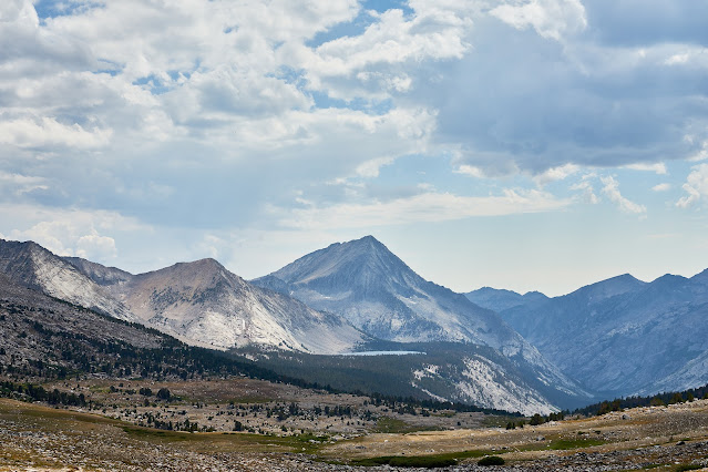
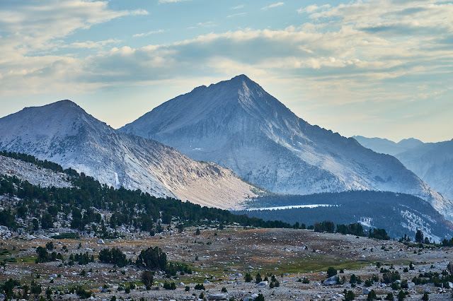
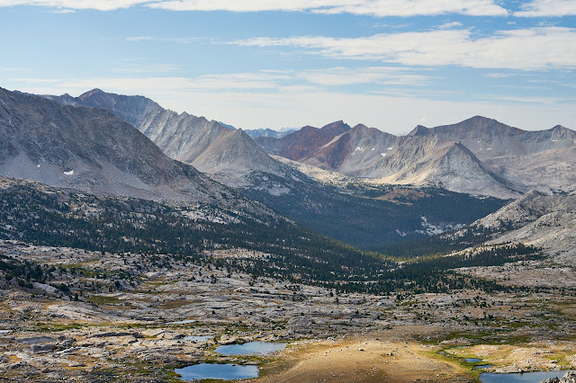
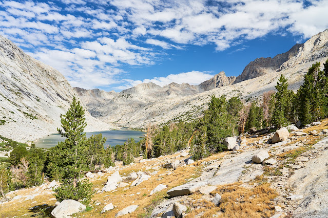
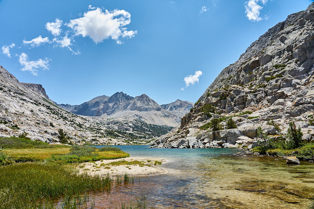
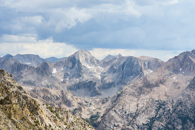
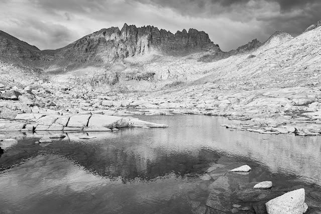
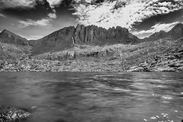
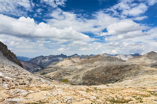
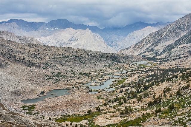
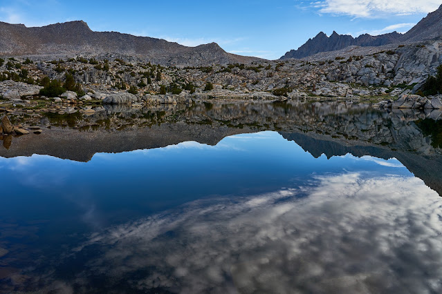
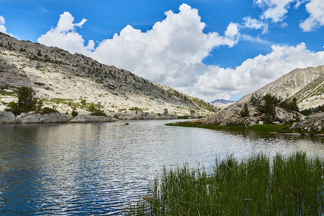
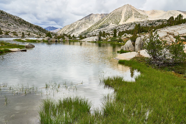
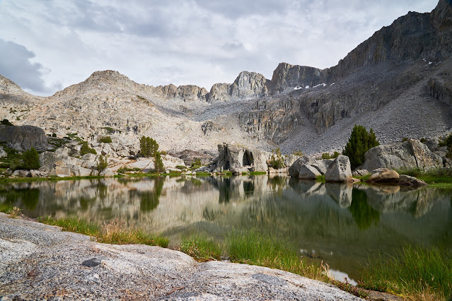
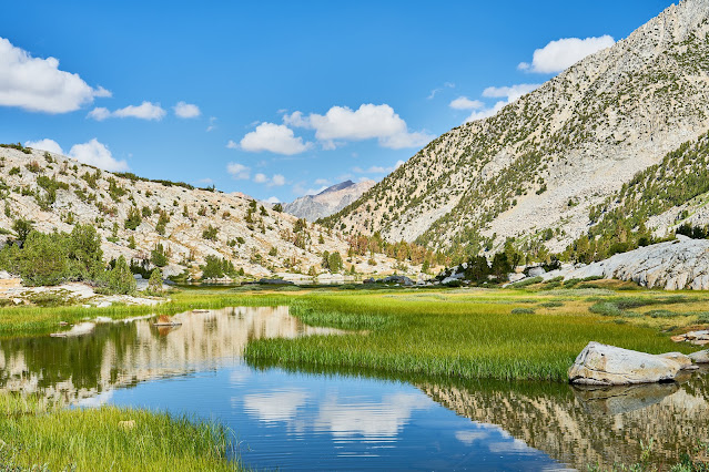
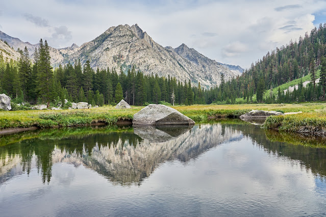
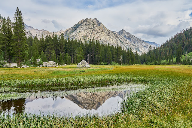
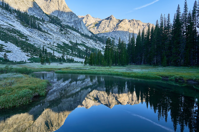
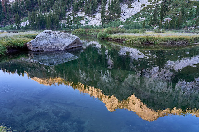
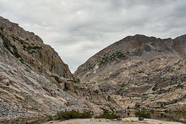
Bench Lake in the distance with Arrow Peak behind it.
Looking a little farther north towards Mt Ruskin and Vernnacher Col
Zoomed in on Bench Lake
Day 2
Woke up to a beautiful morning, heading north to Upper Basin and Mather Pass for the day.
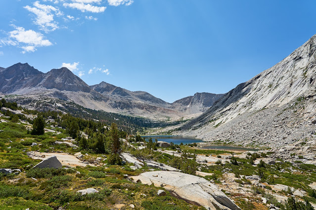
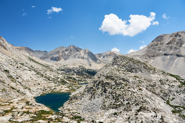
Bench Lake again
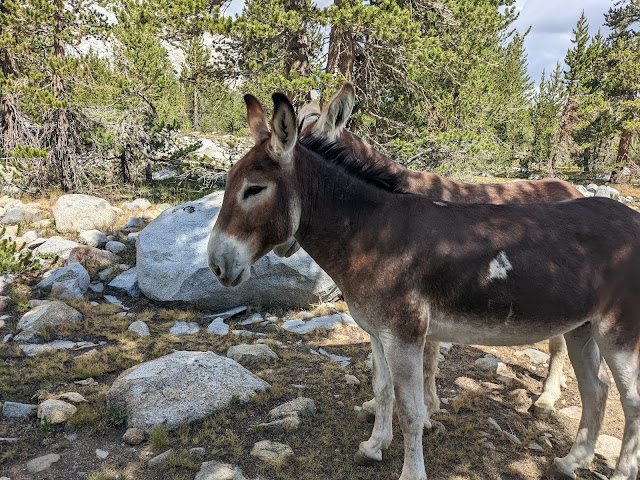
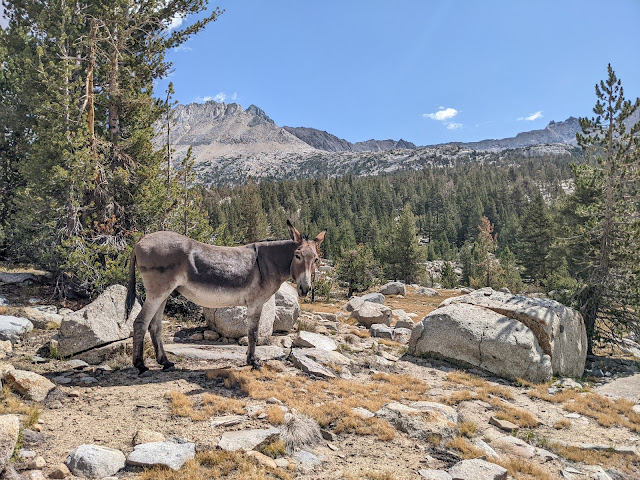
I made my way north by going cross country for a bit, basically paralleling the JMT but on the east side of the river. After about an hour, I eventually rock hopped the river and found the JMT. As I was hiking I started hearing bells. At first I thought I was imagining it, but then I came around a corner and found a bunch of mules, a couple of which had bells on.
I was thinking of @scatman and @Rockskipper when I took these photos")
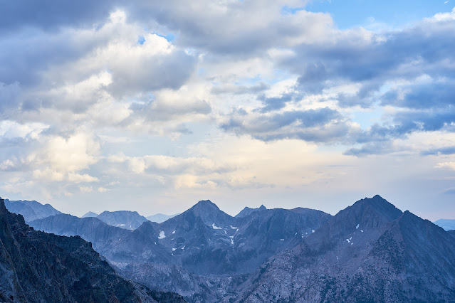
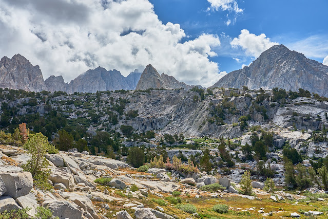
Onward north into Upper Basin, clouds are building to the west.
I set up early because I had thoughts of tackling Split Mountain, but the clouds were getting thicker and I didn't really have it in me to climb another 2000 feet. Not long after this photo, the wind picked up and the rain started and then the hail and graupel. Thankfully, everything blew over in about an hour.
After the storm, looking south
I wasn't going to do Split Mountain, but I wandered around the lakes below Mather Pass and then back to camp for dinner.
Day 3
Beautiful day but clouds already building.
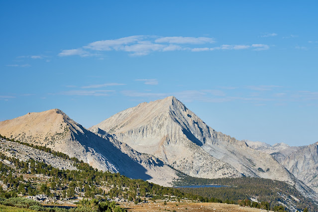
Sunrise and Split Mountain
I packed up and took another look at Split Mountain and then headed up to Mather Pass. This is looking south from below the pass.
Looking north from Mather Pass at the Palisades and Palisade Lakes
I passed through the basin and the Palisade Lakes. The bee sting on my hand was still itching and was a little swollen. It wasn't getting worse but still annoying. I happened to talk to a JMT hiker at the lower lake and she said she had tons of different medicines including Benadryl. She gave me a couple and that seemed to make the problem go away.
Near the outlet of the lower lake
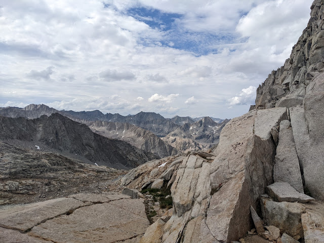
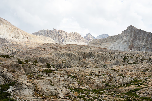
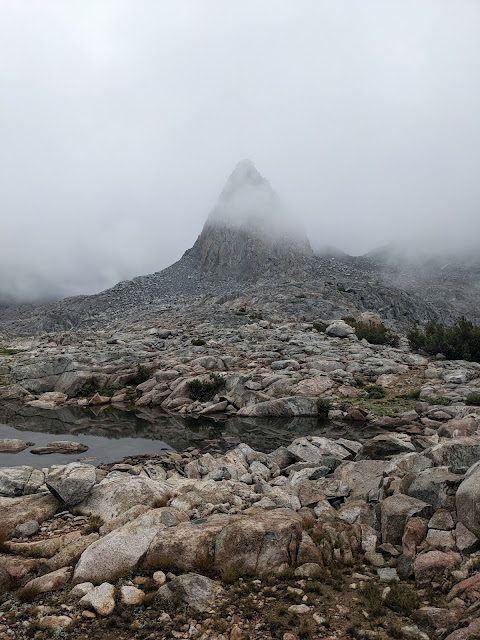
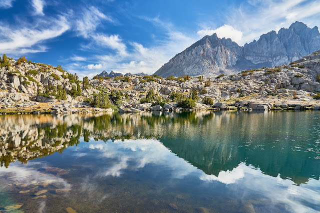
Time for some off-trail exploration. Climbing to Cirque Pass and looking down at the lower Palisade Lake and Mather Pass in the distance. I put my camera in my pack after this since there was going to be some scrambling to get to Cirque Pass.
The climb to the pass ended up being a lot of fun with only a little bit of route finding near the top. I got to the top of Cirque Pass, saw the building clouds and hurried down.
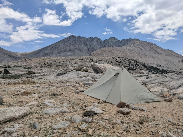
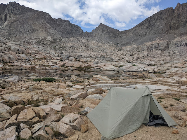
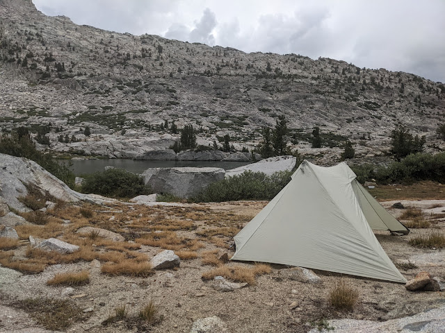
Only the first little bit of the route down from the pass was steep (there is a bit of a chute at the very top) and then it flattens out to benches that were easy to deal with. I basically aimed for the outlet of the lake. It probably would have been even easier if I wasn't in a hurry to get low. I got down to the lake, found a well used flat spot and quickly set up my tent.
I had a little bit of time to poke around and then the rain started again.
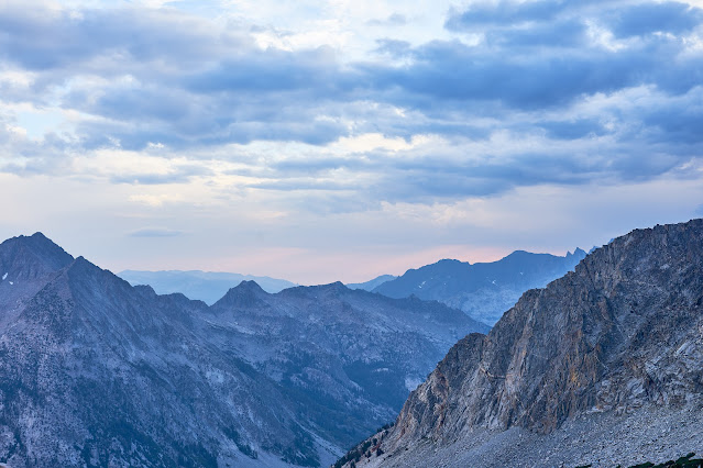
Clouds building to the west ...
... and to the east.
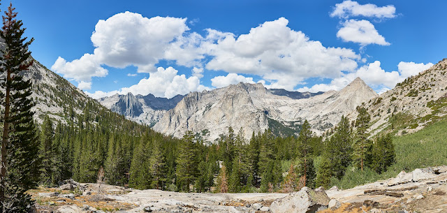
Pano looking down the Glacier Creek
I was hopeful that the clouds would make for a nice sunset, but they never broke apart.
Day 4
Clouds already
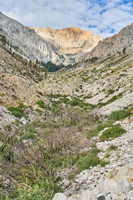
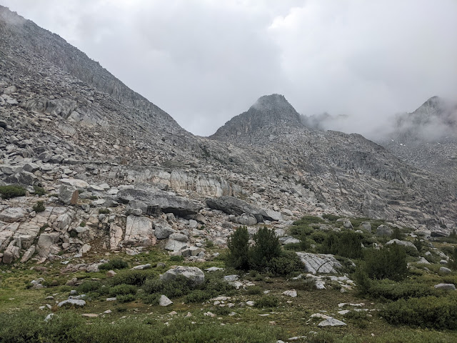
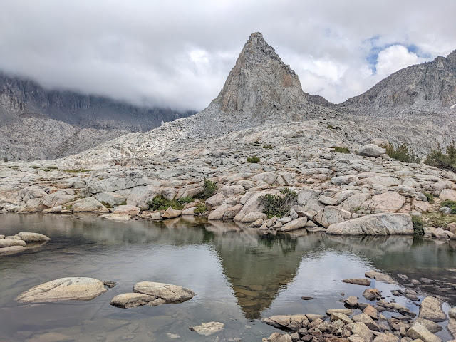
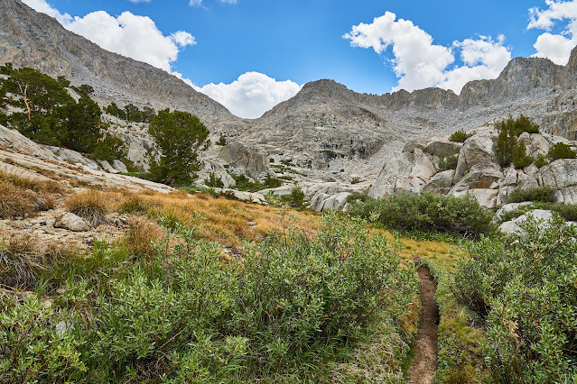
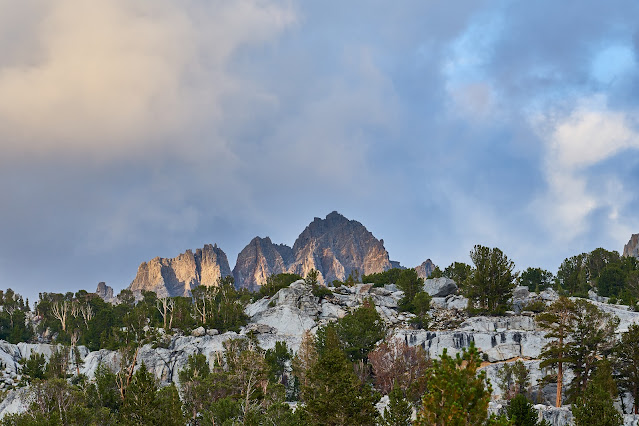
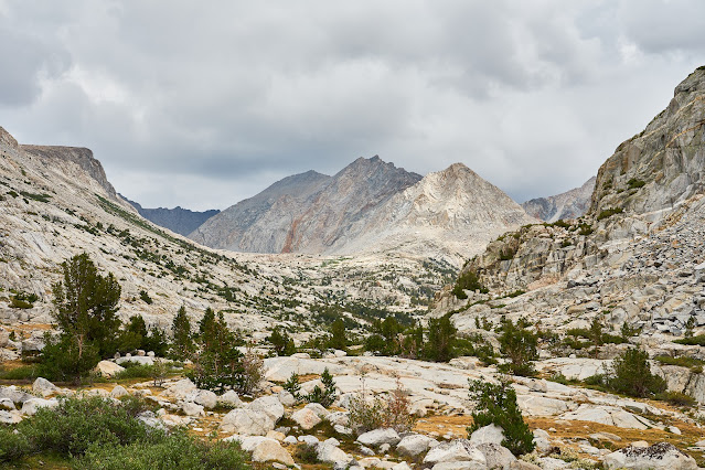
Over Potluck Pass, not a huge fan of the east side (up from Glacier Creek), very loose and sandy, easy to get "lost", probably a lot better with someone else to help with route finding. Super easy going down on the west side (Palisade Basin).
I think this is from the top of Potluck Pass
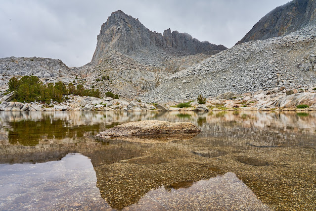
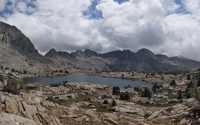
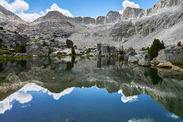
The highest of the Barrett Lakes was a good place to rest. I stripped down and jumped in and then dried off in the sun. But clouds were building and there was another pass to cross.
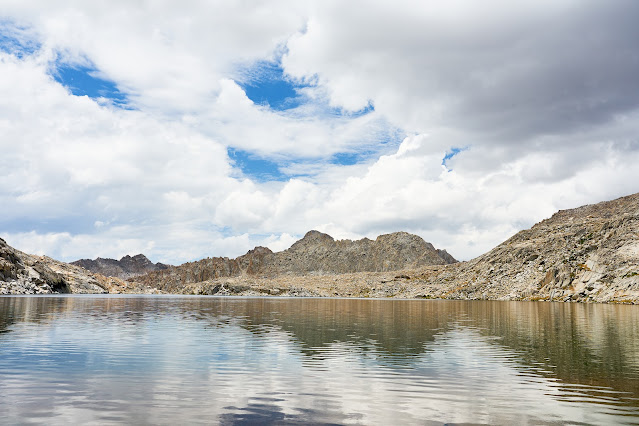
The Barrett Lakes basin looked really interesting. I'd like to set up camp for a night or two and spend some time poking around.
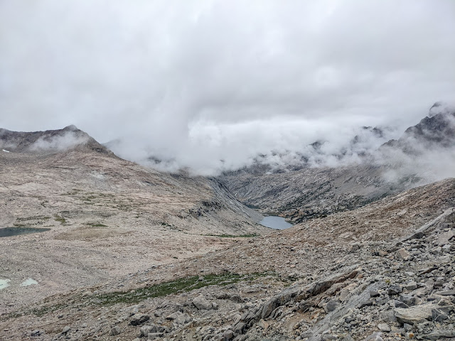
Looking down at Dusy Basin from Knapsack Pass, lots of dark clouds. I put my camera away and hurried down the scree covered slope. I had read some trip reports online, but clearly had mixed something up because I aimed for the upper part of the basin which took me through tons of talus, most was stable but there was enough loose stuff to make it "interesting". From reading online, I should have aimed for the lower basin and a user trail.
Lots of dark clouds gathering over Dusy Basin
I got down from the pass, found a site to set up camp, got set up and the sky opened up, hours of rain, some really heavy, at one point, I was digging a trench trying to channel water away from my tent. I ended up eating a bar for dinner along with some GORP because it was impossible to cook dinner.
Day 5
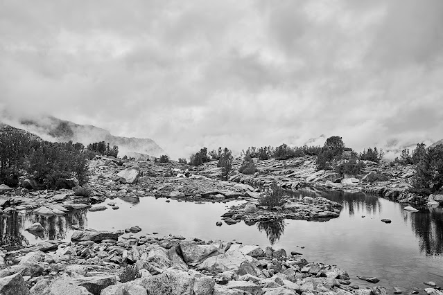
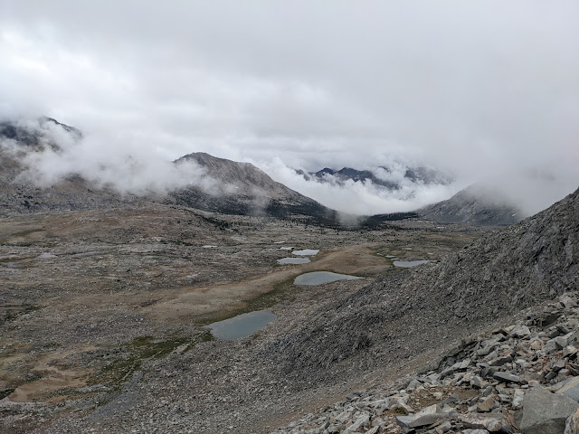
It wasn't raining, but there were a ton of low clouds, very atmospheric
There was clearly a strong chance of rain, so I took a couple photos with my camera and when I went exploring, I only had my cell phone.
View from camp was not bad
Sometimes the clouds would come in really thick, it was fun to watch them move across the water.
I did a bit of wandering around upper Dusy Basin in between rain, thankfully it never did more than drizzle and never for long. I spent quite a bit of time reading in the tent, but I was able to get out and explore a bit. It ended up being a good rest day, but I would have liked less rain to really explore Dusy.
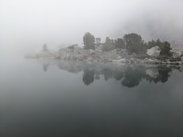
My camp was on the far side of the lake, Knapsack Pass is the low point on the left.
Day 6
Bluer skies but still clouds building in the morning. Today was going to be short since I was just moving down to Lower Dusy to check things out.
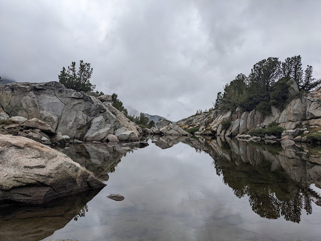
Took the long way out of the upper part of Dusy and headed towards Bishop Pass and the trail and then down the trail to the lower basin. Very good basin to wander in, easy to see why Dusy Basin is so popular.

Clouds are getting thicker, I set up camp towards the end of the basin where it looked like drainage should not be a problem
Clouds to the west, the rain held off for a bit, gave me a little time to explore the area
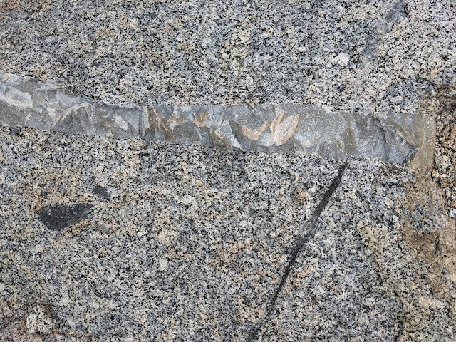
Interesting rock
User trail to Knapsack Pass (the low point on the ridge)
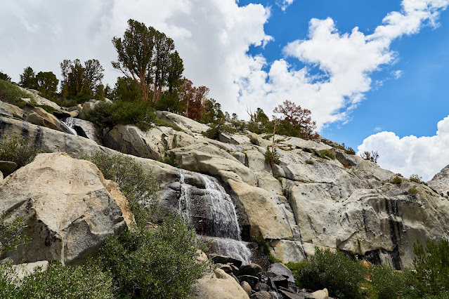
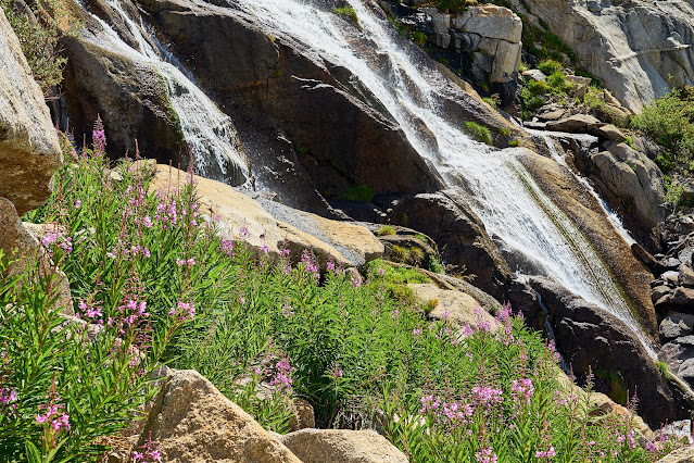
Waterfall draining from the upper part of Dusy
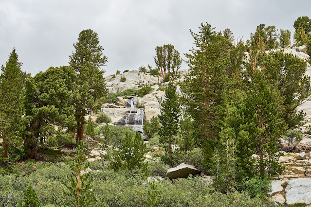
Different angle
Eventually, I had to climb in the tent for a bit, there were still lots of clouds when I crawled out an hour or so later. Not surprisingly, the rain came back and I got more reading time in the tent. In between showers, I ran into a couple groups of hikers that I chatted with a bit. Someone mentioned washed out roads for some of the east side trailheads which made me a little nervous, but I had another couple of days before I had to worry about the rental car.
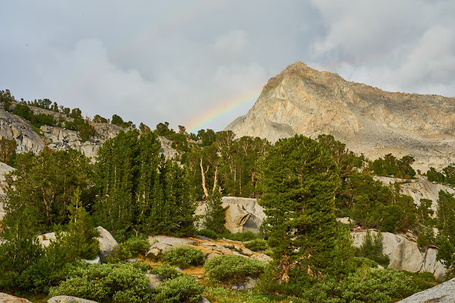
I was talking to a couple of people when the rainbow appeared. Someone made a joke about Noah and 40 days of rain, I replied that we were probably not that lucky
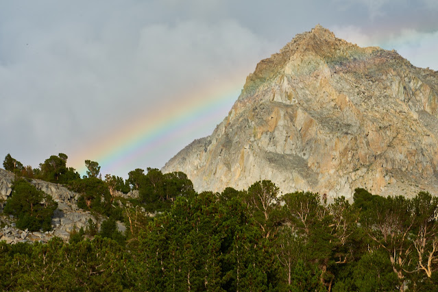
The rainbow has disappeared
Clouds look interesting to the west, maybe I will finally get a good sunset.
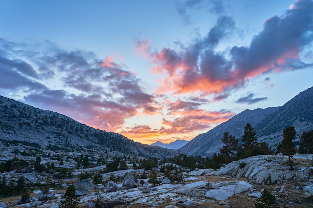
Did a little astrophotography and went to bed
Day 7
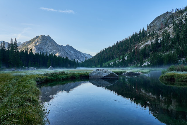
Finally, no clouds in the sky when I wake up, fingers crossed
Heading down to the JMT
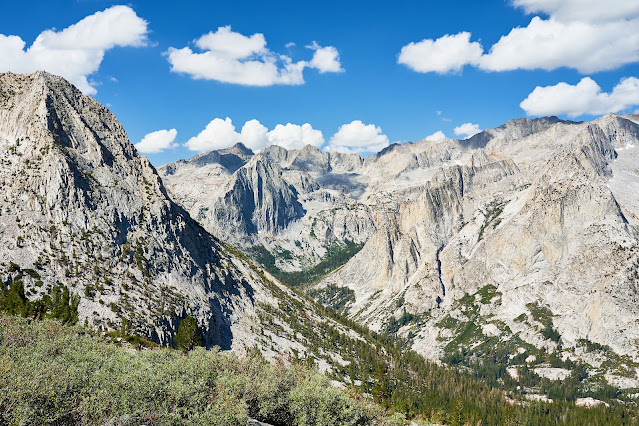
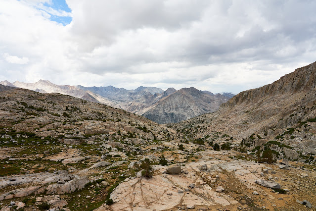
Pano from the Dusy Basin trail looking west, I believe the pointy peak on the right is Mt. Langille with The Black Divide in the background.
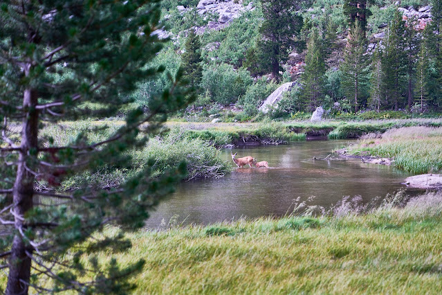
I got down to the JMT and wandered over to the ranger station to see if there was any news about washed out roads. The ranger said she had not heard anything about Taboose, so I left hopeful that I'd be able to get my car out. I headed south on the JMT and considered making the climb to Ladder Lake. I'd decided that it didn't make sense to make a 2000' climb just to hang out in my tent, so I kept moving until I came to a great campsite on the edge of Grouse Meadow and I decided that would make a good home for the night.
There is a great swimming spot where the river widens and slows so I jumped in and floated in the current for a bit. Later I watched this doe and baby ford the river in the same spot.
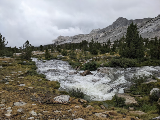
Grouse Meadow is beautiful and thankfully the bugs were not an issue.
Middle Fork of the Kings River is barely moving here
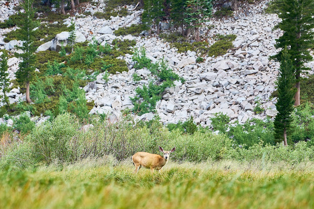
Another deer in the meadow
A young couple heading south on the JMT asked if I minded if they set up near by. I said no problem. They said they had gotten creamed on top of Muir Pass, interesting since I had not seen more than a light sprinkle in the late afternoon.
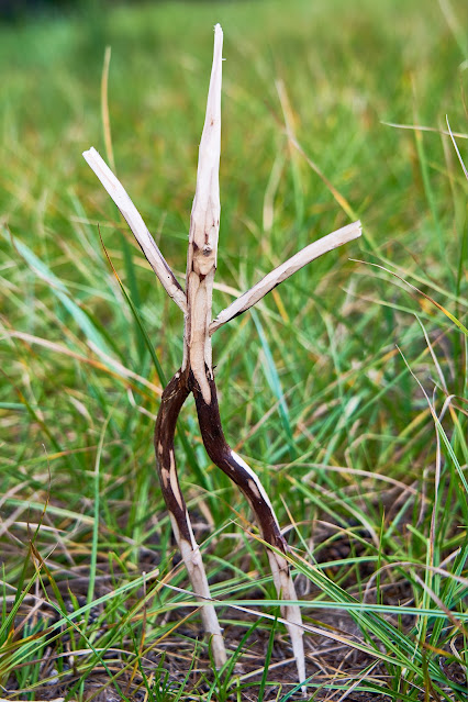
At one point, I did not feel like reading and decided to play with my knife for a bit, watch the deer, whittle a stick. One thing lead to another and this popped out. I left it propped up near the fire ring, hopefully it made someone smile or just say "what the hell?"
Day 8
Weather actually looks nice, Grouse Meadow is still beautiful
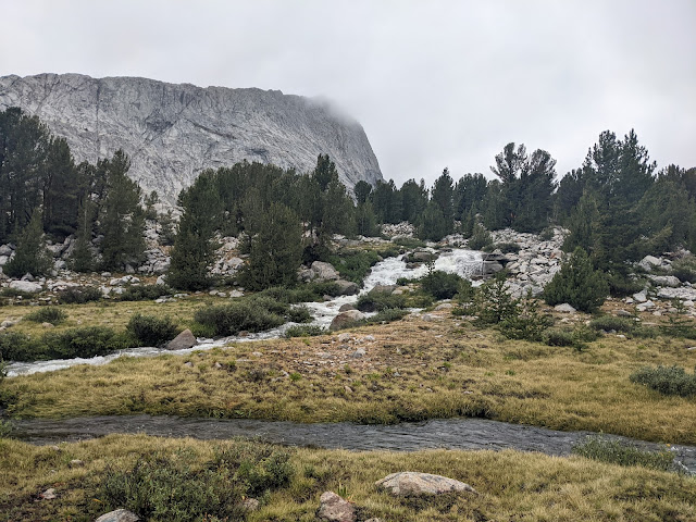
South on the JMT, I had originally planned on going off-trail to Amphitheater Lake, but again decided it did not make sense given the weather. So I continued south back to the Palisade Lakes.

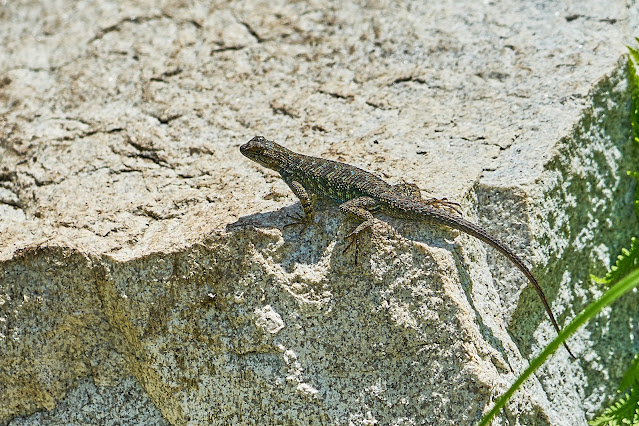
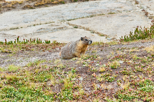
I found this guy near the bottom of The Golden Staircase.
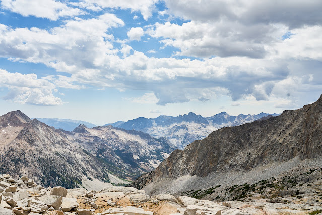
I was glad I got a reasonable start because even at 9am the climb is hot and without shade ...
... tremendous views though.
I kept thinking how great a swim was going to feel, but the clouds were getting thicker.
I hurried past the lower Palisade Lake and quickly got set up in between the two lakes and dived in my tent just as the sky opened up, rain, thunder, lightning. The temperature dropped enough that I crawled in my sleeping bag while I read. After a bit, I was hearing voices, but it was still pouring so I did not try to figure out what was going on.
After a couple hours of very heavy rain, it finally stopped. I found four tents set up really close to me. The occupants came out and apologized for setting up so close, but the lightning made them scramble to get off the trail. We chatted a bit while cooking dinners and watched the sky. They were hoping to make it over Bishop Pass in a couple of days, but the rain had slowed them down. After a bit, the rain came back with a vengeance and we all dived into our tents for the night.
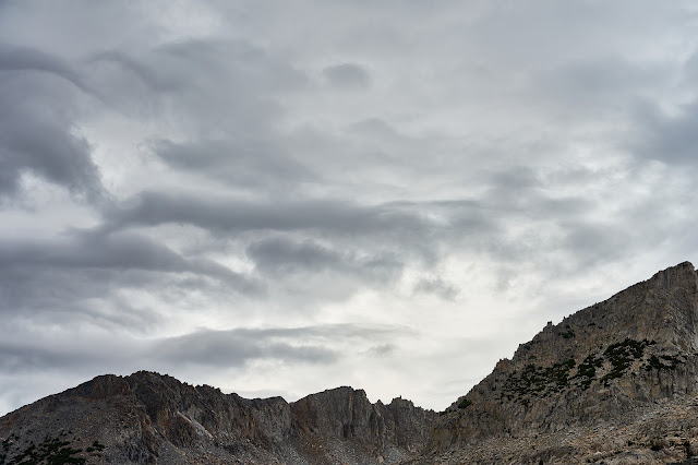
Ominous sky right before the rain hits.
Day 9
It rained all night but has slowed to a solid drizzle. No point in hanging out in my tent all day.
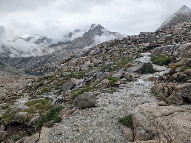
The trail up to Mather Pass was a solid stream in places, but it did not matter because my feet were soaked within 5 minutes of hiking. Every little creek that had been an easy rock hop was now overflowing.
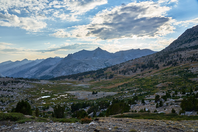
Palisade Lakes and lots of clouds
Upper Basin and lots of clouds
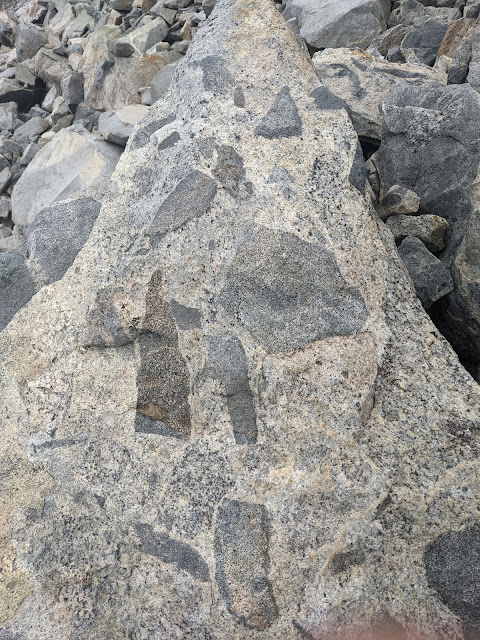
Interesting rock below Mather Pass
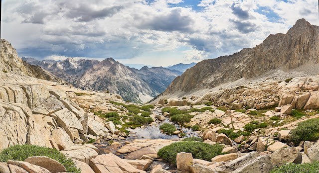
Getting lower into Upper Basin, the river is getting bigger
I crossed the river high in Upper Basin so I could stay on the east side of the river. I'm very glad I did since the JMT crossing at the South Fork of the Kings looked dangerous. People were still crossing it, but it looked stupid to me.
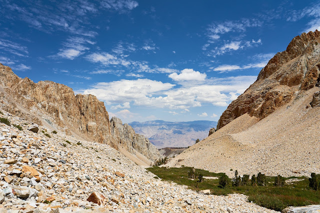
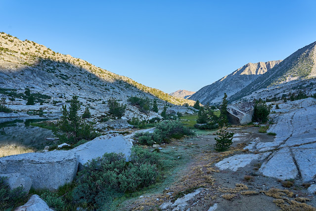
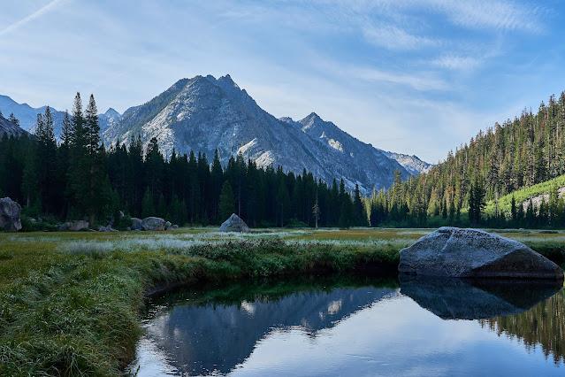
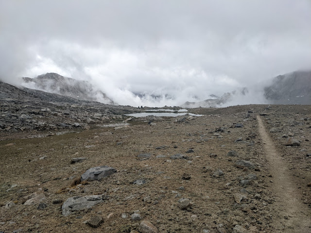
It was really windy, I was wet and I looked at the sky and decided against Bench Lake for the night, so I headed over Taboose Pass. I had seen a small site about 1500' below the pass hoping that it would be out of the wind.
I think this is near the top of Taboose looking east.
Day 10
Sunny, but the clouds are building again higher up
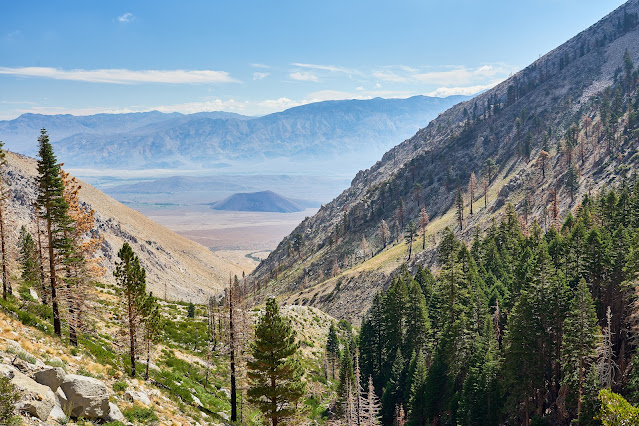
Owens Valley about 5000' below
Down in the desert and almost back to the car. Ready for a beer and a shower
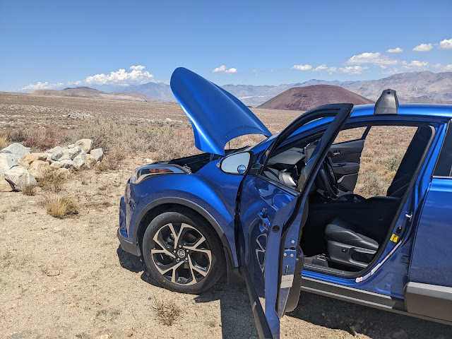
I got to the car and the battery was dead. I had cell service so I wasn't going to die. I debated calling the rental company but was afraid that I had violated the rental agreement by taking it off pavement. So, I called AAA. It took a bit to make them understand where I was and they called a tow truck in Bishop. Should be there in an hour. After about 90 minutes, I called AAA back. After some confusion, I was given the number for the truck and could actually talk to someone from the area. But, he did not really know where I was either. We zeroed in on the Taboose Creek Campground and then I described the road to the trailhead and he was finally heading my way. After another hour, he called me back and said that he did not know if his truck would make it up the horrible road. A little begging and pleading on my part and he agreed to give it a try. I could see him slowly making his way closer and eventually he made it. He pulled out the battery pack in the car started right up.
Owens Valley while I waited, it was hot.
I got a room in Bishop for the next two nights and then met a friend in Reno and then home. Good trip even if the weather did not cooperate.
Taboose Pass (Inyo NF)
I had grand plans for a big loop out of Taboose Pass. A little bit on the JMT and a bunch of cross-country passes over 11 nights. I had lots of time and flexibility, so I could just see how things went.
Outline of my plans: Taboose -> Upper Basin -> Mather Pass -> Cirque Pass -> Potluck Pass -> Knapsack Pass -> Dusy Basin -> JMT -> Ladder Lake -> JMT -> Amphitheater Lake -> Cataract Creek Pass -> Dumbell Lakes -> Dumbell Pass -> Lakes Basin -> Cartridge Pass -> Bench Lake -> Taboose Pass
The weather forecast is filled with warnings of monsoon weather for the week, hopefully it won't be too bad.

A little foreshadowing, it was bad! Rain everyday, a little bit of hail and graupel mixed in. And a couple days with biblical amounts of rain. Basically, it looked like the spring runoff for a couple of days.
These graphs show river gauges on both sides of the Sierra.
East Side, a little north of where I was

West side, south of where I was

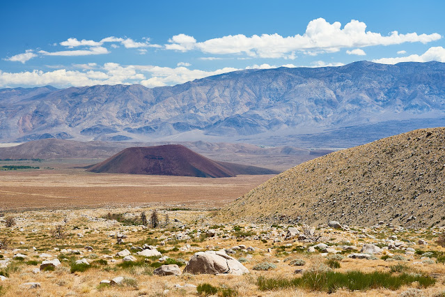
I flew into Reno, got my car and drove south to Taboose Pass. Nasty weather to the south, I hope I don't have to sleep in my tiny car.

Looks a little better to the west, maybe I'll get lucky.

The road is in bad enough shape that I gave up trying to get all the way to the trailhead. Instead, I found a little pulloff about a mile short and set up camp. I got lucky with the weather and didn't have to squeeze into the car.

Day 1
Fabulous sunrise over the White Mountains. Beautiful way to start the day but makes me nervous to see that many clouds already building.

Hints of dawn on the Sierra Crest

I was hiking a little after 6am, the time stamp on this photo is 6:46.

Clouds building over Taboose Pass

Not long after these flower photos, I got stung by a bee on my hand. It has been a long time since my last sting, but I did not have a good reaction, lots of swelling, but no breathing problems. I was hopeful that this time would not be as bad. I was less than an hour from the car, so if things started going sideways, I could hike back. I popped a couple Benadryl and hoped that it would help. I decided to hang out for about 30 minutes to see what was going to happen. My hand swelled a little, but didn't seem worth worrying about, so onward and upward.


Bear way across the canyon

Looking East towards the valley

Clouds were building by the time I got to the top of the pass. The timestamp here is 3:25pm so about 9 hours of hiking with a couple short breaks (and one long for the bee sting) along the way, not bad for 8 miles and 6400' of elevation gain.

I found a place to setup camp and quickly filtered water and cooked dinner. I was able to finish dinner not long before the rain started.

The rain did not last long, so I got a bit of a sunset, but it was windy and I was tired (still on east coast time) so I did not stay up very long.
Bench Lake in the distance with Arrow Peak behind it.

Looking a little farther north towards Mt Ruskin and Vernnacher Col

Zoomed in on Bench Lake


Day 2
Woke up to a beautiful morning, heading north to Upper Basin and Mather Pass for the day.
Bench Lake again

I made my way north by going cross country for a bit, basically paralleling the JMT but on the east side of the river. After about an hour, I eventually rock hopped the river and found the JMT. As I was hiking I started hearing bells. At first I thought I was imagining it, but then I came around a corner and found a bunch of mules, a couple of which had bells on.
I was thinking of @scatman and @Rockskipper when I took these photos


Onward north into Upper Basin, clouds are building to the west.
I set up early because I had thoughts of tackling Split Mountain, but the clouds were getting thicker and I didn't really have it in me to climb another 2000 feet. Not long after this photo, the wind picked up and the rain started and then the hail and graupel. Thankfully, everything blew over in about an hour.

After the storm, looking south

I wasn't going to do Split Mountain, but I wandered around the lakes below Mather Pass and then back to camp for dinner.

Day 3
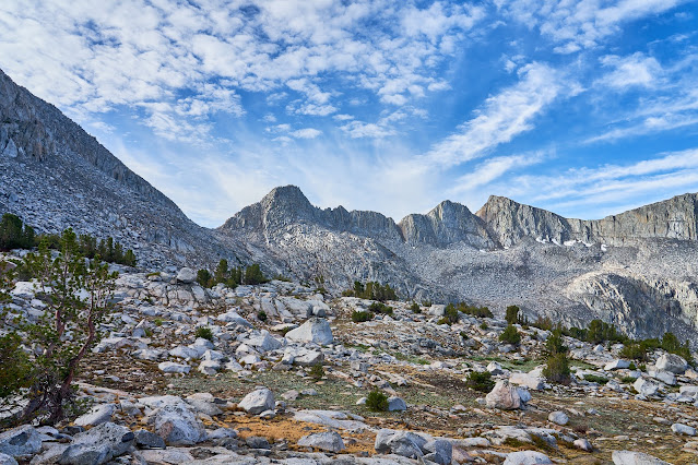
Beautiful day but clouds already building.
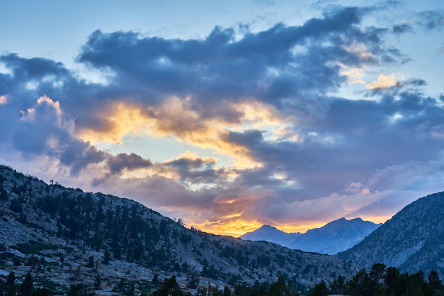
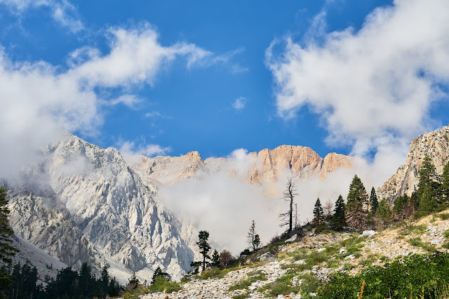
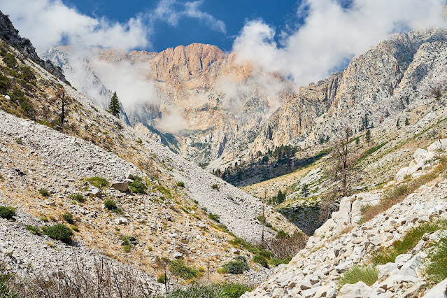
Sunrise and Split Mountain

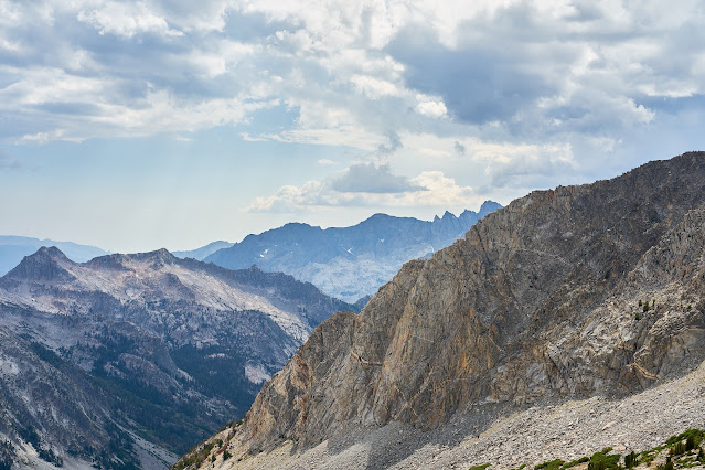
I packed up and took another look at Split Mountain and then headed up to Mather Pass. This is looking south from below the pass.

Looking north from Mather Pass at the Palisades and Palisade Lakes
I passed through the basin and the Palisade Lakes. The bee sting on my hand was still itching and was a little swollen. It wasn't getting worse but still annoying. I happened to talk to a JMT hiker at the lower lake and she said she had tons of different medicines including Benadryl. She gave me a couple and that seemed to make the problem go away.


Near the outlet of the lower lake

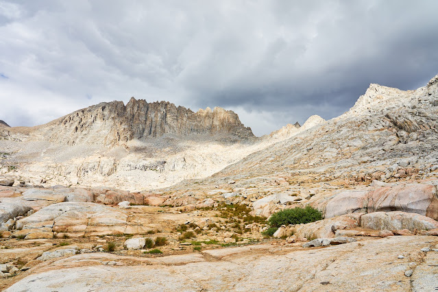
Time for some off-trail exploration. Climbing to Cirque Pass and looking down at the lower Palisade Lake and Mather Pass in the distance. I put my camera in my pack after this since there was going to be some scrambling to get to Cirque Pass.

The climb to the pass ended up being a lot of fun with only a little bit of route finding near the top. I got to the top of Cirque Pass, saw the building clouds and hurried down.
Only the first little bit of the route down from the pass was steep (there is a bit of a chute at the very top) and then it flattens out to benches that were easy to deal with. I basically aimed for the outlet of the lake. It probably would have been even easier if I wasn't in a hurry to get low. I got down to the lake, found a well used flat spot and quickly set up my tent.

I had a little bit of time to poke around and then the rain started again.

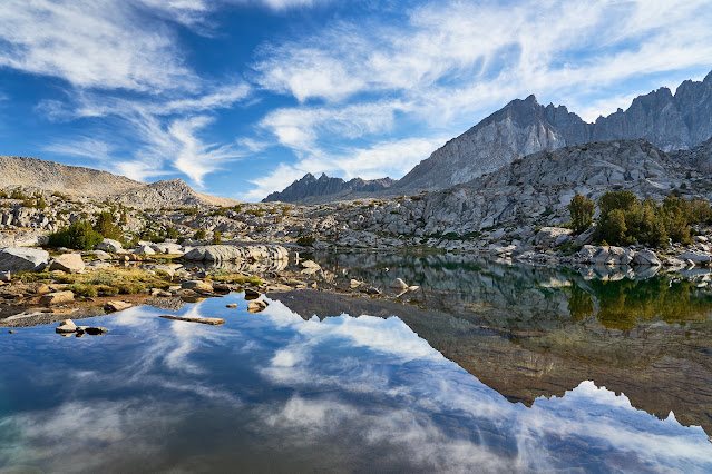
Clouds building to the west ...


... and to the east.

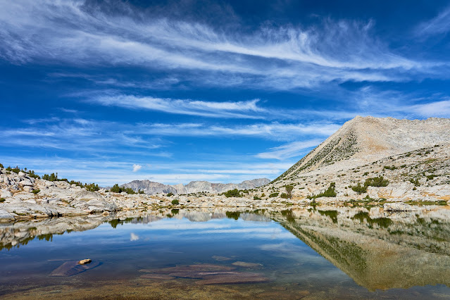
Pano looking down the Glacier Creek


I was hopeful that the clouds would make for a nice sunset, but they never broke apart.


Day 4
Clouds already

Over Potluck Pass, not a huge fan of the east side (up from Glacier Creek), very loose and sandy, easy to get "lost", probably a lot better with someone else to help with route finding. Super easy going down on the west side (Palisade Basin).

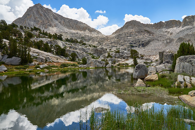
I think this is from the top of Potluck Pass

The highest of the Barrett Lakes was a good place to rest. I stripped down and jumped in and then dried off in the sun. But clouds were building and there was another pass to cross.

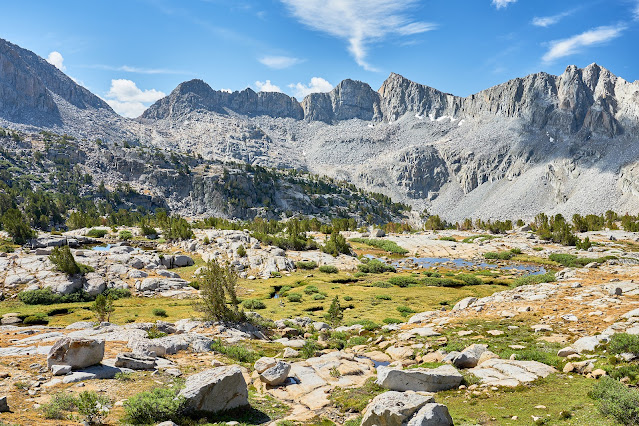
The Barrett Lakes basin looked really interesting. I'd like to set up camp for a night or two and spend some time poking around.


Looking down at Dusy Basin from Knapsack Pass, lots of dark clouds. I put my camera away and hurried down the scree covered slope. I had read some trip reports online, but clearly had mixed something up because I aimed for the upper part of the basin which took me through tons of talus, most was stable but there was enough loose stuff to make it "interesting". From reading online, I should have aimed for the lower basin and a user trail.
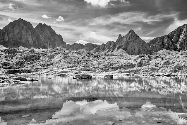
Lots of dark clouds gathering over Dusy Basin

I got down from the pass, found a site to set up camp, got set up and the sky opened up, hours of rain, some really heavy, at one point, I was digging a trench trying to channel water away from my tent. I ended up eating a bar for dinner along with some GORP because it was impossible to cook dinner.
Day 5
It wasn't raining, but there were a ton of low clouds, very atmospheric
There was clearly a strong chance of rain, so I took a couple photos with my camera and when I went exploring, I only had my cell phone.
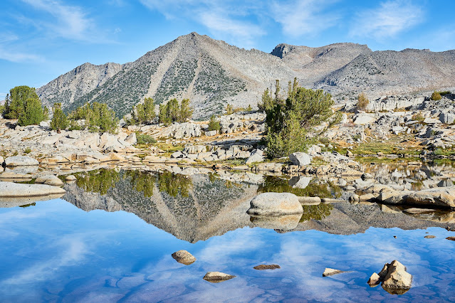
View from camp was not bad

Sometimes the clouds would come in really thick, it was fun to watch them move across the water.

I did a bit of wandering around upper Dusy Basin in between rain, thankfully it never did more than drizzle and never for long. I spent quite a bit of time reading in the tent, but I was able to get out and explore a bit. It ended up being a good rest day, but I would have liked less rain to really explore Dusy.


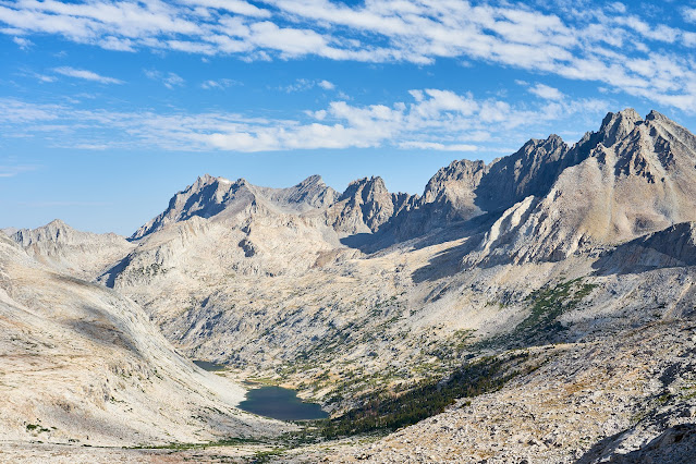
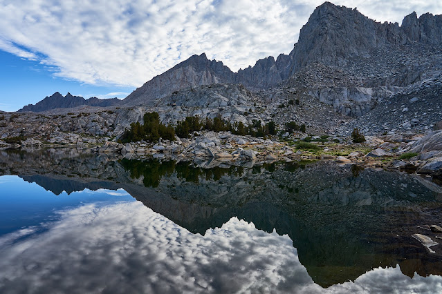
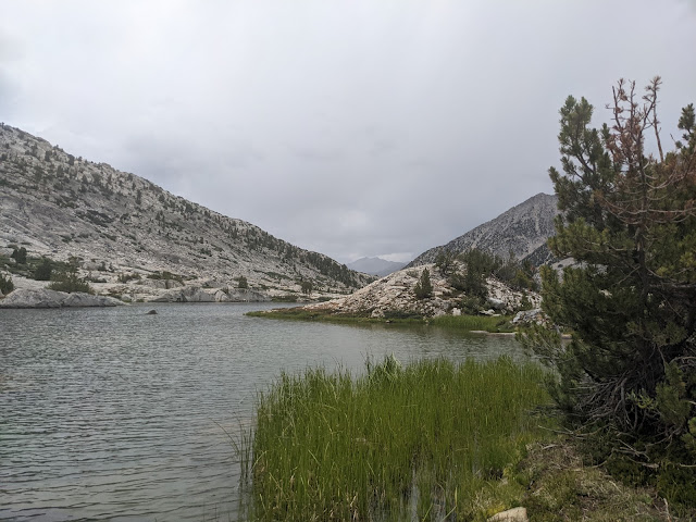
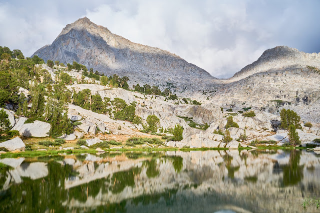
My camp was on the far side of the lake, Knapsack Pass is the low point on the left.

Day 6
Bluer skies but still clouds building in the morning. Today was going to be short since I was just moving down to Lower Dusy to check things out.
Took the long way out of the upper part of Dusy and headed towards Bishop Pass and the trail and then down the trail to the lower basin. Very good basin to wander in, easy to see why Dusy Basin is so popular.


Clouds are getting thicker, I set up camp towards the end of the basin where it looked like drainage should not be a problem

Clouds to the west, the rain held off for a bit, gave me a little time to explore the area

Interesting rock


User trail to Knapsack Pass (the low point on the ridge)

Waterfall draining from the upper part of Dusy

Different angle


Eventually, I had to climb in the tent for a bit, there were still lots of clouds when I crawled out an hour or so later. Not surprisingly, the rain came back and I got more reading time in the tent. In between showers, I ran into a couple groups of hikers that I chatted with a bit. Someone mentioned washed out roads for some of the east side trailheads which made me a little nervous, but I had another couple of days before I had to worry about the rental car.

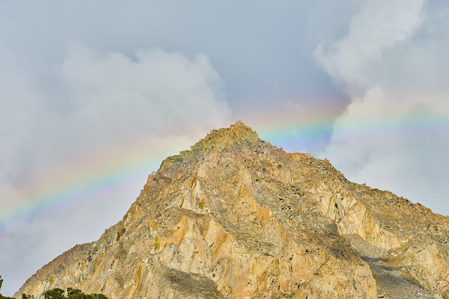
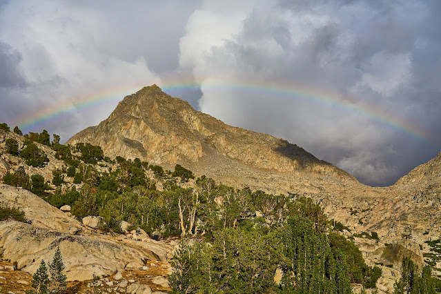
I was talking to a couple of people when the rainbow appeared. Someone made a joke about Noah and 40 days of rain, I replied that we were probably not that lucky


The rainbow has disappeared


Clouds look interesting to the west, maybe I will finally get a good sunset.


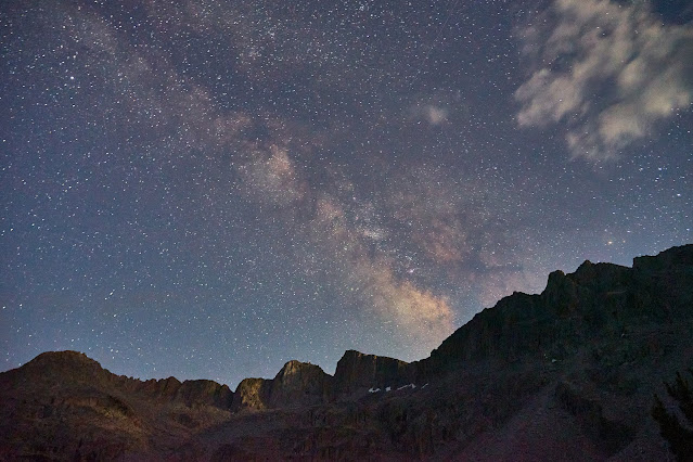
Did a little astrophotography and went to bed

Day 7
Finally, no clouds in the sky when I wake up, fingers crossed


Heading down to the JMT


Pano from the Dusy Basin trail looking west, I believe the pointy peak on the right is Mt. Langille with The Black Divide in the background.


I got down to the JMT and wandered over to the ranger station to see if there was any news about washed out roads. The ranger said she had not heard anything about Taboose, so I left hopeful that I'd be able to get my car out. I headed south on the JMT and considered making the climb to Ladder Lake. I'd decided that it didn't make sense to make a 2000' climb just to hang out in my tent, so I kept moving until I came to a great campsite on the edge of Grouse Meadow and I decided that would make a good home for the night.

There is a great swimming spot where the river widens and slows so I jumped in and floated in the current for a bit. Later I watched this doe and baby ford the river in the same spot.

Grouse Meadow is beautiful and thankfully the bugs were not an issue.


Middle Fork of the Kings River is barely moving here

Another deer in the meadow

A young couple heading south on the JMT asked if I minded if they set up near by. I said no problem. They said they had gotten creamed on top of Muir Pass, interesting since I had not seen more than a light sprinkle in the late afternoon.

At one point, I did not feel like reading and decided to play with my knife for a bit, watch the deer, whittle a stick. One thing lead to another and this popped out. I left it propped up near the fire ring, hopefully it made someone smile or just say "what the hell?"

Day 8
Weather actually looks nice, Grouse Meadow is still beautiful


South on the JMT, I had originally planned on going off-trail to Amphitheater Lake, but again decided it did not make sense given the weather. So I continued south back to the Palisade Lakes.


I found this guy near the bottom of The Golden Staircase.

I was glad I got a reasonable start because even at 9am the climb is hot and without shade ...

... tremendous views though.

I kept thinking how great a swim was going to feel, but the clouds were getting thicker.


I hurried past the lower Palisade Lake and quickly got set up in between the two lakes and dived in my tent just as the sky opened up, rain, thunder, lightning. The temperature dropped enough that I crawled in my sleeping bag while I read. After a bit, I was hearing voices, but it was still pouring so I did not try to figure out what was going on.

After a couple hours of very heavy rain, it finally stopped. I found four tents set up really close to me. The occupants came out and apologized for setting up so close, but the lightning made them scramble to get off the trail. We chatted a bit while cooking dinners and watched the sky. They were hoping to make it over Bishop Pass in a couple of days, but the rain had slowed them down. After a bit, the rain came back with a vengeance and we all dived into our tents for the night.
Ominous sky right before the rain hits.


Day 9
It rained all night but has slowed to a solid drizzle. No point in hanging out in my tent all day.
The trail up to Mather Pass was a solid stream in places, but it did not matter because my feet were soaked within 5 minutes of hiking. Every little creek that had been an easy rock hop was now overflowing.

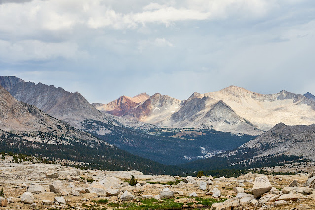
Palisade Lakes and lots of clouds

Upper Basin and lots of clouds

Interesting rock below Mather Pass


Getting lower into Upper Basin, the river is getting bigger


I crossed the river high in Upper Basin so I could stay on the east side of the river. I'm very glad I did since the JMT crossing at the South Fork of the Kings looked dangerous. People were still crossing it, but it looked stupid to me.
It was really windy, I was wet and I looked at the sky and decided against Bench Lake for the night, so I headed over Taboose Pass. I had seen a small site about 1500' below the pass hoping that it would be out of the wind.
I think this is near the top of Taboose looking east.

Day 10
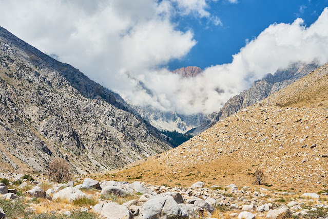
Sunny, but the clouds are building again higher up
Owens Valley about 5000' below


Down in the desert and almost back to the car. Ready for a beer and a shower

I got to the car and the battery was dead. I had cell service so I wasn't going to die. I debated calling the rental company but was afraid that I had violated the rental agreement by taking it off pavement. So, I called AAA. It took a bit to make them understand where I was and they called a tow truck in Bishop. Should be there in an hour. After about 90 minutes, I called AAA back. After some confusion, I was given the number for the truck and could actually talk to someone from the area. But, he did not really know where I was either. We zeroed in on the Taboose Creek Campground and then I described the road to the trailhead and he was finally heading my way. After another hour, he called me back and said that he did not know if his truck would make it up the horrible road. A little begging and pleading on my part and he agreed to give it a try. I could see him slowly making his way closer and eventually he made it. He pulled out the battery pack in the car started right up.

Owens Valley while I waited, it was hot.

I got a room in Bishop for the next two nights and then met a friend in Reno and then home. Good trip even if the weather did not cooperate.