Ben
Member
- Joined
- Sep 12, 2014
- Messages
- 1,873
In july i decided to try some off trail hiking in the Sawtooths. I had not done this before, any where really, but i wanted to, so i thought about it some. I decided to go up Baron Creek, a trail that i knew very well, and come back down Goat Creek, a drainage that i have never been in. Goat Creek is closed to all stock, dogs, and fires, regardless of fire pans or blankets. It also has no trail. I figured that it was better to go down the drainage with out a trail than up, and i was probably right about that. Baron Creek and Goat Creek parallel one an other, running long into the Sawtooths from the West side, and meeting the South Fork Payette River about a mile and a half from each other.
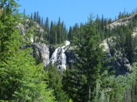
Due to some unforeseen difficulties getting out of the house, i ended up leaving saturday morning in stead of friday, getting to theGrandjean trail head may be around eleven. It's about a mile and a half along the South Fork Payette River trail to the junction with Baron Creek. There are no views of the river in that stretch, or the next, to Goat Creek. I walked quickly. I saw a decent number of people, more than twenty that day, which is quite a bit more than usual, but it's july now. There's not much to see along the trail until you get Baron Falls, and then above it. But it doesn't take that long. This is one of the better shots i've ever taken of Baron Falls.
And then here are flowers along the trail above the falls.
It's about eleven miles to Baron Lake. Here is the outlet. There were a couple people camped here, but not as many as there could be. Baron Lakes are worth the hike.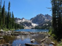
I continued on the trail up above Baron Lake, and then past Upper Baron Lake. Monte Verita just left of center here, and Warbonnet to the right. On the left of Verita you can see the saddle i should have headed for initially.
The trail continues above the lakes all the way over the Baron Divide, connecting to the Redfish Lake Creek drainage. Looking at the topo, i had imagined it best to hike the trail all the way up to the ridge, and then traverse the crest around to the Goat Creek drainage. And that is what i did.

A ways along the ridge, looking back down at the Baron Lakes. I believe Baron Peak is on the horizon about dead center.
Looking over the other side, Alpine Lake on the right, unnamed ponds on the left. Those ponds are lovely by the way.
The ridge was very rocky, and i did a lot of scrambling. Probably with out needing to. So i stopped. Eventually, when i could, i dropped below the crest of the ridge on it's left side, and walked along below for a ways. I'm heading for the saddle all the way on the right. It really wasn't that bad getting there. Alpine Lake again.

Looking down the ridge before i dropped off it. It was pretty fantastic having 360 views all the way along it, no obstruction either direction.
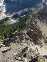
Looking down at Baron Lakes closer to the pass. Again, i think it's Baron Peak near center there.
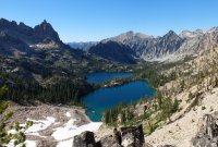
The other side, down toward Alpine Lake again.
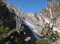
Looking down at Baron Lakes. I believe i should have come up this way and saved my self some trouble. After walking along below the ridge i came up to a low point along it and started following the crest again. As i went up i came across a goat trail leading across the scree straight to where i wanted to go. It starts at the low trees on the right and crosses the snow. I came up from the lake on it's right side in this picture. Looking from here i think that i should have followed the shoulder between the lakes up to this depression, and then climbed it to the trees at that saddle. Might have saved an hour or so.
Looking the other way along the goat trail to the saddle on the edge of Monte Verita.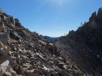
Looking over the saddle at Warbonnet and Little Warbonnet Lakes.
The peak behind them. South of. I was a little fixated with it. There was a face glaring.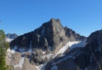
I went up from the saddle to the broken walls of Verita.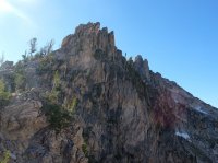
This guy was up near the saddle also.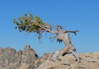
Looking back at the route i had come. From the far side of the lakes. On the distant horizon you can see the Whiteclouds.
If you look you can kind of make out the line the goat trail makes from one saddle to the other, across the slop on the left. I sat up here for a moment. It was nice. But i was thirsty and hungry.
Zoomed in on the Whiteclouds.
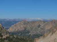
I like the shadow of Verita here.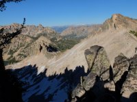
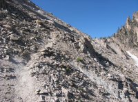
A use trail continued down from the saddle to the lakes. Steep, rough, and loose. In a little ways part of the slope turns to solid rock, and i found it easier to descend on that.
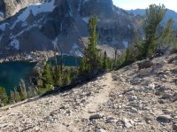
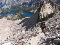
Still descending to Warbonnet Lakes, looking across the Feather Lakes below them, and out over the larger Goat Creek drainage. This is definitely one of the nicest areas of the Sawtooths that i have been to. And i wouldn't see any one else in it.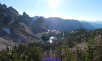
Warbonnet Lakes again.
The hills beyond Goat Creek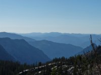
I made my way down to the bottom of Little Warbonnet Lake, pumped water, and ate dinner. After that i went on to find a spot that looked happy to camp. Here's the wide streampond below the lake.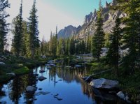
Warbonnet Peak from the back side.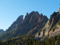
And Monte Verita from the same. It's called the Sawtooths. Probably the most jagged, broken peak i've ever seen.

The sun going down over one of the Feather Lakes where i decided to camp. Around here some of the bare rock is glacier polished, and you can see scratches in the rock all moving down the drainage.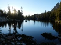
Camp, the next morning.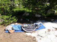
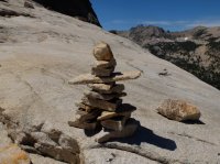
Below the Feather Lakes i found this excellent cairn.
Warbonnet and Verita as i start to leave. Up high it was easy to get around. Later on it would be difficult.
Looking down on Blue Rock Lake. I didn't go all the way to the lake. I cut over to the right to start heading down the valley sooner. I was on my way home.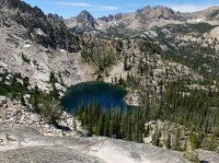
Blue Rock Lake and Goat Creek drainage. I'd follow the valley all the way out to the gray at the end of it.
The way down was rough. Once or twice there was a nice spot like this. Mostly thought it was trying to find a way that didn't exist through thick fully grown bushes. Steep sections of rock between trees, marshy areas. Streams leaking water all over the place from side drainages. It wasn't awful, but i didn't enjoy it too much either. Brush and dead fall were a huge problem.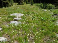
Any where near the creek was too over grown to do any reasonable walking. Eventually i ended up traveling on the fringe between the vegetation and the steeper slopes. I made ok time this way, but it wasn't easy, or quick. You can see the exit to the South Fork Payette River finally approaching here.
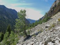
Looking back at the peaks i had descended from just that morning, from near the end of Goat Creek. It took me about twice as long to make it down Goat Creek as it took to come up Baron Creek on the trail. It would have been quicker for me to have gone back over the saddle i'd crossed the evening before. But now i know. The upper reaches of Goat Creek are fantastic, incredible, but i don't think there's any reason to travel along Goat Creek to get there. May be if backpacking has just gotten too easy.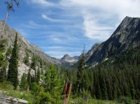
After i reached the South Fork Payette, which felt great, i had about three miles on the trail back to it's head. I stopped where the trail crosses Goat Creek and broke for a minute. I think i got back to my car just a little bit late. Great trip though, glad i finally did it. I need to go back and spend some time at the top.
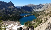
Featured image for home page:
Due to some unforeseen difficulties getting out of the house, i ended up leaving saturday morning in stead of friday, getting to theGrandjean trail head may be around eleven. It's about a mile and a half along the South Fork Payette River trail to the junction with Baron Creek. There are no views of the river in that stretch, or the next, to Goat Creek. I walked quickly. I saw a decent number of people, more than twenty that day, which is quite a bit more than usual, but it's july now. There's not much to see along the trail until you get Baron Falls, and then above it. But it doesn't take that long. This is one of the better shots i've ever taken of Baron Falls.

And then here are flowers along the trail above the falls.

It's about eleven miles to Baron Lake. Here is the outlet. There were a couple people camped here, but not as many as there could be. Baron Lakes are worth the hike.

I continued on the trail up above Baron Lake, and then past Upper Baron Lake. Monte Verita just left of center here, and Warbonnet to the right. On the left of Verita you can see the saddle i should have headed for initially.

The trail continues above the lakes all the way over the Baron Divide, connecting to the Redfish Lake Creek drainage. Looking at the topo, i had imagined it best to hike the trail all the way up to the ridge, and then traverse the crest around to the Goat Creek drainage. And that is what i did.

A ways along the ridge, looking back down at the Baron Lakes. I believe Baron Peak is on the horizon about dead center.

Looking over the other side, Alpine Lake on the right, unnamed ponds on the left. Those ponds are lovely by the way.

The ridge was very rocky, and i did a lot of scrambling. Probably with out needing to. So i stopped. Eventually, when i could, i dropped below the crest of the ridge on it's left side, and walked along below for a ways. I'm heading for the saddle all the way on the right. It really wasn't that bad getting there. Alpine Lake again.

Looking down the ridge before i dropped off it. It was pretty fantastic having 360 views all the way along it, no obstruction either direction.

Looking down at Baron Lakes closer to the pass. Again, i think it's Baron Peak near center there.

The other side, down toward Alpine Lake again.

Looking down at Baron Lakes. I believe i should have come up this way and saved my self some trouble. After walking along below the ridge i came up to a low point along it and started following the crest again. As i went up i came across a goat trail leading across the scree straight to where i wanted to go. It starts at the low trees on the right and crosses the snow. I came up from the lake on it's right side in this picture. Looking from here i think that i should have followed the shoulder between the lakes up to this depression, and then climbed it to the trees at that saddle. Might have saved an hour or so.

Looking the other way along the goat trail to the saddle on the edge of Monte Verita.

Looking over the saddle at Warbonnet and Little Warbonnet Lakes.

The peak behind them. South of. I was a little fixated with it. There was a face glaring.

I went up from the saddle to the broken walls of Verita.

This guy was up near the saddle also.

Looking back at the route i had come. From the far side of the lakes. On the distant horizon you can see the Whiteclouds.

If you look you can kind of make out the line the goat trail makes from one saddle to the other, across the slop on the left. I sat up here for a moment. It was nice. But i was thirsty and hungry.

Zoomed in on the Whiteclouds.

I like the shadow of Verita here.

A use trail continued down from the saddle to the lakes. Steep, rough, and loose. In a little ways part of the slope turns to solid rock, and i found it easier to descend on that.

Still descending to Warbonnet Lakes, looking across the Feather Lakes below them, and out over the larger Goat Creek drainage. This is definitely one of the nicest areas of the Sawtooths that i have been to. And i wouldn't see any one else in it.

Warbonnet Lakes again.

The hills beyond Goat Creek

I made my way down to the bottom of Little Warbonnet Lake, pumped water, and ate dinner. After that i went on to find a spot that looked happy to camp. Here's the wide streampond below the lake.

Warbonnet Peak from the back side.

And Monte Verita from the same. It's called the Sawtooths. Probably the most jagged, broken peak i've ever seen.

The sun going down over one of the Feather Lakes where i decided to camp. Around here some of the bare rock is glacier polished, and you can see scratches in the rock all moving down the drainage.

Camp, the next morning.

Below the Feather Lakes i found this excellent cairn.

Warbonnet and Verita as i start to leave. Up high it was easy to get around. Later on it would be difficult.

Looking down on Blue Rock Lake. I didn't go all the way to the lake. I cut over to the right to start heading down the valley sooner. I was on my way home.

Blue Rock Lake and Goat Creek drainage. I'd follow the valley all the way out to the gray at the end of it.

The way down was rough. Once or twice there was a nice spot like this. Mostly thought it was trying to find a way that didn't exist through thick fully grown bushes. Steep sections of rock between trees, marshy areas. Streams leaking water all over the place from side drainages. It wasn't awful, but i didn't enjoy it too much either. Brush and dead fall were a huge problem.

Any where near the creek was too over grown to do any reasonable walking. Eventually i ended up traveling on the fringe between the vegetation and the steeper slopes. I made ok time this way, but it wasn't easy, or quick. You can see the exit to the South Fork Payette River finally approaching here.

Looking back at the peaks i had descended from just that morning, from near the end of Goat Creek. It took me about twice as long to make it down Goat Creek as it took to come up Baron Creek on the trail. It would have been quicker for me to have gone back over the saddle i'd crossed the evening before. But now i know. The upper reaches of Goat Creek are fantastic, incredible, but i don't think there's any reason to travel along Goat Creek to get there. May be if backpacking has just gotten too easy.

After i reached the South Fork Payette, which felt great, i had about three miles on the trail back to it's head. I stopped where the trail crosses Goat Creek and broke for a minute. I think i got back to my car just a little bit late. Great trip though, glad i finally did it. I need to go back and spend some time at the top.
Featured image for home page:

Last edited:

