Ben
Member
- Joined
- Sep 12, 2014
- Messages
- 1,873
I've thought for a while on a larger loop through the sawtooths. early in august i took the time to do it. I wanted to do a hike with consecutive days of ~3,000' elevation so i could have some idea what to expect when i did the wonderland trail a week later. Here's what it looked like.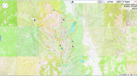
http://caltopo.com/map?id=0120
And the link. I call it my inner outer loop. I hiked clock wise, and skirted the edge of the range before coming back to my car through the center of it. I also think the trace looks a little like sea horse. the dark blue dot on the left is where i started. The purple dots break the loop into 17 mile sections, according to the drawn lines. The light blue dots are approximately where i slept each night. I did the loop in four days. closer to three and a half, i left work friday after noon, and started hiking some time after three.
I started from Grandjean, closest trail head to my house. Lovely after noon. I went up the Trail Creek trail, which parts almost immediately from the route that i'd be coming back on. The trail crosses the creek a couple times as it makes it's way up the drainage.
A couple flowers in the first couple hours.
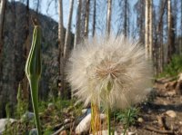
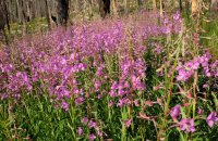
The trail ascends not quite steeply, but concertedly, about 3,000' in about five miles. After that it continues up less steeply. I passed the trail junction for Trailer Lakes, which doesn't go any where else. Views of the range open up just a little bit here.
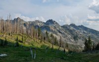
And i continued past the junction for Observation Peak, which also doesn't go any where else, and for the trail that goes down the other side to Stanley Lake. Both those trails meet the trail coming up from Trail Creek at the same place. A four way junction. I went East toward McGown Lakes, and Sawtooth Lake beyond.
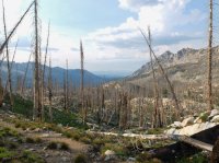
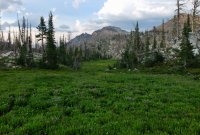
A lot of the area around the top here is badly burned out. But you're able to see a little more as a result. The picture above is looking back down Trail Creek's drainage. Below is a meadow on the way to McGown Lakes.
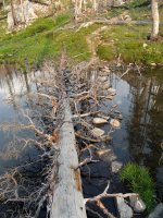
Just a small pond. It pinches in the middle, and appears as two small ponds just barely connected.
Here's the crossing at the pinch mentioned above.
And then looking back.
And looking across the other segment.
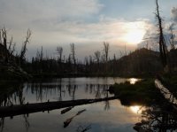
Not much later i passed one of the McGown Lakes. It's all a nice area up here. Not many people. Even in august.

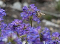
And then i came across this bee.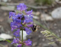 So i took a few pictures.
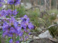
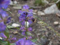
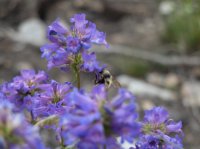
Beyond that it was over the pass to Sawtooth Lake. At the top you get a good view of Stanley all the way down below.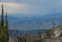
Sawtooth Lake is one of my favorites. Just for it's sheer size. Brimming in that bowl. Views of the lake are good the whole way down the trail to the outlet on the left end in the picture.


There appeared to be a couple small groups already camped near the out let of Sawtooth. But i had to keep going beyond there any way. Evening was getting close. If i wasn't going to be able to finish my loop in the four days that i had, there were options to shorten it, but i didn't want to do that.
Below Sawtooth Lake the trail passes Alpine Lake. One of two 'Alpine Lake's in the Sawtooths. This was the second place that i ever backpacked, with my dad and two of my younger brothers.

Still above Alpine Lake, you can see the prominent ridge that bounds Iron Creek below. I went down to the bottom there before setting up camp for the first night.
The view from the tent.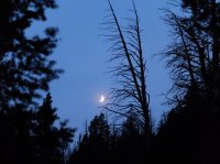
The next morning, breakfast on Iron Creek. The water was perfectly clear. This area sees a lot of traffic, but very soon i was away from it again.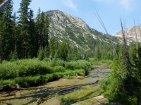
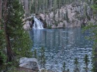
I continued around the northern edge of range, eventually coming to Goat Falls, below Goat Lake.
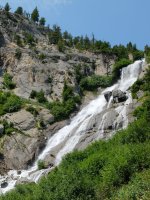
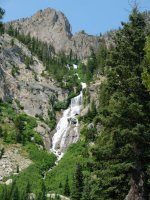
Beyond Goat Creek, again, one of two in the Sawtooths, i continued to bend around toward the East side. A lot of the trail looked like this.
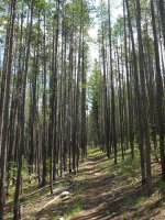
Uniform trees.
Not much to see during this stretch. Continual hiking was broken at one point passing by small Marshall Lake. And then i just kept walking through the forest, making my way around toward Redfish.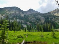
Eventually the trail comes out on a ridge that leads down and out toward Redfish Lake. The view is open from the ridge top. You can see Sawtooth peaks on the right, and out across the Salmon River valley to the Whiteclouds beyond.

The Whiteclouds in the distance.
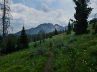
The trail coming down from the ridge. It was a little monotonous, but it was nice. No people here.
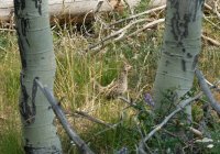
Little hen in the aspens.
Getting closer to Redfish. Above the valley of Fishhook Creek.
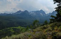
An other point where i could view Stanley, and this time the Salmon River too.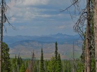
And an other good view of the peaks.
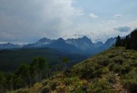
And eventually i made my way down here to Redfish Lake. It was strange to see a place so busy with people in the middle of so much not seeing people. I stopped there long enough to cook lunch on a picnic table, and to refill my water bottles from the tap there. Good sized lake. Grand Mogul should be the peak on the left, straight out the lake.

Redfish Lake Creek exiting the lake.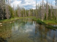
The trail beyond the creek. The lake is just out of sight, other side of the fence. It didn't go on long like this. Shortly i came to the Heyburn Mountain campground where an other trail ascends to a ridge above the lake.
Uniform trees along the trail, before ascending above the lake.
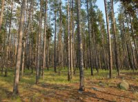
There was a lot of going up from Redfish Lake. And mountain bike tracks. This portion of trail lies outside the wilderness. Eventually the ridge nears Grand Mogul, and the trail turns South, paralleling the higher peaks. I made camp the second night just off the trail along this stretch between Redfish Lake and Hellroaring Lake.
The next day i continued on, crossed Decker Creek, and ended up going the wrong way down Huckleberry Creek for just a minute because i missed a trail junction where a sign had been knocked down. Relatively early in the day i made it to Hellroaring Lake. It's about ten miles from Redfish Lake. From here it's about four miles on to Imogene Lake.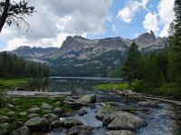
Hellroaring Lake was my first backpack, clear back when i was eight or nine, or some thing like that. I had no idea what i was getting into back then, i just followed my Dad up to a lake. I remember my brother and i and a couple family friends spending a significant portion of the day playing on the logs that span the whole way across the lake there. As i remember it there were even more there all those years ago.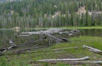
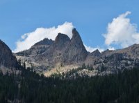
The trail continues along the edge of Hellroaring. About center there you can see the Finger of Fate. The pointier feature.
Finger of Fate.
Near the end of the lake the trail starts up again on it's way to Imogene Lake. Here's a section of board walk in between the two.
A pond with lily pads along the trail.
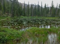
A pond without lily pads.
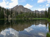
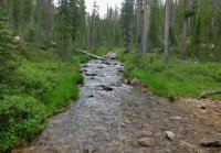
And a creek along the trail.
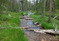
And then i came to Imogene. I think Imogene is one of the prettiest. It's large, and has a nice shape, and for some reason, even the times i've seen other people there, i've always felt solitude there.

I also really like the islands and peninsulas sticking into the lake.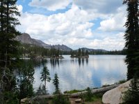
Here is One Tree Island.
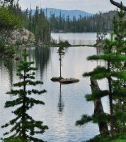
From Imogene Lake i continued to a pass beyond it. It was a nice pass, good quiet character. Here's looking back down at Imogene Lake. I had to cross a bit of that snow field on the way up.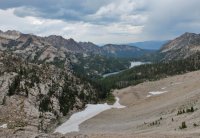
And here's looking out the other side of the pass. You can see clearly the trail below, quickly heading back up to an other pass. To the left of this picture a trail heads down to Edith, Farley, and Yellowbelly Lakes. The little bit of water visible is not any of those.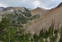
In this picture you can just see Edith Lake in the trees. I'm just below the pass from Imogene Lake here.
It didn't take long to make it down from the one pass and back up to the other. The picture here is looking back at the pass from Imogene, between the peaks at center and right.

And then looking over the other side from the pass. Unnamed lake. Looking at the South Fork Payette drainage here.
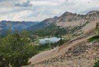
Also from the same pass. Some of the rocks here have uncharacteristic color. Also that might be Edna or Virginia Lake in the distance on the right.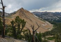
My camera battery started to give out here, so i took fewer pictures. Edna Lake is large and quiet, and feels like an other place that it would be easy to find solitude. Even if there were other people there. Virginia Lake is not far below it, and is smaller, and seems a little more convenient. These pictures are of Virginia Lake.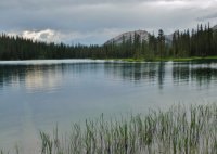
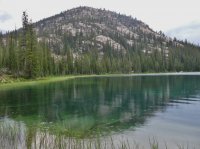
Beyond Virginia Lake i followed the very early stages of the South Fork Payette River a short ways to a turn off for Hidden Lake. There's a little bit of an ascent up to Hidden Lake, but it's worth it. The lake lies in a valley hanging above the South Fork Payette. It's not far from the larger lakes below.
This is just a large pond in the exit stream of Hidden Lake.
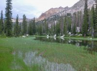
Hidden Lake was gorgeous. Few people. The trail continues up along the West side of the lake and then heads to a pass beyond it. Here's looking back over Hidden Lake.
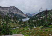
And here is a very deep blue tarn above Hidden Lake on the way to that pass.
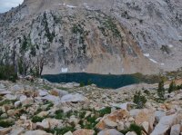
And here's that pass, and the ridge beyond it. Hidden Lake through the Cramer Lakes was probably my favorite part of this whole trip. It's the area i've had the least experience with before, and it's also deepest in the range. There were people, but not too many. I saw one party at Hidden Lake, and only a couple at Middle Cramer Lake. No thing compared to some of the busy areas this time of year.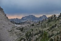
This was one of the ridges coming off the pass between Hidden Lake and the Cramers.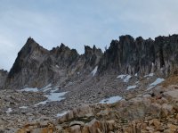
Coming down the pass. An unnamed lake above the valley that holds the Cramer Lakes. Evening was almost here.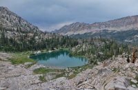
The trail bends wide around the edge of Upper Cramer Lake. The colors in this picture are pretty close.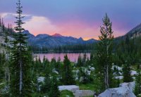
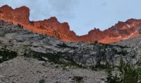
And then i looked back, and there was the glow on that craggy ridge behind.
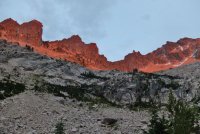
Middle Cramer Lake has a pretty sweet in let. It was late, but camping here was a little full. I went just past to Lower Cramer Lake. And set up in the rain. Only time i really got wet.
The next day i hiked down to Redfish Lake Creek, crossed it, and then headed up to Alpine Lake. The second one in the range. Not the same one that i passed on day one. No more pictures, the camera was dead dead beyond Middle Cramer. Pretty straight up to Alpine from the creek. Beyond Alpine it's up some more past a few beautiful high ponds, over the pass to Baron Lakes. My water filter had finally silted up to not pump at all any more, so i walked out quick on a quart. I stopped and rested by those ponds below the pass to Baron Lakes, all alone, one of the nicest mountain rests i've ever taken. Then i crossed the pass, and hustled the last eleven or so miles down the Baron Lakes trail. I've been up and down it a lot. Got back to the car before six thirty and drove home before dark. Great time.
Lots of people near some trail heads. No one at all on the outside stretches to and from Redfish Lake. Seventeen named lakes in barely four days. I don't know what else to say. Hope the pictures told the story better than me.
Featured image for home page:

http://caltopo.com/map?id=0120
And the link. I call it my inner outer loop. I hiked clock wise, and skirted the edge of the range before coming back to my car through the center of it. I also think the trace looks a little like sea horse. the dark blue dot on the left is where i started. The purple dots break the loop into 17 mile sections, according to the drawn lines. The light blue dots are approximately where i slept each night. I did the loop in four days. closer to three and a half, i left work friday after noon, and started hiking some time after three.
I started from Grandjean, closest trail head to my house. Lovely after noon. I went up the Trail Creek trail, which parts almost immediately from the route that i'd be coming back on. The trail crosses the creek a couple times as it makes it's way up the drainage.
A couple flowers in the first couple hours.


The trail ascends not quite steeply, but concertedly, about 3,000' in about five miles. After that it continues up less steeply. I passed the trail junction for Trailer Lakes, which doesn't go any where else. Views of the range open up just a little bit here.

And i continued past the junction for Observation Peak, which also doesn't go any where else, and for the trail that goes down the other side to Stanley Lake. Both those trails meet the trail coming up from Trail Creek at the same place. A four way junction. I went East toward McGown Lakes, and Sawtooth Lake beyond.

A lot of the area around the top here is badly burned out. But you're able to see a little more as a result. The picture above is looking back down Trail Creek's drainage. Below is a meadow on the way to McGown Lakes.

Just a small pond. It pinches in the middle, and appears as two small ponds just barely connected.

Here's the crossing at the pinch mentioned above.

And then looking back.

And looking across the other segment.

Not much later i passed one of the McGown Lakes. It's all a nice area up here. Not many people. Even in august.

And then i came across this bee.
 So i took a few pictures.


Beyond that it was over the pass to Sawtooth Lake. At the top you get a good view of Stanley all the way down below.

Sawtooth Lake is one of my favorites. Just for it's sheer size. Brimming in that bowl. Views of the lake are good the whole way down the trail to the outlet on the left end in the picture.


There appeared to be a couple small groups already camped near the out let of Sawtooth. But i had to keep going beyond there any way. Evening was getting close. If i wasn't going to be able to finish my loop in the four days that i had, there were options to shorten it, but i didn't want to do that.
Below Sawtooth Lake the trail passes Alpine Lake. One of two 'Alpine Lake's in the Sawtooths. This was the second place that i ever backpacked, with my dad and two of my younger brothers.

Still above Alpine Lake, you can see the prominent ridge that bounds Iron Creek below. I went down to the bottom there before setting up camp for the first night.

The view from the tent.

The next morning, breakfast on Iron Creek. The water was perfectly clear. This area sees a lot of traffic, but very soon i was away from it again.

I continued around the northern edge of range, eventually coming to Goat Falls, below Goat Lake.


Beyond Goat Creek, again, one of two in the Sawtooths, i continued to bend around toward the East side. A lot of the trail looked like this.

Uniform trees.
Not much to see during this stretch. Continual hiking was broken at one point passing by small Marshall Lake. And then i just kept walking through the forest, making my way around toward Redfish.

Eventually the trail comes out on a ridge that leads down and out toward Redfish Lake. The view is open from the ridge top. You can see Sawtooth peaks on the right, and out across the Salmon River valley to the Whiteclouds beyond.

The Whiteclouds in the distance.

The trail coming down from the ridge. It was a little monotonous, but it was nice. No people here.

Little hen in the aspens.

Getting closer to Redfish. Above the valley of Fishhook Creek.

An other point where i could view Stanley, and this time the Salmon River too.

And an other good view of the peaks.

And eventually i made my way down here to Redfish Lake. It was strange to see a place so busy with people in the middle of so much not seeing people. I stopped there long enough to cook lunch on a picnic table, and to refill my water bottles from the tap there. Good sized lake. Grand Mogul should be the peak on the left, straight out the lake.

Redfish Lake Creek exiting the lake.

The trail beyond the creek. The lake is just out of sight, other side of the fence. It didn't go on long like this. Shortly i came to the Heyburn Mountain campground where an other trail ascends to a ridge above the lake.

Uniform trees along the trail, before ascending above the lake.

There was a lot of going up from Redfish Lake. And mountain bike tracks. This portion of trail lies outside the wilderness. Eventually the ridge nears Grand Mogul, and the trail turns South, paralleling the higher peaks. I made camp the second night just off the trail along this stretch between Redfish Lake and Hellroaring Lake.
The next day i continued on, crossed Decker Creek, and ended up going the wrong way down Huckleberry Creek for just a minute because i missed a trail junction where a sign had been knocked down. Relatively early in the day i made it to Hellroaring Lake. It's about ten miles from Redfish Lake. From here it's about four miles on to Imogene Lake.

Hellroaring Lake was my first backpack, clear back when i was eight or nine, or some thing like that. I had no idea what i was getting into back then, i just followed my Dad up to a lake. I remember my brother and i and a couple family friends spending a significant portion of the day playing on the logs that span the whole way across the lake there. As i remember it there were even more there all those years ago.

The trail continues along the edge of Hellroaring. About center there you can see the Finger of Fate. The pointier feature.

Finger of Fate.

Near the end of the lake the trail starts up again on it's way to Imogene Lake. Here's a section of board walk in between the two.

A pond with lily pads along the trail.

A pond without lily pads.

And a creek along the trail.


And then i came to Imogene. I think Imogene is one of the prettiest. It's large, and has a nice shape, and for some reason, even the times i've seen other people there, i've always felt solitude there.

I also really like the islands and peninsulas sticking into the lake.

Here is One Tree Island.

From Imogene Lake i continued to a pass beyond it. It was a nice pass, good quiet character. Here's looking back down at Imogene Lake. I had to cross a bit of that snow field on the way up.

And here's looking out the other side of the pass. You can see clearly the trail below, quickly heading back up to an other pass. To the left of this picture a trail heads down to Edith, Farley, and Yellowbelly Lakes. The little bit of water visible is not any of those.

In this picture you can just see Edith Lake in the trees. I'm just below the pass from Imogene Lake here.

It didn't take long to make it down from the one pass and back up to the other. The picture here is looking back at the pass from Imogene, between the peaks at center and right.

And then looking over the other side from the pass. Unnamed lake. Looking at the South Fork Payette drainage here.

Also from the same pass. Some of the rocks here have uncharacteristic color. Also that might be Edna or Virginia Lake in the distance on the right.

My camera battery started to give out here, so i took fewer pictures. Edna Lake is large and quiet, and feels like an other place that it would be easy to find solitude. Even if there were other people there. Virginia Lake is not far below it, and is smaller, and seems a little more convenient. These pictures are of Virginia Lake.


Beyond Virginia Lake i followed the very early stages of the South Fork Payette River a short ways to a turn off for Hidden Lake. There's a little bit of an ascent up to Hidden Lake, but it's worth it. The lake lies in a valley hanging above the South Fork Payette. It's not far from the larger lakes below.
This is just a large pond in the exit stream of Hidden Lake.

Hidden Lake was gorgeous. Few people. The trail continues up along the West side of the lake and then heads to a pass beyond it. Here's looking back over Hidden Lake.

And here is a very deep blue tarn above Hidden Lake on the way to that pass.

And here's that pass, and the ridge beyond it. Hidden Lake through the Cramer Lakes was probably my favorite part of this whole trip. It's the area i've had the least experience with before, and it's also deepest in the range. There were people, but not too many. I saw one party at Hidden Lake, and only a couple at Middle Cramer Lake. No thing compared to some of the busy areas this time of year.

This was one of the ridges coming off the pass between Hidden Lake and the Cramers.

Coming down the pass. An unnamed lake above the valley that holds the Cramer Lakes. Evening was almost here.

The trail bends wide around the edge of Upper Cramer Lake. The colors in this picture are pretty close.

And then i looked back, and there was the glow on that craggy ridge behind.

Middle Cramer Lake has a pretty sweet in let. It was late, but camping here was a little full. I went just past to Lower Cramer Lake. And set up in the rain. Only time i really got wet.

The next day i hiked down to Redfish Lake Creek, crossed it, and then headed up to Alpine Lake. The second one in the range. Not the same one that i passed on day one. No more pictures, the camera was dead dead beyond Middle Cramer. Pretty straight up to Alpine from the creek. Beyond Alpine it's up some more past a few beautiful high ponds, over the pass to Baron Lakes. My water filter had finally silted up to not pump at all any more, so i walked out quick on a quart. I stopped and rested by those ponds below the pass to Baron Lakes, all alone, one of the nicest mountain rests i've ever taken. Then i crossed the pass, and hustled the last eleven or so miles down the Baron Lakes trail. I've been up and down it a lot. Got back to the car before six thirty and drove home before dark. Great time.
Lots of people near some trail heads. No one at all on the outside stretches to and from Redfish Lake. Seventeen named lakes in barely four days. I don't know what else to say. Hope the pictures told the story better than me.
Featured image for home page:

Last edited:
