Sawtooths, 68 mile loop, August

Haha ......... I can go then if you push my wheelchair for me........ I'll be almost 70.

I'll push your wheelchair anywhere you would like to go! At least we'll be doing the same hike for a change. I bet at 70, you'll be hiking into areas that a person half your age would think twice about doing.
 
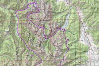
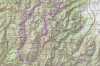
@ben cowan - Here is the loop I'm contemplating in 2017 or 2018.

Sawtooth_Wilderness_North_Half.jpg
North Half

Sawtooth_Wilderness_South_Half.jpg
South Half

I thought I would start and end at what is marked on South Half map as "Powerplant Campground". Any thoughts?
 
I'd go on this one .........you are the planner and navigator on it ............ but
Go north to south, it's generally downhill. (Iron Creek TH?). I'd start at Alturas LK TH.... Getting to the Powerplant at Atlanta or Grandjean is a long long drive.....been on it. Looks pretty good for 'staying on trail'....you getting soft? I'd go TImpa Lk to 3 Island Lk to Spangle. Off trail from Timpa Lk, a little steep but piece of cake. .... Or from Alturs Lk TH, go up ALpine Creek and over to Flytrip to hook into your route. I'd cut back to Cramer Lks from Edna Lk then to Alpine Lk. Redfish is nice but not that nice. From Baron I'd go around near Tohobit Pk into Fishhook drainage, over Thompsom Pass to Goat Lk, then around to Alpine and Sawtooth Lk. Or bypass that end, Sawtooth Lk is nice but not that nice and crowded usually. Fly down the West side from Granjean to Atlanta and back to Alturas LK TH......
Personally I don't like staying in those looong canyons, rather be more on top. Allow for fishing time... :)

Go to the resources section...I posted a gpx file of my trip I took...so good info.

Email me your route, I'll plug it into Garmin Maps.....also what kinda miles did you get. How many days you thinking? bobb169 at hotmail dot com
 
@ben cowan - Here is the loop I'm contemplating in 2017 or 2018.
I thought I would start and end at what is marked on South Half map as "Powerplant Campground". Any thoughts?
Both you (@scatman ) and @Bob .. You GO boys. I'd go too. I am an expert planner but I can't plan out in 2017 and 2018 :) Good on ya...

I would assist with Bob's wheelchair. He is a little guy so it shouldn't be too hard.
 
scatman
you wanna see it all huh. i've done most of the trails you've got there, except for the south half. i haven't been much south past elk lake or ardeth lake. the only hike i ever did from the boise river side was up the little queens river, which is off your route.

i've struggled a lot with figuring out a good long loop in the sawtooths. i still don't have a great solution.

any way, if you want to know what i think. i think that hiking from grandjean over to sawtooth lake is worth it. and as you said you've never been, i think that you should see sawtooth and alpine lakes. they're good. there are good views of the interior of the range from above north fork baron creek, and baron lakes and alpine lake are nice. i've never seen redfish lake from the inlet, but i'd be interested to. you're less likely to see any one between redfish lake and hellroaring than probably any where else you're looking at there. it's a nice quiet section with some views across the salmon river valley to the white clouds. hellroaring lake is nice, and i think imogene is exceptional. the passes south of imogene are nice, particularly the one farther south. the bigger southern lakes, like vernon and edna, are nice, but not as nice as i would've hoped. like i said, i can't tell you any thing really about the southern section. the south fork payette river trail is long, like Bob said, but elk lake was mildly interesting. and i hiked all the way from elk lake back to grandjean in just a few hours the time that i was there, so it's not like it's a big deal.

all that being said, i think the best parts of the sawtooths in my opinion are the cramer and hidden lakes area, and the toxaway, twin and alices lakes. which i imagine doesn't make planning your trip any easier. i would highly advise not missing those bits, but have a hard time advising you how to incorporate them into some thing that includes the other sections you'd want to see. my experience at the head of goat creeks drainage, around warbonnet and feather lakes was also on par with those areas, but it is slightly off trail. close favorites after those would be imogene lake, the divide between baron and alpine lakes, and the divide between edith and edna lakes.

if you haven't, and would like to, check out this.
South Fork Payette River, june
it covers a little of what you're looking at also. i went in june, so i didn't go far, the river was too high at the crossing, and there was nothing but snow on the other side of it any way.
 
haha Art .......... I'd bring more gear then....
 
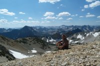
I think this is one of the best spots in the Sawtooth's, Thompson Pass, by the highest peak in the Sawtooth NRA (I think). The entire Range looking south is the background:

061 Thompson Pass - Bob.JPG
 
Last edited:
You guys recognize that, besides Ben, one of the most knowledgeable off-piste Sawtooth travelers and route designers is @Bob, right? If you haven't you need to read his trip he referenced above and is linked here: http://backcountrypost.com/forum/th...daho-north-to-south-traverse.1933/#post-27479.

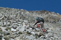
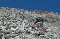
Word of warning. Here is one of his preferred hiking styles (he claims to hate hiking uphill but look at him). He was broadcasting the same anti-uphill message as we bushwhacked over 12K' in the Lost River's this autumn.
image.jpg
 

Attachments

  • image.jpg
    image.jpg
    218.5 KB · Views: 7
haha .................. you were supposed to keep quiet. I create 'interesting' routes.
 
@Bob and @ben cowan , thanks for the input. I'm going to pull out my Sawtooth wilderness map and follow your suggestions on the map and see what looks practical. Since I've never hiked in the Sawtooths before, I thought the loop that I came up with might give me a general feeling for the wilderness area. If I do too much off-trail stuff I can't get anyone to go on these trips with me! :D
 
@langutah - I've read bob's report, even downloaded his gpx file. His route is quite impressive. That's what makes me feel confident that he will still be doing this kind of thing when he is 70!
 
Scat ........... I'll go off trail ...... some of the best is there.
 
Back
Top