NateGeesaman
Donkey
- Joined
- Jan 20, 2012
- Messages
- 272
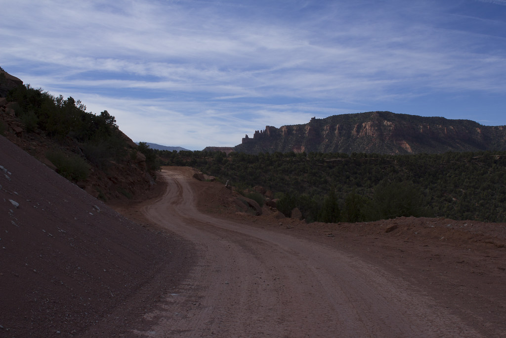
For the second summer in a row I found myself headed to the desert for a backpacking trip with someone I had yet to meet, thank you backcountrypost.com! I was racing the sun to the campsite that @langutah had designated as our meeting spot. Even in my rushed state, I drove quite carefully and passed a record 8 various police officers patrolling the masses of people headed to Moab for the long weekend. Looking for a campsite in an unfamiliar area after dark was not a prospect that excited me, but my departure was delayed by a morning making some extra $ washing windows with an old friend. Whatever kind of hurry I was in, I believe that you have to make time to stop and take pics when in an area so pleasing to the eye.
Beef Basin Road View by NateGeesaman, on Flickr
getting there, getting late
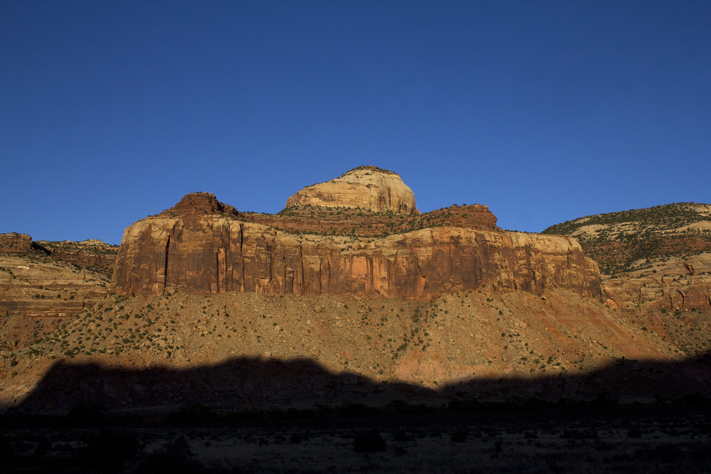
Cathedral Butte by NateGeesaman, on Flickr
even later, still must stop for a few photos
Upper Salt Creek Blues by NateGeesaman, on Flickr
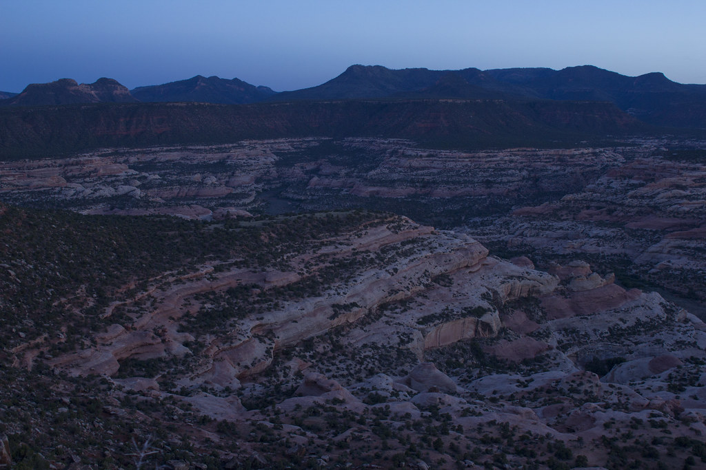
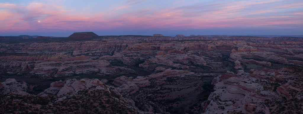
I enjoyed sunset from the slow going road that got me to where Art had set up camp. I pulled into camp and got a hearty greeting from Art and an offering of some red wine and food. The view from camp was absolutely fantastic. Art enthusiastically helped orient me to the expansive landscape in front of us that we would spend the next 4 days walking. As the sun set, the big moon raised to light the beautiful canyons below us.
Camp dusk moonrise by NateGeesaman, on Flickr
I finished the night enjoying the captivating moon lit landscape and a tall cold beer.
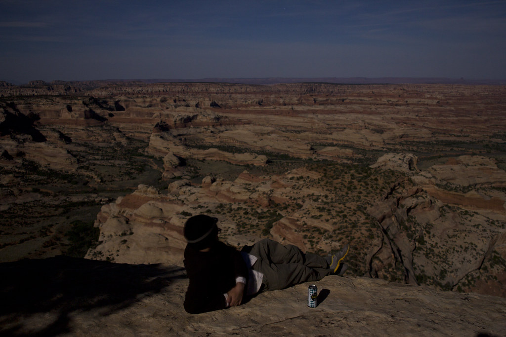
Beer Time by NateGeesaman, on Flickr
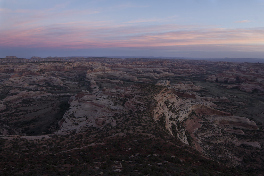
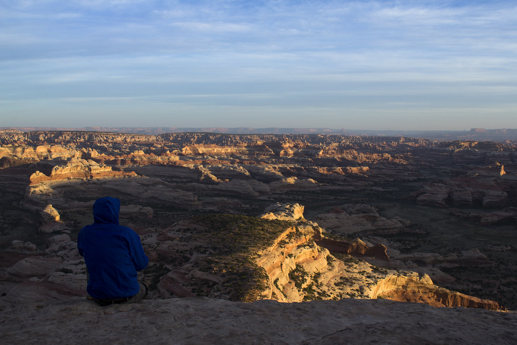
I slept well, but awoke feeling a mild cold that had now creeped fully into my system. Tea, a great sunrise, breakfast, breakfast, and more tea had me feeling like I could climb a mountain anyways.
Sunrise from camp by NateGeesaman, on Flickr
14mm camp sunrise by NateGeesaman, on Flickr
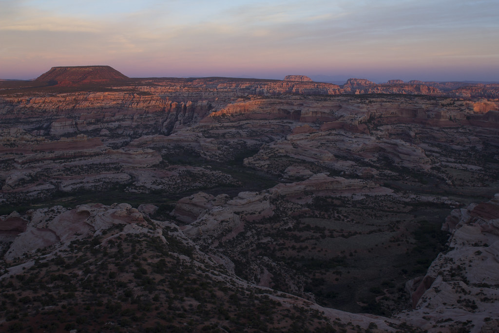
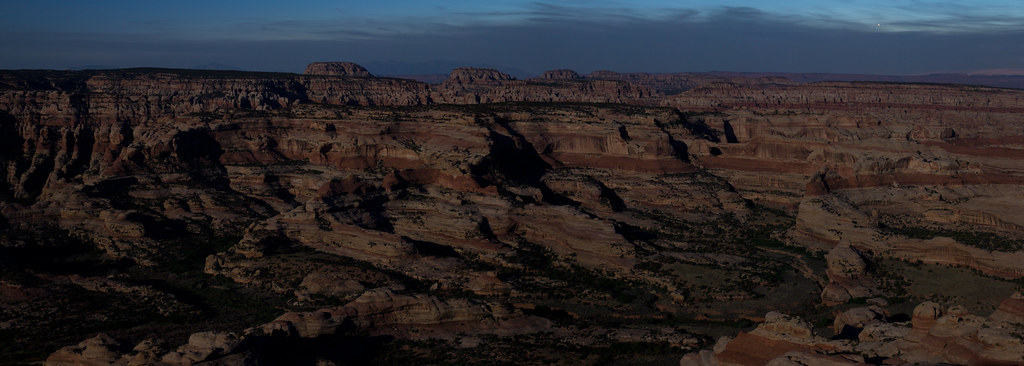
Sunrise from camp 2 by NateGeesaman, on Flickr
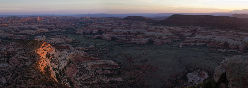
Big Pocket Sunrise Pano by NateGeesaman, on Flickr
Tea Time by NateGeesaman, on Flickr
I was even able to see some ruins with my binoculars during this sunrise. Even though I was feeling under the weather, I was getting quite excited to get in there.
What a great place to be enjoying a sunrise, but it was time to set up the shuttle and get hiking. So it was just Art and I on a trip that once had a possibility of a six man crew. For one reason or another everyone else had to drop out on Nick's permit. 2 people and 2 cars was all we needed to connect the beautiful 40+ mile route. Time to set up the shuttle.
Beef Basin Driving by NateGeesaman, on Flickr
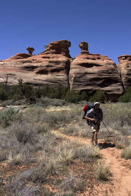
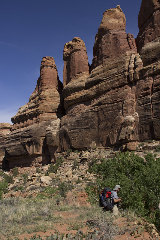
After checking in at the visitors center and piling into Art's truck we headed back to the Cathedral Butte trail head and flung our heavy packs on our backs and started the climb down to Upper Salt Creek and towards The Big Pocket where we would set up our first camp. The view from the trail head was exciting.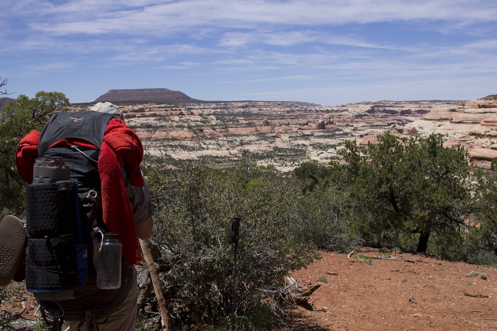
Art Start by NateGeesaman, on Flickr
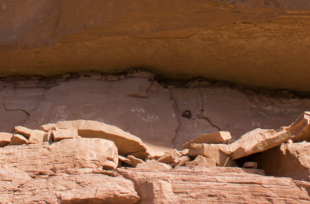
It was not long into our days hiking that we saw some rock art.
Odd Panel by NateGeesaman, on Flickr
Then we saw the impressive work of a farmer who ranched cattle in the area circa 1890. I didn't take many pictures of it, but Kirk's Cabin was a pretty impressive old structure. Supposedly Kirk only ranched the area for a few years and found himself unable to make a living, but his cabin was used for many years to come by cowboys in the area until Canyonlands became a national park. In his short time in the area, Kirk built a structure to last through the ages with limited resources.
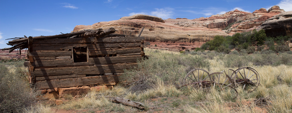
KIRKS CABIN PANO by NateGeesaman, on Flickr
The hike to our camp was short, maybe 6 miles. We set our tents up and the head cold I had took a grip on me. My energy was zapped after hiking and setting up the tent. I fell asleep, sans sleeping pad, on the floor of my tent to try and power nap my way out of my drained state. It worked well enough as I was able to muster enough energy to hike the surrounding hills in search of an arch that was not there.
Wedding Ring Search by NateGeesaman, on Flickr
Now I had two maps that both marked Wedding Ring Arch in the hills above that campsite, both a Kelsey guidebook map and a National Geographic map. Art had and older National Geographic map that marked that arch much further North. In the end both of my maps were wrong, but it was fun to wake up our slick rock brains by wandering the hills looking for the arch. That made us think that National Geographic is copying Kelsey. When they updated their map, they moved Wedding Ring Arch to the location Kelsey had marked instead of where they had it on their older maps, which is the correct location. It was disheartening not to find the arch because photos I had seen of it made it look like a beauty. I didn't yet know that we would find the arch further along on our journey many many miles from where it was marked on my maps.
I went to bed early that night and slept like a rock. I awoke feeling much better than the day before and ready for a full days hiking. We ate breakfast, watered up, and packed up quickly getting on the trail pretty early. It was a beautiful day with near perfect hiking temps and a beautiful sky.
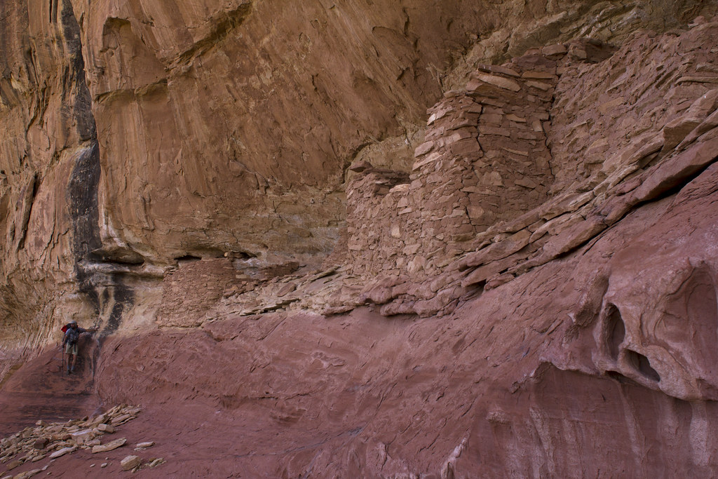
We found our first ruins early on that day. They were quite beautiful and tucked into a cliff that had a lot of nice geology going on.
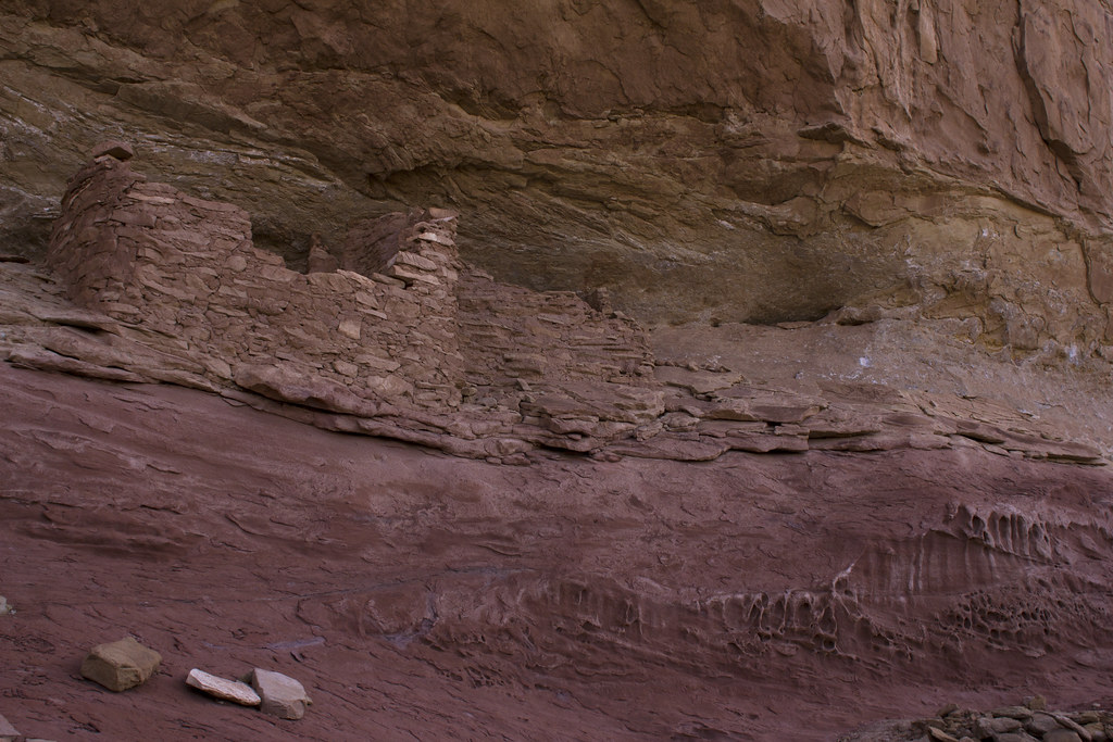
Salt Creek Granary by NateGeesaman, on Flickr
Art knows how to make a picture.
Art and some ruins by NateGeesaman, on Flickr
Then we saw one of my favorite arches I have seen. It is high up on some beautifully white and pink broadly striped cliffs and has such a beautiful shape. Its almond shape reminds me of a big eye watching on from high and it has a stout architecture that gives it great character.
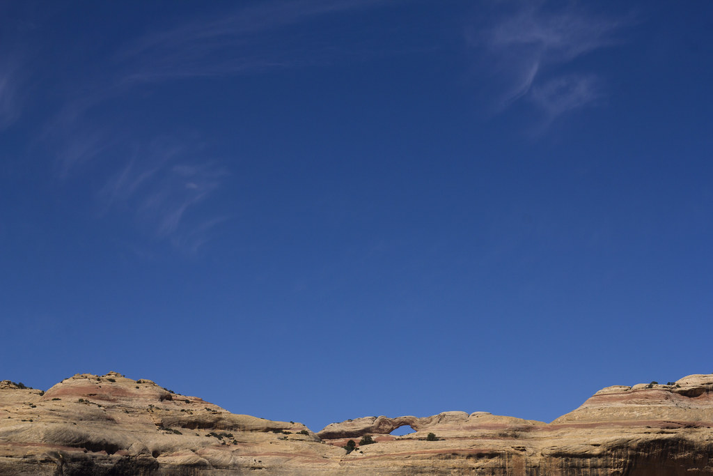
Salt Creek Natural Arch 2 by NateGeesaman, on Flickr
Salt Creek Natural Arch 1 by NateGeesaman, on Flickr
What a beautiful trail!
Sawlt Creek by NateGeesaman, on Flickr
Art is quite a knowledgeable birder and helped nurture my appreciation of birds. Graceful swallows swooping around us were an almost constant bonus of this beautiful area.
Swallow Watching by NateGeesaman, on Flickr
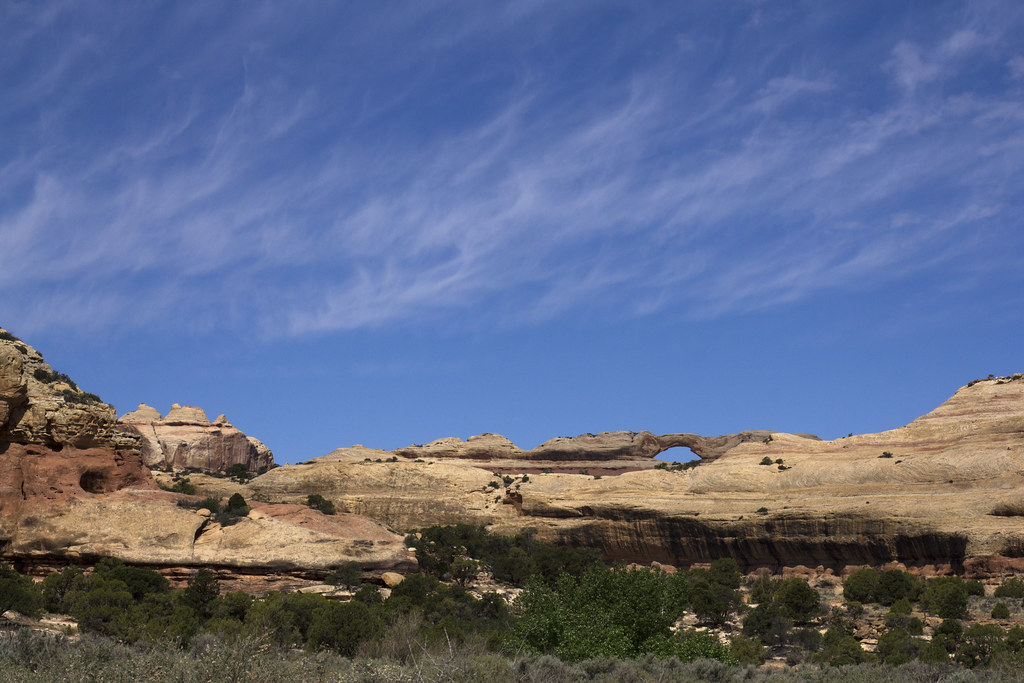
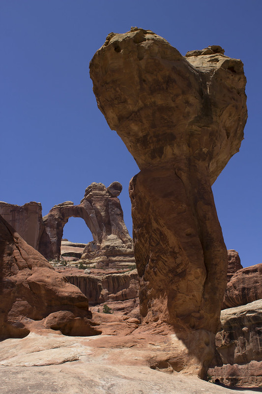
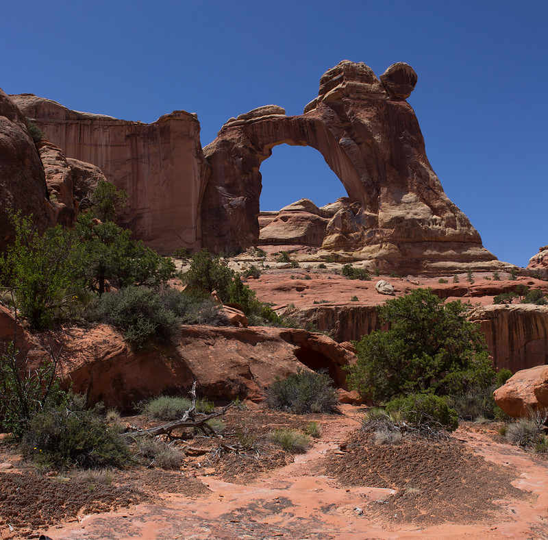
Then we found Wedding Ring Arch which I was worried we might not see. Again, newer National Geographic maps and the map in my Kelsey guide book had this misplaced further South by a few miles. Art's older National Geographic map had it correctly placed.
Art and Wedding Ring Arch by NateGeesaman, on Flickr
Close to Wedding Ring Arch, we got a peek at Fish-eye Arch.
Fisheye Arch by NateGeesaman, on Flickr
Arches that look like eyes, beautiful green spring foliage, abundant evidence of an ancient civilization, and beautiful geology all around made this area feel very special.
Next we explored the "Squash Patch" ruin. The coolest thing about this ruin for me was the huge squash plant that had been growing and reseeding here for over 800 years.
Ancient Squash by NateGeesaman, on Flickr
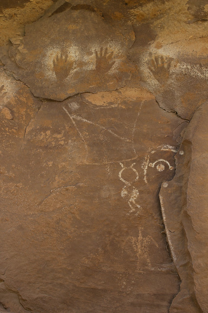
We guessed that these marking were a method of counting crops. Guessing that this area housed a crop worthy of 5 high fives.
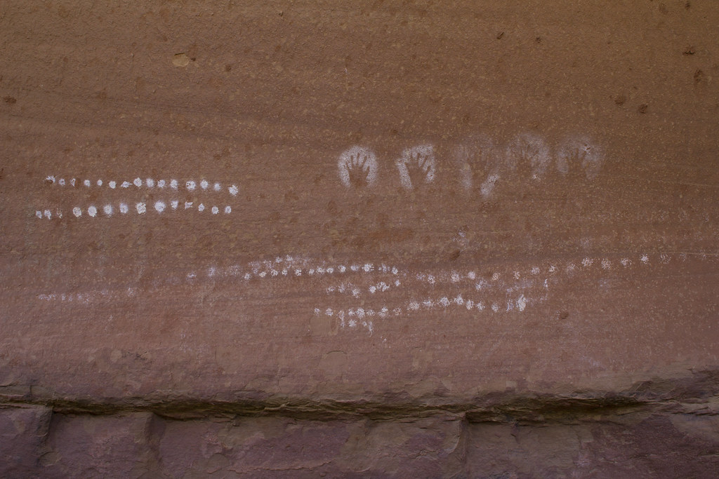
5 hands by NateGeesaman, on Flickr
I didn't touch it. My mitt is just in the shot for size comparison.
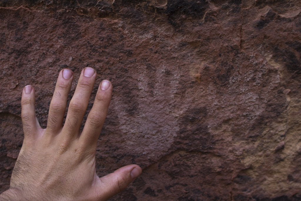
Baby Hands by NateGeesaman, on Flickr
There were a lot of other things to appreciate about this ruin like big circular storage areas dug into the mud, many grinding stones, broken pottery, and pictographs. We spent a good amount of time exploring this area and resting.
Between ruins and arches, the trail had a lot of character to appreciate. Here Art is seen hiking underneath some impressive sandstone toadstools.
Art Toadstooling by NateGeesaman, on Flickr
Then we arrived at a series of deep joints in the rock that we decided to bust out the tripod.
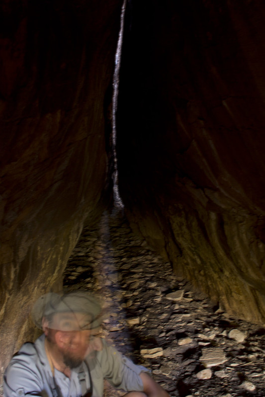
Art faces by NateGeesaman, on Flickr
Selfie in a joint by NateGeesaman, on
Flickr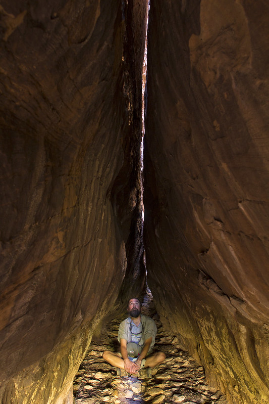
Art Cave Sit by NateGeesaman, on Flickr
We arrived at a perfect time when the direct light was hitting the floor of the cave.
Joint Selfie Ray by NateGeesaman, on Flickr
Art in a joint by NateGeesaman, on Flickr
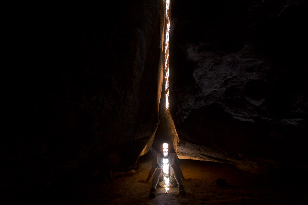
Art Clevity Raya by NateGeesaman, on Flickr
On to the goods! Now we were getting to the very impressive The All American Man. This pictograph is very beautiful and also beautifully set in a sweet little cave with a couple nice granaries.
Recent radiocarbon dating has proven this to be an authentic panel of Puebloan people. This thing predates the American Flag and American Gladiators, which makes it even cooler.
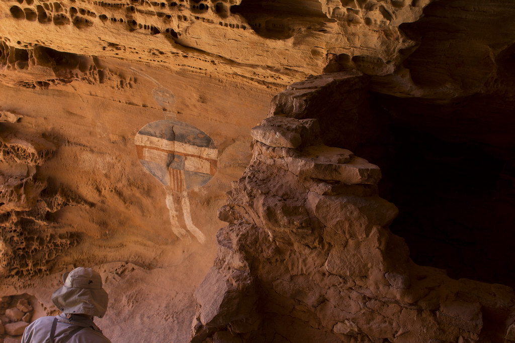
All American Man by NateGeesaman, on Flickr
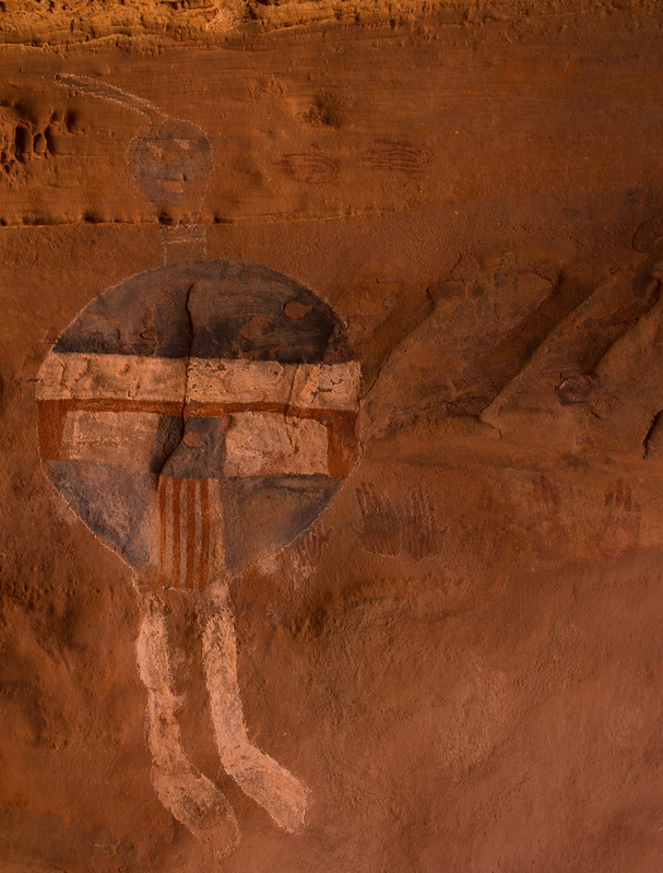
All American Man Verto by NateGeesaman, on Flickr
This was Art’s favorite pictograph he has seen and justifiably so. Beautifully set and special in character and color.
On we hiked
Salt Creek Trail by NateGeesaman, on Flickr
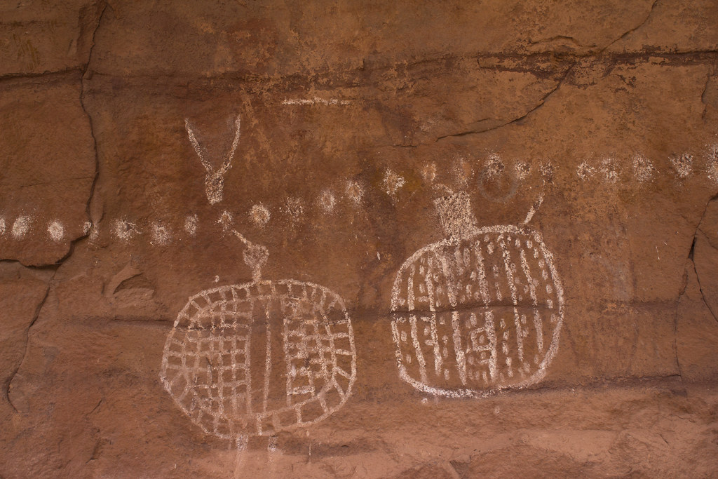
4 faces panel was the next attraction
4 FACES 2 by NateGeesaman, on Flickr
4 faces panel by NateGeesaman, on Flickr
These panels had some nice ruins around them as well and were worth a nice long visit.
The next stop would be our beautiful camp. The highlight of our camp for me was this little ruin that Nick alerted us to, but still took a while to spot.
Ruin during the blue hour by NateGeesaman, on Flickr
On to the next day. We were looking at a big day of hiking. My cold was in recession and I felt excited for the long beautiful day ahead. We spied some pictographs early on. They were high up on a ledge and required a little scrambling to get a good view of.
Salt Creek patterns by NateGeesaman, on Flickr
Regrettably, I didn’t hike all the way up to these ones, because it did not look easy and I had just seen the Four Faces panel to satisfy my pictographic eye. I had to crop this photo quite a bit to get a decent view of the beautiful white figures on the wall.
2 warriors by NateGeesaman, on Flickr
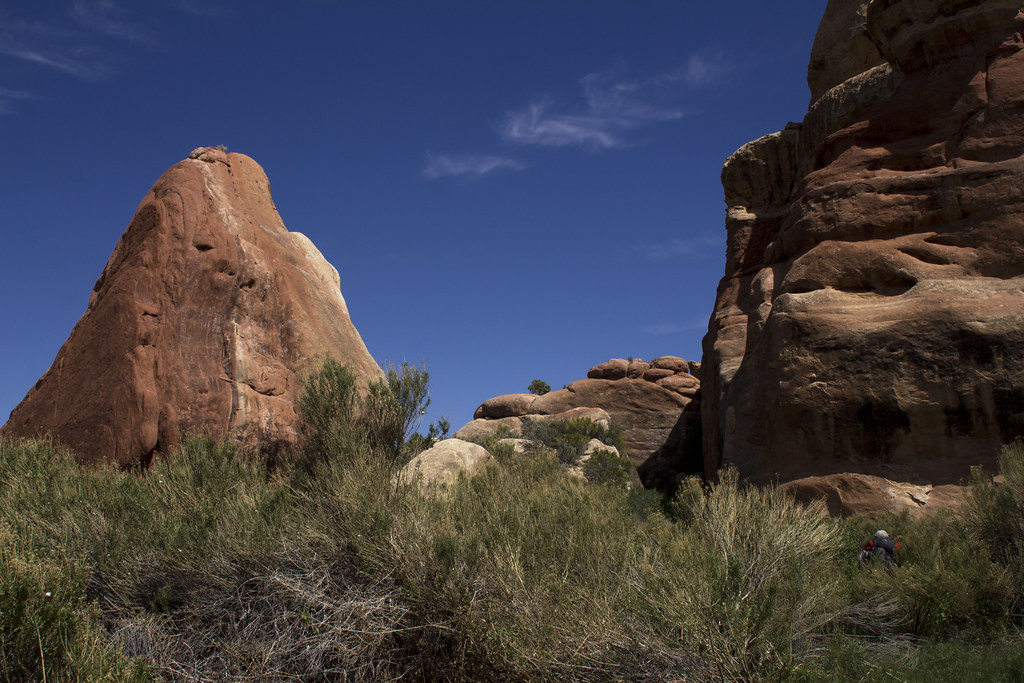
The trail was always changing in character and provided a landscape that never became tiresome or dull.
Art knobs by NateGeesaman, on Flickr
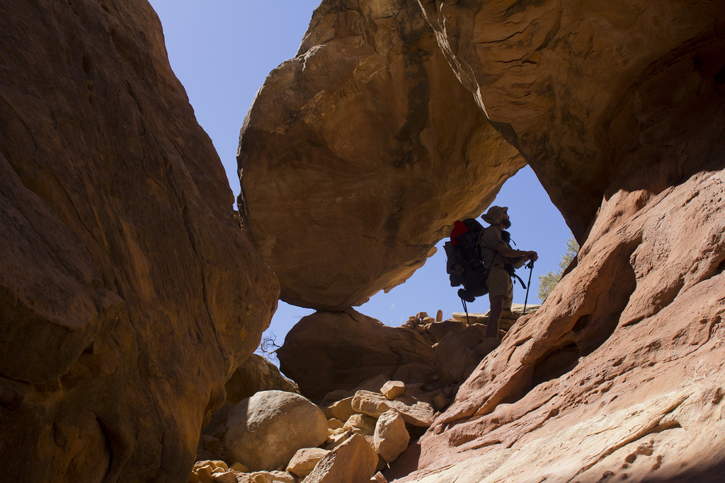
A fellow backpacker that we had met on our first day at the watering hole had told us that one of his favorite times along his journey was the side hike up to underneath Angel Arch, the biggest arch in canyonlands. I had also been very impressed with some photos I had seen of the arch, so we made it a point to add that hike to our itinerary. Molar Rock was another beautiful feature in this area.
Angel Arch Molar Rock by NateGeesaman, on Flickr
Angel Arch Pano by NateGeesaman, on Flickr
HUGE Arch! Arches like this and Druid arch are similar in character and dwarf most other arches I have seen. The hike to the base of the arch was challenging and reminiscent of the hike to underneath Druid Arch as well. Art gave me some steep sandstone tips from his wealth of experience that made that part of the hike more fun.
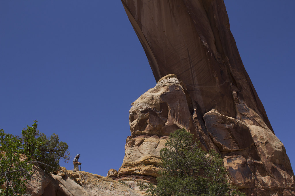
Art Abajo de Angel by NateGeesaman, on Flickr
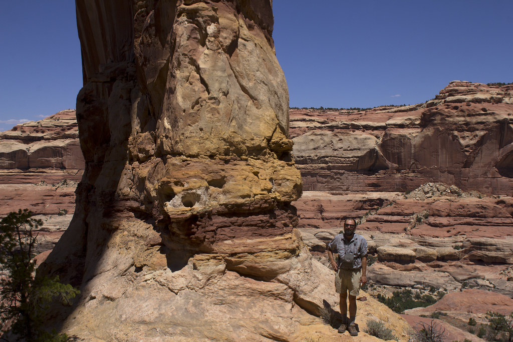
Art at Angel's Base by NateGeesaman, on Flickr
Looking up from underneath the monstrous structure:
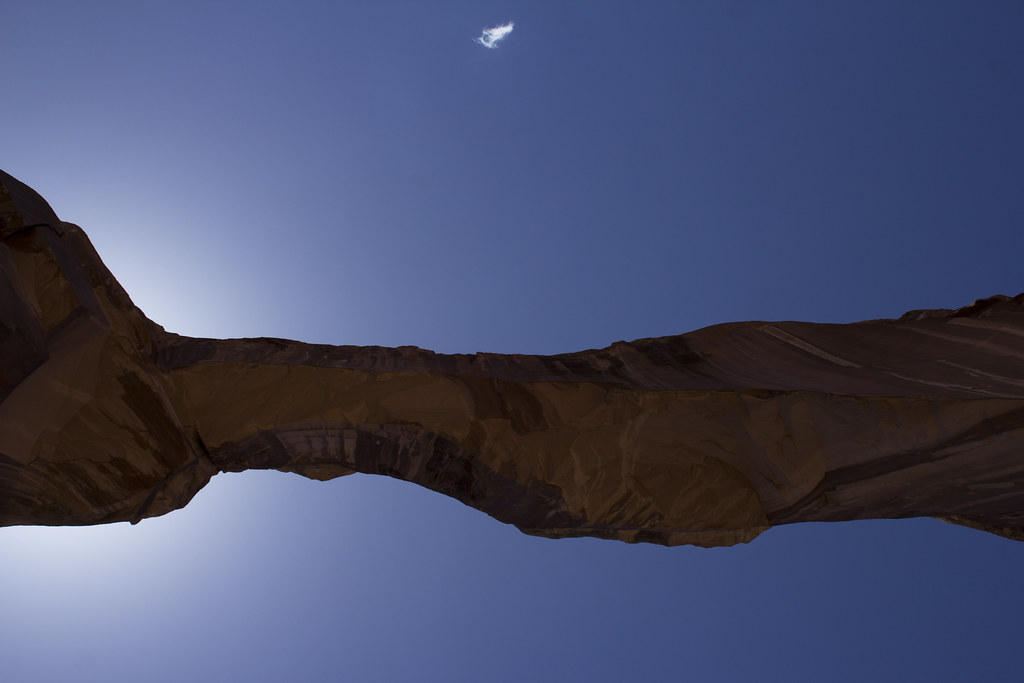
Angel Arch Up by NateGeesaman, on Flickr
After spending a while enjoying the amazing view of the canyon from underneath the arch, we moved on and put the packs back on. Further down Salt Creek we go.
Salt Creek Pools by NateGeesaman, on Flickr
I saw a huge tiger salamander leisurely munching tadpoles in this area, but didn’t get close enough for a good photo unfortunately.
This was the first night of at large camping where we were free to choose a camp. Art found a nice camp under some big trees that would house us for the night. We were both pretty beat from the long day of hiking, 14 miles if I remember right, and Art was starting to feel like he caught my cold. bummer.
I shot this while watering up by camp.
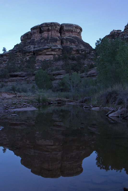
Salt Creek Reflection by NateGeesaman, on Flickr
Our last day was set to be a long one. We chose to hike out via the Peek-a-boo trail to avoid the slog at the end of Salt Creek, but along with adding a lot of nice scenery to the hike it also added a few miles.
It was not long before we made it to the Peek-a-boo picto panel. You can see pictographs that are hundreds of years older underneath the newer white shield wielding warriors.
Peek-a-boo Panel by NateGeesaman, on Flickr
This was where we got turned around a bit. We were a mile off trail when I heard Art say, “We’re f**king up!” as he looked at his GPS a ways ahead of me on the trail. We went through a hole in the cliff next to the Peek-a-boo panel instead of continuing along the cliff as we should have and headed back up salt creek. Two bonuses of going the wrong way were that I found my map which I had unknowingly dropped and we saw an arch we missed when headed down canyon. We got back on track and began the scenic slickrock Peek-a-boo trail.
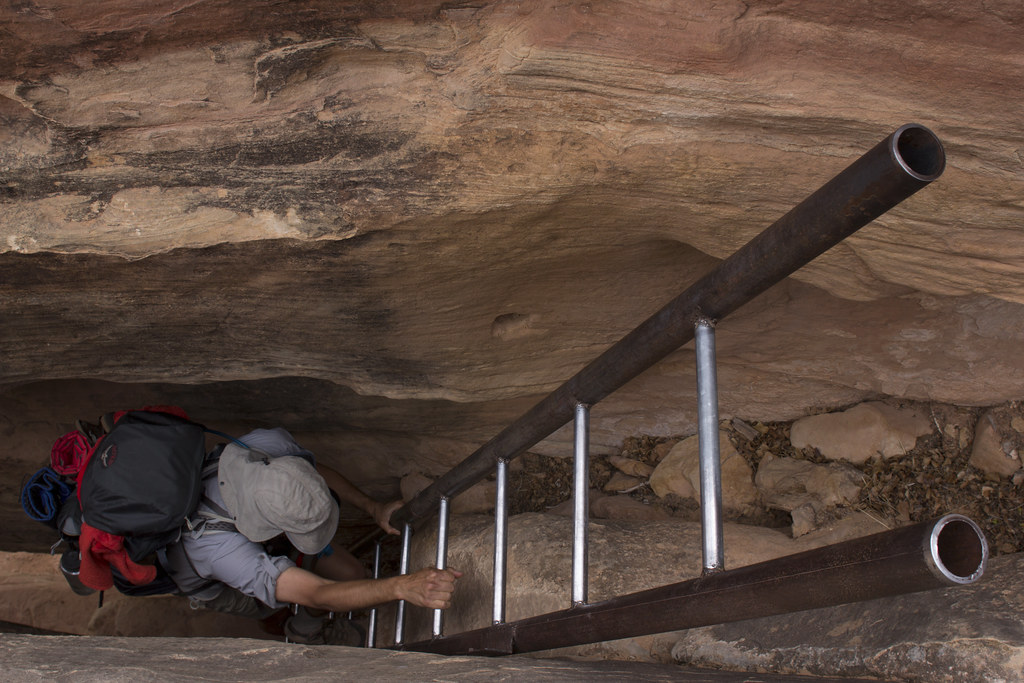
Peek-a-boo Ladder by NateGeesaman, on Flickr
Art Peek-a-boo 1 by NateGeesaman, on Flickr
Art was feeling the full force of the wicked head cold that beat down my energy on our first day on the trail. I recall the echoes of his sneezes as we passed through deep canyons. I can remember him exclaiming, “I’m leaking oil!” As we labored along, frequently clearing his nose into his handkerchief. I felt bad for passing on the pain. The scenery was a serious lift though and kept us pushing along.
Art by NateGeesaman, on Flickr
Peek-a-boo Art by NateGeesaman, on Flickr
Peek-a-boo Art 2 by NateGeesaman, on Flickr
Another long long day of hiking came to an end at Squaw Flat where my car was parked. We enjoyed the customary victory beers and chips before we headed back to Cathedral Butte to get Art’s truck.
Along the way we noticed a little extra wobble in my steering wheel and as soon as we hit the dirt road it got a little worse. We stopped and looked at my tire and found it to be hanging on by just one nut. The other four bolts had snapped off! The bolts were so short that I couldn’t even secure the tire on any more. A fellow traveler along the Beef Basin Road stopped and saw if they could help. They came back when they found one of the nuts from my tire in the road a little further along. They were kind enough to take Art back to his truck while I stayed behind and tried to fix my tire. The bolts looked like they still might have enough thread to fit on my little spare tire. I had to scrape at the threads in the bolts with a butter knife as they were full of warped metal from when they snapped. It took me a while, but I got my spare on there good and tight while Art retrieved his truck.
Beautiful Tire Troubles by NateGeesaman, on Flickr
There was a big storm rolling in and we got off the dirt road just as a heavy downpour started. I was super relieved to be on my way home and able to avoid an expensive tow. Art was a great companion that kept a cool head and a helpful attitude when we faced the adversity of illness, car troubles, wrong turns, and long days on the trail. I could not have hoped for a better companion on the trail and was very grateful for our meeting. I could not have hoped for better scenery either. This was a great trip that will not be easily forgotten.
Featured image for home page:

Beef Basin Road View by NateGeesaman, on Flickr
getting there, getting late
Cathedral Butte by NateGeesaman, on Flickr
even later, still must stop for a few photos
Upper Salt Creek Blues by NateGeesaman, on Flickr
I enjoyed sunset from the slow going road that got me to where Art had set up camp. I pulled into camp and got a hearty greeting from Art and an offering of some red wine and food. The view from camp was absolutely fantastic. Art enthusiastically helped orient me to the expansive landscape in front of us that we would spend the next 4 days walking. As the sun set, the big moon raised to light the beautiful canyons below us.
Camp dusk moonrise by NateGeesaman, on Flickr
I finished the night enjoying the captivating moon lit landscape and a tall cold beer.
Beer Time by NateGeesaman, on Flickr
I slept well, but awoke feeling a mild cold that had now creeped fully into my system. Tea, a great sunrise, breakfast, breakfast, and more tea had me feeling like I could climb a mountain anyways.
Sunrise from camp by NateGeesaman, on Flickr
14mm camp sunrise by NateGeesaman, on Flickr
Sunrise from camp 2 by NateGeesaman, on Flickr
Big Pocket Sunrise Pano by NateGeesaman, on Flickr
Tea Time by NateGeesaman, on Flickr
I was even able to see some ruins with my binoculars during this sunrise. Even though I was feeling under the weather, I was getting quite excited to get in there.
What a great place to be enjoying a sunrise, but it was time to set up the shuttle and get hiking. So it was just Art and I on a trip that once had a possibility of a six man crew. For one reason or another everyone else had to drop out on Nick's permit. 2 people and 2 cars was all we needed to connect the beautiful 40+ mile route. Time to set up the shuttle.
Beef Basin Driving by NateGeesaman, on Flickr
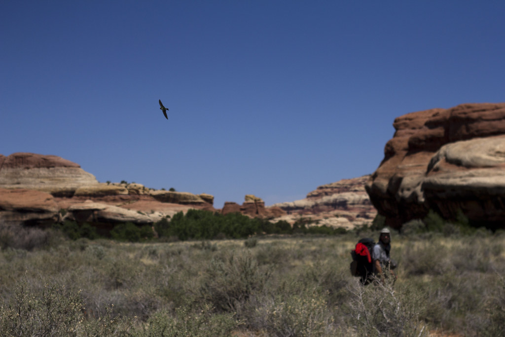
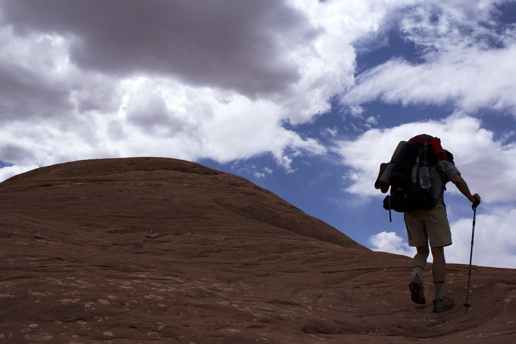
After checking in at the visitors center and piling into Art's truck we headed back to the Cathedral Butte trail head and flung our heavy packs on our backs and started the climb down to Upper Salt Creek and towards The Big Pocket where we would set up our first camp. The view from the trail head was exciting.
Art Start by NateGeesaman, on Flickr
It was not long into our days hiking that we saw some rock art.
Odd Panel by NateGeesaman, on Flickr
Then we saw the impressive work of a farmer who ranched cattle in the area circa 1890. I didn't take many pictures of it, but Kirk's Cabin was a pretty impressive old structure. Supposedly Kirk only ranched the area for a few years and found himself unable to make a living, but his cabin was used for many years to come by cowboys in the area until Canyonlands became a national park. In his short time in the area, Kirk built a structure to last through the ages with limited resources.
KIRKS CABIN PANO by NateGeesaman, on Flickr
The hike to our camp was short, maybe 6 miles. We set our tents up and the head cold I had took a grip on me. My energy was zapped after hiking and setting up the tent. I fell asleep, sans sleeping pad, on the floor of my tent to try and power nap my way out of my drained state. It worked well enough as I was able to muster enough energy to hike the surrounding hills in search of an arch that was not there.
Wedding Ring Search by NateGeesaman, on Flickr
Now I had two maps that both marked Wedding Ring Arch in the hills above that campsite, both a Kelsey guidebook map and a National Geographic map. Art had and older National Geographic map that marked that arch much further North. In the end both of my maps were wrong, but it was fun to wake up our slick rock brains by wandering the hills looking for the arch. That made us think that National Geographic is copying Kelsey. When they updated their map, they moved Wedding Ring Arch to the location Kelsey had marked instead of where they had it on their older maps, which is the correct location. It was disheartening not to find the arch because photos I had seen of it made it look like a beauty. I didn't yet know that we would find the arch further along on our journey many many miles from where it was marked on my maps.
I went to bed early that night and slept like a rock. I awoke feeling much better than the day before and ready for a full days hiking. We ate breakfast, watered up, and packed up quickly getting on the trail pretty early. It was a beautiful day with near perfect hiking temps and a beautiful sky.
We found our first ruins early on that day. They were quite beautiful and tucked into a cliff that had a lot of nice geology going on.
Salt Creek Granary by NateGeesaman, on Flickr
Art knows how to make a picture.
Art and some ruins by NateGeesaman, on Flickr
Then we saw one of my favorite arches I have seen. It is high up on some beautifully white and pink broadly striped cliffs and has such a beautiful shape. Its almond shape reminds me of a big eye watching on from high and it has a stout architecture that gives it great character.
Salt Creek Natural Arch 2 by NateGeesaman, on Flickr
Salt Creek Natural Arch 1 by NateGeesaman, on Flickr
What a beautiful trail!
Sawlt Creek by NateGeesaman, on Flickr
Art is quite a knowledgeable birder and helped nurture my appreciation of birds. Graceful swallows swooping around us were an almost constant bonus of this beautiful area.
Swallow Watching by NateGeesaman, on Flickr
Then we found Wedding Ring Arch which I was worried we might not see. Again, newer National Geographic maps and the map in my Kelsey guide book had this misplaced further South by a few miles. Art's older National Geographic map had it correctly placed.
Art and Wedding Ring Arch by NateGeesaman, on Flickr
Close to Wedding Ring Arch, we got a peek at Fish-eye Arch.
Fisheye Arch by NateGeesaman, on Flickr
Arches that look like eyes, beautiful green spring foliage, abundant evidence of an ancient civilization, and beautiful geology all around made this area feel very special.
Next we explored the "Squash Patch" ruin. The coolest thing about this ruin for me was the huge squash plant that had been growing and reseeding here for over 800 years.
Ancient Squash by NateGeesaman, on Flickr
We guessed that these marking were a method of counting crops. Guessing that this area housed a crop worthy of 5 high fives.
5 hands by NateGeesaman, on Flickr
I didn't touch it. My mitt is just in the shot for size comparison.
Baby Hands by NateGeesaman, on Flickr
There were a lot of other things to appreciate about this ruin like big circular storage areas dug into the mud, many grinding stones, broken pottery, and pictographs. We spent a good amount of time exploring this area and resting.
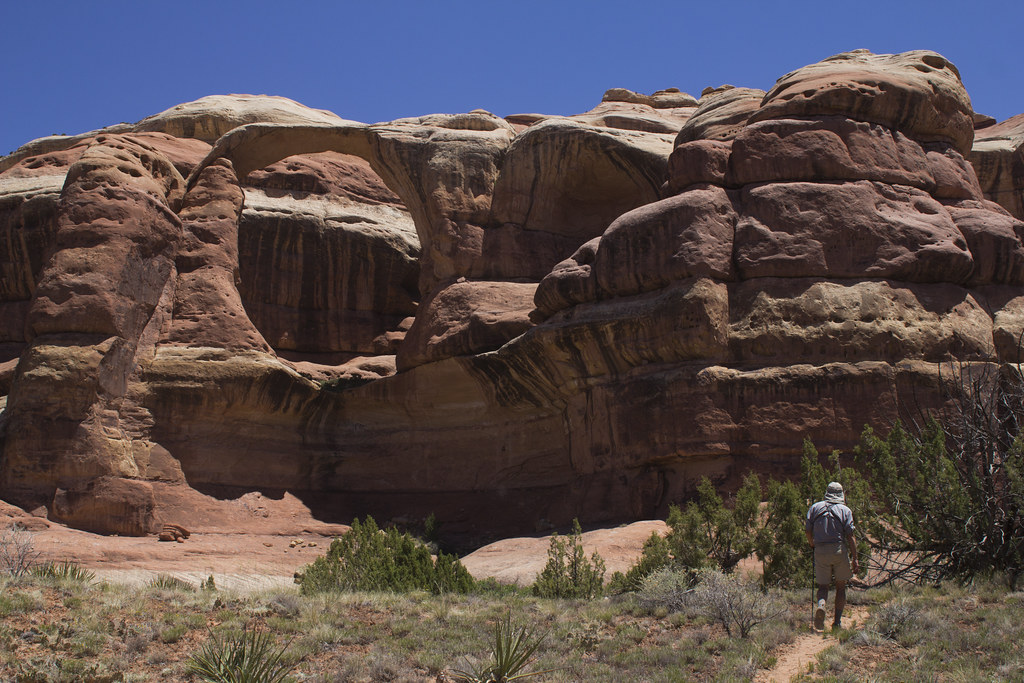
Between ruins and arches, the trail had a lot of character to appreciate. Here Art is seen hiking underneath some impressive sandstone toadstools.
Art Toadstooling by NateGeesaman, on Flickr
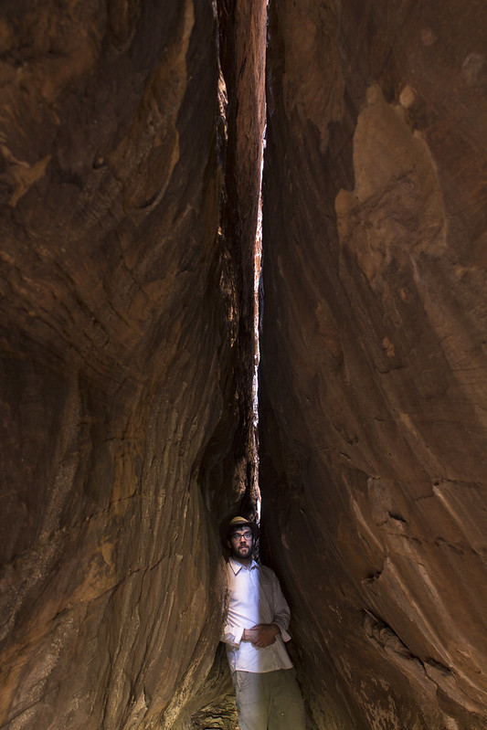
Then we arrived at a series of deep joints in the rock that we decided to bust out the tripod.
Art faces by NateGeesaman, on Flickr
Selfie in a joint by NateGeesaman, on
Flickr
Art Cave Sit by NateGeesaman, on Flickr
We arrived at a perfect time when the direct light was hitting the floor of the cave.
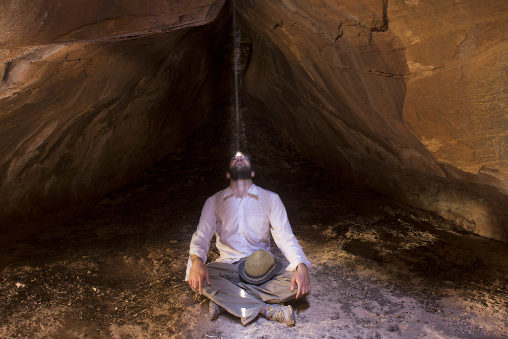
Joint Selfie Ray by NateGeesaman, on Flickr
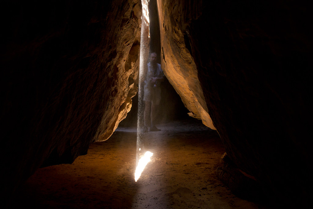
Art in a joint by NateGeesaman, on Flickr
Art Clevity Raya by NateGeesaman, on Flickr
On to the goods! Now we were getting to the very impressive The All American Man. This pictograph is very beautiful and also beautifully set in a sweet little cave with a couple nice granaries.
Recent radiocarbon dating has proven this to be an authentic panel of Puebloan people. This thing predates the American Flag and American Gladiators, which makes it even cooler.
All American Man by NateGeesaman, on Flickr
All American Man Verto by NateGeesaman, on Flickr
This was Art’s favorite pictograph he has seen and justifiably so. Beautifully set and special in character and color.
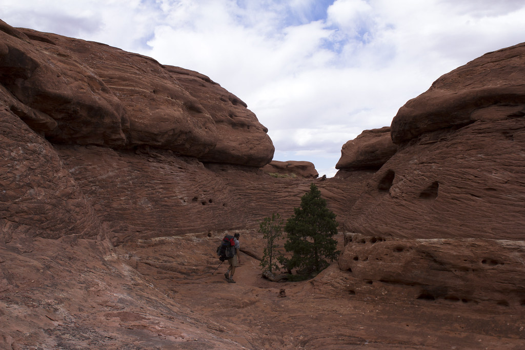
On we hiked
Salt Creek Trail by NateGeesaman, on Flickr
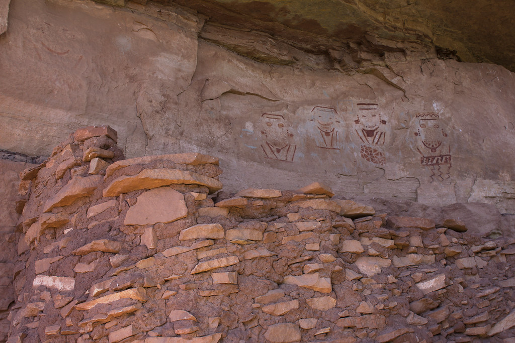
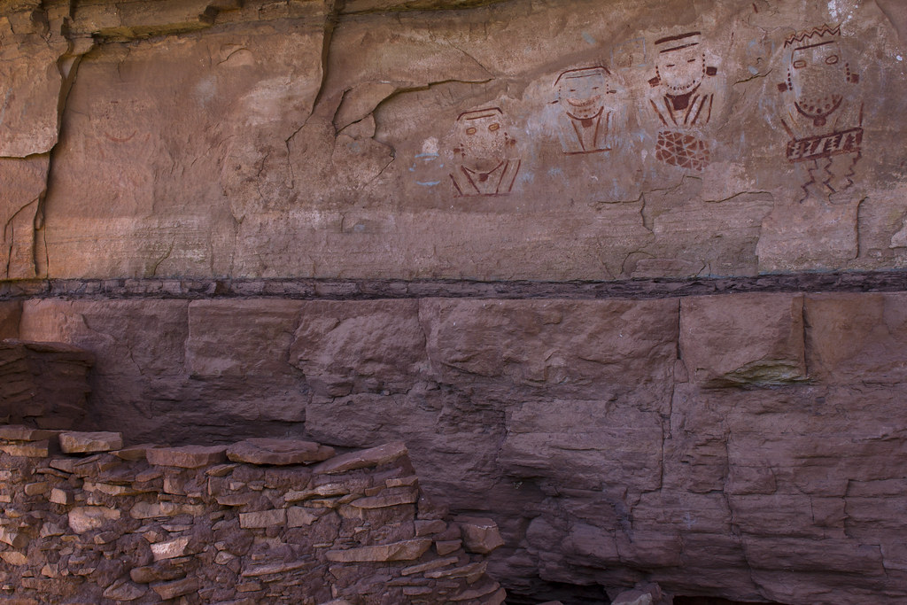
4 faces panel was the next attraction
4 FACES 2 by NateGeesaman, on Flickr
4 faces panel by NateGeesaman, on Flickr
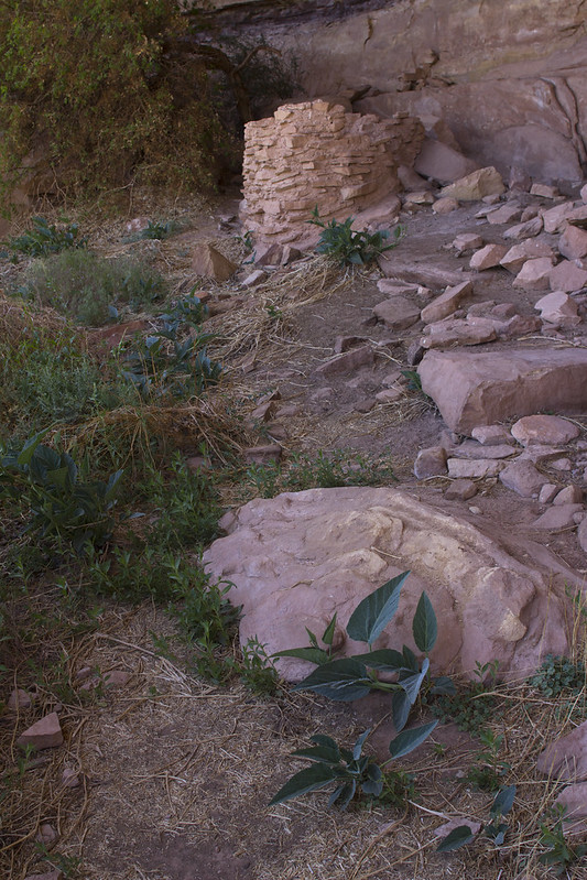
These panels had some nice ruins around them as well and were worth a nice long visit.
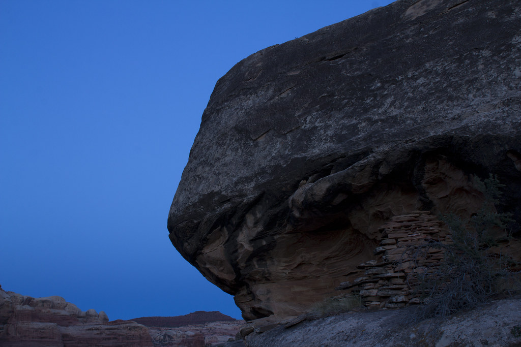
The next stop would be our beautiful camp. The highlight of our camp for me was this little ruin that Nick alerted us to, but still took a while to spot.
Ruin during the blue hour by NateGeesaman, on Flickr
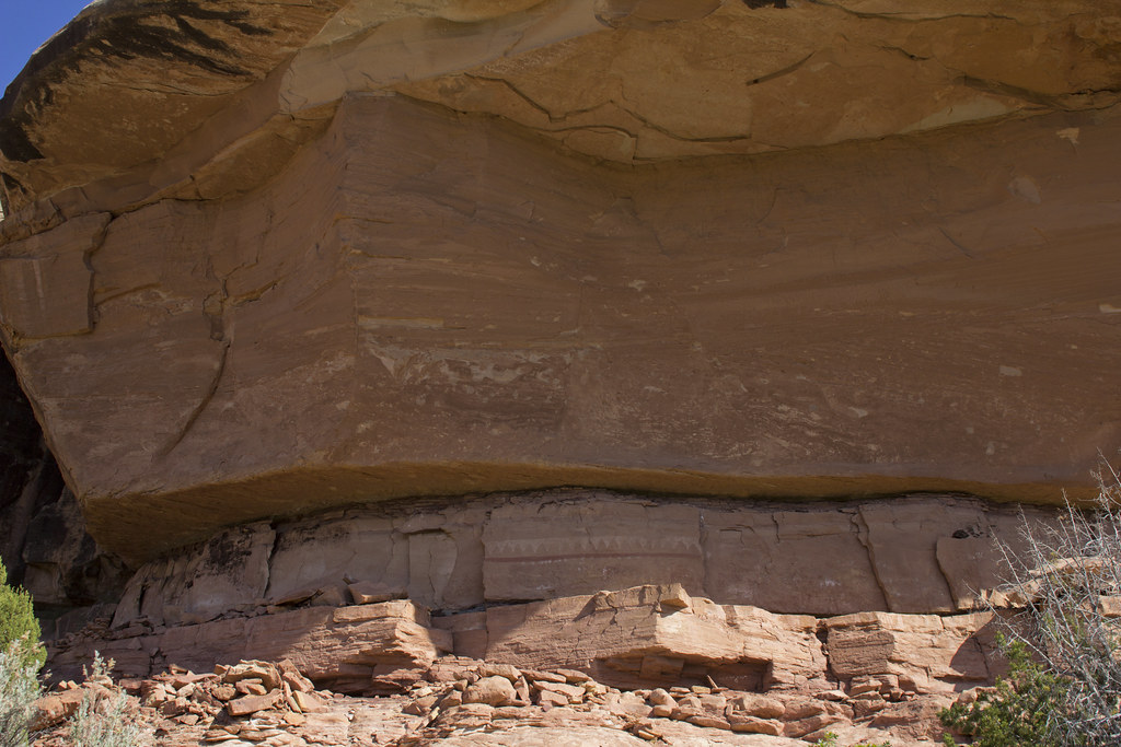
On to the next day. We were looking at a big day of hiking. My cold was in recession and I felt excited for the long beautiful day ahead. We spied some pictographs early on. They were high up on a ledge and required a little scrambling to get a good view of.
Salt Creek patterns by NateGeesaman, on Flickr
Regrettably, I didn’t hike all the way up to these ones, because it did not look easy and I had just seen the Four Faces panel to satisfy my pictographic eye. I had to crop this photo quite a bit to get a decent view of the beautiful white figures on the wall.
2 warriors by NateGeesaman, on Flickr
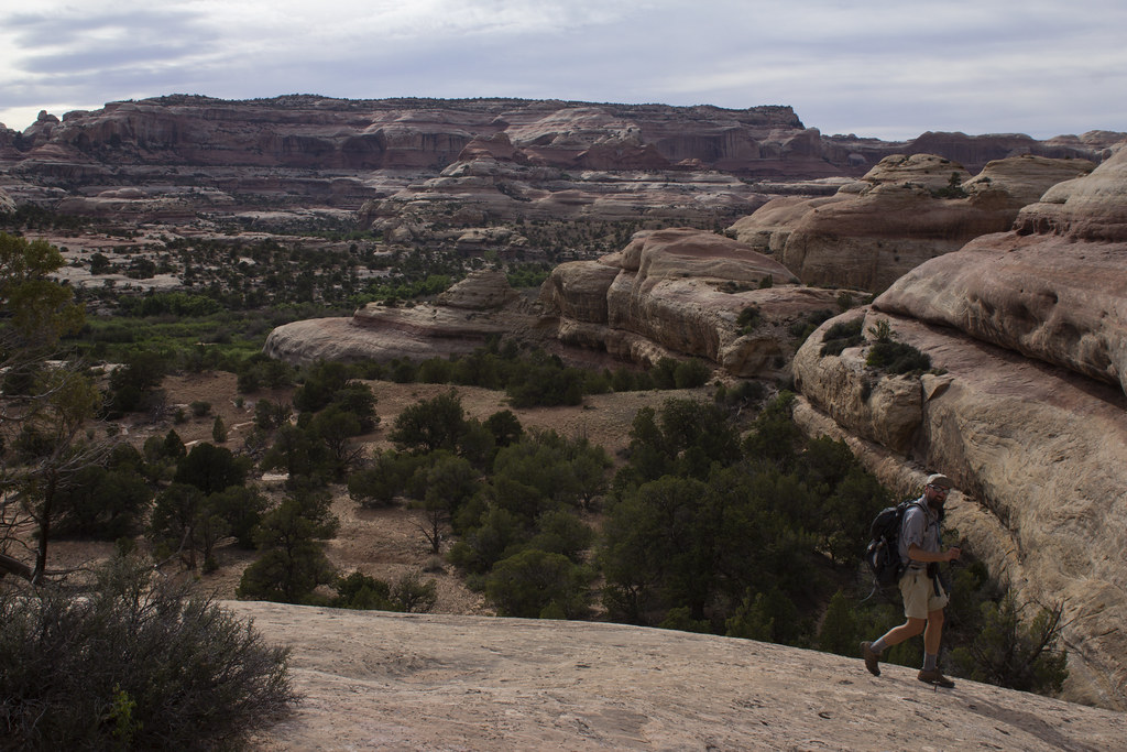
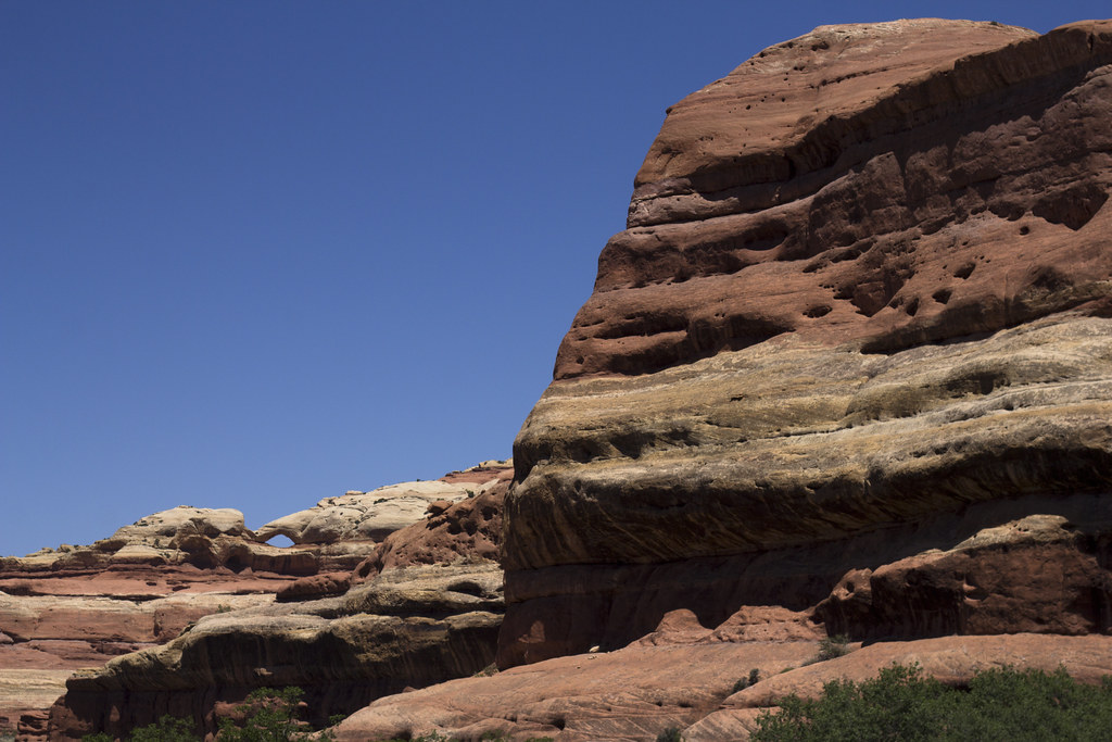
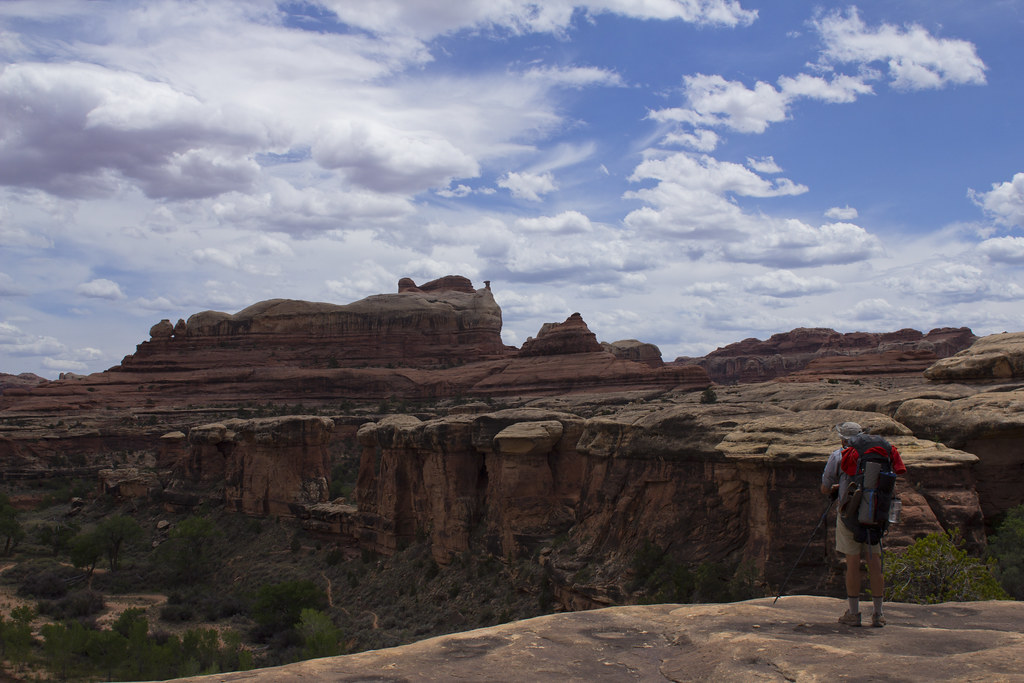
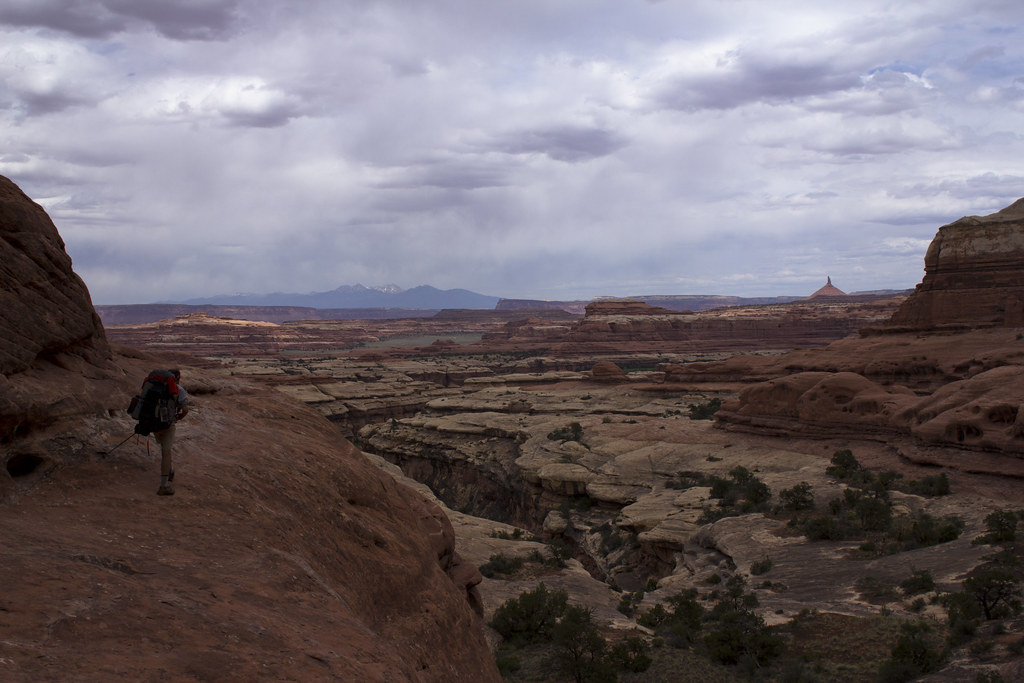
The trail was always changing in character and provided a landscape that never became tiresome or dull.
Art knobs by NateGeesaman, on Flickr
A fellow backpacker that we had met on our first day at the watering hole had told us that one of his favorite times along his journey was the side hike up to underneath Angel Arch, the biggest arch in canyonlands. I had also been very impressed with some photos I had seen of the arch, so we made it a point to add that hike to our itinerary. Molar Rock was another beautiful feature in this area.
Angel Arch Molar Rock by NateGeesaman, on Flickr
Angel Arch Pano by NateGeesaman, on Flickr
HUGE Arch! Arches like this and Druid arch are similar in character and dwarf most other arches I have seen. The hike to the base of the arch was challenging and reminiscent of the hike to underneath Druid Arch as well. Art gave me some steep sandstone tips from his wealth of experience that made that part of the hike more fun.
Art Abajo de Angel by NateGeesaman, on Flickr
Art at Angel's Base by NateGeesaman, on Flickr
Looking up from underneath the monstrous structure:
Angel Arch Up by NateGeesaman, on Flickr
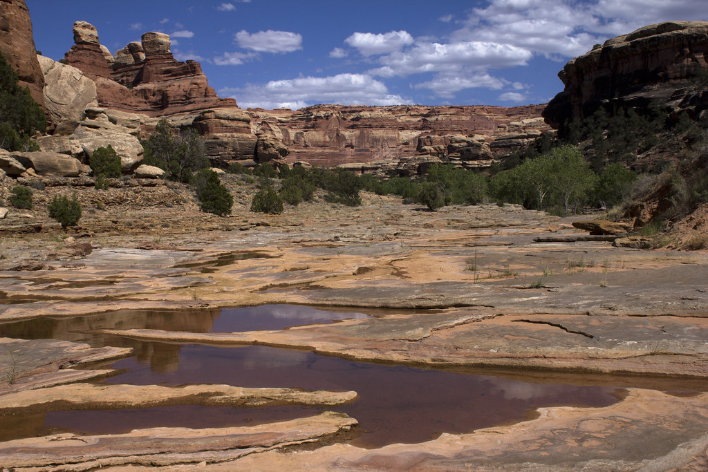
After spending a while enjoying the amazing view of the canyon from underneath the arch, we moved on and put the packs back on. Further down Salt Creek we go.
Salt Creek Pools by NateGeesaman, on Flickr
I saw a huge tiger salamander leisurely munching tadpoles in this area, but didn’t get close enough for a good photo unfortunately.
This was the first night of at large camping where we were free to choose a camp. Art found a nice camp under some big trees that would house us for the night. We were both pretty beat from the long day of hiking, 14 miles if I remember right, and Art was starting to feel like he caught my cold. bummer.
I shot this while watering up by camp.
Salt Creek Reflection by NateGeesaman, on Flickr
Our last day was set to be a long one. We chose to hike out via the Peek-a-boo trail to avoid the slog at the end of Salt Creek, but along with adding a lot of nice scenery to the hike it also added a few miles.
It was not long before we made it to the Peek-a-boo picto panel. You can see pictographs that are hundreds of years older underneath the newer white shield wielding warriors.
Peek-a-boo Panel by NateGeesaman, on Flickr
This was where we got turned around a bit. We were a mile off trail when I heard Art say, “We’re f**king up!” as he looked at his GPS a ways ahead of me on the trail. We went through a hole in the cliff next to the Peek-a-boo panel instead of continuing along the cliff as we should have and headed back up salt creek. Two bonuses of going the wrong way were that I found my map which I had unknowingly dropped and we saw an arch we missed when headed down canyon. We got back on track and began the scenic slickrock Peek-a-boo trail.
Peek-a-boo Ladder by NateGeesaman, on Flickr
Art Peek-a-boo 1 by NateGeesaman, on Flickr
Art was feeling the full force of the wicked head cold that beat down my energy on our first day on the trail. I recall the echoes of his sneezes as we passed through deep canyons. I can remember him exclaiming, “I’m leaking oil!” As we labored along, frequently clearing his nose into his handkerchief. I felt bad for passing on the pain. The scenery was a serious lift though and kept us pushing along.
Art by NateGeesaman, on Flickr
Peek-a-boo Art by NateGeesaman, on Flickr
Peek-a-boo Art 2 by NateGeesaman, on Flickr
Another long long day of hiking came to an end at Squaw Flat where my car was parked. We enjoyed the customary victory beers and chips before we headed back to Cathedral Butte to get Art’s truck.
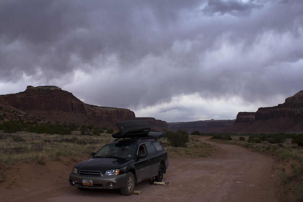
Along the way we noticed a little extra wobble in my steering wheel and as soon as we hit the dirt road it got a little worse. We stopped and looked at my tire and found it to be hanging on by just one nut. The other four bolts had snapped off! The bolts were so short that I couldn’t even secure the tire on any more. A fellow traveler along the Beef Basin Road stopped and saw if they could help. They came back when they found one of the nuts from my tire in the road a little further along. They were kind enough to take Art back to his truck while I stayed behind and tried to fix my tire. The bolts looked like they still might have enough thread to fit on my little spare tire. I had to scrape at the threads in the bolts with a butter knife as they were full of warped metal from when they snapped. It took me a while, but I got my spare on there good and tight while Art retrieved his truck.
Beautiful Tire Troubles by NateGeesaman, on Flickr
There was a big storm rolling in and we got off the dirt road just as a heavy downpour started. I was super relieved to be on my way home and able to avoid an expensive tow. Art was a great companion that kept a cool head and a helpful attitude when we faced the adversity of illness, car troubles, wrong turns, and long days on the trail. I could not have hoped for a better companion on the trail and was very grateful for our meeting. I could not have hoped for better scenery either. This was a great trip that will not be easily forgotten.
Featured image for home page:
")
 You passed me not too long after we got going after the panel, speedy hiker that you are.