NorthwestWanderer
Member
- Joined
- May 3, 2018
- Messages
- 292
I've been eyeing on google SAT view for awhile a possible route from Copper Pass trail to Blue lake. There seemed to be a low point at the Posthole Peak Col and Blue lakes moraine runs up to it gradually. It's been awhile since i've hiked Blue lake due to its popularity, but my wife and her friend hiked there not long ago and my wife got a (half picture) of the moraine. I decided to go for it. My best friend Ian would join me. This would be a good trip to continue my conditioning before Aaron takes me on his 6 day Olympic NP trip that will involve some off trail travel.
Ian doesn't hike too often but he is former army and in his own words "good at ignoring his pain" so a dandy old cascade humbler was a-brewing!

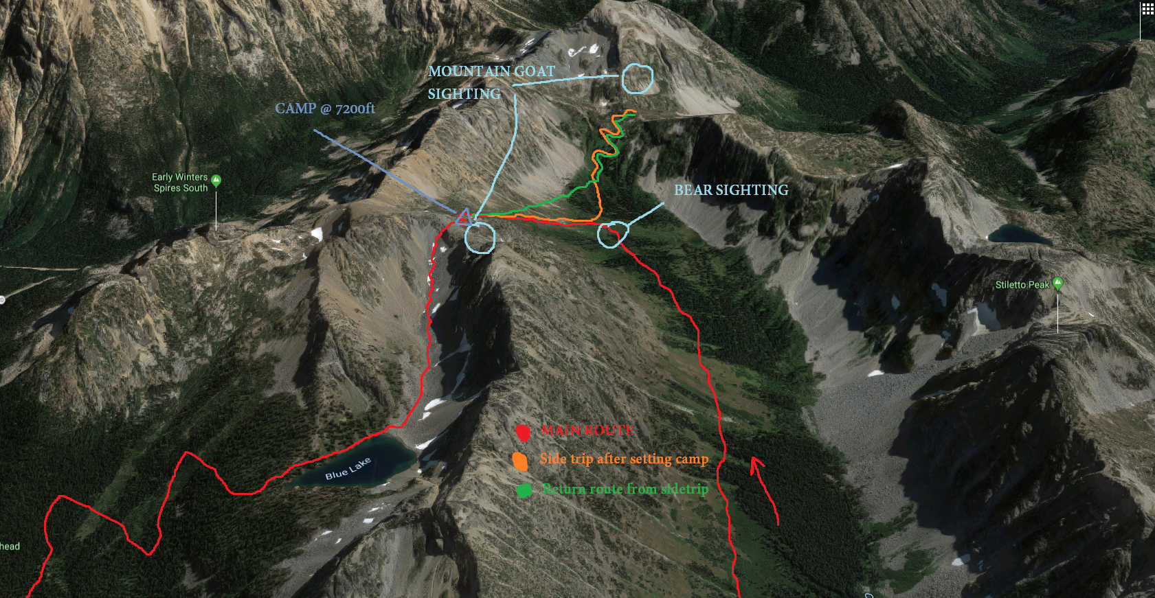
So far we've come about 3 miles and 1600ft of elevation gain to get to the trail about .25 miles behind us in this photo. (The trail runs between the trees back in that meadow down yonder). At this point was where we branch off and begin the climb up to Posthole peak col. Ian looking up at the climb to come muttering "Well this is gonna suck"
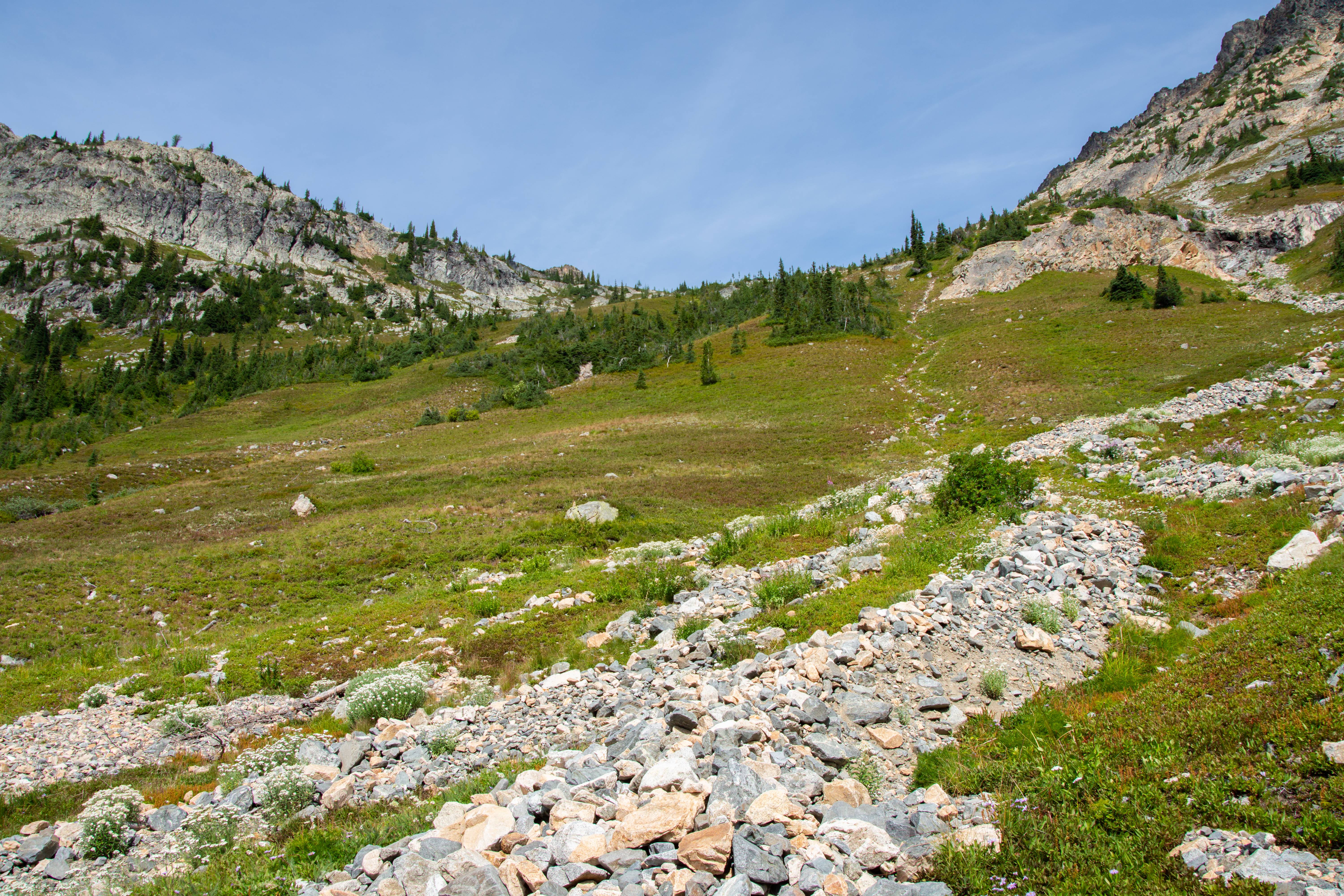
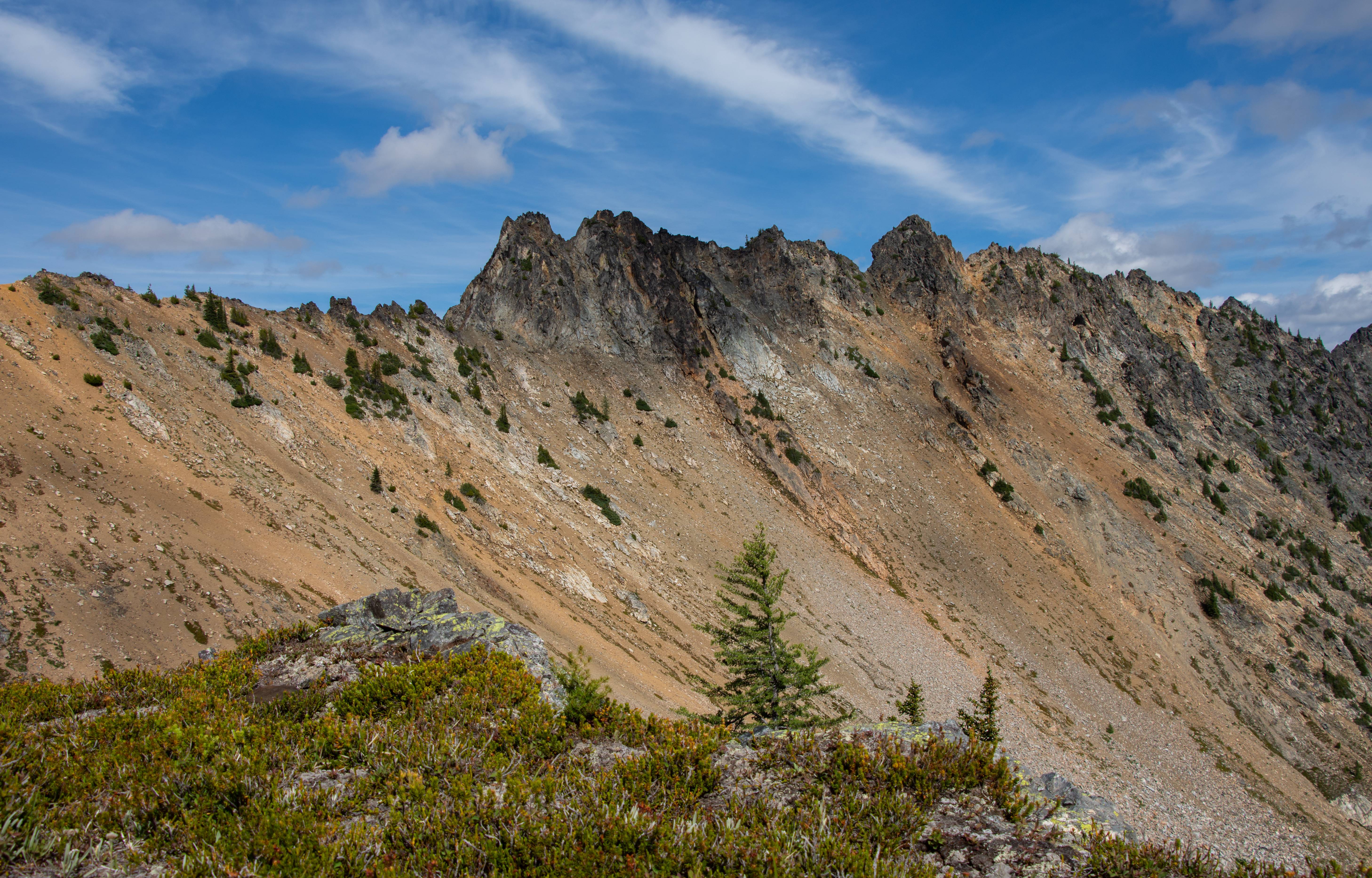
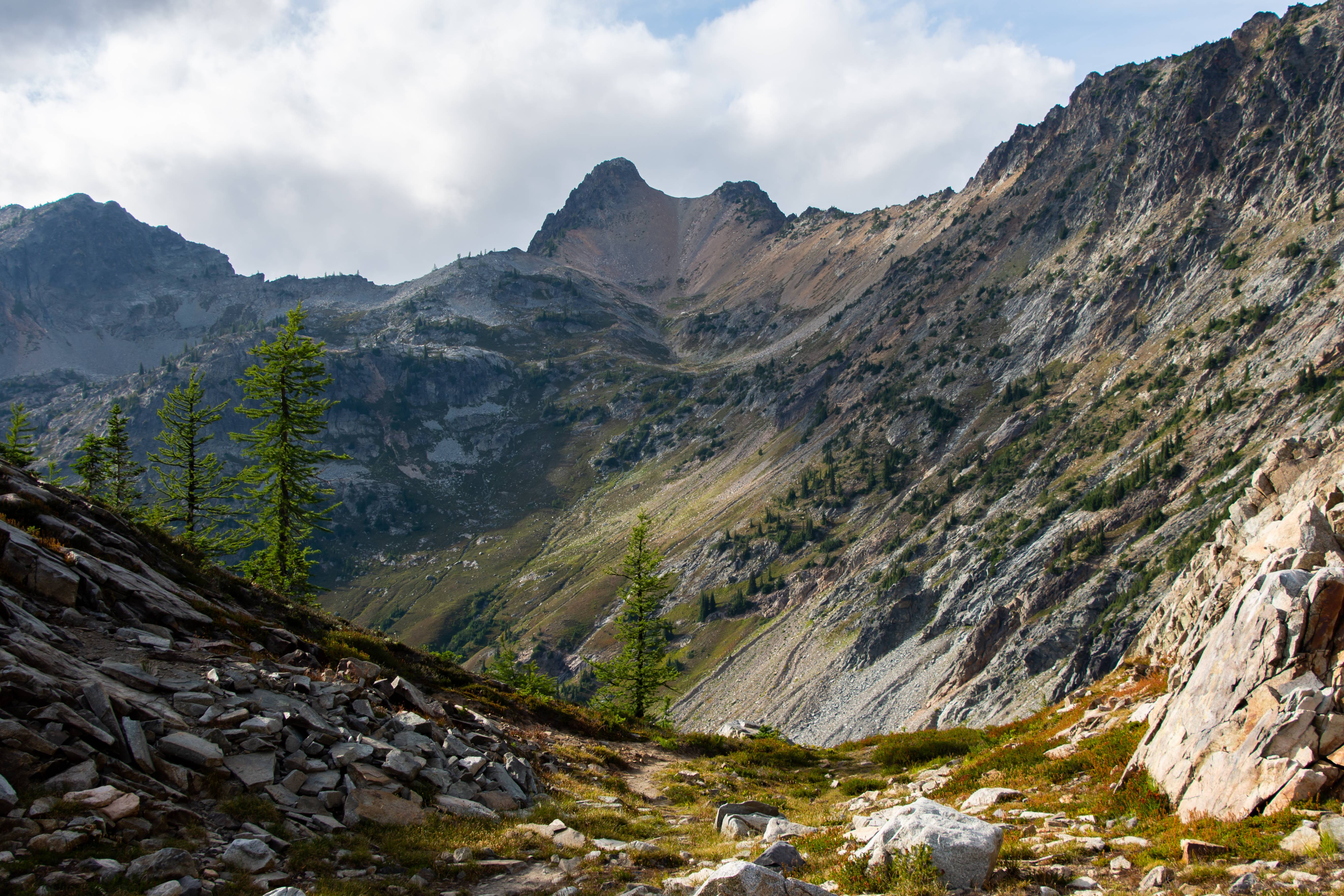
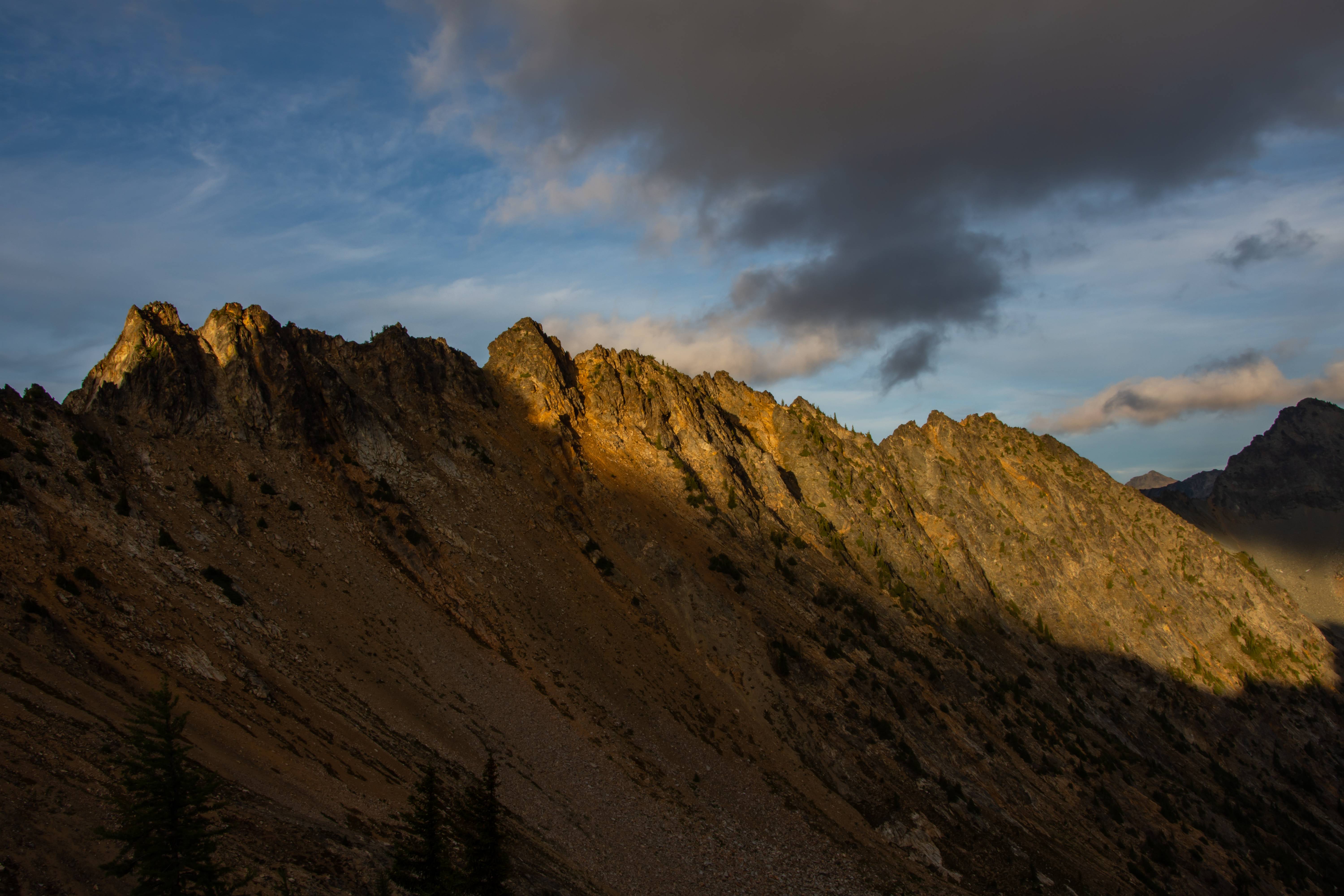
Halfway up Stage 1 of 3. Stage 1 is berry bushes, grass and open meadow. Over the crest of the trees is stage 2 : heather and rocks for about the same distance. Then Stage 3 is a long rock slog for the final gain. We will gain a little over 1400ft of elevation in about 2500ft of walking most of it on Stage 3.
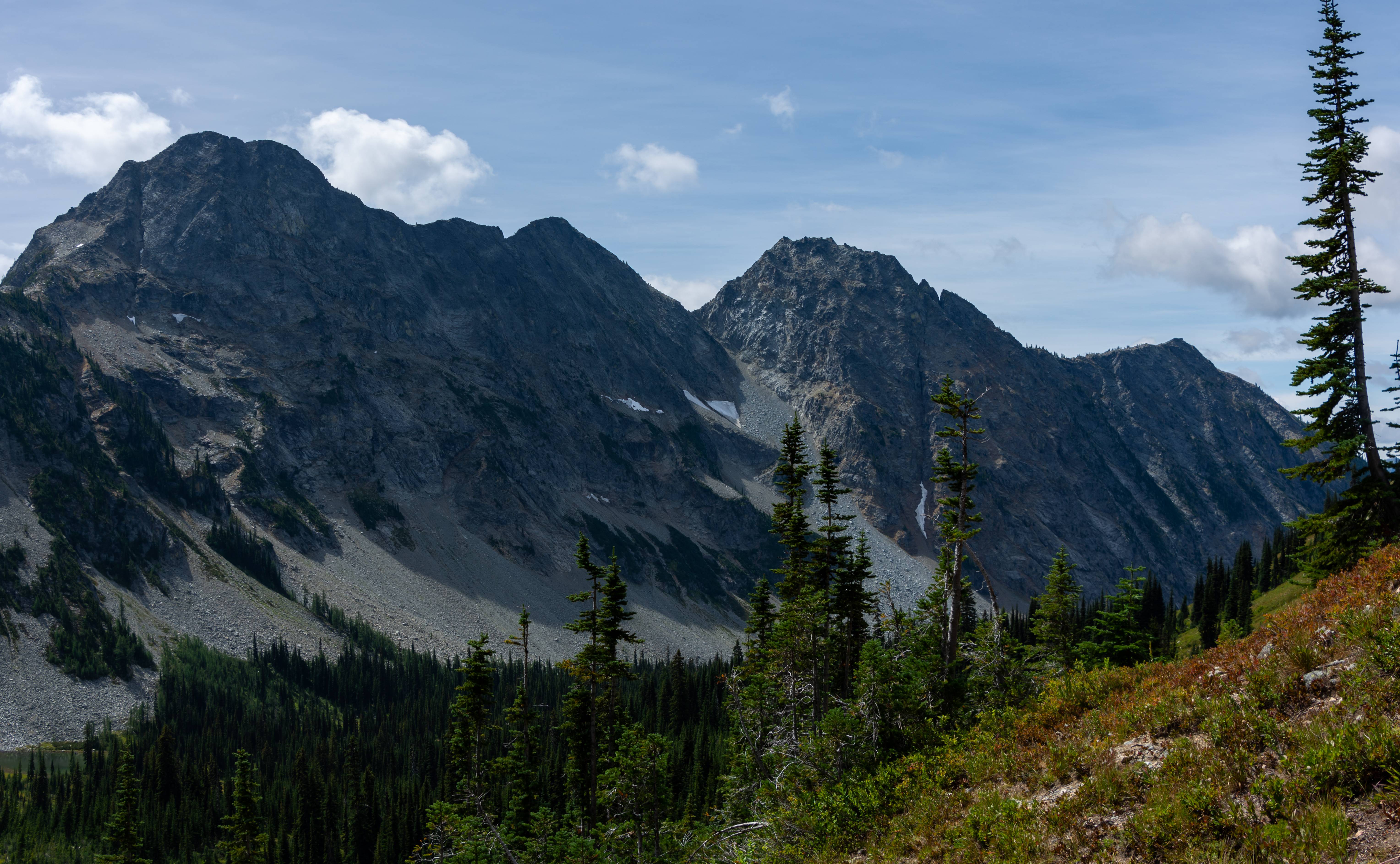
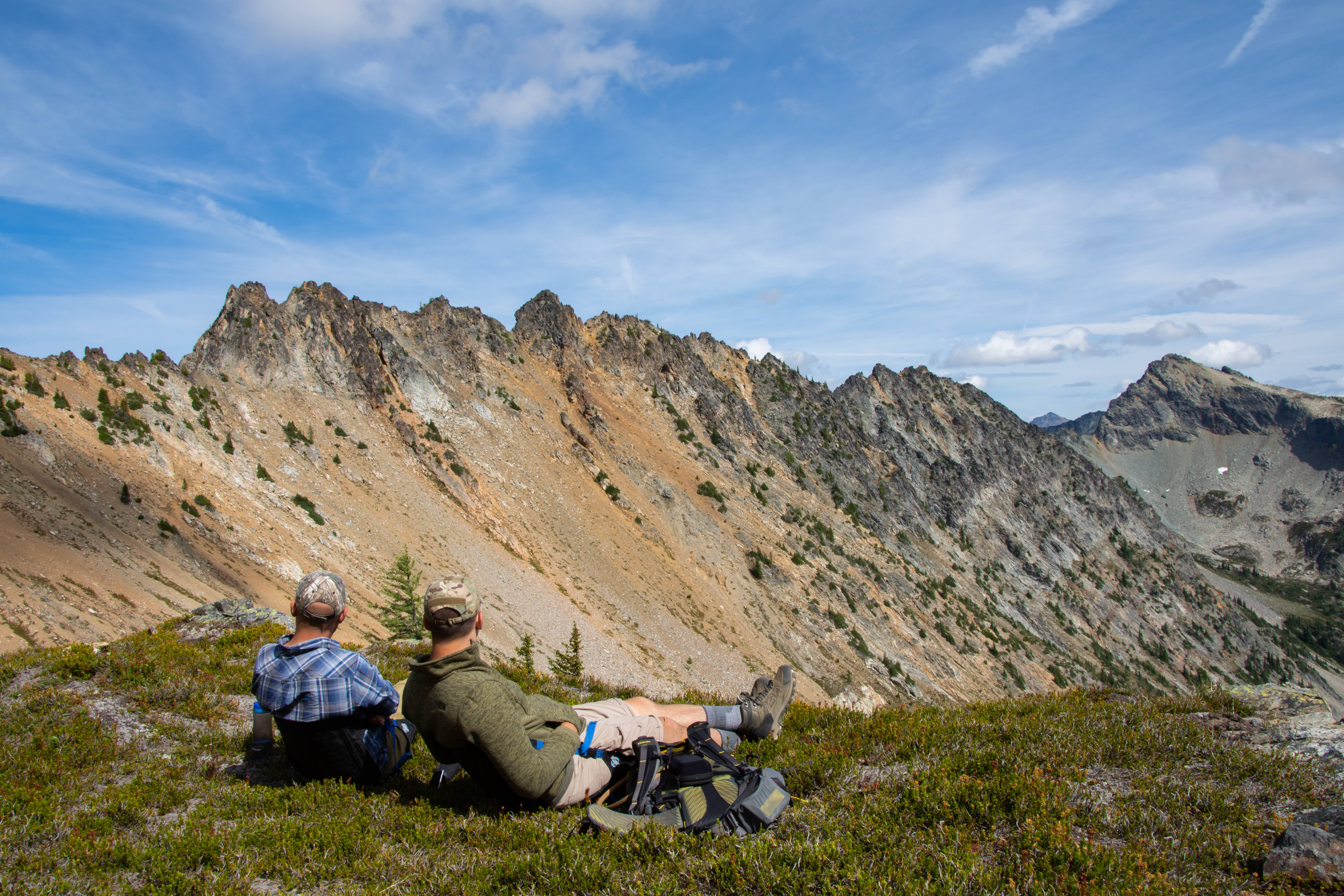
Taking a breather at the transition of Stage 1 to 2 to look at Stilleto peak.
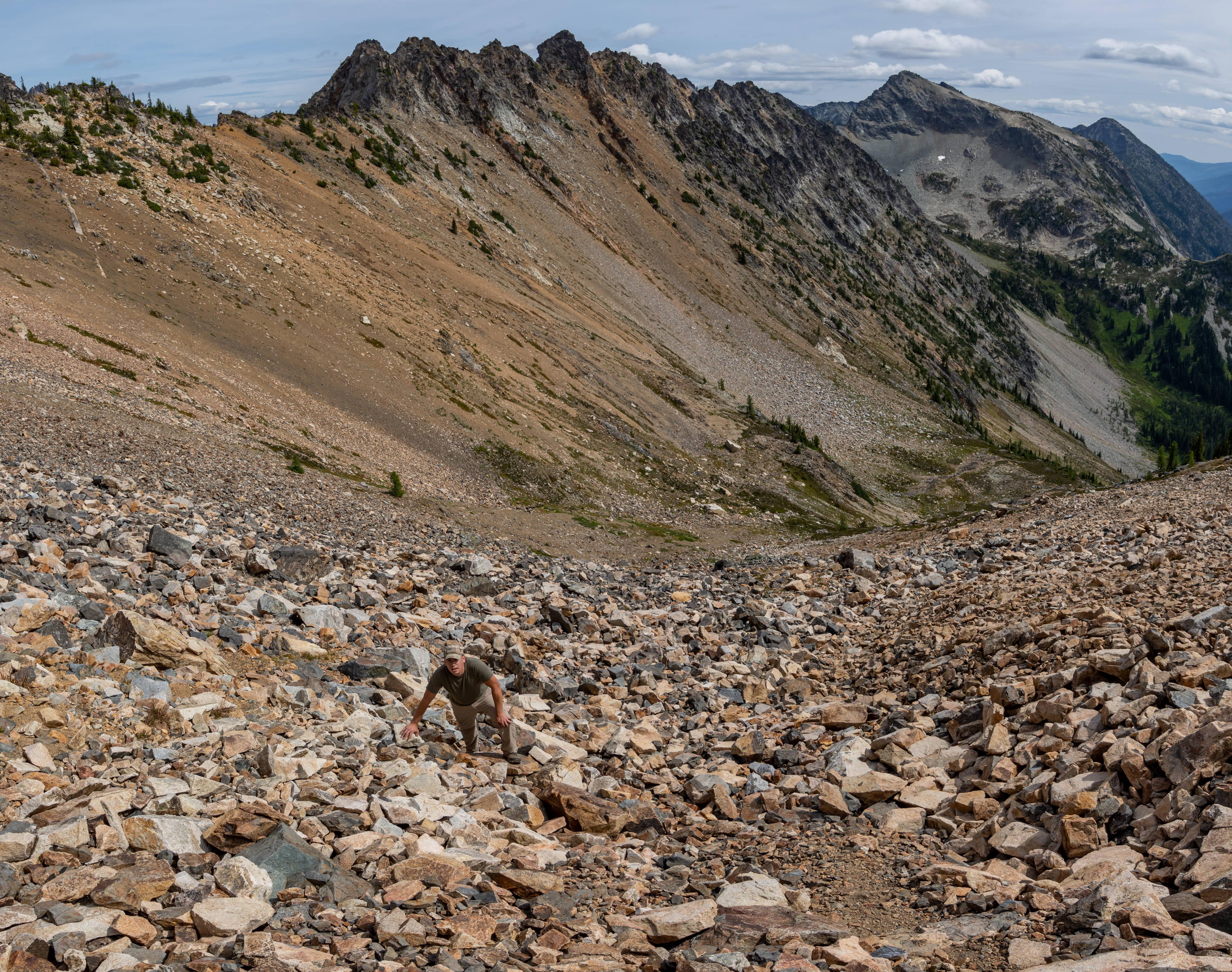
We started in the green trees all the way down top right of picture. At stage 2/3 transition (back by the big white rock at the flat section) we dropped our packs at what looked to be an excellent camping spot. Without the weight we cruised up stage 3 to the crux of the trip to see if there was an access point down to blue lake. "This is so much easier without a pack" Ian remarks.
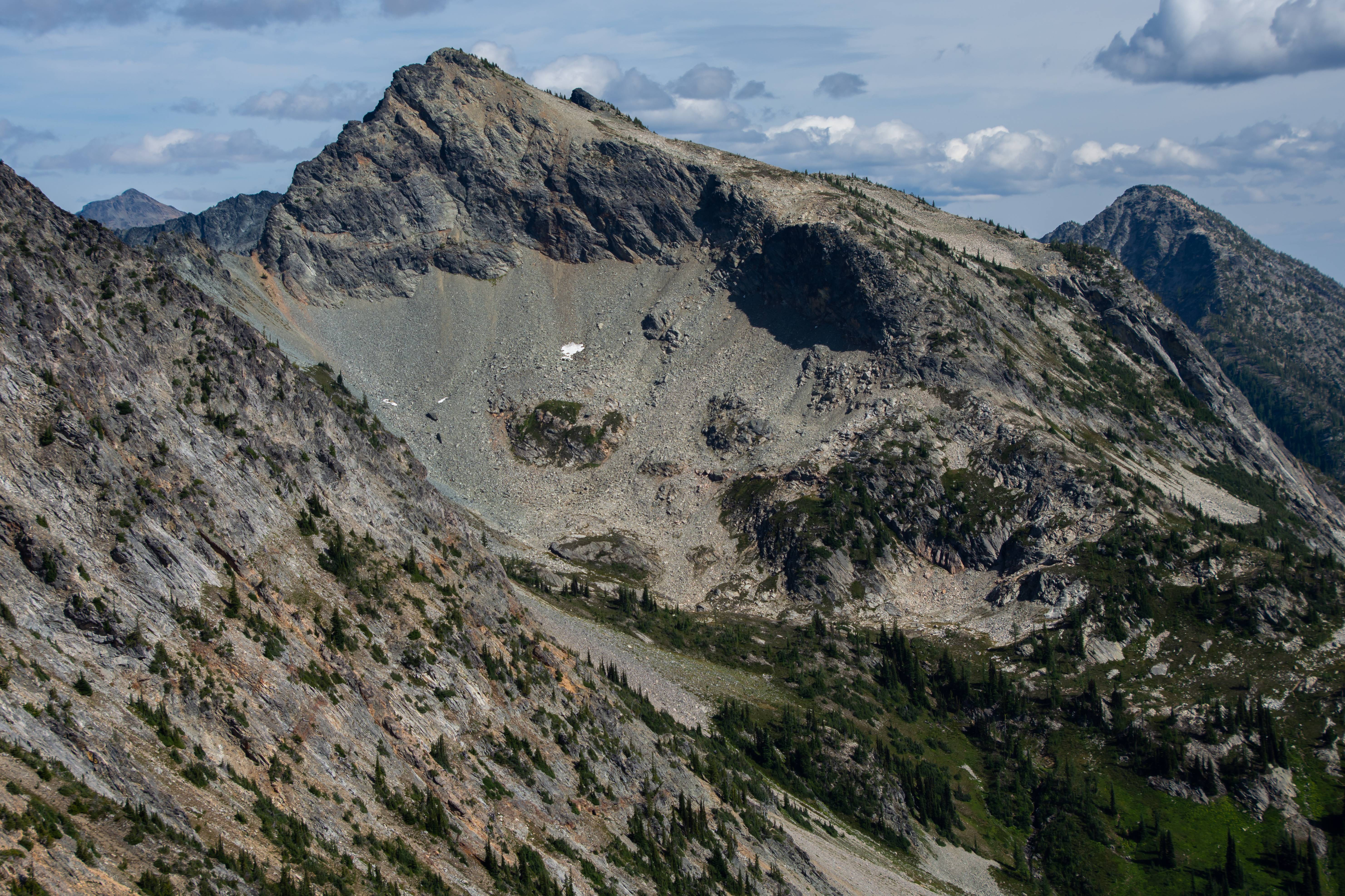
... Upon cresting the top I check over the first section I come across looking for a way down. Immediately greeted by some of the sketchiest shit I've seen in awhile "Nope." i say to myself. Looking another 50 ft down a goat trail was present, following it led us to El Dorado!

A gully to the blue lake moraine! It's able to be done!!! Also 200ft away is an AMAZING camping spot! We rested up top for a few minutes before descending for our packs then slogging them up stage 3 to the new camp spot.

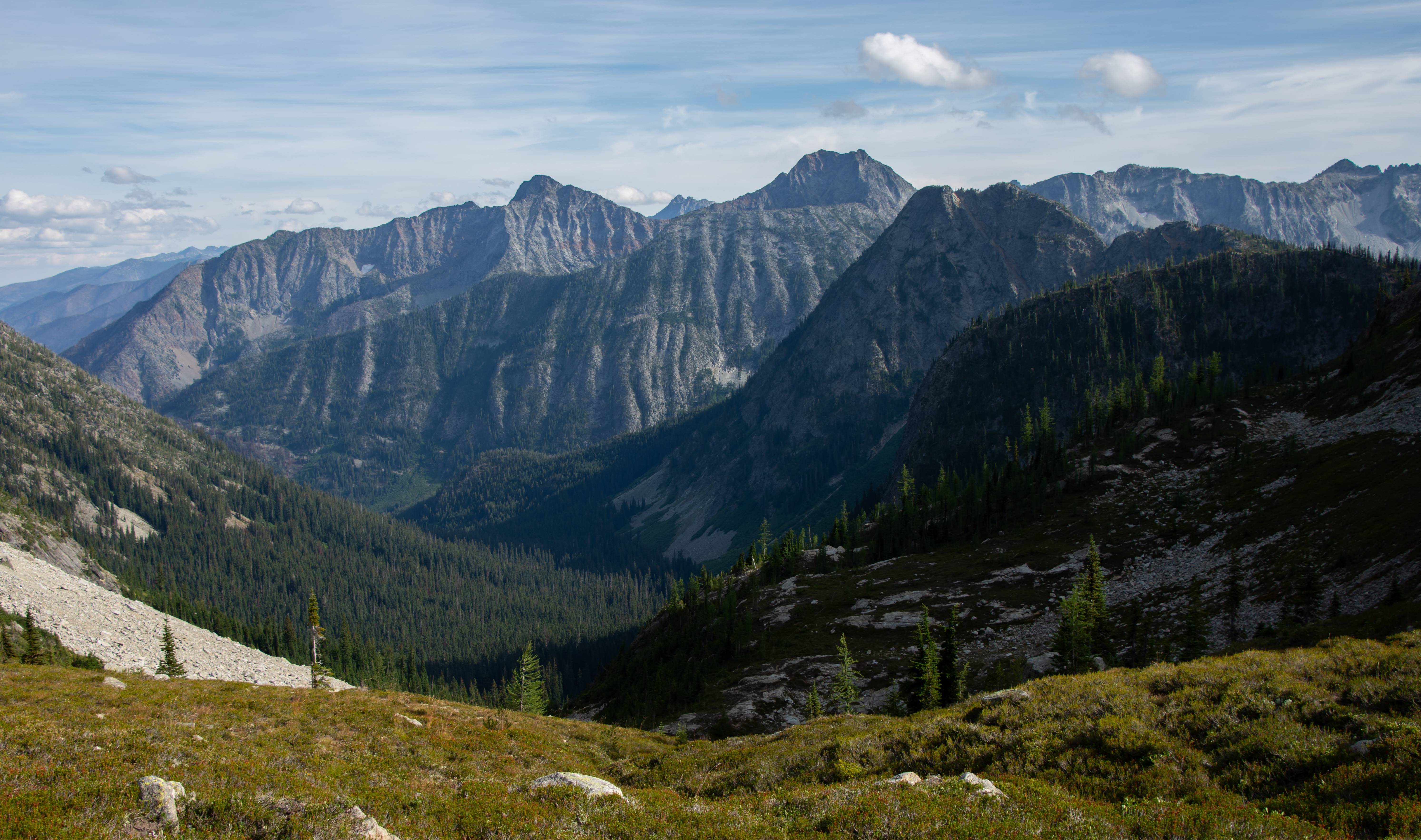
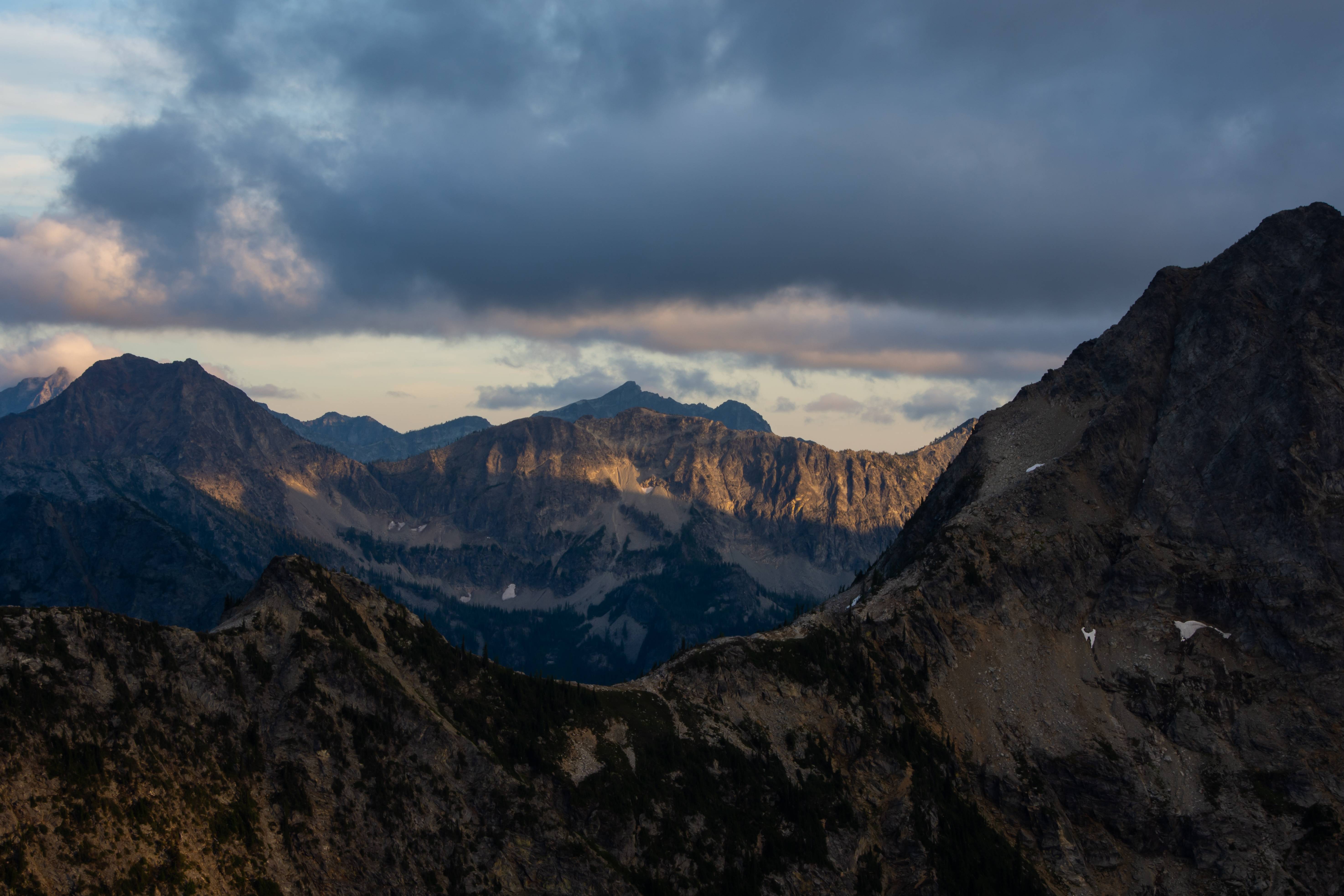
Excellent views of the other side. We were in Okanogan National Forest which allows drone use unless posted otherwise. I'm not the biggest fan of drones, that being said Ian got some pretty amazing and unreal video shots (he let me use them in my video too!) Being the only ones in the whole Stilleto valley and telling him to not bother wildlife with it as a stubborn trip leader I allowed him to fly his drone. He got a pretty damn good shot of our camp overlooking the valley & copper pass.
As we relaxed we started to hear chirping. I'm 99.999999% sure we heard mountain lion chirps. It was off in the direction we were looking. My time-lapse caught us looking off that way quite a bit because that's where the sound was coming from.
This led to being bombarded by questions from Ian about the risk of us being eaten by a cougar or bear tonight. As the day went on it wouldn't help his paranoia either haha!
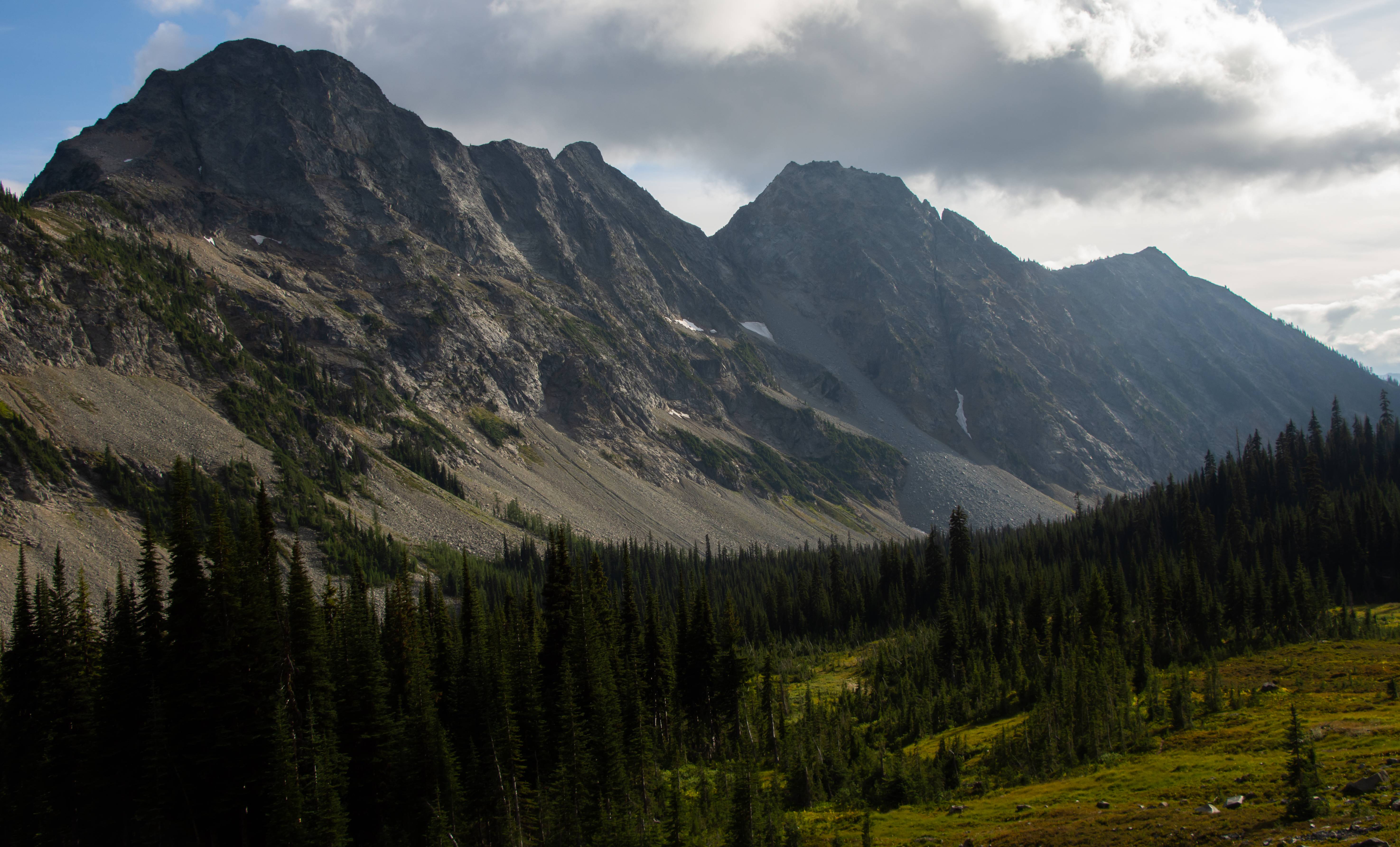
Pica Peak
We rested for 2 hours and had a snack. With camp set up we day tripped down to Copper pass (camera right). We needed to drop elevation regardless because there was NO water anywhere up there and the only water was a small creek that ran through center valley. On the way back from Copper Pass we filled our bottles at the stream and I slung a full bag of water in my platypus around my neck and lugged it up-hill back to camp.

Flowers littered along the stream we filled up at.
At the top of Copper pass and now in the Lake-Chelan Sawtooth Wilderness. NO DRONE ZONE IAN!
Looking back up at our camp. It is between the far left peak and the middle brown peak. Toward the last green before the tippy top. We were going to continue from Copper to a lake on the other side of Stilleto but Ian's head was starting to hurt and we still needed to make the climb back up to camp so we called it at the pass.
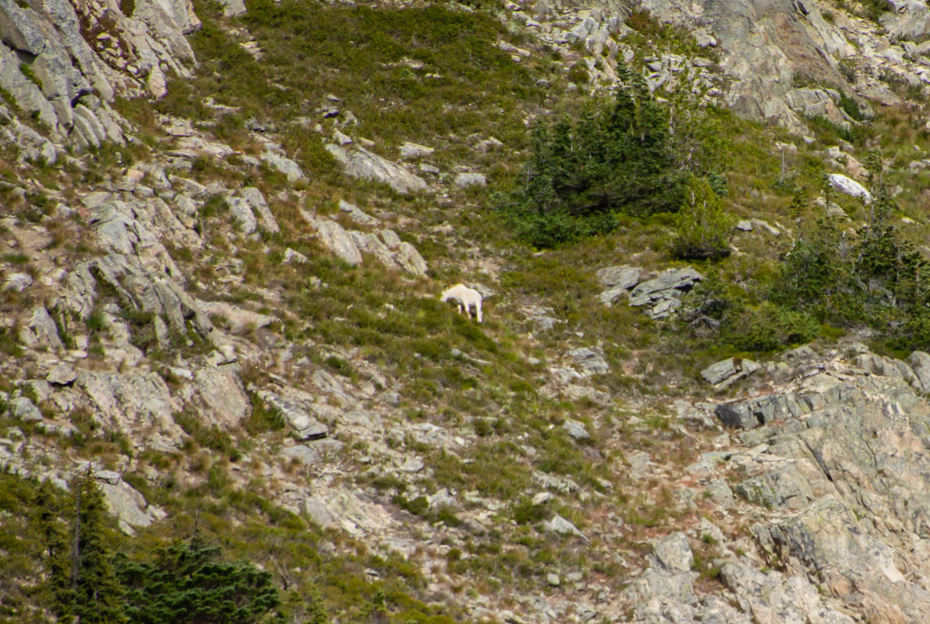
GOAT! Look at that side-hill action! It didn't help I told Ian about goat attack stories so not only was he asking lots of questions about cougars and bears, but now goats too!
3 hours from sunset. Slogging back up hill to camp. At the end of day 1 we will have a net elevation gain of 5009 feet @ a little under 10 miles.
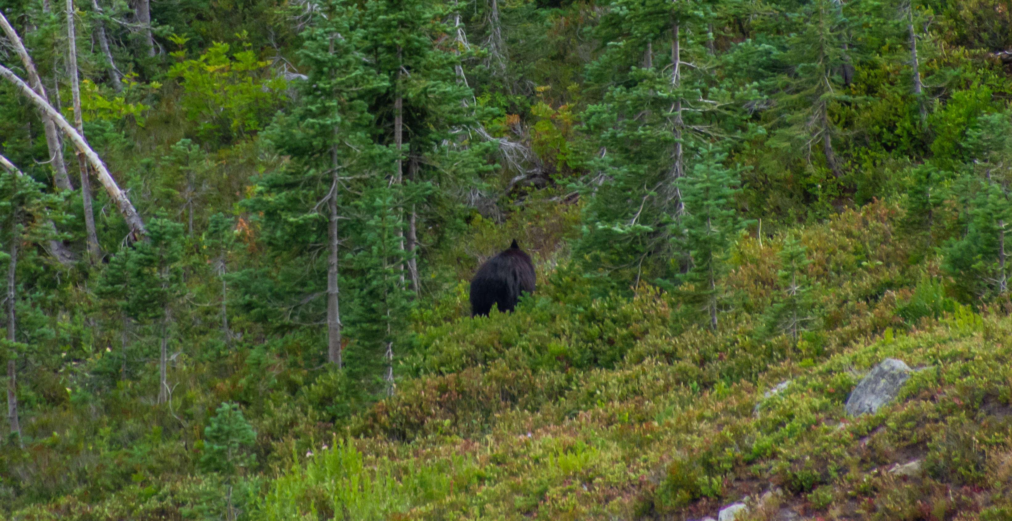
Bear! He was staring at us as we were side hillin'. We stopped to look at him and he just kept munching on berries. We bored him. He started slowly working his way further back into the trees (opposite direction of our tent). Ian wasn't loving it like I was lol. I was able to ease the tension a bit. I'm also pretty sure this is the same local bear from my last years trip to this valley that I reported on. It behaved the same way. Saw person, didn't care for person, slowly wandered away from person in no real hurry.
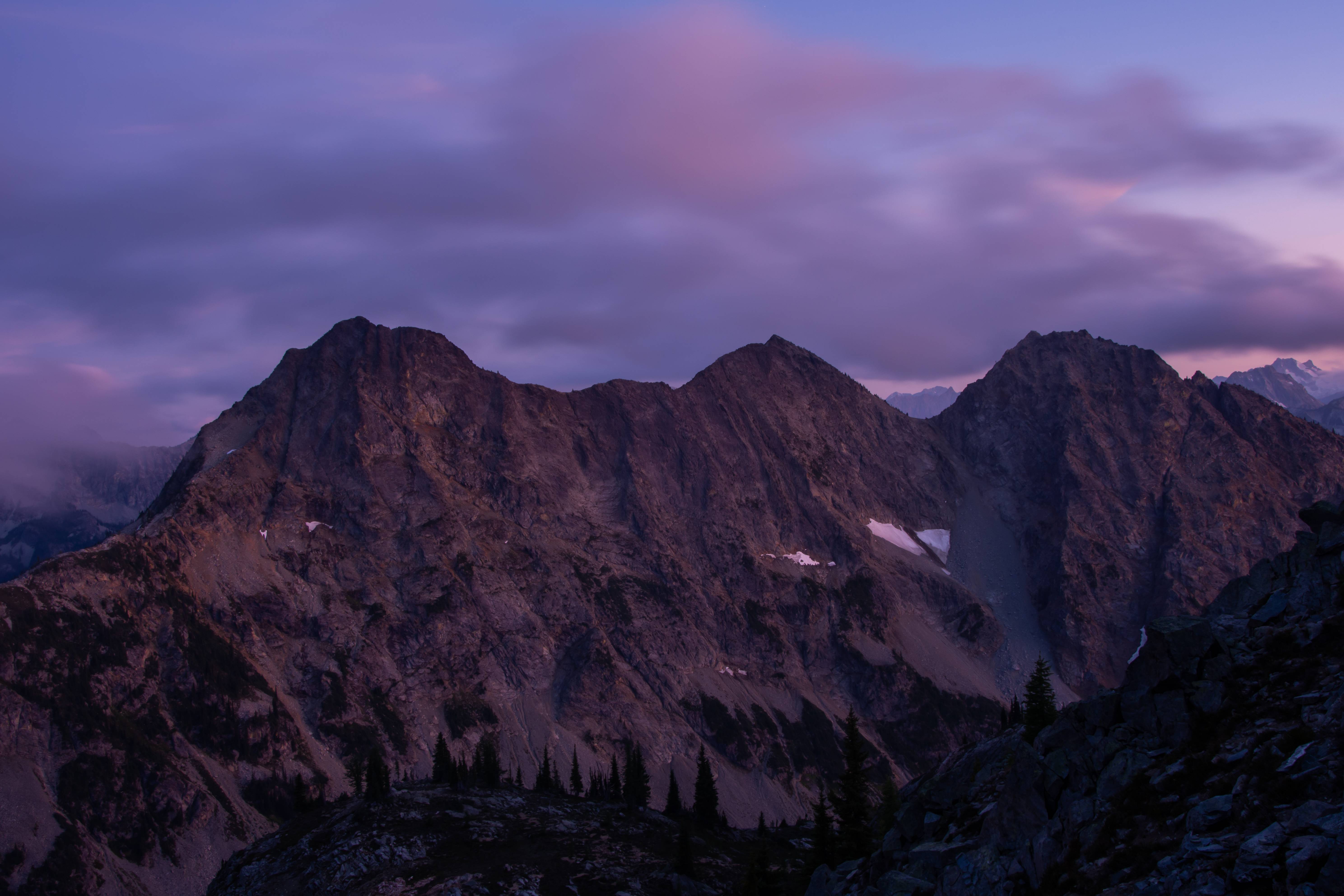
Sunset was great.
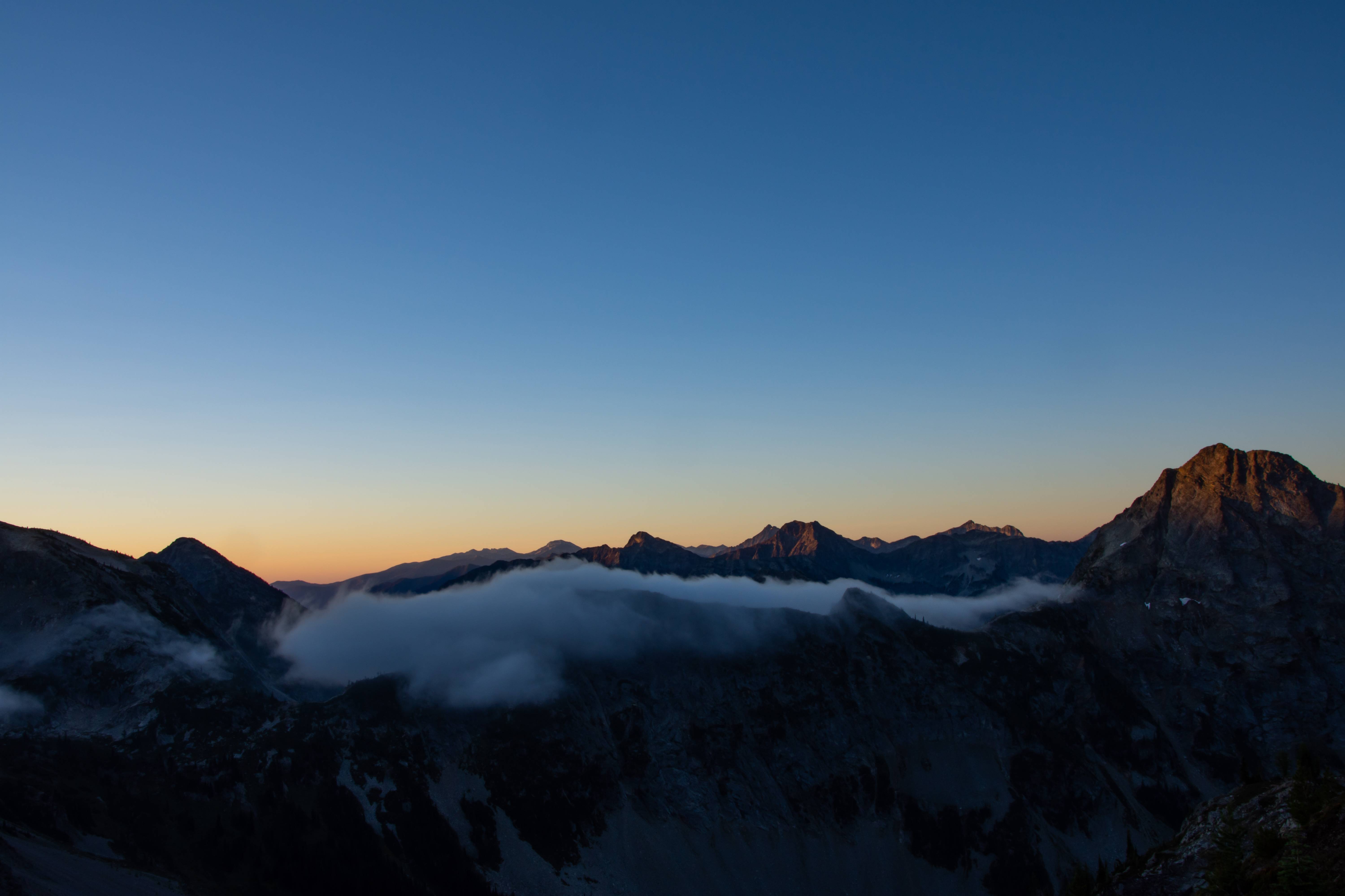
Sunrise!
Time to drop elevation fast!
Goats were watching us, probably mocking us for our slow descent.
Black Peak
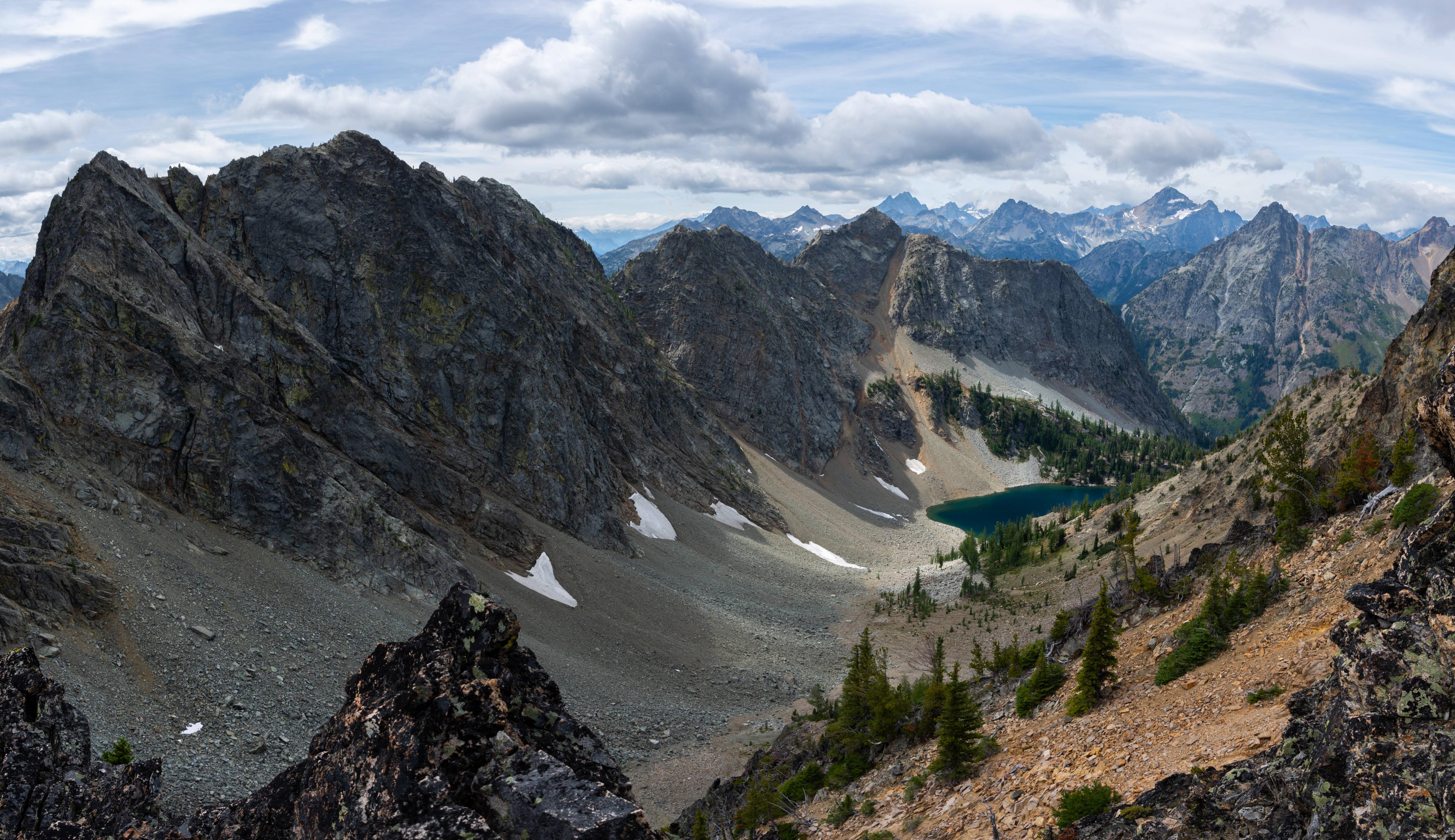
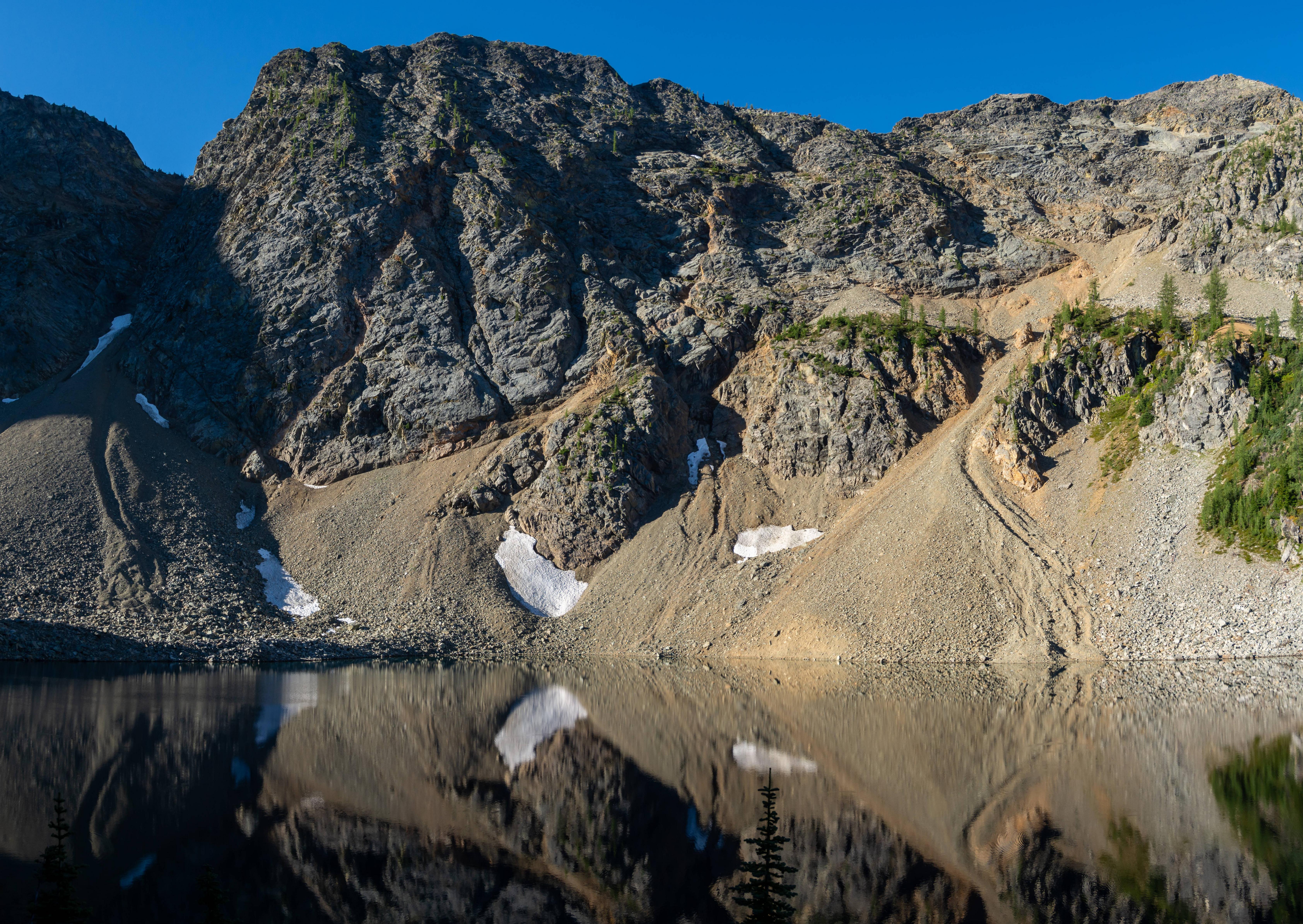
Survived the gully! Now in the moraine. The rest of the day is gravy.
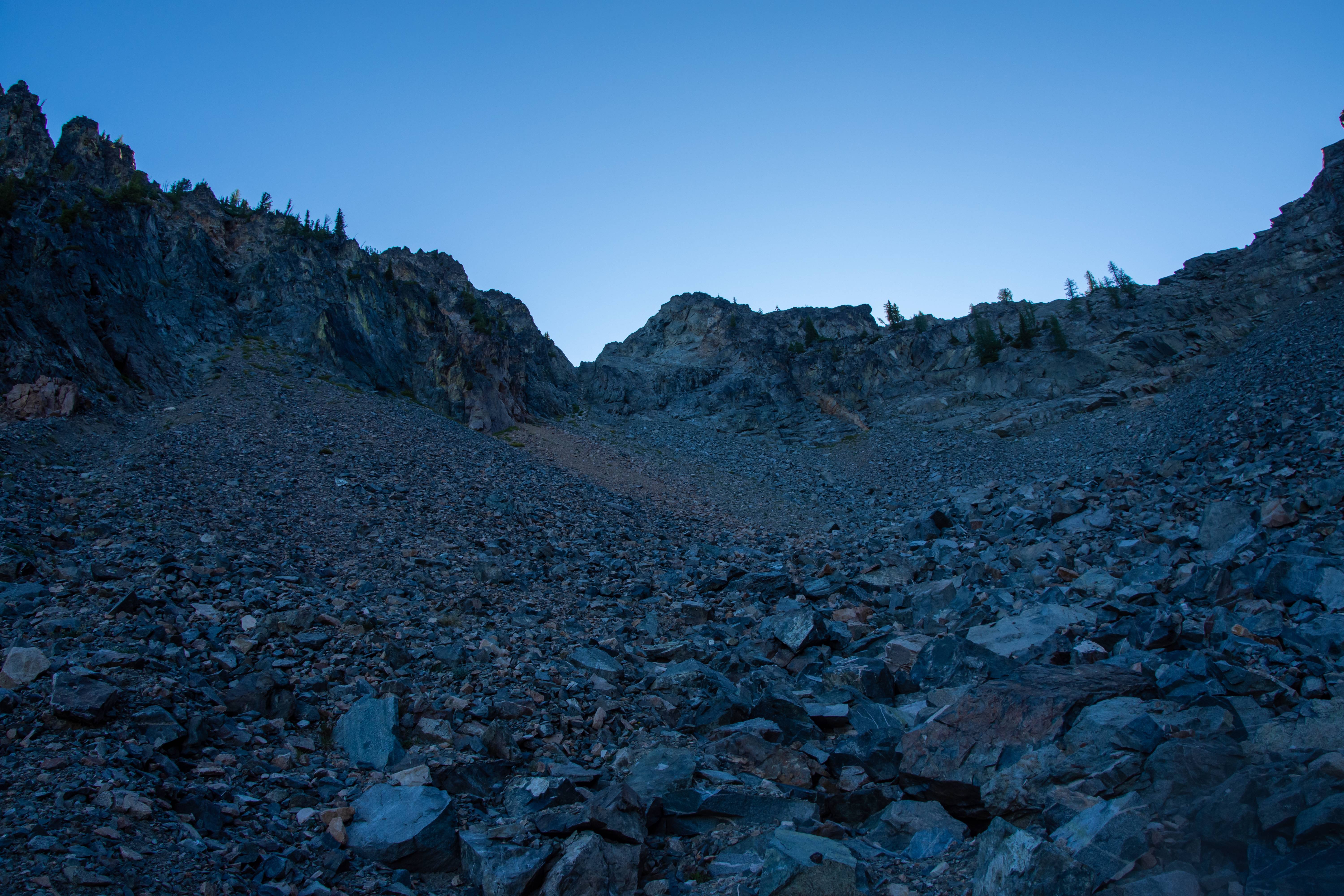
the V notch is where we descended from.
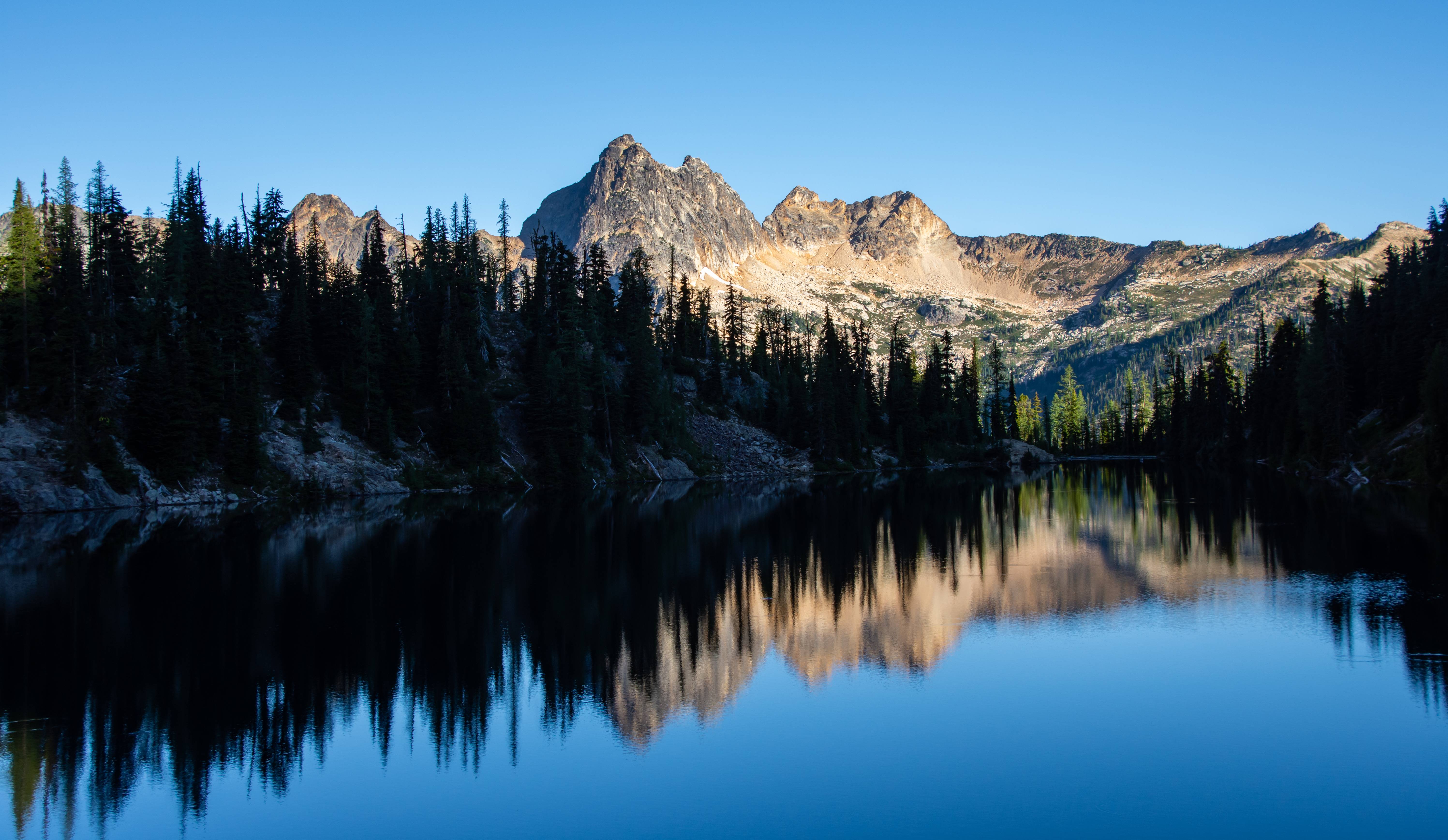
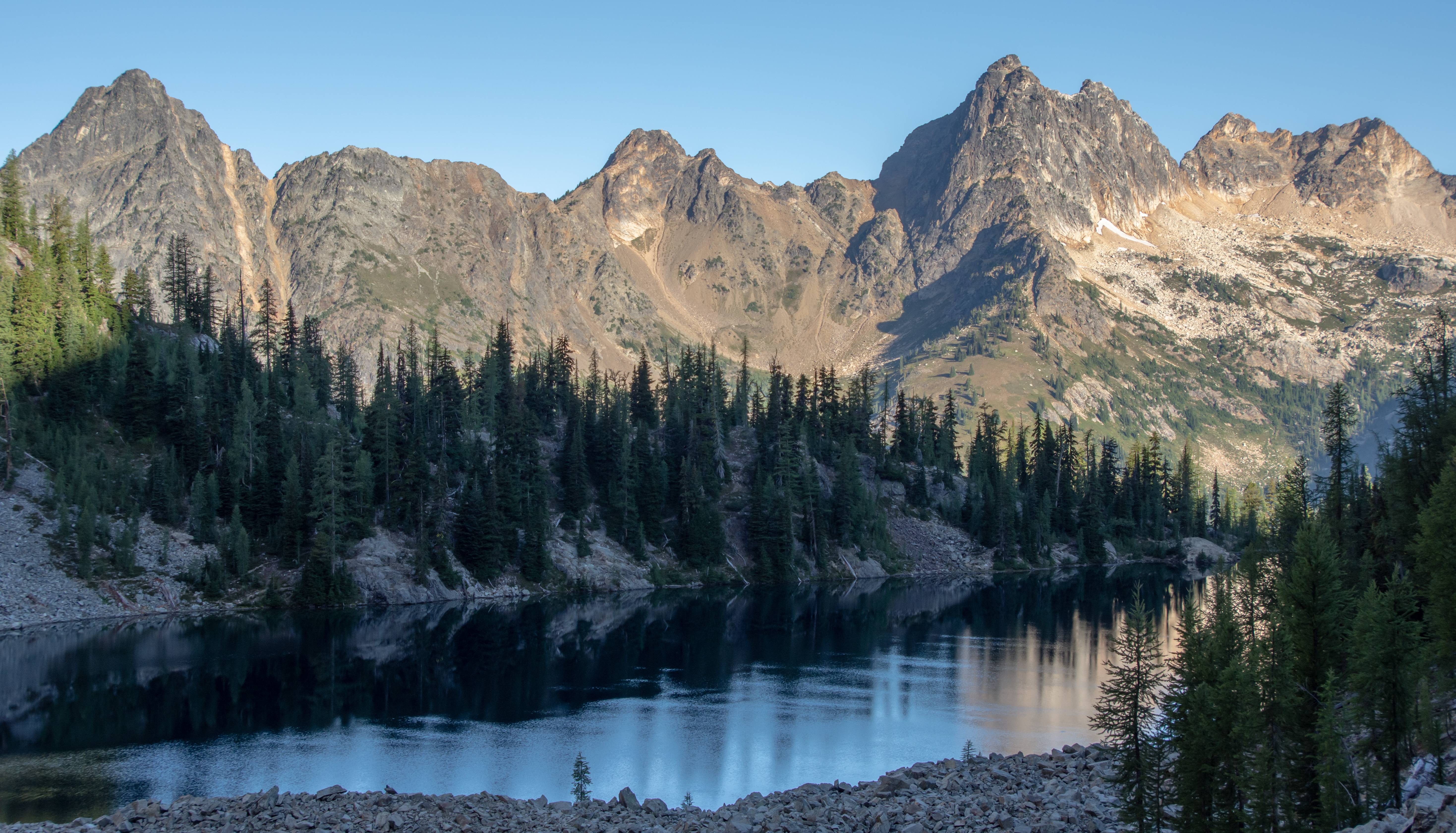
Blue lake. When we were there, it was a ghost town (weird). Once we hit the trail down to the parking lot we must have passed 12 backpackers on the way up(and there it is!). Blue lake is one of the more popular trails in the North Cascades.
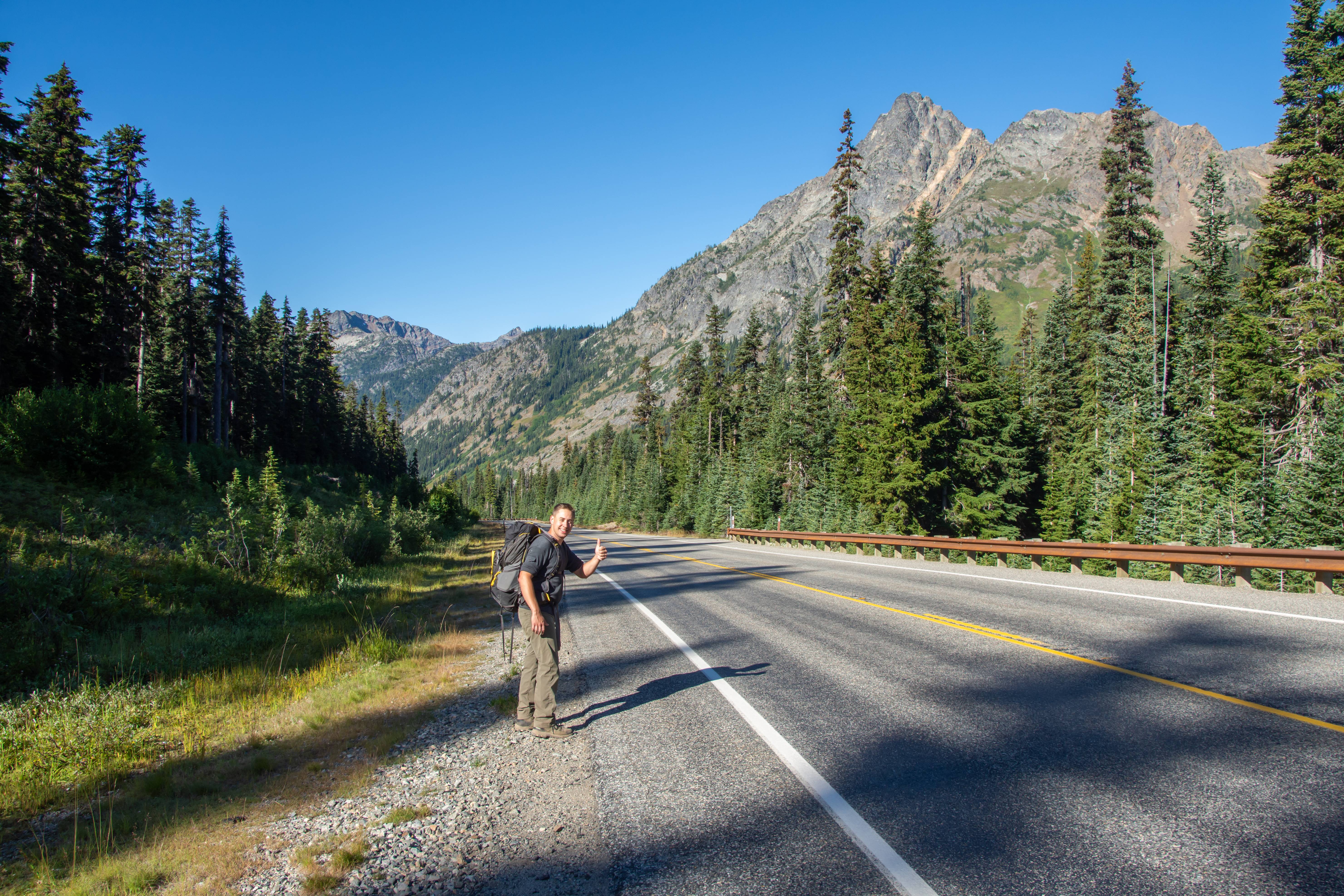
The most dangerous part of our trip. The 1.5 mile road walk back to my truck and then driving home. Despite the roughness around the edges Ian had an absolute blast for his first off trail adventure and wants to do another one!
Now onward to the Olympics for 6 days and 5 nights!
 .
.