Udink
Still right here.
- Joined
- Jan 17, 2012
- Messages
- 1,748
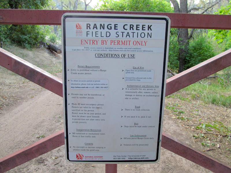
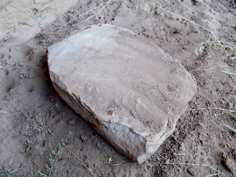
Last weekend I ranged into Range Creek for a second time, the first being nearly four years ago on the day after Thanksgiving. That late November day was cold and snowy, but right now it's still relatively warm at 6,800' elevation. The forecast temperatures were in the low-80s, so I drove in on Saturday evening and spent the night, hoping to get an early start on Sunday morning. I'd read about a petroglyph in Little Horse Canyon that I hadn't seen before, so on my way into Range Creek I drove slowly looking for it. It turned out to be very close to the confluence with Range Creek. Nearby I found what appeared to be a metate in a boulder. I slept in the Jeep that night, hearing a lot of unexplainable noises. Many times I heard what sounded like the antenna "boinging," and other times I thought I heard a distant car door closing. I slept fitfully all night, waking by 6:30AM.
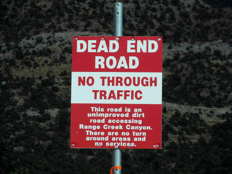
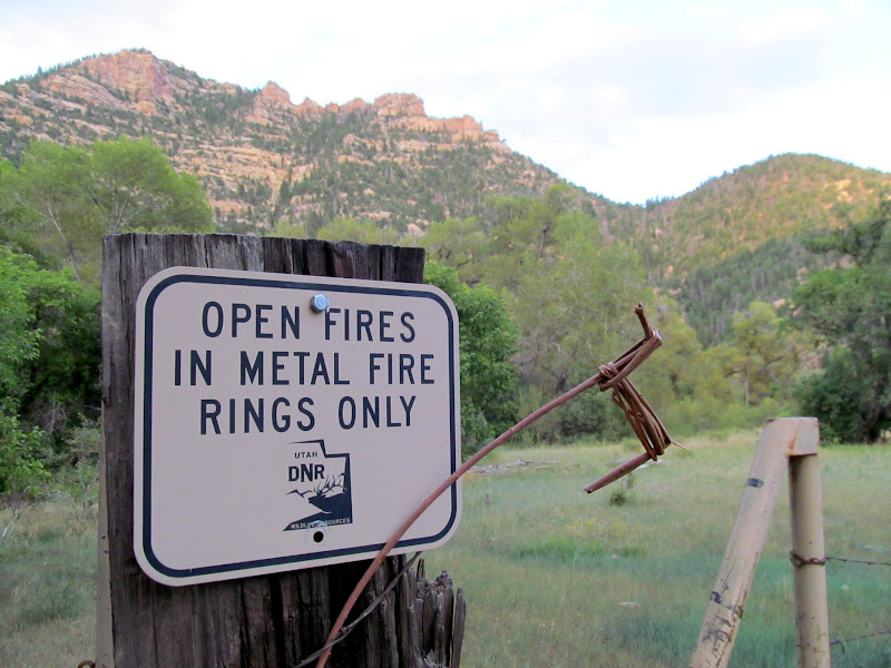
New sign in Horse Canyon. How does one leave a dead-end road with no turn around areas?
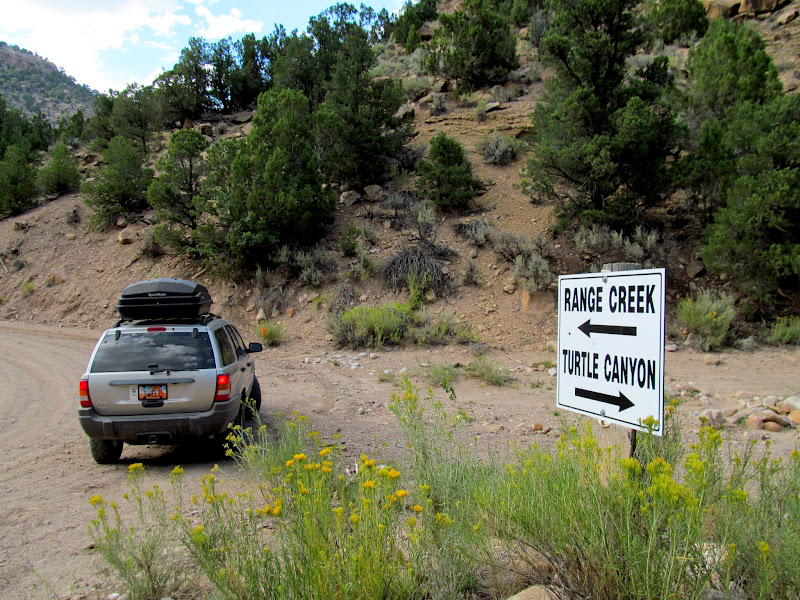
I think I'll go left this time
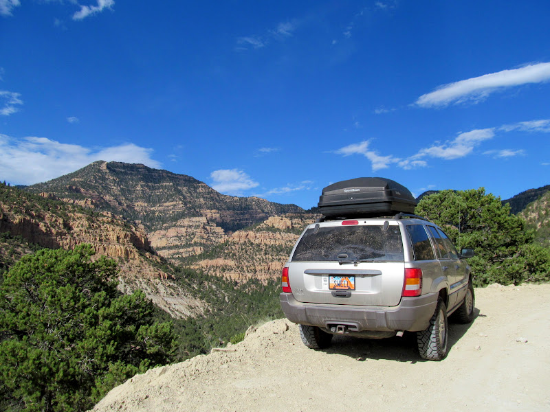
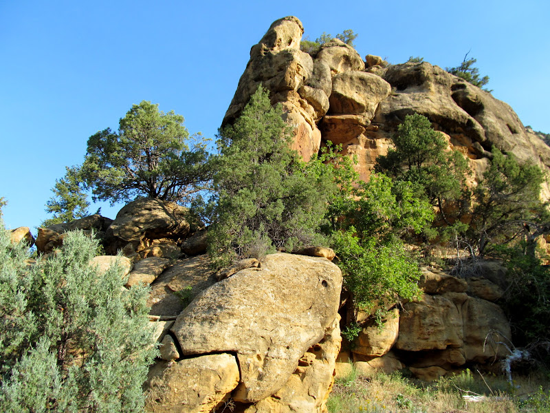
Climbing above the South Fork of Horse Canyon
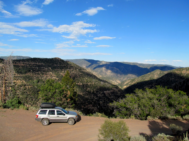
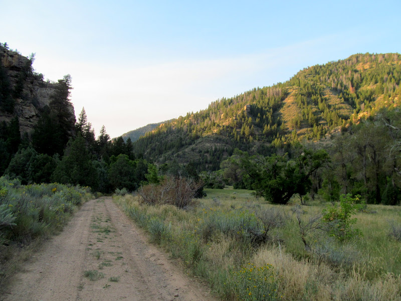
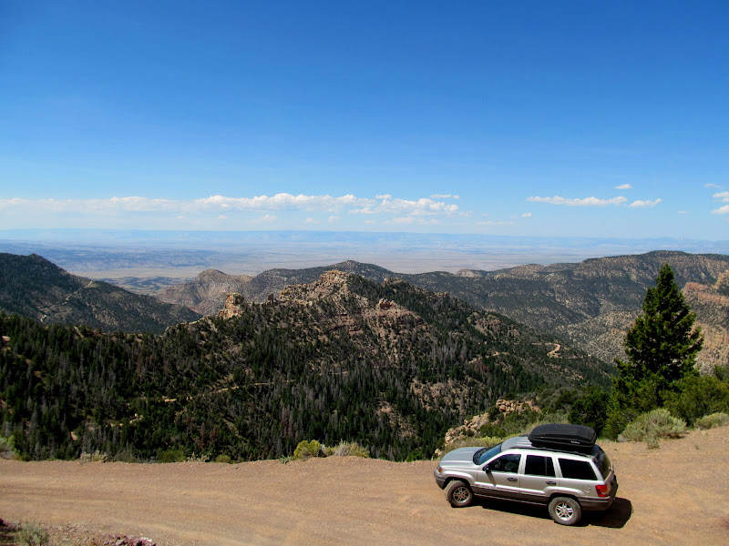
At the pass, heading down into Range Creek
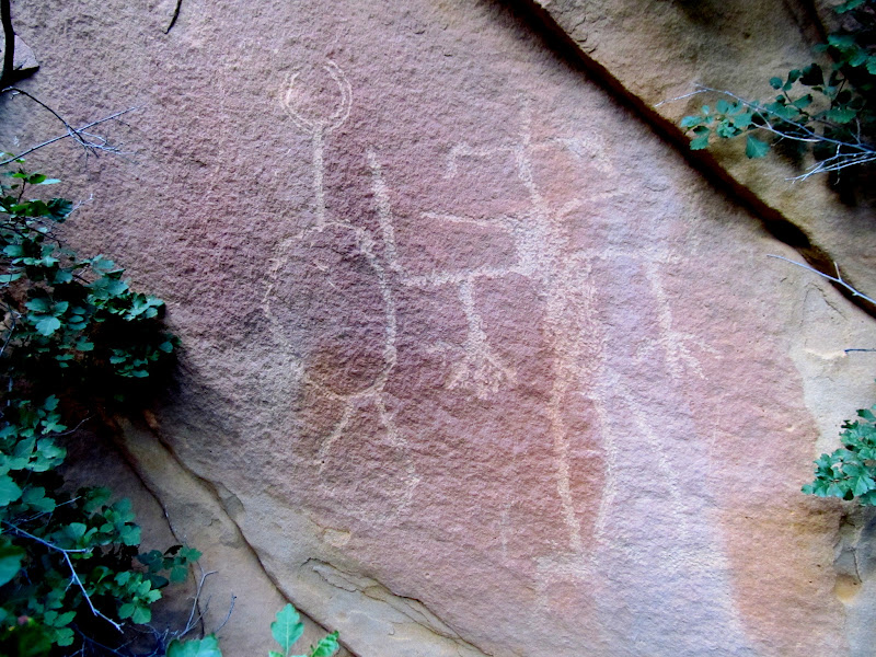
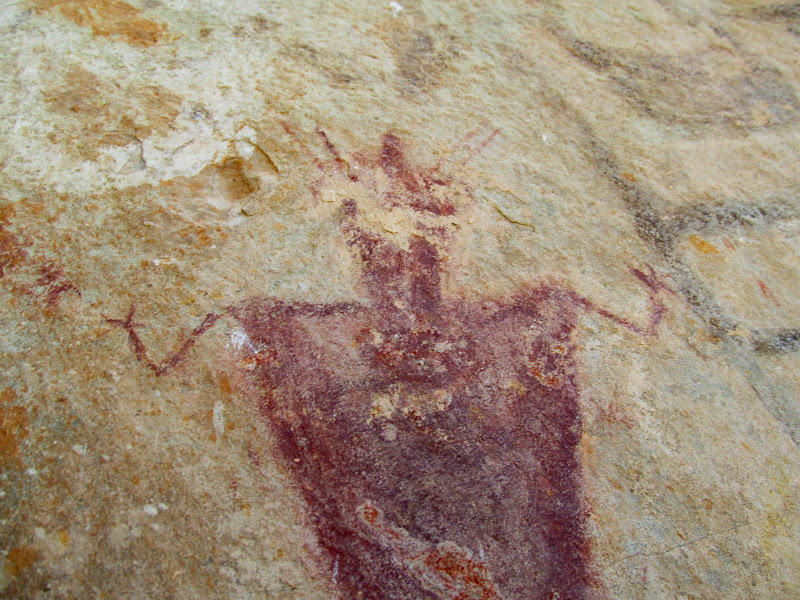
Tripod Man (or Woman?)
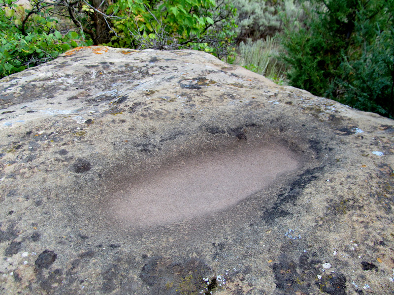
Possible metate in a boulder
Split-twig figurine
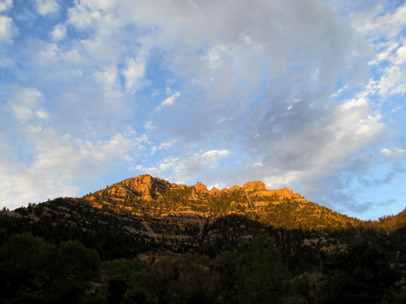
Evening shadows ascending the canyon walls
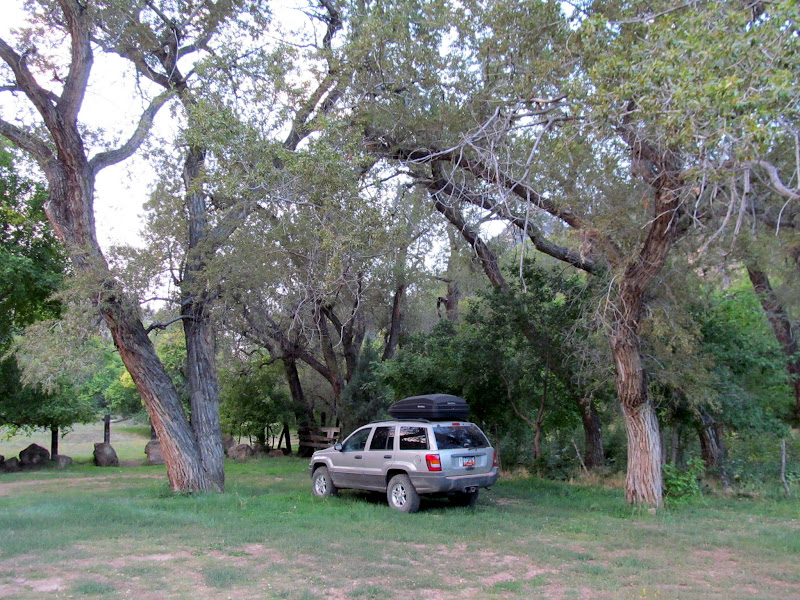
Sleeping accommodations
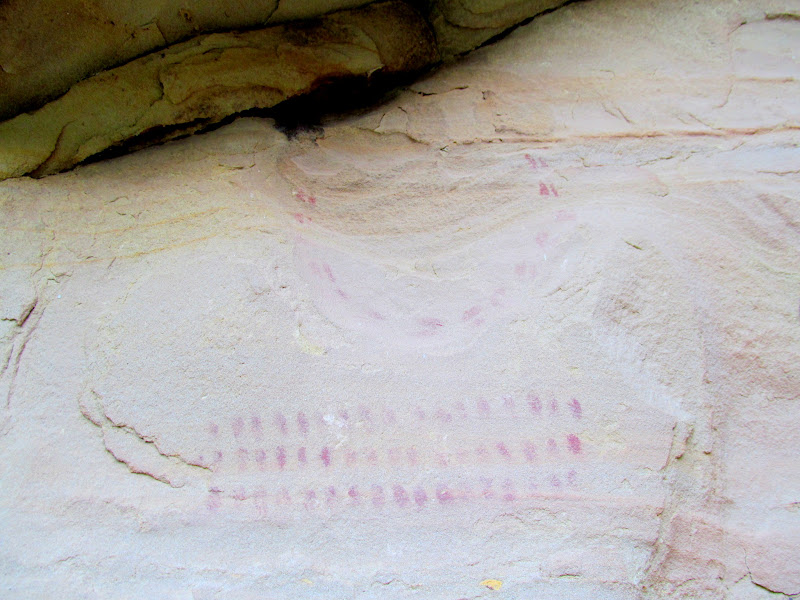
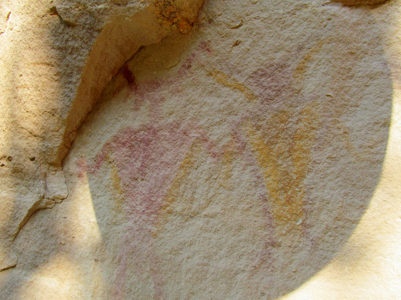
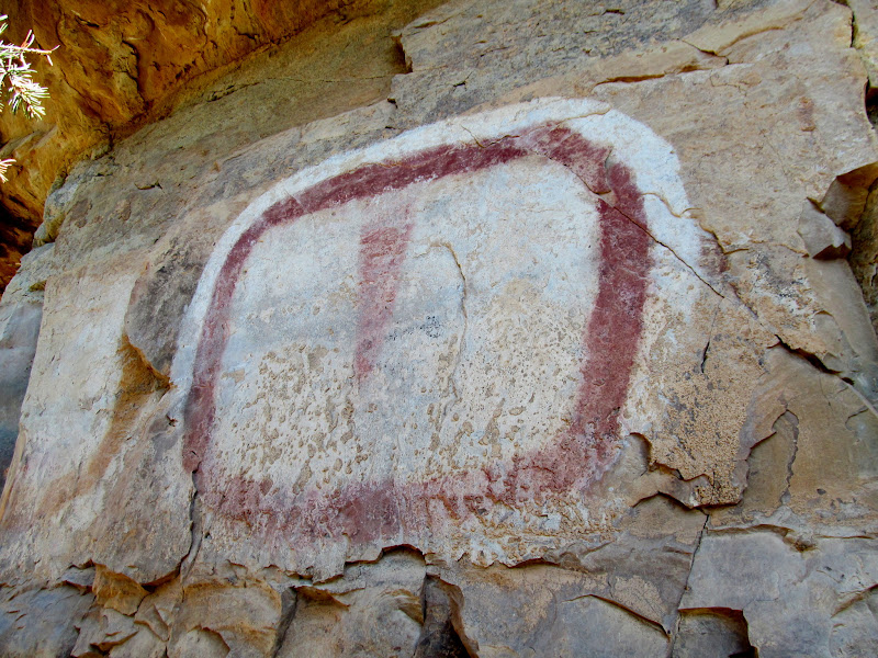
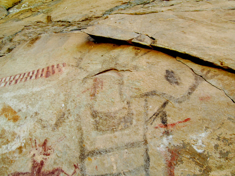
Shortly after 7:00AM I entered the Range Creek property and began walking along the road. I first hiked north, reaching the TN Ranch property boundary and, finding nothing of interest in that direction, turned to the south. I passed up a number of sites that I'd seen on my prior trip. An alcove that I hadn't noticed before, even though it's visible from the road, called to me and held a couple of surprises. Under an overhang were some faint red fingerprint pictographs in rows and a partial circle. Near the rock art, at the base of the cliff, there was what appeared to be an upside-down metate. The edges were worked and it was just the right size and shape. I overturned the rock and saw that it was almost completely flat on the other side, with no tell-tale trough indicating that it had ever been used to grind seeds or grain. Perhaps there was pecking or other marks indicating use underneath the layer of dirt adhering to the rock, but I didn't want to disturb it further so I turned it back over and left it alone.
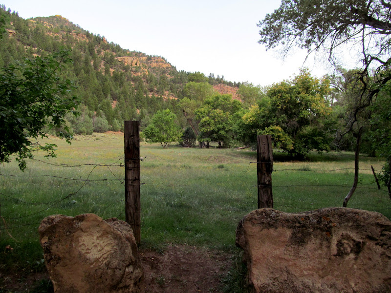
Entrance
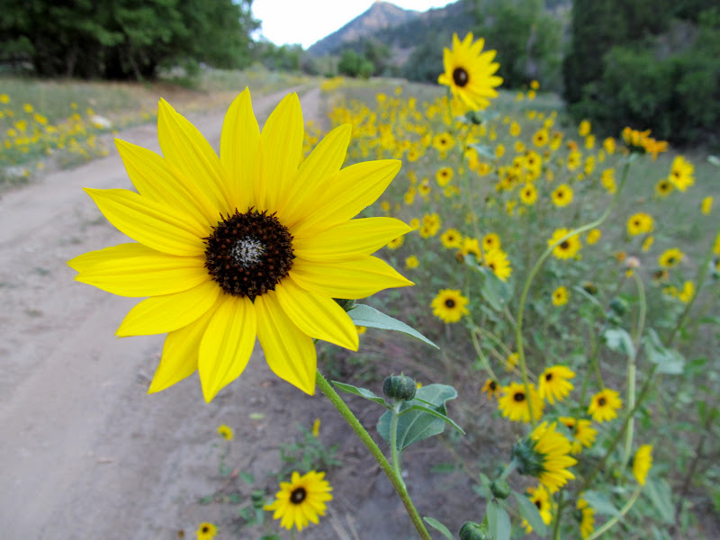
Sunflowers lining the road
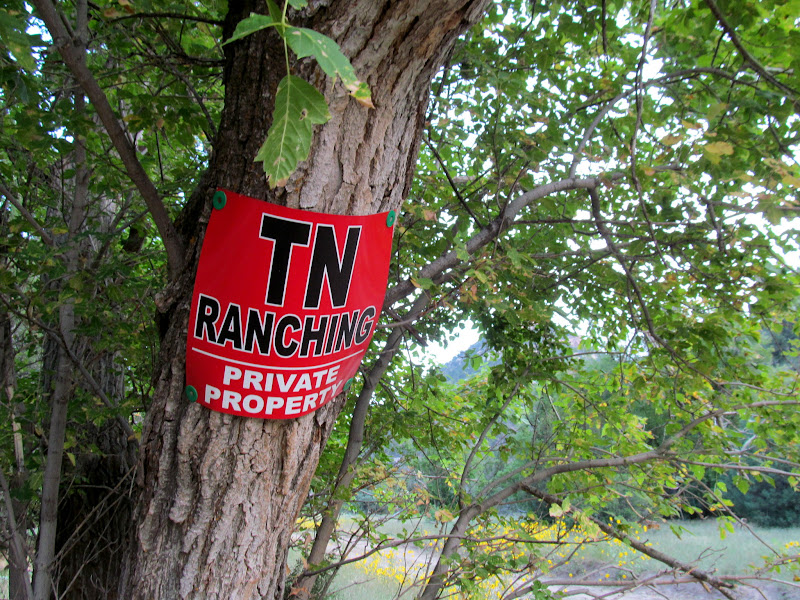
TN Ranching sign
Range Creek north gate
Just walkin' down the road as the sun rises
Locomotive Rock

Rows of dots
Looks like an overturned metate?
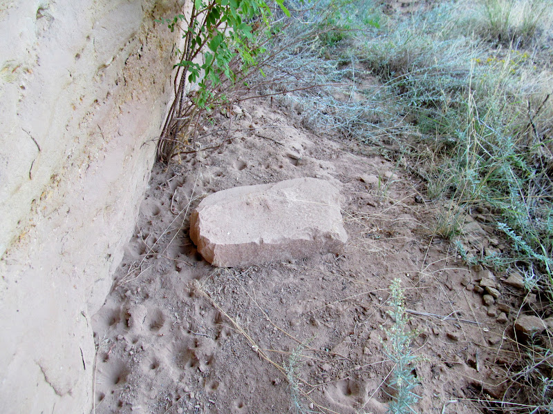
Hmm...maybe an unused metate?
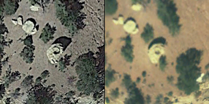
I continued my walk down the road for another 30 minutes, stopping only once at a petroglyph site that I'd been to before. Someone had scratched an arrow into the dirt road pointing toward the site. Shortly before 9:00AM I reached my first objective. While casually poking around the area in Google Earth days earlier, I spotted a small circle atop a boulder that I was almost certain was man-made. I climbed up past some pictographs that I'd visited before. Sunlight was trickling through some trees and made photographing them difficult. I climbed higher until I reached the boulder and my hopes were deflated. There was nothing even close to resembling a man-made structure on top. Since I'd already ascended a couple hundred feet, I decided to go yet farther up. I found a small petroglyph panel that I've never even seen a photograph of. While finding a structure didn't pan out, at least I found something on that ridge.
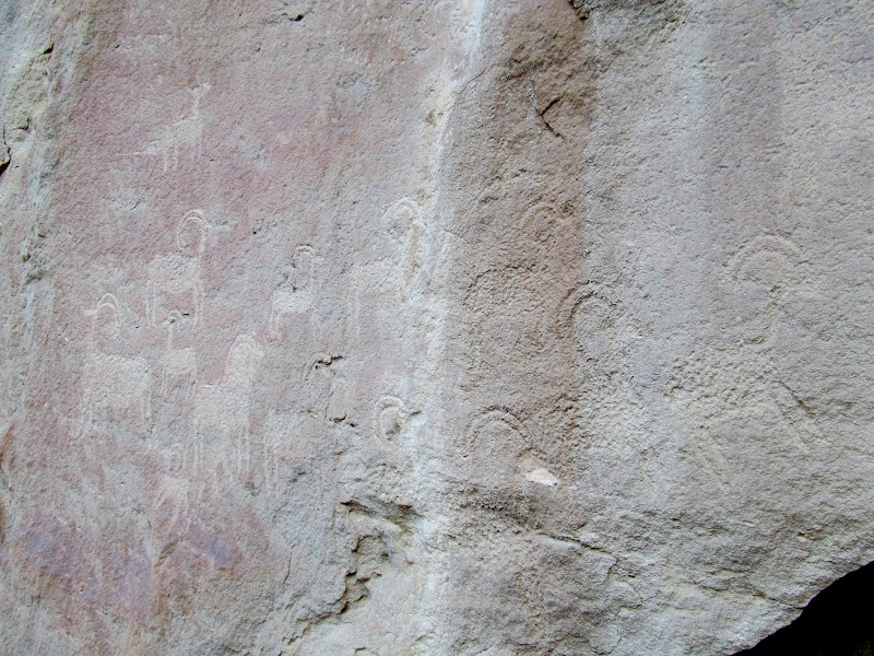
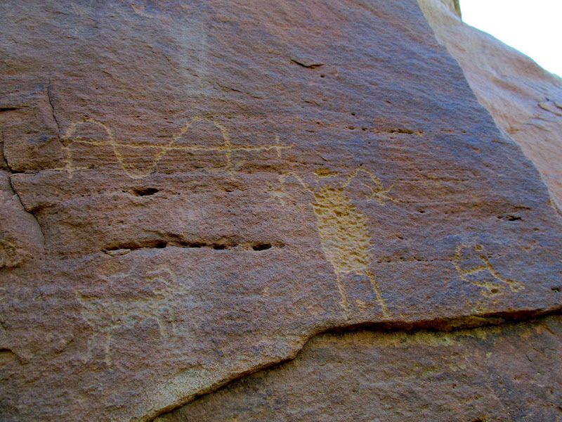
Sheep petroglyphs with a canine in the upper-left
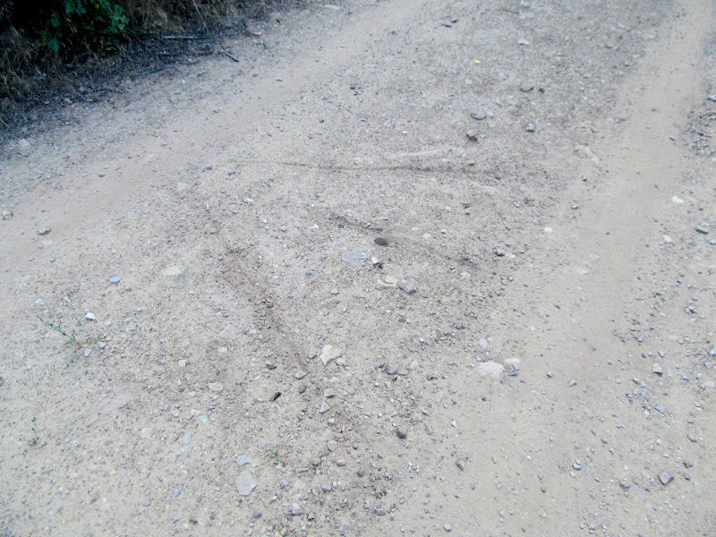
Arrow in the road pointing to a rock art site
Satellite imagery showing a possible stone circle atop a boulder
Rocky climb to some pictographs
Fremont pictographs, shaded by my hat
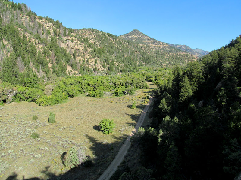
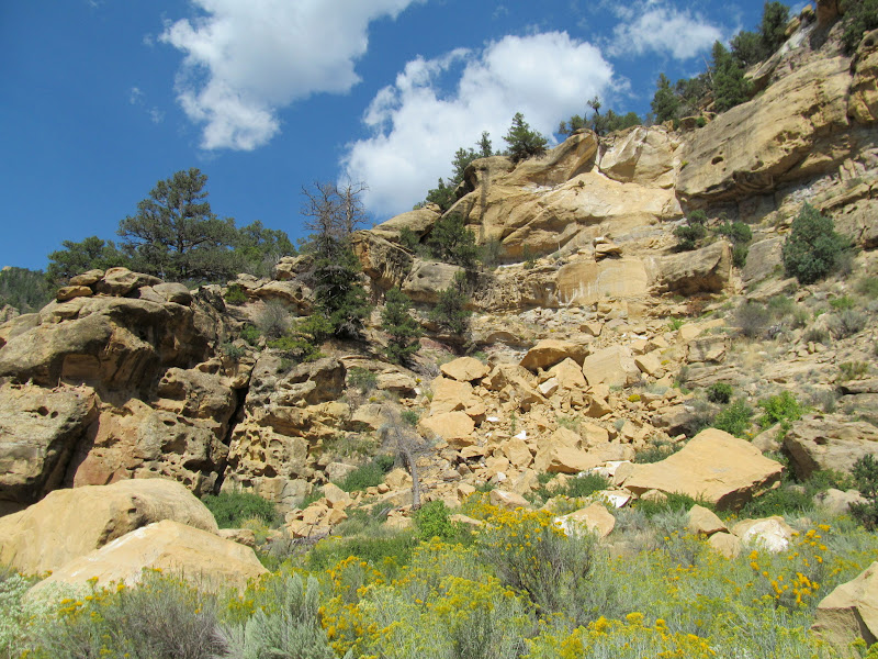
Range Creek Canyon
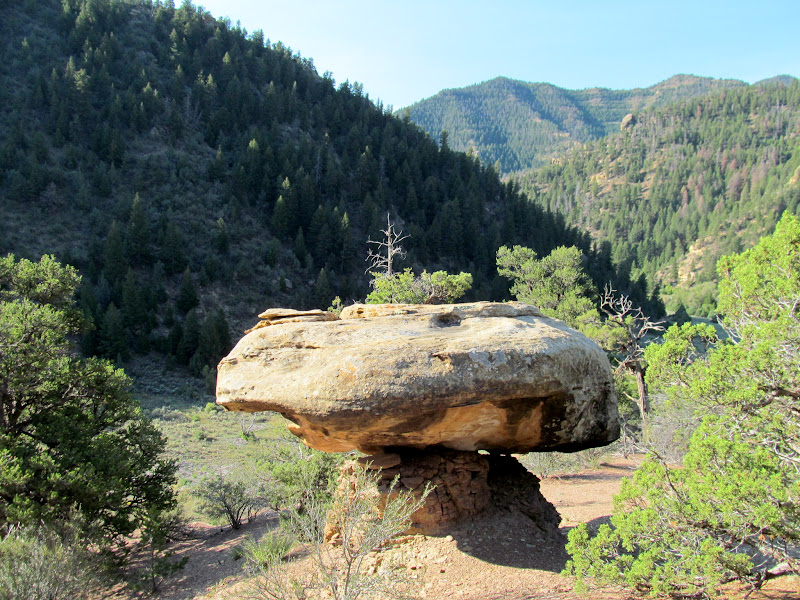
Boulder on a pedestal, but no circle of rocks
Petroglyphs high above the canyon floor
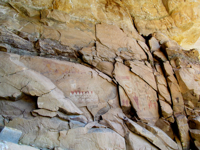
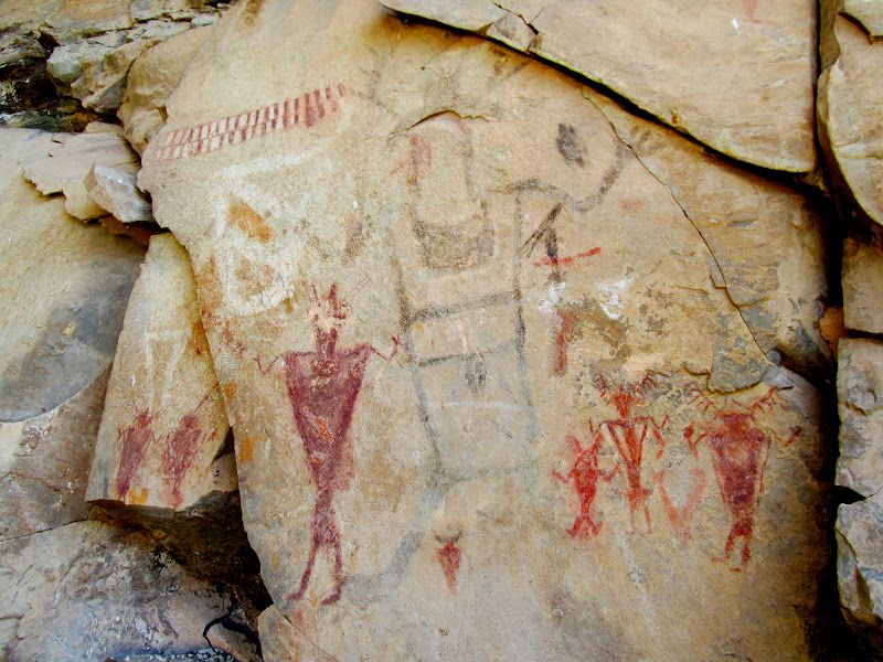
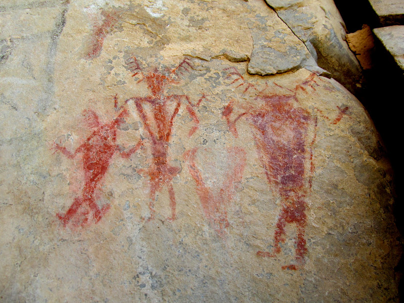
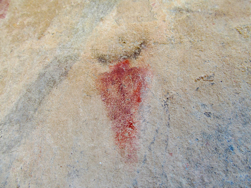
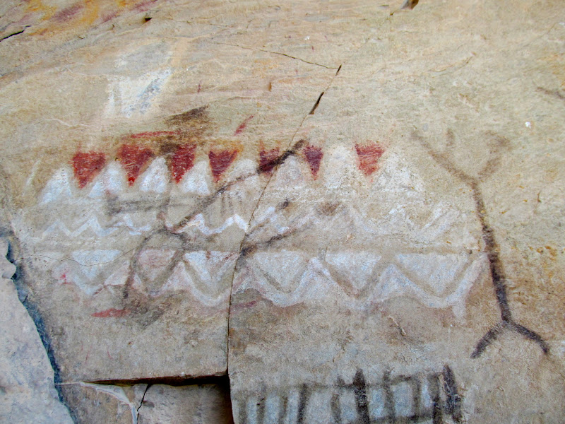
After some more road-walking I once again scrambled and climbed my way above the canyon floor to visit some remarkable pictographs. I had only seen them from below at a distance during my last trip to Range Creek. This time I was determined to get an up-close look. I climbed through some unstable rockfall, then wound my way back and forth while continuing to ascend over ledges and giant boulders. On one sloping ledge there were even some weathered moqui steps to make the climb easier. I reached the level of the rock art and then traversed a narrow ledge until reaching the "TV pictograph." A little farther beyond that and I was standing in an alcove with a number of exceptional Fremont pictographs in white, yellow, black, and shades of red.
TV pictograph
A remarkable, large pictograph panel
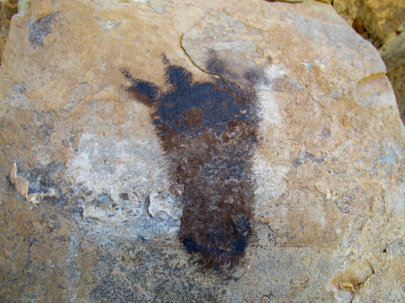
Four-toed bear pictograph in black
My favorite part of the panel
Four Fremont figures
Cool little horned figure
Central figure, with cowboy hat and elk antlers
Fremont figure with fine antennae and fingers
Geometric designs
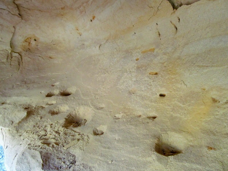
Petroglyphs and deeply-pecked holes
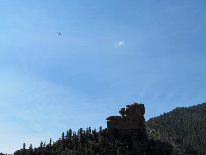
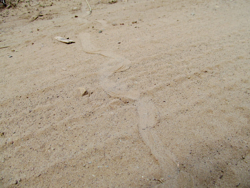
I rested and took advantage of the coolness inside the alcove. My plan had included climbing up to Locomotive Rock next, but I decided there in that alcove that I'd done enough for the day. I loaded up on fluids now that my frozen Powerade was thawed enough to drink, and then began walking up the canyon along the road. It was hot out, but I was feeling good and I walked briskly and cheerfully back toward the Range Creek gate. I'd seen nobody else in the canyon all morning except for two airplanes that flew low overhead, circling Locomotive Rock a couple of times before continuing on. I'd been keeping an eye open for bear or cougar tracks along the road, but saw none. I did, however, see many places where snakes had crossed it.
Rockfall and ledges along the route down from the alcove
Airplane over Locomotive Rock
Snake crossing
At the pass, heading home
I made it back to the Jeep at noon and, upon getting there, grabbed a drink and a snack for the drive home. I heard another phantom car door close, but then I realized it was real when I saw a person approaching me from the gate. It was Mike, the ranger/security guy who oversees visitors to the canyon. We chatted for about 15 minutes about what I'd been up to that morning. I told him about the small petroglyph panel I'd found and he was going to check with Corinne, the field station manager, to see if she already knew of it. He said there were only two other people who had permits to be in the canyon that day but they never showed. I really did have the canyon to myself all morning, and for the short five hours that I spent inside the gate, I'd seen plenty to keep me satisfied...until my next trip.
Photo Gallery: Range Creek II
New sign in Horse Canyon. How does one leave a dead-end road with no turn around areas?
I think I'll go left this time
Climbing above the South Fork of Horse Canyon
At the pass, heading down into Range Creek
Tripod Man (or Woman?)
Possible metate in a boulder
Split-twig figurine
Evening shadows ascending the canyon walls
Sleeping accommodations
Shortly after 7:00AM I entered the Range Creek property and began walking along the road. I first hiked north, reaching the TN Ranch property boundary and, finding nothing of interest in that direction, turned to the south. I passed up a number of sites that I'd seen on my prior trip. An alcove that I hadn't noticed before, even though it's visible from the road, called to me and held a couple of surprises. Under an overhang were some faint red fingerprint pictographs in rows and a partial circle. Near the rock art, at the base of the cliff, there was what appeared to be an upside-down metate. The edges were worked and it was just the right size and shape. I overturned the rock and saw that it was almost completely flat on the other side, with no tell-tale trough indicating that it had ever been used to grind seeds or grain. Perhaps there was pecking or other marks indicating use underneath the layer of dirt adhering to the rock, but I didn't want to disturb it further so I turned it back over and left it alone.
Entrance
Sunflowers lining the road
TN Ranching sign
Range Creek north gate
Just walkin' down the road as the sun rises
Locomotive Rock
Rows of dots
Looks like an overturned metate?
Hmm...maybe an unused metate?
I continued my walk down the road for another 30 minutes, stopping only once at a petroglyph site that I'd been to before. Someone had scratched an arrow into the dirt road pointing toward the site. Shortly before 9:00AM I reached my first objective. While casually poking around the area in Google Earth days earlier, I spotted a small circle atop a boulder that I was almost certain was man-made. I climbed up past some pictographs that I'd visited before. Sunlight was trickling through some trees and made photographing them difficult. I climbed higher until I reached the boulder and my hopes were deflated. There was nothing even close to resembling a man-made structure on top. Since I'd already ascended a couple hundred feet, I decided to go yet farther up. I found a small petroglyph panel that I've never even seen a photograph of. While finding a structure didn't pan out, at least I found something on that ridge.
Sheep petroglyphs with a canine in the upper-left
Arrow in the road pointing to a rock art site
Satellite imagery showing a possible stone circle atop a boulder
Rocky climb to some pictographs
Fremont pictographs, shaded by my hat
Range Creek Canyon
Boulder on a pedestal, but no circle of rocks
Petroglyphs high above the canyon floor
After some more road-walking I once again scrambled and climbed my way above the canyon floor to visit some remarkable pictographs. I had only seen them from below at a distance during my last trip to Range Creek. This time I was determined to get an up-close look. I climbed through some unstable rockfall, then wound my way back and forth while continuing to ascend over ledges and giant boulders. On one sloping ledge there were even some weathered moqui steps to make the climb easier. I reached the level of the rock art and then traversed a narrow ledge until reaching the "TV pictograph." A little farther beyond that and I was standing in an alcove with a number of exceptional Fremont pictographs in white, yellow, black, and shades of red.
TV pictograph
A remarkable, large pictograph panel
Four-toed bear pictograph in black
My favorite part of the panel
Four Fremont figures
Cool little horned figure
Central figure, with cowboy hat and elk antlers
Fremont figure with fine antennae and fingers
Geometric designs
Petroglyphs and deeply-pecked holes
I rested and took advantage of the coolness inside the alcove. My plan had included climbing up to Locomotive Rock next, but I decided there in that alcove that I'd done enough for the day. I loaded up on fluids now that my frozen Powerade was thawed enough to drink, and then began walking up the canyon along the road. It was hot out, but I was feeling good and I walked briskly and cheerfully back toward the Range Creek gate. I'd seen nobody else in the canyon all morning except for two airplanes that flew low overhead, circling Locomotive Rock a couple of times before continuing on. I'd been keeping an eye open for bear or cougar tracks along the road, but saw none. I did, however, see many places where snakes had crossed it.
Rockfall and ledges along the route down from the alcove
Airplane over Locomotive Rock
Snake crossing
At the pass, heading home
I made it back to the Jeep at noon and, upon getting there, grabbed a drink and a snack for the drive home. I heard another phantom car door close, but then I realized it was real when I saw a person approaching me from the gate. It was Mike, the ranger/security guy who oversees visitors to the canyon. We chatted for about 15 minutes about what I'd been up to that morning. I told him about the small petroglyph panel I'd found and he was going to check with Corinne, the field station manager, to see if she already knew of it. He said there were only two other people who had permits to be in the canyon that day but they never showed. I really did have the canyon to myself all morning, and for the short five hours that I spent inside the gate, I'd seen plenty to keep me satisfied...until my next trip.
Photo Gallery: Range Creek II