Udink
Still right here.
- Joined
- Jan 17, 2012
- Messages
- 1,692
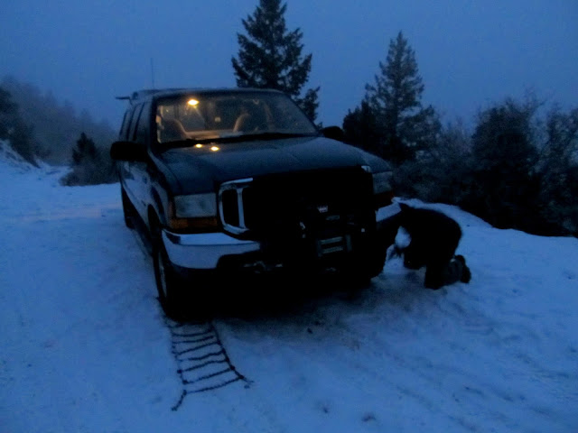
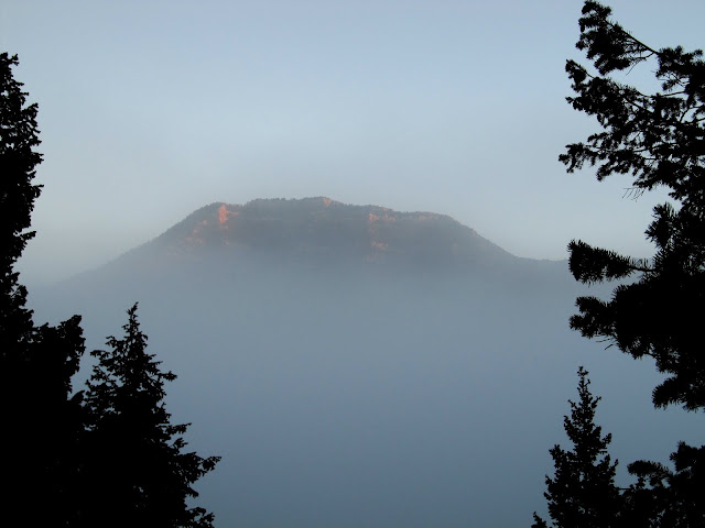
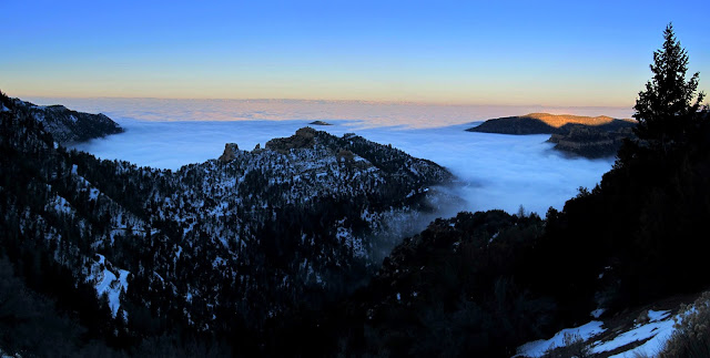
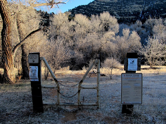
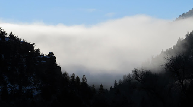
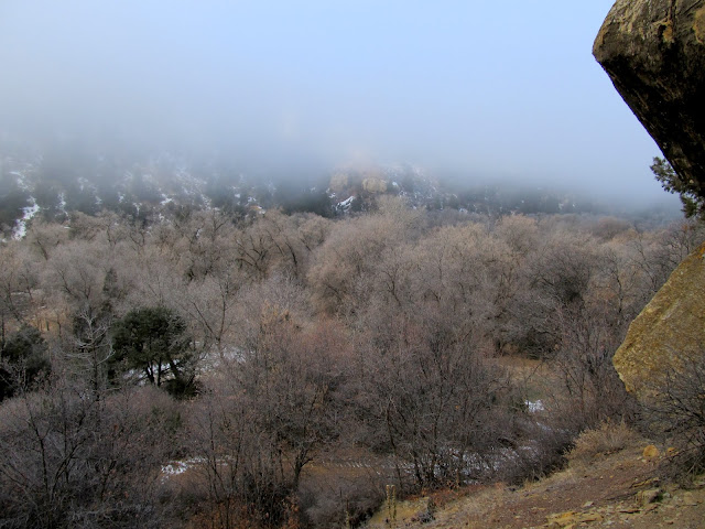
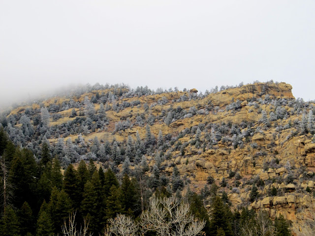
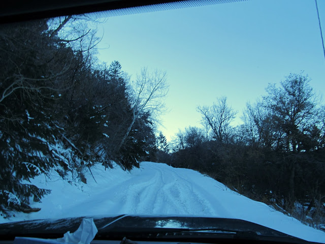
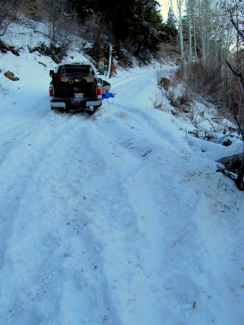
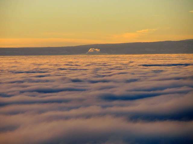
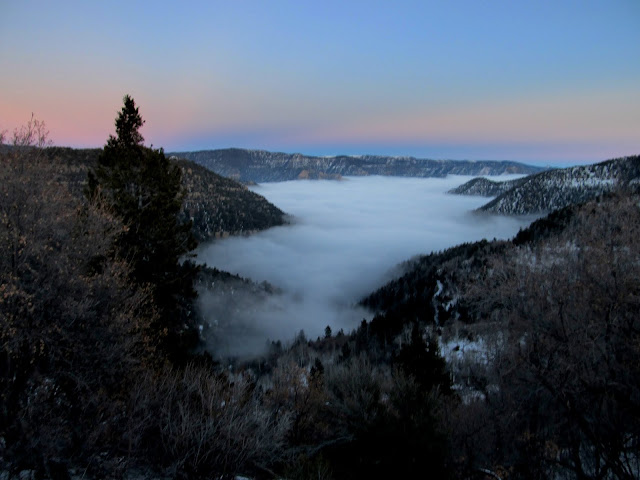
I finally took advantage of an opportunity to visit Range Creek this weekend. It's not as though I haven't had ample opportunities--it's really close to home and full of the stuff I like most: rock art, ruins, wildlife, and beautiful scenery. Alan invited me to accompany him on the day after Thanksgiving and I couldn't pass up such an offer. He's been there many times and is very knowledgeable about the area. A permit is required to gain entry into Range Creek, costing only one dollar and otherwise with very little red tape. Access is only allowed on foot or on horseback and, lacking horses, we, of course, planned on hiking all day. It was Alan's turn to drive and he picked me up a little before 6AM on Friday. He'd spoken to the ranger that patrols Range Creek and was advised that tire chains were necessary to negotiate the steep, snowy road over the pass from Horse Canyon to Little Horse Canyon. Once we ran into snow in Horse Canyon we stopped to chain up the front tires of Alan's truck. After that we climbed and climbed, eventually getting above the fog and witnessing a wonderful sunrise from the pass with the valley below filled with fog.
Chaining up in Horse Canyon
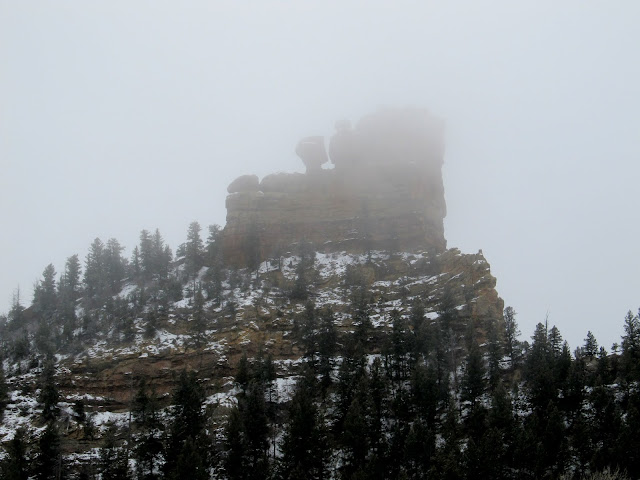
Patmos Head through the fog at sunrise
Foggy Horse Canyon and sunny Patmos Head
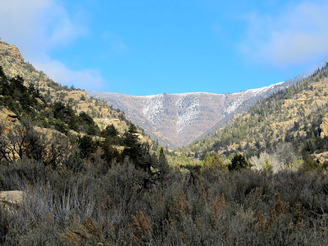
View over the fog-filled Castle Valley
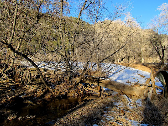
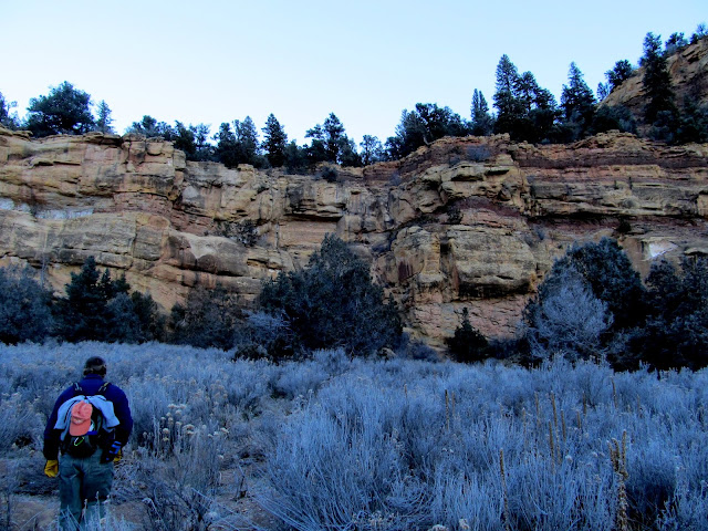
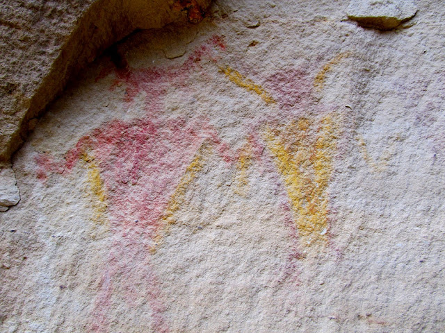
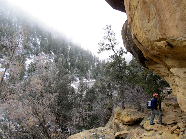
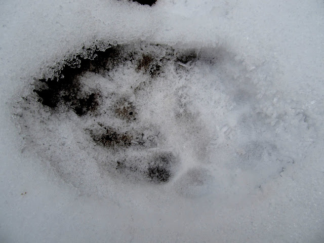
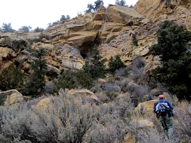
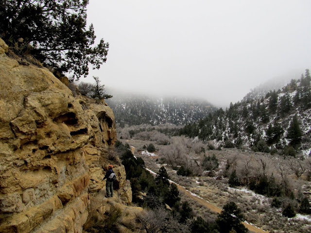
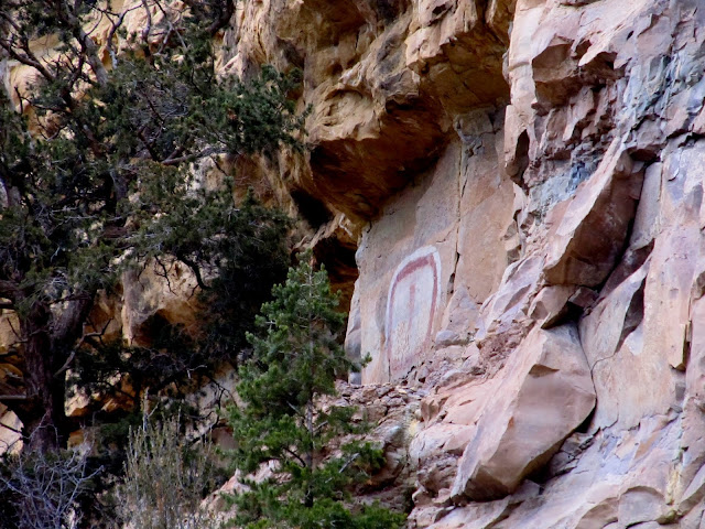
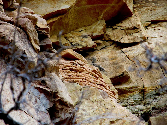
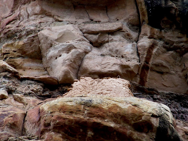
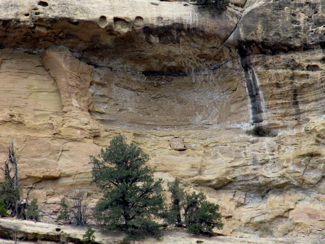
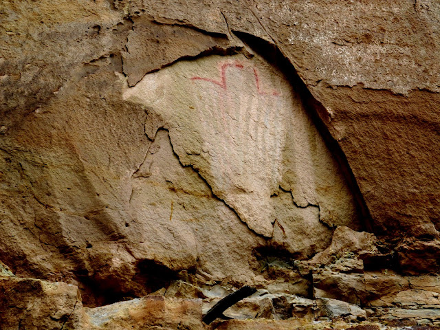
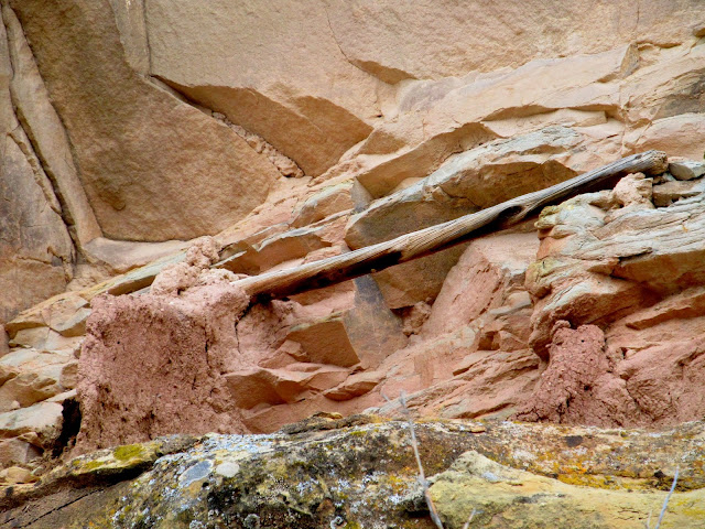
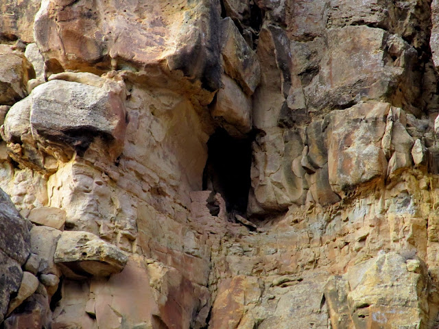
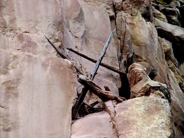
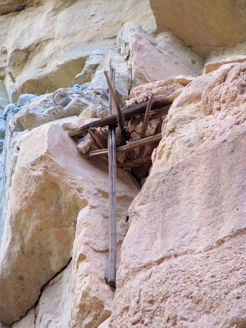
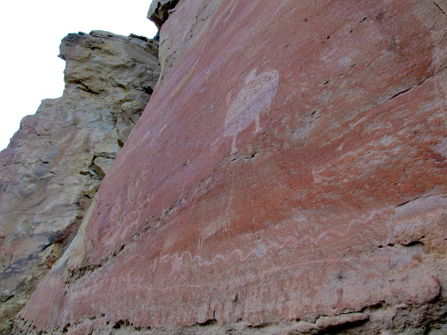
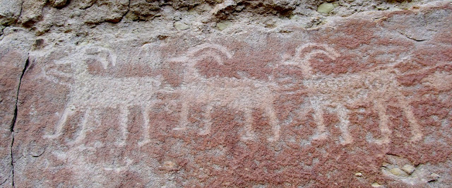
Though our destination was relatively close to Price, the steep, winding, snow-covered road took quite some time to negotiate and we didn't start hiking until almost 8:30. We crossed Range Creek on some logs then visited a petroglyph site very close to the entrance gate. Although it was sunny when we started hiking, as we descended the canyon we entered more fog and it stuck with us most of the day. We visited another petroglyph site, then some pictographs with the remains of a granary above it. We saw bear footprints in the snow, though I'd been hoping the bears would be hibernating this late in the year. We neared Locomotive Rock and climbed up to some pictographs. Actually, Alan climbed up while I waited below a sketchy climb that I didn't dare make. I got a few photos from far below while he got close-ups. We later learned the correct way to climb up to the pictographs but I'll have to try that route on a later trip.
Range Creek trailhead
Fallen tree that I used to cross the creek
Approaching the rock art site nearest the trailhead
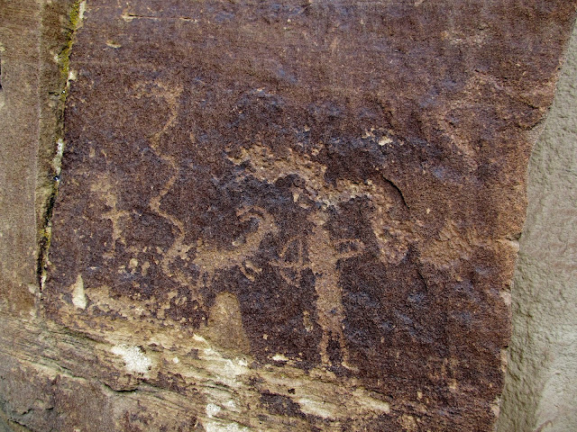
Petroglyphs
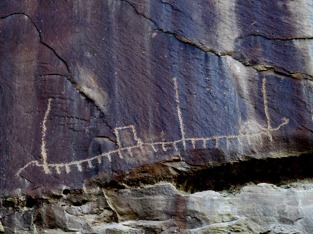
Human figure with large hands
Fog down the canyon
Just below the fog while climbing up to some petroglyphs
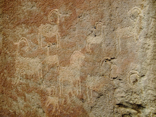
Sheep petroglyphs
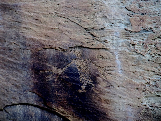
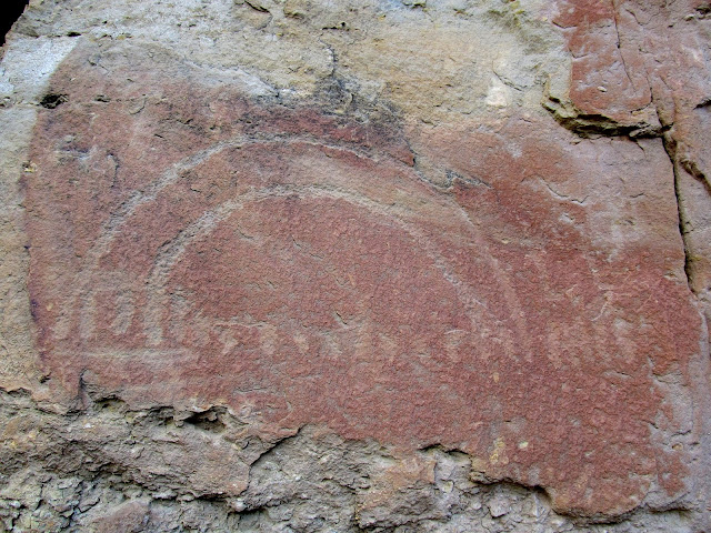
Red and yellow pictographs
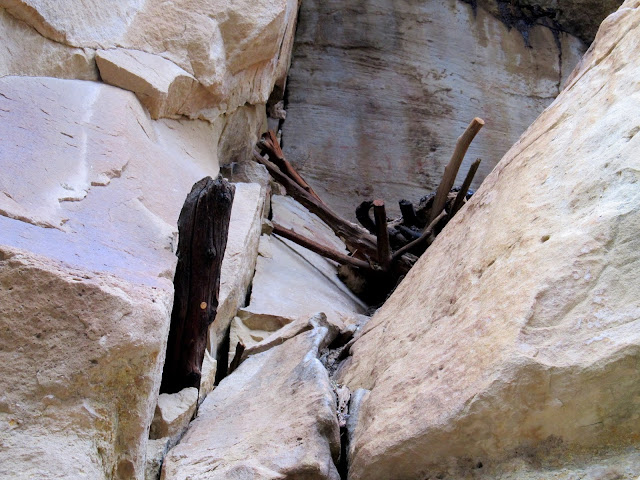
Remains of a granary
Alan on a ledge
Bear track in the snow
Locomotive Rock
Granary hidden high in some cliffs
Climbing up to some pictographs
Looking for a way up the cliffs
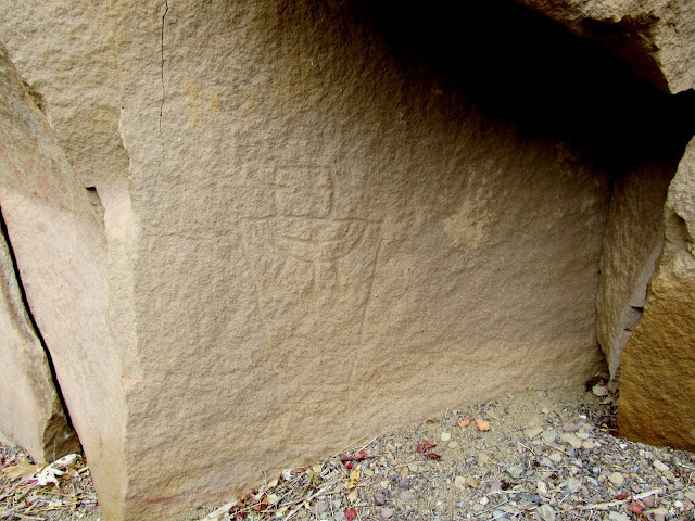
TV pictograph
Granary
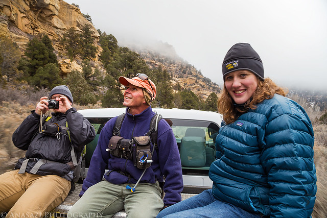
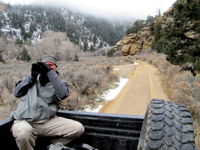
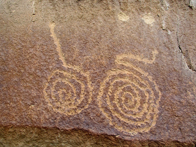
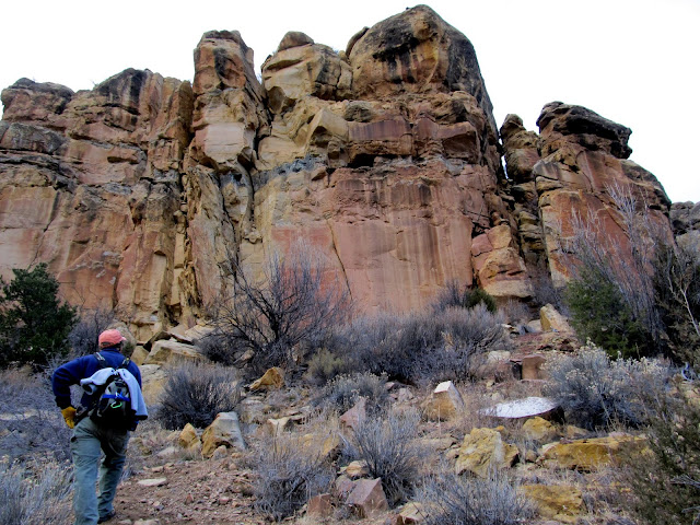
When we descended from the pictographs and started walking farther down the road, we noticed two people walking down the road toward us. Alan had spoken to the ranger a couple of days earlier and heard about someone from Grand Junction with a Jeep who also had a permit for the same day. I only know a couple of people in Grand Junction and only one of them drives a Jeep. I mentioned this to Alan and we weren't surprised at all to see Randy and Kelly approaching us. Alan and I walked up the road to greet them and, as we were chatting, the ranger, Mike, pulled up in his truck. Mike offered to give us all a ride farther down the canyon to our next destinations, so we gratefully accepted the ride and hopped in the back of the truck. Randy and Kelly got out near the Fat Man petroglyph, while Alan and I went further to Nelson Canyon. There was a large concentration of petroglyphs at Nelson Canyon and we spent a lot of time checking them out.
Hitching a ride in the back of the ranger's truck
Granary
Petroglyphs covering the sandstone
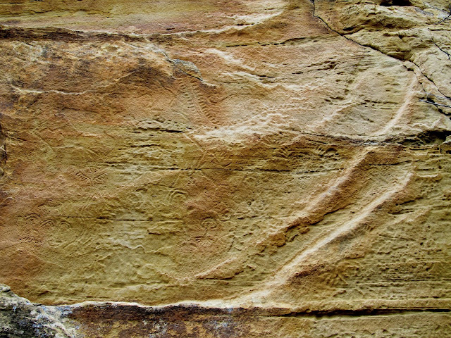
Petroglyphs
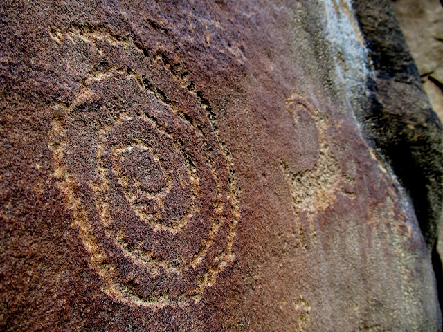
Spiral and sheep petroglyphs
Petroglyphs
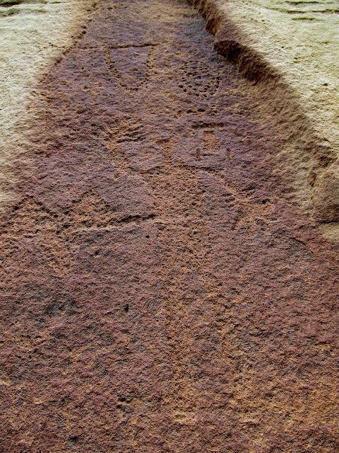
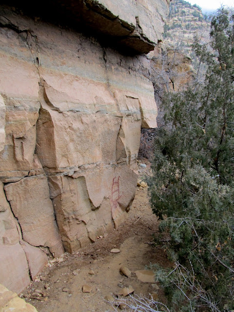
Mike had told Alan and me a little about the Upside-Down Man pictograph, and we thought we might be able to find it based on his description. We got to a good starting point and split up, with Alan going upstream and me going downstream, agreeing to holler if either of us found it. I started seeing some minor petroglyphs and eventually ran into Upside-Down Man. I whistled loudly to Alan only to hear him approaching through the brush a short distance away.
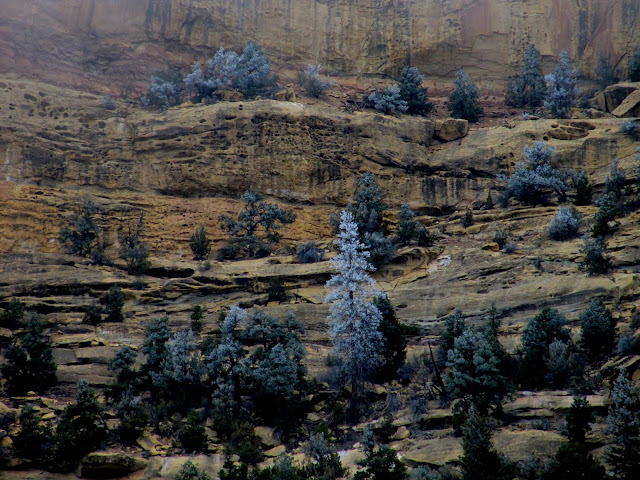
Frost-covered trees
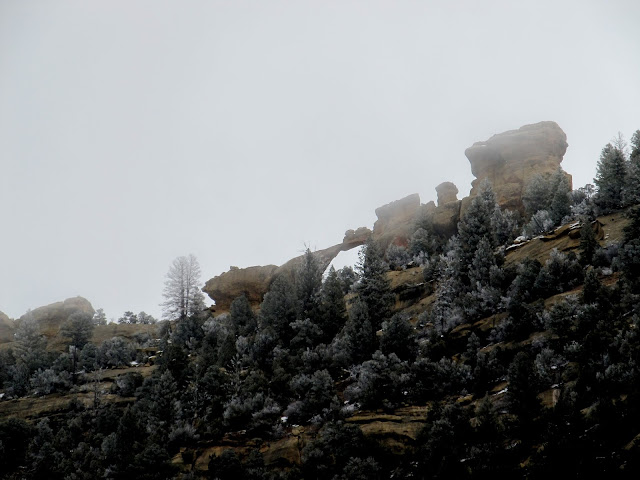
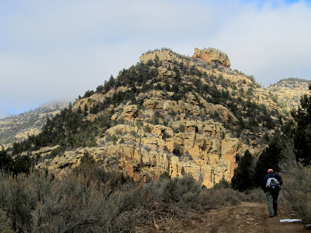
Budge's Arch
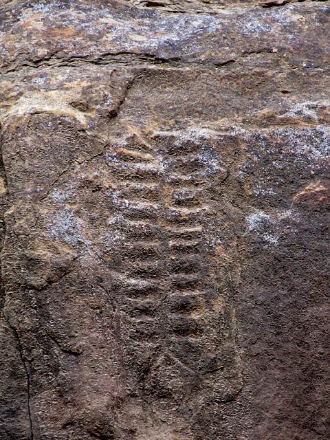
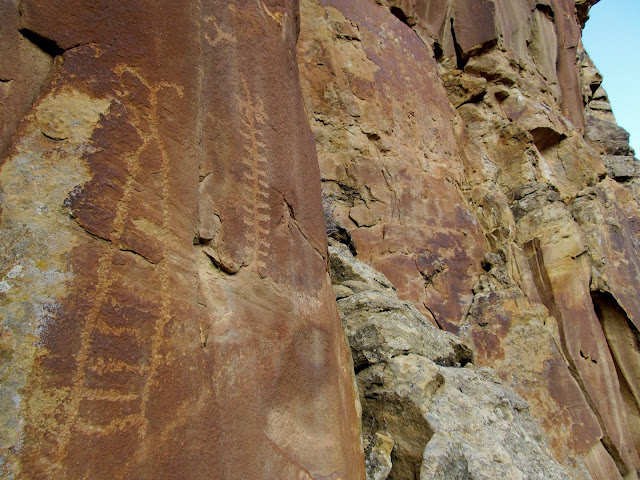
Centipede petroglyph
Snake petroglyphs
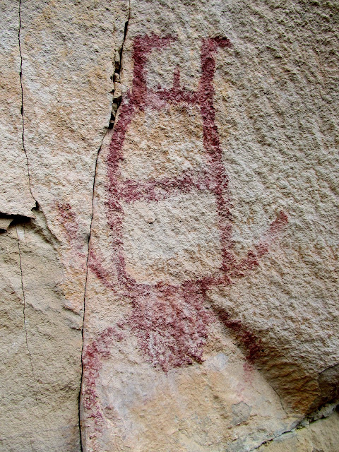
Upside-Down Man
Upside-Down Man
White pictographs near Upside-Down Man
Petroglyph and handprint near Upside-Down Man
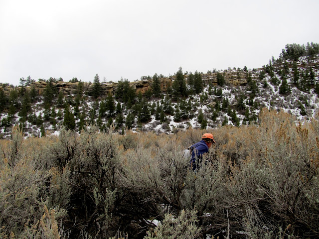
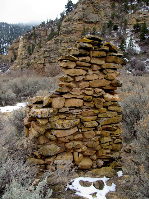
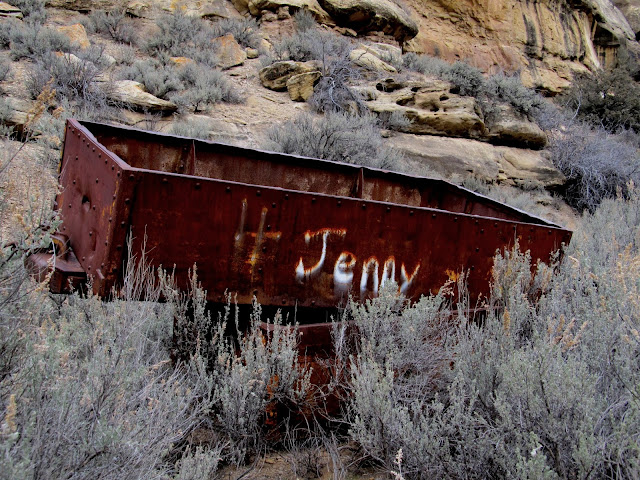
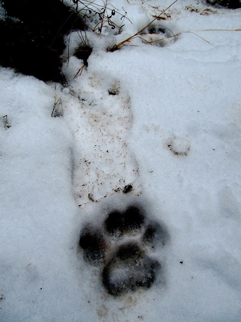
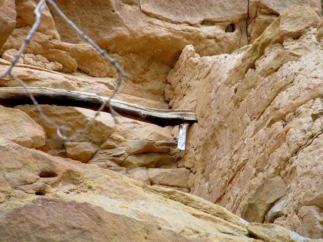
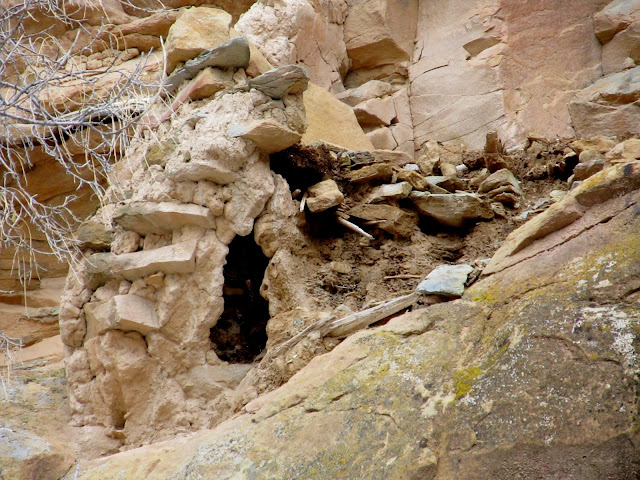
We crossed the creek again and did some bushwhacking through some tall sagebrush instead of following the road. We saw an old (though historically recent) cowboy fireplace, some petroglyphs, a ruined granary, some rusty ore cars, and cougar tracks in the snow as we approached Alan's main destination--a large pictograph and a few granaries. We'd initially planned on hiking down the canyon as far as these granaries but catching a ride from Mike allowed us to go yet farther down the canyon and work our way back up to them. The granaries and pictograph were alone worth the trip into Range Creek, but they were rather anti-climactic considering all that we'd already seen. I suppose that's a roundabout way of stating just how amazing Range Creek is. The canyon is so rich with ancient sites that they cease to amaze after you've already seen a dozen or more.
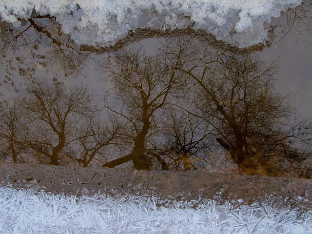
Reflection in Range Creek
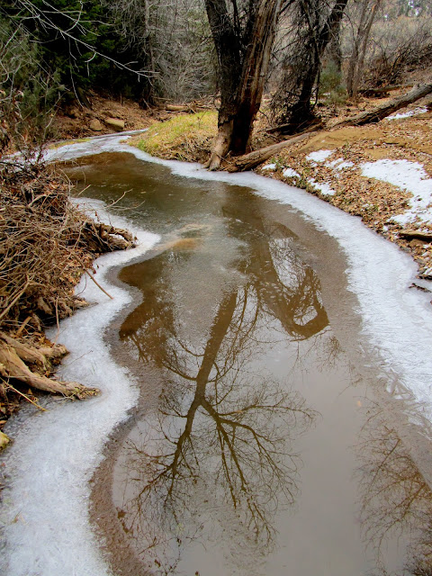
Range Creek
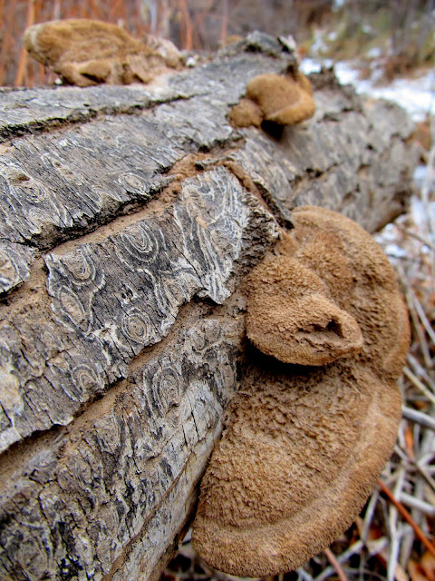
Fungus on a fallen tree
Bushwhacking through six-foot-tall sagebrush
Old cowboy fireplace
Ore cars
Cougar tracks (with Alan's footprint for scale)
Granary way high up in some cliffs
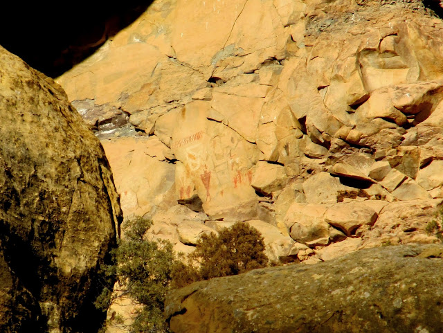
Pictograph above some granaries
Metal tag on a timber in a granary
Granary
Granary
We lunched at Barton Canyon and visited some petroglyphs there. I walked across the road to relieve myself and Alan told me to go pee by a nearby pine tree. I did, and found that around the tree was a ring of rocks that was almost certainly a pit house at one time. After a short hike up the road we went to the Fat Man petroglyph panel, following Randy's and Kelly's footprints. There were two granaries above the rock art, one of which had a petroglyph next to it that I didn't even notice until I got home and looked at my photos.
Frosted trees
Road-walking near Barton Canyon
Barton Canyon
Granary
High petroglyphs
Petroglyphs
Climbing up to some petroglyphs
Granary and a petroglyph
Granary
Fat Man petroglyphs
Sheep near Fat Man
Petroglyphs
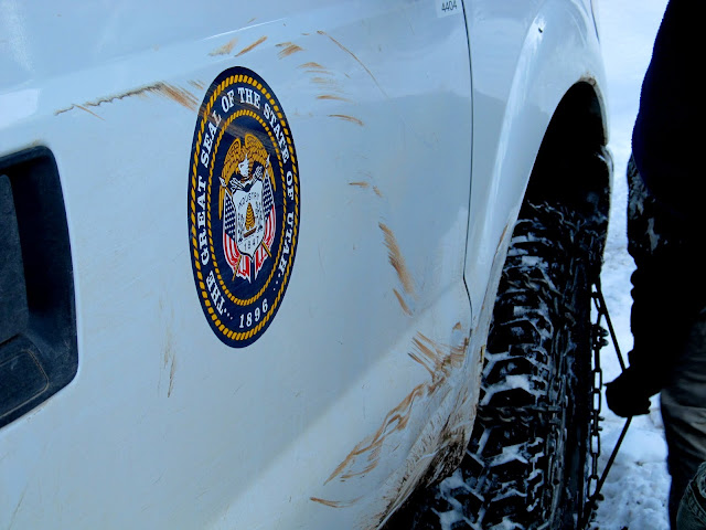
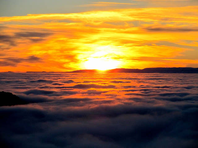
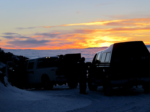
We walked up the road some more without any further stops planned, and Mike came along and offered us another ride at almost the same place he'd picked us up earlier in the day. He dropped us off at Alan's truck and it seemed that the trip was over. However, there were still some experiences to come. Mike stopped just before the road steepened as it climbed up Little Horse Canyon toward the pass to put chains on his rear tires. He was hauling an ATV out of the archaeology field camp and decided to only chain up the rears since there was extra weight there. We were stopped behind him and Alan decided to chain up his rear tires as well since he'd done a little slipping and sliding during the drive in. Mike got started up the canyon before we did, and we caught up to him again a short distance before the pass right after he'd had a close call, sliding off the road and almost rolling down a hill that could easily have killed him. He was already chaining up his front tires when we arrived, so Alan and I helped him with that and shoveled some snow off the road to give him an easier start up the hill. He made it to the pass with no more problems and we stopped there to witness an amazing sunset.
Granary
Pictographs
Hitchin' another ride
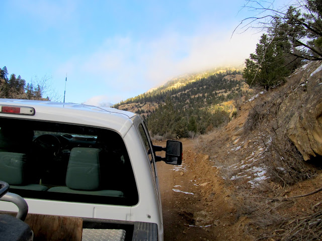
Climbing up Little Horse Canyon out of Range Creek
Here the ranger slid off the road and almost rolled down the mountain
Damage to the ranger's truck
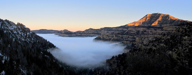
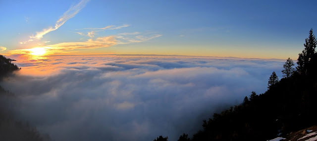
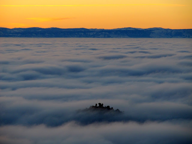
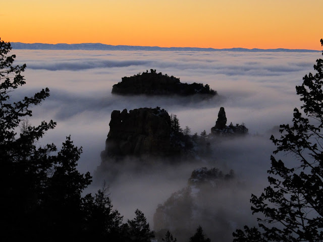
The entire Castle Valley was filled with fog as the sun sunk behind the horizon. From the eastern Book Cliffs to the Wasatch Plateau, and from the northern Book Cliffs south as far as we could see was a solid lake of fog, with a couple of puffs poking above the fog caused by steam and smoke from power plants. The fog receded a little as the sun went down and the sky lit up, revealing some mountaintop islands. I walked a short distance east along the top of the pass and saw that the fog had been creeping up Little Horse Canyon as the mountain shadows advanced. It was just one awesome experience to top off a day of awesome experiences.
Sunset above the clouds
Hunter power plant way across the valley
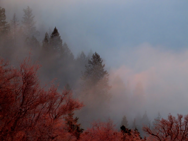
Trees and fog
Sunset over the clouds
An island in the clouds
Fog creeping up Little Horse Canyon after sunset
Horse Canyon Pass
Ridges in the fog
Full photo gallery:
https://picasaweb.google.com/Dennis.Udink/RangeCreek
Featured image for home page:

Chaining up in Horse Canyon
Patmos Head through the fog at sunrise
Foggy Horse Canyon and sunny Patmos Head
View over the fog-filled Castle Valley
Though our destination was relatively close to Price, the steep, winding, snow-covered road took quite some time to negotiate and we didn't start hiking until almost 8:30. We crossed Range Creek on some logs then visited a petroglyph site very close to the entrance gate. Although it was sunny when we started hiking, as we descended the canyon we entered more fog and it stuck with us most of the day. We visited another petroglyph site, then some pictographs with the remains of a granary above it. We saw bear footprints in the snow, though I'd been hoping the bears would be hibernating this late in the year. We neared Locomotive Rock and climbed up to some pictographs. Actually, Alan climbed up while I waited below a sketchy climb that I didn't dare make. I got a few photos from far below while he got close-ups. We later learned the correct way to climb up to the pictographs but I'll have to try that route on a later trip.
Range Creek trailhead
Fallen tree that I used to cross the creek
Approaching the rock art site nearest the trailhead
Petroglyphs
Human figure with large hands
Fog down the canyon
Just below the fog while climbing up to some petroglyphs
Sheep petroglyphs
Red and yellow pictographs
Remains of a granary
Alan on a ledge
Bear track in the snow
Locomotive Rock
Granary hidden high in some cliffs
Climbing up to some pictographs
Looking for a way up the cliffs
TV pictograph
Granary
When we descended from the pictographs and started walking farther down the road, we noticed two people walking down the road toward us. Alan had spoken to the ranger a couple of days earlier and heard about someone from Grand Junction with a Jeep who also had a permit for the same day. I only know a couple of people in Grand Junction and only one of them drives a Jeep. I mentioned this to Alan and we weren't surprised at all to see Randy and Kelly approaching us. Alan and I walked up the road to greet them and, as we were chatting, the ranger, Mike, pulled up in his truck. Mike offered to give us all a ride farther down the canyon to our next destinations, so we gratefully accepted the ride and hopped in the back of the truck. Randy and Kelly got out near the Fat Man petroglyph, while Alan and I went further to Nelson Canyon. There was a large concentration of petroglyphs at Nelson Canyon and we spent a lot of time checking them out.
Hitching a ride in the back of the ranger's truck
Granary
Petroglyphs covering the sandstone
Petroglyphs
Spiral and sheep petroglyphs
Petroglyphs
Mike had told Alan and me a little about the Upside-Down Man pictograph, and we thought we might be able to find it based on his description. We got to a good starting point and split up, with Alan going upstream and me going downstream, agreeing to holler if either of us found it. I started seeing some minor petroglyphs and eventually ran into Upside-Down Man. I whistled loudly to Alan only to hear him approaching through the brush a short distance away.
Frost-covered trees
Budge's Arch
Centipede petroglyph
Snake petroglyphs
Upside-Down Man
Upside-Down Man
White pictographs near Upside-Down Man
Petroglyph and handprint near Upside-Down Man
We crossed the creek again and did some bushwhacking through some tall sagebrush instead of following the road. We saw an old (though historically recent) cowboy fireplace, some petroglyphs, a ruined granary, some rusty ore cars, and cougar tracks in the snow as we approached Alan's main destination--a large pictograph and a few granaries. We'd initially planned on hiking down the canyon as far as these granaries but catching a ride from Mike allowed us to go yet farther down the canyon and work our way back up to them. The granaries and pictograph were alone worth the trip into Range Creek, but they were rather anti-climactic considering all that we'd already seen. I suppose that's a roundabout way of stating just how amazing Range Creek is. The canyon is so rich with ancient sites that they cease to amaze after you've already seen a dozen or more.
Reflection in Range Creek
Range Creek
Fungus on a fallen tree
Bushwhacking through six-foot-tall sagebrush
Old cowboy fireplace
Ore cars
Cougar tracks (with Alan's footprint for scale)
Granary way high up in some cliffs
Pictograph above some granaries
Metal tag on a timber in a granary
Granary
Granary
We lunched at Barton Canyon and visited some petroglyphs there. I walked across the road to relieve myself and Alan told me to go pee by a nearby pine tree. I did, and found that around the tree was a ring of rocks that was almost certainly a pit house at one time. After a short hike up the road we went to the Fat Man petroglyph panel, following Randy's and Kelly's footprints. There were two granaries above the rock art, one of which had a petroglyph next to it that I didn't even notice until I got home and looked at my photos.
Frosted trees
Road-walking near Barton Canyon
Barton Canyon
Granary
High petroglyphs
Petroglyphs
Climbing up to some petroglyphs
Granary and a petroglyph
Granary
Fat Man petroglyphs
Sheep near Fat Man
Petroglyphs
We walked up the road some more without any further stops planned, and Mike came along and offered us another ride at almost the same place he'd picked us up earlier in the day. He dropped us off at Alan's truck and it seemed that the trip was over. However, there were still some experiences to come. Mike stopped just before the road steepened as it climbed up Little Horse Canyon toward the pass to put chains on his rear tires. He was hauling an ATV out of the archaeology field camp and decided to only chain up the rears since there was extra weight there. We were stopped behind him and Alan decided to chain up his rear tires as well since he'd done a little slipping and sliding during the drive in. Mike got started up the canyon before we did, and we caught up to him again a short distance before the pass right after he'd had a close call, sliding off the road and almost rolling down a hill that could easily have killed him. He was already chaining up his front tires when we arrived, so Alan and I helped him with that and shoveled some snow off the road to give him an easier start up the hill. He made it to the pass with no more problems and we stopped there to witness an amazing sunset.
Granary
Pictographs
Hitchin' another ride
Climbing up Little Horse Canyon out of Range Creek
Here the ranger slid off the road and almost rolled down the mountain
Damage to the ranger's truck
The entire Castle Valley was filled with fog as the sun sunk behind the horizon. From the eastern Book Cliffs to the Wasatch Plateau, and from the northern Book Cliffs south as far as we could see was a solid lake of fog, with a couple of puffs poking above the fog caused by steam and smoke from power plants. The fog receded a little as the sun went down and the sky lit up, revealing some mountaintop islands. I walked a short distance east along the top of the pass and saw that the fog had been creeping up Little Horse Canyon as the mountain shadows advanced. It was just one awesome experience to top off a day of awesome experiences.
Sunset above the clouds
Hunter power plant way across the valley
Trees and fog
Sunset over the clouds
An island in the clouds
Fog creeping up Little Horse Canyon after sunset
Horse Canyon Pass
Ridges in the fog
Full photo gallery:
https://picasaweb.google.com/Dennis.Udink/RangeCreek
Featured image for home page:
")