- Joined
- Dec 23, 2013
- Messages
- 4,327
This report covers a backpacking trip of 71 miles (includes day hikes) completed by a group of six that begins and ends at the Beula Lake Trailhead located on the Grassy Lake Road in the Caribou – Targee National Forest. The loop begins by hiking up to Beula Lake, then off-trail up the Pitchstone Plateau and across the plateau before dropping down into the Ferris Fork drainage. We then proceed up Gregg Fork before backtracking and heading down the Bechler River and eventually to Bechler Meadows. After leaving the meadows, we circle around the plateau to Mountain Ash Creek and on to Union Falls before completing the loop along the South Boundary Trail. Along the way there will be day hikes to Phantom Fumarole, Douglas Knob and Dunanda Falls
Day 1 – Beula Lake Trailhead to campsite 8A1 on Beula Lake (3 miles)
The first half mile up the Beula Lake Trail is rather steep to the Park boundary, but with fresh legs you will hardly notice. Once at the boundary, there is an intersection with the South Boundary Trail, the trail on which we will complete our loop. I look down the trail to the west to see what it will be like on day eight when we are almost out.
The trail from the junction to Beula Lake is interesting in only one regard and that is that the north side of the trail is burned while to the south of it, it has not. The trail must have been the containment line. We cover the three miles to the lake in about an hour and fifteen minutes. Once at the lake, we set up camp and I go for a hike down to Hering Lake which is located south of Beula Lake. The mosquitoes were intense at the lake and soon drove me back to camp where they were a little more manageable. Back at camp, we build a campfire and eat dinner. One from our party purchased a fishing license and is having quite a bit of success on Beula Lake. After refilling my water bottles, I retire for the evening and rest up for tomorrow’s off-trail hike.
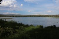
Beula Lake
Day 2 – campsite 8A1 on Beula Lake to campsite 8P2 on the Pitchstone Plateau (off-trail - 8 miles)
We wake up to dark clouds but it is not yet raining. We eat breakfast and head out early, anticipating a long day ahead of us. We hike north along the lake to its outlet, which is actually the beginning of Falls River. There is more water coming out of Beula Lake than I thought there would be, which will make this a tougher ford. We all take off our boots and put sandals on and cross over to the north side of the river. After putting our boots back on, we continue down Falls River until we reach the first major tributary flowing in from the north. Along this stretch of the River, we get to see Bradley Falls. Also around this time, it begins to rain. This would be the start of three days of sometimes heavy, nearly continuous rainfall.
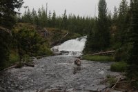
Bradley Falls
We turn north along the tributary and begin follow it. The tributary soon takes a more northeastern path which we will hike along up onto the Pitchstone Plateau. At first we are travelling through a burn area but soon we leave it behind. Even though we are out of the burn, we still have to step over downfall quite frequently. Soon, we begin hiking through a large marshy area as we work our way northeast. There is water everywhere and the rain is relentless. The drainage is beginning to close in a bit as we move on and there are many narrow waterfalls that are cascading down the side of the plateau. We pass at least six of them as we move on up the drainage. I find them quite beautiful.
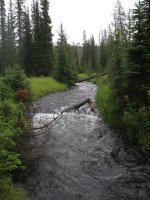
Drainage we are following up onto the Pitchstone Plateau
After taking a quick break, we start climbing up the ridge above the drainage, essentially starting to climb the plateau. The going is easier even though it is a steep climb. About two thirds of the way up the plateau, we will take a right and begin following a dry drainage that will lead us to an elongated meadow that we will follow into camp. Once on top, we find the meadow and eventually arrive at campsite 8P2 where we will stay for two nights.
Day 3 – Day hike to Phantom Fumarole (2 miles)
Today would be an easy day. Our only agenda is to hike to Phantom Fumarole which is located just a touch over a mile down the Pitchstone Plateau Trail. Phantom Fumarole is a thermal area of mud pots on the Pitchstone.
We wake up to fog but it eventually burns off. We plan on eating lunch at the thermal area so we do not leave until around 11:00 am. Before we leave, a ranger with a work crew shows up and asks to see our permit. He confirms our permit and tells us that they will be constructing a new bear pole and moving the campsite for our neighboring campsite 8P1.
We arrive at the fumarole around noon and take some time to explore the area. Besides the thermal features themselves, there are areas of ground covered in moss that I particularly like. We circle our way around the thermals and chose a spot to eat. As soon as we breakout the food it begins to rain. We try to weather the storm but eventually we decide to return to camp.
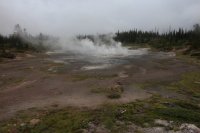
Phantom Fumarole
Just before reaching camp, the rain stops. I detour over to 8P1 to watch the construction of the bear pole. The work crew was kind enough to let me watch them. Quite the operation they have going. They use a couple of straps with loops in the end that they step into. They work these straps slowly up the support trees in order to rig up a pulley system that they use to pull the bear pole up to fifteen feet. Once they finish on one side then they do the same on the other support tree. When all is said and done, they attach the pole with a length of chain to the support trees using large bolts that they ratchet into the support trees. This operation took most of the day to accomplish and they hiked back to the trailhead around 5:00 pm. I returned to 8P2, ate dinner, enjoyed the campfire for a bit and then retired for the night to rest up for the long day tomorrow.
Day 4 - campsite 8P2 to campsite 9D2 (off-trail across the Pitchstone Plateau, then follow Ferris Fork to the Bechler River and on to camp on Gregg Fork – 15 miles)
This is the day that everyone was excited for or perhaps dreaded. We wake up to another foggy morning. We eat breakfast and pack up camp quickly anticipating a long hike today. We immediately have to climb 180 feet up a small ridge north of 8P2 to gain access to what is essentially the top of the plateau. Once on top, we begin to hike through meadows and occasional lines of trees. At this point, due to the fog, it is hard to make out just how extensive the meadows are, but once the fog begins to burn off it becomes apparent. Of course we aren’t just dealing with the fog but also heavy rain at times. The temperature up top was in the forties with some wind to go along with it. This made for a chilly hike across the plateau.
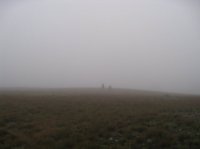
Foggy conditions on day 4
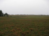
On top of the Pitchstone Plateau
While on top we saw a large bull elk, some wolf tracks and bear scat, along with numerous wildflowers. The drainages on top were all dry, but we did run into patches of snow in places. At 8800 ft., I would have thought all the snow would all have been melted by this time. We took two breaks while crossing the plateau and our route across took us by two ponds located on the north side of the Pitchstone. We also ran into a mysterious trail junction post on the north end. The signs had nothing written on them, yet clearly they were for navigational purposes. It was shear dumb luck that we even saw the junction signs. After checking out the junction, we began to descend a dry drainage that would lead us to the headwaters of Ferris Fork.
We mostly stayed above the drainage, as this made for easier hiking and eventually we arrived at Ferris Fork which at this point was dry. Only a couple hundred feet what began to trickle between the lava rock and we had a creek on our hands. We stopped and ate lunch in the rain, hunkering down in a thick stand of trees to try and keep the rain off of us.
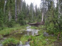
Headwaters of Ferris Fork
After lunch we continued on down Ferris Fork, where it became wider and steeper. Eventually, cascades and waterfalls became the norm. We checked out as many falls as we could along this stretch, sometimes hiking along the creek and sometimes on the ridge above for easier navigating. At some point, we could look out over the lower portion of Ferris Fork and steam rising from thermal features. This was the location of infamous “Mr. Bubbles” and we didn’t have too much further to go.
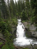
Waterfall on Ferris Fork
After arriving at “Mr.Bubbles”, the sun broke out of the clouds! We had not seen the sun for almost three days. This was a welcome relief after a long wet hike. Morale is high! Needless to say, we took some time to soak in “Mr. Bubbles” and relax. Once finished at “Mr. Bubbles”, we put our packs back on and headed towards camp. We had to hike up a long hill to get to campsite 9D2 and my legs were rubbery after soaking in the hot spring, so it took me awhile to make it up the hill and to camp. At camp, it was a quick meal and to bed. Whew! I’m beat!
Day 5 – day hike to Douglas Knob then on to campsite 9B4 (10.9 miles)
We’re off this morning to find an old trail that leads to the north end of the Pitchstone Plateau. The trail, supposedly, branches off from the Bechler River Trail at the edge of a meadow located about seven tenths of a mile south of Douglas Knob. We hike up to the knob just to see it and start hunting for the trail on the way back.
We find the intersection of the trail with the Bechler River Trail and are able to follow it to Gregg Fork. Once at the creek, we lose it and cannot pick it back up again. One of my backpacking partners has approximate GPS points of where it might be. But these do not help to locate the old trail beyond the creek. I’m wondering if this trail has something to do with the junction marker we saw up top. Well, after giving up on the trail hunting, we return to camp, pack up, and then head down Bechler Canyon to 9B4 which is located at the mouth of the canyon.
Now the walk down the Bechler is special! You have cascades, large waterfalls to observe and a couple of big fords of the Bechler, along with the continuous sound of rushing water to relax you as you hike. I’d hiked up the Bechler to Old Faithful back in 2005 (can’t believe it’s been almost ten years ago) and it was just as wonderful a hike the second time. This stretch of trail is highly recommended. We see two marmots and a pika along this stretch of trail. We arrive at camp around 8:30 at night, eat dinner around 9:00 and then hit the sack.
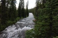
Cascades on the Bechler River
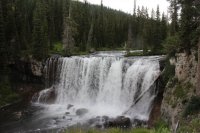
Iris Falls
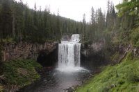
Colonnade Falls
Day 6 – campsite 9B4 to campsite 9B2 then a day hike to Dunanda Falls (10 miles)
I had originally requested campsite 9B4 for two nights but that could not be arranged so we had to pack up and move 1.4 miles down the trail to campsite 9B2 located on the edge of Bechler Meadows. After arriving at 9B2 and quickly wetting up camp, we head off for Dunanda Falls which is located on Boundary Creek to the northwest of our camp. We immediately have to fords the Bechler River again and this time it is a deep ford (over my waist for a bit) though the current is fairly slow. After crossing, we proceed up the Bechler Meadows Cutoff Trail until it meets up with the Boundary Creek Trail. Once at Boundary Creek, we follow the creek to Dunanda Falls. We also take in Silver Scarf Falls on the way.
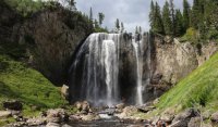
Dunanda Falls are gorgeous. We hike down a rather steep trail to the base of the falls to take it all in. At the bottom there are some thermal pools that are rocked off from the creek that people are relaxing in. I assume these equate to mini “Mr. Bubbles”, but I did not test them out to see how warm they actually were. These little hot tubs are located on both sides of the creek below the falls. After eating a few snacks by the creek a thunderstorm rolls over and it begins to rain.
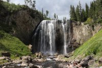
Dunanda Falls
We hike back up the gorge and start heading back to camp. The mosquitoes were bad the entire trip but on this stretch they were the worst. I don’t know if it was the sudden rain or what, but they were horrible. When we arrived at camp they had died down quite a bit.
Day 7 – campsite 9B2 to campsite 9U4 plus day hike to Union Falls and Ouzel Pool (14.3 miles)
The weather remains good all day today which is good because it will be a long day though nothing difficult terrain wise. The highlight of the hike to 9U4 is crossing Mountain Ash Creek on a large log that is slightly tilted on its west end. It takes me a few minutes to get across. My balance isn’t what it used to be! We arrive at camp around three in the afternoon and then head up to Union Falls which is almost two miles further up the trail.
Once again, Union Falls is another impressive fall in this neck of the woods. I take a few pictures then head down the trail to go see Ouzel Pool. Ouzel Pool is essentially a swimming hole located at the base of a small fall located on a tributary of Mountain Ash Creek. The water coming off the fall is lukewarm which makes it a quite enjoyable swim. As you approach the fall from in the pool, the water rapidly becomes over your head. There is also quite a bit of current that wants to push you downstream. After the pool, we return to camp and eat and then I walked over to the Union Falls Patrol Cabin to ask the rangers some questions about the backcountry. They are more than helpful, and both seem to know quite a bit about off-trail travel in this corner of the Park. As darkness sets in, I return to camp and call it a night.
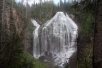
Union Falls
Day 8 – campsite 9U4 to the Beula Lake Trailhead (8.2 miles)
Not much to report on the last day. We had a steep climb up out of Proposition Creek on the Old Marysville Road that took me some time to complete. The highlight again would have to be fording the Falls River near the southern park boundary. Once we forded the river, we soon arrived at the Grassy Lake spillway and from there we took the South Boundary Trail back to the Beula Lake Trail to complete our loop and then we hiked the last .5 mile back to our vehicle.
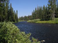
Falls River at the ford
Thoughts: Another enjoyable trip. Of course I would have liked to take the rain out of days 2, 3 and 4, and I could have done without the mosquitoes, and perhaps a touch more wildlife would have been nice, but all in all it was a good trip. If you really enjoy waterfalls then this route might be for you.
For those who want to see all the images from our trip here is the link.
Pitchstone/Bechler/Union Falls loop Images
And of course we saw a grizzly bear on the way out just south of Flagg Ranch along the road.
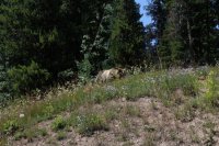

Featured image for home page:
Day 1 – Beula Lake Trailhead to campsite 8A1 on Beula Lake (3 miles)
The first half mile up the Beula Lake Trail is rather steep to the Park boundary, but with fresh legs you will hardly notice. Once at the boundary, there is an intersection with the South Boundary Trail, the trail on which we will complete our loop. I look down the trail to the west to see what it will be like on day eight when we are almost out.
The trail from the junction to Beula Lake is interesting in only one regard and that is that the north side of the trail is burned while to the south of it, it has not. The trail must have been the containment line. We cover the three miles to the lake in about an hour and fifteen minutes. Once at the lake, we set up camp and I go for a hike down to Hering Lake which is located south of Beula Lake. The mosquitoes were intense at the lake and soon drove me back to camp where they were a little more manageable. Back at camp, we build a campfire and eat dinner. One from our party purchased a fishing license and is having quite a bit of success on Beula Lake. After refilling my water bottles, I retire for the evening and rest up for tomorrow’s off-trail hike.

Beula Lake
Day 2 – campsite 8A1 on Beula Lake to campsite 8P2 on the Pitchstone Plateau (off-trail - 8 miles)
We wake up to dark clouds but it is not yet raining. We eat breakfast and head out early, anticipating a long day ahead of us. We hike north along the lake to its outlet, which is actually the beginning of Falls River. There is more water coming out of Beula Lake than I thought there would be, which will make this a tougher ford. We all take off our boots and put sandals on and cross over to the north side of the river. After putting our boots back on, we continue down Falls River until we reach the first major tributary flowing in from the north. Along this stretch of the River, we get to see Bradley Falls. Also around this time, it begins to rain. This would be the start of three days of sometimes heavy, nearly continuous rainfall.

Bradley Falls
We turn north along the tributary and begin follow it. The tributary soon takes a more northeastern path which we will hike along up onto the Pitchstone Plateau. At first we are travelling through a burn area but soon we leave it behind. Even though we are out of the burn, we still have to step over downfall quite frequently. Soon, we begin hiking through a large marshy area as we work our way northeast. There is water everywhere and the rain is relentless. The drainage is beginning to close in a bit as we move on and there are many narrow waterfalls that are cascading down the side of the plateau. We pass at least six of them as we move on up the drainage. I find them quite beautiful.

Drainage we are following up onto the Pitchstone Plateau
After taking a quick break, we start climbing up the ridge above the drainage, essentially starting to climb the plateau. The going is easier even though it is a steep climb. About two thirds of the way up the plateau, we will take a right and begin following a dry drainage that will lead us to an elongated meadow that we will follow into camp. Once on top, we find the meadow and eventually arrive at campsite 8P2 where we will stay for two nights.
Day 3 – Day hike to Phantom Fumarole (2 miles)
Today would be an easy day. Our only agenda is to hike to Phantom Fumarole which is located just a touch over a mile down the Pitchstone Plateau Trail. Phantom Fumarole is a thermal area of mud pots on the Pitchstone.
We wake up to fog but it eventually burns off. We plan on eating lunch at the thermal area so we do not leave until around 11:00 am. Before we leave, a ranger with a work crew shows up and asks to see our permit. He confirms our permit and tells us that they will be constructing a new bear pole and moving the campsite for our neighboring campsite 8P1.
We arrive at the fumarole around noon and take some time to explore the area. Besides the thermal features themselves, there are areas of ground covered in moss that I particularly like. We circle our way around the thermals and chose a spot to eat. As soon as we breakout the food it begins to rain. We try to weather the storm but eventually we decide to return to camp.

Phantom Fumarole
Just before reaching camp, the rain stops. I detour over to 8P1 to watch the construction of the bear pole. The work crew was kind enough to let me watch them. Quite the operation they have going. They use a couple of straps with loops in the end that they step into. They work these straps slowly up the support trees in order to rig up a pulley system that they use to pull the bear pole up to fifteen feet. Once they finish on one side then they do the same on the other support tree. When all is said and done, they attach the pole with a length of chain to the support trees using large bolts that they ratchet into the support trees. This operation took most of the day to accomplish and they hiked back to the trailhead around 5:00 pm. I returned to 8P2, ate dinner, enjoyed the campfire for a bit and then retired for the night to rest up for the long day tomorrow.
Day 4 - campsite 8P2 to campsite 9D2 (off-trail across the Pitchstone Plateau, then follow Ferris Fork to the Bechler River and on to camp on Gregg Fork – 15 miles)
This is the day that everyone was excited for or perhaps dreaded. We wake up to another foggy morning. We eat breakfast and pack up camp quickly anticipating a long hike today. We immediately have to climb 180 feet up a small ridge north of 8P2 to gain access to what is essentially the top of the plateau. Once on top, we begin to hike through meadows and occasional lines of trees. At this point, due to the fog, it is hard to make out just how extensive the meadows are, but once the fog begins to burn off it becomes apparent. Of course we aren’t just dealing with the fog but also heavy rain at times. The temperature up top was in the forties with some wind to go along with it. This made for a chilly hike across the plateau.

Foggy conditions on day 4

On top of the Pitchstone Plateau
While on top we saw a large bull elk, some wolf tracks and bear scat, along with numerous wildflowers. The drainages on top were all dry, but we did run into patches of snow in places. At 8800 ft., I would have thought all the snow would all have been melted by this time. We took two breaks while crossing the plateau and our route across took us by two ponds located on the north side of the Pitchstone. We also ran into a mysterious trail junction post on the north end. The signs had nothing written on them, yet clearly they were for navigational purposes. It was shear dumb luck that we even saw the junction signs. After checking out the junction, we began to descend a dry drainage that would lead us to the headwaters of Ferris Fork.
We mostly stayed above the drainage, as this made for easier hiking and eventually we arrived at Ferris Fork which at this point was dry. Only a couple hundred feet what began to trickle between the lava rock and we had a creek on our hands. We stopped and ate lunch in the rain, hunkering down in a thick stand of trees to try and keep the rain off of us.

Headwaters of Ferris Fork
After lunch we continued on down Ferris Fork, where it became wider and steeper. Eventually, cascades and waterfalls became the norm. We checked out as many falls as we could along this stretch, sometimes hiking along the creek and sometimes on the ridge above for easier navigating. At some point, we could look out over the lower portion of Ferris Fork and steam rising from thermal features. This was the location of infamous “Mr. Bubbles” and we didn’t have too much further to go.

Waterfall on Ferris Fork
After arriving at “Mr.Bubbles”, the sun broke out of the clouds! We had not seen the sun for almost three days. This was a welcome relief after a long wet hike. Morale is high! Needless to say, we took some time to soak in “Mr. Bubbles” and relax. Once finished at “Mr. Bubbles”, we put our packs back on and headed towards camp. We had to hike up a long hill to get to campsite 9D2 and my legs were rubbery after soaking in the hot spring, so it took me awhile to make it up the hill and to camp. At camp, it was a quick meal and to bed. Whew! I’m beat!
Day 5 – day hike to Douglas Knob then on to campsite 9B4 (10.9 miles)
We’re off this morning to find an old trail that leads to the north end of the Pitchstone Plateau. The trail, supposedly, branches off from the Bechler River Trail at the edge of a meadow located about seven tenths of a mile south of Douglas Knob. We hike up to the knob just to see it and start hunting for the trail on the way back.
We find the intersection of the trail with the Bechler River Trail and are able to follow it to Gregg Fork. Once at the creek, we lose it and cannot pick it back up again. One of my backpacking partners has approximate GPS points of where it might be. But these do not help to locate the old trail beyond the creek. I’m wondering if this trail has something to do with the junction marker we saw up top. Well, after giving up on the trail hunting, we return to camp, pack up, and then head down Bechler Canyon to 9B4 which is located at the mouth of the canyon.
Now the walk down the Bechler is special! You have cascades, large waterfalls to observe and a couple of big fords of the Bechler, along with the continuous sound of rushing water to relax you as you hike. I’d hiked up the Bechler to Old Faithful back in 2005 (can’t believe it’s been almost ten years ago) and it was just as wonderful a hike the second time. This stretch of trail is highly recommended. We see two marmots and a pika along this stretch of trail. We arrive at camp around 8:30 at night, eat dinner around 9:00 and then hit the sack.

Cascades on the Bechler River

Iris Falls

Colonnade Falls
Day 6 – campsite 9B4 to campsite 9B2 then a day hike to Dunanda Falls (10 miles)
I had originally requested campsite 9B4 for two nights but that could not be arranged so we had to pack up and move 1.4 miles down the trail to campsite 9B2 located on the edge of Bechler Meadows. After arriving at 9B2 and quickly wetting up camp, we head off for Dunanda Falls which is located on Boundary Creek to the northwest of our camp. We immediately have to fords the Bechler River again and this time it is a deep ford (over my waist for a bit) though the current is fairly slow. After crossing, we proceed up the Bechler Meadows Cutoff Trail until it meets up with the Boundary Creek Trail. Once at Boundary Creek, we follow the creek to Dunanda Falls. We also take in Silver Scarf Falls on the way.
Dunanda Falls are gorgeous. We hike down a rather steep trail to the base of the falls to take it all in. At the bottom there are some thermal pools that are rocked off from the creek that people are relaxing in. I assume these equate to mini “Mr. Bubbles”, but I did not test them out to see how warm they actually were. These little hot tubs are located on both sides of the creek below the falls. After eating a few snacks by the creek a thunderstorm rolls over and it begins to rain.

Dunanda Falls
We hike back up the gorge and start heading back to camp. The mosquitoes were bad the entire trip but on this stretch they were the worst. I don’t know if it was the sudden rain or what, but they were horrible. When we arrived at camp they had died down quite a bit.
Day 7 – campsite 9B2 to campsite 9U4 plus day hike to Union Falls and Ouzel Pool (14.3 miles)
The weather remains good all day today which is good because it will be a long day though nothing difficult terrain wise. The highlight of the hike to 9U4 is crossing Mountain Ash Creek on a large log that is slightly tilted on its west end. It takes me a few minutes to get across. My balance isn’t what it used to be! We arrive at camp around three in the afternoon and then head up to Union Falls which is almost two miles further up the trail.
Once again, Union Falls is another impressive fall in this neck of the woods. I take a few pictures then head down the trail to go see Ouzel Pool. Ouzel Pool is essentially a swimming hole located at the base of a small fall located on a tributary of Mountain Ash Creek. The water coming off the fall is lukewarm which makes it a quite enjoyable swim. As you approach the fall from in the pool, the water rapidly becomes over your head. There is also quite a bit of current that wants to push you downstream. After the pool, we return to camp and eat and then I walked over to the Union Falls Patrol Cabin to ask the rangers some questions about the backcountry. They are more than helpful, and both seem to know quite a bit about off-trail travel in this corner of the Park. As darkness sets in, I return to camp and call it a night.

Union Falls
Day 8 – campsite 9U4 to the Beula Lake Trailhead (8.2 miles)
Not much to report on the last day. We had a steep climb up out of Proposition Creek on the Old Marysville Road that took me some time to complete. The highlight again would have to be fording the Falls River near the southern park boundary. Once we forded the river, we soon arrived at the Grassy Lake spillway and from there we took the South Boundary Trail back to the Beula Lake Trail to complete our loop and then we hiked the last .5 mile back to our vehicle.

Falls River at the ford
Thoughts: Another enjoyable trip. Of course I would have liked to take the rain out of days 2, 3 and 4, and I could have done without the mosquitoes, and perhaps a touch more wildlife would have been nice, but all in all it was a good trip. If you really enjoy waterfalls then this route might be for you.
For those who want to see all the images from our trip here is the link.
Pitchstone/Bechler/Union Falls loop Images
And of course we saw a grizzly bear on the way out just south of Flagg Ranch along the road.


Featured image for home page:

Last edited by a moderator:
