Pine Creek/Granite Park fall excursion (High Sierra)

fossana

Member
Joined
Jan 11, 2018
Messages
855
Since I was in Bishop on Sunday for a friend's bday party I took Monday off to take my fur niece, Pika, on a hike. I hadn't been up to Granite Park in a few years, so I took advantage of the cooler fall temps and foliage for a reunion.

Route (out/back)
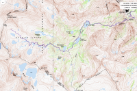
 map.png

Logistics
Start/end: Pine Creek trailhead
Mileage: ~17 miles
Elevation gain: ~4500'
Navigation: paper map is fine; junctions signed
Filterable water: many creeks and lakes
Backcountry permits (overnight trips): White Mt Ranger Station in Bishop
Bathrooms: outhouses at the Pine Creek climbing area before the trailhead
Dogs: allowed
Nearest town/gas: Bishop, CA

Report
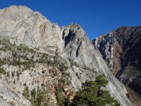
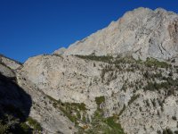
I left the trailhead ~7:45am while the long Pine Creek switchbacks were in the shade. The trail heads up an old tungsten mining road before entering wilderness. There are still remnants of the old cable tramway system, old shafts and mining buildings.

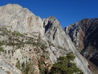
The surrounding cliffs were bathed in morning light, which helped to distract from the slog up the old road.
sDSC07601.JPG

sDSC07603.JPG

The first of many lakes is Pine Lake and it's the only place I encountered people in the wilderness zone.
sDSC07650.JPG

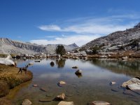
I was surprised at the amount of water remaining into September and the plentiful trout. At 6.5 miles the trail splits and I took the path around Honeymoon Lake toward Granite Park.
sDSC07695.JPG

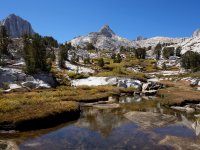
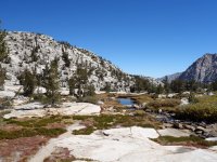
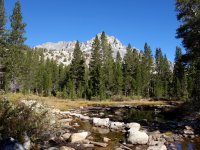
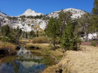
The craggy granite peaks and domes perfectly framed the fall and evergreen foliage.
sDSC07716.JPG

sDSC07749.JPG

sDSC07763.JPG

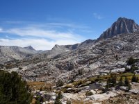
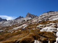
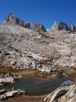
Above Honeymoon Lake the trees begin to diminish as you enter Granite Park. I always forget just how incredible the landscape is in this area.
sDSC07792.JPG

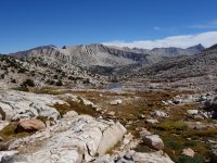
About a mile from Italy Pass I decided to head back.
sDSC07826.JPG

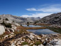
The views were just as spectacular on the return as they were on the way up.
sDSC07847.JPG

sDSC07872.JPG

sDSC07903.JPG

As always Pika proved to be an optimal trail companion and photo model.
sDSC07908.JPG

Back at Pine Lake I heard but did not see a small group of people.
sDSC07952.JPG

Finally I started the long switchback descent to the parking lot, then to Mt Rambler for dinner with friends. After several decades of exploration I have yet to tire of the Sierra.
sDSC07965.JPG
 

Attachments

  • sDSC07601.JPG
    sDSC07601.JPG
    901.4 KB · Views: 50
  • sDSC07670.JPG
    sDSC07670.JPG
    954.7 KB · Views: 52
  • sDSC07810.JPG
    sDSC07810.JPG
    815.9 KB · Views: 67
Beautiful photos, thanks for sharing! That's a gorgeous place with great water reflections.

Are you running or hiking/walking this? You are doing some very impressive milage and elevation gains on your hikes .
I saw a previous hike with 24 miles, which is almost a Marathon, not so long ago ;) WELL DONE!
 
Thank you. These are hikes. I haven't been able to run for a few years due to a disc injury. I enjoy high mileage days (up to ~40 miles), so I can be lazy and not carry bivy gear.
 
Thank you. These are hikes. I haven't been able to run for a few years due to a disc injury. I enjoy high mileage days (up to ~40 miles), so I can be lazy and not carry bivy gear.

That's really excellent- good for you! You are clearly in superb shape.
Just today I saw a trip report from Booth Lake, CO. I injured my back on a hike to Booth Lake in 2012 and had L4 slip forward over L5, which brings the whole spine forward and pinched the sciatica nerve, so I could neither walk or stand for months. Steep descends aggrevate that back injury and could even worsen it, so that's all out of the question for me now a days.... It's fantastic you can still do that! Thanks for sharing.
 
I wouldn't call it superb for me, but I do ok.

Yikes, hope you can get your pain in check and still enjoy the outdoors. I got run over by a 1.5 ton boulder a few years ago while stepping off of a glacier and it aggravated an old (and previously asymptomatic) motorcycle injury. Now I get sciatica if I try to run, but it's mostly ok otherwise.

Ouch....! Back injuries and pinched nerves are a pain in the rear, but I can keep it in check (usually) when we hike. Good luck!
 
Since I was in Bishop on Sunday for a friend's bday party I took Monday off to take my fur niece, Pika, on a hike. I hadn't been up to Granite Park in a few years, so I took advantage of the cooler fall temps and foliage for a reunion.

Route (out/back)
View attachment 69824

Logistics
Start/end: Pine Creek trailhead
Mileage: ~17 miles
Elevation gain: ~4500'
Navigation: paper map is fine; junctions signed
Filterable water: many creeks and lakes
Backcountry permits (overnight trips): White Mt Ranger Station in Bishop
Bathrooms: outhouses at the Pine Creek climbing area before the trailhead
Dogs: allowed
Nearest town/gas: Bishop, CA

Report
I left the trailhead ~7:45am while the long Pine Creek switchbacks were in the shade. The trail heads up an old tungsten mining road before entering wilderness. There are still remnants of the old cable tramway system, old shafts and mining buildings.

The surrounding cliffs were bathed in morning light, which helped to distract from the slog up the old road.
View attachment 69826

View attachment 69828

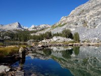
The first of many lakes is Pine Lake and it's the only place I encountered people in the wilderness zone.
View attachment 69825

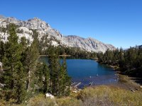
I was surprised at the amount of water remaining into September and the plentiful trout. At 6.5 miles the trail splits and I took the path around Honeymoon Lake toward Granite Park.
View attachment 69830

The craggy granite peaks and domes perfectly framed the fall and evergreen foliage.
View attachment 69831

View attachment 69832

View attachment 69833

Above Honeymoon Lake the trees begin to diminish as you enter Granite Park. I always forget just how incredible the landscape is in this area.
View attachment 69834

About a mile from Italy Pass I decided to head back.
View attachment 69836

The views were just as spectacular on the return as they were on the way up.
View attachment 69837

View attachment 69838

View attachment 69839

As always Pika proved to be an optimal trail companion and photo model.
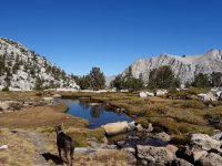
View attachment 69840

Back at Pine Lake I heard but did not see a small group of people.
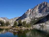
View attachment 69841

Finally I started the long switchback descent to the parking lot, then to Mt Rambler for dinner with friends. After several decades of exploration I have yet to tire of the Sierra.
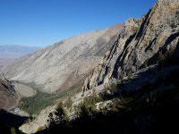
View attachment 69842
Granite! Great TR and photos. Always love to see more of the Range of Light.
 
Thanks, Art. The Sierra is a magical place with some great granite.
 
Every time I see trip reports of the High Sierra I wish I could easily explore the area. Sadly, I live on the other side of the continent so I have to live vicariously through trip reports :)

Hopefully, I can get back there next summer. Until then, thanks for the photos/trip report
 
about half way through i was scared there weren't going to be any pictures of the fur niece. thanks for sharing, gorgeous.
 
Nice day hike! The "Granite Park" moniker seems to be apt. Italy Pass itself looks fairly friendly as far as off-trail passes go. Have you been over?

If that pass goes, then you could make a really interesting lollipop with that route, the SHR, and established trail through French Canyon and over Pine Creek Pass.
 
thanks! I haven't been over Italy Pass, but have checked out the other side of the crest from Julius Caesar and Bear Creek Spire. I'd like to go into Bear Lakes at some point and check out the SHR, or some variation of it.
 
Similar threads
Thread starter Title Forum Replies Date
priz1234 Pine River, Lake Creek, Flint Creek Loop San Juan. 7/3-7/5 Backpacking 6
ram A Christmas Pine Creek/Keyhole Canyoneering 1
Tim Valentine Big Pine Creek Eastern Sierra Backpacking 10
McKee80 TR: Bear Lakes Basin Pine Creek TH 09-05/11-19 Backpacking 14
Laura Pine Creek for newbies? Trip Planning 5
cmgz Pine Valley Mts.-Water Canyon to Mill Creek Backpacking 0
Bill Pine Creek 9.2012 Canyoneering 10
Ross Invite Pine Creek, Misery Canyon or The Subway (Zion area) Meet Up (Members Only) 1
Ross Trip partners for south-west Utah (Pine Creek,Misery,Bull Valley etc) Trip Planning 0
wabenho Big Pine Lakes – John Muir Wilderness Backpacking 6
wsp_scott Ancient Bristlecone Pine Forest Hiking & Camping 1
fossana Browns Point > Summit > Whipple loop (Pine Valley Mountains Wilderness, UT) Hiking & Camping 1
Ugly Wednesday Night's Red Pine Winter Sports 2
danger02ward White Pine Lake Logan Canyon Backpacking 2
Red Rock Rangers Backpacking Pine Valley Mountains Backpacking 5
Bigred72 Red Pine Lake Backpacking 1
Jackson Red Pine Lake Backpacking 6
Parma Pine Island Lake - Grandaddy Basin Backpacking 1
natylka White Pine-July 2014 Hiking & Camping 6
natylka Red Pine-July 2014 Hiking & Camping 0
Nick Limber Pine & Tony Grove Hiking & Camping 8
toejam Mission Pine Ridge Hiking & Camping 5
regehr Hiker death in White Pine, Little Cottonwood General Discussion 0
andyjaggy white pine lake. Trip Planning 8
steve Snowshoeing American Fork Canyon - Pine Hollow to Tibble Fork Res Hiking & Camping 10
gnwatts Pine and Step Canyon. 2006 & 2013 Hiking & Camping 7
Tyler Red Pine (Wasatch) Hiking & Camping 5
HomerJ White Pine Lake, Cache Valley - July 2008 Backpacking 2
rinats Canyonlands/Needles: Salt Creek to Chesler Park Trip Planning 6
shredhiker Slough Creek mid June? Trip Planning 11
Spud Salt Creek Canyon question Trip Planning 11
BobFink Mirror Plateau via Pelican Valley and Pelican Creek, July / August 2023 Backpacking 12
Janice Such a GRAND Canyon - Deer Creek / Tapeats / Thunder River Backpacking 21
Jackson Little Rock Creek Backpacking 5
scatman Yellowstone's Thorofare, Headwaters of Thorofare Creek, Majo Pass, Younts Peak, Bob's Canyon, and Cub Creek - August 9, 2023 - Days 7 through 10 Backpacking 34
scatman Yellowstone's Thorofare, Headwaters of Thorofare Creek, Majo Pass, Younts Peak, Bob's Canyon, and Cub Creek - August 9, 2023 - Days 1 through 6 Backpacking 56
J South Crandall Creek and the Hoodoos Wyoming and Yellowstone? Trip Planning 3
CodyL Maple Creek or Duck Creek Drainages-YNP Trip Planning 0
J Pacific Creek or North Buffalo Fork? Teton Wilderness, Thorofare ,etc. Trip Planning 10
I Rescue Creek - Yellowstone National Park - June 3, 2023 Backpacking 15
Dreamer Slough Creek - YNP - 6/5-7/23 Backpacking 3
shredhiker Blacktail Creek June 2023 Backpacking 4
Dreamer Rescue Creek -YNP - 6/3-5/23 Backpacking 3
shredhiker Slough Creek May 2023 Backpacking 11
scatman Rescue Creek - Yellowstone National Park - June 3, 2023 Backpacking 56
Gretchen Millward Trachyte Creek via Woodruff Canyon, April 2023 Backpacking 9
I Slough Creek - Yellowstone June 5 & 6 Meet Up (Members Only) 19
scatman City Creek Loop - April 23, 2023 Hiking & Camping 8
F Thorofare/South Boundary/Wolverine Creek Trip Planning 2
scatman Rescue Creek - Yellowstone National Park Meet Up (Members Only) 19

Similar threads

Back
Top