Navigation
Install the app
How to install the app on iOS
Follow along with the video below to see how to install our site as a web app on your home screen.
Note: This feature may not be available in some browsers.
More options
You are using an out of date browser. It may not display this or other websites correctly.
You should upgrade or use an alternative browser.
You should upgrade or use an alternative browser.
Seldom Seen Anderson
Member
- Joined
- Jan 19, 2012
- Messages
- 739
Late spring who is in?
- Joined
- Aug 9, 2007
- Messages
- 12,955
Late spring who is in?
I might be.
- Joined
- Aug 9, 2007
- Messages
- 12,955
I've been sitting here looking at all the details. I think for me personally, I'd want to do it unconventionally and go down from the top then exit out French Canyon to the 4WD road. Probably setup the last camp in that area and explore down into The Barracks and up Poverty Wash as day hikes. (or just going in/out there and explore up and down) Might be easier getting through the log jam that way. The big reason I'd do it that way is simply so I can bring my dog. That, and the Checkerboard exit sucks (done it twice). I imagine I could get away with taking her out that way if I had to, but I'd rather not break the rules. Probably not appealing for most people to do it that way though, so I'll probably do it some other time. Has anyone here driven the dirt road out to the edge of French Canyon (near Rock Canyon)? I assume it's HC 4WD, but any other info on it?
Bob
Trailmaster
- Joined
- Mar 3, 2013
- Messages
- 4,828
The checkerboard climb is a pain. The hike from the end of the dirt road from Mt Carmel is boring for quite a ways (bad horse flys as well). Is French Cyn the one from near Elephant Cove? Don't know that, I think it's Rock Canyon. Could go in via Mineral Gulch or Meadow Cyn back out Rock Cyn. Good camp at Rock Cyn jct.
- Joined
- Aug 9, 2007
- Messages
- 12,955
The checkerboard climb is a pain.
Amen, brotha. I would not miss skipping that. Check out Joe Braun's guide to Parunuweap, specifically this map: http://www.citrusmilo.com/zionguide/maps/joebraun_barracks3.jpg
http://www.citrusmilo.com/zionguide/barracks.cfm
French Canyon is right across and a bit upstream from Poverty Wash. A little west of Rock Canyon. Right here: 37.172927, -112.843672
Bob
Trailmaster
- Joined
- Mar 3, 2013
- Messages
- 4,828
Yea Nick, I have similar maps. I just looked before you posted. I think it's French, but it's not named on mine. Mineral Gulch or Meadow hits the highway, That road to the Poverty trail is rough, the climb is steep. The pic on the other link shows the dirt road hike part.
I think I have another way in as well, have to look in my stuff.
I think I have another way in as well, have to look in my stuff.
Seldom Seen Anderson
Member
- Joined
- Jan 19, 2012
- Messages
- 739
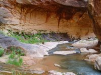
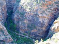
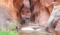
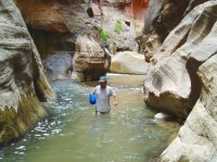
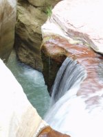
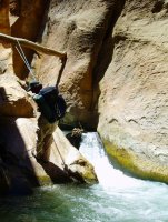
I entered via french, camped near french and exited rock (it was a much longer walk from french to rock than i planned) pretty much what you described nick but skipped the first section of the barrack. It would be difficult to get a dog down french (not impossible but there were a few spots you would need to lower the dog) but rock just had some steep scrambling. Once in Parunuweap We went down as far as we could to the falls but couldn't figure out how to get past one large obstacle. Also explored poverty which was impressive and misery from the bottom as far in as we could get. I also absolutely destroyed my feet with some chacos. Couldnt feel the blisters until it was way too late. The log jam had too much water so we did the rabbit hole and it wasn't bad, with two people could easily pass packs. Road to french was sandy. I think i put it in 4w just because but with some speed probably wasn't needed (jeep is 4 wheel all. I put it in low for a climb or two) can't wait to go back hopefully this spring. I want to see the petroglyphs and caves and 7 arch in mineral (basically the upper part of the barracks)
Don't like ads? Become a BCP Supporting Member and kiss them all goodbye. Click here for more info.

