b.stark
Forever Wandering
- Joined
- Apr 8, 2015
- Messages
- 1,302
In the last week of August of this year, @futurafree and myself did a 7 day loop in the Teton Wilderness. Chris messaged me about doing a backpacking trip and threw out the idea(among others) of hiking in the Teton Wilderness. Naturally, I was foolish enough to pick the longest and most remote option. We hiked roughly 70 miles from Turpin Meadow trailhead, with about 80 miles of that being uphill (this number grew as the trip was planned an then progressed). We had hoped to get over Majo Pass, but between running short on mileage for the first few days then getting a major weather system right when we were in the high country, we(mainly me) modified the route to go down the South Fork of the Yellowstone.
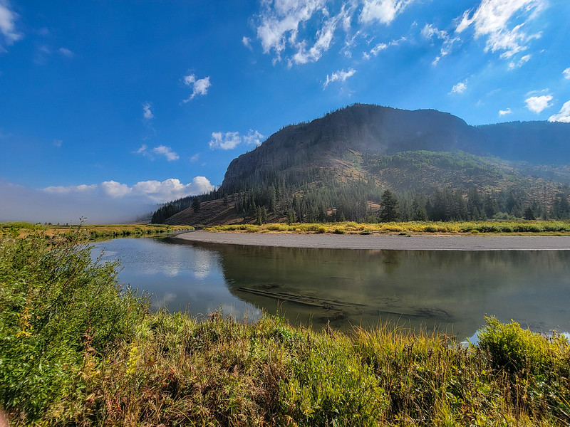
The first 2.5 days the weather was sunny and HOT. The trail was mainly uphill and had been beaten to moon dust by pack strings. I've never been so dirty on a hike before as those first couple days. I think the heat played a major part in falling short on mileage the first few days.
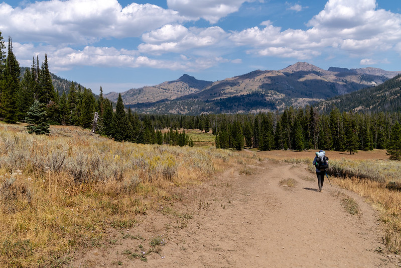
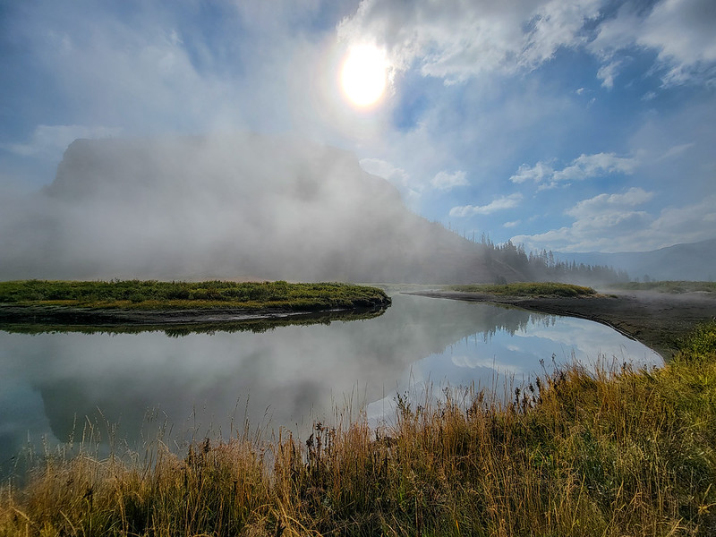
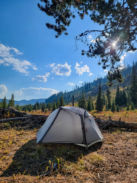
Headed toward our first camp. We started about noon and the trail was hot and dusty right away.
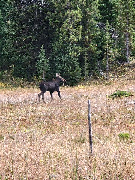
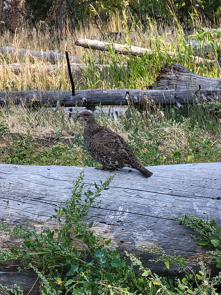
Our first campsite was an old outfitter camp not far from the Soda Springs. Not an amazing site, but it worked. All the wildlife visited us there. On the trail leading to the site were tracks of a sow and cubs. A moose ran through camp. And there were flocks of grouse everywhere.
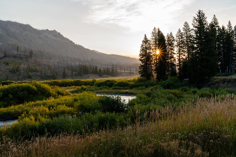
The view on the morning of day 2 was excellent and we were serenaded by a wolf at first light.
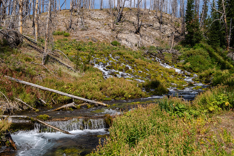
This day turned out to be a slog. Hot, open burn areas, lots of uphill... I think I was suffering a bit from altitude, or being out of shape, or both. The dust from the trail was pretty unbearable and seemed to be blowing the same way we were walking at all times.
Big Springs is much better in person than in pictures. Pretty impressive to be there, looks kind of uninspiring in pictures.
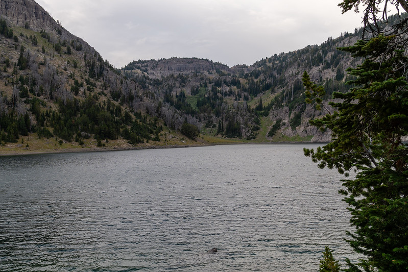
We made camp at Crater Lake, at a site that wasn't the best, but we figured would work for a night... until we noticed about as awful of a widowmaker as could be above our tents and had to move to an even less OK site. It was cool and breezy in the evening, but calmed down to be a pretty nice night.
The climb up out of Crater Lake is a bit of a slog, but not awful. It was nice to get it done in the morning when it was still cool.
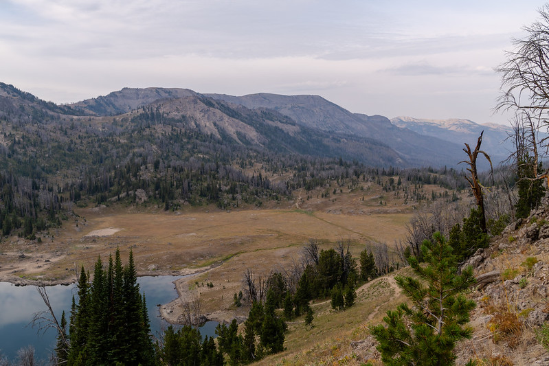
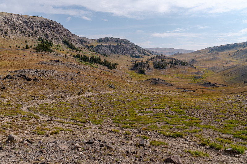
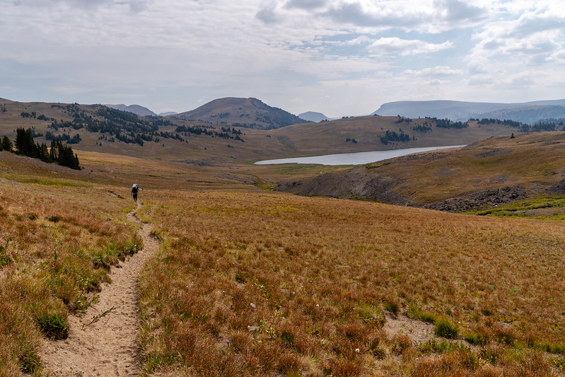
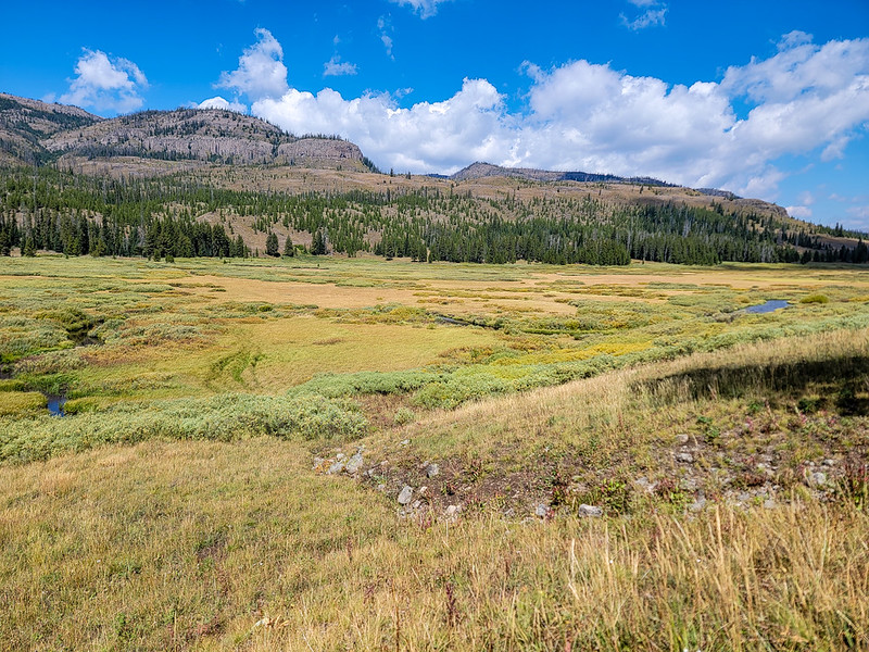
Apart from the constant moon dust on the trail, it was very nice to break into the open country after the climb out of Crater Lake. Nice rolling country on the way to Ferry Lake.
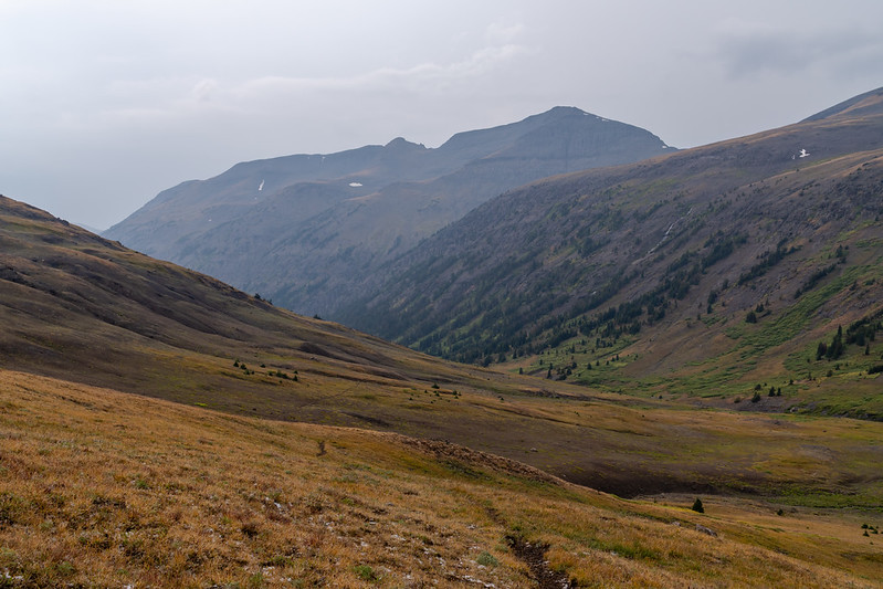
Nearing Ferry Lake
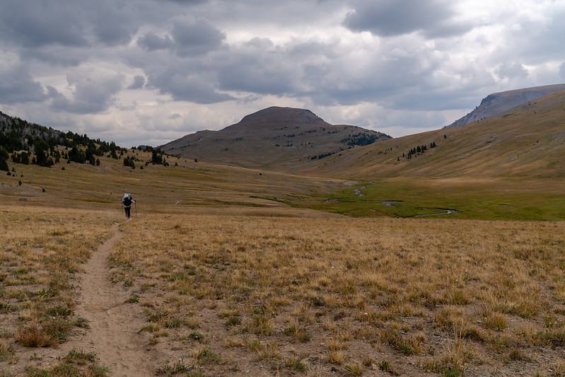
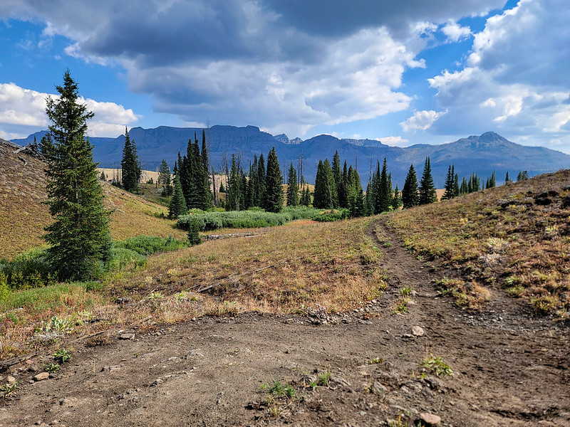
It seemed like an awful long way from Ferry Lake to the Marston Pass area. Storms were forecast to move in on this afternoon, and clouds were in fact gathering. We had been having some discussions about route options, but storms here made it a very real discussion. While waiting out the storms below the unnamed pass to the South Fork of the Yellowstone, I campaigned pretty hard to head down the South Fork, concerned mainly about bad weather going over into the South Fork then over toward Majo Pass (not a great place to be hiking with thunderstorms in the sky and in the forecast). Chris accepted the change of plans, though wasn't overly enthusiastic about it (I wasn't either, but I thought and still think it a sound decision).
We debated not even going over to the South Fork on this day. Thunderstorms were moving through, and we were really not sure if they were going to keep coming and force us to camp on the Marston Pass side. Eventually we made a run for the pass in intermittent drizzle and only one or two distant rumbles of thunder. The trail up toward the South Fork is a little indistinct where it starts going up, but becomes a well worn trail not far up.
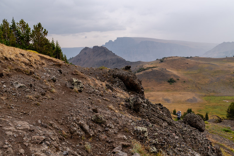
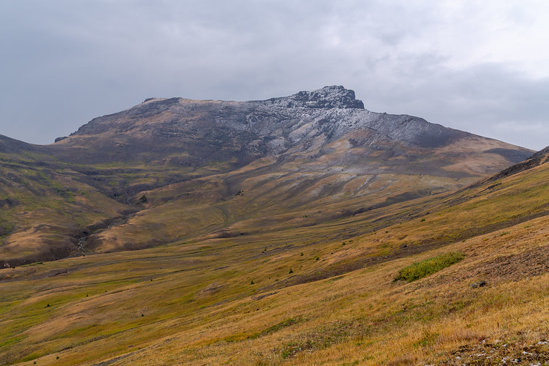
We noticed fresh snow and sleet on the peaks (and on the ground) as we approached the pass... an option we discussed was the camp somewhere way up high to make the original route work, but neither of us wanted to camp up high in icy cold storms at this point. We pressed on to the first big meadow in the upper South Fork, hoping to find a passable campsite.
I was incredibly pleased to finally see Younts and Thorofare with my own eyes. Hopefully I get to see them again someday. We continued on down the now very muddy trail.
Our campsite that evening was decent, but not super inspiring. Mediocre campsites seemed to be a theme of this trip. I'm not sure I'd really like to revisit any of them all that badly and they kind of seemed in my mind a necessary evil to do the trip we were doing. I don't even have a good picture from the camp on night 3.
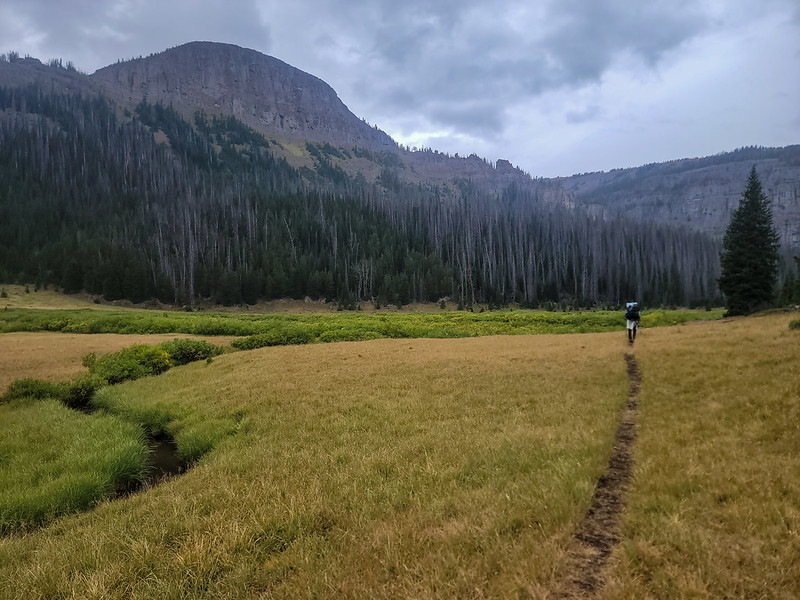
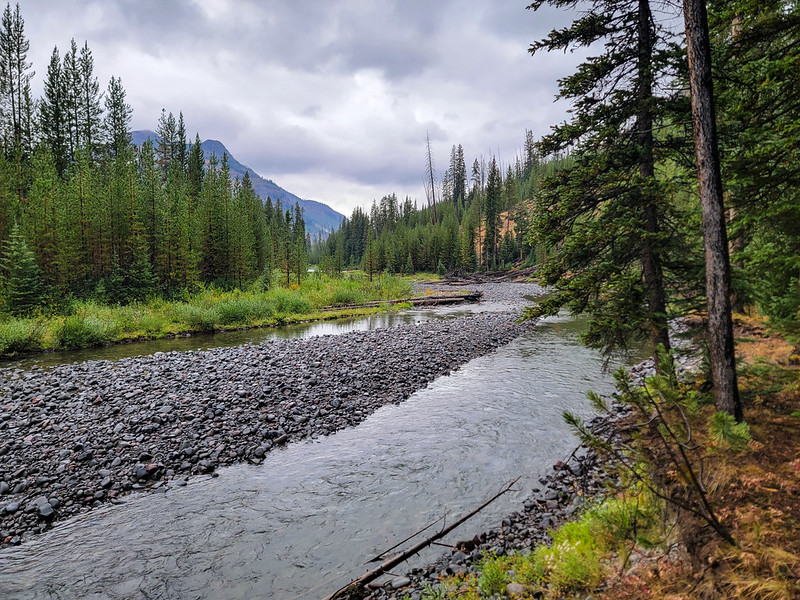
The next day tested me a bit. It rained on and off all day long. Eventually my pants got so wet I had to switch to just wearing my rain pants. The trail in the upper South Fork is fairly rough, with lots of short but steep up and downs around and through gullies and a lot of thrashing through willows in the meadow sections. In the timber the undergrowth was soaking wet and not all that fun to hike through, keeping us cold and wet.
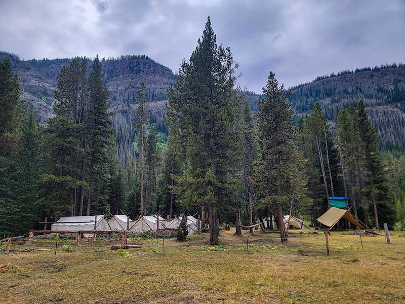
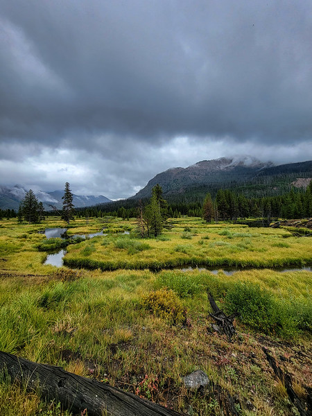
Past the crossing of the North Fork of the Yellowstone, the trail becomes much easier. It seems to get much more use and the valley widens out enough to have a consistently flatter bottom. We passed a big outfitter camp near Woodard Canyon.
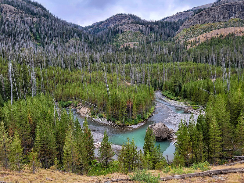
We were treated to occasional views of a now quite beautiful Yellowstone River
Once again we made camp at a pretty "meh" site. It was near a small, clear side creek though (the Yellowstone had been running dirty at times due to the rain) just after talking to people with a pack string headed toward the camp near Woodard Canyon. Another group headed there would pass by as we set up camp. There were elk bugling during the evening and morning, which was nice.
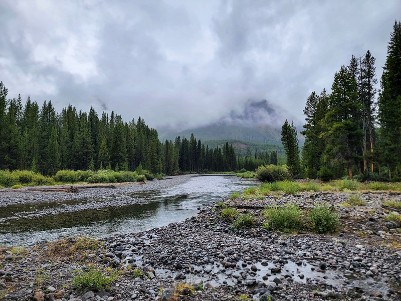
The next day was again rainy. In morning I had accepted the rain, more or less, and was dealing with it OK, though I was tired of wet gear. We hiked along a now spectacularly wild Yellowstone River valley.
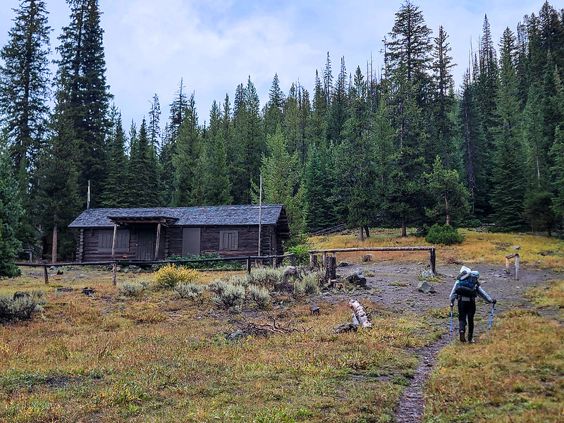
As we approached Hawk's Rest, rain set in good. The trail goes through deep willows, and we were not having fun. There is a huge outfitter camp a couple miles up from Hawk's Rest that I did not take any pictures of. At one point we stopped under some trees for a while and ate some snacks as hiking in the rain was just getting that unbearable. Eventually we made it to Hawk's Rest Patrol Cabin and though the rain had stopped at that point, we took shelter under the porch for a solid break.
When we went to search for a campsite, rain set in again and did it ever rain. Harder than it had at any point on the trip. We searched for a long time to find an acceptable campsite. As it rained, the flats in the valley slowly filled with standing water and I began to curse the sky and rain with great vigor. After perhaps 1.5 hours, the rain stopped, and we once again found a site that was just passable. We set up and got supper in breaks between rounds of rain.
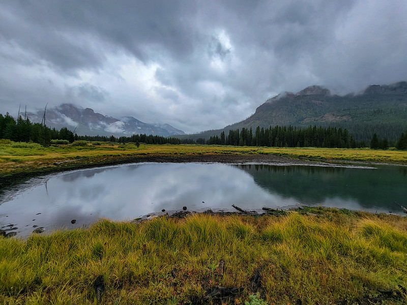
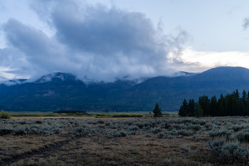
As the evening went on some breaks in the clouds did show up, giving us hope better weather the next day.
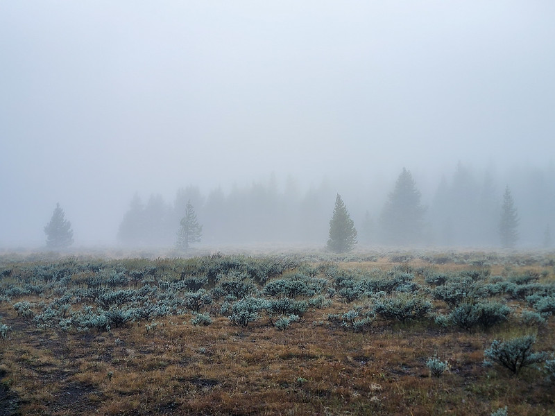
My hope for a sunny morning the next day was shattered as Chris got out of his tent and said that the place was completely socked in with fog. I think this was also the coldest morning of the trip, right on the edge of frost. I stayed in my sleeping bag for an extra hour just because it was warm in there and I did not really want to think about hiking through cold, foggy willows, which is what the first couple miles of the day would be.
After a very cold breakfast and time packing up camp, we started hiking. The fog slowly started breaking at first, eventually lifting to give us a sunny day. Gotta tell you that sun was divine when it did show up.
After a few miles it got nice enough that I traded my rain pants for shorts (my regular hiking pants were still soaked through, too wet to wear). We hiked onward, eventually passing Two Ocean Pass.
We made camp by a tiny stream along the trail just before it drops into the North Fork meadows. Another pretty mediocre site by many measures, but it was close to clear water and I wasn't sure we'd find another campsite until the far end of the North Fork meadows, so it seemed as good a place as any.
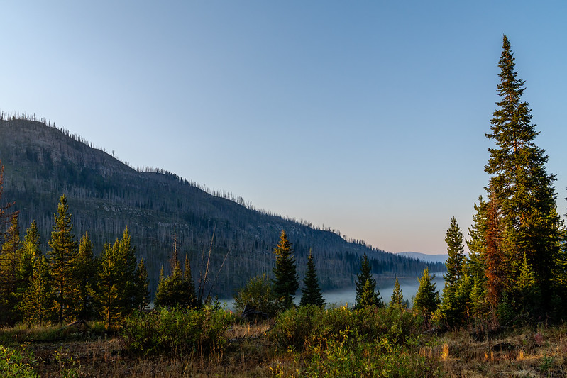
The final night was quite uneventful, with fog in the valleys on the final morning of our hike.
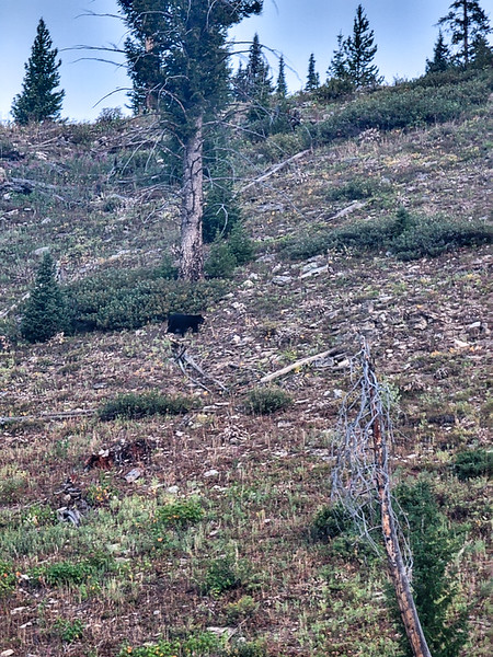
And as one final highlight, a small black bear walked past camp on the hillside. I was a bit nervous as it looked to be a juvenile finding out how to live on its own, but it simply passed on by and gave us no trouble.
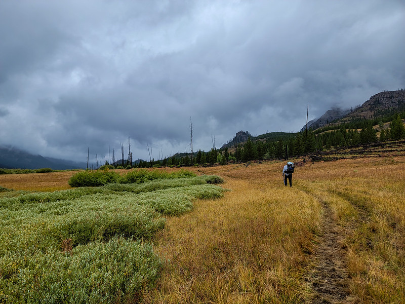
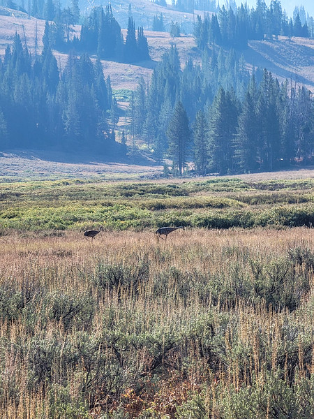
On the hike through the North Fork meadows we finally saw a couple Sandhill Cranes. I'd heard some around Hawk's Rest, but couldn't spot any of them.
We completed the final miles pretty quickly, though the last few were slowed by an endless flow of pack strings and day hikers. After a while I finally realized the number of people on the trail was probably partly because it was Labor Day weekend.
Overall, I'm really happy with this trip, even though we(mostly me) changed the route during the hike and the 2.5 days of cold rain was kind of awful. I got to see some places that have been on the list for a long time (Younts/Thorofare, some of the headwaters of the Yellowstone, Hawk's Rest, Two Ocean Pass) and even with the changes this is mileage-wise the longest hike I've ever done. My gear for the trip was pretty good, though getting my pants soaked and not being able to dry them out for half the trip was a notable point of failure. Big thanks to Chris for putting up with me for a week in the wilderness, that is no small feat in itself.
The first 2.5 days the weather was sunny and HOT. The trail was mainly uphill and had been beaten to moon dust by pack strings. I've never been so dirty on a hike before as those first couple days. I think the heat played a major part in falling short on mileage the first few days.
Headed toward our first camp. We started about noon and the trail was hot and dusty right away.
Our first campsite was an old outfitter camp not far from the Soda Springs. Not an amazing site, but it worked. All the wildlife visited us there. On the trail leading to the site were tracks of a sow and cubs. A moose ran through camp. And there were flocks of grouse everywhere.
The view on the morning of day 2 was excellent and we were serenaded by a wolf at first light.
This day turned out to be a slog. Hot, open burn areas, lots of uphill... I think I was suffering a bit from altitude, or being out of shape, or both. The dust from the trail was pretty unbearable and seemed to be blowing the same way we were walking at all times.
Big Springs is much better in person than in pictures. Pretty impressive to be there, looks kind of uninspiring in pictures.
We made camp at Crater Lake, at a site that wasn't the best, but we figured would work for a night... until we noticed about as awful of a widowmaker as could be above our tents and had to move to an even less OK site. It was cool and breezy in the evening, but calmed down to be a pretty nice night.
The climb up out of Crater Lake is a bit of a slog, but not awful. It was nice to get it done in the morning when it was still cool.
Apart from the constant moon dust on the trail, it was very nice to break into the open country after the climb out of Crater Lake. Nice rolling country on the way to Ferry Lake.
Nearing Ferry Lake
It seemed like an awful long way from Ferry Lake to the Marston Pass area. Storms were forecast to move in on this afternoon, and clouds were in fact gathering. We had been having some discussions about route options, but storms here made it a very real discussion. While waiting out the storms below the unnamed pass to the South Fork of the Yellowstone, I campaigned pretty hard to head down the South Fork, concerned mainly about bad weather going over into the South Fork then over toward Majo Pass (not a great place to be hiking with thunderstorms in the sky and in the forecast). Chris accepted the change of plans, though wasn't overly enthusiastic about it (I wasn't either, but I thought and still think it a sound decision).
We debated not even going over to the South Fork on this day. Thunderstorms were moving through, and we were really not sure if they were going to keep coming and force us to camp on the Marston Pass side. Eventually we made a run for the pass in intermittent drizzle and only one or two distant rumbles of thunder. The trail up toward the South Fork is a little indistinct where it starts going up, but becomes a well worn trail not far up.
We noticed fresh snow and sleet on the peaks (and on the ground) as we approached the pass... an option we discussed was the camp somewhere way up high to make the original route work, but neither of us wanted to camp up high in icy cold storms at this point. We pressed on to the first big meadow in the upper South Fork, hoping to find a passable campsite.
I was incredibly pleased to finally see Younts and Thorofare with my own eyes. Hopefully I get to see them again someday. We continued on down the now very muddy trail.
Our campsite that evening was decent, but not super inspiring. Mediocre campsites seemed to be a theme of this trip. I'm not sure I'd really like to revisit any of them all that badly and they kind of seemed in my mind a necessary evil to do the trip we were doing. I don't even have a good picture from the camp on night 3.
The next day tested me a bit. It rained on and off all day long. Eventually my pants got so wet I had to switch to just wearing my rain pants. The trail in the upper South Fork is fairly rough, with lots of short but steep up and downs around and through gullies and a lot of thrashing through willows in the meadow sections. In the timber the undergrowth was soaking wet and not all that fun to hike through, keeping us cold and wet.
Past the crossing of the North Fork of the Yellowstone, the trail becomes much easier. It seems to get much more use and the valley widens out enough to have a consistently flatter bottom. We passed a big outfitter camp near Woodard Canyon.
We were treated to occasional views of a now quite beautiful Yellowstone River
Once again we made camp at a pretty "meh" site. It was near a small, clear side creek though (the Yellowstone had been running dirty at times due to the rain) just after talking to people with a pack string headed toward the camp near Woodard Canyon. Another group headed there would pass by as we set up camp. There were elk bugling during the evening and morning, which was nice.
The next day was again rainy. In morning I had accepted the rain, more or less, and was dealing with it OK, though I was tired of wet gear. We hiked along a now spectacularly wild Yellowstone River valley.
As we approached Hawk's Rest, rain set in good. The trail goes through deep willows, and we were not having fun. There is a huge outfitter camp a couple miles up from Hawk's Rest that I did not take any pictures of. At one point we stopped under some trees for a while and ate some snacks as hiking in the rain was just getting that unbearable. Eventually we made it to Hawk's Rest Patrol Cabin and though the rain had stopped at that point, we took shelter under the porch for a solid break.
When we went to search for a campsite, rain set in again and did it ever rain. Harder than it had at any point on the trip. We searched for a long time to find an acceptable campsite. As it rained, the flats in the valley slowly filled with standing water and I began to curse the sky and rain with great vigor. After perhaps 1.5 hours, the rain stopped, and we once again found a site that was just passable. We set up and got supper in breaks between rounds of rain.
As the evening went on some breaks in the clouds did show up, giving us hope better weather the next day.
My hope for a sunny morning the next day was shattered as Chris got out of his tent and said that the place was completely socked in with fog. I think this was also the coldest morning of the trip, right on the edge of frost. I stayed in my sleeping bag for an extra hour just because it was warm in there and I did not really want to think about hiking through cold, foggy willows, which is what the first couple miles of the day would be.
After a very cold breakfast and time packing up camp, we started hiking. The fog slowly started breaking at first, eventually lifting to give us a sunny day. Gotta tell you that sun was divine when it did show up.
After a few miles it got nice enough that I traded my rain pants for shorts (my regular hiking pants were still soaked through, too wet to wear). We hiked onward, eventually passing Two Ocean Pass.
We made camp by a tiny stream along the trail just before it drops into the North Fork meadows. Another pretty mediocre site by many measures, but it was close to clear water and I wasn't sure we'd find another campsite until the far end of the North Fork meadows, so it seemed as good a place as any.
The final night was quite uneventful, with fog in the valleys on the final morning of our hike.
And as one final highlight, a small black bear walked past camp on the hillside. I was a bit nervous as it looked to be a juvenile finding out how to live on its own, but it simply passed on by and gave us no trouble.
On the hike through the North Fork meadows we finally saw a couple Sandhill Cranes. I'd heard some around Hawk's Rest, but couldn't spot any of them.
We completed the final miles pretty quickly, though the last few were slowed by an endless flow of pack strings and day hikers. After a while I finally realized the number of people on the trail was probably partly because it was Labor Day weekend.
Overall, I'm really happy with this trip, even though we(mostly me) changed the route during the hike and the 2.5 days of cold rain was kind of awful. I got to see some places that have been on the list for a long time (Younts/Thorofare, some of the headwaters of the Yellowstone, Hawk's Rest, Two Ocean Pass) and even with the changes this is mileage-wise the longest hike I've ever done. My gear for the trip was pretty good, though getting my pants soaked and not being able to dry them out for half the trip was a notable point of failure. Big thanks to Chris for putting up with me for a week in the wilderness, that is no small feat in itself.
")

