John Morrow
Member
- Joined
- May 22, 2015
- Messages
- 1,102
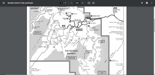
This is disappointing, this map makes it appear that the entire Horse Canyon system is off limits to backpack camping except for a few slivers of east side sidecanyon heads. I don't seem to remember it being that limited. It used to be a certain distance beyond the jeep trail. Anyone else aware of this or ask the NPS what the exact boundary line is. I always hated how useless this scale non-topo map was for determining legality. Camping in any side drainage wash is about as LNT as one can be. I've never seen a person in a Horse Canyon side drainage in my three backpacks in there.

Also, there is a link to this map when one is in reservations for Needles Overnigjht in Rec.gov but it is a Dead Link. I had to go back to the CANY website to locate it.

Also, there is a link to this map when one is in reservations for Needles Overnigjht in Rec.gov but it is a Dead Link. I had to go back to the CANY website to locate it.
Last edited:
