My Home From the Sky: A week in the La Sal Mountains

TheDunedain

Not all those who wander are lost
Joined
Feb 11, 2012
Messages
37
16.JPG

This is going to be a long one folks:

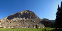
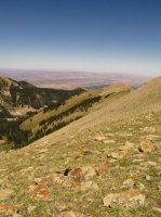
Long have I looked at the overwhelming laccolith formations of the La Sal Mountains that tower above the Moab desert in awe contemplating the views that each scree stack might offer. I could only imagine the feeling of being high upon those towers that are the highest points for hundreds of miles in any direction. This June on my last week off for my job I had in Monticello I had the pleasure of doing a few short, yet amazing backpacking trips with some peak bagging on the side in the mystical realm that is the La Sals.

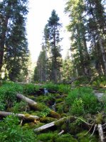
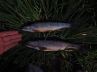
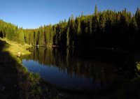
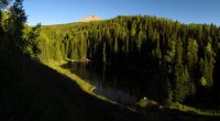
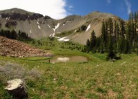
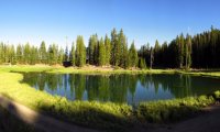
I met up with a friend who was coming down from Salt Lake around 1PM and we headed up the La Sal road towards Oowah Lake to have lunch and to do some fishing. I unfortunately do not own a fly rod so my friend did most of the fishing. From Oowah we headed up on an overnight backpacking trip to Clark Lake which is just about 2 miles from Oowah, so nothing serious at all. Clark Lake sits nestled away in a thick pine forest and does not offer too much for views other than a little slice of the top of Haystack. We set up camp and did some exploring up stream where there is a beautiful moss-covered waterfall, and then later hiked up the trail above the lake where we could get a little glimpse of Mount Mellenthin. We did a little bit more fishing that night (which was actually pretty good for such a small lake) and then hiked back down to Oowah the next morning.

That morning from Oowah we headed over to the Geyser Pass road with the intent of hiking up high into Gold Hill basin to summit Mount Tukuhnikivats the next day. On the way over we stopped to check out an old abandoned mine my friend spotted on his GPS but were unable to get to it for we were stopped by a gaping canyon. So with our mine search being a failure we headed over to the Gold Hill trailhead where I had been a few weeks prior when I had bagged the 12,053 ft Little Tukuhnikivats which was a horrendous hike that involved hiking up nearly 50 degree snowfields and scree with no set route at all (I think I found one cairn on the entire hike). This had been my highest elevation I had ever been having grown up in the Wasatch with it's highest peak Nebo reaching only 11,929 feet, and now I was back for the big time.

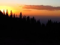
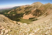
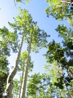
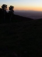
The Gold Hill basin trail is good for about the first 2 miles or so and then peters out in to no trail at all, but we had a GPS so we were fine. The trail passes through some of the largest aspen forests I have ever seen with some reaching up to 80-100 feet or possible higher with trunks a few feet in diameter. That day we just hiked roughly 4 miles to the top of the basin where we camped next to a stream on the north side of Tuk which towered above us. That night we did a small hike to establish a route up to the Tuk ridge and decided on an extremely steep and loose chute that appeared to be the best option from the basin unless we wanted to do a little freesoloing, which sounded even more dangerous. From the bottom of the chute we watched an blood red sunset over the Moab valley and returned to camp to prepare for the next big day.

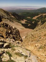
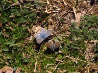
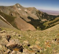
On the day of our Tuk summit we woke up leisurely and headed up the sketchiest chute I have ever hiked in my entire life. It seemed that the entire chute was either loose scree or dirt and it took an extreme effort to get to the top which took at least an hour maybe more to get up what looked to be no more than 1000 feet. Making it to the ridge made it all worth while though where we were greeted by beautiful blue butterflies (yay alliteration!) and a species of high elevation swallow that I had also encountered on Little Tuk that dart around on the thermals at incredibly high speeds for who knows what reason. From there we walked across the ridge to the final grueling leg of the Tuk climb which is basically climbing up incredibly steep scree hoping that your footing is solid (there is somewhat of a path through the scree from people climbing it over time but not much of one). After ascending several false summits we finally made it to the top of what Edward Abbey called the Island in the Sky.

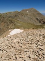
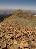
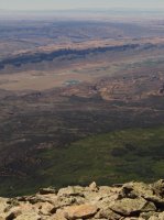
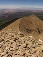
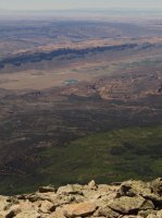
Standing atop the 12,487 ft monolith that is Tukuhnikivats I found myself gazing at the most spectacular view I have ever seen in my short 20 years of life. From the flat table top summit Tuk drops what appears to be almost vertically 6000+ feet to an infinity pool of sandstone on almost all sides with only sky above (which made my friend a bit woozy). I found myself seeing so many places that I had adventured before and had wished to adventure. From the top (this is going to be tedious) I could see the rest of the La Sal range, the Book Cliffs, Yellowcat Flats, Castle Valley, Arches, The San Rafael Swell, Canyonlands, The Henry Mountains, The Abajos, The Bears Ears, South Mountain and the Medicine Lakes, Sleeping Ute Mountain, Paradox Valley, The San Juan Mountains and so many more subtleties that I could never name. From this Island in the Sky all was quiet (with the exception of the wind and the occasional bombarding swallow that would zip by a few inches from our heads) and from this vantage point where one can see the earth curve below you I truly realized how incredibly infinitesimal I as a human being was and that all my plans to visit all these places below me were really quite meaningless for there will always be places I have yet to explore. In this split second of discovery whilst surveying the most vast of lands I felt that I had found any and all meaning there is in life and that I would be content to stare into this sea of rock until my dying days. It was at this time that my friend started asking me almost incessantly if I wanted to head down then for apparently the sensation of being on a tabletop in the sky was a little to much for the guy. But that's life I suppose, all is fleeting, reminds me of some lyrics by a Hip-Hop artist by the name of Eyedea:
its the excitement of knowing everything you touch is new
I just wish I couldv'e stopped to cherish the moment while it lasted but
maybe thats the point, the second your smart enough to recognize freedom
your no longer free
you see heaven isn't some place that we go to when we die
It's that split second in life where you actually feel alive
and until the end of time, we chase the memory of that
hoping the future holds something better than the past

Anyway now that my lust for Mount Tukuhnikivats has been slaked I'll continue on with the report.

After hiking down from Tuk and out of Gold Hill the next day we stopped in Moab for some more supplies and then back up to the Geyser Pass Road for a day of taking it easy and checking out some lakes after our Gold Hill trip. First we headed over to Dark Canyon Lake where we did a bit of fishing and took lunch and then over to Blue Lake (which has a great view of Mount Mellenthin and Lone Cone in the San Juan Mountains in SE Colorado) where we spent the night and prepared our gear for the next day where we had planned to hike up to the base of Mount Peale and then summit it the next day.

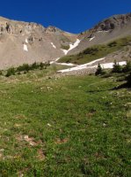
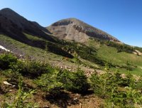
For our hike up to Peale we found a small dirt road that got us a bit close to the base and then hiked up only about a mile or two to the tree line and camped next to a stream being fed from a snow field. We did a bit of scouting and it appeared our route up to the ridge would prove to be much easier than the route up Tuk.

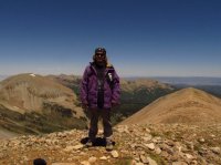
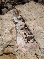
We set off in the morning to go climb the highest of the La Sals. On the way up to the ridge we found a rock with some dinosaur bone embedded in it which was pretty cool to find. I should mention that the La Sals have some of the most unique geology of any mountain range I have been in. You can be walking up scree and the type of rock will change almost every 100 feet or so and there are a large amount crystal veins in the rocks. Anyway from the ridge we followed a pretty well laid path of cairns that leads to the base of the scree (on the ridge anyway) and followed a path that had been worn into the scree from rocks settling from people hiking it so much. From our camp it only took us about an hour to get to the top at 12,721 ft making it a much easier hike than Tuk and the highest elevation I had ever been at the time.

The view from Peale is definitely amazing but it doesn’t have the same “falling off the earth” feel that Tuk has making it slightly less spectacular than Tuk in my opinion (which is not that humble). Peale however offers much better views of the rest of the La Sals, Paradox Valley and the Delores, and the San Juan Mountains in Colorado making it a great view just a much less colorful one. There is a pretty cool “shack” of sorts with no roof made of rocks at the top of Peale that provides almost complete protection from the wind which made for a great place to cook lunch.

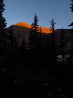
From the summit of the highest mountain in the second highest mountain range in home state of Utah we said goodbyes to our eye in the sky which almost seemed commonplace by that time and headed back down to camp where we packed up and left for the car. That night we found a great car camping spot on the Gold Hill basin road and were left with an amazing sunset over Canyonlands and the Henrys which lit up Tuk and Mellenthin in a brilliant gold-orange color cluing us in to where Gold Hill gets its name. My experience in the La Sal Mountains is one that I cannot compare to any in my entire life and it has easily become my favorite mountain range I have ever had the pleasure of visiting. I cannot wait to return.

Here's the Pics:
new.JPGnew2.JPGnew1.JPGnew3.JPG9.JPG17.JPG18.JPG9.JPGnew4.JPGnew7.JPG21.JPGnew5.JPGnew8.JPGnew9.JPG4.JPG1.JPG10.JPG7.JPG2.JPG3.JPG14.JPG5.JPG11.JPG12.JPG19.JPGnew11.JPGnew12.JPGnew13.JPGnew14.JPG6.JPG13.JPGnew16.JPGnew15.JPG20.JPG

Photos courtesy of Jared Judd

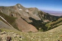
Featured image for home page:
slide.jpg
 
Duuuuude. Amazing report! :twothumbs: For as close as they are to me, I've never been in the La Sals. After reading this, I hope to remedy that in 2013.
 
I unfortunately do not own a fly rod...

Nah... you don't need a fly rod to fish Oowah. I've totally failed to catch TONS of fish in Oowah with nothing more than a garage sale rod, a Zebco 404, and some beers.

Awesome trip report!
 
Sorry for the double post, but I wanted to thank you for sharing the bit about the swallows. I grew up looking at Tuk and Peale... wondered what was up there but never went to go look. I never thought it would be birds and butterflies.

Also, would love to see more pics from the summits if you have them. Thanks again for the TR.
Yeah man the swallows were indeed surprising the first time I went up Lil Tuk and they seemed to be more extreme at the tops of Tuk and Peale. I was super paranoid that one of them was going to run into me and stick into my temple or something because they must have been going at least 60 mph but I would probably say even faster. I really wished I had more pics from the summits but unfortunately my friend was taking the photos and not myself. When I found out that he hadn't taken any pictures of the Abajos, Sleeping Ute, or the San Juans I wanted to smack him but oh well. Just another reason I should own a camera I suppose. I highly recommend the La Sals though. Everyone always thinks to go to the desert around the Moab area and not the mountains so the La Sals are pretty empty, at least in the high elevations when I was there. Btw if you summit Tuk DO NOT take the route up from Gold Hill. Its way to dangerous and loose for my liking. If I were to summit it again I would go up from the Medicine Lakes Road by South Mountain for its just a long grassy slope all the way up the south facing aspect until you get to the ridge and have to do that final scree section I mentioned. An if there are any paragliders or hanggliders out there, I would like see someone do that from the top of Tuk. ;) Sorry for all the doubles of pictures btw.
 
This makes my desire to visit these mountains grow. I wonder is there more fishing opportunities to be had then n oowah? Often fishing is one of my main motivations to backpack a destination.

Sent from my ASUS Transformer Pad TF300T using Tapatalk 2
 
This makes my desire to visit these mountains grow. I wonder is there more fishing opportunities to be had then n oowah? Often fishing is one of my main motivations to backpack a destination.

Sent from my ASUS Transformer Pad TF300T using Tapatalk 2
There's definitely fishing to be had in the La Sals. Not much in the way of backpacking to lakes though. We did that short overnight to Clark Lake and it had quite a few fish. I know Dark Canyon Lake and Blue Lake both have fish but there are roads that go there and I'm pretty sure from what I've heard the Medicine Lakes on the south side of the range are supposed to have fish but I've never been there myself. I think there are only like 12 legitimate lakes in the La Sals though, at least thats what I remember hearing.
 
Nice writing, I enjoyed it.

The true feeling of freedom is what I love about these backcountry trips. I'm glad a few others get to appreciate that.
 
Yeah, most all the fishing is drive up. Medicine lakes does have fish, but they are really just tiny little ponds - you have to be careful casting into them or your lure ends up in the weeds on the other side <grin>. If you buy a Colorado license, Buckeye reservoir just over the border is another real nice fishing spot up there.

BTW... I think (but am not positive) that those are moths, not butterflies. I do know, that some of the numerous black bear in the La Sals spend a lot of time in the spring above timberline eating them while still in larval form. I had been seeing the bears rolling rocks and appearing to eat dirt for years before I ran into a biologist who explained they were searching and eating moths. I would guess they are the main attraction for the swallow as well.

- DAA
could you identify the species? I'd be curious to know. Yeah there are definitely quite a few bears in the La Sals indeed. I saw one run across the road when I did Lil Tuk in May. Made me pretty paranoid about camping in the area.
 
No, I'm not very knowledgeable about insects.

I've had bears in my car camps several times in the La Sals, and a couple close encounters while hiking. Always a high point of the trip for me :D. My old Honda ATV has punctures in the fender where a bear chewed on it in the La Sals when it was still brand new in 1995. This year in August a bear visited camp in the night twice, I found out my dog is getting too old to chase them off and so am I :roflmao:.

The coolest experience I've ever had with any predator was in the La Sals two years ago when I stalked to within 38 yards of the biggest lion I've ever seen and then maintained eye contact with him for 45 minutes while the roles were reversed and he stalked me. That was on the east flank of Mt. Peale, below Dark Canyon lake. It was a really neat experience. Wish I'd had a camera with me!

- DAA
 
Similar threads
Thread starter Title Forum Replies Date
norwegianxplorer 7 days backpacking Breheimen/Glacier Home National Park in Norway Backpacking 2
The Trout Whisperer A Lil’ overnighter close to home Late Jan 2021 Backpacking 2
kwc Short Hike Close to Home June 2018 Southern Adirondacks Hiking & Camping 1
Absarokanaut Captions for Rotating Photos of Trips on Forum "Home" Page? Questions, Suggestions & Support 6
b.stark Album Home Photography 158
DiscGo Featured Image for Home Page Photography 3
uintafly Look what I came home with? (new pack) Gear 13
Ben Mountain Home Craters Off Road 10
WasatchWill In Home Freeze Dryer Gear 3
IntrepidXJ Salt Creek Exploring & The Drive Home Hiking & Camping 3
IntrepidXJ Sunrise in Bryce and the Drive Home Hiking & Camping 7
IntrepidXJ Back Home Through Bluff Hiking & Camping 1
Nick I'm in Home Theater Magazine! Photography 9
kwc Smoke on the water … fire in the sky … General Discussion 6
TheMountainRabbit Sky Pond (Rocky Mountain NP) - January 2023 Hiking & Camping 8
Rockskipper Interesting article about dark sky parks General Discussion 12
Yvonne Sky Rim Trail, Yellowstone, August 6, 2020 Hiking & Camping 15
IntrepidXJ Over the Edge: Island in the Sky Hiking & Camping 6
SKLund Island in the Sky: Cheatin and I Know It Trip Planning 21
Shirt357 Up to The Sky Pond Hiking & Camping 2
b.stark A Trip to Watch the Sky (Eclipse ramblings) Everything Else 4
Dave Somewhere between Sky and Syncline Hiking & Camping 12
H ON THE ROAD WILD WEST :: Yellowstone, Grand Teton, & Glacier National Park Big Sky Road Trip Photography 8
Dirkules Good multi-day hike "Island in the Sky" - your recommendations?! Trip Planning 2
DrNed Canyonlands - Island In The Sky Hiking & Camping 12
Bob Dark Sky Finder Resource Discussions 5
Joey Invite Yellowstone's Thorofare and Gallatin/Sky Rim area Meet Up (Members Only) 4
Sarah Canyonlands: Hiking the Needles and Island in the Sky Hiking & Camping 6
IntrepidXJ Island in the Sky Tour Everything Else 3
Cody Syncline-Taylor Loop, Island in the Sky Backpacking 10
IntrepidXJ Gray Canyon and the Island in the Sky Everything Else 4
Nick Fire in the sky General Discussion 0
Nick Island in the Sky, January 2012 Hiking & Camping 15
S Titcomb Basin week itinerary options? Trip Planning 11
fossana A challenging week on the Escalante Overland Route Backpacking 21
Janice Wonderful Week in the Winds Backpacking 7
radioradio Sad Cowboy Traverse - A Week in Escalante Backpacking 12
dennisrodman A week in the Grand Canyon / Boucher / Hermit / Tonto Trail Trip Planning 4
Outdoor_Fool Week-long Ramble Through Southern Yellowstone Backpacking 22
Outdoor_Fool A week in the Big Belly Backpacking 20
forest dweller Invite update / edit - have off second and third week in August - wanting to backpack in Glacier, Olympic or Yellowstone, hinges on finding companions. Meet Up (Members Only) 37
J Trip first week of April 2021 Southern UT/Anywhere AZ - Death Hollow, Coyote Gulch, or other suggestions? Trip Planning 9
TrektheWorld St. George - Thanksgiving Week Everything Else 7
scatman Yellowstone Lake - A Two Week Paddle Trip - July 28, 2019 On The Water 44
RyanP Lower Death Hollow next week (late May/early June), miscellaneous questions Trip Planning 16
scatman Yellowstone Lake - 2 Week Canoe Trip - Summer 2019 Trip Planning 24
W 3-4 days in the Sawtooths, first week of June 2019 Trip Planning 16
Titans This week- Kanab, Arizona strip Trip Planning 13
Titans 3 week Arizona road trip: Tucson Desert Rain & Hiking SAGUARO NP Hiking & Camping 1
wsp_scott A week in the Sierra Nevada Backpacking 23

Similar threads

Back
Top