- Joined
- Aug 8, 2016
- Messages
- 2,077
This day hike would turn out to be quite the adventure. Definitely among the best hikes I've ever done.
Having been in recovery mode after surgery on my feet in December of 2017 I got a really late start getting back on the trail in 2018. I decided I would set a modest bucket list of only one goal: to summit Mt Timpanogos located in the Wasatch Mountains in Utah. I began doing some research on the best route to take. There are two popular routes: The Timpooneke Trail which approaches the mountain from the north starting along the Alpine Loop road. The other, the Aspen Grove trail, which heads west from just above the Sundance Ski area. I also ran across one other obscure reference in an internet post, the Hartsky Cutoff. The article described a trail abandoned some time ago and recently re-discovered by a guy named Hartsky (don't recall his first name). It leaves the Aspen Grove trail in the Primrose Cirque area and heads north easterly, hooking up with the Horse Flats trail ending at the Summit Trail head. The idea of being able to make a loop out of it was appealing.
I posted here on BCP to see what folks thought about Timpooneke vs Aspen Grove. I got lots of good advice from @Ugly @DrNed, @Jackson and @regehr. Regehr made mention of having done the Hartsky Cutoff so that pretty much sealed the deal. I would make it a loop! It would be a pretty long day, somewhere around 16+ miles if I figured my route correctly, but I was excited for the adventure. Little did I know at the time just how much adventure there would be!
Mt Timpanogos is a very popular destination and justifiably so. I wanted to try to avoid some of the crowds if possible. With all the wild fires all summer long I kept watch for a day that would hopefully be as clear as possible. The forecast looked reasonably good for September 27th, a Thursday. So, at the last minute I took that day off from work and packed up the night before.
I got an early start and headed out for Provo Canyon. I found I was just not feeling it for some reason as I drove along. I thought it maybe was just getting up so early after a less than restful night's sleep. As much as I try I am not naturally a morning person. By the time I got to Heber I really wasn't feeling any better so I decided to make a stop at McDonald's, go in, sit down and have some breakfast with the hope that would help. Turned out that's exactly what I needed. I headed on down Provo Canyon and up the Alpine Loop to the Summit Trail Head where I would begin my journey.
I videoed my trip if you would like to follow along. I know many of you don't always have time to watch but I think you will enjoy this one, especially an on-trail encounter of the four legged kind as I'm rushing to get down the trail before dark. If you're not able to just skip on for the rest of the report. Also, most of my pictures here are not all the greatest. Somewhat hazy conditions from the smoke along with some issue with my camera was producing soft focus. Never did figure out what it was. My apologies for that.
I began my trip at the Summit Trail Head at about 7:15am as the sun was just starting to light things up. Weather was looking really nice and eye candy started right off the bat.
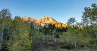
My route would take me down the Willow Hollow trail to the Salamander Flat area then on to the Timpooneke Trail Head. This was a pretty good drop of several hundred feet but I would end the trip at the same point, so that was okay.
Being so late in the season, and a particularly dry year there was no water coming over Scout Falls. Beautiful never the less.
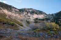
First look at the ridge line as the sun continued to slowly creep in.
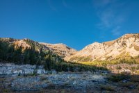
Looking back north to see some of the other major peaks of the Wasatch and the tiny little trail head *way* down there.
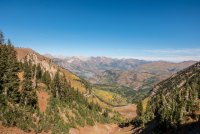
A look at North Timpanogos.
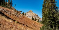
First sight of the target. Things were getting pretty exciting at this point.
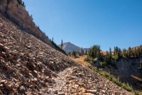
By the time I had reached the basin below Timpanogos I was already running low on water. I had just stopped to talk with a guy heading down. He told me there was no water anywhere in the basin except perhaps at Emerald Lake which was along my route on the way out. I only had about a cup and a half and a few grapes. I was pretty concerned, but I wasn't going to bail at this point. I continued up the Timpanogos Summit trail where I stopped for a lunch break about a quarter of a mile from the saddle. It was not the best place to rest with no shade but the weather was pretty delightful and I even managed a much-needed snooze.
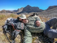
Arriving at the saddle the views were spectacular. Such a unique mountain, unlike any other area in the Wasatch. But, wait... What? I'm going up to that tiny little summit shack way up there?
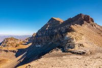
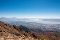
View of the Utah County area. Although the air quality was much improved over previous days it was still pretty hazy. An ongoing fire is visible in the distance.
Looking to the northeast across the basin from which I came. You can see the Uinta Mountains in the distance with yet another fire raging on.
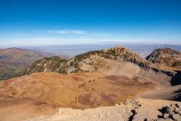
The climb to the summit appeared a bit daunting to me but I was up for the challenge. Exposure was reasonable all the way up. One section was particularly spicy though where the trail climbs up a rock chute on several short switch backs. Looking up it was a bit intimidating but doing it was not all that bad. Once past there the trail follows just below the ridge line to the summit.
Finally made the summit!
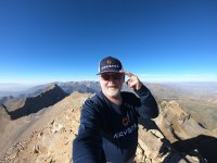
Gratuitous summit selfie. You may notice a change in my wardrobe. The company that I work for was recently bought by another and the combined company is now known as Waystar. The story behind the name comes from the new CEO who grew up in Provo and graduated from BYU. After a promotional firm failed to to come up with an acceptable new name, the new CEO decided to call it Waystar. Now keep in mind that the two newly merged companies are located in Georgia and Kentucky. The CEO told the story that as a boy he would go with a group to hike up a mountain in the early hours using flashlights to light their way. Once they reached the saddle their leader told them to turn off their flashlights and let the lights from the city and the stars light the rest of the way up to the summit, hence the name Waystar. Turns out the summit is Mt Timpanogos! I thought it would be fun press for the company to get a selfie on the summit of the name-sake mountain wearing some company swag. Besides, it was yet another good reason to climb that day!
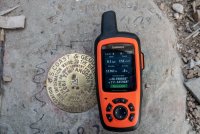
You may or may not have noticed the time on my InReach when I was showing the elevation with the benchmark. Quarter to five! Oh my heck! I had quite a ways to go to get down off the mountain and back to the truck and not very much time to do so. *And* I was going to be taking a unmarked, un-maintained route, to boot. Needless to say I only stayed on the summit a few minutes and headed down.
Once down off the saddle I now had to cross the slide at the base of the massif. All of the trail so far had been challenging but very enjoyable. Not so much this part. It was poorly cairned and loose rock for the entire distance. Not the best of conditions for a speed descent.
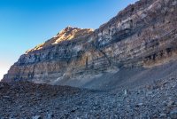
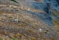
Having been out of water since arriving at the summit I was really in need of some hydration. I made my way to Emerald Lake where I think I tanked up about three liters. I left my pack, and of course my cameras, while I had made may way down to the water's edge. I was filtering when I heard footsteps off to my left. I assumed I was going to see another hiker and didn't bother looking until I finished filtering. When I finally looked up there were three mountain goats, all of fifty feet from me, getting a drink. I was very surprised they were not the least bit bothered by my being there. Dang! Why didn't I have my camera?
As I continued down the trail I saw several more goats at a distance along the way.
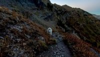
It was getting pretty dark as I started down the switch backs. I was concerned about being on them in the dark especially in a rush to do so. At one point I turned a corner and there as a goat right in front of me on the trail! I grabbed the GoPro and started recording (this is what you might enjoy in the video). Not having had any experience with mountain goats I didn't know what to expect. Would he move off as I continued down the trail? Would he become aggressive toward me? We had a bit of a stand off while having a little negotiation with him when he started moving slowly toward me. Okay, decision made. I'm going to have to short cut this switch back and drop down. Of course, doing so I slipped in the loose gravel and ended up on my butt while the goat watched. Sheesh! This is a screen grab from the GoPro video. It was almost dark so sorry for the poor quality.
Well, that was pretty fun but now things were getting serious. I continued down the switch backs with my headlamp. By the time I had gotten to the area of the Hartsky Cutoff it was completely dark. I had a decision to make. I had the GPS coordinates for the cutoff, which, by the way, I would have never found in the dark without. So do I attempt to locate and navigate the cutoff or do I continue down to the Aspen Grove Trail Head? If I choose the latter I would be faced with several miles of road walking to get up to the Summit Trail Head. That was not very appealing. Or, do I go ahead and attempt the cutoff, not knowing anything about it other than a rough route I had created on my InReach based on satellite imagery of what I thought *could* be the trail.
I had some warm clothes and a tarp in case I needed shelter for the night and the weather was pretty mild. I decided that if I can find the cutoff I would attempt it so I continued on watching to arrive at the waypoint. I walked past it as I didn't see anything that looked like a trail heading off to the north. I went back up to that location again and saw what looked like *could* be a faint trail heading up a narrow clearing in the brush. Up I went and shortly signs of a trail showed themselves.
I continued following my route and managed to find my way on *the* trail with only a couple of times where I lost it. I knew there was supposed to be a reliable spring somewhere along the way and lo and behold I found it! It was a piped spring so I figured it would be pure at is source so I tanked up again. It was good water and I was encouraged that I was on the right track.
Continuing on the trail got a little hard to determine but I just kept navigating towards where I expected to find the intersection with the Horse Flat Trail. I was pretty relieved when I found my self back on an established trail. Woohoo! I took a little break, checked in at home, and headed on to the Summit Trail Head a few miles further.
My route and track.
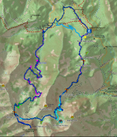
This was quite the experience! Going to have to do it again some day!
Having been in recovery mode after surgery on my feet in December of 2017 I got a really late start getting back on the trail in 2018. I decided I would set a modest bucket list of only one goal: to summit Mt Timpanogos located in the Wasatch Mountains in Utah. I began doing some research on the best route to take. There are two popular routes: The Timpooneke Trail which approaches the mountain from the north starting along the Alpine Loop road. The other, the Aspen Grove trail, which heads west from just above the Sundance Ski area. I also ran across one other obscure reference in an internet post, the Hartsky Cutoff. The article described a trail abandoned some time ago and recently re-discovered by a guy named Hartsky (don't recall his first name). It leaves the Aspen Grove trail in the Primrose Cirque area and heads north easterly, hooking up with the Horse Flats trail ending at the Summit Trail head. The idea of being able to make a loop out of it was appealing.
I posted here on BCP to see what folks thought about Timpooneke vs Aspen Grove. I got lots of good advice from @Ugly @DrNed, @Jackson and @regehr. Regehr made mention of having done the Hartsky Cutoff so that pretty much sealed the deal. I would make it a loop! It would be a pretty long day, somewhere around 16+ miles if I figured my route correctly, but I was excited for the adventure. Little did I know at the time just how much adventure there would be!
Mt Timpanogos is a very popular destination and justifiably so. I wanted to try to avoid some of the crowds if possible. With all the wild fires all summer long I kept watch for a day that would hopefully be as clear as possible. The forecast looked reasonably good for September 27th, a Thursday. So, at the last minute I took that day off from work and packed up the night before.
I got an early start and headed out for Provo Canyon. I found I was just not feeling it for some reason as I drove along. I thought it maybe was just getting up so early after a less than restful night's sleep. As much as I try I am not naturally a morning person. By the time I got to Heber I really wasn't feeling any better so I decided to make a stop at McDonald's, go in, sit down and have some breakfast with the hope that would help. Turned out that's exactly what I needed. I headed on down Provo Canyon and up the Alpine Loop to the Summit Trail Head where I would begin my journey.
I videoed my trip if you would like to follow along. I know many of you don't always have time to watch but I think you will enjoy this one, especially an on-trail encounter of the four legged kind as I'm rushing to get down the trail before dark. If you're not able to just skip on for the rest of the report. Also, most of my pictures here are not all the greatest. Somewhat hazy conditions from the smoke along with some issue with my camera was producing soft focus. Never did figure out what it was. My apologies for that.
I began my trip at the Summit Trail Head at about 7:15am as the sun was just starting to light things up. Weather was looking really nice and eye candy started right off the bat.

My route would take me down the Willow Hollow trail to the Salamander Flat area then on to the Timpooneke Trail Head. This was a pretty good drop of several hundred feet but I would end the trip at the same point, so that was okay.
Being so late in the season, and a particularly dry year there was no water coming over Scout Falls. Beautiful never the less.

First look at the ridge line as the sun continued to slowly creep in.

Looking back north to see some of the other major peaks of the Wasatch and the tiny little trail head *way* down there.

A look at North Timpanogos.

First sight of the target. Things were getting pretty exciting at this point.

By the time I had reached the basin below Timpanogos I was already running low on water. I had just stopped to talk with a guy heading down. He told me there was no water anywhere in the basin except perhaps at Emerald Lake which was along my route on the way out. I only had about a cup and a half and a few grapes. I was pretty concerned, but I wasn't going to bail at this point. I continued up the Timpanogos Summit trail where I stopped for a lunch break about a quarter of a mile from the saddle. It was not the best place to rest with no shade but the weather was pretty delightful and I even managed a much-needed snooze.

Arriving at the saddle the views were spectacular. Such a unique mountain, unlike any other area in the Wasatch. But, wait... What? I'm going up to that tiny little summit shack way up there?

View of the Utah County area. Although the air quality was much improved over previous days it was still pretty hazy. An ongoing fire is visible in the distance.

Looking to the northeast across the basin from which I came. You can see the Uinta Mountains in the distance with yet another fire raging on.

The climb to the summit appeared a bit daunting to me but I was up for the challenge. Exposure was reasonable all the way up. One section was particularly spicy though where the trail climbs up a rock chute on several short switch backs. Looking up it was a bit intimidating but doing it was not all that bad. Once past there the trail follows just below the ridge line to the summit.
Finally made the summit!

Gratuitous summit selfie. You may notice a change in my wardrobe. The company that I work for was recently bought by another and the combined company is now known as Waystar. The story behind the name comes from the new CEO who grew up in Provo and graduated from BYU. After a promotional firm failed to to come up with an acceptable new name, the new CEO decided to call it Waystar. Now keep in mind that the two newly merged companies are located in Georgia and Kentucky. The CEO told the story that as a boy he would go with a group to hike up a mountain in the early hours using flashlights to light their way. Once they reached the saddle their leader told them to turn off their flashlights and let the lights from the city and the stars light the rest of the way up to the summit, hence the name Waystar. Turns out the summit is Mt Timpanogos! I thought it would be fun press for the company to get a selfie on the summit of the name-sake mountain wearing some company swag. Besides, it was yet another good reason to climb that day!

You may or may not have noticed the time on my InReach when I was showing the elevation with the benchmark. Quarter to five! Oh my heck! I had quite a ways to go to get down off the mountain and back to the truck and not very much time to do so. *And* I was going to be taking a unmarked, un-maintained route, to boot. Needless to say I only stayed on the summit a few minutes and headed down.
Once down off the saddle I now had to cross the slide at the base of the massif. All of the trail so far had been challenging but very enjoyable. Not so much this part. It was poorly cairned and loose rock for the entire distance. Not the best of conditions for a speed descent.

Having been out of water since arriving at the summit I was really in need of some hydration. I made my way to Emerald Lake where I think I tanked up about three liters. I left my pack, and of course my cameras, while I had made may way down to the water's edge. I was filtering when I heard footsteps off to my left. I assumed I was going to see another hiker and didn't bother looking until I finished filtering. When I finally looked up there were three mountain goats, all of fifty feet from me, getting a drink. I was very surprised they were not the least bit bothered by my being there. Dang! Why didn't I have my camera?
As I continued down the trail I saw several more goats at a distance along the way.

It was getting pretty dark as I started down the switch backs. I was concerned about being on them in the dark especially in a rush to do so. At one point I turned a corner and there as a goat right in front of me on the trail! I grabbed the GoPro and started recording (this is what you might enjoy in the video). Not having had any experience with mountain goats I didn't know what to expect. Would he move off as I continued down the trail? Would he become aggressive toward me? We had a bit of a stand off while having a little negotiation with him when he started moving slowly toward me. Okay, decision made. I'm going to have to short cut this switch back and drop down. Of course, doing so I slipped in the loose gravel and ended up on my butt while the goat watched. Sheesh! This is a screen grab from the GoPro video. It was almost dark so sorry for the poor quality.

Well, that was pretty fun but now things were getting serious. I continued down the switch backs with my headlamp. By the time I had gotten to the area of the Hartsky Cutoff it was completely dark. I had a decision to make. I had the GPS coordinates for the cutoff, which, by the way, I would have never found in the dark without. So do I attempt to locate and navigate the cutoff or do I continue down to the Aspen Grove Trail Head? If I choose the latter I would be faced with several miles of road walking to get up to the Summit Trail Head. That was not very appealing. Or, do I go ahead and attempt the cutoff, not knowing anything about it other than a rough route I had created on my InReach based on satellite imagery of what I thought *could* be the trail.
I had some warm clothes and a tarp in case I needed shelter for the night and the weather was pretty mild. I decided that if I can find the cutoff I would attempt it so I continued on watching to arrive at the waypoint. I walked past it as I didn't see anything that looked like a trail heading off to the north. I went back up to that location again and saw what looked like *could* be a faint trail heading up a narrow clearing in the brush. Up I went and shortly signs of a trail showed themselves.
I continued following my route and managed to find my way on *the* trail with only a couple of times where I lost it. I knew there was supposed to be a reliable spring somewhere along the way and lo and behold I found it! It was a piped spring so I figured it would be pure at is source so I tanked up again. It was good water and I was encouraged that I was on the right track.
Continuing on the trail got a little hard to determine but I just kept navigating towards where I expected to find the intersection with the Horse Flat Trail. I was pretty relieved when I found my self back on an established trail. Woohoo! I took a little break, checked in at home, and headed on to the Summit Trail Head a few miles further.
My route and track.

This was quite the experience! Going to have to do it again some day!
Last edited:

 Now I'm going to have to go check out the Hartsky Trail.