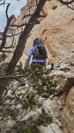
bjp
New Member
- Joined
- Jan 4, 2024
- Messages
- 4
Hey guys,
I have been thinking about sharing some insights about my latest trip for quite some time now. I am not a native speaker, so there is a bit hesitation... but here we go:
In the fall of 2024, I wanted to be on a route that felt a bit like the Hayduke Trail (I hiked the HDT in 2017). And I wanted to create my own route -inspired by others like Jamal Green and Amy & James. It should be varied (slot canyons, slick rock, the Escalante) and challenging (climbing, exposed areas, dry sections), have great views and offer opportunities to be a little away from the hustle and bustle of the trails. After a few weeks of research and tinkering, the route was ready. Packed with splendors and challenges, logistically relatively doable and a special feature: the Beehive Traverse as the crowning glory at the end of the trip.
I'm naming this route the Bonnie Abbzug Trail. Bonnie is a fictional character and part of the Monkey Wrench Gang. This makes Ms. Abbzug a friend in crime (so to speak) of George Washington Hayduke III.
The route is about 200mi / 320km long.
Highlights: Phipps Arch, Big Horn Canyon, Harris Wash, Escalante River, Choprock Canyon, Fold Canyon, Stevens Canyon and Baker Route, Halls Creek Narrows, Lower and Upper Muley Twist Canyon, Sheets Gulch, and certainly the most fascinating section, the last dance to Fruita
Biggest challenge in 2024
Drought. Me an my partner decided to bypass Fold Canyon and thus Stevens Canyon and Halls Creek Narrows. Hardly any rain in summer, basically no rain in fall so far. For us, the uncertainty about water availability between Escalante River and Stevens Canyon or even Muley Tanks was too great.
We spent ten days on the shorter route. The route was very challenging, but even more rewarding. At times I carried 9 liters of water, but every day there was a lot to see and experience. On the last day, the weather changed in the afternoon: winter arrived with lots of snow. Lucky us we cut the trip short. And we skipped a part between upper Muley Twist Canyon and Sheets Gulch TH. Another reason to come back to this beautiful place.
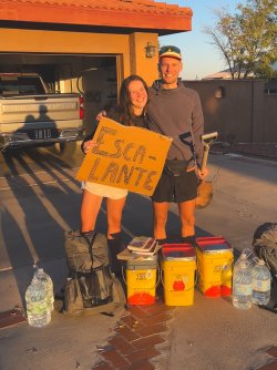
Days 1,2,3,4
Phipps Arch (N1), Big Horn Canyon, Harris Wash (with Zebra Slot and Tunnel Slot; N2), Escalante River, Choprock Canyon (N3), over the Circle Cliffs to the Moody Road, Middle Moody Canyon (N4), the Fold, Halls Creek, to Lower Muley Twist Canyon.
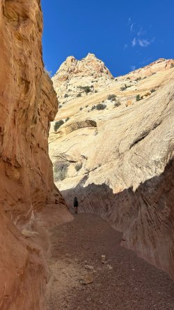
The Abbzug Trail kept its promise. The first few days of hiking were beautiful and challenging. Day 1: Hitchhiking to the TH, hiking to Phipps Arch. Day 2: On day two we hiked over a "bowl" into the varied Big Horn Canyon. Not even 24 hours on the trail yet, but there is no end to the highlights: Zebra Slot, Tunnel Slot. Harris Wash challenges us to bushwhack. The high walls and alcoves were a welcomed change to Big Horn Canyon we had seen the day before. We spent the second night about 12 km away from the Escalante. Thankfully, the strenuous Escalante Canyon interlude was short. But frustration promotes humility and balance On the third afternoon we reached Choprock Canyon. Wow! I had no idea. My backpack was about as heavy as the positive surprise haha. The Escalante was the last reliable source (!) of water until the Muley Tanks, around 48 hours away. I schlepped around 9 liters of water on the way through the Choprock. Day four was also Hayduke- aka Abzug-like: first climbing over the Circle Cliffs, then walking for hours along the shadeless Moody Road in the best beach weather. Middle Moody Canyon was just a means to an end, the actual route runs south to Fold Canyon. Next time!
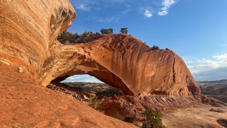
Phipps Arch
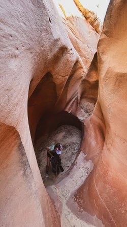
Big Horn C
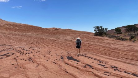
Above Tunnel Slot
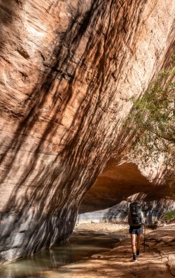
Harris Wash
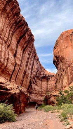
Choprock C
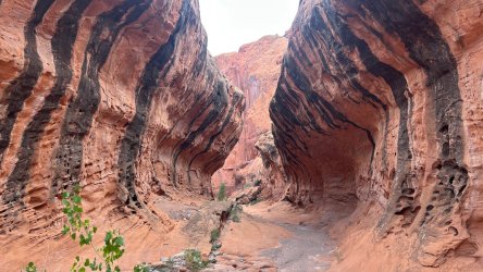
Choprock
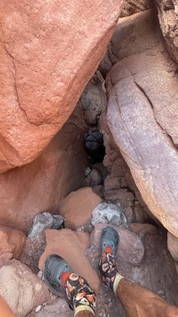
climb over to the moody road
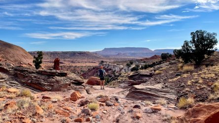
moody road a little bit further down
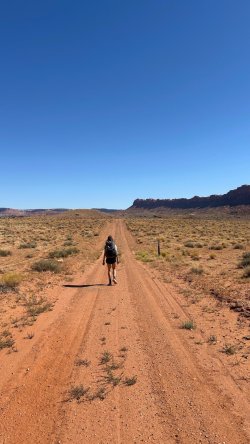
moody roadwalk. That is part of the deal and is to be embraced as any other day
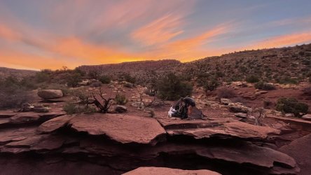
Days 5,6
Halls Creek, Lower Muley Twist N5), Burr Trail Rd/Cache 1, Hitch
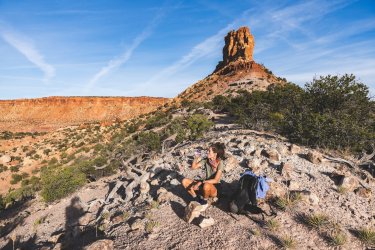
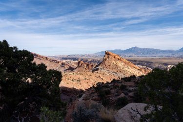
On day five we arrived in Capitol Reef National Park via the Fold and Red Slide. First Halls Creek, then via the Muley Tanks (almost empty) into the Lower Muley Twist Canyon. The "wrinkles" of the fold are very impressive! Shortly after we set foot in the dry Halls Creek, we met two girls. With good news: about 1 mile to the north there was, surprisingly, a pothole. Wow, finally some relief from the constant thirst. The Lower Muley Twist Canyon did not disappoint. The tanks were almost empty. Did not expect it...
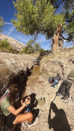
Pothole Halls Creek. we took what we can, we did not wanted to put all our chips on the muley tanks..
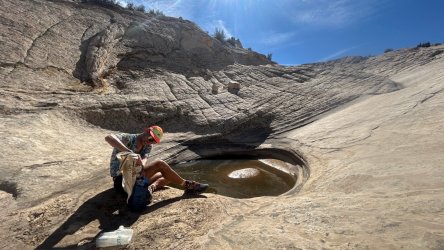
Muley tanks or in our case: Muley Tank. there was only on filled tank.
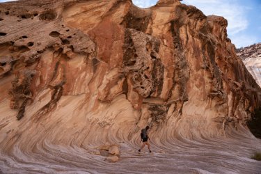
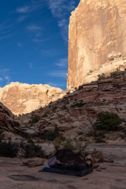
We spent Night 5 in the canyon, framed by high walls. Beautiful. The closer we got to the next cache, the more I became concerned about continuing the hike as planned. It was unclear how challenging the descent into Coleman Canyon would be. In the end we decided to skip the section and hitchhike from Burr Trail Rd to Sheets Gulch TH.
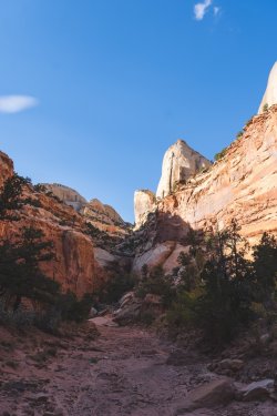
Lower Muley Twist Canyon
Days 6,7
Sheets Gulch (N6), Pleasant Creek
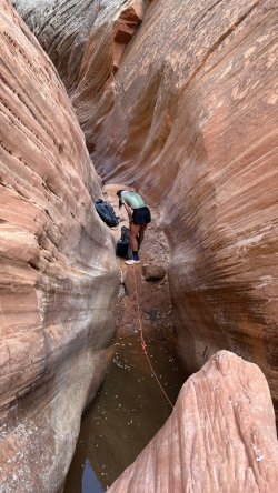
The narrow alley and high walls of Sheets Gulch are super impressive. For most hikers, the gulch was a dead end after a couple of miles in October 2024: if you didn't climb, you couldn't get any further . With a super challenging obstacle, a bit of solitude and an impressive landscape, you get a premium rating from me. Sheets Gulch deserves it - with an extra star. The climb over the obstacle took my hiking partner about 40 minutes. The main challenge was the cold water and washed out big rock. You really could not get a good starting point and a lot of grip. But with the dyneema rope and some trials we finally made it happen. It was a close call... This is what you get in Canyon country, you never know how the canyon looks like after a flash flood.
The next section after sheets gulch was ok-ish. The 'salmon' made me smile, but Pleasant Creek in the Dixie National Forest didn't. It was a cow shithole . In the lower reaches, things looked different again. From the border with Capitol Reef NP, it get extremely beautiful again.
We hiked to cache number 2. The start of the next stage of the Abbzug Trail, the Beehive Traverse. The weather had become a bit rougher that day.
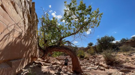
Beginning of Sheets Gulch.
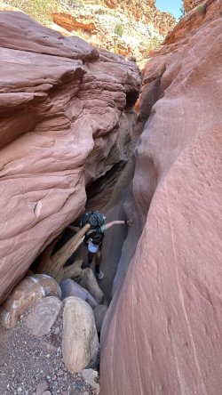
One of a couple of obstacles
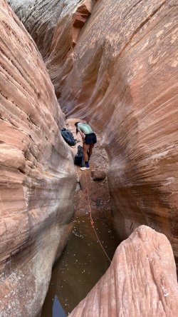
the big obstacle. I basically pulled from above and my partner climbed up. It was tough to find the first steps into this. Stemming was the way to go, but still...tuff.
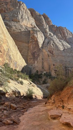
sheets gulch is as beautiful as it gets.
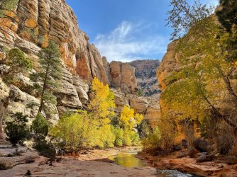
Pleasant Creek
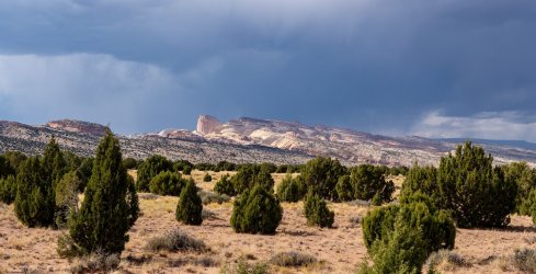
Golden Throne in the distance.
Day 7, 8, 9, 10
There is a trip report from wasatchwill (on this webiste and on YouTube) and a vlog by Jamal Green YouTube. These guys write and vlog way better than I can. And pictures just don't do this part of the trek justice. The only thing I add to their reports: I am very very happy have hiked this "trail". It was quite an experience, pretty difficult at times and very very dry. We had only at the very beginning some potholes and somewhere in the middle one medium size pothole we could get water. Everything else was dry, even the "Bighorn Tank"... It was exhausting, challenging, humbling.
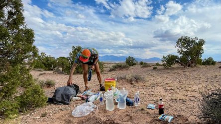
Cache No 2 at the beginning of the last part of the trip
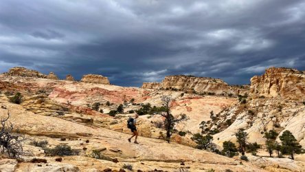
Beginning of the beehive
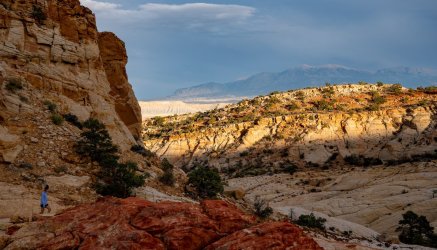
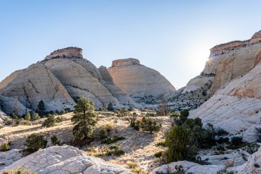
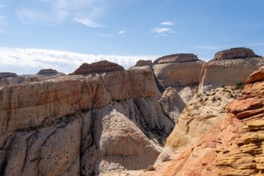
the henrys in the background. And those colors...
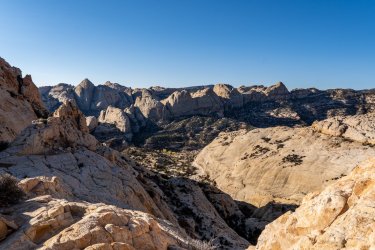
looking back over Pleasant Creek Canyon
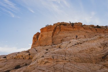
first real obstacle. Managable, but scary at time.
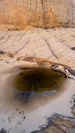
the only pothole on the trail (apart from the ones right at the beginning).
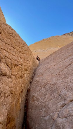
(not my) buttcrack canyon
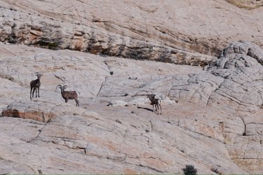
sheepies
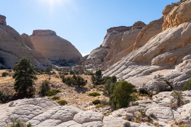
golden throne in the background.
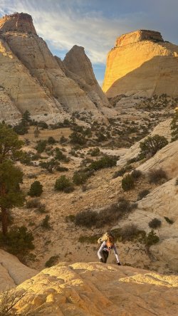
early birds
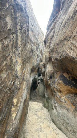
hiking in this slot while it is full of cold water, puh, that would have been a totally different story... (shoutout to WasatchWill!).
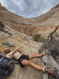
puh. On pictures everything looks so beautiful, relaxed, easy.
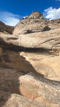
"bighorn" tank. empty
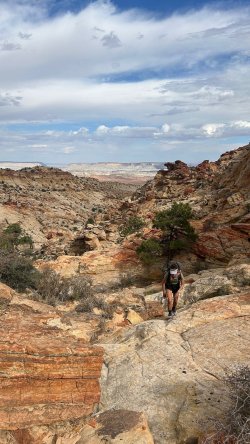
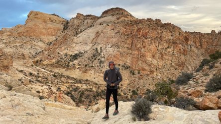
it got colder and windier during the last days.
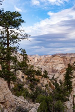
what a view. Only some more miles left.
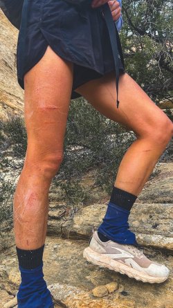
the beehive takes it toll.
After 10 days we arrived safe and sound back in Fruita. Just minutes after we got into our rental, it started to rain and snow. Bad weather for three days. We were lucky we took the cut off and the hitch. Back then when we decided to cut off and hitch it felt pretty bad, cause we would not make it as a continuous hike miss some of the most beautiful part. Sometimes it's for a good reason. During the last days we didn't see anybody, the scenic drive road was closed. Last but not least, we drove to the caches, collected the empty buckets and threated ourselves with some coffee and sandwiches. The thunderstorm passed by while we stayed in Escalante and prepared for our next hike.
It was a great experience.
I have been thinking about sharing some insights about my latest trip for quite some time now. I am not a native speaker, so there is a bit hesitation... but here we go:
In the fall of 2024, I wanted to be on a route that felt a bit like the Hayduke Trail (I hiked the HDT in 2017). And I wanted to create my own route -inspired by others like Jamal Green and Amy & James. It should be varied (slot canyons, slick rock, the Escalante) and challenging (climbing, exposed areas, dry sections), have great views and offer opportunities to be a little away from the hustle and bustle of the trails. After a few weeks of research and tinkering, the route was ready. Packed with splendors and challenges, logistically relatively doable and a special feature: the Beehive Traverse as the crowning glory at the end of the trip.
I'm naming this route the Bonnie Abbzug Trail. Bonnie is a fictional character and part of the Monkey Wrench Gang. This makes Ms. Abbzug a friend in crime (so to speak) of George Washington Hayduke III.
The route is about 200mi / 320km long.
Highlights: Phipps Arch, Big Horn Canyon, Harris Wash, Escalante River, Choprock Canyon, Fold Canyon, Stevens Canyon and Baker Route, Halls Creek Narrows, Lower and Upper Muley Twist Canyon, Sheets Gulch, and certainly the most fascinating section, the last dance to Fruita
Biggest challenge in 2024
Drought. Me an my partner decided to bypass Fold Canyon and thus Stevens Canyon and Halls Creek Narrows. Hardly any rain in summer, basically no rain in fall so far. For us, the uncertainty about water availability between Escalante River and Stevens Canyon or even Muley Tanks was too great.
We spent ten days on the shorter route. The route was very challenging, but even more rewarding. At times I carried 9 liters of water, but every day there was a lot to see and experience. On the last day, the weather changed in the afternoon: winter arrived with lots of snow. Lucky us we cut the trip short. And we skipped a part between upper Muley Twist Canyon and Sheets Gulch TH. Another reason to come back to this beautiful place.

Days 1,2,3,4
Phipps Arch (N1), Big Horn Canyon, Harris Wash (with Zebra Slot and Tunnel Slot; N2), Escalante River, Choprock Canyon (N3), over the Circle Cliffs to the Moody Road, Middle Moody Canyon (N4), the Fold, Halls Creek, to Lower Muley Twist Canyon.
The Abbzug Trail kept its promise. The first few days of hiking were beautiful and challenging. Day 1: Hitchhiking to the TH, hiking to Phipps Arch. Day 2: On day two we hiked over a "bowl" into the varied Big Horn Canyon. Not even 24 hours on the trail yet, but there is no end to the highlights: Zebra Slot, Tunnel Slot. Harris Wash challenges us to bushwhack. The high walls and alcoves were a welcomed change to Big Horn Canyon we had seen the day before. We spent the second night about 12 km away from the Escalante. Thankfully, the strenuous Escalante Canyon interlude was short. But frustration promotes humility and balance

Phipps Arch

Big Horn C

Above Tunnel Slot

Harris Wash

Choprock C

Choprock

climb over to the moody road

moody road a little bit further down

moody roadwalk. That is part of the deal and is to be embraced as any other day

Days 5,6
Halls Creek, Lower Muley Twist N5), Burr Trail Rd/Cache 1, Hitch
On day five we arrived in Capitol Reef National Park via the Fold and Red Slide. First Halls Creek, then via the Muley Tanks (almost empty) into the Lower Muley Twist Canyon. The "wrinkles" of the fold are very impressive! Shortly after we set foot in the dry Halls Creek, we met two girls. With good news: about 1 mile to the north there was, surprisingly, a pothole. Wow, finally some relief from the constant thirst. The Lower Muley Twist Canyon did not disappoint. The tanks were almost empty. Did not expect it...


Pothole Halls Creek. we took what we can, we did not wanted to put all our chips on the muley tanks..

Muley tanks or in our case: Muley Tank. there was only on filled tank.


We spent Night 5 in the canyon, framed by high walls. Beautiful. The closer we got to the next cache, the more I became concerned about continuing the hike as planned. It was unclear how challenging the descent into Coleman Canyon would be. In the end we decided to skip the section and hitchhike from Burr Trail Rd to Sheets Gulch TH.

Lower Muley Twist Canyon
Days 6,7
Sheets Gulch (N6), Pleasant Creek
The narrow alley and high walls of Sheets Gulch are super impressive. For most hikers, the gulch was a dead end after a couple of miles in October 2024: if you didn't climb, you couldn't get any further . With a super challenging obstacle, a bit of solitude and an impressive landscape, you get a premium rating from me. Sheets Gulch deserves it - with an extra star. The climb over the obstacle took my hiking partner about 40 minutes. The main challenge was the cold water and washed out big rock. You really could not get a good starting point and a lot of grip. But with the dyneema rope and some trials we finally made it happen. It was a close call... This is what you get in Canyon country, you never know how the canyon looks like after a flash flood.
The next section after sheets gulch was ok-ish. The 'salmon' made me smile, but Pleasant Creek in the Dixie National Forest didn't. It was a cow shithole
We hiked to cache number 2. The start of the next stage of the Abbzug Trail, the Beehive Traverse. The weather had become a bit rougher that day.

Beginning of Sheets Gulch.

One of a couple of obstacles

the big obstacle. I basically pulled from above and my partner climbed up. It was tough to find the first steps into this. Stemming was the way to go, but still...tuff.

sheets gulch is as beautiful as it gets.

Pleasant Creek

Golden Throne in the distance.
Day 7, 8, 9, 10
There is a trip report from wasatchwill (on this webiste and on YouTube) and a vlog by Jamal Green YouTube. These guys write and vlog way better than I can. And pictures just don't do this part of the trek justice. The only thing I add to their reports: I am very very happy have hiked this "trail". It was quite an experience, pretty difficult at times and very very dry. We had only at the very beginning some potholes and somewhere in the middle one medium size pothole we could get water. Everything else was dry, even the "Bighorn Tank"... It was exhausting, challenging, humbling.

Cache No 2 at the beginning of the last part of the trip

Beginning of the beehive

the henrys in the background. And those colors...

looking back over Pleasant Creek Canyon

first real obstacle. Managable, but scary at time.

the only pothole on the trail (apart from the ones right at the beginning).


(not my) buttcrack canyon

sheepies

golden throne in the background.

early birds

hiking in this slot while it is full of cold water, puh, that would have been a totally different story... (shoutout to WasatchWill!).


puh. On pictures everything looks so beautiful, relaxed, easy.

"bighorn" tank. empty


it got colder and windier during the last days.

what a view. Only some more miles left.

the beehive takes it toll.
After 10 days we arrived safe and sound back in Fruita. Just minutes after we got into our rental, it started to rain and snow. Bad weather for three days. We were lucky we took the cut off and the hitch. Back then when we decided to cut off and hitch it felt pretty bad, cause we would not make it as a continuous hike miss some of the most beautiful part. Sometimes it's for a good reason. During the last days we didn't see anybody, the scenic drive road was closed. Last but not least, we drove to the caches, collected the empty buckets and threated ourselves with some coffee and sandwiches. The thunderstorm passed by while we stayed in Escalante and prepared for our next hike.
It was a great experience.
Attachments
Last edited:

