- Joined
- Dec 2, 2019
- Messages
- 182
I just loved this hike ! It is undoubtedly one of the best backpacking trips I have done in the South-West.
I had visited Capitol Reef National Park on several occasions, walking many of the park trails, and exploring some of the backcountry on day-hikes. I had wondered for a while whether it may be possible to connect some of the established trails and 'unofficial' backcountry routes into a longer backpacking adventure.
There is a backcountry route within the park that has become more popular in recent years, but is still relatively little traveled. This is the Beehive Traverse. It's an ingenious route that connects a series of the park's remote canyons, domes, slots, fins, mesas, slopes, and bowls into a continuous trek. From a personal perspective, the issue is that, from the trip reports I have read, this route is probably a little out of my comfort zone in terms of difficulty, especially as I tend to hike alone. If someone with the backcountry prowess and experience of Jamal Green (@Jammer), when describing parts of the route, says: "... [they] just weren’t fun and some spots were potentially dangerous ...", then I know it's beyond my capabilities.
Thus, from my previous wanderings in Capitol Reef (and a lot of Google Earth research !) it did seem that there might be an easier alternative route through the central section of the park. My idea was to come up with a fun multi-day backpacking route that, as I say, would link several of the regular park trails and known backcountry routes. There was one 'gap' in the overall route however, and I couldn't find any information on how to connect 2 distinct particular trails. Thus, before I set off on the trek, I had to do an exploratory day-hike to try to establish if this gap could be traversed. Thankfully it did, which was a huge relief, so I was fairly hopeful that I'd be able to make a decent attempt at this route through the National Park.
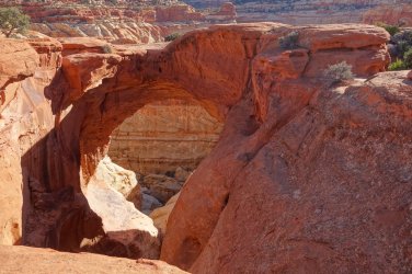
The starting point would be the Chimney Rock trailhead, and my objective was to link up the maintained park trails of Chimney Rock, Spring Canyon, Navajo Knobs, Frying Pan, Grand Wash, Golden Throne, Capitol Gorge, and Burro Wash into a single route. The idea was to use a series of known, but little traveled backcountry routes such as those to Fern's Nipple and across the Slickrock Expanse, to connect these all together. In addition, I planned to make short side-trips to Hickman Bridge and Cassidy Arch.
The planned route went something like this:
Day 1: Chimney Rock Trail.....Spring Canyon Trail.......Connector Route........Navajo Knobs Trail
Day 2: Navajo Knobs Trail......Hickman Bridge Trail.....Cohab Canyon Trail....Frying Pan Trail
Day 3: Frying Pan Trail..........Cassidy Arch Trail..........Grand Wash Trail........Fern's Nipple Route......Connector Route
Day 4: Connector Route........Golden Throne Trail.......Capitol Gorge Trail......Connector Route..........Slickrock Expanse
Day 5: Slickrock Expanse.......Pleasant Creek..............Connector Route........Burro Wash Trail
After obtaining my backpacking permit from the friendly folks at the visitor center, I set off on my adventure.
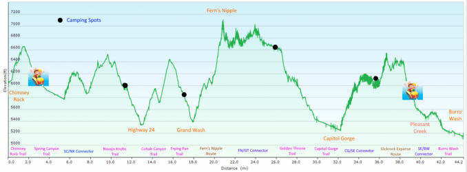
I hiked just over 44 miles in the 5 days of backpacking, with elevation gains of over 6,300 feet. There are plenty of ups and downs ! It would clearly be possible to hike this in 3 or 4 days, but I used the extra time to do quite a bit of off-trail exploring, especially around the Slickrock Expanse, where one could happily wander for several days.
It almost goes without saying that this route offers almost non-stop spectacular views across Capitol Reef and its surroundings. Although I was familiar with much of the route in advance, the opportunity to camp in the backcountry of the park, and to enjoy the early morning and late evening views was a very special experience. The entire hike was magnificent, and more than met my expectations.
I won't bore everyone this time with a detailed day-by-day report; hopefully the photos below will suffice to tell the story. However, I'll make a few observations below about the overall trip. Feel free to skip the boring bits, and scroll down to the photos
As I say, I absolutely loved this hike, and highly recommend it. From the elevation profile below, it is evident just how undulating the entire route is. Based on this, I've termed this: 'The Rollercoaster Route'
.I had visited Capitol Reef National Park on several occasions, walking many of the park trails, and exploring some of the backcountry on day-hikes. I had wondered for a while whether it may be possible to connect some of the established trails and 'unofficial' backcountry routes into a longer backpacking adventure.
There is a backcountry route within the park that has become more popular in recent years, but is still relatively little traveled. This is the Beehive Traverse. It's an ingenious route that connects a series of the park's remote canyons, domes, slots, fins, mesas, slopes, and bowls into a continuous trek. From a personal perspective, the issue is that, from the trip reports I have read, this route is probably a little out of my comfort zone in terms of difficulty, especially as I tend to hike alone. If someone with the backcountry prowess and experience of Jamal Green (@Jammer), when describing parts of the route, says: "... [they] just weren’t fun and some spots were potentially dangerous ...", then I know it's beyond my capabilities.
Thus, from my previous wanderings in Capitol Reef (and a lot of Google Earth research !) it did seem that there might be an easier alternative route through the central section of the park. My idea was to come up with a fun multi-day backpacking route that, as I say, would link several of the regular park trails and known backcountry routes. There was one 'gap' in the overall route however, and I couldn't find any information on how to connect 2 distinct particular trails. Thus, before I set off on the trek, I had to do an exploratory day-hike to try to establish if this gap could be traversed. Thankfully it did, which was a huge relief, so I was fairly hopeful that I'd be able to make a decent attempt at this route through the National Park.
The starting point would be the Chimney Rock trailhead, and my objective was to link up the maintained park trails of Chimney Rock, Spring Canyon, Navajo Knobs, Frying Pan, Grand Wash, Golden Throne, Capitol Gorge, and Burro Wash into a single route. The idea was to use a series of known, but little traveled backcountry routes such as those to Fern's Nipple and across the Slickrock Expanse, to connect these all together. In addition, I planned to make short side-trips to Hickman Bridge and Cassidy Arch.
The planned route went something like this:
Day 1: Chimney Rock Trail.....Spring Canyon Trail.......Connector Route........Navajo Knobs Trail
Day 2: Navajo Knobs Trail......Hickman Bridge Trail.....Cohab Canyon Trail....Frying Pan Trail
Day 3: Frying Pan Trail..........Cassidy Arch Trail..........Grand Wash Trail........Fern's Nipple Route......Connector Route
Day 4: Connector Route........Golden Throne Trail.......Capitol Gorge Trail......Connector Route..........Slickrock Expanse
Day 5: Slickrock Expanse.......Pleasant Creek..............Connector Route........Burro Wash Trail
After obtaining my backpacking permit from the friendly folks at the visitor center, I set off on my adventure.
I hiked just over 44 miles in the 5 days of backpacking, with elevation gains of over 6,300 feet. There are plenty of ups and downs ! It would clearly be possible to hike this in 3 or 4 days, but I used the extra time to do quite a bit of off-trail exploring, especially around the Slickrock Expanse, where one could happily wander for several days.
It almost goes without saying that this route offers almost non-stop spectacular views across Capitol Reef and its surroundings. Although I was familiar with much of the route in advance, the opportunity to camp in the backcountry of the park, and to enjoy the early morning and late evening views was a very special experience. The entire hike was magnificent, and more than met my expectations.
I won't bore everyone this time with a detailed day-by-day report; hopefully the photos below will suffice to tell the story. However, I'll make a few observations below about the overall trip. Feel free to skip the boring bits, and scroll down to the photos
As I say, I absolutely loved this hike, and highly recommend it. From the elevation profile below, it is evident just how undulating the entire route is. Based on this, I've termed this: 'The Rollercoaster Route'
.
.
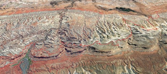
Google Earth view of the route looking north
.
.
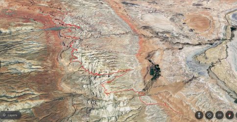
Google Earth view of the route looking east
-------------
I realize that this route wouldn't be for everyone since one obvious downside is that, by following many of the park trails, it is inevitable that there will be plenty of other people on the same trail. This didn't really bother me, probably because I knew that I'd be heading to a wonderful isolated backcountry camp spot later in the day. Also, there wasn't a single person hiking any of the connector routes when I was there, and even the park's maintained trails weren't really that busy (although the parking lots certainly were !).
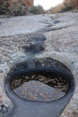
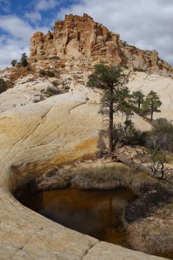
Another advantage of hiking via the trailhead parking lots of Hickman Bridge, Grand Wash, and Capitol Gorge was that there were plenty of opportunities to ask other visitors if they could spare some water; which in almost every circumstance they are delighted to do. Water is also always available in Pleasant Creek, and in the many potholes across the Slickrock Expanse. There's also a high probability of finding water in the water tanks, close to Capitol Gorge.
--------------
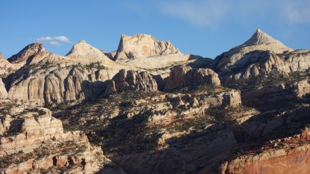
Since the route mainly follows the maintained trails within the National Park, much of the walking is very straightforward. The challenges obviously come in the backcountry sections but, even here, there are very few difficulties. The Fern's Nipple route is easy to follow and is marked by cairns for virtually the entire way from the low benches above Grand Wash to the base of the final peak. There are a couple of rather annoying steep, brushy, narrow chutes to negotiate in the latter stages of the Fern's Nipple route, and I had to push my pack up and over a couple of high ledges, but there isn't anything that should deter an experienced backpacker.
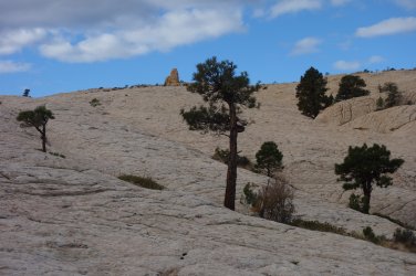
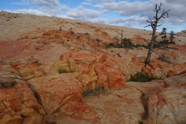
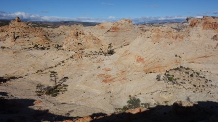
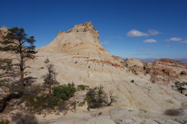
There isn't any kind of trail over the Slickrock Expanse; it is really just a case of meandering to your heart's content across the acres of magnificent sandstone, and then finally heading downhill to reach Pleasant Creek. This is a wonderful area for random exploring, with a multitude of colorful rocks, unusual formations, hoodoos, pondarosa pine oases, and water-filled potholes. From the top, there are several superb views across the park. Although I had visited this area several times before on day-hikes from the Notom-Bullfrog Road, I was still able to find some memorable new vistas, which I just randomly stumbled upon whilst exploring.
The remaining connector routes are all unmarked and having a GPS route and Topo map available would be useful. These routes are relatively simple to follow although, personally, I do tend to veer off-course towards a pretty rock formation or a killer viewpoint on a regular basis. Thus, some good route-finding skills are helpful in these remote backcountry areas.
--------------
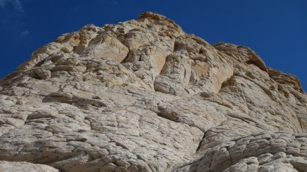
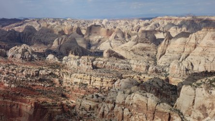
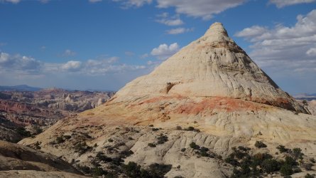
I had hoped to reach the summit of Fern's Nipple, but a combination of a strong wind and a crisis of confidence stopped me about 30 feet from the top. This final section is rather exposed and is a bit of a challenge. Of my 3 trips here, I have only made it to the summit once. The compensation, in any event, is the stupendous views available from (or close to !) the highest vantage point in the park at 7,064 feet.
From the base of Fern's Nipple, the hiker can continue east or west to join the connector route towards the Golden Throne Trail. Both require a little route-finding, but the east option around the base is probably a little easier. The west option drops into a sandy wash and looks simple, but there is an unexpected pour-off which needs to be bypassed via a clamber up a steep slickrock slope.
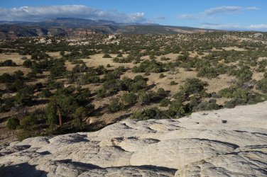
The Fern's Nipple/Golden Throne Connector is one the few relatively flat sections of the entire route, and should make for some simple hiking. Unfortunately, much of this area is covered in literally thousands of small cacti which appear to have ninja-like qualities, as merely brushing them seems to cause the pads to hurl themselves mercilessly at the lower leg, easily penetrating exposed skin. Long pants are reccomended ! Interestingly, in the few sections without cactus, there are several areas where stone flakes (lithic scatter) are evident, suggesting that this high plateau was a hunting area for the Ancient Ones several thousand years ago. I wonder how they dealt with the cactus !
---------------
The route ends at the Burro Wash Trailhead on the Notom-Bullfrog Road. This is a fairly quiet road, with relatively few vehicles passing, but I hoped that by reaching the trailhead by mid-afternoon, I stood a good chance of hitchhiking back to where my vehicle was parked. I was running later than expected and got to the road about 5pm, which still gave me about 2 hours until sunset to catch a ride. As expected, there were very few cars, and over the next 90 minutes, only 7 or 8 had passed by; none of whom were looking to pick up a smelly hiker. As 7pm approached, and darkness fell, I realised I'd probably have to pitch my tent for another night in a wash, close to the road, and then try again the next morning. Then at 6.55pm a car pulled over. It was a lovely Dutch couple who had got hopelessly lost and had headed down the Notom Road in search of a motel. Luckily, (for them and me !) they had turned around, but still didn't know where to find a bed for the night. They were delighted when I told them I could point them towards the several motels in Torrey, a few miles away, and were more than happy to drop me off along Highway 24, where I could quickly walk back to my car.
An alternative to finishing this hike at Burro Wash could be to hike west along the Pleasant Creek Route, after descending from the Slickrock Expanse. This is a beautiful walk with many interesting features to discover, which ends at the Pleasant Creek dirt road. From there, it is less then 3 miles to the turn-off to Capitol Gorge, from where there would be a lot of passing cars, if one wanted to catch a ride back to the visitor center or campground.
-----------------
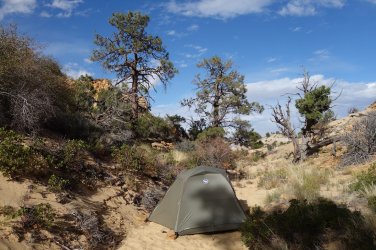
It really wouldn't be a memorable backpacking trip for me, without at least one incident of note ! Upon reaching the slickrock expanse, I found a beautiful secluded and sheltered (!) spot to pitch my tent. It was only mid-afternoon, so I had plenty of time to explore this magnificent area for the rest of the day. It was a beautiful day with barely a cloud in the sky. Whilst sitting inside my tent, sorting out my sleeping bag, and camp mat, I heard an almighty 'whooshing' sound, as though an enormous vacuum cleaner had been turned on. I was then literally thrown forward by the force of what was, in fact, a huge gust of wind. The structure of the tent bent over me as I leant forward, and then just as suddenly recoiled back with equal force. This time though, I heard a dramatic 'crunch' above my head. One of the tent poles had snapped ! This was a first for me. For the next 20 minutes the wind was relentless and fierce, and I sat clinging on to the walls of the tent, hoping that it wouldn't be ripped to shreds, as I was buffeted in all directions. It felt like being on a small boat being tossed and turned by huge ocean waves. Just as suddenly as it arrived, the wind was gone, and as I popped my head out of the tent, the sky's above were still perfect and blue. In common with all backpackers, I carry a small bag of 'useful stuff', that almost never gets used for anything. There are elastic bands, bulldog clips, safety pins, zip ties, superglue, and goodness knows what else in there. Thankfully, there was also a tent-pole splint in the bag, so I was able to use that to fashion a quick repair of my tent. It worked wonderfully, and was still going strong by the end of my trip, 3 weeks later.
-----------------
The adventure begins !
.
.
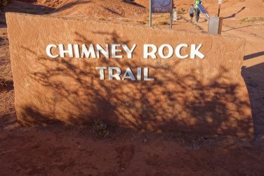
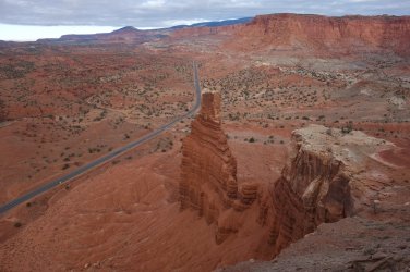
Chimney Rock viewpoint
.
.
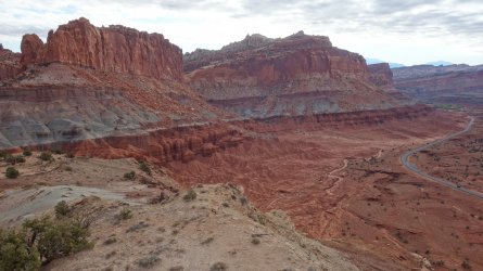
View of the reef from Chimney Rock Trail
.
.
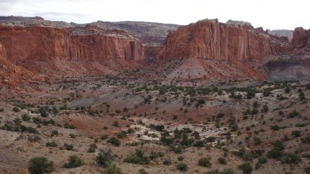
Chimney Rock Trail leading to Spring Canyon Trail
.
.
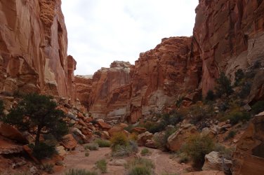
Spring Canyon Trail
.
.
The Hidden Glen (!) on the Spring Canyon - Navajo Knobs Connector
.
.
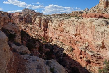
View of The Castle from the Navajo Knobs Trail
.
.
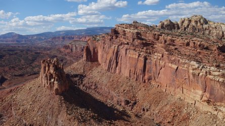
Rim walking on the Navajo Knobs Trail
.
.
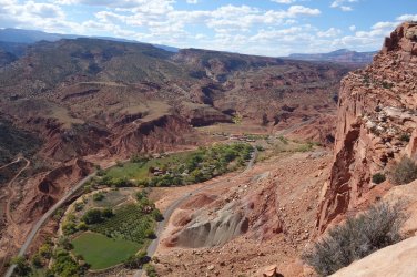
View of the Fruita orchards from the Navajo Knobs Trail
.
.
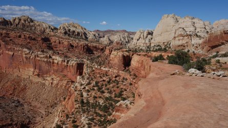
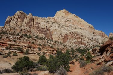
Navajo Knobs Trail
.
.
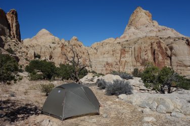
Camping off the Navajo Knobs Trail
.
.
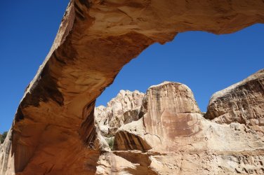
Hickman Bridge
.
.
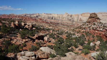
Frying Pan Trail
.
.
View towards the Fern's Nipple Route from the Frying Pan Trail
.
.
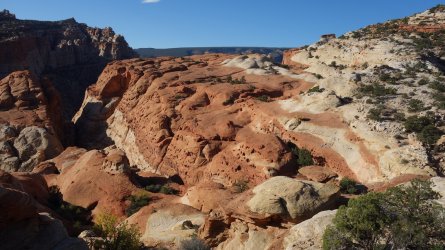
View towards the Cassidy Arch Trail from the Frying Pan Trail
.
.
Cassidy Arch
.
.
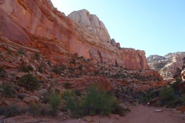
Grand Wash
.
.
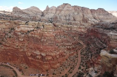
Looking down on Grand Wash from the Fern's Nipple Route
.
.
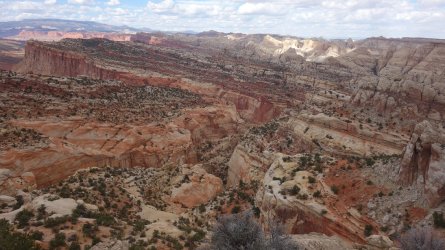
View from the approach to Fern's Nipple
.
.
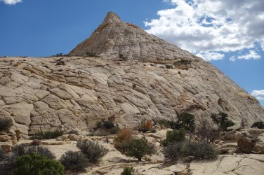
The base of Fern's Nipple
.
.
The final approach to Fern's Nipple ... which of the 3 exposed routes will you take ?
.
.
View from the final approach to Fern's Nipple
.
.
Fern's Nipple looking north
.
.
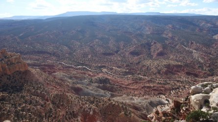
View west of the Scenic Drive
.
.
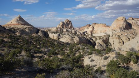
View of Fern's Nipple from the Connector Route towards Golden Throne
.
.
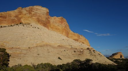
Approaching the Golden Throne
.
.
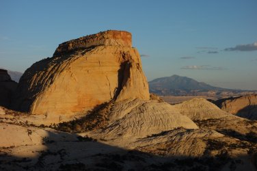
The Golden Throne at sunset
.
.
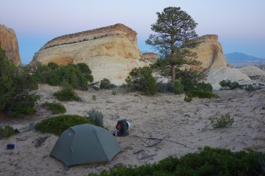
Camping with views of the Golden Throne
.
.
Fern's Nipple - Golden Throne Connector covered in thousands of cactus
.
.
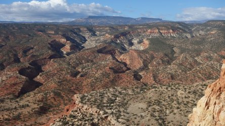
View west from Fern's Nipple - Golden Throne Connector
.
.
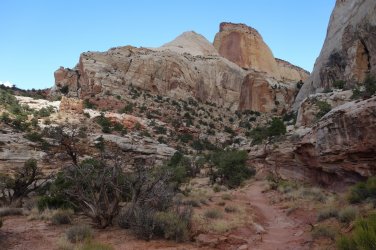
Descending on the Golden Throne Trail
.
.
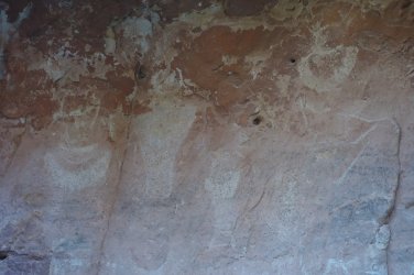
Rock art in Capitol Gorge
.
.
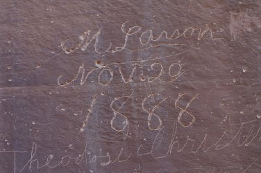
Pioneer signatures in Capitol Gorge
.
.
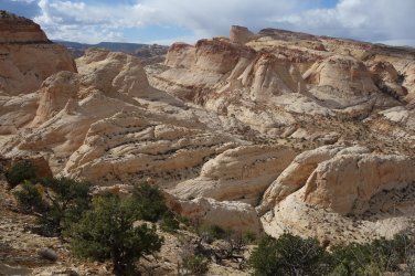
Ascending the Capitol Gorge - Slickrock Expanse Connector
.
.
Camping in a sheltered (!) spot on the approach to the Slickrock Expanse
.
.
Many Pools on the approach to the Slickrock Expanse
 ......
 .
..
.
Slickrock Expanse
.
.
Colorful rocks on Slickrock Expanse
.
.
Slickrock Expanse
.
.
Slickrock Expanse
.
.
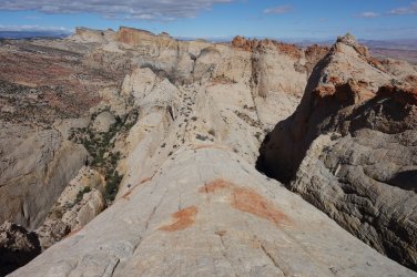
Incredible viewpoint from the top of huge sandstone fin
.
.
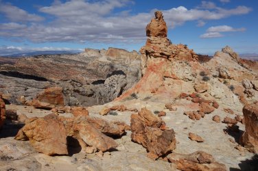
Slickrock Expanse
.
.
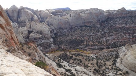
Slickrock Expanse
.
.
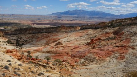
View of Pleasant Creek from the Slickrock Expanse
.
.
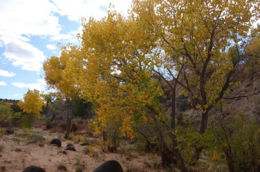
Pleasant Creek
.
.
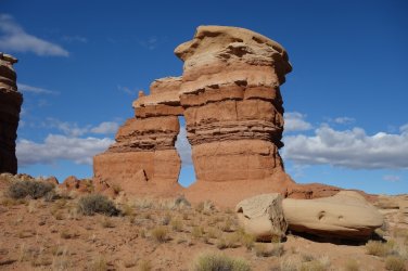
Burro Wash Arch
.
.
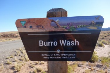
Burro Wash
.
.
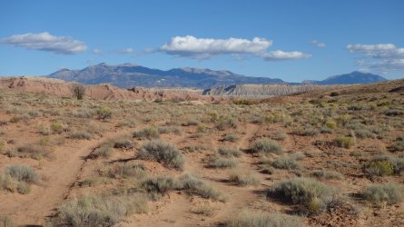
End of the hike !
.
.
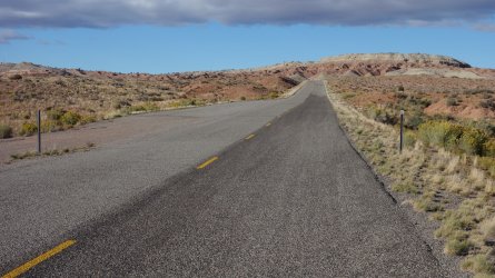
Hmmm ... where are all the cars ?
.
.
"Life is a rollercoaster ... Just gotta ride it ..." - Ronan Keating
.
.
.
.
