- Joined
- Dec 23, 2013
- Messages
- 4,297
On Friday, July the 3rd, my hiking partner Matt and I attempted a 16.3 mile hike beginning at the end of Millcreek Canyon, hiking up to Murdock Peak then heading west along the Millcreek Ridge to Grandeur Peak.
We met at the small park at the end of Wasatch Boulevard near Parley's Canyon at 5:00 am and left our vehicles at our endpoint. My wife then shuttled us up to the top of Millcreek and we hit the trail at 5:30 am. The temperature was a nice 53 degrees when we started hiking. It took us about an hour and forty five minutes to cover the 3.3 miles to the summit of Murdock Peak. At first we had the pleasure of hiking in the moonlight but soon the sun was hitting Gobblers Knob located on the south side of the canyon. As we made our way up Murdock, soon the prominent Cottonwood Ridge came into view.
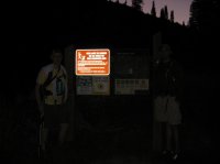
At the trailhead

Not quite a full moon
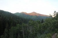
Sunlight on Gobblers Knob
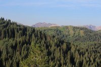
Cottonwood Ridge coming into view
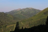
Gobblers Knob and Mount Raymond

Murdcok Peak
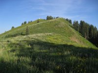
Almost to the top
Once on top of Murdock Peak, the rest of the day seemed pretty straight forward; just follow the ridge for thirteen miles back to Salt Lake. The first section from Murdock Peak to Millvue Peak was relatively easy with only two small areas of intense bushwhacking. The wildflowers along this stretch, and actually the entire hike, were absolutely fabulous!
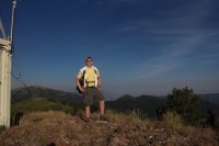
Scatman on top of Murdock Peak
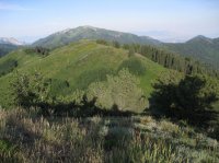
Looking down the ridge in the direction we are hiking. Grandeur Peak is located on the far right side of the photo way in the background.
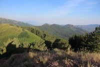
Another look along the ridge with Grandeur way in the back just left of center and Mount Aire to the right of center
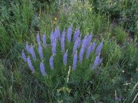
Wildflowers along the way
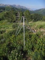
Abandoned tripod on the ridge

Sticky Geraniums along the way
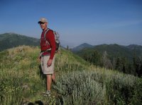
Matt on the ridge
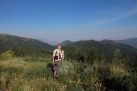
Scatman with a good view of the rest of the Millcrrek Ridge behind. Grandeur Peak is in the center way in the back just above my head.
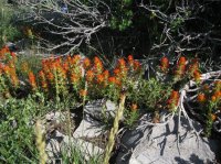
Paintbrush
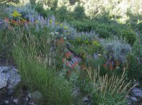
More wildflowers
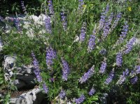
And still more
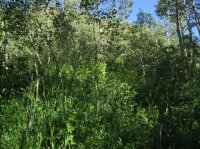
One of the areas with intense bushwhacking before Millvue Peak
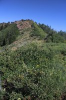
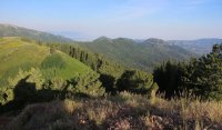
Looking along he ridge in our direction of travel
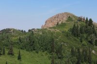
What looms ahead
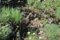
Grouse that actually attacked me protecting its young
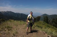
Me on Millvue Peak - Grandeur Peak getting closer! Mount Olympus can be seen over my right shoulder in the distance.
After Millvue Peak things began to get rougher the bushwhacking grew more intense and the general up and down became steeper. There is a trail down from Millvue to the saddle between Lambs Canyon and Elbow Fork but it is grown over and we lost it about halfway down. This cost us valuable time towards the end of the hike that we could have used.
At the saddle. the trail continues along the ridge to the north for about four tenths of a mile and then it is off-trail travel again as we dropped down to a saddle and then gained the ridge again east of Mount Aire. Once reaching the unnamed peak to the east of Mount Aire we dropped down to another saddle before beginning our climb to the summit of Mount Aire.
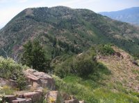
Good look at Mount Aire

Looking back on the unnamed peak east of Mount Aire
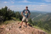
Matt on top of Mount Aire - Parley's Canyon in the background
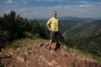
Scatman on Mount Aire
We then proceeded down the normal trail that ascends Mount Aire until we reached the saddle between Elbow Fork and Smith Creek Canyon. At this point we picked up and old trail to gain the ridge again that quickly became grown over and soon we lost it. From this point it was just a flat out nasty bushwhack to reach the head of Burch Hollow. Without question, the hardest bushwhacking I have ever done.

Bushwhacking through similar vegetation all the way to Burch Hollow. Nasty stuff!
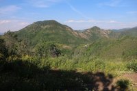
Looking back on Mount Aire and the unnamed peak to the east
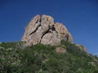
Large rock at the head of Burch Hollow
Once we reached the large rock at the head of Burch Hollow, there is an elk trail that runs along the north side of the ridge that would take us almost all the way to Church Fork Peak. Once on top of Church Fork Peak, we had Grandeur Peak staring us in the face!

Elk trail followed to Church Fork Peak
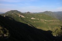
Looking back on Burch Hollow. Mount Aire on the left in the background and Millvue on the right of the image.
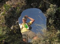
A mirror on top of Church Fork Peak
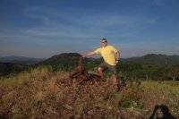
Scatman on top of Church Fork Peak. Mount Aire just above my right hand in the distance.
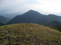
Grandeur Peak in front of us!
After Church Fork Peak, we headed out towards Grandeur. This section turned out to be extremely tough going and our pace was slowed considerably. We were also losing precious daylight as we made our way.
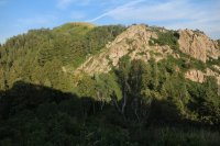
Looking back up at Church Fork Peak. A nice scramble down the rocks.

Last good image of Grandeur that I could get with the fading light
We finally reached the Church Fork Trail that heads up Grandeur Peak from the east side. we only had a half mile to go; maybe twenty five of thirty minutes of hiking at the most and Matt could not continue uphill. He was completely out of gas. Bonked! He could only mange to go slowly downhill so we hiked out on the Church fork Trail to the road.
We completed the hike at 12:05 Saturday morning. Over 18.5 hours of hiking! Happy Fourth of July!
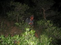
Matt, sliding down on his rear end to the Church fork Trail, exhausted

Scatman at the Church Fork Trail on Grandeur Peak
Since we didn't exit at the West Slope Trailhead for Grandeur, we had some folks who passed us at the end of the Church Fork Trail call my wife when they had cell service and she came and picked us up.
Wow, what a hike! It really took it out of me. I'm not sure how hot it got up on the ridge but it was hot. I carried 3 liters of Gatorade and 5.5 liter of water, three of which were frozen. I probably should have carried one more liter of water or Gatorade. My legs are beat to shit, I've got two nasty blisters on my right foot underneath my calluses and three days later my energy levels haven't returned to normal though certainly they are heading in the right direction.
I might mention that we saw three moose, two deer, probably twenty grouse, seven horned toads, a few hawks, a vulture (probably circling us) and a vole which made this trip excellent form a wildlife perspective.
For those who want to see all the images of our hike, here is the link.
Millcreek Ridge Images
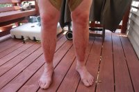
Ouch!
Enjoy.
Featured image for home page:
We met at the small park at the end of Wasatch Boulevard near Parley's Canyon at 5:00 am and left our vehicles at our endpoint. My wife then shuttled us up to the top of Millcreek and we hit the trail at 5:30 am. The temperature was a nice 53 degrees when we started hiking. It took us about an hour and forty five minutes to cover the 3.3 miles to the summit of Murdock Peak. At first we had the pleasure of hiking in the moonlight but soon the sun was hitting Gobblers Knob located on the south side of the canyon. As we made our way up Murdock, soon the prominent Cottonwood Ridge came into view.

At the trailhead

Not quite a full moon

Sunlight on Gobblers Knob

Cottonwood Ridge coming into view

Gobblers Knob and Mount Raymond

Murdcok Peak

Almost to the top
Once on top of Murdock Peak, the rest of the day seemed pretty straight forward; just follow the ridge for thirteen miles back to Salt Lake. The first section from Murdock Peak to Millvue Peak was relatively easy with only two small areas of intense bushwhacking. The wildflowers along this stretch, and actually the entire hike, were absolutely fabulous!

Scatman on top of Murdock Peak

Looking down the ridge in the direction we are hiking. Grandeur Peak is located on the far right side of the photo way in the background.

Another look along the ridge with Grandeur way in the back just left of center and Mount Aire to the right of center

Wildflowers along the way

Abandoned tripod on the ridge

Sticky Geraniums along the way

Matt on the ridge

Scatman with a good view of the rest of the Millcrrek Ridge behind. Grandeur Peak is in the center way in the back just above my head.

Paintbrush

More wildflowers

And still more

One of the areas with intense bushwhacking before Millvue Peak

Looking along he ridge in our direction of travel

What looms ahead

Grouse that actually attacked me protecting its young

Me on Millvue Peak - Grandeur Peak getting closer! Mount Olympus can be seen over my right shoulder in the distance.
After Millvue Peak things began to get rougher the bushwhacking grew more intense and the general up and down became steeper. There is a trail down from Millvue to the saddle between Lambs Canyon and Elbow Fork but it is grown over and we lost it about halfway down. This cost us valuable time towards the end of the hike that we could have used.
At the saddle. the trail continues along the ridge to the north for about four tenths of a mile and then it is off-trail travel again as we dropped down to a saddle and then gained the ridge again east of Mount Aire. Once reaching the unnamed peak to the east of Mount Aire we dropped down to another saddle before beginning our climb to the summit of Mount Aire.

Good look at Mount Aire

Looking back on the unnamed peak east of Mount Aire

Matt on top of Mount Aire - Parley's Canyon in the background

Scatman on Mount Aire
We then proceeded down the normal trail that ascends Mount Aire until we reached the saddle between Elbow Fork and Smith Creek Canyon. At this point we picked up and old trail to gain the ridge again that quickly became grown over and soon we lost it. From this point it was just a flat out nasty bushwhack to reach the head of Burch Hollow. Without question, the hardest bushwhacking I have ever done.

Bushwhacking through similar vegetation all the way to Burch Hollow. Nasty stuff!

Looking back on Mount Aire and the unnamed peak to the east

Large rock at the head of Burch Hollow
Once we reached the large rock at the head of Burch Hollow, there is an elk trail that runs along the north side of the ridge that would take us almost all the way to Church Fork Peak. Once on top of Church Fork Peak, we had Grandeur Peak staring us in the face!

Elk trail followed to Church Fork Peak

Looking back on Burch Hollow. Mount Aire on the left in the background and Millvue on the right of the image.

A mirror on top of Church Fork Peak

Scatman on top of Church Fork Peak. Mount Aire just above my right hand in the distance.

Grandeur Peak in front of us!
After Church Fork Peak, we headed out towards Grandeur. This section turned out to be extremely tough going and our pace was slowed considerably. We were also losing precious daylight as we made our way.

Looking back up at Church Fork Peak. A nice scramble down the rocks.

Last good image of Grandeur that I could get with the fading light
We finally reached the Church Fork Trail that heads up Grandeur Peak from the east side. we only had a half mile to go; maybe twenty five of thirty minutes of hiking at the most and Matt could not continue uphill. He was completely out of gas. Bonked! He could only mange to go slowly downhill so we hiked out on the Church fork Trail to the road.
We completed the hike at 12:05 Saturday morning. Over 18.5 hours of hiking! Happy Fourth of July!

Matt, sliding down on his rear end to the Church fork Trail, exhausted

Scatman at the Church Fork Trail on Grandeur Peak
Since we didn't exit at the West Slope Trailhead for Grandeur, we had some folks who passed us at the end of the Church Fork Trail call my wife when they had cell service and she came and picked us up.
Wow, what a hike! It really took it out of me. I'm not sure how hot it got up on the ridge but it was hot. I carried 3 liters of Gatorade and 5.5 liter of water, three of which were frozen. I probably should have carried one more liter of water or Gatorade. My legs are beat to shit, I've got two nasty blisters on my right foot underneath my calluses and three days later my energy levels haven't returned to normal though certainly they are heading in the right direction.
I might mention that we saw three moose, two deer, probably twenty grouse, seven horned toads, a few hawks, a vulture (probably circling us) and a vole which made this trip excellent form a wildlife perspective.
For those who want to see all the images of our hike, here is the link.
Millcreek Ridge Images

Ouch!
Enjoy.
Featured image for home page:


