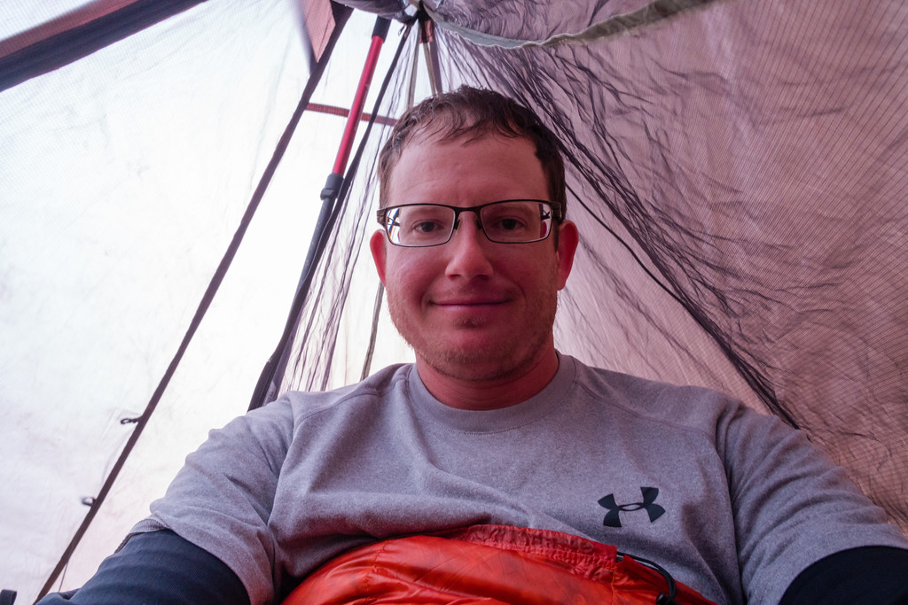
b.stark
Forever Wandering
- Joined
- Apr 8, 2015
- Messages
- 1,193
I'm stealing a bit of Brian's thunder here, but hey I have more spare time than him, so here goes nothing:
In April of this year, I was invited along on a trip to the Maze District of Canyonlands National Park, near Moab, UT. The Grand Canyon last year got my interest up in desert environments. I usually only really backpack in the Rocky Mountains, but the desert is a very interesting place I've always wanted to explore some more. So, when Curt asked if I'd like to go, I promptly said yes and got my vacation time put in soon as we had a solid date for the trip nailed down. After all the planning and changes of planning were done, we ended up with 5 days in the Maze, entering via jet boat to Spanish Bottom. Curt and I would drive from Nebraska, and have about a day and a half to spend before the backpacking trip proper began. So, we decided to see some of the sights in the area around Moab.
We left Lincoln, NE at a decent time in the morning, headed for Glenwood Springs, CO. I had never been through the mountains in the winter, so as we drove through Colorado on I-70 I paid a lot of attention, well, much as I could while driving. Not as much snow as I'd hoped, but it was still nice. There was a fresh coat of snow on the way home, though, which I really enjoyed seeing.
A quick stop at Frisco, CO.
The next day we started early for Moab. I was very excited at the first view of the La Sals.
We took the scenic route to Moab along Utah 128. Definitely worth it.
Next stop was Arches, to be a real tourist for a bit. I really wanted to brave the crowds and hike to Delicate Arch. Worth it, to me.
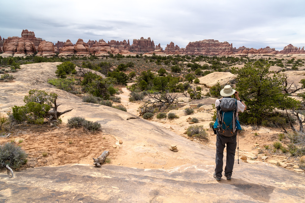
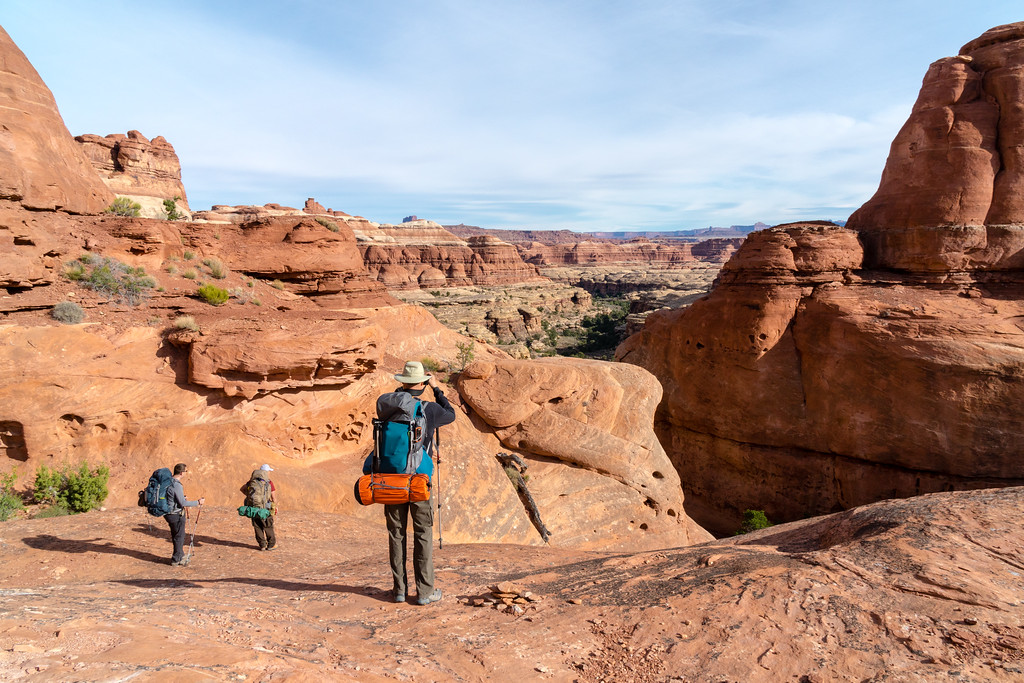
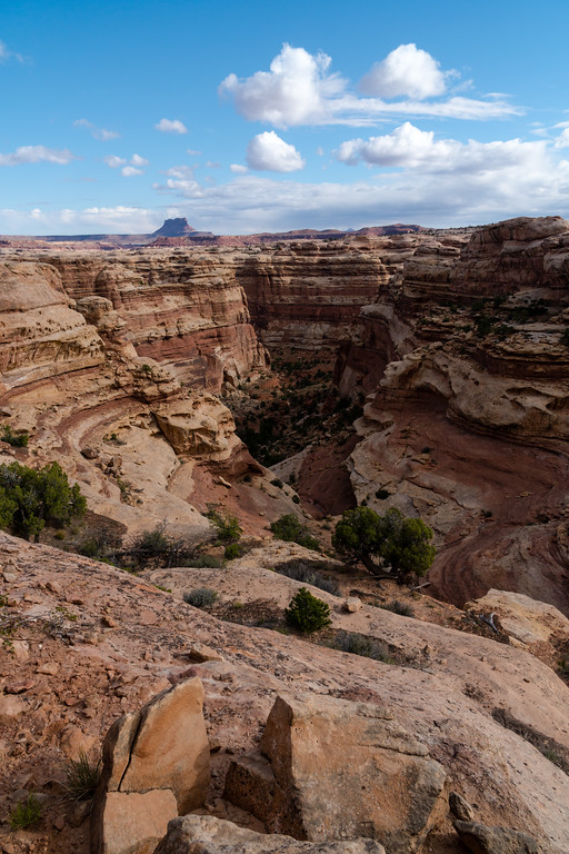
We spent a while hiking to other arches in the area, then headed toward the Needles District to camp overnight. Since we had a lot of time the next day, we figured on doing a dayhike to Druid Arch and/or Chesler Park.
The drive down to the Needles was much cooler than I expected. All along Indian Creek the scenery was excellent. We stopped at Newspaper Rock, and were flagged down by a couple as we pulled into the parking lot. Unfortunately, they had locked their keys in their car. Since I had my shiny new pickup along, I didn't have it stocked with the standard farmer-special stuff like #9 wire, and we couldn't find any, so I wasn't able to help them unlock it that way. Gave the guy a ride back to a point where we could get cell service and call AAA. They turned out to be from Washington, and he told some good hunting stories of trips in the area of Mount St. Helens. We didn't stay until they got their car unlocked, but they weren't still there the next day so hopefully all ended well for them. Because of all that, I never did get any pictures of Newspaper Rock, but it was definitely worth stopping to see.
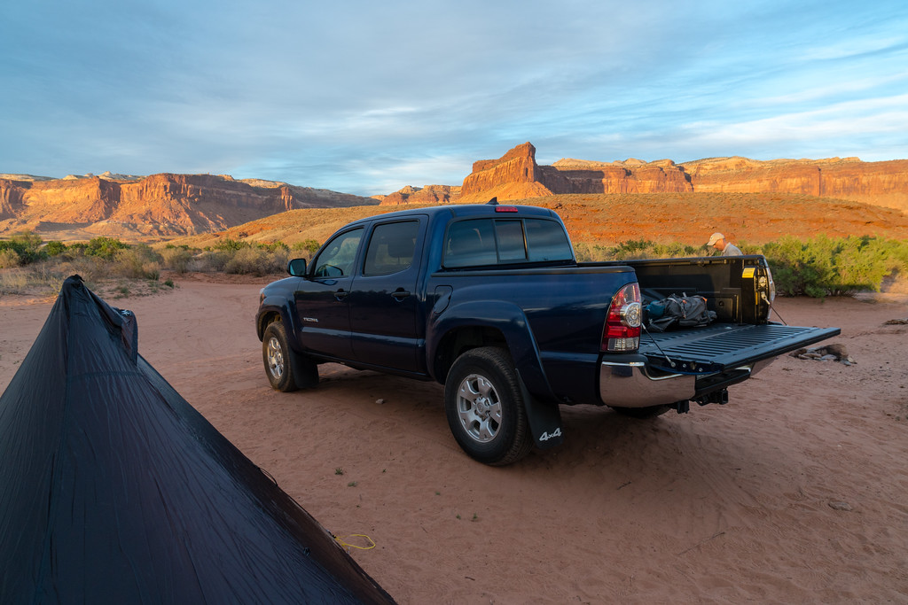
We camped that night at a BLM campground just outside the national park. The views and weather were both excellent, with brightly lit cliffs sending out the day for us. The place was sandy and dusty, but that's kind of the desert. When setting up my Duomid, it instantly got covered in sand when I laid it out, and... it has never been the same since. The desert sand loves Duomids more than me, evidently, and simply will not let go.
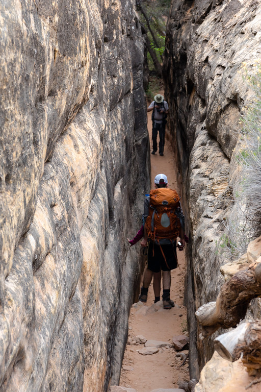
A while after we had set camp, a couple pulled in and camped next to us. We got to talking to them, and found that they were out on a road trip a few months long, seeing a wide swath of the country. Curt invited them along on our hike the next day, and they decided to come along. So, the next day we drove to the Elephant Hill trailhead and headed for Druid Arch.
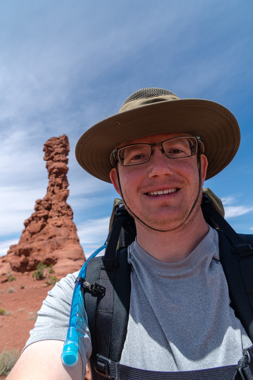
A cool joint along the way
Druid Arch was as impressive as anything we saw in Arches, to me, even though it's not really a classic arch in form. We were also apparently the first people there that day, and had something like an hour or 1.5 hours to ourselves there. On the way back we met quite a few people, both dayhikers and backpackers. Plenty of water farther up in Elephant Canyon. We nixed the hike through Chesler Park to avoid getting overly worn out before our backpacking trip tomorrow, and the couple we were hiking with wanted to find a campground with showers.
Needles on the way back to the trailhead
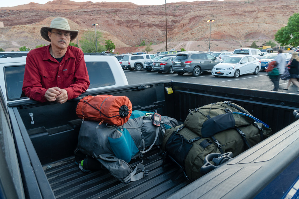
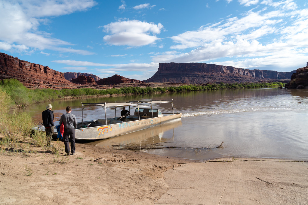
Curt and I then headed to Moab to meet up with the other two going to the Maze. We had some issue with cell service in Moab, but finally got things figured out. At the hotel, we all got to doing our last minute packing and repacking, and finally were ready for the Maze. The next morning, we headed to Tex's Riverways plenty early to get our boat ride to Spanish Bottom.
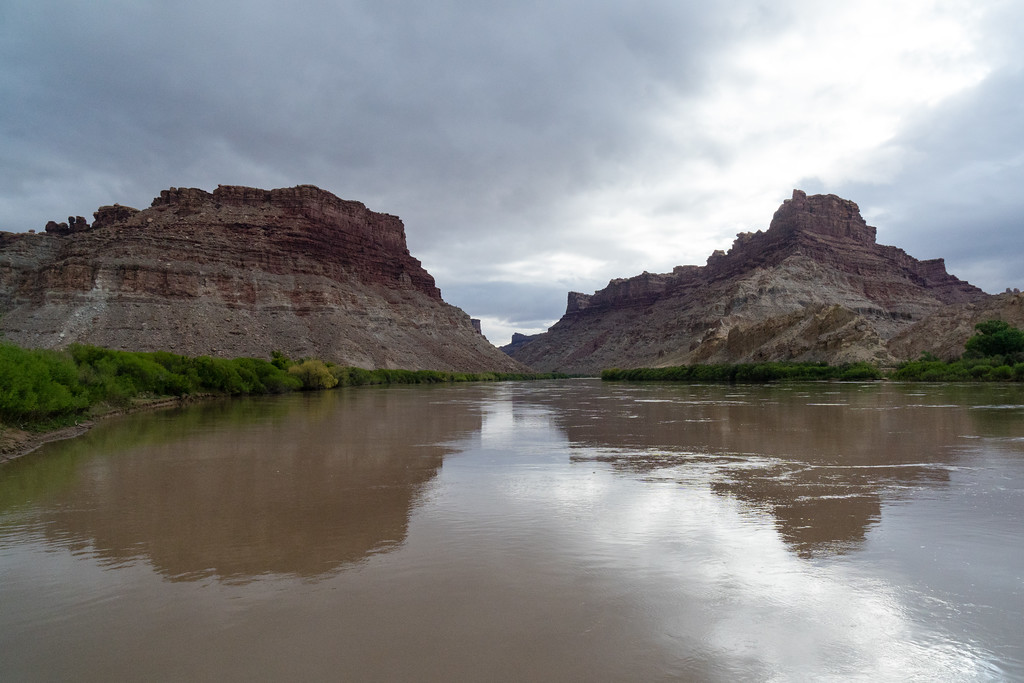
After all the formalities and the bus ride, we got on the river. The boat ride down the river is about 50 miles long and takes around 2 hours. The boat ride to Spanish Bottom, although cold, was the single most enjoyable boat ride I've ever done. Great scenery and a smooth ride all the way.
After arriving at Spanish Bottom, we left the boat, which would pick us up at the same spot in 5 days. Our first challenge was a climb of about 1200 feet in a mile, up to the Dollhouse. We made the climb well enough, with somewhat threatening skies.
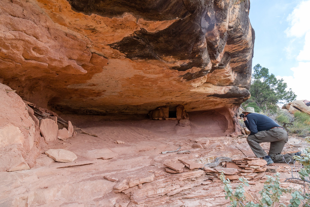
First order of business was a side trip to the Granaries.
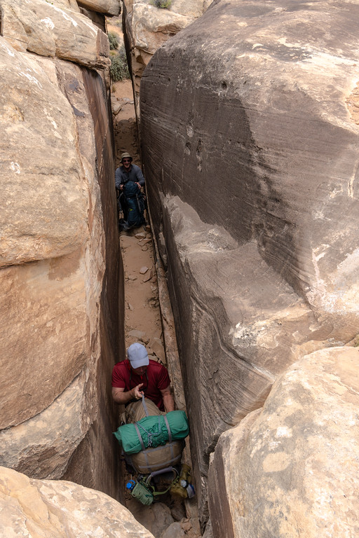
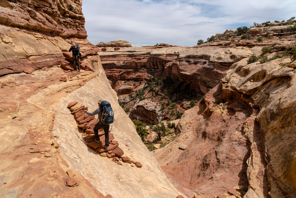
The trail through the Dollhouse requires you to go through a joint where you have to hand your pack up to somebody above.
Then on past Beehive Arch.
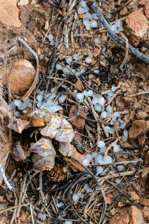
A bit further on and we took a break. My shoes were filling with sand and we all needed a break for some food. Just after getting ready to go... HAIL!
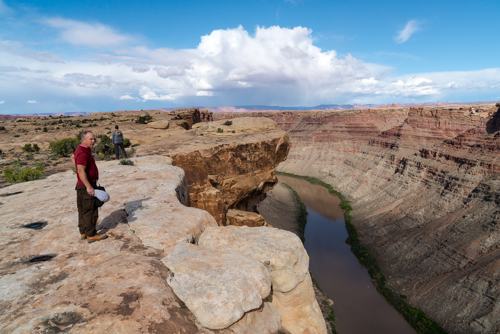
After hiking onward and making camp, we dayhiked to the overlook of the confluence of the Green and Colorado. Well, 3 of the 4 of us did. I was convinced that at the point of this picture I was looking at the confluence somehow, and didn't figure out my mistake until the rest of the group was already back to where I was. Oh well, the view of the Colorado was great, and I finally got my bearings after a confusing day of hiking.
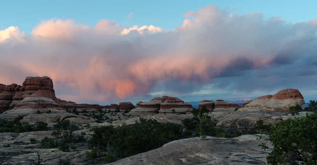
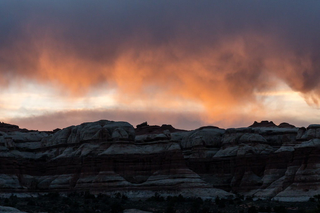
The sunset was excellent that night, with brightly lit clouds and alpenglow on the La Sals.
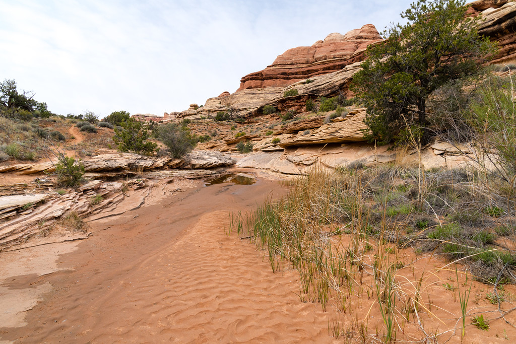
The next day the goal was to camp between Chimney Rock and Pete's Mesa. Those plans would change partway through the day, for better or worse. The morning hike into Water Canyon was fun.
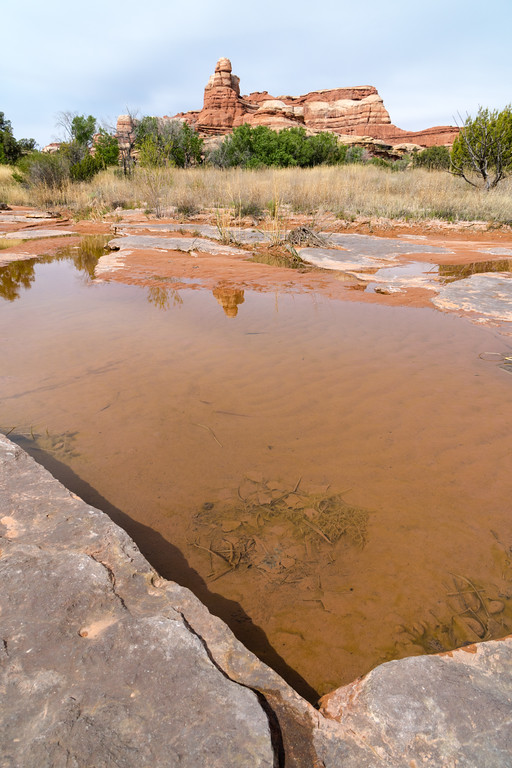
Water Canyon was our first stop to fill up on water. True to its name, it had water, including a couple tiny trickles of waterfalls.
The hike up out of Water Canyon is loads of fun.
A little water in Shot Canyon. This hike was a lot tougher than I thought it would be. Just lots of sand and little ups and downs that added up, and the heat was really kicking in.
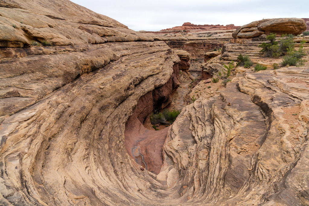
Eventually we found the famous steps up and out of Shot. It wasn't a terrible climb, to me, and the steps were very cool.

We took a good rest at Chimney Rock. We had decided that instead of camping on the ridge between there and Pete's Mesa, we would push to the spring at the end of Pictograph Fork. This would add quite a bit of distance, but put us in good shape to make the last few days of the hike more relaxing. Brian wasn't feeling very well, so we hoped that making the last few days short would be better.
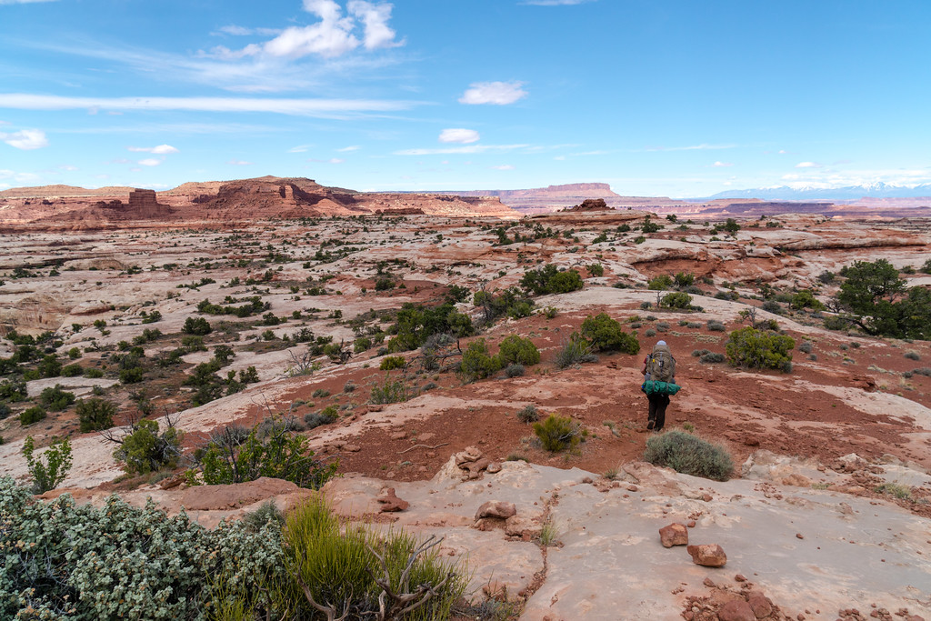
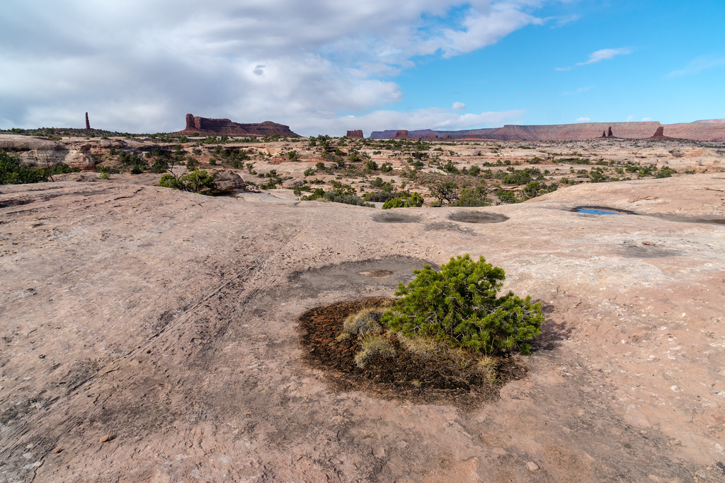
The hike along this ridge was probably my favorite part of the trip. Great views of the Maze, the La Sals, the Land of Standing Rocks, Elaterite Butte, Ekker Butte, the Chocolate Drops, Pete's Mesa... no shortage of things to see. In certain ways, the slickrock here reminded me a bit of high alpine country in the mountains. Small islands of dirt and plants clinging to life, surrounded by harsh rock. My kind of hiking for sure.
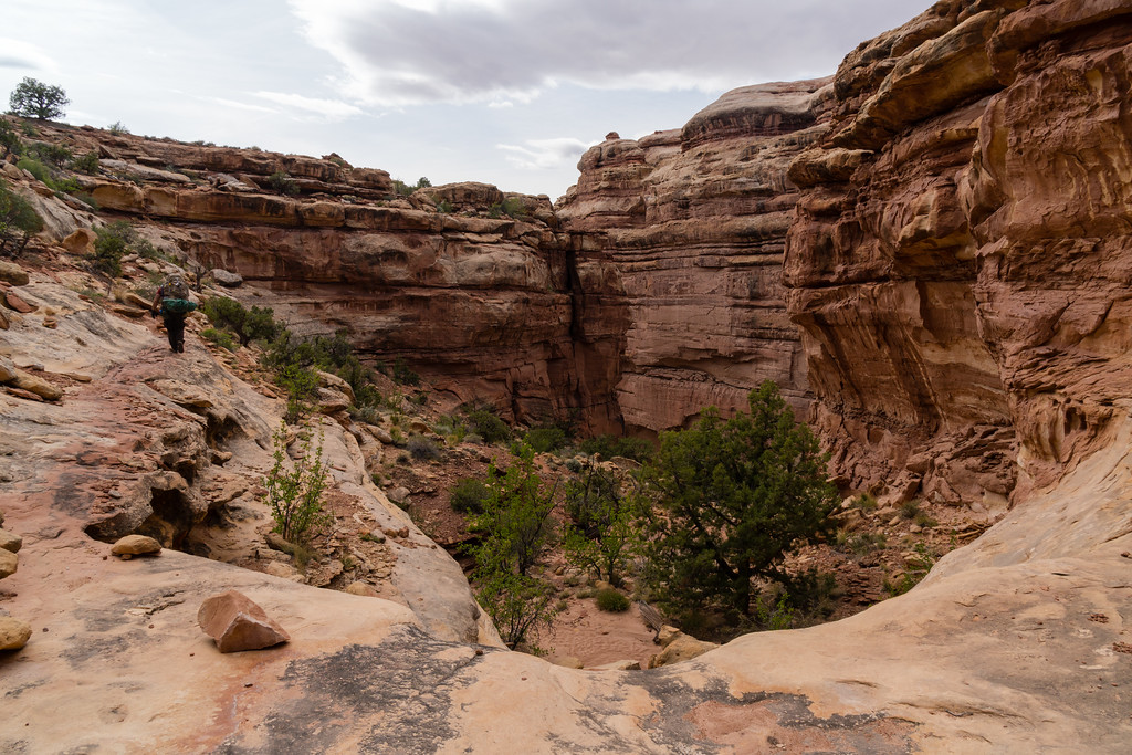
The drop down into the Maze was tough. We were tired, it was hot, and we wanted to get to camp and relax. It seemed to take forever, the downclimb was typical of what we were coming to expect from the area, but the hike through sand at the bottom pretty much all the way to the spring was a bit rough. I don't like hiking in sand!
Finally we did find the spring, and we made camp right at the junction with Pictograph Fork. Very nice campsite.
It rained overnight, causing trouble for the other three, who weren't using tents. I pretty much slept through it, and was quite comfortable inside my dust-coated Duomid.
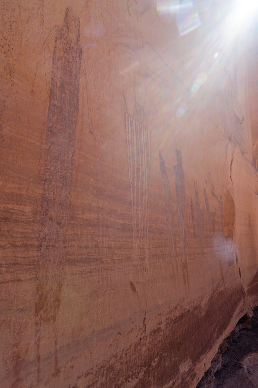
The next morning, we were headed up toward the Harvest Scene. Our original intention was to head upward and go out of the Maze at The Plug, although at this point we were thinking of camping as far up the canyon as we could instead of camping up high near the Land of Standing Rocks.
Good views of the Chocolate Drops from below. SOMEBODY had to bring up that the white rocks on top looked like marshmallows, and of course nobody had any to share...
We spent quite a while at the Harvest Scene. Talked to a couple rangers there, and one of them spoke of the route out to Chimney Rock being easier than going up to the Plug. Also, water seemed more readily accessible up the Chimney Rock fork of the canyon. So, we decided to head up that way and camp near water in the canyon. The forecast for that night was also a bit windy if I recall correctly, so staying low seemed more wise than camping high in open country.
We hiked up the Chimney Rock fork of the canyon, eventually getting great views of said rock ahead of us. We found water, and a side canyon with excellent camping sites. This was as far as we would go today. This was probably my favorite campsite of the trip. Good weather, nice views, water, and a relaxed afternoon. Also a monstrous Juniper tree, maybe 2.5+ feet in diameter at its base.
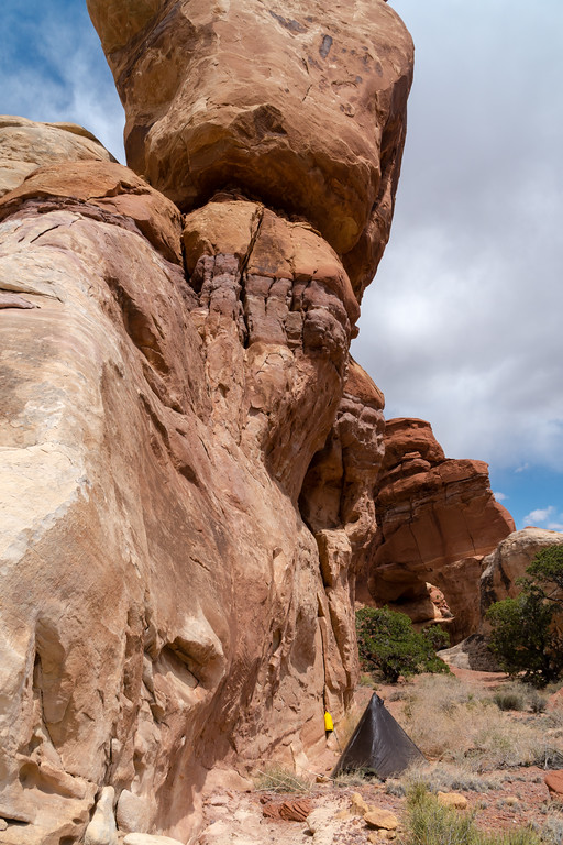
The next days' plan was a bit perplexing. I would have preferred to push on to Spanish Bottom and camp there, but the group didn't have all the required equipment to camp there. To camp close would mean getting legal camp somewhere near the Dollhouse, and you can't camp within half a mile of that. In the end, we ended up camping at Beehive Arch, after searching fruitlessly for other sites in that area.
The climb out of the Maze to Chimney Rock was about equivalent to any other climb out we'd done. Steep slickrock, some climbing, and a couple sets of rock steps.
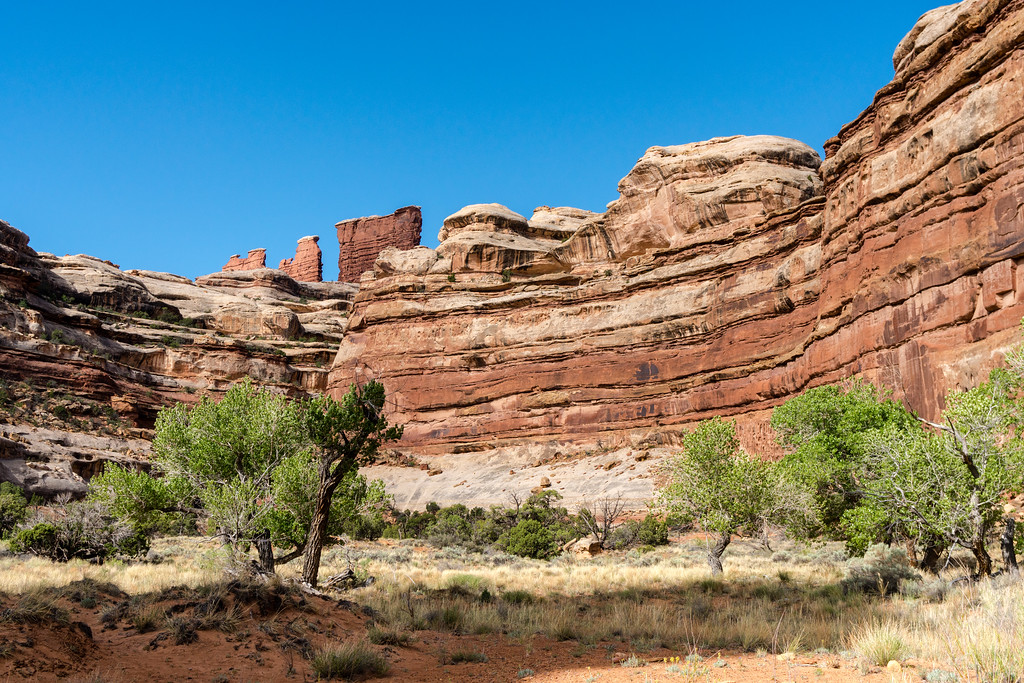
Up top, there were outstanding views of the Land of Standing Rocks.
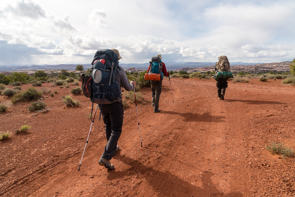
The skies were a bit threatening as we road walked to the Dollhouse. There are sure some challenging spots on this road. I would not like to drive my own pickup on this road!
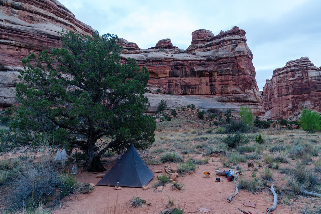
Camp at Beehive Arch.
The afternoon at Beehive Arch was a long one. We got to camp early and were all antsy to get back out. We killed time around camping by eating extra food, drinking plenty of water, and general tomfoolery. Eventually it started to.... snow. It was definitely a cold evening, and eventually I retired to my tent to warm up and read. Still smiling despite the weather!
Our last sunset almost matched the first for color and beauty. I was concerned it would be a very cold night, but slept comfortably as any, and never even put my beanie on (sign of a very cold night for me).
The next morning we made an early start for Spanish Bottom. Why so much earlier? Well... it's tradition for me to make a sprint to the trailhead on the last day of a hike, for whatever reason. So there was that. Also, the weather looked maybe sketchy, so it seemed good to get to Spanish Bottom and deal with weather there rather than on the 1200 foot descent. But mostly I wanted to get back to civilization! I think the hike from our campsite to the bottom took maybe 1.5 hours for me. I did a bit of rushing down the trail, and made it a bit ahead of the rest of the group.
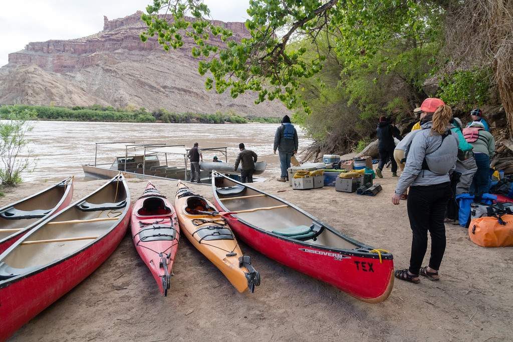
The boat showed up on time. We would be hauled out with quite a few canoers and kayakers. Everything fit in the boat with room to spare, and the guides loaded the thing up very quickly, saying that we were a “light” load. We lucked out and this was their only pickup for the day, so we went nonstop back up to Potash Bottom, just over 2 hours for the ride I think. It wasn't as interesting the second time through, probably because I was ready to be back. Food and showers were high on the list of priorities!
Uneventful boat ride back (it was cold, again). A stop at the Moab Diner for lunch, then Curt and I parted ways with Steve and Brian. We (Curt and I) stayed in Grand Junction that night, and drove back home to Nebraska the next day, through freshly powdered mountains in Colorado, and a frustrating April snowstorm in central Nebraska. I drove about 855 miles that day, a long one but didn't break my personal record of 900+ in a day.
THE END.
In April of this year, I was invited along on a trip to the Maze District of Canyonlands National Park, near Moab, UT. The Grand Canyon last year got my interest up in desert environments. I usually only really backpack in the Rocky Mountains, but the desert is a very interesting place I've always wanted to explore some more. So, when Curt asked if I'd like to go, I promptly said yes and got my vacation time put in soon as we had a solid date for the trip nailed down. After all the planning and changes of planning were done, we ended up with 5 days in the Maze, entering via jet boat to Spanish Bottom. Curt and I would drive from Nebraska, and have about a day and a half to spend before the backpacking trip proper began. So, we decided to see some of the sights in the area around Moab.
We left Lincoln, NE at a decent time in the morning, headed for Glenwood Springs, CO. I had never been through the mountains in the winter, so as we drove through Colorado on I-70 I paid a lot of attention, well, much as I could while driving. Not as much snow as I'd hoped, but it was still nice. There was a fresh coat of snow on the way home, though, which I really enjoyed seeing.
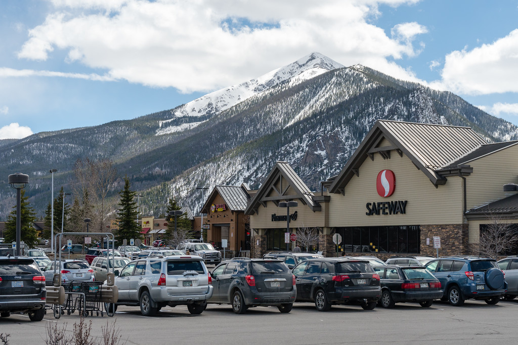
A quick stop at Frisco, CO.
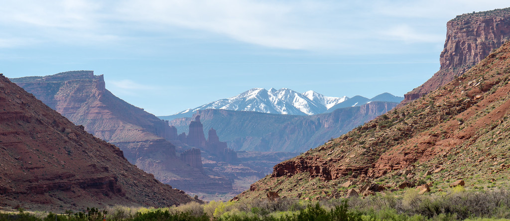
The next day we started early for Moab. I was very excited at the first view of the La Sals.
We took the scenic route to Moab along Utah 128. Definitely worth it.
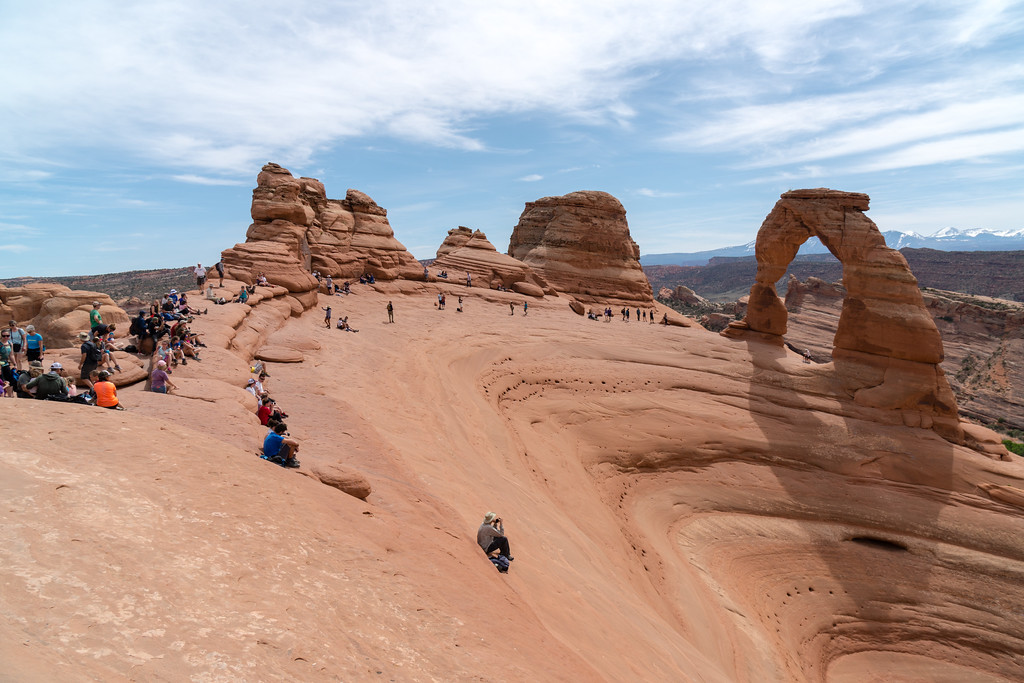
Next stop was Arches, to be a real tourist for a bit. I really wanted to brave the crowds and hike to Delicate Arch. Worth it, to me.
We spent a while hiking to other arches in the area, then headed toward the Needles District to camp overnight. Since we had a lot of time the next day, we figured on doing a dayhike to Druid Arch and/or Chesler Park.
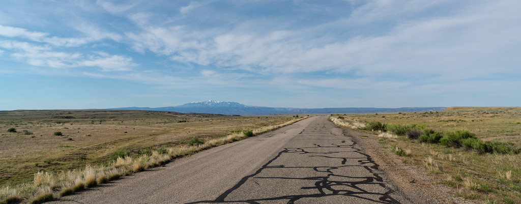
The drive down to the Needles was much cooler than I expected. All along Indian Creek the scenery was excellent. We stopped at Newspaper Rock, and were flagged down by a couple as we pulled into the parking lot. Unfortunately, they had locked their keys in their car. Since I had my shiny new pickup along, I didn't have it stocked with the standard farmer-special stuff like #9 wire, and we couldn't find any, so I wasn't able to help them unlock it that way. Gave the guy a ride back to a point where we could get cell service and call AAA. They turned out to be from Washington, and he told some good hunting stories of trips in the area of Mount St. Helens. We didn't stay until they got their car unlocked, but they weren't still there the next day so hopefully all ended well for them. Because of all that, I never did get any pictures of Newspaper Rock, but it was definitely worth stopping to see.
We camped that night at a BLM campground just outside the national park. The views and weather were both excellent, with brightly lit cliffs sending out the day for us. The place was sandy and dusty, but that's kind of the desert. When setting up my Duomid, it instantly got covered in sand when I laid it out, and... it has never been the same since. The desert sand loves Duomids more than me, evidently, and simply will not let go.
A while after we had set camp, a couple pulled in and camped next to us. We got to talking to them, and found that they were out on a road trip a few months long, seeing a wide swath of the country. Curt invited them along on our hike the next day, and they decided to come along. So, the next day we drove to the Elephant Hill trailhead and headed for Druid Arch.
A cool joint along the way
Druid Arch was as impressive as anything we saw in Arches, to me, even though it's not really a classic arch in form. We were also apparently the first people there that day, and had something like an hour or 1.5 hours to ourselves there. On the way back we met quite a few people, both dayhikers and backpackers. Plenty of water farther up in Elephant Canyon. We nixed the hike through Chesler Park to avoid getting overly worn out before our backpacking trip tomorrow, and the couple we were hiking with wanted to find a campground with showers.
Needles on the way back to the trailhead
Curt and I then headed to Moab to meet up with the other two going to the Maze. We had some issue with cell service in Moab, but finally got things figured out. At the hotel, we all got to doing our last minute packing and repacking, and finally were ready for the Maze. The next morning, we headed to Tex's Riverways plenty early to get our boat ride to Spanish Bottom.
After all the formalities and the bus ride, we got on the river. The boat ride down the river is about 50 miles long and takes around 2 hours. The boat ride to Spanish Bottom, although cold, was the single most enjoyable boat ride I've ever done. Great scenery and a smooth ride all the way.
After arriving at Spanish Bottom, we left the boat, which would pick us up at the same spot in 5 days. Our first challenge was a climb of about 1200 feet in a mile, up to the Dollhouse. We made the climb well enough, with somewhat threatening skies.
First order of business was a side trip to the Granaries.
The trail through the Dollhouse requires you to go through a joint where you have to hand your pack up to somebody above.
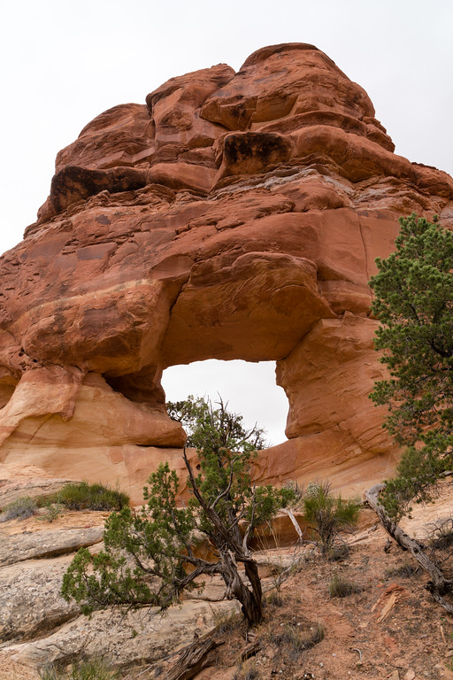
Then on past Beehive Arch.
A bit further on and we took a break. My shoes were filling with sand and we all needed a break for some food. Just after getting ready to go... HAIL!
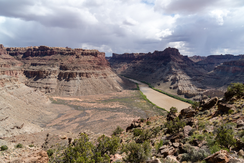
After hiking onward and making camp, we dayhiked to the overlook of the confluence of the Green and Colorado. Well, 3 of the 4 of us did. I was convinced that at the point of this picture I was looking at the confluence somehow, and didn't figure out my mistake until the rest of the group was already back to where I was. Oh well, the view of the Colorado was great, and I finally got my bearings after a confusing day of hiking.
The sunset was excellent that night, with brightly lit clouds and alpenglow on the La Sals.
The next day the goal was to camp between Chimney Rock and Pete's Mesa. Those plans would change partway through the day, for better or worse. The morning hike into Water Canyon was fun.
Water Canyon was our first stop to fill up on water. True to its name, it had water, including a couple tiny trickles of waterfalls.
The hike up out of Water Canyon is loads of fun.
A little water in Shot Canyon. This hike was a lot tougher than I thought it would be. Just lots of sand and little ups and downs that added up, and the heat was really kicking in.
Eventually we found the famous steps up and out of Shot. It wasn't a terrible climb, to me, and the steps were very cool.
We took a good rest at Chimney Rock. We had decided that instead of camping on the ridge between there and Pete's Mesa, we would push to the spring at the end of Pictograph Fork. This would add quite a bit of distance, but put us in good shape to make the last few days of the hike more relaxing. Brian wasn't feeling very well, so we hoped that making the last few days short would be better.
The hike along this ridge was probably my favorite part of the trip. Great views of the Maze, the La Sals, the Land of Standing Rocks, Elaterite Butte, Ekker Butte, the Chocolate Drops, Pete's Mesa... no shortage of things to see. In certain ways, the slickrock here reminded me a bit of high alpine country in the mountains. Small islands of dirt and plants clinging to life, surrounded by harsh rock. My kind of hiking for sure.
The drop down into the Maze was tough. We were tired, it was hot, and we wanted to get to camp and relax. It seemed to take forever, the downclimb was typical of what we were coming to expect from the area, but the hike through sand at the bottom pretty much all the way to the spring was a bit rough. I don't like hiking in sand!
Finally we did find the spring, and we made camp right at the junction with Pictograph Fork. Very nice campsite.
It rained overnight, causing trouble for the other three, who weren't using tents. I pretty much slept through it, and was quite comfortable inside my dust-coated Duomid.
The next morning, we were headed up toward the Harvest Scene. Our original intention was to head upward and go out of the Maze at The Plug, although at this point we were thinking of camping as far up the canyon as we could instead of camping up high near the Land of Standing Rocks.
Good views of the Chocolate Drops from below. SOMEBODY had to bring up that the white rocks on top looked like marshmallows, and of course nobody had any to share...
We spent quite a while at the Harvest Scene. Talked to a couple rangers there, and one of them spoke of the route out to Chimney Rock being easier than going up to the Plug. Also, water seemed more readily accessible up the Chimney Rock fork of the canyon. So, we decided to head up that way and camp near water in the canyon. The forecast for that night was also a bit windy if I recall correctly, so staying low seemed more wise than camping high in open country.
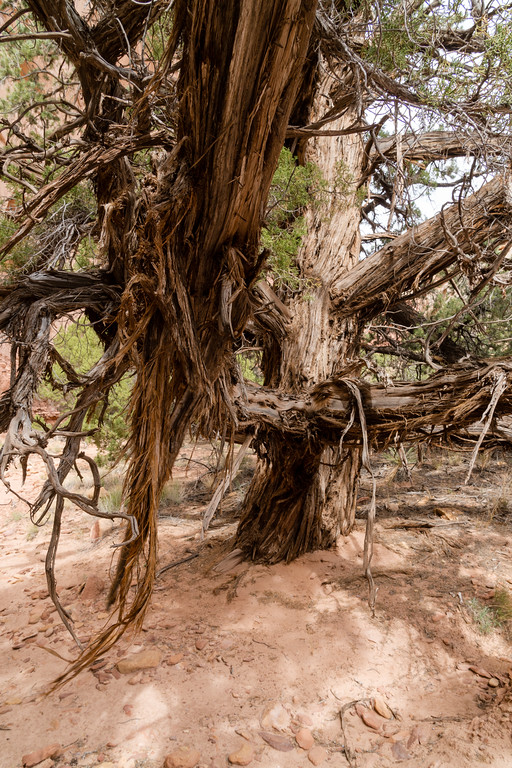
We hiked up the Chimney Rock fork of the canyon, eventually getting great views of said rock ahead of us. We found water, and a side canyon with excellent camping sites. This was as far as we would go today. This was probably my favorite campsite of the trip. Good weather, nice views, water, and a relaxed afternoon. Also a monstrous Juniper tree, maybe 2.5+ feet in diameter at its base.
The next days' plan was a bit perplexing. I would have preferred to push on to Spanish Bottom and camp there, but the group didn't have all the required equipment to camp there. To camp close would mean getting legal camp somewhere near the Dollhouse, and you can't camp within half a mile of that. In the end, we ended up camping at Beehive Arch, after searching fruitlessly for other sites in that area.
The climb out of the Maze to Chimney Rock was about equivalent to any other climb out we'd done. Steep slickrock, some climbing, and a couple sets of rock steps.
Up top, there were outstanding views of the Land of Standing Rocks.
The skies were a bit threatening as we road walked to the Dollhouse. There are sure some challenging spots on this road. I would not like to drive my own pickup on this road!
Camp at Beehive Arch.
The afternoon at Beehive Arch was a long one. We got to camp early and were all antsy to get back out. We killed time around camping by eating extra food, drinking plenty of water, and general tomfoolery. Eventually it started to.... snow. It was definitely a cold evening, and eventually I retired to my tent to warm up and read. Still smiling despite the weather!
Our last sunset almost matched the first for color and beauty. I was concerned it would be a very cold night, but slept comfortably as any, and never even put my beanie on (sign of a very cold night for me).
The next morning we made an early start for Spanish Bottom. Why so much earlier? Well... it's tradition for me to make a sprint to the trailhead on the last day of a hike, for whatever reason. So there was that. Also, the weather looked maybe sketchy, so it seemed good to get to Spanish Bottom and deal with weather there rather than on the 1200 foot descent. But mostly I wanted to get back to civilization! I think the hike from our campsite to the bottom took maybe 1.5 hours for me. I did a bit of rushing down the trail, and made it a bit ahead of the rest of the group.
The boat showed up on time. We would be hauled out with quite a few canoers and kayakers. Everything fit in the boat with room to spare, and the guides loaded the thing up very quickly, saying that we were a “light” load. We lucked out and this was their only pickup for the day, so we went nonstop back up to Potash Bottom, just over 2 hours for the ride I think. It wasn't as interesting the second time through, probably because I was ready to be back. Food and showers were high on the list of priorities!
Uneventful boat ride back (it was cold, again). A stop at the Moab Diner for lunch, then Curt and I parted ways with Steve and Brian. We (Curt and I) stayed in Grand Junction that night, and drove back home to Nebraska the next day, through freshly powdered mountains in Colorado, and a frustrating April snowstorm in central Nebraska. I drove about 855 miles that day, a long one but didn't break my personal record of 900+ in a day.
THE END.
