Udink
Still right here.
- Joined
- Jan 17, 2012
- Messages
- 1,748
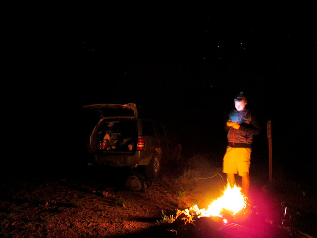
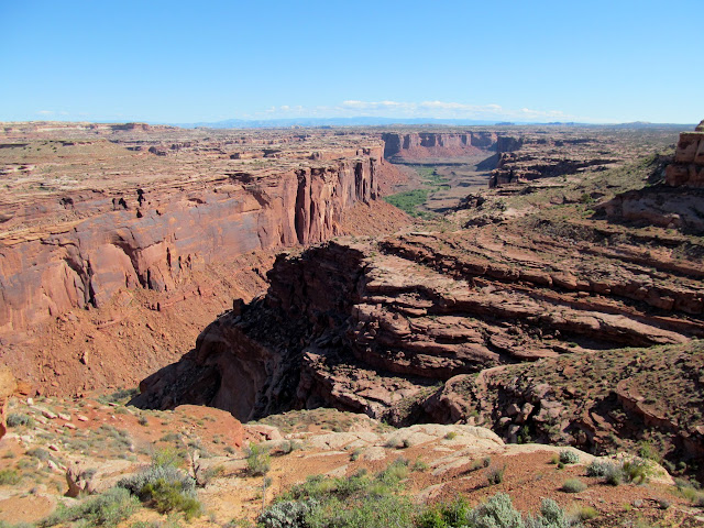
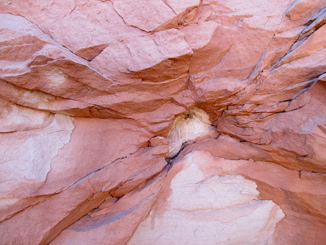
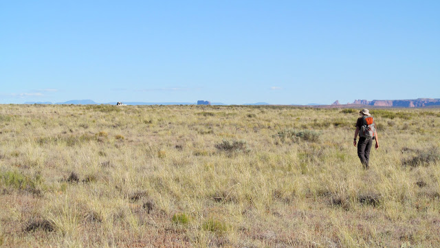
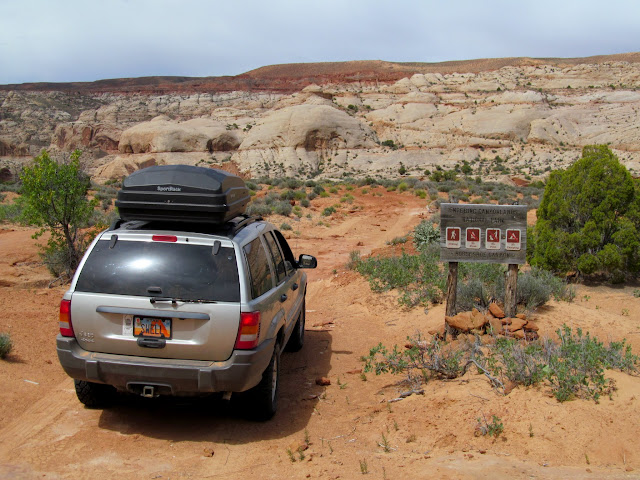
"Surely there must be more rock art in Horseshoe Canyon outside of the Canyonlands National Park unit, right?" I've often had that thought, and I finally took the opportunity to test it out. The canyon spans 25 air miles from its head near Hans Flats to the mouth at the Green River, but only about five miles of that, in the middle part of the canyon, is a part of the detached national park unit that contains the famous Great Gallery and other incredible Barrier Canyon style rock art. I figured the best chance for finding additional rock art would be near the mouth, where an abandoned meander of the Green River forms the horseshoe shape for which the canyon is named. I recruited Chris to accompany me on the trip and we left town on Friday afternoon. A little while after turning north onto the Spur road we encountered a man walking toward us on the dirt road. I customarily stop when I see people walking on remote roads just to make sure they're not in need of any assistance, but before I rolled to a stop I saw the NPS logo on the guy's shirt. It was clear that he was just a Park Service employee out for an evening walk, but I chatted with him for a bit anyway. He asked what we were up to and I told him we were going to camp at the end of the Spur road and hike down the Angel Trail in the morning. I was surprised, then, when he asked if I'd checked in with Kathryn at the ranger station and whether we had a camping permit. "Nope," I said, "we'll be on BLM land so none of that is necessary." I'm not sure whether he was just flexin' or genuinely didn't know anything about the area and its regulations. He abruptly ended the conversation with an, "Okay then, you guys have a good time." Continuing north, we saw some nice views of the La Sals and the Abajos in the spotty sunshine, though as we neared the end of the Spur road the skies grew dark. A couple of miles shy of the end of the road we hiked to the rim of Horseshoe Canyon to do some scouting for the following day's hike. Just as we reached the end of the road the sun peeked out very briefly, lighting everything up pinkish-orange before setting. I had planned on setting up a tent but the sky cleared before bed time and I ended up sleeping on a tarp on the ground.
La Sal Mountains
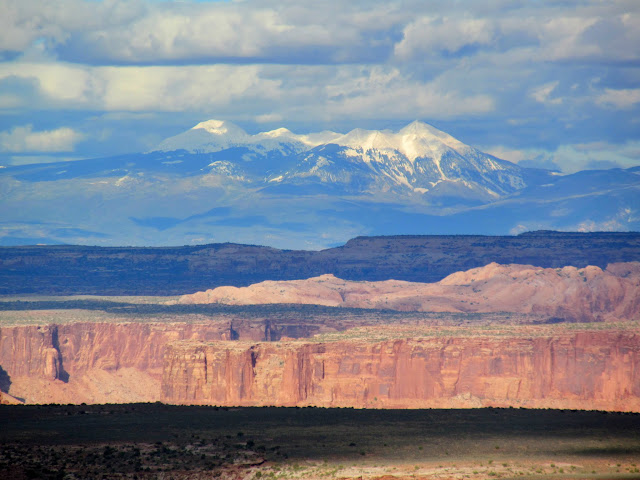
Abajo Mountains
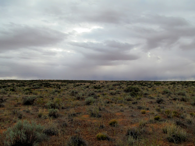
Dark skies, with flat terrain belying the canyon country ahead
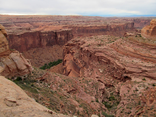
Lower Horseshoe Canyon from the rim
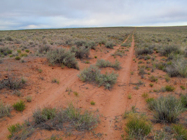
Two-track road across the Spur
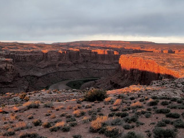
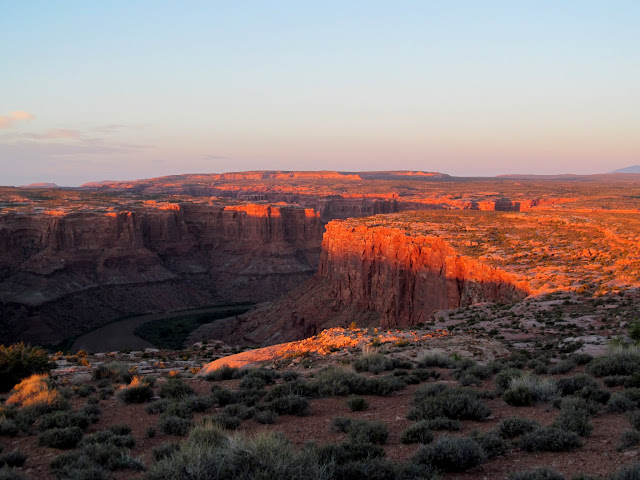
Shadows rising on the canyon walls above the Green River
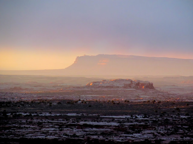
Book Cliffs
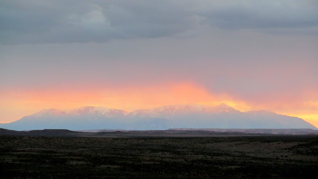
Henry Mountains
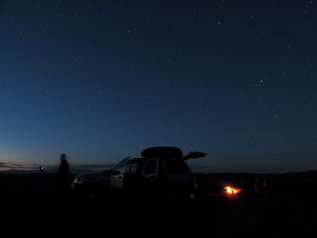
Camp fire and cell service!
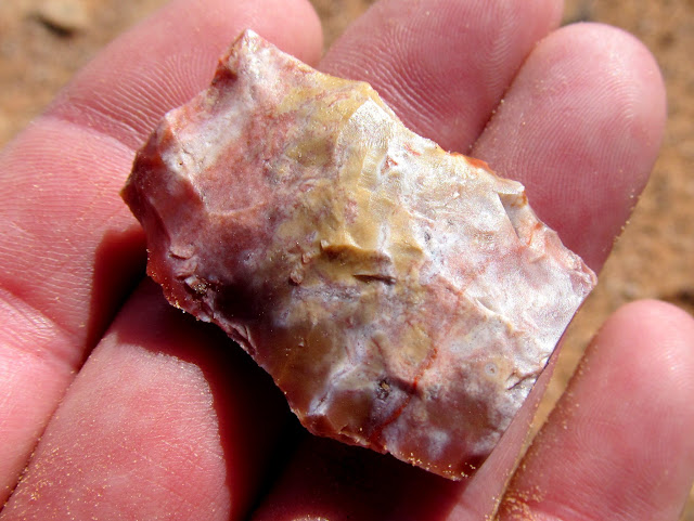
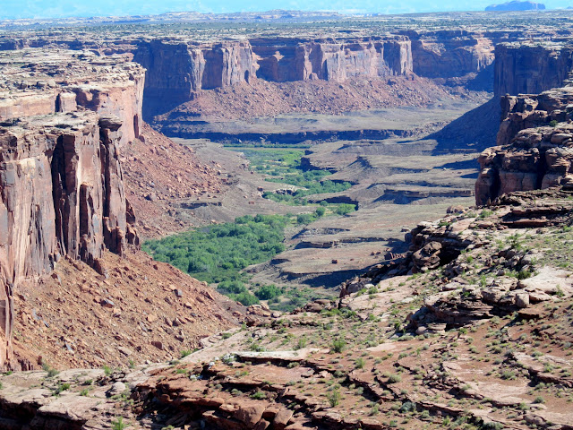
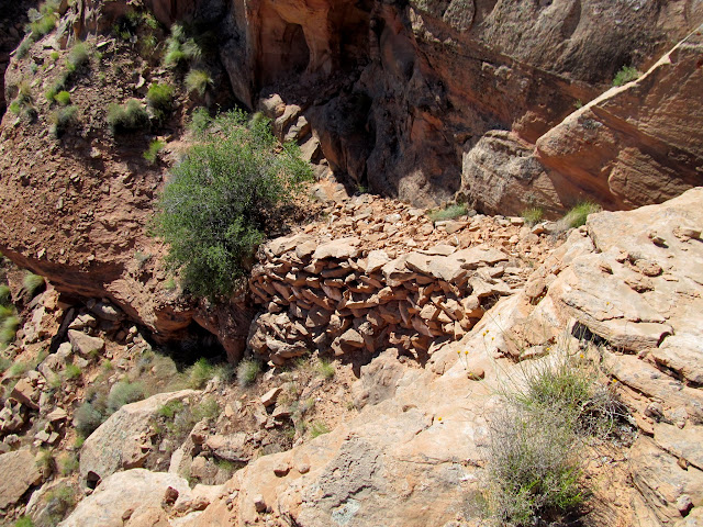
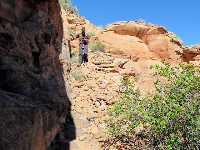
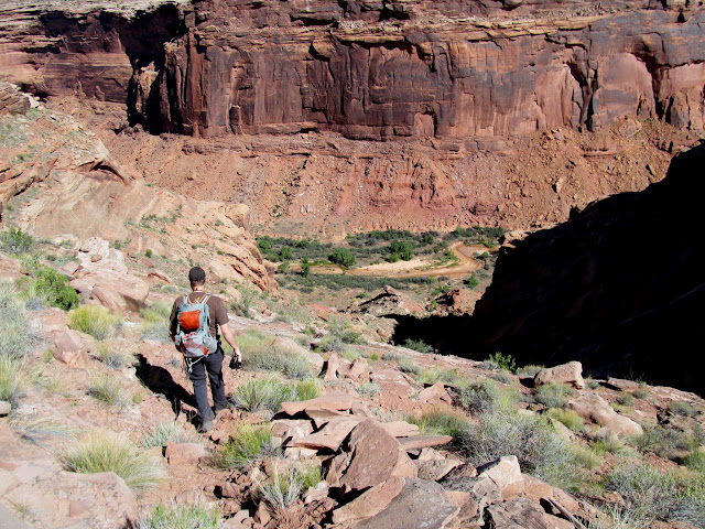
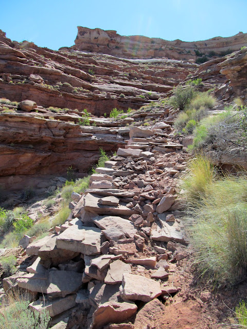
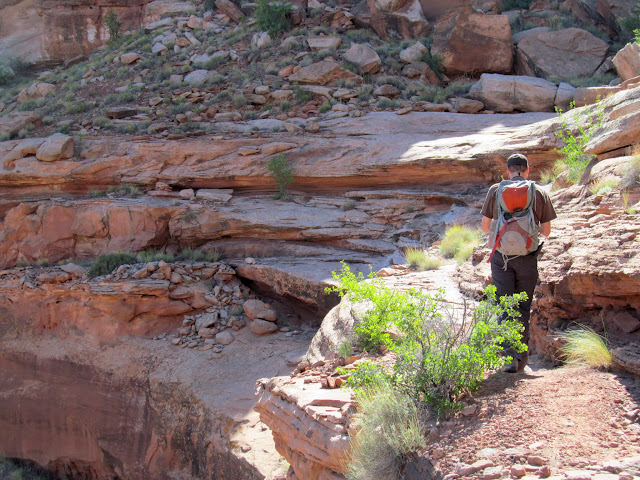
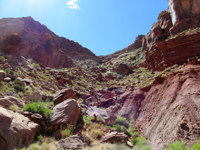
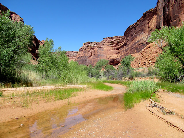
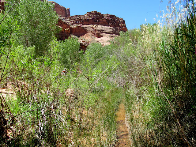
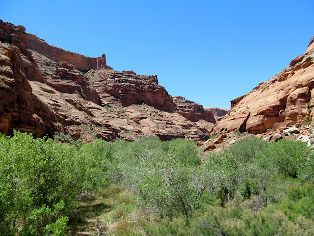
The sun woke us up on Saturday morning and we had a leisurely breakfast before loading the Jeep and driving a few miles up the road. Another relatively flat walk through the brush led us to the rim of Horseshoe Canyon and the top of the Angel Trail. Lithic flakes were abundant along the rim and we each even found a worked point. The trail was a piece of work! A tremendous amount of construction was done to make stairs and ramps over the many ledges to make them passable to livestock. In at least two locations there were signs of the sandstone being blasted off to make the route wide enough. After descending 1,000 feet we were in the bottom of the canyon. Water was flowing through the sandy wash, and we followed it upstream. The previous evening's scouting trip to the rim convinced me that there would be more potential for rock art in the sandstone walls upstream rather than the high talus slopes downstream.
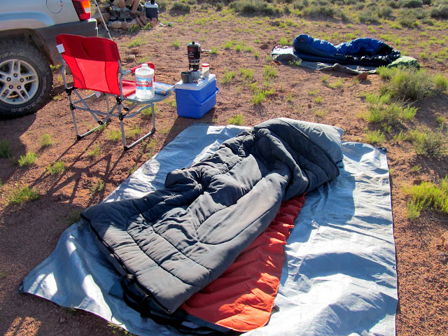
Breakfast and bed
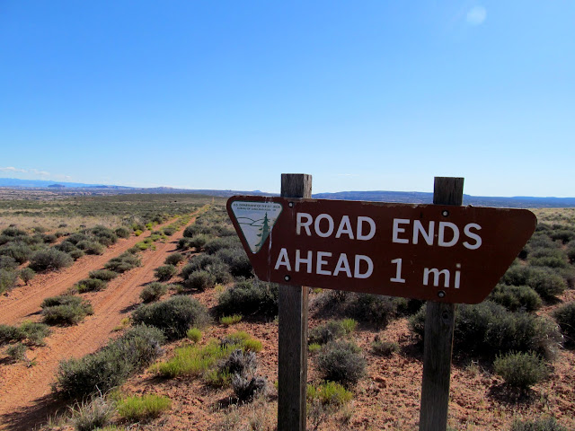
Road sign
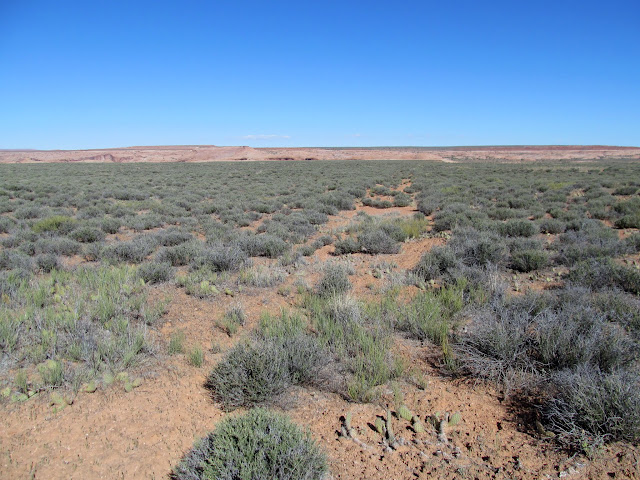
Faint dozer track
Worked flint
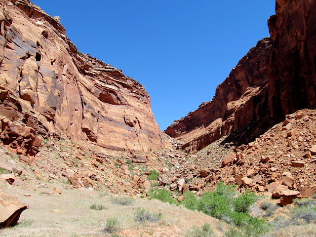
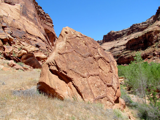
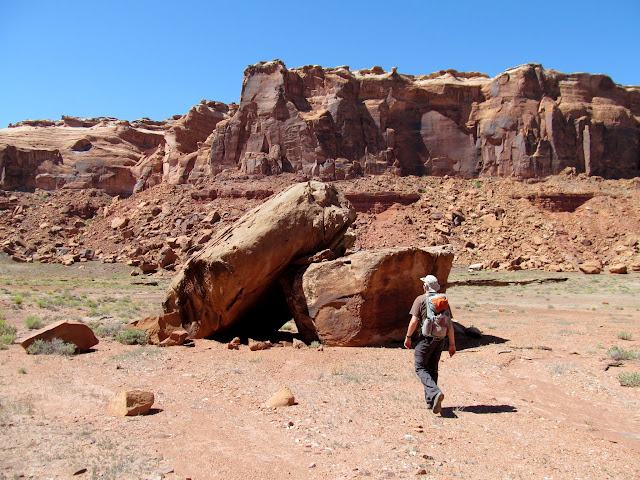
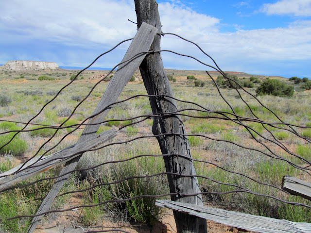
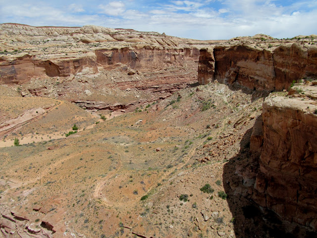
Horseshoe Canyon
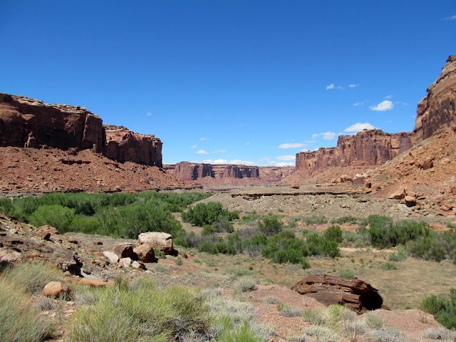
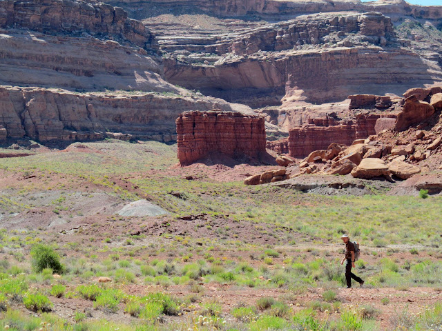
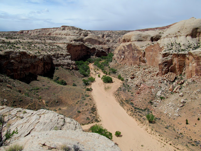
Lower Horseshoe Canyon
Impressive rock stacking on the trail
Chris descending the stacked rocks
Descending the Angel Trail
Part of a long, stacked stone ramp
Across some ledges
Sandstone fractured by blasting
View up the Angel Trail
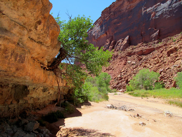
Water in Horseshoe Canyon
Hiking upstream
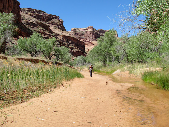
Cactus flowers were prevalent but there were a few other wildflowers in bloom. At first the hiking was easy, across firm, damp sand and with few plants in the way. Farther upstream the going got tough. The watercourse narrowed and became choked with cottonwoods, willows, and tall grasses, and in places there was quicksand that threatened to swallow us if we didn't move quickly. I sunk once to my ankles for several steps before I could escape to firmer ground. After a lunch break we thrashed through the jungle some more. I climbed out for a higher vantage point and couldn't see any relief from the thick undergrowth ahead, so we returned back down the canyon and checked out the section downstream from the Angel Trail.
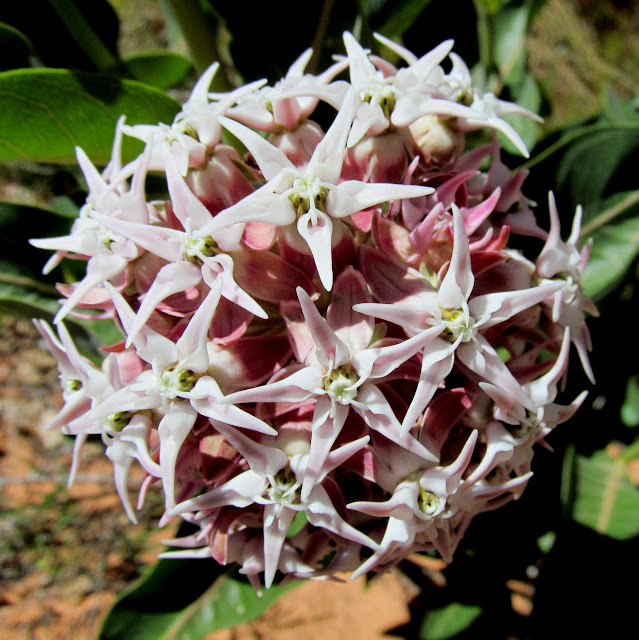
Showy Milkweed (Asclepias speciosa)
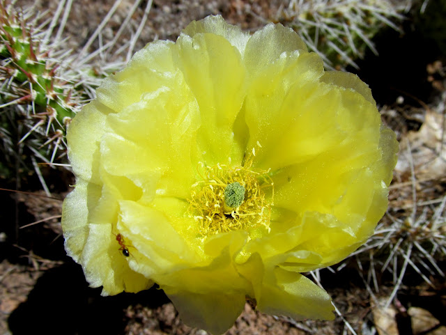
Prickly Pear Cactus (Opuntia polyacantha)
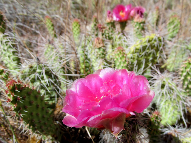
Prickly Pear Cactus (Opuntia polyacantha)
Side canyon which may be passable all the way to the rim
Quicksand!
Thick growth in the canyon bottom
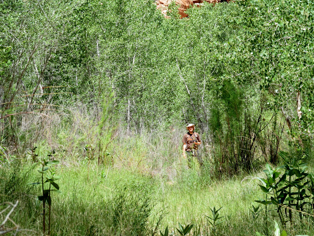
Bushwhacking up the watercourse
View from above the floodplain
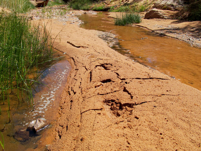
Five-foot-wide fossilized mud cracks
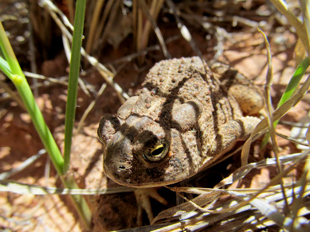
Toad
The stream had receded and the watercourse at the bottom of the trail was now dry. It was a mile or so of easy walking before we climbed up into the abandoned meander of the Green. Low rock walls had been built to hold livestock inside the rincon. We didn't go far into the meander because there were great views of much of the surrounding terrain. I spent a lot of time scouring the surrounding cliffs and boulders with binoculars but didn't see squat. The many large boulders nearby were devoid of even cowboy writings.
Cottonwood growing on the edge
Lower Horseshoe from the downstream end of the abandoned meander
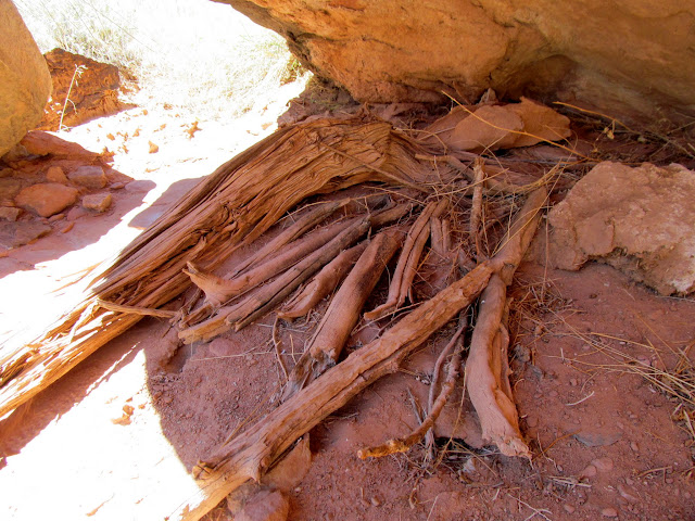
Old firewood stack under an overhanging boulder
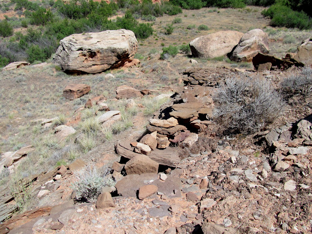
Stacked rock walls to keep sheep in the meander
Checkin' out some boulders
Lookin' squatchy
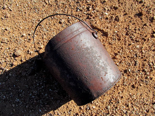
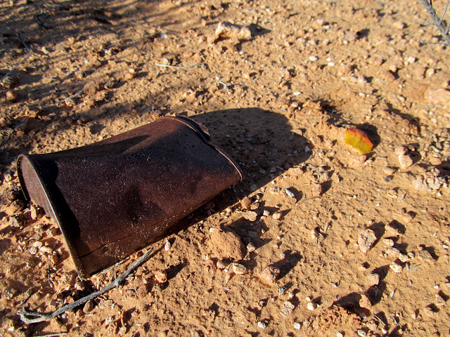
It was easy to make the call to head out of the canyon. I was surprised that we'd seen virtually no signs of human presence other than the constructed stock trail. It had been a long day already, but the 1,000' climb up the Angel Trail still lie ahead. I just took it easy and rested often and made it up without much trouble. I finished the last of my water (out of four liters total) at the top of the trail, though I'd been conserving it up until that point. At the top of the trail we found a scattering of old cans, a bucket, a broken wooden box, and a shovel handle--must've been where the cowboys camped. Chris and I returned to the end of the Spur road and camped another night there, seeing another nice sunset and turning in a little earlier than usual.
View while climbing back up the Angel Trail
Rusty bucket
Refuse from two different cultures
Across the flats toward the Jeep
Back at the same camp spot for the same sunset
Starry night at camp
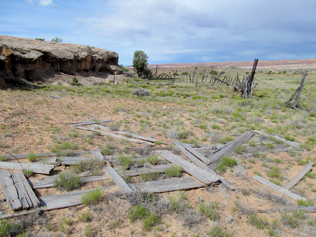
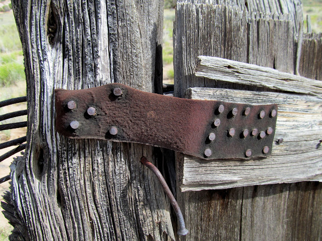
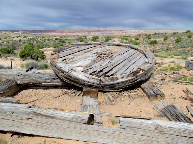
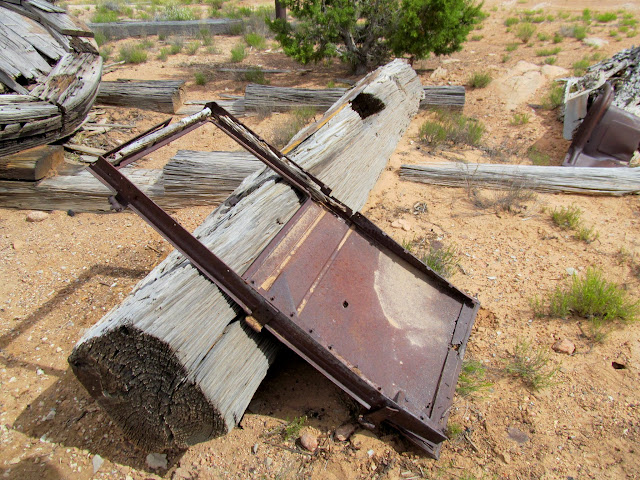
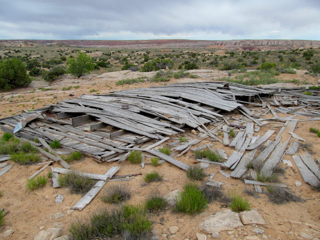
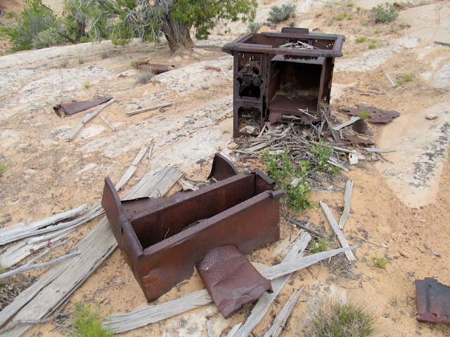
The plan for Sunday was to simply head home, but with a few stops along the way. The first such stop was at the old Tidwell Ranch. The road to the ranch from the west, which crosses Horseshoe Canyon, was financed by the Phillips Oil Company in the late 1920s. The company had a large drilling operation on the east side of the canyon but never struck any oil. The Tidwell family took over the area and ranched there until the mid-1940s, utilizing the buildings and materials left behind by the oil company. Before reaching the ranch, Chris and I visited a corral made from the separated strands of thick steel cable. At the ranch itself was a scattering of interesting old junk. An enormous wooden wheel--part of the drilling rig--was the first thing we encountered there. Elsewhere were parts of old vehicles, huge timbers, and a collapsed cabin and nearby stove. We spent over an hour wandering and examining all the things left behind.
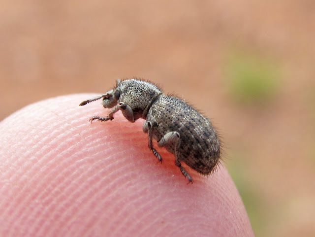
A bug that was on my sleeping bag
Corral near Tidwell Ranch
Separated cable strands used for the corral
Leather strap used for a gate hinge
Drill rig at Tidwell Ranch
Old car door
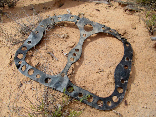
Head gasket
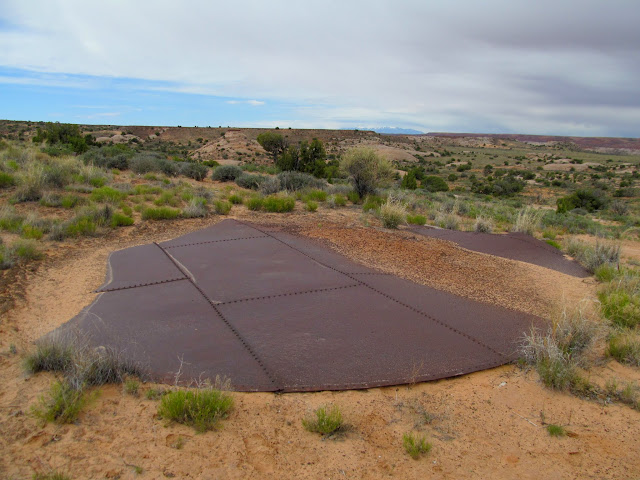
Bottom of a water tank
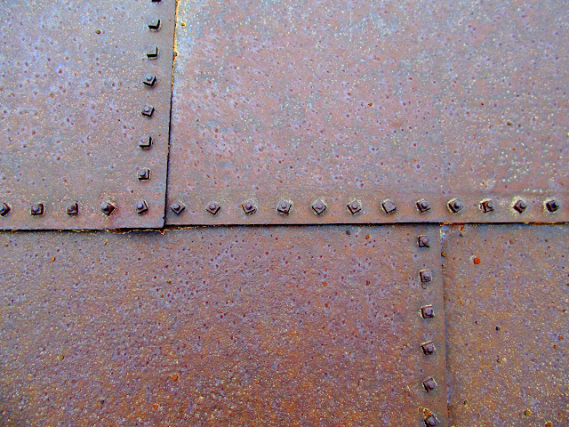
Water tank detail
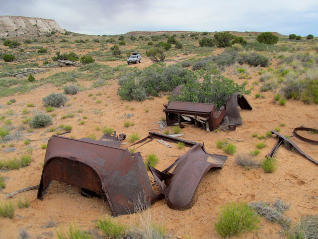
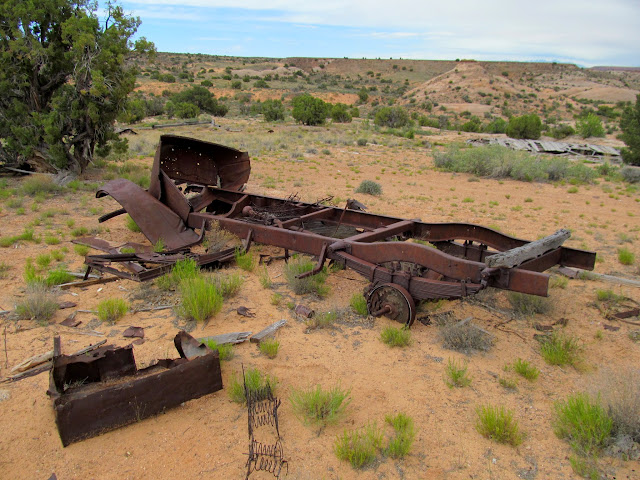
Parts of an old vehicle
Truck frame and parts
Collapsed cabin
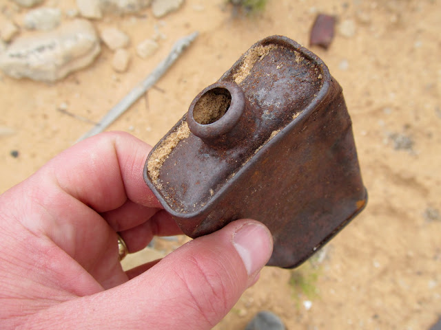
Unusual metal bottle
Stove
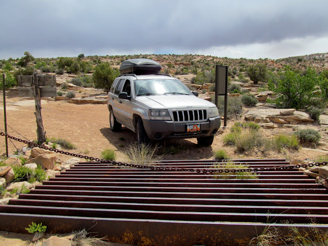
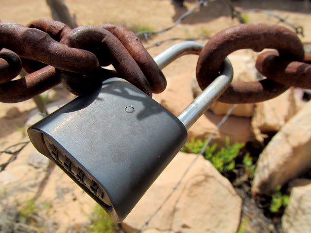
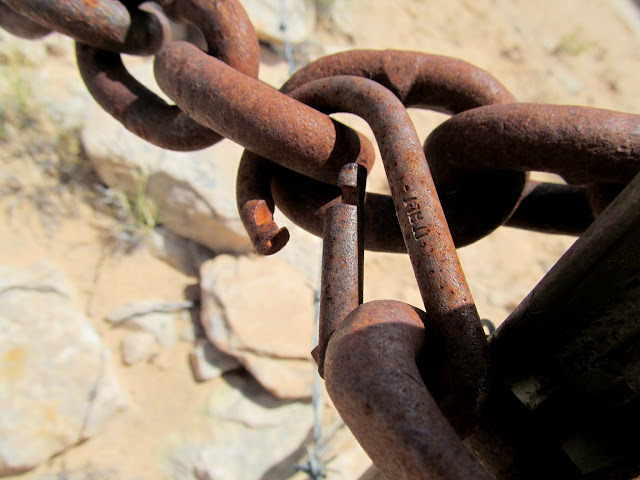
Continuing a couple miles down this side road, we entered Canyonlands National Park and drove to the end of vehicular travel. A cattle guard and chain block access, though I find it humorous that the chain is secured with a padlock on one side and a carabiner on the other. We peered briefly into Horseshoe Canyon, seeing a few hikers and one man walking his horse up the steep road on the opposite side of the canyon. I put the Jeep in 4-low for the rough climb back out from the edge of Horseshoe Canyon. The exhaust had gotten quite hot from the higher-RPM, lower-speed driving, and I started to smell what I would describe as "toasted wood." Driving on rarely-used and overgrown roads had packed a lot of brush and grass between the transfer case crossmember and the body of the Jeep, pressing it tightly against the exhaust pipe and front driveshaft. I stopped and removed the worst of it, and ended up having to remove more after I returned home.
Entering Canyonlands
Cattle guard and chain across the road
One side of the chain is locked
The other is held with a carabiner
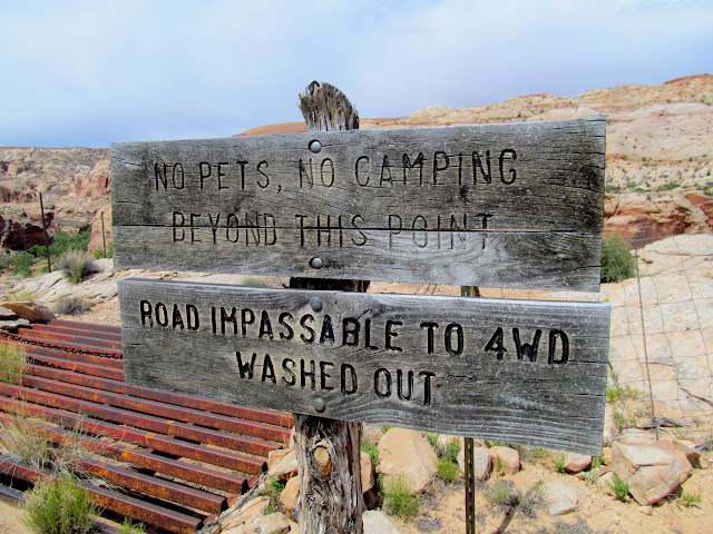
Road "impassible"
Old road on the east side of Horseshoe Canyon
Horseshoe Canyon
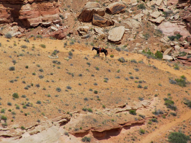
Man walking his horse
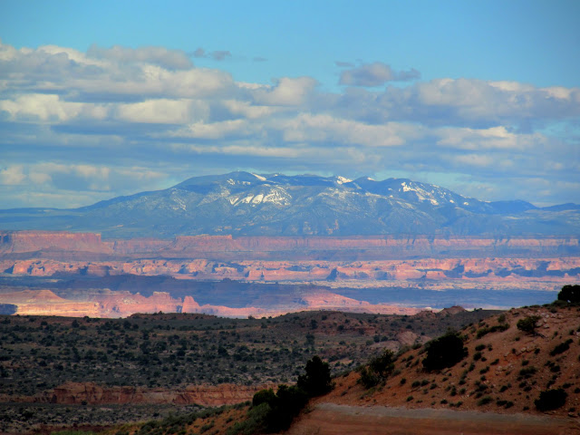
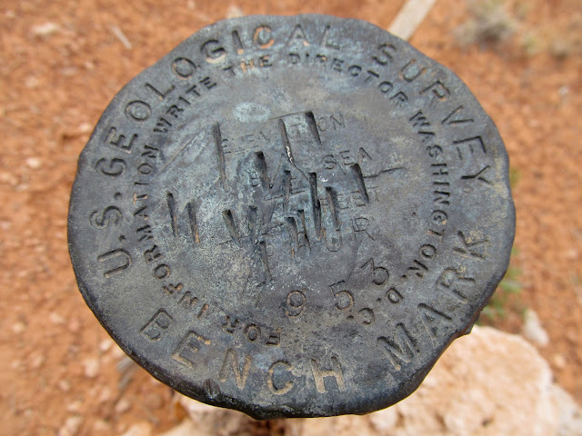
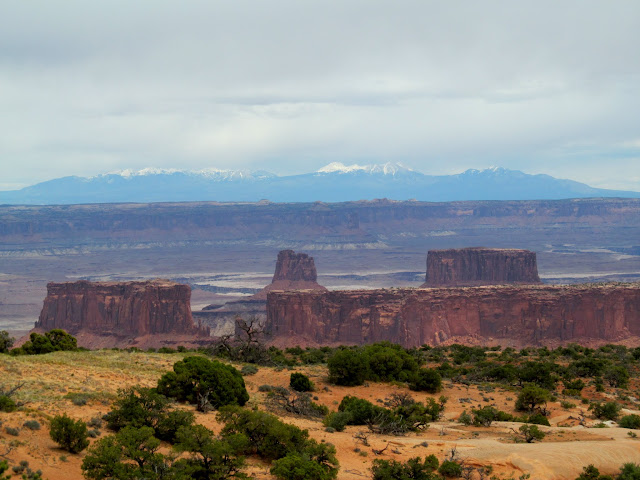
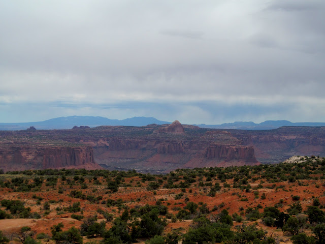
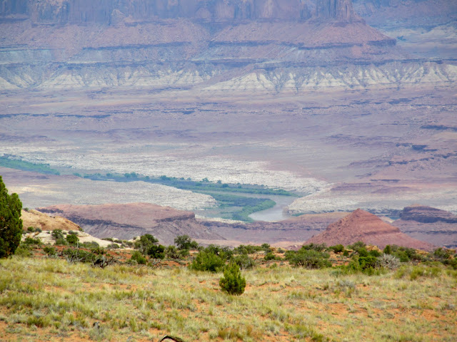
One final stop on the way home was at a place the cowboys called Vantage Point, shown as "SPUR 6,267'" on the USGS topo map. It certainly is a good vantage point, with views of the La Sals and Abajos in the distance, and closer is the Green River, Buttes of the Cross, and Cleopatra's Chair.
Vandalized "Spur 1953" survey marker
La Sals above Buttes of the Cross
Cleopatra's Chair and the Abajos
The Green River above Millard Canyon
While the search for rock art was a bust, I still had a good time. I don't think my explorations along the Spur are over yet.
Photo Gallery: Lower Horseshoe Canyon
GPS Track and Photo Waypoints:
[ Google Earth KMZ ] [ Gmap4 Satellite ] [ Gmap4 Topo ]
La Sal Mountains
Abajo Mountains
Dark skies, with flat terrain belying the canyon country ahead
Lower Horseshoe Canyon from the rim
Two-track road across the Spur
Shadows rising on the canyon walls above the Green River
Book Cliffs
Henry Mountains
Camp fire and cell service!
The sun woke us up on Saturday morning and we had a leisurely breakfast before loading the Jeep and driving a few miles up the road. Another relatively flat walk through the brush led us to the rim of Horseshoe Canyon and the top of the Angel Trail. Lithic flakes were abundant along the rim and we each even found a worked point. The trail was a piece of work! A tremendous amount of construction was done to make stairs and ramps over the many ledges to make them passable to livestock. In at least two locations there were signs of the sandstone being blasted off to make the route wide enough. After descending 1,000 feet we were in the bottom of the canyon. Water was flowing through the sandy wash, and we followed it upstream. The previous evening's scouting trip to the rim convinced me that there would be more potential for rock art in the sandstone walls upstream rather than the high talus slopes downstream.
Breakfast and bed
Road sign
Faint dozer track
Worked flint
Horseshoe Canyon
Lower Horseshoe Canyon
Impressive rock stacking on the trail
Chris descending the stacked rocks
Descending the Angel Trail
Part of a long, stacked stone ramp
Across some ledges
Sandstone fractured by blasting
View up the Angel Trail
Water in Horseshoe Canyon
Hiking upstream
Cactus flowers were prevalent but there were a few other wildflowers in bloom. At first the hiking was easy, across firm, damp sand and with few plants in the way. Farther upstream the going got tough. The watercourse narrowed and became choked with cottonwoods, willows, and tall grasses, and in places there was quicksand that threatened to swallow us if we didn't move quickly. I sunk once to my ankles for several steps before I could escape to firmer ground. After a lunch break we thrashed through the jungle some more. I climbed out for a higher vantage point and couldn't see any relief from the thick undergrowth ahead, so we returned back down the canyon and checked out the section downstream from the Angel Trail.
Showy Milkweed (Asclepias speciosa)
Prickly Pear Cactus (Opuntia polyacantha)
Prickly Pear Cactus (Opuntia polyacantha)
Side canyon which may be passable all the way to the rim
Quicksand!
Thick growth in the canyon bottom
Bushwhacking up the watercourse
View from above the floodplain
Five-foot-wide fossilized mud cracks
Toad
The stream had receded and the watercourse at the bottom of the trail was now dry. It was a mile or so of easy walking before we climbed up into the abandoned meander of the Green. Low rock walls had been built to hold livestock inside the rincon. We didn't go far into the meander because there were great views of much of the surrounding terrain. I spent a lot of time scouring the surrounding cliffs and boulders with binoculars but didn't see squat. The many large boulders nearby were devoid of even cowboy writings.
Cottonwood growing on the edge
Lower Horseshoe from the downstream end of the abandoned meander
Old firewood stack under an overhanging boulder
Stacked rock walls to keep sheep in the meander
Checkin' out some boulders
Lookin' squatchy
It was easy to make the call to head out of the canyon. I was surprised that we'd seen virtually no signs of human presence other than the constructed stock trail. It had been a long day already, but the 1,000' climb up the Angel Trail still lie ahead. I just took it easy and rested often and made it up without much trouble. I finished the last of my water (out of four liters total) at the top of the trail, though I'd been conserving it up until that point. At the top of the trail we found a scattering of old cans, a bucket, a broken wooden box, and a shovel handle--must've been where the cowboys camped. Chris and I returned to the end of the Spur road and camped another night there, seeing another nice sunset and turning in a little earlier than usual.
View while climbing back up the Angel Trail
Rusty bucket
Refuse from two different cultures
Across the flats toward the Jeep
Back at the same camp spot for the same sunset
Starry night at camp
The plan for Sunday was to simply head home, but with a few stops along the way. The first such stop was at the old Tidwell Ranch. The road to the ranch from the west, which crosses Horseshoe Canyon, was financed by the Phillips Oil Company in the late 1920s. The company had a large drilling operation on the east side of the canyon but never struck any oil. The Tidwell family took over the area and ranched there until the mid-1940s, utilizing the buildings and materials left behind by the oil company. Before reaching the ranch, Chris and I visited a corral made from the separated strands of thick steel cable. At the ranch itself was a scattering of interesting old junk. An enormous wooden wheel--part of the drilling rig--was the first thing we encountered there. Elsewhere were parts of old vehicles, huge timbers, and a collapsed cabin and nearby stove. We spent over an hour wandering and examining all the things left behind.
A bug that was on my sleeping bag
Corral near Tidwell Ranch
Separated cable strands used for the corral
Leather strap used for a gate hinge
Drill rig at Tidwell Ranch
Old car door
Head gasket
Bottom of a water tank
Water tank detail
Parts of an old vehicle
Truck frame and parts
Collapsed cabin
Unusual metal bottle
Stove
Continuing a couple miles down this side road, we entered Canyonlands National Park and drove to the end of vehicular travel. A cattle guard and chain block access, though I find it humorous that the chain is secured with a padlock on one side and a carabiner on the other. We peered briefly into Horseshoe Canyon, seeing a few hikers and one man walking his horse up the steep road on the opposite side of the canyon. I put the Jeep in 4-low for the rough climb back out from the edge of Horseshoe Canyon. The exhaust had gotten quite hot from the higher-RPM, lower-speed driving, and I started to smell what I would describe as "toasted wood." Driving on rarely-used and overgrown roads had packed a lot of brush and grass between the transfer case crossmember and the body of the Jeep, pressing it tightly against the exhaust pipe and front driveshaft. I stopped and removed the worst of it, and ended up having to remove more after I returned home.
Entering Canyonlands
Cattle guard and chain across the road
One side of the chain is locked
The other is held with a carabiner
Road "impassible"
Old road on the east side of Horseshoe Canyon
Horseshoe Canyon
Man walking his horse
One final stop on the way home was at a place the cowboys called Vantage Point, shown as "SPUR 6,267'" on the USGS topo map. It certainly is a good vantage point, with views of the La Sals and Abajos in the distance, and closer is the Green River, Buttes of the Cross, and Cleopatra's Chair.
Vandalized "Spur 1953" survey marker
La Sals above Buttes of the Cross
Cleopatra's Chair and the Abajos
The Green River above Millard Canyon
While the search for rock art was a bust, I still had a good time. I don't think my explorations along the Spur are over yet.
Photo Gallery: Lower Horseshoe Canyon
GPS Track and Photo Waypoints:
[ Google Earth KMZ ] [ Gmap4 Satellite ] [ Gmap4 Topo ]