mattvogt7
Member
- Joined
- Jan 20, 2012
- Messages
- 108
Hey thanks for bearing with my laziness. Here is the rest of the TR.
Links to the rest of the trip reports from this series:
Part 1 | Part 2 | Part 3 | Part 4
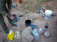 Sorting the cache
We woke up the third morning emboldened by the fact that we had made it to our cache and that we would actually have time to enjoy the upcoming portion of the journey. We had been told by countless sources that the section from the Horse Trail to Salt Canyon was the most spectacular of the entire trip and we were eager to see for ourselves.
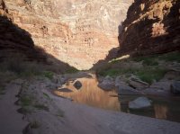 View from camp down-canyon
Having to only make six to eight miles we let ourselves sleep in and took comfort in the lazy morning and huge cooked breakfast we consumed. By this time we were both quite sick of the protein bars, which had been our staple food for the last two days, and could not believe how much a hot meal and coffee could affect ones mental well being for the better. After breakfast we packed up and headed out as the first rays of sun touched the canyon floor
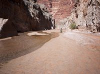
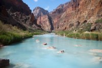
The four miles from camp to Blue Springs were quite enjoyable. There were a few crossings here and there but we became proficient at cutting the corners of the small river we were traveling with and made good time. An hour or so after we started, we finally reached Blue Spring. Blue Springs is a truly special place. It is the source for the year round flows and turquoise water that the LCR is so known for. It was incredible to see it bubbling up from a head wall on Canyon left and I was able to sit and ponder on how singularly amazing it was to see this place, that because of the difficulty in reaching it, few ever see. As I sat and took it in I gazed high up on the canyon wall behind the Spring, scouting for signs of the elusive, and supposedly very difficult and exposed “Blue Springs route,” but did not find any markers distinguishing it. I would not be sharing this spot with anyone else this day.
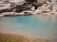 Blue Springs
Downstream of where we were standing the current picked up dramatically and, because the river was already just over waist deep, a stand-alone crossing didn’t seem to doable. This, taken in conjunction with the fact that we were both very hot and wanted a break from the heavy packs, served as a catalyst for inflating (which was a long, slow, pain in the ass) the tubes and floating the packs.
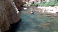
After what seemed like an hour of blowing up the tubes, we looked at each other with an excited, schoolboy like giddiness. Walking out into the current I eventually came to a point where the swift current was pushing me downstream at a chest level and, with my pack not so firmly secured to the tube, “let go.” We ended up floating for quite a long stretch and I remember looking up, watching the canyon pass by me as the river took us onward, and, for the first time on the trip, being completely present in the moment. It was such an odd feeling to be moving without having to expel any energy. Time seemed to slow down, the world became silent as I was allowed to simply look around and take the canyon in.
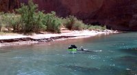
Eventually we came around a sharp R handed bend and noticed two cots set up on a sandy beach on river left. We walked out of the water briefly to look over the camp, but noticed there were no people occupying it, and put back into the river. We floated a short while longer and eventually noticed a young man sitting in a lawn chair listening to satellite radio. We got out of the water and walking up to him he looked at us with a curious amusement. We learned he worked for Fish and Wildlife doing work restoring the native Humpback Chub population and that this was the most up-canyon camp of the four that dotted the lower river. What was crazy is that he was from Hood River, Oregon, about an hour from where I grew up. He obviously was way too comfortable, not working at all, and we got the vibe he wanted to be left alone, so we headed out. Before we left, as we were about to get back in the river he yelled while pointing to canyon R, “hey, there is a trail from here all the way to the helicopter pad at Salt Canyon if you want to take it.” We could not believe our ears.
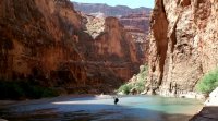
We were so used to making our own decision as to where to go, moving at a snails pace, and picking up on signs of animal trails that finding hard packed trail completely changed the dynamic of our trip. We flew! In fact, we couldn’t believe how easy and fast it really was. After a long day of crossings and scrambling we were reinvigorated and kept yelling to each other how awesome this was. We continued to fly down canyon, following the narrow trail hacked out in the forest of reeds, for another mile or two.
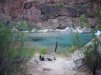 Camp
Camp
Eventually we came to a small sandy beach on canyon L just big enough for our two small tents. At the base of a huge travertine waterfall we built a small fire, dried our clothes, reminisced about the previous three days, and, for the first time since leaving Cameron, got to enjoy the late afternoon. We were two miles above Salt Camp, we had trail from here to the confluence, we felt truly safe and for the first time, what we had done the previous days really sank in.
We stayed up late, listening to the falls reverberate off the canyon walls, taking in the massive starry sky and eating, drinking, and laughing until we could stand it no longer. It would be the last night where it would be just the two us, where the canyon still felt “wild,” and our last taste of the overwhelming peace that I imagine accompanies such raw environments. The sleep I had that night was the deepest and most satisfying I’d had in a long while. Tomorrow we would be at the confluence.
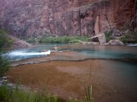
Waking up Saturday morning we were still unsure whether or not we were going to camp at the base of Salt Canyon and meet up with our friends from the hospital or make it a longer day and get to the confluence. It was a nice mental deviation, just to have a choice, as the logistics of the past three days had been etched in stone for months.
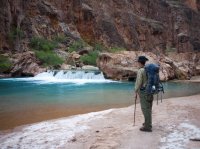
The trail continued for some time on the left hand side of the canyon straddling the base of the red cliffs as it wound itself through thickets of overgrowth. The character of both canyon and river in this section (from our camp the night before to what ended up being Salt Camp) were the most beautiful section of the entire trip in my opinion. I am sure that were this canyon and its river located somewhere off the Navajo reservation it would be a must hike destination, bringing the crowds associated with places such as Havasu (which this place much resembled).
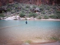
We crossed at a particularly wide though shallow section in the gorge and scramble out of an ankle deep mud pit up onto the shore on the other side. Locating the trail again we headed off downstream only to get off track, spend 45 minutes boulder hopping.
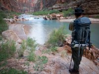
Eventually we found a good path that stayed on canyon right for about half of a mile and climbing a steep sandy hill looking down-canyon, we finally saw Salt Canyon entering the main gorge on river right. The small side canyon signifies known territory, and, more importantly, safety.
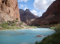
Salt Canyon coming in on the R
We decided to bypass Salt Camp and head towards the confluence. The path only gets bigger and more “trail-like” as we make our way downstream. We figured it must be because many of the rafters stopping at the confluence, a popular spot for commercial rafting trips, come up this far into the canyon to see the Hopi Sipapu.
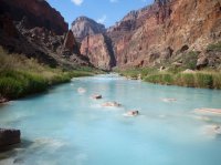
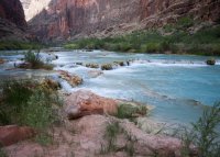
About an hour after salt camp we came to the Sipapu. From a distance the Sipapu appears to be a strange apparition, nothing more than a rounded pile of red dirt sitting at the base of a large canyon wall. In reality, this is a place of great spiritual significance for the Hopi people. It represents their birthplace; the small recessed bubbling hole symbolizes the portal through which their ancient ancestors first emerged to enter the present world
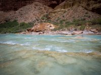
Sipapu
Pushing on we climbed up above the river skirting a fluted rock shelf and looked down to see hordes of rafters enjoying the warm waters of the Little Colorado. It was a bit of a shock to the system to see so many people gathered in one area, but the realization that we were near the confluence quells any negative feelings we have. We followed the ledge for a bit before we realized it was not the right way and that we needed to be on the upstream side on the confluence to access good cold water from the Colorado. We scramble back down to the island and look for a place to cross. Finding it, we blow up the rafts one last time.
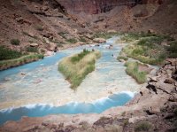
We climb up on to the shore and dropping our packs under some shade survey our surroundings. From where we are standing we have a great view of the confluence; the LCR and its warm turquoise waters flowing gently into the cool, dark green swift currents of the Colorado. We are here. The convergence of water in front of us, housed by Grand Canyon National Park proper, represents our destination, our turn around point, and we take a second to let it sink in.
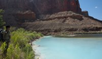
Contemplating our final crossing - Colorado River is the darker water
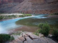
Finally at the confluence
One the other side we were welcomed by a commercial rafting group who kindly presented us with 4 ice-cold PBR’s, 2 cokes, and fresh fruit right out of their cooler.
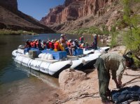
Awesome commercial group
We made camp and a small fire a short distance up-canyon from the Confluence in moderate proximity to two small backpacking groups who had come down the Beamer Trail and whom will head back out the Tanner Trail. Staying up late, we watch the stars come alive over the open flame of our fire before finally heading to bed.
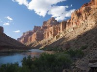
View of Grand Canyon from Camp
Links to the rest of the trip reports from this series:
Part 1 | Part 2 | Part 3 | Part 4
Featured image for home page:
Links to the rest of the trip reports from this series:
Part 1 | Part 2 | Part 3 | Part 4
 Sorting the cache
We woke up the third morning emboldened by the fact that we had made it to our cache and that we would actually have time to enjoy the upcoming portion of the journey. We had been told by countless sources that the section from the Horse Trail to Salt Canyon was the most spectacular of the entire trip and we were eager to see for ourselves.
 View from camp down-canyon
Having to only make six to eight miles we let ourselves sleep in and took comfort in the lazy morning and huge cooked breakfast we consumed. By this time we were both quite sick of the protein bars, which had been our staple food for the last two days, and could not believe how much a hot meal and coffee could affect ones mental well being for the better. After breakfast we packed up and headed out as the first rays of sun touched the canyon floor

The four miles from camp to Blue Springs were quite enjoyable. There were a few crossings here and there but we became proficient at cutting the corners of the small river we were traveling with and made good time. An hour or so after we started, we finally reached Blue Spring. Blue Springs is a truly special place. It is the source for the year round flows and turquoise water that the LCR is so known for. It was incredible to see it bubbling up from a head wall on Canyon left and I was able to sit and ponder on how singularly amazing it was to see this place, that because of the difficulty in reaching it, few ever see. As I sat and took it in I gazed high up on the canyon wall behind the Spring, scouting for signs of the elusive, and supposedly very difficult and exposed “Blue Springs route,” but did not find any markers distinguishing it. I would not be sharing this spot with anyone else this day.
 Blue Springs
 Downstream of where we were standing the current picked up dramatically and, because the river was already just over waist deep, a stand-alone crossing didn’t seem to doable. This, taken in conjunction with the fact that we were both very hot and wanted a break from the heavy packs, served as a catalyst for inflating (which was a long, slow, pain in the ass) the tubes and floating the packs.

After what seemed like an hour of blowing up the tubes, we looked at each other with an excited, schoolboy like giddiness. Walking out into the current I eventually came to a point where the swift current was pushing me downstream at a chest level and, with my pack not so firmly secured to the tube, “let go.” We ended up floating for quite a long stretch and I remember looking up, watching the canyon pass by me as the river took us onward, and, for the first time on the trip, being completely present in the moment. It was such an odd feeling to be moving without having to expel any energy. Time seemed to slow down, the world became silent as I was allowed to simply look around and take the canyon in.

Eventually we came around a sharp R handed bend and noticed two cots set up on a sandy beach on river left. We walked out of the water briefly to look over the camp, but noticed there were no people occupying it, and put back into the river. We floated a short while longer and eventually noticed a young man sitting in a lawn chair listening to satellite radio. We got out of the water and walking up to him he looked at us with a curious amusement. We learned he worked for Fish and Wildlife doing work restoring the native Humpback Chub population and that this was the most up-canyon camp of the four that dotted the lower river. What was crazy is that he was from Hood River, Oregon, about an hour from where I grew up. He obviously was way too comfortable, not working at all, and we got the vibe he wanted to be left alone, so we headed out. Before we left, as we were about to get back in the river he yelled while pointing to canyon R, “hey, there is a trail from here all the way to the helicopter pad at Salt Canyon if you want to take it.” We could not believe our ears.

We were so used to making our own decision as to where to go, moving at a snails pace, and picking up on signs of animal trails that finding hard packed trail completely changed the dynamic of our trip. We flew! In fact, we couldn’t believe how easy and fast it really was. After a long day of crossings and scrambling we were reinvigorated and kept yelling to each other how awesome this was. We continued to fly down canyon, following the narrow trail hacked out in the forest of reeds, for another mile or two.
 Camp
CampEventually we came to a small sandy beach on canyon L just big enough for our two small tents. At the base of a huge travertine waterfall we built a small fire, dried our clothes, reminisced about the previous three days, and, for the first time since leaving Cameron, got to enjoy the late afternoon. We were two miles above Salt Camp, we had trail from here to the confluence, we felt truly safe and for the first time, what we had done the previous days really sank in.
We stayed up late, listening to the falls reverberate off the canyon walls, taking in the massive starry sky and eating, drinking, and laughing until we could stand it no longer. It would be the last night where it would be just the two us, where the canyon still felt “wild,” and our last taste of the overwhelming peace that I imagine accompanies such raw environments. The sleep I had that night was the deepest and most satisfying I’d had in a long while. Tomorrow we would be at the confluence.

Waking up Saturday morning we were still unsure whether or not we were going to camp at the base of Salt Canyon and meet up with our friends from the hospital or make it a longer day and get to the confluence. It was a nice mental deviation, just to have a choice, as the logistics of the past three days had been etched in stone for months.

The trail continued for some time on the left hand side of the canyon straddling the base of the red cliffs as it wound itself through thickets of overgrowth. The character of both canyon and river in this section (from our camp the night before to what ended up being Salt Camp) were the most beautiful section of the entire trip in my opinion. I am sure that were this canyon and its river located somewhere off the Navajo reservation it would be a must hike destination, bringing the crowds associated with places such as Havasu (which this place much resembled).

We crossed at a particularly wide though shallow section in the gorge and scramble out of an ankle deep mud pit up onto the shore on the other side. Locating the trail again we headed off downstream only to get off track, spend 45 minutes boulder hopping.

Eventually we found a good path that stayed on canyon right for about half of a mile and climbing a steep sandy hill looking down-canyon, we finally saw Salt Canyon entering the main gorge on river right. The small side canyon signifies known territory, and, more importantly, safety.

Salt Canyon coming in on the R
We decided to bypass Salt Camp and head towards the confluence. The path only gets bigger and more “trail-like” as we make our way downstream. We figured it must be because many of the rafters stopping at the confluence, a popular spot for commercial rafting trips, come up this far into the canyon to see the Hopi Sipapu.


About an hour after salt camp we came to the Sipapu. From a distance the Sipapu appears to be a strange apparition, nothing more than a rounded pile of red dirt sitting at the base of a large canyon wall. In reality, this is a place of great spiritual significance for the Hopi people. It represents their birthplace; the small recessed bubbling hole symbolizes the portal through which their ancient ancestors first emerged to enter the present world

Sipapu
Pushing on we climbed up above the river skirting a fluted rock shelf and looked down to see hordes of rafters enjoying the warm waters of the Little Colorado. It was a bit of a shock to the system to see so many people gathered in one area, but the realization that we were near the confluence quells any negative feelings we have. We followed the ledge for a bit before we realized it was not the right way and that we needed to be on the upstream side on the confluence to access good cold water from the Colorado. We scramble back down to the island and look for a place to cross. Finding it, we blow up the rafts one last time.

We climb up on to the shore and dropping our packs under some shade survey our surroundings. From where we are standing we have a great view of the confluence; the LCR and its warm turquoise waters flowing gently into the cool, dark green swift currents of the Colorado. We are here. The convergence of water in front of us, housed by Grand Canyon National Park proper, represents our destination, our turn around point, and we take a second to let it sink in.

Contemplating our final crossing - Colorado River is the darker water

Finally at the confluence
One the other side we were welcomed by a commercial rafting group who kindly presented us with 4 ice-cold PBR’s, 2 cokes, and fresh fruit right out of their cooler.

Awesome commercial group
We made camp and a small fire a short distance up-canyon from the Confluence in moderate proximity to two small backpacking groups who had come down the Beamer Trail and whom will head back out the Tanner Trail. Staying up late, we watch the stars come alive over the open flame of our fire before finally heading to bed.

View of Grand Canyon from Camp
Links to the rest of the trip reports from this series:
Part 1 | Part 2 | Part 3 | Part 4
Featured image for home page:


