DrNed
The mountains are calling and I must go
- Joined
- Mar 31, 2013
- Messages
- 1,026
I'm planning a week long Uintas loop this summer starting at China Meadows TH going to Henry's Fork Lake. Spend night's 1-2 at Henry's Fork Lake. Summit King's come down and camp some where near the HIghline / Smith's Fork Pass trail for night 3.
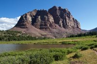
So here's where I need advice. As I see it I've got 3 ways I can access Red Castle area.
1. Continue on the Highline over Tungsten Pass and Porcupine Pass, then leave the trail and go up
and over into the Red Castle area. Doing the reverse of @Nick 's route I measure the distance to be 7.3 miles to an arbitrary camp spot below Red Castle Lake. Going over 3 passes and climbing and descending through the boulders into Red Castle I've got to imagine these would be "hard" miles.
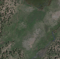
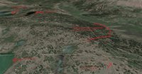
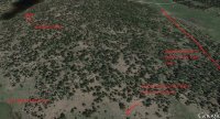
2. Follow Smith's Fork Pass trail over Smith's Fork Pass until this point then leave the trail cutting towards a spot just above Lower Red Castle Lake. Like I have shown here:
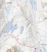
This route I measure to be 6.3 miles to the same camp spot.
3. Follow the trail exactly as it is on the map to the same camp spot comes to about 8.5 miles.
So my question is, is there any reason why I shouldn't take the 2nd route? I've looked at Google Earth and I can't see any geographical reasons why I shouldn't make this short cut. Honestly I can't figure out why the trail doesn't go this way anyways. So for those who have been to the Red Castle area (I haven't) please share your advice on my options and any compelling reasons why I shouldn't take the noted short cut.
So here's where I need advice. As I see it I've got 3 ways I can access Red Castle area.
1. Continue on the Highline over Tungsten Pass and Porcupine Pass, then leave the trail and go up
and over into the Red Castle area. Doing the reverse of @Nick 's route I measure the distance to be 7.3 miles to an arbitrary camp spot below Red Castle Lake. Going over 3 passes and climbing and descending through the boulders into Red Castle I've got to imagine these would be "hard" miles.
2. Follow Smith's Fork Pass trail over Smith's Fork Pass until this point then leave the trail cutting towards a spot just above Lower Red Castle Lake. Like I have shown here:

This route I measure to be 6.3 miles to the same camp spot.
3. Follow the trail exactly as it is on the map to the same camp spot comes to about 8.5 miles.
So my question is, is there any reason why I shouldn't take the 2nd route? I've looked at Google Earth and I can't see any geographical reasons why I shouldn't make this short cut. Honestly I can't figure out why the trail doesn't go this way anyways. So for those who have been to the Red Castle area (I haven't) please share your advice on my options and any compelling reasons why I shouldn't take the noted short cut.

