slc_dan
Desert Rat-Weekend Warrior
- Joined
- Jun 7, 2012
- Messages
- 1,687
Continued from part 1.
We were up on the esplanade, and had a clear uninterrupted view of our goal in sight. Art gazed upon the mound with a small grin. I stared down at this view, and that red knoll while up on that ridge, he said while pointing up at the southern rim. He’d been planning this trip. I was lucky enough to be added on to these plans. We were very lucky for those that had come before us.
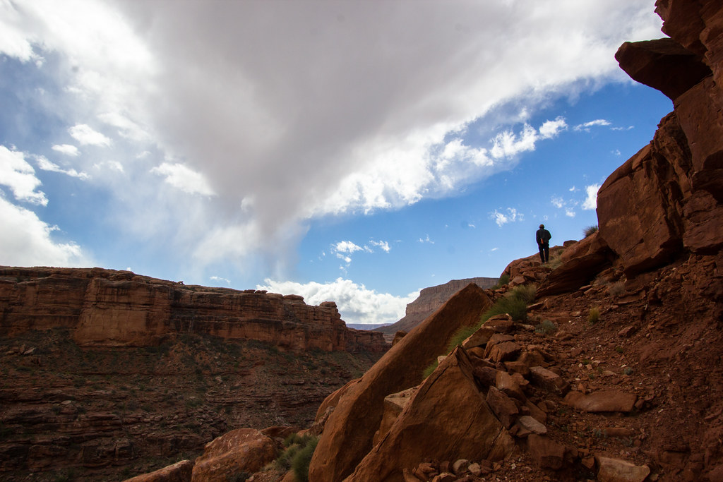
We walked quickly over this Supai formation. Yucca graveyards rattled as we silently walked past. We shoot for the northern slope. The walk up is short, but the views are so spectacular that I stop several times.
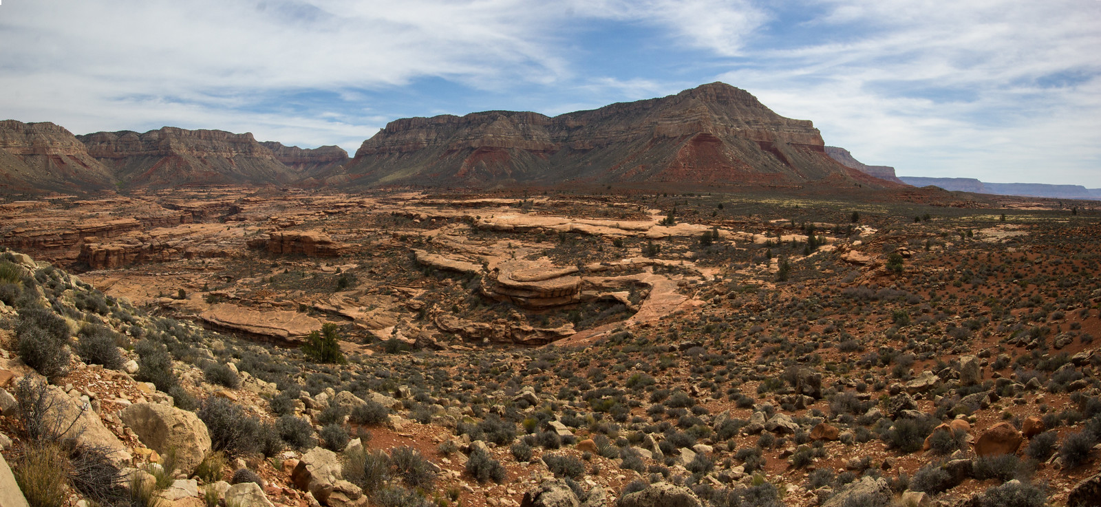 Fishtail Pano by slc_dan, on Flickr
The white boulders are loose, and sharp. I scrap my hand lightly when using one for balance. Art is first to ascend. We all shortly follow.
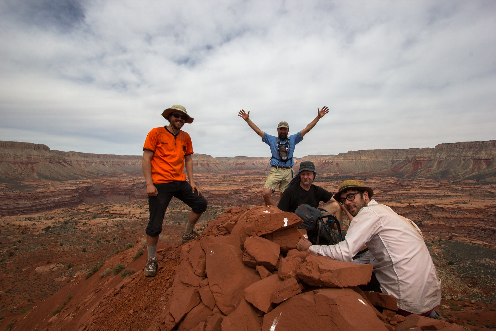 victory shot by slc_dan, on Flickr
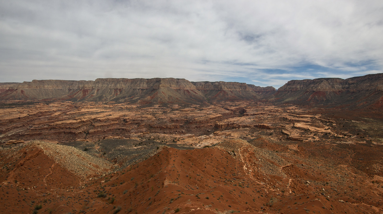
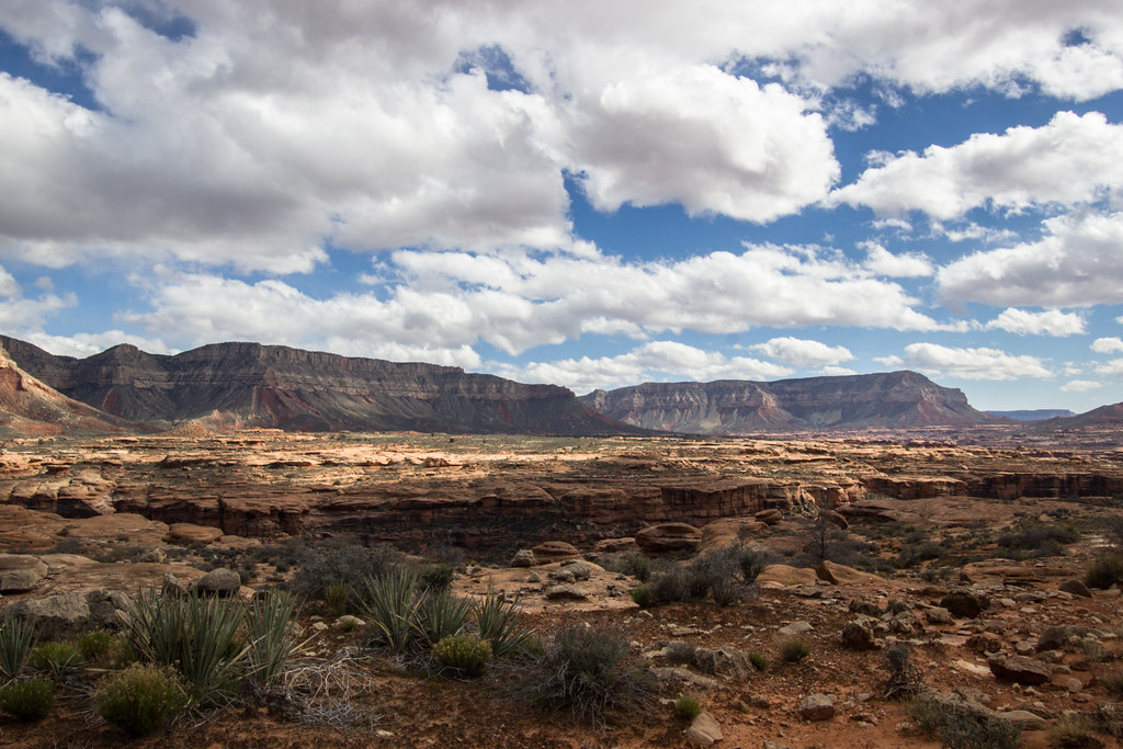
The peak was fun, but it was the view I was really after.
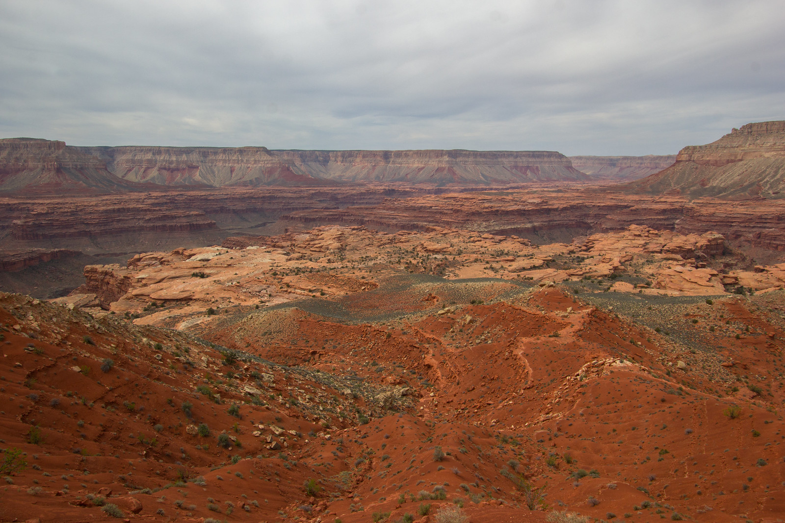 Peak View Southwest by slc_dan, on Flickr
 View North panor by slc_dan, on Flickr
 view north panor two by slc_dan, on Flickr
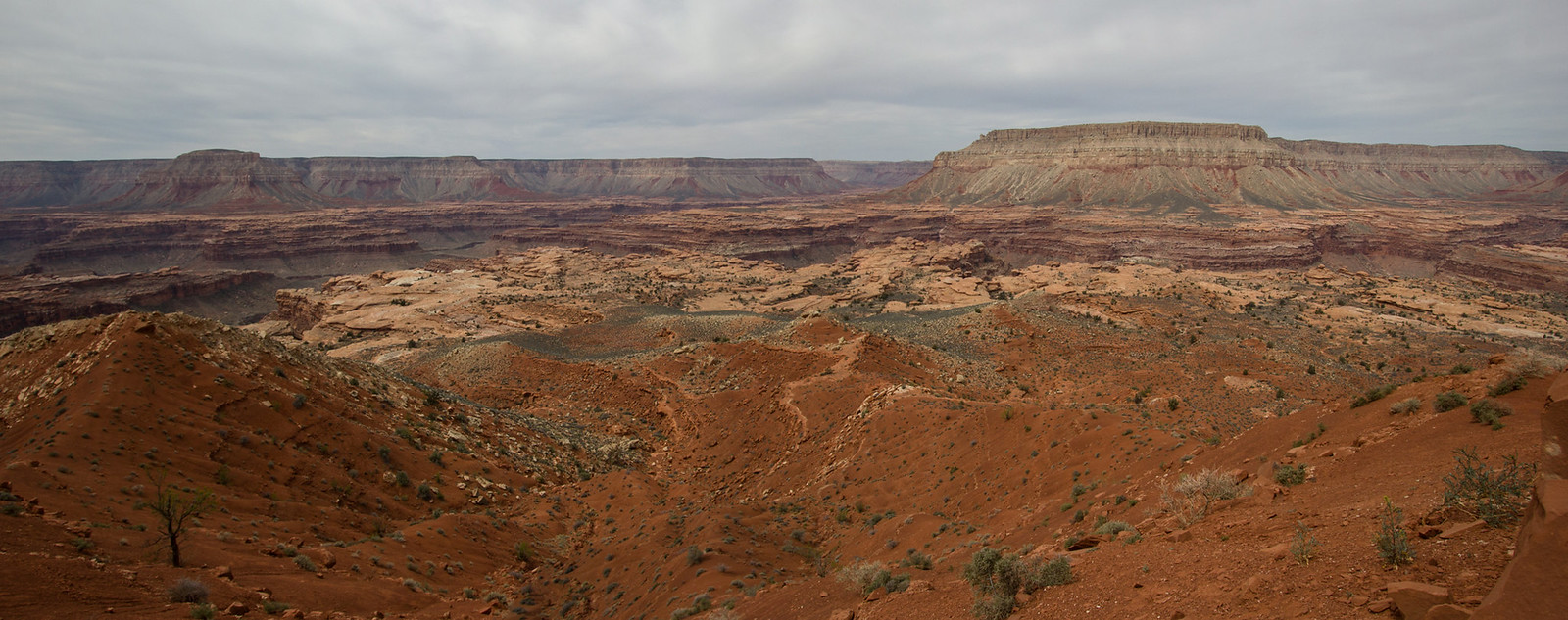 View South Panor by slc_dan, on Flickr
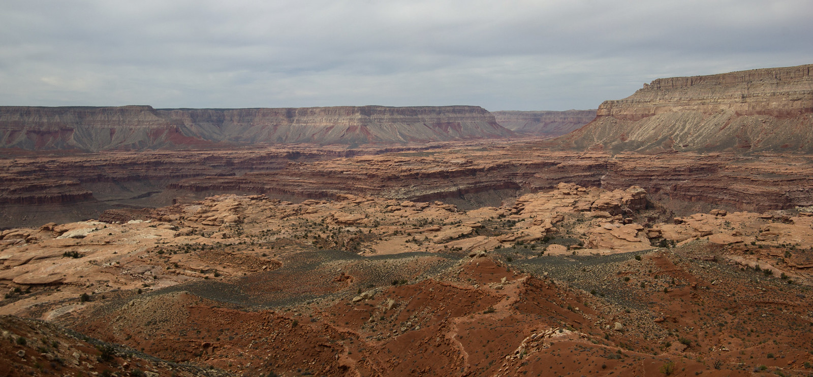 View South two Panor by slc_dan, on Flickr
We took our time on top. We steeped in the view. A few of us searched for a register, but found nothing. The walk down was smooth. Keeping on the red meant easier walking, even if a bit steeper.
 Back down by slc_dan, on Flickr
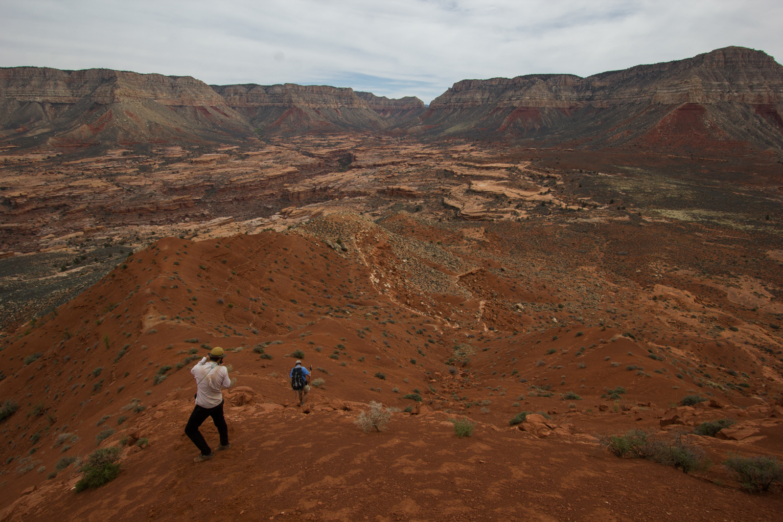
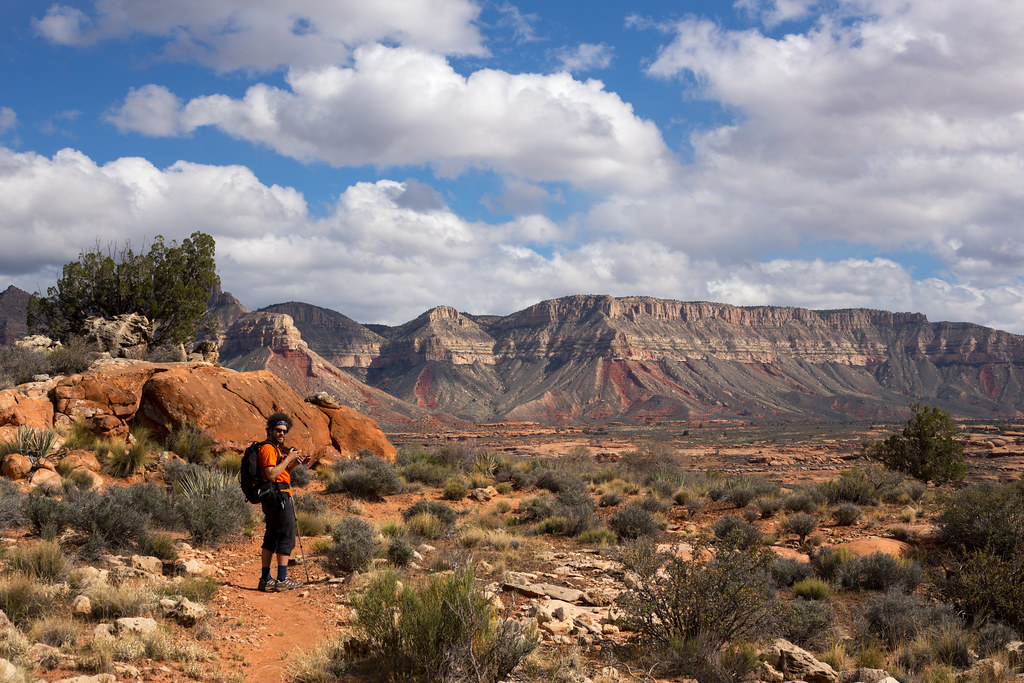
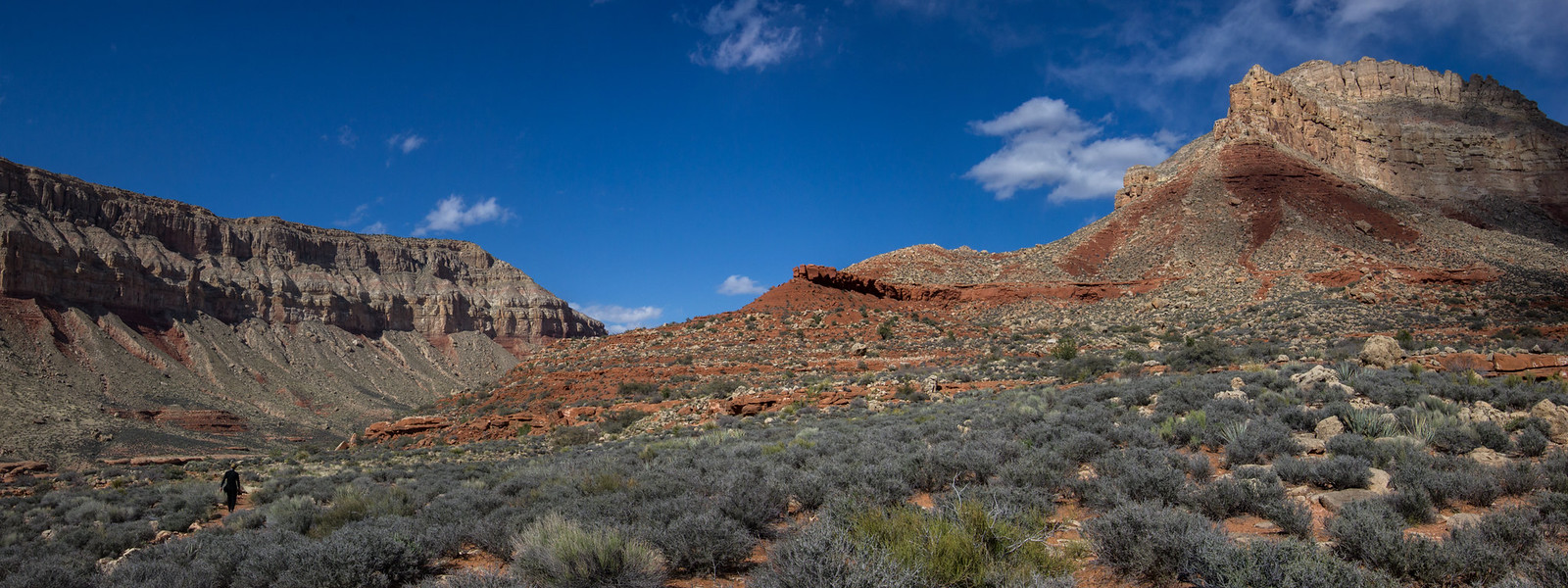
We made our way back the way we came. With a little experience on our side this route was more efficient. As we fell back into the side drainage, the view from above led us on an easier path into Indian Hollow.
 team Down drainage-2 by slc_dan, on Flickr
At this intersection I decided to head up, due East, Indian Hollow where we had not yet explored. The others weren’t as excited at the prospect, and went back west towards camp.
Up canyon was as beautiful as the intersection that we left. I left my camera and all things behind. I climbed up a few waterfalls, that were just difficult enough to be fun, and just easy enough to not be scary alone. I hiked quickly up the canyon, and was alone. I was able to experience that distinct solitude that only comes after several days out in the wilderness. I sat and listened to the clear, quiet silence. No screens to update me on the importance of insignificance. No beeps, or ugly man-made noise. Zero expectations of doing anything other than to sit, utilize all of my senses for the glory of nothing. After I packed a long period of contemplation into a relatively short time, I gathered my things and went back down canyon.
The walking was swift, and I soon came upon Nate walking down canyon. Up canyon was really cool, I mention. Yeah, I didn’t go far up, but the reflections were nice, he answers. I realize I’m missing my walking stick. Shit, I’m going to have to go back and get it, I say aloud. I head back up canyon a third time and climb the nice sandstone slightly waterfall for a third time. It is a fun obstacle. I come upon my pole and trot back. I come upon Nate again, before we both return to camp.
 Back down Indian Hollow, again by slc_dan, on Flickr
 Indian Hollow Mosey by slc_dan, on Flickr
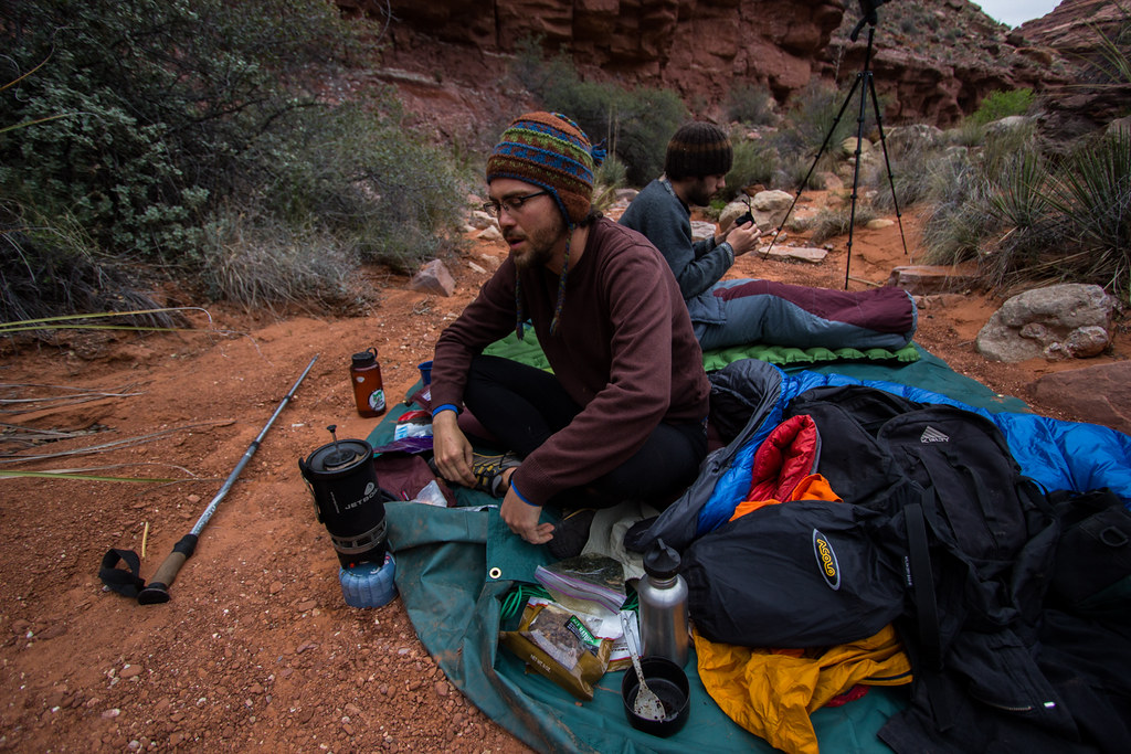
We repeat much of last night’s festivities. There is a calm feeling of accomplishment due to conquering the knoll. I’m grateful to be included in the trip, and happy to have helped in making it happen. After tea, dinner, and stumbling around our excellent camp, we all surrender to the night.
More coffee in the morning, but I ration upon realizing how low I am. Don is quick to say he’s got some instant stuff, and the rest is passed out accordingly.
 Morning camp by slc_dan, on Flickr
Our itinerary today is to hike further down Indian Hollow. We’ll pass our intersection with Ojojojo, and head up onto the redwall due to some impassable dry falls. From there we come off the redwall before making one final camp in Kwagunt Canyon.
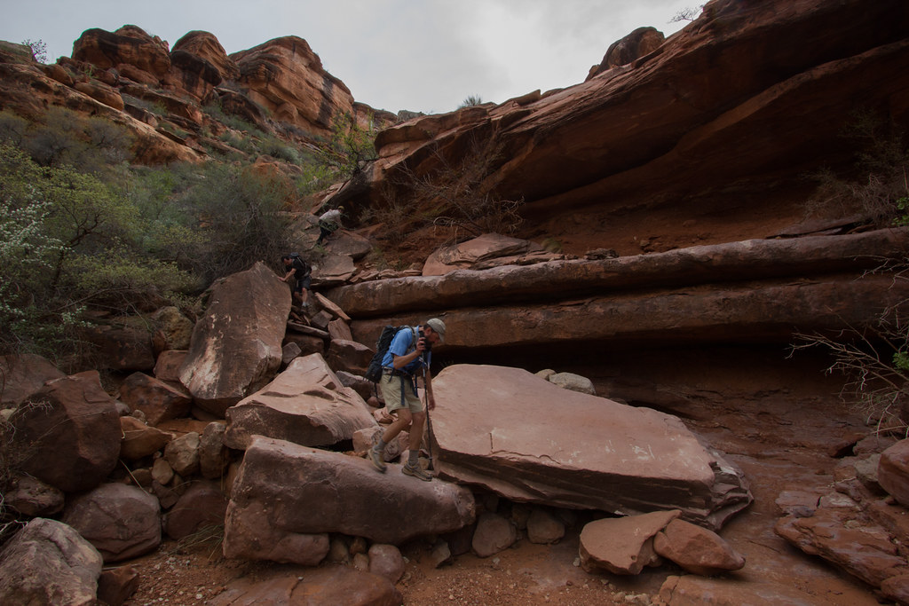
The step up onto the redwall was well cairned. Nate and Don had climbed down a fun boulder while Art and I had already made it upon the ledge. They then had the fun opportunity to climb up what they had just climbed down.
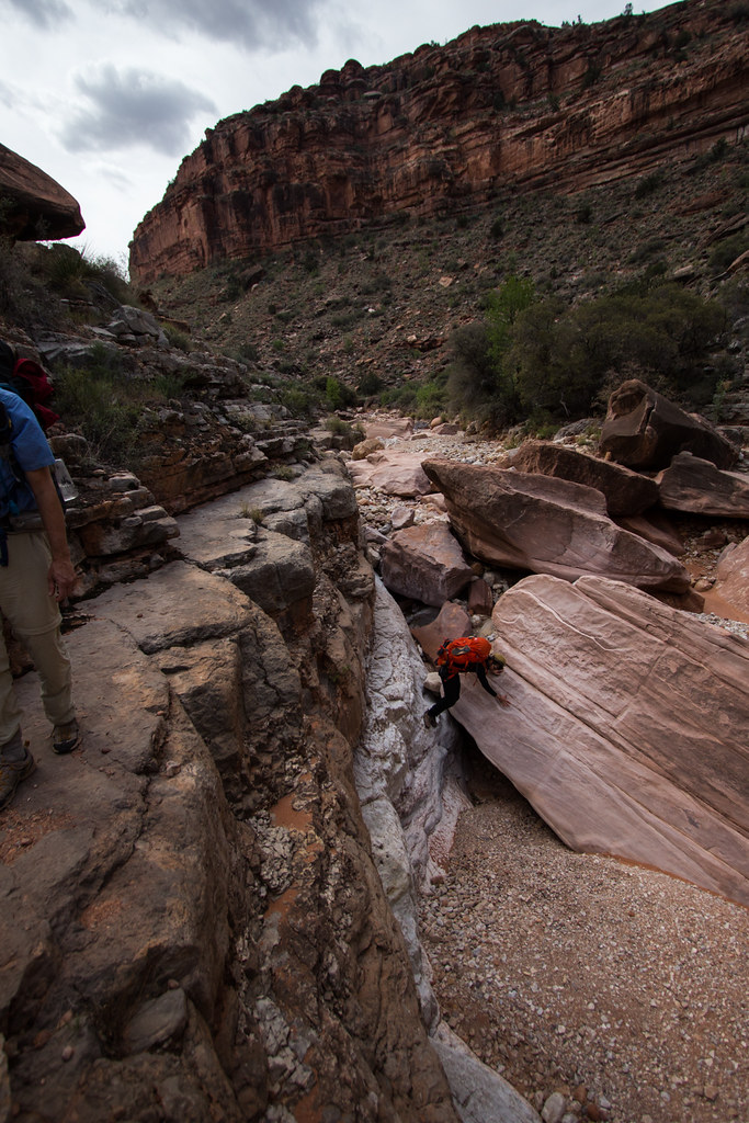 Team Orange Down Climb by slc_dan, on Flickr
The clouds danced across the sky. Moving shadows spread out as the moved over the landscape. We continued along this ledge, and walked with joy.
 Redwall Walking 1 by slc_dan, on Flickr
 Redwall Walking 2 by slc_dan, on Flickr
Before long we stopped at a beautiful, but windy spot for lunch. I set up a time lapse, which I look forward to including in an upcoming project.
 Redwall Walking Lunch by slc_dan, on Flickr
We consulted our map, and figured we were nearing the end of our redwall walking. We packed back up, and kept on. Soon our trail went back down. The easy walking turned back into the bone dry arroyo. We peered back toward Indian Hollow. The limestone slots called us like sirens, but the thundering clouds above heeded better warning to stay out.
The necessity for careful walking kept us looking down until we reached a fork. The angles of both canyons were all wrong. Art turned on his GPS. Well damn, we are far past where we should be, he stated. We quickly decided to change our plans. Instead of camping in Kwagunt Hollow, we would now turn up Mountain Sheep Spring, and camp there.
The wind was strong, and the dark clouds above threatened. Nate and I packed tentless, so were were quite picky with our camp spots. Art stopped under a great giant boulder that had fallen near the river bend. We stopped for a bit, and read through the beta we had collected from the internet (another thanks to bobbordash). This says he was delighted to find pictographs above him when he woke up. This spot is ok, but I want to be delighted, Don said. We nodded in agreement, and walked up stream further. We found the beautiful spring noted in the beta, as well as the well worn campsite across from the fall.
Photo courtesy of @NateGeesaman
 Mountain Sheep Spring by NateGeesaman, on Flickr
This was a great spot. Third day is always the hardest for me, Art said in a state of exhaustion. You are free to continue on a day hike, but I’m done. Don chimed in with, sitting with my book down by that fall is sounding real nice. I glanced over to Nate with one eyebrow raised. He simply nodded.
I ditched all heaviness from my pack. Nate tied a water bottle around his shoulder, and we took off. Soon we came to the first sign we had seen in 3 days. This trail is built and maintained, also a first in 3 days. This created easy, struggle free walking. The wind blew gusts of wind at our face. The clouds were rushed along, while giving up weight through rain. This is the kind of weather you want when walking across the esplanade.
 Jumpup Ranger Trail Nate by slc_dan, on Flickr
 Jumpup Ranger trail light play by slc_dan, on Flickr
Another great photo from @NateGeesaman
 Ranger Trail 3 by NateGeesaman, on Flickr
 Jump Up Ranger Pano by slc_dan, on Flickr
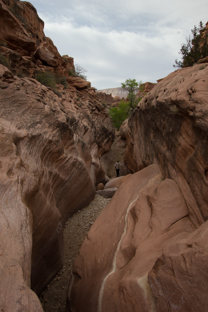
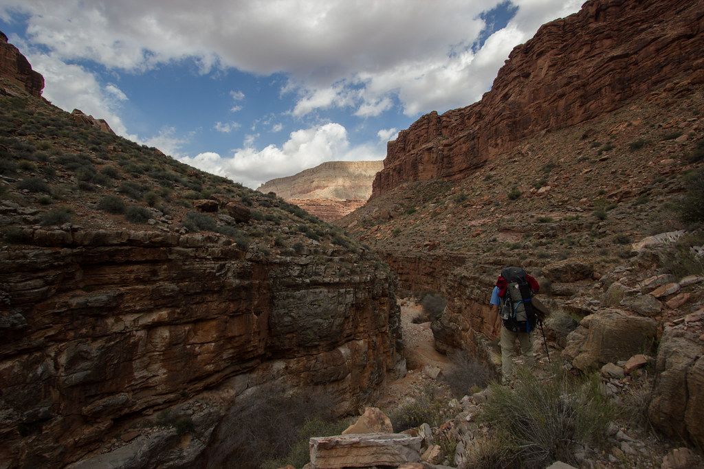
Before long we saw our second sign of the trip. Go down canyon for Jump Up, or follow the trail out to go somewhere else. We went down canyon. Jump Up begins quite open, but closes in close fast.
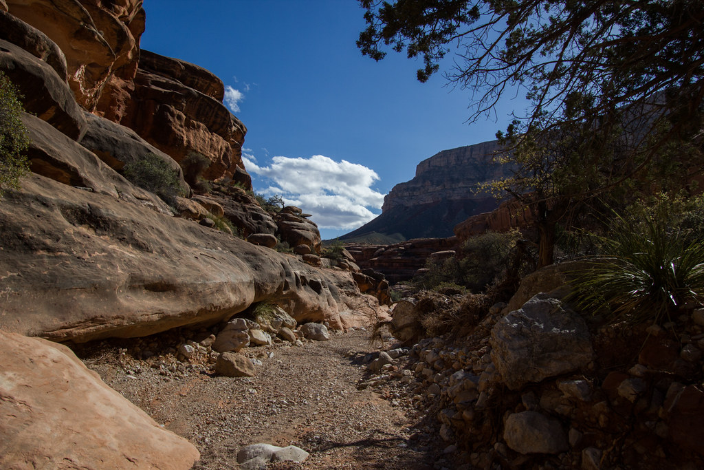 Into Jumpup by slc_dan, on Flickr
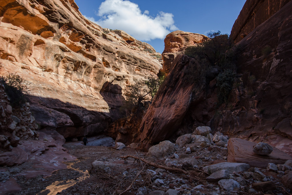 Into Jumpup 2 by slc_dan, on Flickr
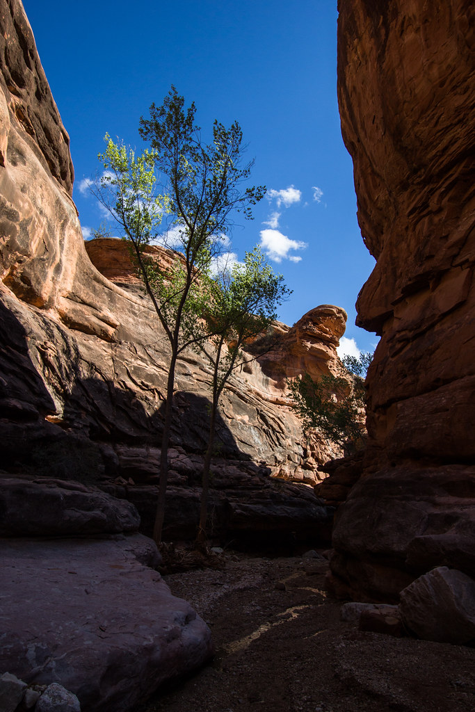 Into Jumpup 3 by slc_dan, on Flickr
I was expecting an exciting obstacle, and it soon presented itself. I went down first, and Nate soon followed. I’ve read that there is a bolt on top, we had no rope, and didn’t search it out. The base of this sketchy ladder was propped up by piles of rocks. I felt it teeter as I climbed down. Enough danger to feel alive, but safe enough to still be so.
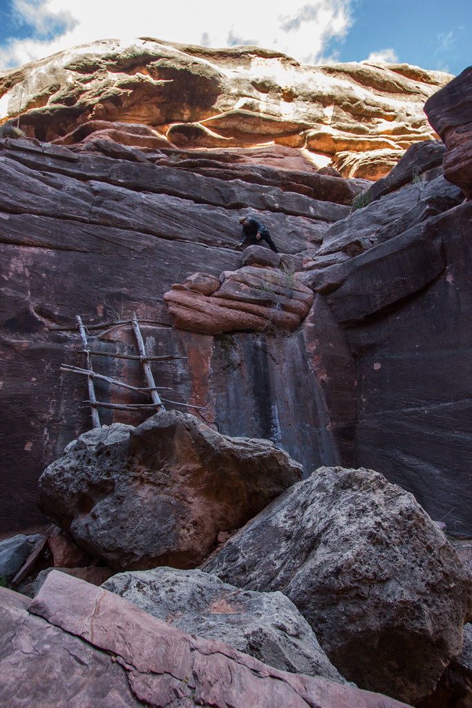 Nate Sketchy Ladder 2 by slc_dan, on Flickr
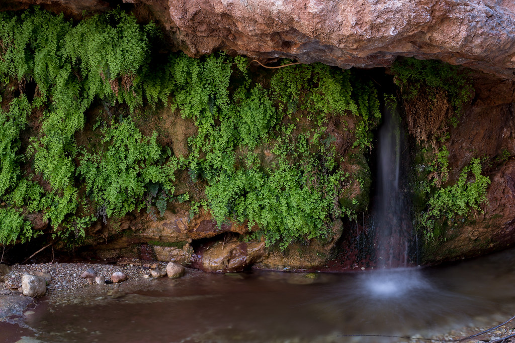
The waterfall that this bypassed, was incredible. Nate and I took a breather underneath, and soaked in the misty cool air. We sat still in the moment. This side hike has been excellent, Nate stated. I concur.
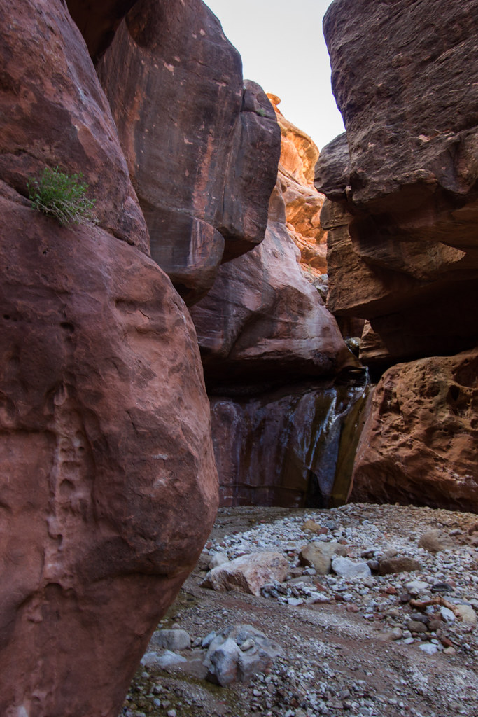 Waterfall Jump Up Canyon by slc_dan, on Flickr
I looked closely at a small oak tree. There I saw a group of small black bugs. (Name? info?)
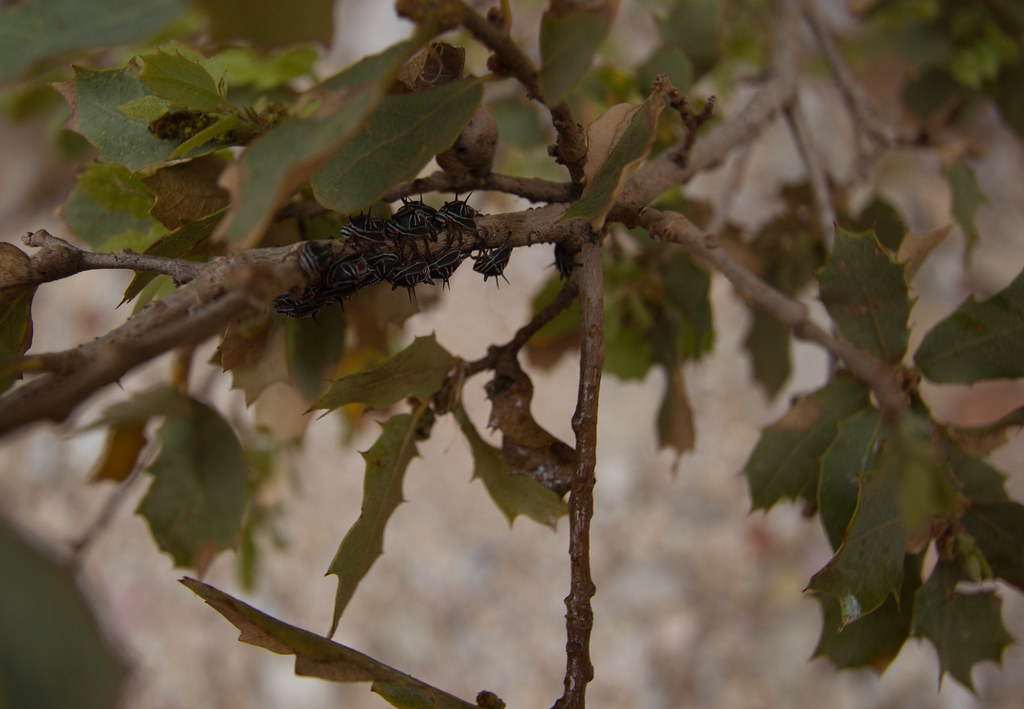 spikey bug by slc_dan, on Flickr
Soon we came back to the exit of Jump Up. It led directly to where we had to look at the GPS before. We continued up Mountain Sheep Spring Canyon. We caught Don sitting near the spring doing exactly as he said. That was kind of quick he said. Gorgeous hike, I said.
We found Art sitting in the spot we left him at. Nice walk? Yes, cherry on top, I answer. We pass him our cameras. He slides on his readers and looks through. Looks nice, how far up was the turn off? He asks. Not too far, maybe a mile tops, Nate answers.
The day turns into evening as we prepare our meals. Shortly after dinner we realize it is a must that we exit the canyon tomorrow. We are completely out of whiskey. We stay up later this evening, I take some star shots.
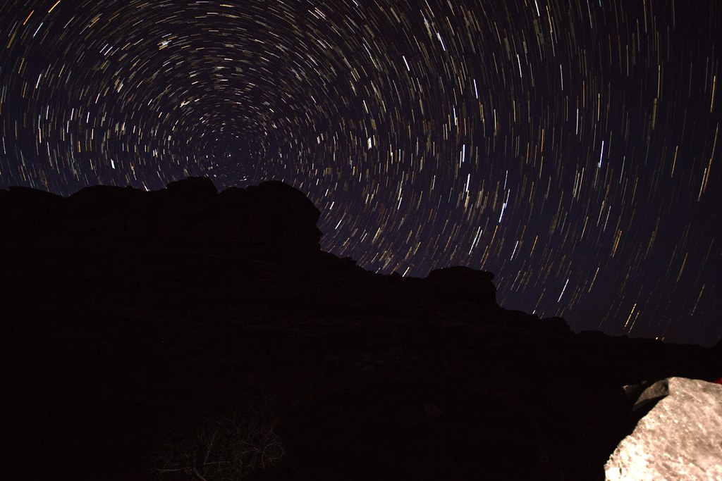 Last night STAK by slc_dan, on Flickr
Photo courtesy of @NateGeesaman
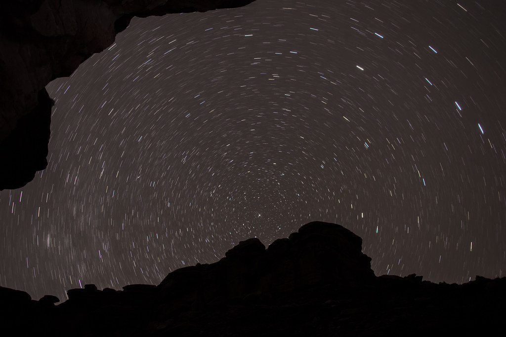 Sowats Canyon Star Trails by NateGeesaman, on Flickr
Before turning the camera off, I turn it around into our little nook for the night.
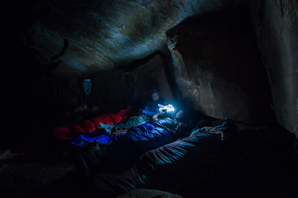 Last night goodnight 2 by slc_dan, on Flickr
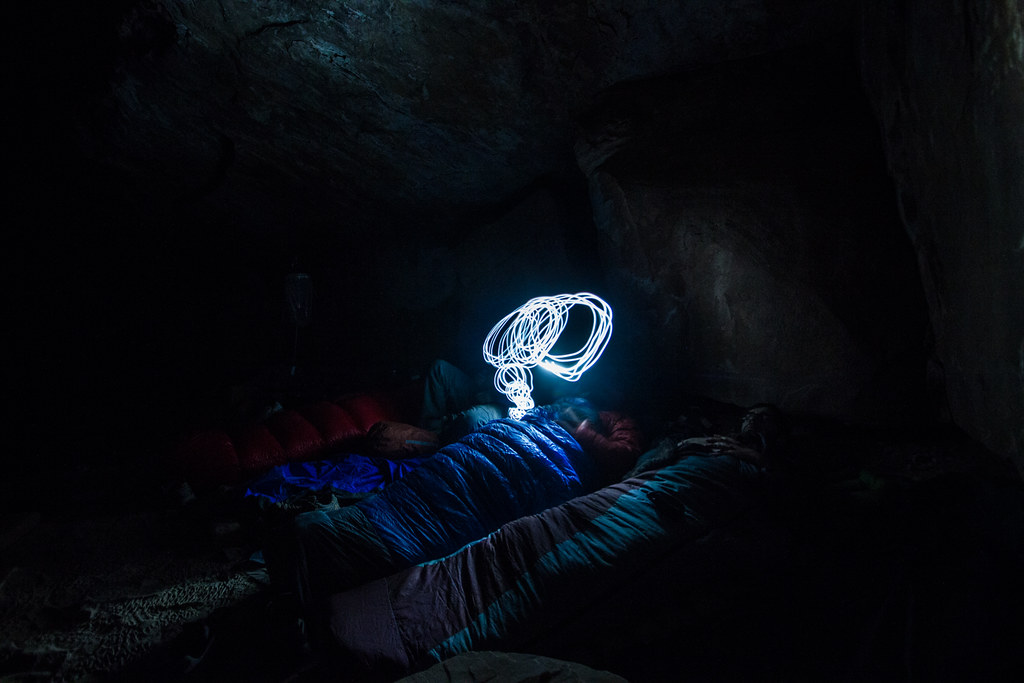 Last night goodnight twirl by slc_dan, on Flickr
Nate played with some lighter painting of nearby pictos.
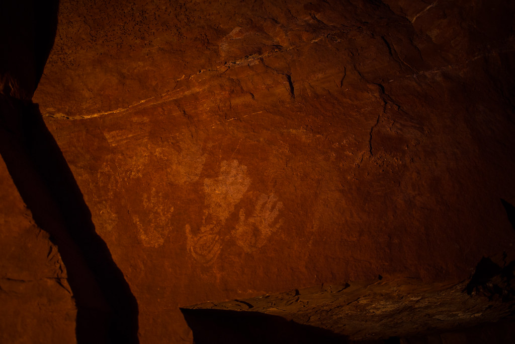 Mountain Sheep Spring Pictos 1 by NateGeesaman, on Flickr
Sam’s mother comes back to him after an odd confrontation that was hard to make out. What the hell mom? Don’t you talk to me like that, she answers. Can we go yet? Follow me closely. The come upon a lone truck in the parking lot. Sam’s mouth is instantly watering. Thoughts of crackers, sugar, chips, and other dense forms of energy flow through his mind. His mouth waters. He pauses under the truck while mom searches for a way into the automobile. His aging mother climbs up the tire, through the wheel well, and barely fits through an opening in the carpet of the cab. Sam follows suit. This is THE life, he thinks aloud. Don’t get too comfortable. They dig in right away. The chiseled tooth is perfect for ripping apart the plastic covering chips, nuts, and other goods. They eat until they can’t.
I awoke in the morning to the putrid smell of my own gas. Those dried banana’s must have been heavier on the sulphur dioxide than I had thought. To everyone’s surprise, Art is up first. He also mentions that it was good we hung our food. He saw two mice run across his bag last night. He rises to grab our hanging food, and brings it over. I make the last remaining coffee, and swallow handfuls of what I have remaining. Cold beer waiting for us up in the truck, I remind myself. We make it a quick morning and get to walking.
We lose the trail for a bit on the esplanade, but quickly reconvene with it. We spot, and talk to the first person that we have seen in 4 days. He has a gigantic backpack on, and looks a bit worn. He’s been up and over the fishtail mesa pass. I’m jealous. He’s 4 days out, and still has 3 to go. I’m more jealous. Although solo, he tells us that it’s nice to see humans for a bit. We pass some beta, and get on our way. I snap one more shot of our knoll in the distance.
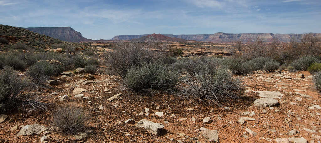 Final Esplanade Pano by slc_dan, on Flickr
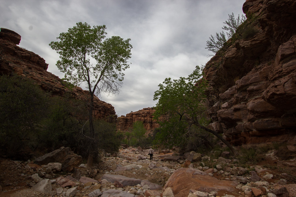
We come upon the first set of cottonwoods that provided our lunch spot days ago. Nate threw down his pack, and I followed. Art walked up. If you don’t mind, I think I’d like to continue, he states. My feet are itching for the same. I tell him I’ll join him. I throw some gorp into my mouth, take a big gulp of water, and toss my pack back on my shoulders.
I raced up the last bit of hike. My heart was beating to the limits of my chest, but I could push it so. All the training I’d been doing had payed off. I had a dumb, smug sense of accomplishment. Upon returning to the parking lot, I stopped short of the trail end. There was an excellent rock in the shade to sit at. As Art came upon me shortly, I asked him to lead out the last few steps. We made it out.
As Art opened the truck, he threw down a tarp and began his after hike ritual. Change of clean clothes, wash off under the cold crisp water reserves, and of course, a cold beer. My ritual isn’t quite as defined, but mostly revolves around that cold fermented beverage. And some delicious food.
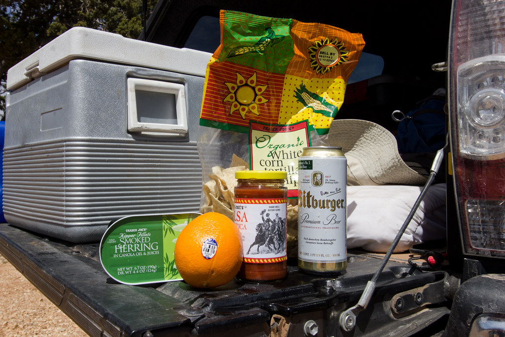 Victory Meal by slc_dan, on Flickr
Upon inspecting our food, we notice all kinds of little holes in the bottoms of the plastic bags. We had put it in the cab, as we had heard word of marmots being particularly aggressive up here, but how the hell had they got into the cab?
We drove out to Sowats point, and took a few photos, but none of mine turned out worth a damn. After compiling everything back into the pickup, we were off. Don had promised to buy us a hot dinner, and we were happy to take him up on it. Centro in Cedar City came at his suggestion, and it was great. It felt odd, but welcome to be in society again.
A week later, Art and his wife met me and mine for dinner. Turns out a mouse had made such a comfortable layer in the truck that it was still there when he went to clean out the truck. His wife was extremely understanding, and I am thankful for that. I asked what happened with the mouse, and it sounds like he got away up at their home in Summit Park.

We were up on the esplanade, and had a clear uninterrupted view of our goal in sight. Art gazed upon the mound with a small grin. I stared down at this view, and that red knoll while up on that ridge, he said while pointing up at the southern rim. He’d been planning this trip. I was lucky enough to be added on to these plans. We were very lucky for those that had come before us.
We walked quickly over this Supai formation. Yucca graveyards rattled as we silently walked past. We shoot for the northern slope. The walk up is short, but the views are so spectacular that I stop several times.
Fishtail Pano by slc_dan, on FlickrThe white boulders are loose, and sharp. I scrap my hand lightly when using one for balance. Art is first to ascend. We all shortly follow.
victory shot by slc_dan, on FlickrThe peak was fun, but it was the view I was really after.
Peak View Southwest by slc_dan, on FlickrView North panor by slc_dan, on Flickrview north panor two by slc_dan, on FlickrView South Panor by slc_dan, on FlickrView South two Panor by slc_dan, on FlickrWe took our time on top. We steeped in the view. A few of us searched for a register, but found nothing. The walk down was smooth. Keeping on the red meant easier walking, even if a bit steeper.
Back down by slc_dan, on FlickrWe made our way back the way we came. With a little experience on our side this route was more efficient. As we fell back into the side drainage, the view from above led us on an easier path into Indian Hollow.
team Down drainage-2 by slc_dan, on FlickrAt this intersection I decided to head up, due East, Indian Hollow where we had not yet explored. The others weren’t as excited at the prospect, and went back west towards camp.
Up canyon was as beautiful as the intersection that we left. I left my camera and all things behind. I climbed up a few waterfalls, that were just difficult enough to be fun, and just easy enough to not be scary alone. I hiked quickly up the canyon, and was alone. I was able to experience that distinct solitude that only comes after several days out in the wilderness. I sat and listened to the clear, quiet silence. No screens to update me on the importance of insignificance. No beeps, or ugly man-made noise. Zero expectations of doing anything other than to sit, utilize all of my senses for the glory of nothing. After I packed a long period of contemplation into a relatively short time, I gathered my things and went back down canyon.
The walking was swift, and I soon came upon Nate walking down canyon. Up canyon was really cool, I mention. Yeah, I didn’t go far up, but the reflections were nice, he answers. I realize I’m missing my walking stick. Shit, I’m going to have to go back and get it, I say aloud. I head back up canyon a third time and climb the nice sandstone slightly waterfall for a third time. It is a fun obstacle. I come upon my pole and trot back. I come upon Nate again, before we both return to camp.
Back down Indian Hollow, again by slc_dan, on FlickrIndian Hollow Mosey by slc_dan, on FlickrWe repeat much of last night’s festivities. There is a calm feeling of accomplishment due to conquering the knoll. I’m grateful to be included in the trip, and happy to have helped in making it happen. After tea, dinner, and stumbling around our excellent camp, we all surrender to the night.
More coffee in the morning, but I ration upon realizing how low I am. Don is quick to say he’s got some instant stuff, and the rest is passed out accordingly.
Morning camp by slc_dan, on FlickrOur itinerary today is to hike further down Indian Hollow. We’ll pass our intersection with Ojojojo, and head up onto the redwall due to some impassable dry falls. From there we come off the redwall before making one final camp in Kwagunt Canyon.
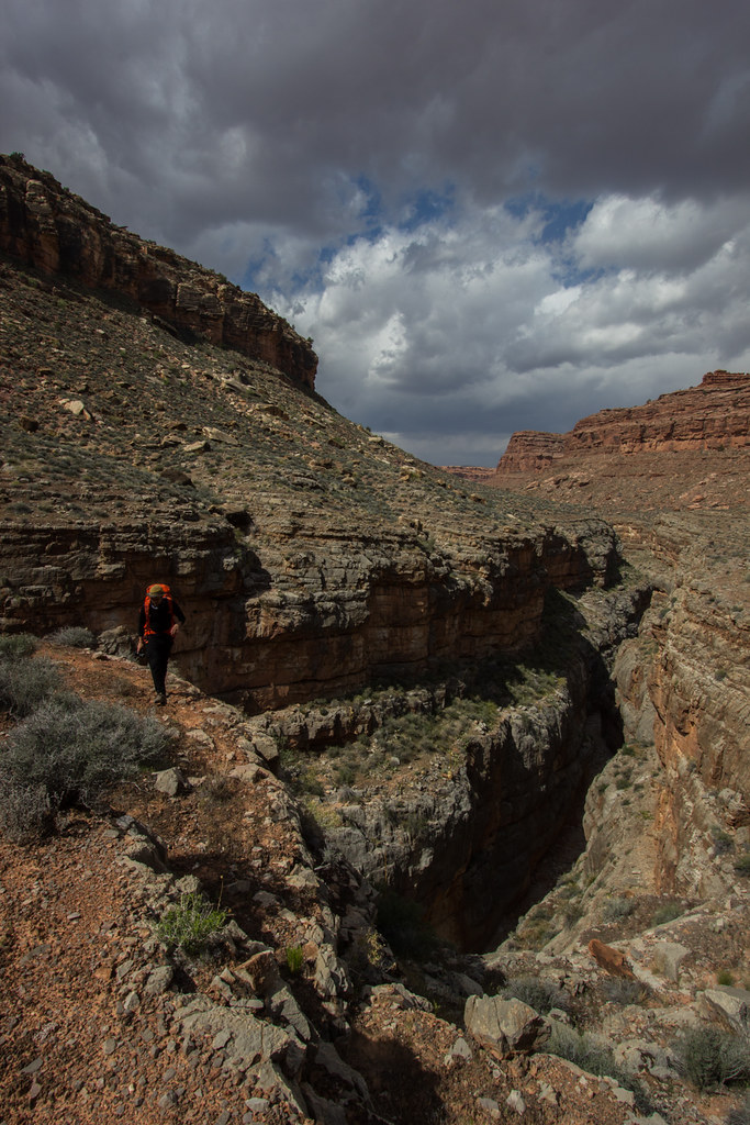
The step up onto the redwall was well cairned. Nate and Don had climbed down a fun boulder while Art and I had already made it upon the ledge. They then had the fun opportunity to climb up what they had just climbed down.
Team Orange Down Climb by slc_dan, on FlickrThe clouds danced across the sky. Moving shadows spread out as the moved over the landscape. We continued along this ledge, and walked with joy.
Redwall Walking 1 by slc_dan, on FlickrRedwall Walking 2 by slc_dan, on FlickrBefore long we stopped at a beautiful, but windy spot for lunch. I set up a time lapse, which I look forward to including in an upcoming project.
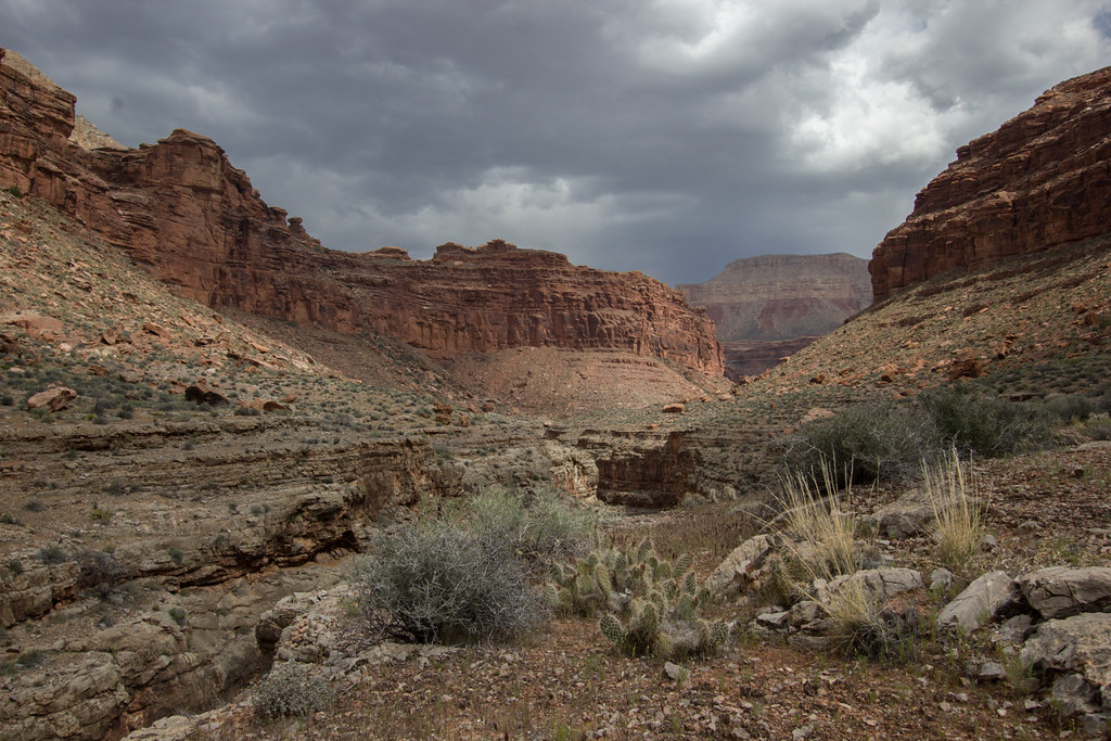
Redwall Walking Lunch by slc_dan, on FlickrWe consulted our map, and figured we were nearing the end of our redwall walking. We packed back up, and kept on. Soon our trail went back down. The easy walking turned back into the bone dry arroyo. We peered back toward Indian Hollow. The limestone slots called us like sirens, but the thundering clouds above heeded better warning to stay out.
The necessity for careful walking kept us looking down until we reached a fork. The angles of both canyons were all wrong. Art turned on his GPS. Well damn, we are far past where we should be, he stated. We quickly decided to change our plans. Instead of camping in Kwagunt Hollow, we would now turn up Mountain Sheep Spring, and camp there.
The wind was strong, and the dark clouds above threatened. Nate and I packed tentless, so were were quite picky with our camp spots. Art stopped under a great giant boulder that had fallen near the river bend. We stopped for a bit, and read through the beta we had collected from the internet (another thanks to bobbordash). This says he was delighted to find pictographs above him when he woke up. This spot is ok, but I want to be delighted, Don said. We nodded in agreement, and walked up stream further. We found the beautiful spring noted in the beta, as well as the well worn campsite across from the fall.
Photo courtesy of @NateGeesaman
Mountain Sheep Spring by NateGeesaman, on FlickrThis was a great spot. Third day is always the hardest for me, Art said in a state of exhaustion. You are free to continue on a day hike, but I’m done. Don chimed in with, sitting with my book down by that fall is sounding real nice. I glanced over to Nate with one eyebrow raised. He simply nodded.
I ditched all heaviness from my pack. Nate tied a water bottle around his shoulder, and we took off. Soon we came to the first sign we had seen in 3 days. This trail is built and maintained, also a first in 3 days. This created easy, struggle free walking. The wind blew gusts of wind at our face. The clouds were rushed along, while giving up weight through rain. This is the kind of weather you want when walking across the esplanade.
Jumpup Ranger Trail Nate by slc_dan, on FlickrJumpup Ranger trail light play by slc_dan, on FlickrAnother great photo from @NateGeesaman
Ranger Trail 3 by NateGeesaman, on FlickrJump Up Ranger Pano by slc_dan, on FlickrBefore long we saw our second sign of the trip. Go down canyon for Jump Up, or follow the trail out to go somewhere else. We went down canyon. Jump Up begins quite open, but closes in close fast.
Into Jumpup by slc_dan, on FlickrInto Jumpup 2 by slc_dan, on FlickrInto Jumpup 3 by slc_dan, on FlickrI was expecting an exciting obstacle, and it soon presented itself. I went down first, and Nate soon followed. I’ve read that there is a bolt on top, we had no rope, and didn’t search it out. The base of this sketchy ladder was propped up by piles of rocks. I felt it teeter as I climbed down. Enough danger to feel alive, but safe enough to still be so.
Nate Sketchy Ladder 2 by slc_dan, on FlickrThe waterfall that this bypassed, was incredible. Nate and I took a breather underneath, and soaked in the misty cool air. We sat still in the moment. This side hike has been excellent, Nate stated. I concur.
Waterfall Jump Up Canyon by slc_dan, on FlickrI looked closely at a small oak tree. There I saw a group of small black bugs. (Name? info?)
spikey bug by slc_dan, on FlickrSoon we came back to the exit of Jump Up. It led directly to where we had to look at the GPS before. We continued up Mountain Sheep Spring Canyon. We caught Don sitting near the spring doing exactly as he said. That was kind of quick he said. Gorgeous hike, I said.
We found Art sitting in the spot we left him at. Nice walk? Yes, cherry on top, I answer. We pass him our cameras. He slides on his readers and looks through. Looks nice, how far up was the turn off? He asks. Not too far, maybe a mile tops, Nate answers.
The day turns into evening as we prepare our meals. Shortly after dinner we realize it is a must that we exit the canyon tomorrow. We are completely out of whiskey. We stay up later this evening, I take some star shots.
Last night STAK by slc_dan, on FlickrPhoto courtesy of @NateGeesaman
Sowats Canyon Star Trails by NateGeesaman, on FlickrBefore turning the camera off, I turn it around into our little nook for the night.
Last night goodnight 2 by slc_dan, on FlickrLast night goodnight twirl by slc_dan, on FlickrNate played with some lighter painting of nearby pictos.
Mountain Sheep Spring Pictos 1 by NateGeesaman, on FlickrMeanwhile on the rim.
Sam’s mother comes back to him after an odd confrontation that was hard to make out. What the hell mom? Don’t you talk to me like that, she answers. Can we go yet? Follow me closely. The come upon a lone truck in the parking lot. Sam’s mouth is instantly watering. Thoughts of crackers, sugar, chips, and other dense forms of energy flow through his mind. His mouth waters. He pauses under the truck while mom searches for a way into the automobile. His aging mother climbs up the tire, through the wheel well, and barely fits through an opening in the carpet of the cab. Sam follows suit. This is THE life, he thinks aloud. Don’t get too comfortable. They dig in right away. The chiseled tooth is perfect for ripping apart the plastic covering chips, nuts, and other goods. They eat until they can’t.
***
I awoke in the morning to the putrid smell of my own gas. Those dried banana’s must have been heavier on the sulphur dioxide than I had thought. To everyone’s surprise, Art is up first. He also mentions that it was good we hung our food. He saw two mice run across his bag last night. He rises to grab our hanging food, and brings it over. I make the last remaining coffee, and swallow handfuls of what I have remaining. Cold beer waiting for us up in the truck, I remind myself. We make it a quick morning and get to walking.
We lose the trail for a bit on the esplanade, but quickly reconvene with it. We spot, and talk to the first person that we have seen in 4 days. He has a gigantic backpack on, and looks a bit worn. He’s been up and over the fishtail mesa pass. I’m jealous. He’s 4 days out, and still has 3 to go. I’m more jealous. Although solo, he tells us that it’s nice to see humans for a bit. We pass some beta, and get on our way. I snap one more shot of our knoll in the distance.
Final Esplanade Pano by slc_dan, on FlickrWe come upon the first set of cottonwoods that provided our lunch spot days ago. Nate threw down his pack, and I followed. Art walked up. If you don’t mind, I think I’d like to continue, he states. My feet are itching for the same. I tell him I’ll join him. I throw some gorp into my mouth, take a big gulp of water, and toss my pack back on my shoulders.
I raced up the last bit of hike. My heart was beating to the limits of my chest, but I could push it so. All the training I’d been doing had payed off. I had a dumb, smug sense of accomplishment. Upon returning to the parking lot, I stopped short of the trail end. There was an excellent rock in the shade to sit at. As Art came upon me shortly, I asked him to lead out the last few steps. We made it out.
As Art opened the truck, he threw down a tarp and began his after hike ritual. Change of clean clothes, wash off under the cold crisp water reserves, and of course, a cold beer. My ritual isn’t quite as defined, but mostly revolves around that cold fermented beverage. And some delicious food.
Victory Meal by slc_dan, on FlickrUpon inspecting our food, we notice all kinds of little holes in the bottoms of the plastic bags. We had put it in the cab, as we had heard word of marmots being particularly aggressive up here, but how the hell had they got into the cab?
We drove out to Sowats point, and took a few photos, but none of mine turned out worth a damn. After compiling everything back into the pickup, we were off. Don had promised to buy us a hot dinner, and we were happy to take him up on it. Centro in Cedar City came at his suggestion, and it was great. It felt odd, but welcome to be in society again.
A week later, Art and his wife met me and mine for dinner. Turns out a mouse had made such a comfortable layer in the truck that it was still there when he went to clean out the truck. His wife was extremely understanding, and I am thankful for that. I asked what happened with the mouse, and it sounds like he got away up at their home in Summit Park.
Somewhere out there Sam is still trying to get along.
Featured image for home page:
")
 Racetrack Knoll Summit Art and Dan
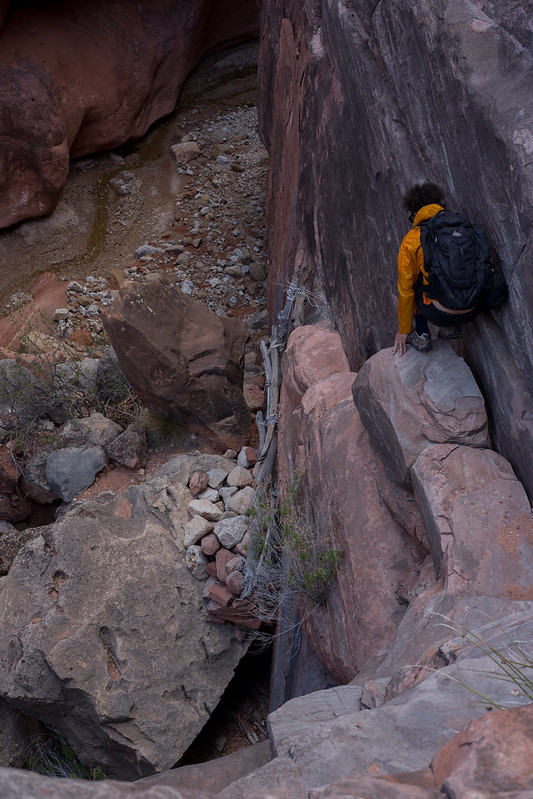 Jumpup ladder
")

